
Day 3 – August 24, 2020
It’s Yelly-stone Day, it’s Yelly-stone Day!!
Seriously, I’m not an early bird, but I sprung up out of my sleeping bag at 5am, ready to get the show on the road and head into Yellowstone National Park for the first time in 29 years. Volcanos! Waterfalls! Geysers! Bubbling mud! The anticipation was boiling over!
I quickly packed up in the dark, patting myself on the back for taking down my tent with ease even though there was little light to work with, boiled up some water for oatmeal, made some tea, threw everything in the car, and headed out of Dubois before the sun came up. Excitement was high, roads were empty, and Garth Brooks was keeping the good songs coming on his satellite radio channel.

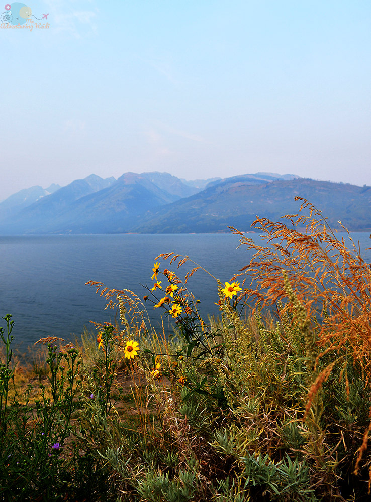
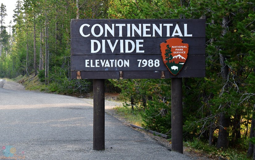
I hit the border of Grand Teton National Park at 7am, and after a quick stop for a photo with the sign, I weaved my way through a traffic jam of humans way too close to a bear on the side of the road (spoiler alert – this was my only bear sighting of this trip, thankfully!). The wildfire smoke was so thick, so I stopped for some photos of the nonexistent Tetons and Jackson Lake, sent my last few text messages while I had cell service, and hit the south entrance of Yellowstone National Park at 7:45am.


Of course, I had to stopped and get a photo with the sign before entering Yellowstone, and I made a few other visitors chuckle as I posed my dinosaurs. Then I spotted steam rising up from the shores of the river, and I squealed. I’M GOING TO BE DRIVING INTO A VOLCANO!
The perk to entering Yellowstone so early is the crowds are diminished (visitor numbers were actually up in 2020 compared to prior years, despite a global pandemic). I only had to wait a few minutes for my turn, where I then learned Craig Pass was closed due to the Lone Star Fire that had recently started. This would put a kink in my plans on the day I’d leave the park, but it was days away before I had to worry. (Tip – I purchased the America the Beautiful federal lands pass for $80, which covers national park entrance fees, and also many other federal sights like national forests day use permit areas. Since I mountain bike a lot at a fee area, this annual pass was worth it!)


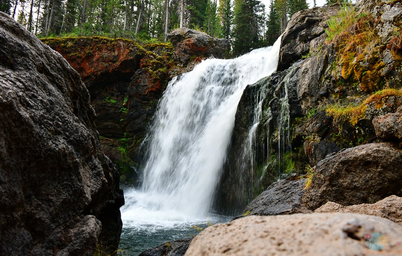
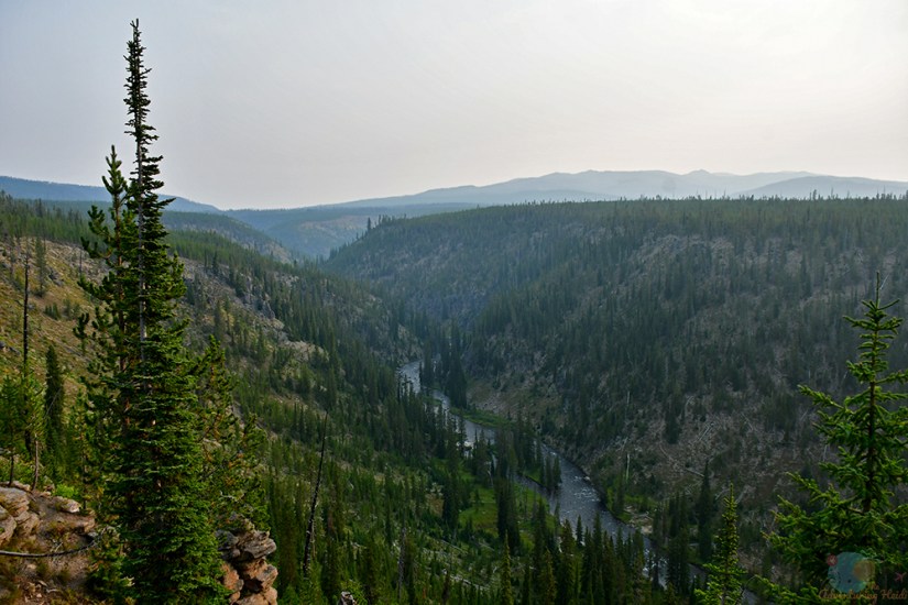
Yellowstone National Park is a big big big place but to me it felt like everything was super close together. Maybe it’s the lower speed limits (20-45mph throughout the park) that makes driving seem to take a long time, or if you’re me, the constantly stopping, but still seemed like everything I had listed out to see were close together, and I definitely wasn’t spend large quantities of time in the car between stops. Shortly after the entrance booth, I came across the first waterfall of the day, Moose Falls.

Moose Falls is a gorgeous plunge on Crawfish Creek, and has a marked pull out for parking. I luckily had the falls to myself for a few minutes before a small tour van arrived. There’s a few viewpoint options, and I made sure to take advantage of them all. It was definitely one of those places that was hard to drag myself away from, but I knew the day was young and I had many more waterfalls to chase.

I must’ve been in some sort of amazing mood, as I drove with my windows down (I never drive with my windows down), my sunroof open (I forget I even have a sunroof), and music blaring as a cruised down the road, in no hurry at all as I took in my beautiful surroundings. My next stop was Lewis Falls, on the Lewis River and edge of the caldera (and some of the youngest rhyolite flow of the caldera, for the geology nerds).

Giddy for my second waterfall of the day (and a little obsessed with being on the caldera rim), I took off up the dirt path, trying to see if I could get close to the falls for a good photo. I noticed paths that scramble down the steep banks of the Lewis River, but once I slipped and landed on my butt, I decided my Chacos were not the appropriate footwear for this, and decided that the bridge over the river was the best I’d do.


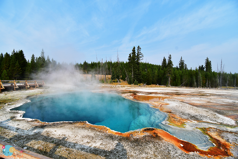
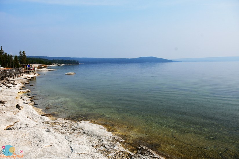
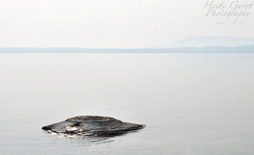
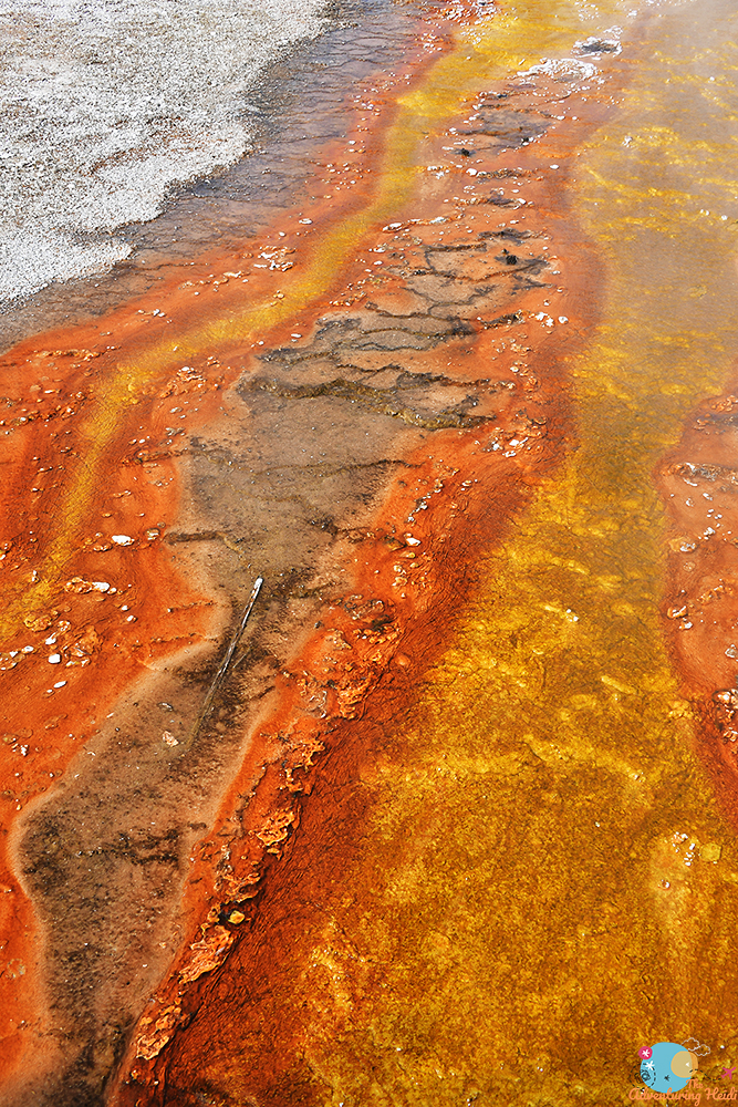
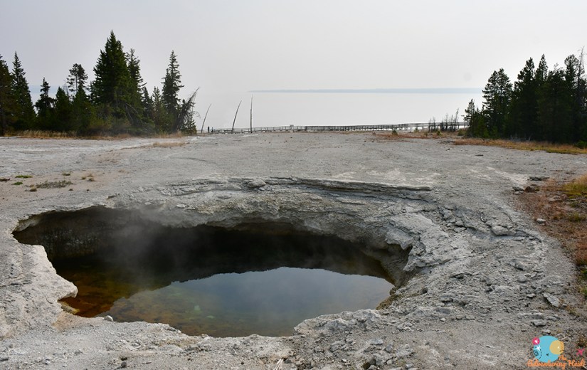
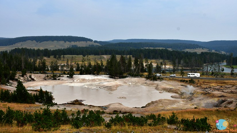
Continuing north, my waterfall chased turned into geothermal madness as I turned off into the West Thumb Geyser Basin on the shores of Yellowstone Lake. The West Thumb of Yellowstone Lake is a small caldera that formed about 180,000 years ago during an explosion in the larger Yellowstone caldera. The geyser basin is one of the smaller ones in Yellowstone, comprising about 1000 feet of the shoreline, and most of the geysers are dormant. However, how often do you see a geyser spouting on the shoreline of a lake? Especially the largest high altitude lake in North America, with “thick rhyolite flows, over 150 hydrothermal vents, several very large and many small hydrothermal explosion craters, underwater landslides, active extensional faulting, evidence of doming of the lake bottom, submerged former shorelines, and sinter cones” with the looming threat of tsunamis? Okay, geology nerd aside, it’s a very beautiful lake – especially when not shrouded in wildfire smoke.
I grabbed a snack, loaded up my camera gear, and set out to see all awesomeness I was craving! (Tip – at every geyser basin I went to, there are paper trail guide books that have great maps and information on key features. You can borrow one and return it, or give a few dollars as a donation and keep it. I picked these up at every site so I could reference trails and features – except for the places visited today, doh!)

Sorry, not sorry, but I literally photographed every single thermal feature I encountered on this trip, no lie. This post, along with upcoming ones, will be very photo intensive as I share my love of all things geothermal with the world!


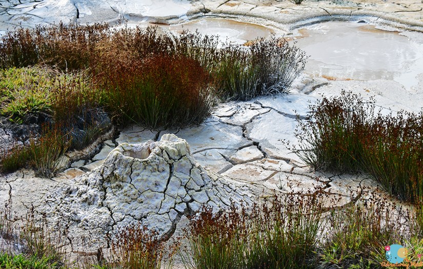


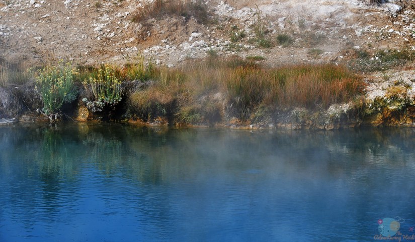

The partially submerged Lakeshore Geyser is your surest bet to see a geyser erupting regularly at West Thumb – but it will be a small eruption of small splashing. Even at just a meter or so, I enjoyed this one as the setting is so unique being in the lake!


Every geothermal feature of West Thumb Geyser Basin explored and photographed (sorry not sorry again), I set off eastward around the north shore of the lake, heading to the trailhead for the Storm Point Hike. This is a relatively easy and flat 2.5 mile hike that lollipops to Storm Point, a rocky outcropping on Yellowstone Lake that starts at the Storm Point Trailhead just east of Fishing Bridge. Though the parking area was nearly full, I only saw a handful of people during my hike, which was great.

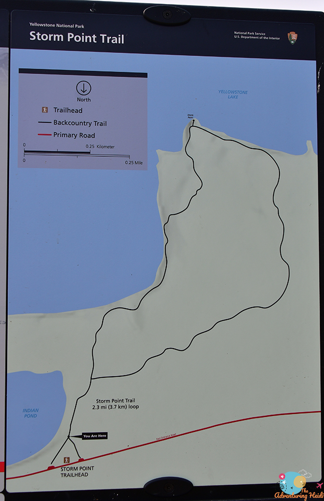


I did the hike in a clockwise fashion on the lollipop part. I can’t say if that meant the views were better, but it seems to be the more popular direction to do the hike.


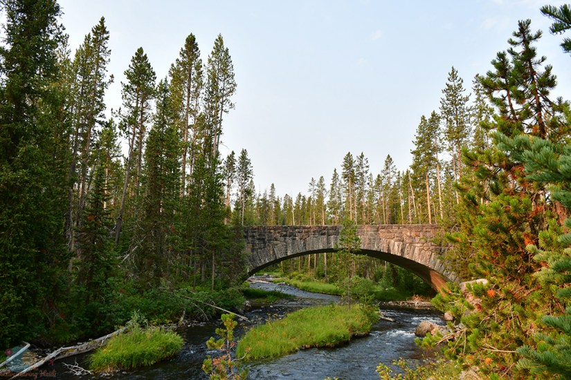
Overall, the hike took me 1 hour 8 minutes total. Because it is mostly flat, it makes for quick walking, and also friendly for those that aren’t hardcore hikers (or whose legs may be trashed from the prior, ahem). I made a quick sandwich at the trailhead before leaving. I decided to stop at the general store at Fishing Bridge to see if they had the passport stamps (they didn’t, or so I was told, I guess the cashiers had some pre-stamped ones), and I picked up a new bag of ice to refresh the cooler. I then decided to stop and check out the actual Fishing Bridge, where no fishing is allowed.

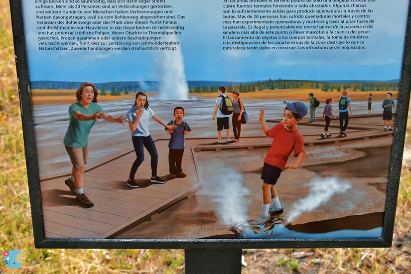
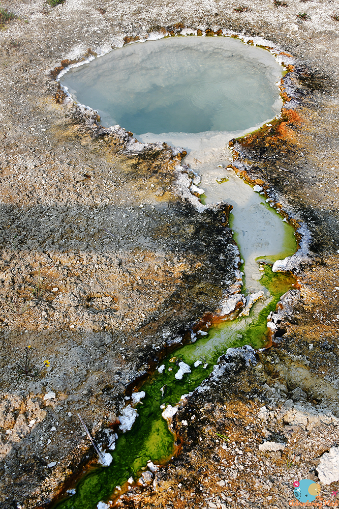
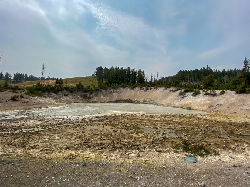
Making my way through the slow traffic heading north, I made it to Mud Volcano without getting stuck in too many traffic jams, and in time to be able to turn into the parking lot before Mr. Bison caused a huge traffic jam of tourists. Mud Volcano is the location of one of the resurgent domes of the Yellowstone Caldera, which means there’s magma fluctuating in the chamber below. This means this is one of the areas scientists keep a close eye on for a sign of volcanic activity, as this is near the area of maximum uplift and sinking of the floor of the caldera. Top it off, many faults converge here and earthquakes are common. In 1978, earthquakes changed the plumbing of the Mud Volcano system, and trees died, new mud pots appeared, and other features were snuffed out. Mud Volcano is geologically active and possibly trying to kill us all, and a good example about how Yellowstone is ever changing. 0.6 mile of boardwalk takes you around the mud pots and fumaroles (the plumbing system lacks adequate groundwater to make these really “splashy” watery types of geothermal features), and includes a pretty steep section that probably isn’t too wheelchair or stroller friendly. A lot people also complain about the sulfur smell, but I am not bothered by it, but it does help assist the crowds and parking lots with emptying quickly.


Time of one of those funny travel stories of no purpose or relevance: I love photographing strange things, like Sizzling Basin. This guy walks by me after I stand up from zooming in on bacterial mat goodness and goes, “Well, I’m glad you’re the one with the camera, as I cannot figure out what in the world you’d be photographing right there, I don’t see anything special!” I chuckle nervously, and then he goes, “I can do calculus though. We all have our talents in life.”
Thanks for assuming I can’t do calculus, random tourist guy. (I actually can’t, math is my weakness, but then again, I’ve never tried…)

A stone’s throw from Mud Volcano to the north is a pull out for Sulphur Caldron, which is just about the most acidic place at Yellowstone outside of your car’s battery (that’s an unverified statement, but seems very likely). The pH of the sulphuric acid-infused water is 1.3, putting it between lemon juice and battery acid, and bacteria called thermoacidophiles actually manage to live there.


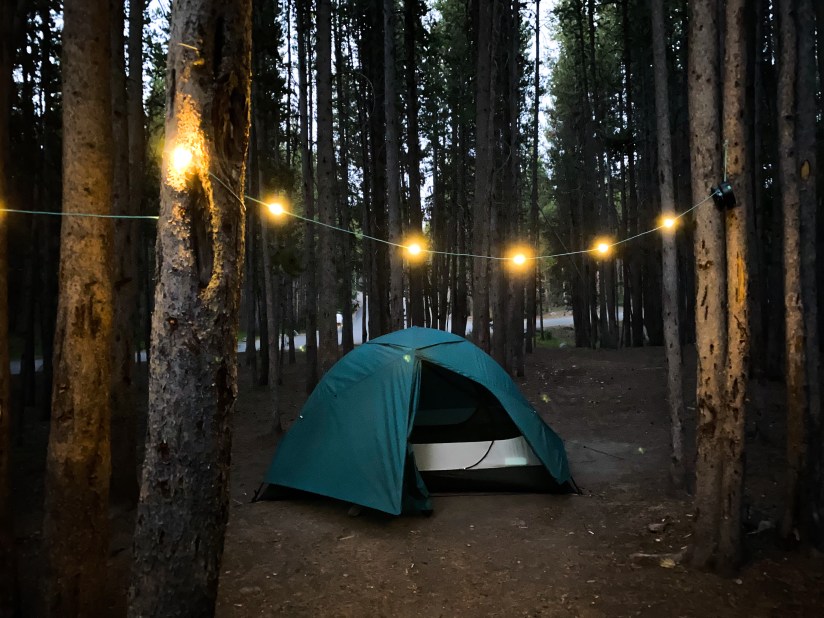
Geothermal-ed out for the day (okay, so that’s not possible for me, honestly), I headed to the Canyon Campground, which is where I would be staying for one night. I had planned more nights in this area, but was only able to book one night when I had to adjust camping reservations. I decided to check in and set up camp and get off my feet for a second before heading out to the explore the Grand Canyon area and finish off the day with a few more waterfall chases.

My site was near the end of one of the tent-only loops – site D88. I had plenty of space to spread out without feeling like I was on top of other campers. The dumpsters were across of my campsite, but it didn’t pose a hassle, and bathrooms were just across the way as well. All tent sites have a bear box to store food, cooking items, and other smelly items securely. I’ve never camped in grizzly country before (well, as an adult where I was on my own to worry about these things), so I definitely read up on how to camp safely when there’s bears afoot. Pretty much all food and cooking items need to be securely stored in the bear box or a (locked) vehicle when not in immediate use. Also, items like lotion, deodorant, and other toiletries also need to be stashed away (meaning do NOT keep them in your tent!). I washed my dishes at the dish washing station, and I changed into “sleeping clothes” at night, so they wouldn’t have food smells on them. I was not about to be a snack! They’re pretty strict in Yellowstone, and Rangers do inspect campsites will and will issue warnings and citations to campers who violate the rules.

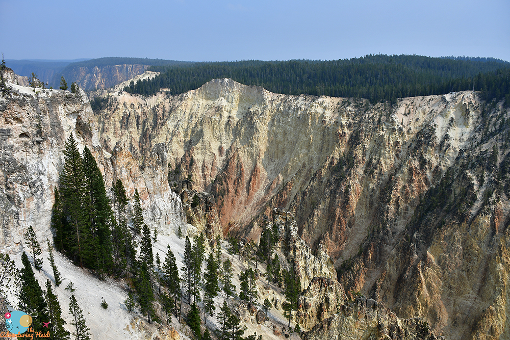
I was vastly unprepared for how too-good-for-words the Grand Canyon of the Yellowstone River would be. I suppose I didn’t pay attention to too many photos of it, and didn’t dive in too deep with planning activities in this area, aside from knowing I wanted to shoot at Artist’s Point in the early morning. Holy. Crap. It took my breath away! Hello, it’s rhyolite, and I’m like obsessed with that stuff!
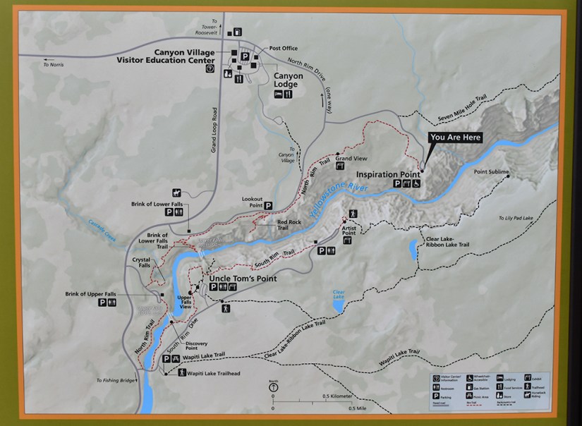
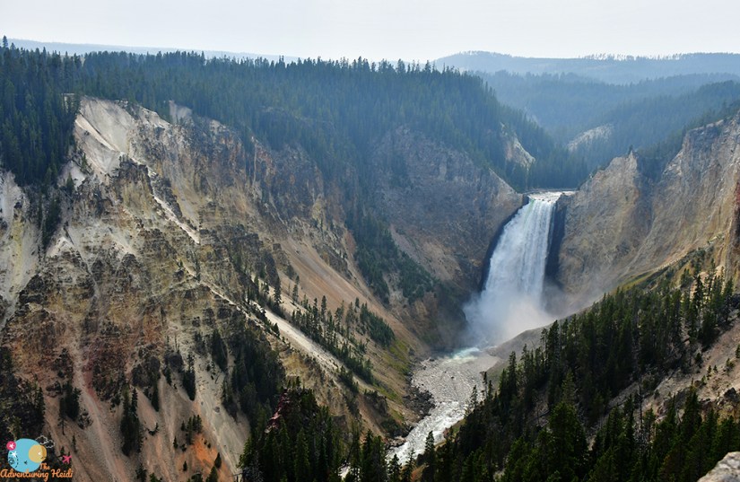
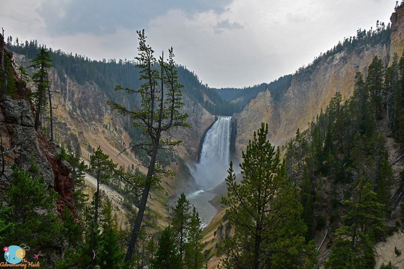
It is believed the canyon formed 140,000 to 160,000 years ago, and past and current hydrothermal activity weakened the rhyolite walls, which allowed the river to eat away this deep V-shaped canyon. It is up to 1200 feet deep and 4000 feet wide. There are two waterfalls, Upper Falls and Lower Falls, which both flow over harder, unaltered rhyolite that resisted erosion. If you’re a rock nerd like me, you can contrast the differences between the unaltered and altered rhyolite.
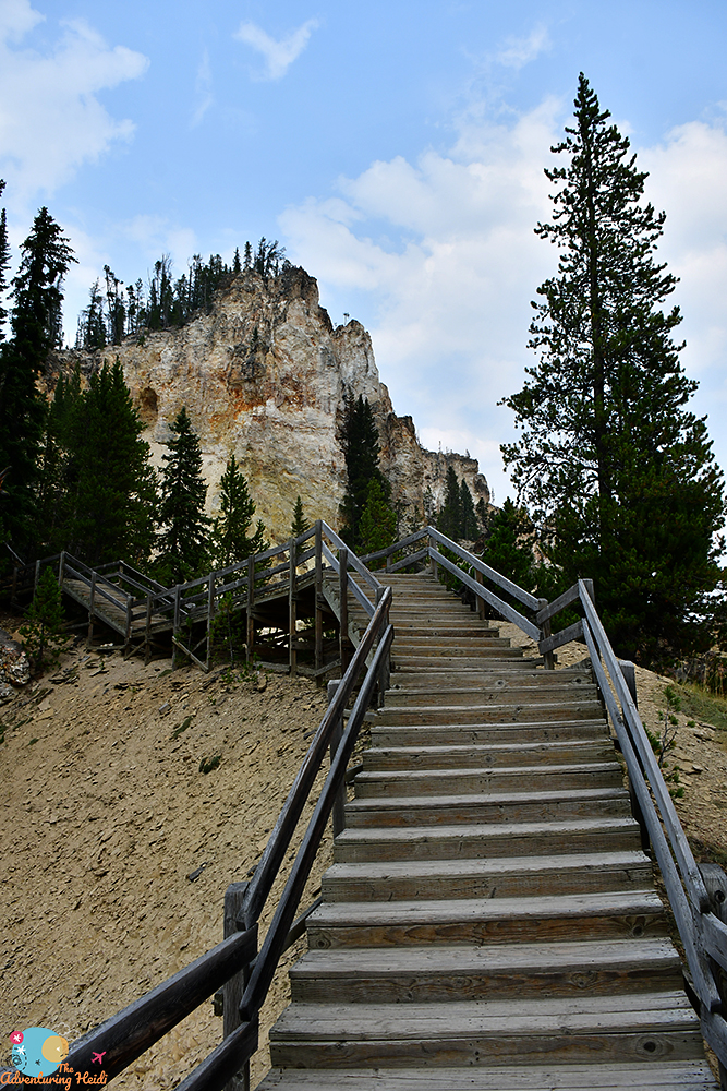
I set out on North Rim Drive, which was tourist central and probably some of my biggest crowds of the trip. The parking lots for the both the “brinks” viewpoints were all full, so I chugged along the one way road, nabbing a spot at Lookout and Red Rocks Point Trailhead with amazing lefthand side parallel parking skills (sorry, just had to brag about that!). I pushed my way through the crowds and selfie sticks, and began my afternoon of descending and climbing countless vertical feet to all the view points. At one point I just began running down because it was easier on my knees… I mean, might as well get a workout, right? You’ll work for the views, but they are worth it! Luckily I am from the altitude Yellowstone is at, so I don’t feel the lack of oxygen – low landers beware!

I continued up the road to Grand View, and then onto Inspiration Point. There is a hiking trail that links all of this, but my legs were so sore from my Fitzpatrick Wilderness hike the day before that the idea of miles of hiking wasn’t on the table (I also had some pretty insane blisters on my “ring” toes that always happen to me after long hikes). I’d end up cutting out a lot of planned hikes from my itinerary. Hindsight is always 20/20, and I was probably overestimating my hiking fitness a bit too much – if I redid it, I would’ve only done Lake Louise the day before for a shorter hike so I would’ve have been destroyed when I got to Yellowstone.


I decided to loop back around North Rim Drive again, and see if I could get parking at the trailheads for Upper and Lower brinks. Pulling towards Upper Brinks Trailhead, traffic jammed up, and there were a bunch of tourons (tourist-morons) literally ten feet away from a grazing bull elk! I took this opportunity get some video for the @touronsofyellowstone Instagram page and to heckle these bonafide idiots through my open car window. Shaking my head, I parked and made my way down to the Brink of Upper Falls, which I had to myself for a few minutes.


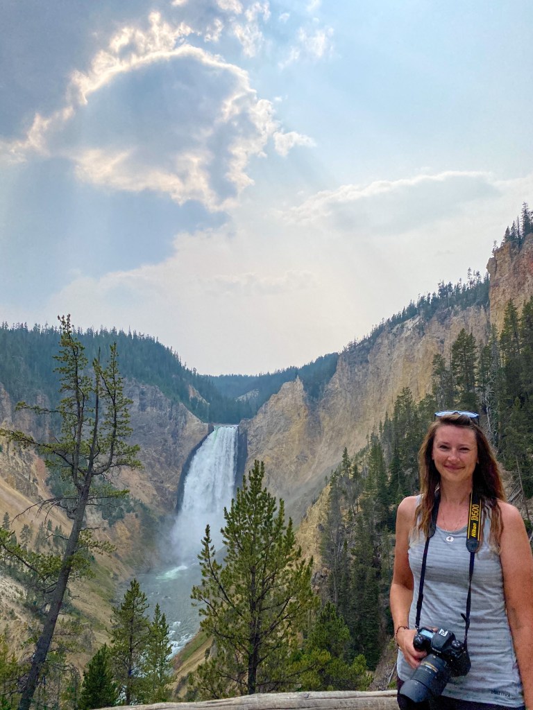
Next up was Brink of the Lower Falls, which was a pretty steep hike, and a lot more crowded than the Upper Falls had been. But boy was it worth it! The roar of the water, the wind in my hair, and the spray in my face… heaven! The scene didn’t seem like it belonged in Wyoming, and I stood in amazement that it took me so many years to visit Yellowstone as an adult. What’s that saying… something like “People travel to far away places to stare in amazement at the places they ignore at home”? Yeah, this 100%, as water gushed over the 308-foot plunge. (To be fair, it takes me less time to fly to Iceland than drive to Yellowstone, that is how big Wyoming is to travel across diagonally!)


Heart full and content, and stomach growling, I called it a day and headed back to my campsite for dinner and relaxation. Once again, like the previous night, I met two women who were traveling and they gave me compliments on being able to set up my own tent and for traveling solo. I was sensing a theme… is it still an oddity a woman sets off on her own for a grand adventure?

Stay tuned for Day 4!


Leave a comment