
There’s just some places that will never make my short-list of places to visit. Not necessarily because they’re bad, but because they have to compete with places like the Sierra Nevada, Wind Rivers, the CDT, the CT, and all the western U.S. national parks for that matter… Enter in Pennsylvania. It is such a place… not a place I dislike or have no interest in, but a place that just can’t compete with everything else on my bucket list. So when a work conference would be bringing me to Pittsburgh, I cued up my obsessive researching to see what I could get up to in two and a half days of personal travel after the conference. Here we go, five National Park Service units (including hitting my 100th at a place with a personal connection), a state high point or two, and all the Marriott-branded hotels (which isn’t a thing I really care about, I just thought my list needed three items!).
April 27-29, 2026
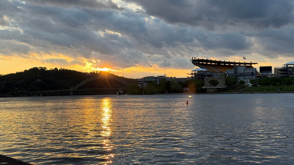
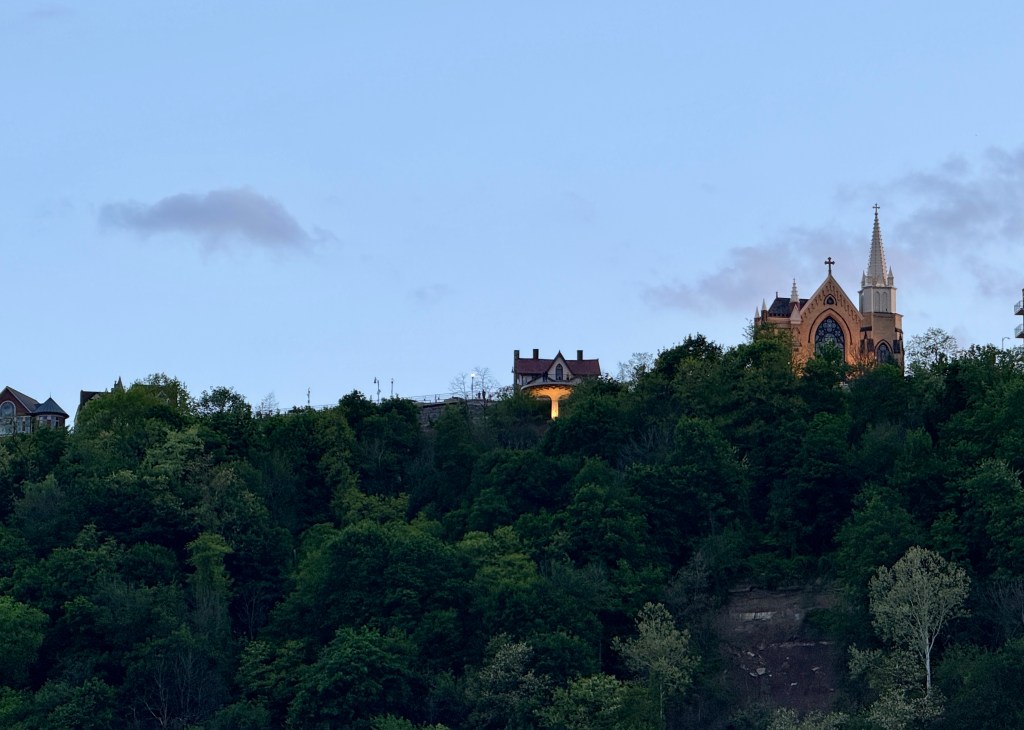
Pittsburgh was the destination for the conference I was attending, and it surprised me by ranking “up there” with the best cities I’ve had to travel to for work! The downtown area provided great restaurant options (always important!) and it was easy to walk to various sights. There were two main non-work activities my coworker and I did: the Duquesne Incline and Point State Park.
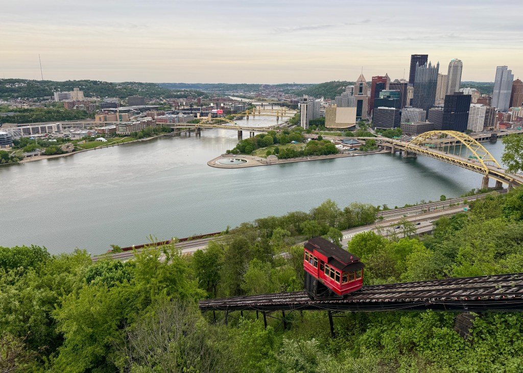
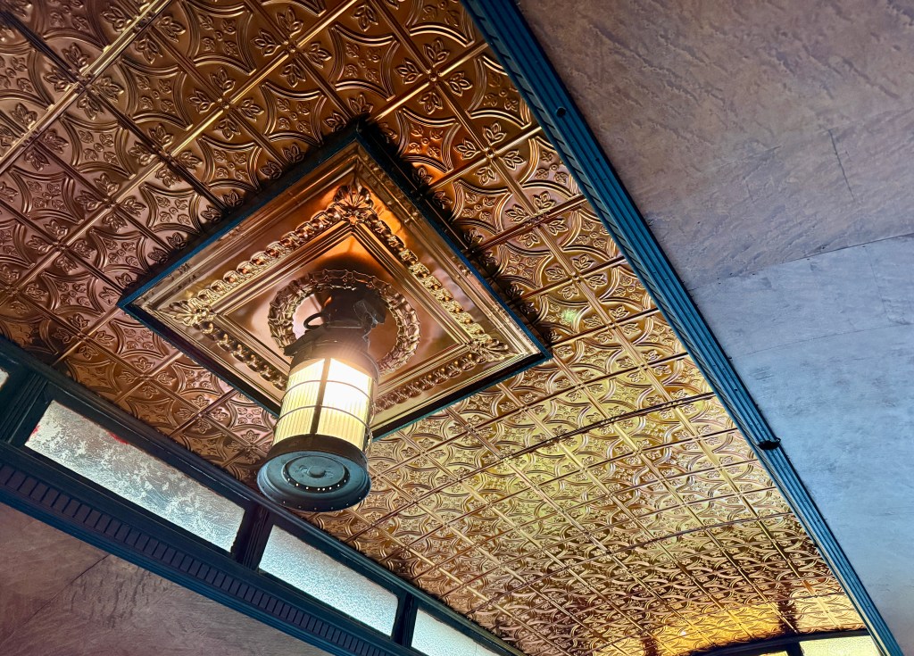
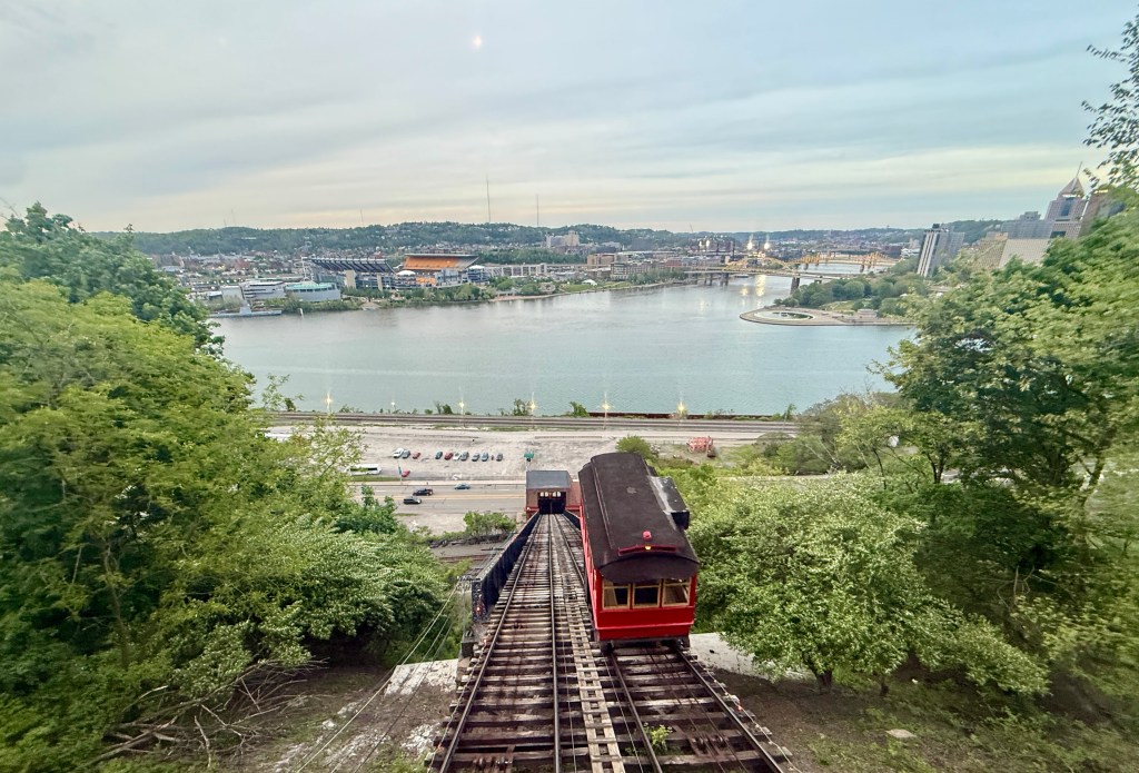
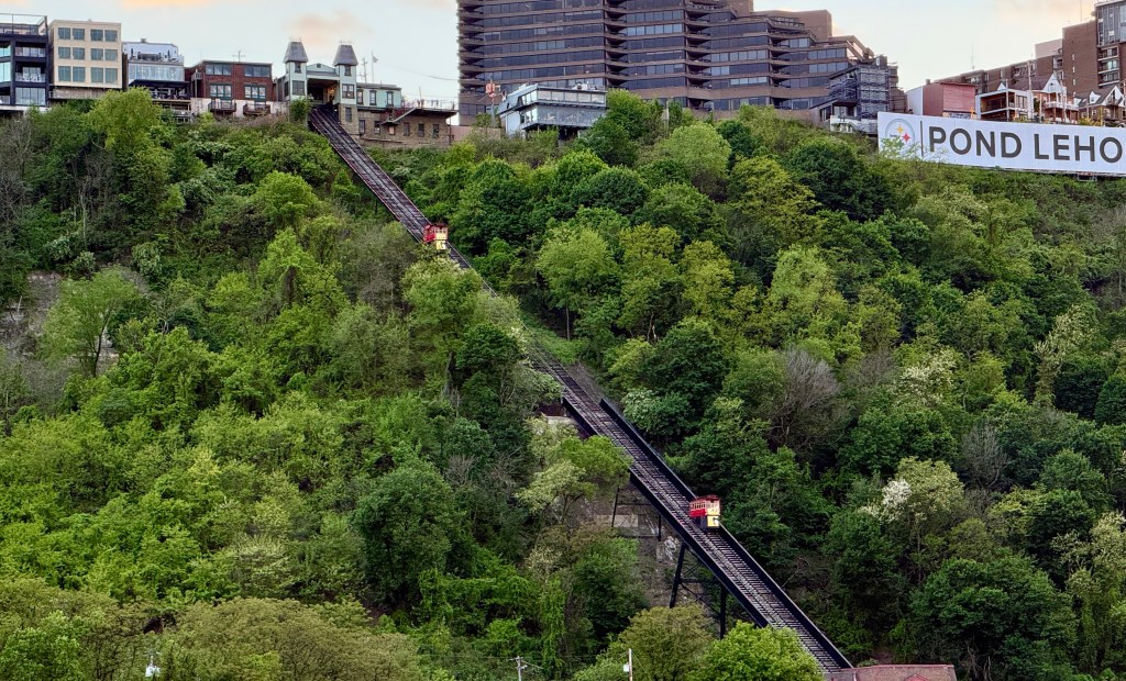
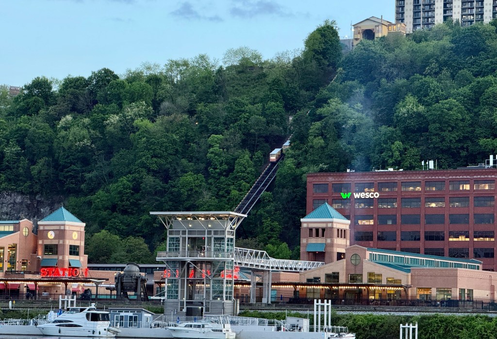
The Duquesne Incline is a 149-year-old funicular railway (a type of cable car) originally built to help transport cargo up and down Mount Washington, part of the South Side neighborhood of Pittsburgh (not to be confused with the really big Mount Washington in New Hampshire).
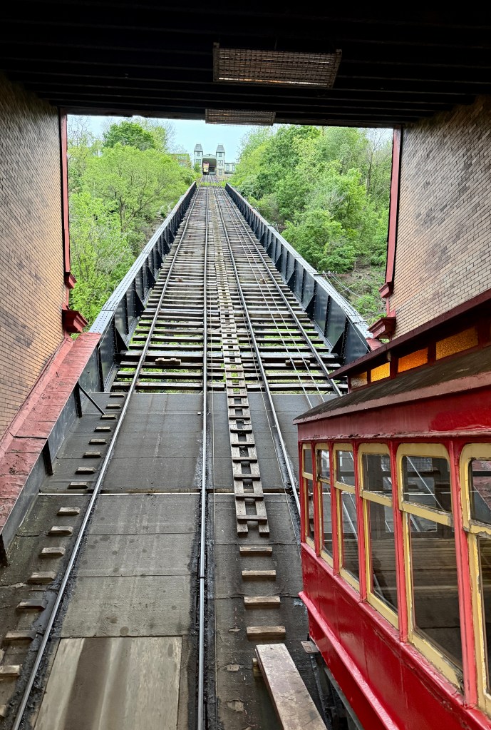
Originally steam powered, the Duquesne Incline was designed by Samuel Diescher, a Hungarian-American civil engineer based in Pittsburgh, and completed in 1877. The incline is 800 feet (244 m) long, 400 feet (122 m) in height, and is inclined at a 30-degree angle. Its track gauge is 5 ft (1,524 mm), which is unusual in the United States (but standard in Finland, Russia, and Mongolia).
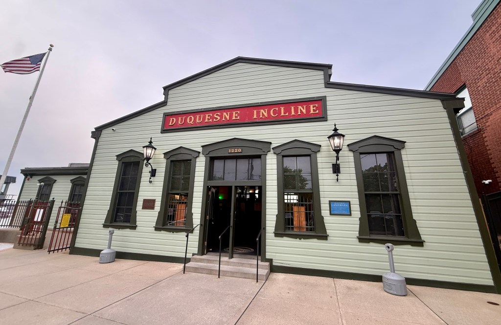
Only two inclines still exist in Pittsburgh, with the Monongahela Incline being other (which is just a short ways from the Duquesne Incline). We took an Uber to the upper station, and enjoyed the famous view over downtown Pittsburgh. Then we boarded to ride the incline down to the lower station, where the fare is collected (as of 2026, it is $2.50 each way per adult).
Initially, after riding the incline down, we were going to walk back to our hotel, but the bridge was closed off. So we took a ride back up the incline, which was nice as we got the car to ourselves so we could enjoy the views better.
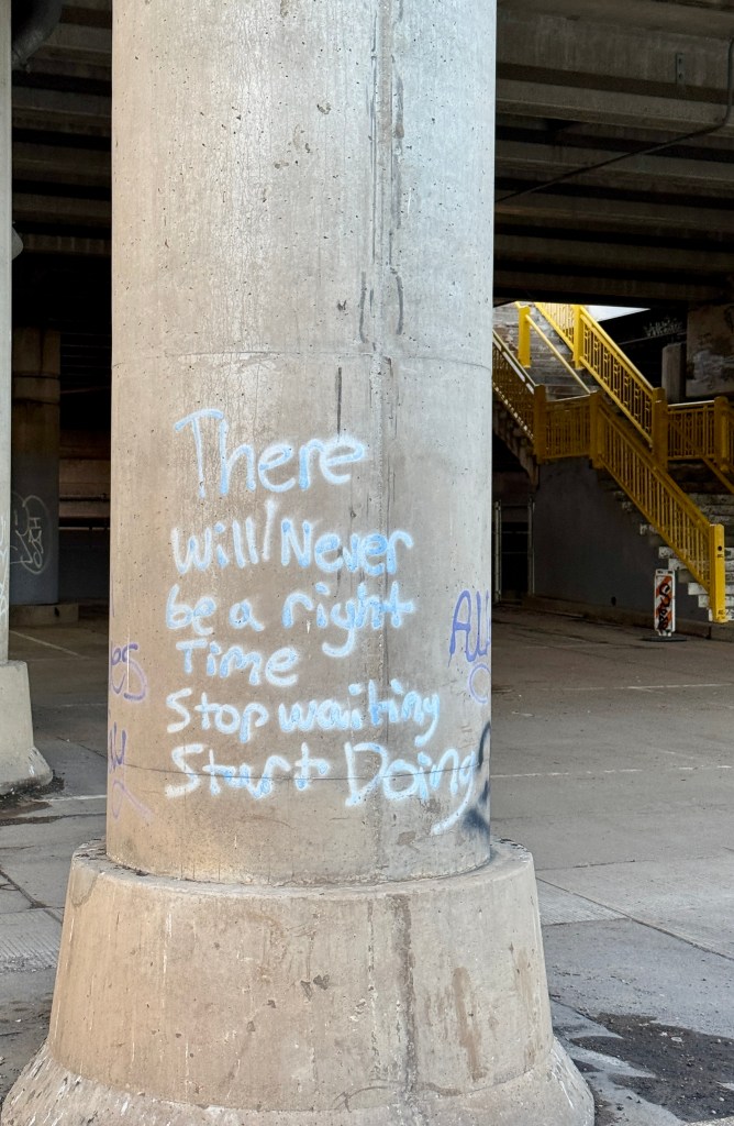
And from here… we took a 3-mile long urban walk back to the Westin, in the dark. My favorite part is when my coworker eagerly headed down the dark, overgrown staircase leading under an overpass, ha! Overall, it never seemed too sketchy and we made it back safely. And, we got to walk underneath the Monongahela Incline! I probably should’ve had better shoes on than brand new Birks, but then again, I had no idea we’d be walking back to the hotel.
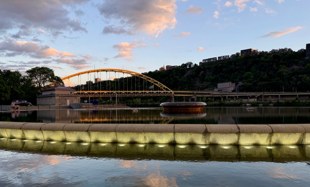
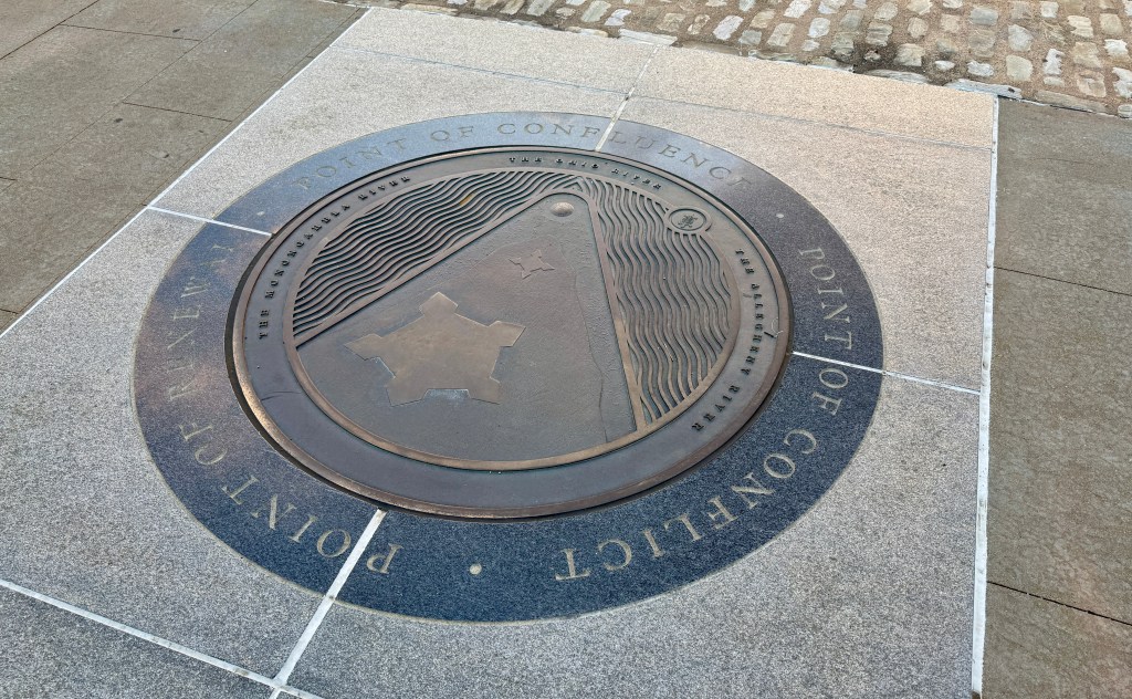
The next day I suggested finding a restaurant close to our hotel, and then walking out to Point State Park, also known as “The Point” in Pittsburgh. This small state park marks the confluence of the Allegheny and Monongahela Rivers, creating the Ohio River. The park also includes the outlines and remains of two of the oldest structures in Pittsburgh, Fort Pitt and Fort Duquesne. Unfortunately, nearly all of the park was closed during our visit, but we were still able to walk on the path along the rivers and visit the fountain area. (I am not sure why there was the closure… the NFL Draft? The Pittsburgh Marathon prep? No idea.)
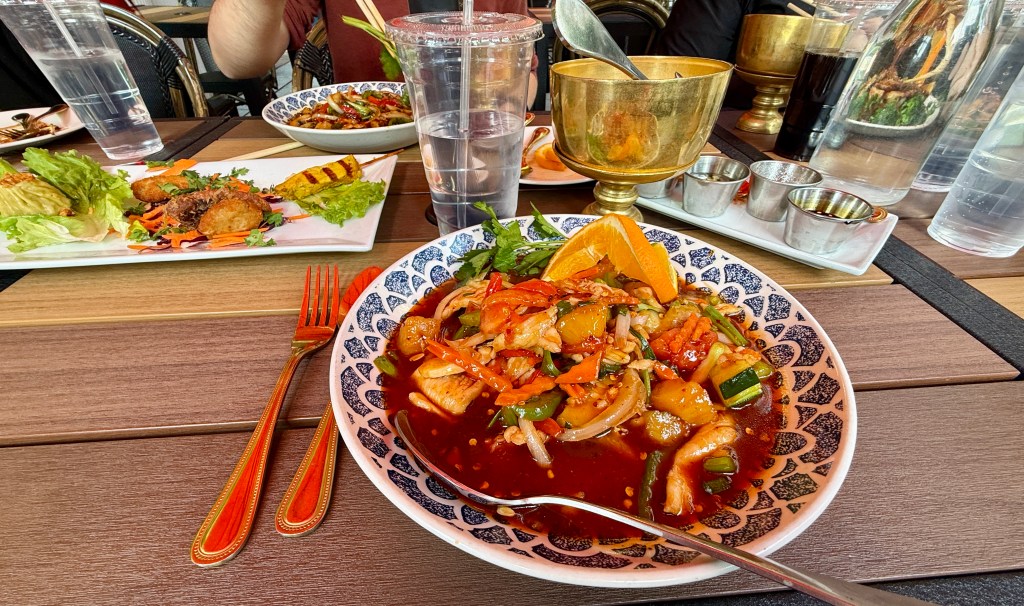
To round up Pittsburgh part of this blog, I must highlight two of the great restaurants we ate at! First up is Nicky’s Thai Kitchen, which we ate at shortly after arriving (and before the big urban hike) with our friends from Indiana.
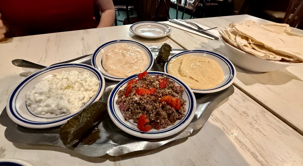
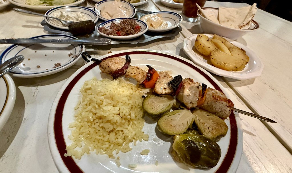
For my favoritest, Christos Mediterranean Grille is where stumbled upon into on our second night. I fell in love! Seriously, I could’ve swam in a pool of the hummus, and adopted Christos as my Greek grandpa! We split the cold combination appetizer for two, which included the said delicious hummus, plus pita bread, taramasalata, tzatziki, stuffed grape leaves, and tabouli. For my entree I got the chicken kebabs, which came with rice and a Greek salad, along with a side of potatoes “that are my grandmother’s recipe,” according to Christos. To top it all off, even though we were stuffed full of food, Christos convinced us to order a slice of his famous Onassis cake, which is made from “rice flour, four eggs for fourteen slices, light honey, and cinnamon!” It was amazing cake, very airy and light. I was so happy we found this place to eat at!
April 30, 2026
The final day of the conference was a half day, and before long I was headed towards the airport to pick up my rental car for two and a half days of exploring western Pennsylvania! I ended up with a Mazda CX-5 with Ontario license plates. Thank goodness my speedometer was in miles per hour (unlike the rest of everything… I set the climate control 18 degrees and decided that felt good enough for my American self)! All that was left to do was accomplish the two hour long drive to the Flight 93 National Memorial, the first place to kick off my road trip. Can we just lament for a moment about how it takes forever to drive anywhere on the east coast?! Two hours can get you 160+ miles down the road in Wyoming. The best I could do this day was barely 100 miles… I digress. I still cannot believe I managed to live three years in New Jersey…
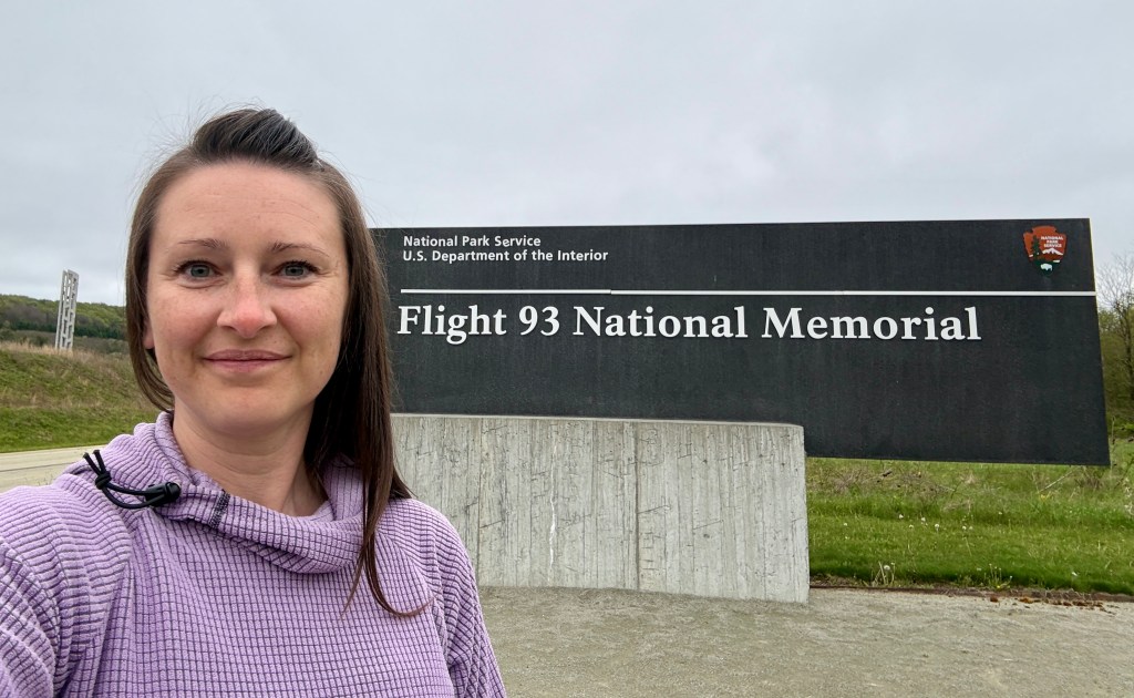
Under gray skies and chilly winds, I arrived at Flight 93 National Memorial, located outside of Shanksville. Usually I feel a sense of excitement when arriving at a new NPS unit, but overall I was somber.
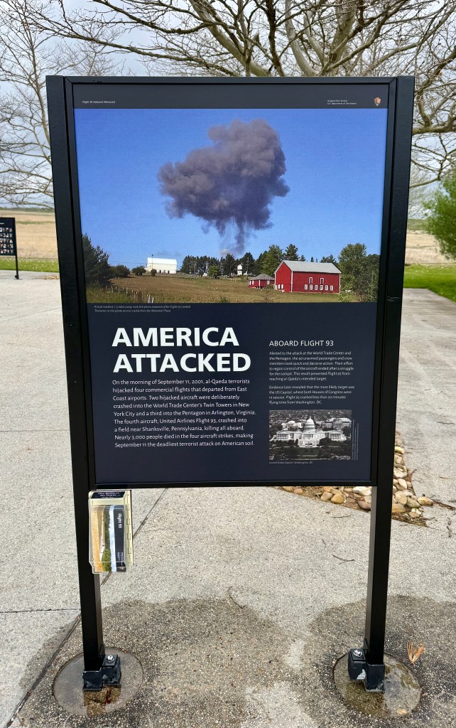
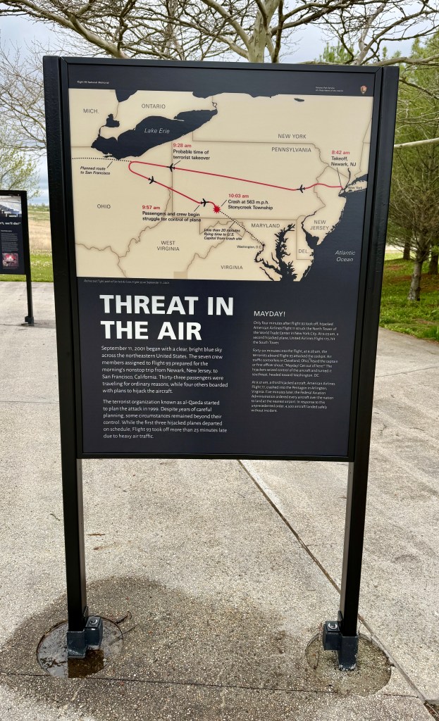
The Flight 93 National Memorial is a memorial built to commemorate the crash of United Airlines Flight 93, which was one of four aircraft hijacked during the September 11 attacks in 2001. Of the four aircraft hijacked on September 11, 2001, United Airlines Flight 93 is the only one that did not reach the hijackers’ intended target, presumed to be either the United States Capitol or the White House, both in Washington, D.C.
I was a senior in high school just shy of my 18th birthday on 9/11, so I have incredibly vivid memories of the day of and the days after. I lost a classmate in the Iraq war that followed. Being almost an adult, I knew life before, and life after, remembering the time when you could just wander about the entire airport without being a ticketed passenger and just wander across the border with Mexico and Canada without a passport. So being at the crash site of Flight 93 stirred up a lot memories and emotions for me, including ones I didn’t even know I had.
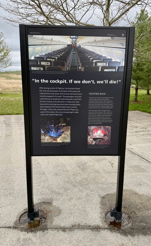
After scowling at the rambunctious 8th graders on a field trip and using the restrooms, I headed to the visitor center where I purchased some postcards and a patch. I then asked the ranger to confirm my plans of walking the two trails, which he seemed surprised I wanted to do because of the wind. I then looked at him and burst out crying, squeaking out, “I was a senior in high school.” I can’t explain it, but I hardly doubt I was the first to do that in front of him. The ranger was so kind, sharing a bit of his experience in the aftermath, and listening to me blabber on about the thoughts in my head. He had his talk to do with the 8th graders in the exhibits, which he invited me to join. I declined (I actually skipped looking at the exhibits all together, though I am sure they are fabulous), and headed to the windy solitude of The Allée in an effort to collect my thoughts and emotions.
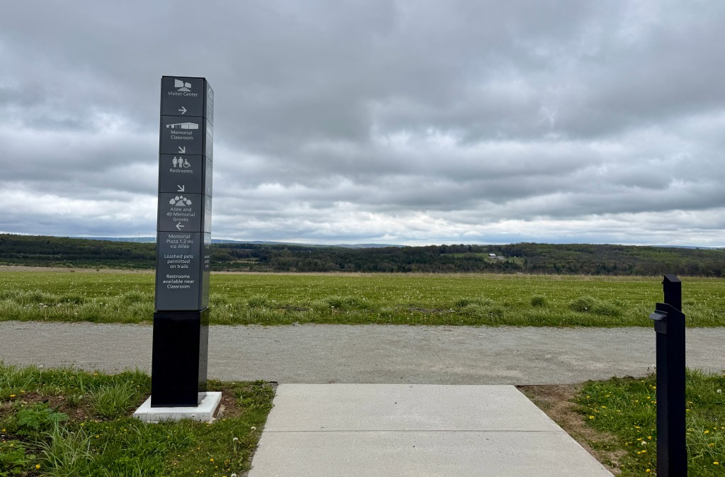
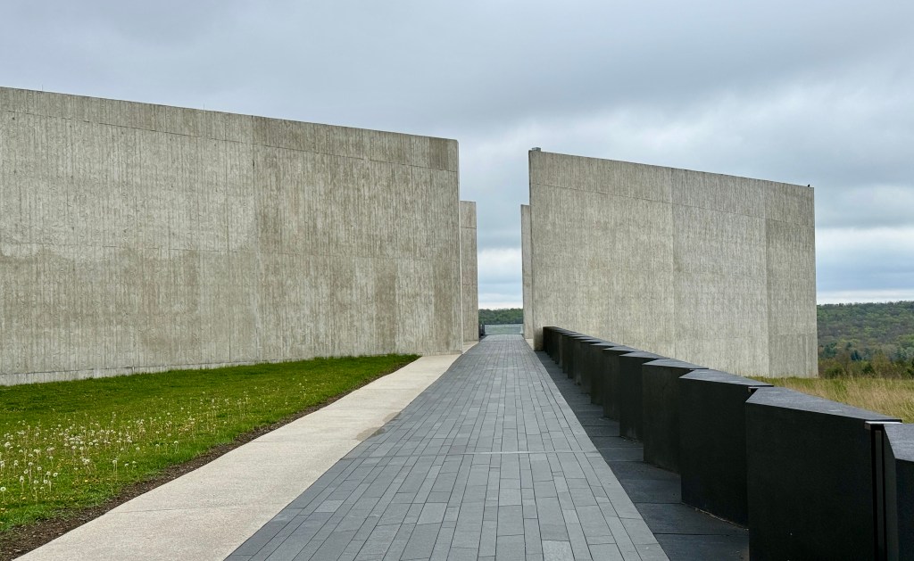
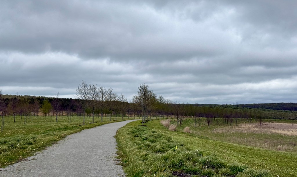
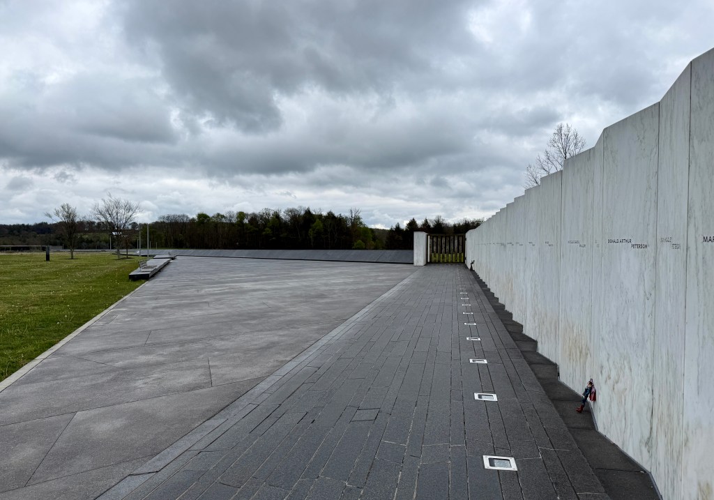
The Allée is a 1.2-mile trail which starts at The Flight Path walkway alongside the Visitor Center. Lined with Red Sunset maple trees the Allée passes the 40 memorial groves and continues over the wetlands bridge. The trail reaches the focal point, the crash site, and the debris field of Flight 93.
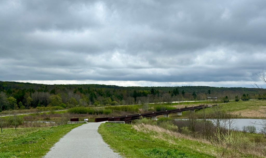
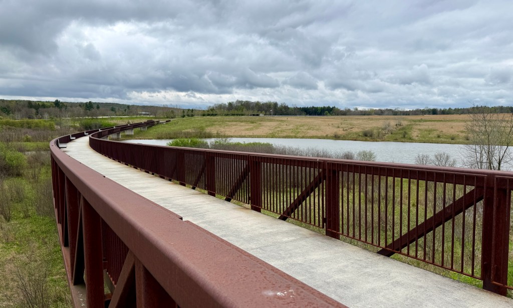
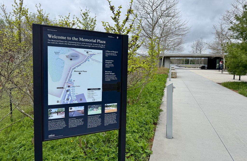
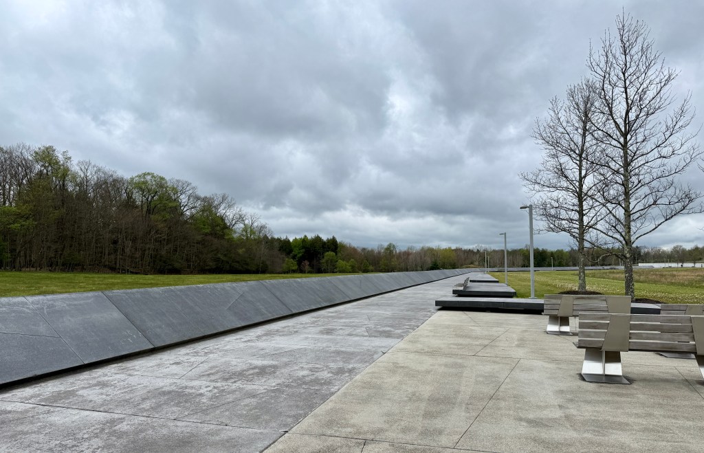
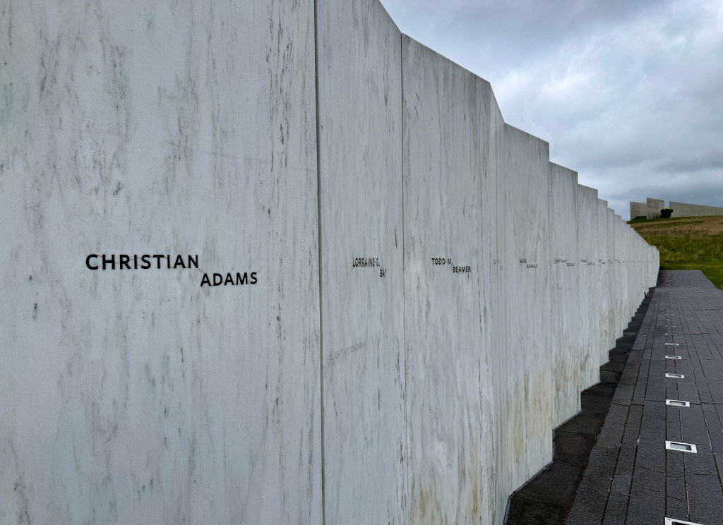
The Allée ends at the Memorial Plaza, which is also accessible by car. This plaza includes informational signs about 9/11 and Flight 93, and leads out to the Wall of Names, where the seven crew and thirty-three passengers are memorized in a row along the flight path to the impact site.
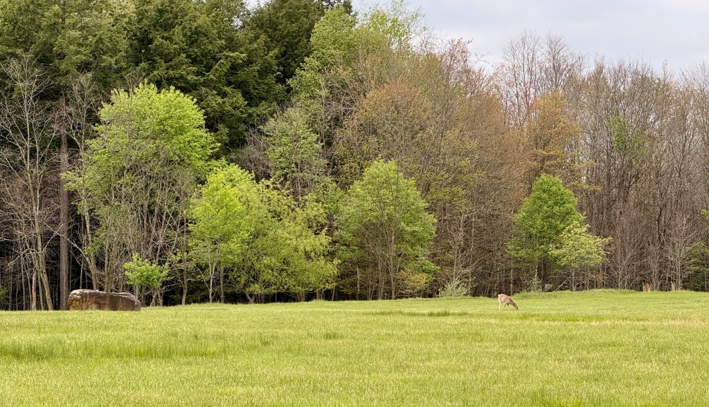
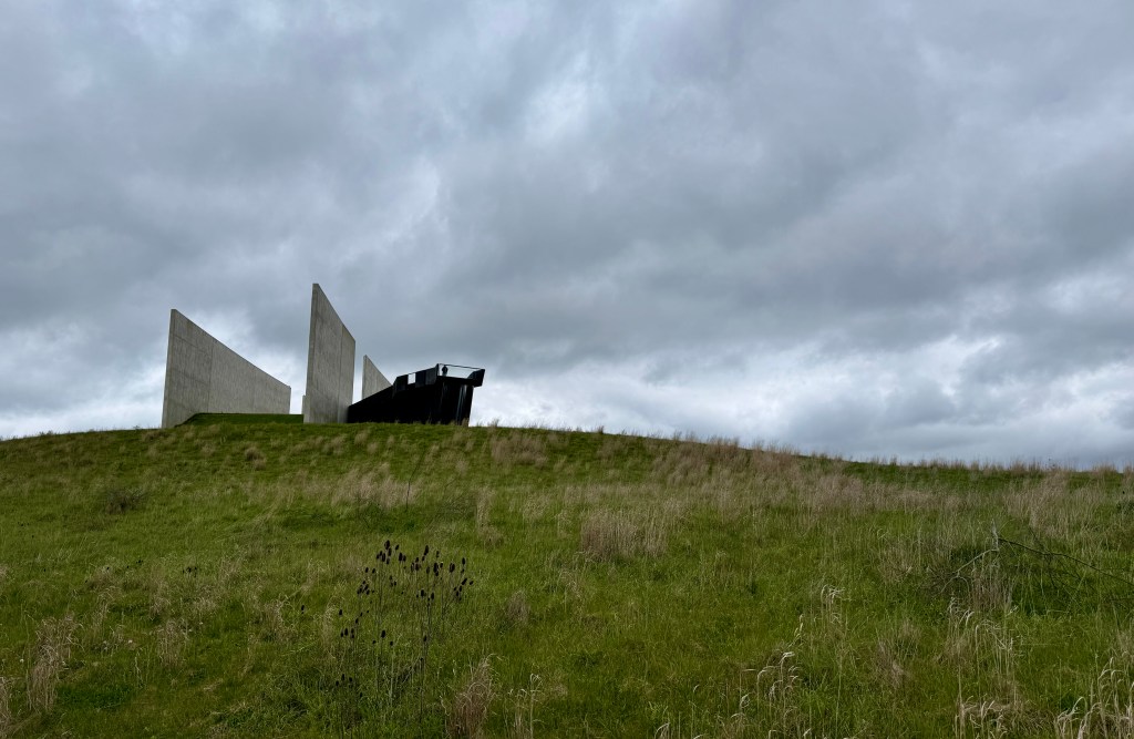
Flight 93’s impact site is marked by a boulder, and the area is closed to the general public. As I approached the area, I noticed four or five deer grazing near the boulder. It gave me pause. Nature marches on, and the deer see nothing but a silent meadow with some darn good grass to eat, unaware of the fiery tragedy of twenty-five years prior.
To wrap up my loop, I took the Western Overlook Trail back towards the parking lot. This trail gains elevation, but switchbacks gently.
The Western Overlook Trail highlights the location where the family members of the passengers and crew of Flight 93 first viewed the crash site after September 11th, 2001.This 0.7-mile trail extends from the Memorial Classroom restroom facilities to the Wall of Names.
My little hike was 2.14 miles total with 187 feet of elevation gain. Luckily the rain held off, and I just dealt with a cold wind. I honestly liked that the weather fit the mood!
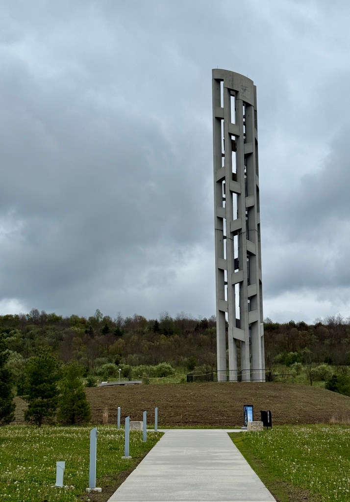
I had one last stop to make, and that was at the Tower of Voices, which is located near the entrance. This is a 93-foot tall structure that has forty wind chimes installed in it, one for each victim. I think I read somewhere that it takes wind speeds of 10-12mph for the chimes to ring, which fortunately I had on this day. I listened for a bit, but was overcome with an eery feeling after not too long.
Whew. What an NPS unit. Not everything can be majestic alpine mountains in the park service, that is for sure. But I am very happy I was able to visit, even if I cried no fewer than three separate times.
I was going to be based in Somerset for two nights, so I headed on the short drive to Fairfield Inn. The sky ended up clearing, and the sun peeked out which was nice to see (I thrive on sunshine!). I ate dinner at Ruby Tuesday (I love me a salad bar), before settling in to plot the next day’s adventures. The next day would be a doozy, so stay tuned!


Leave a comment