
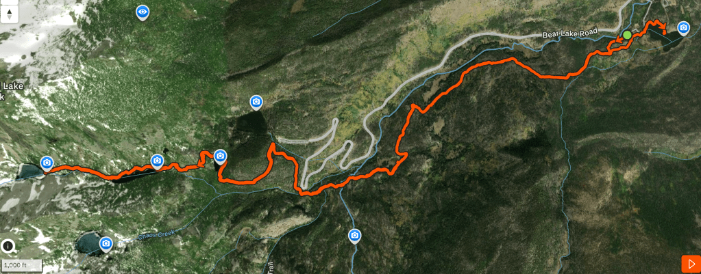
Winter flew by this year, and I had spent exactly zero days hiking in Rocky Mountain National Park. Winter is my favorite season for exploring RMNP as timed entry reservations are suspended and the crowds are a fraction of the high season. And here it was, mid-April with the days dwindling down that I could just pop into the park whenever I wanted. After being inspired by a hike seen on Strava recently, I finally committed – I would take the long way up to Emerald Lake by parking at Sprague Lake and hiking up the Glacier Creek Trail. The hike would be just about 10 miles long with 2000 feet of elevation gain, just what I needed as I attempt to re-kickstart training for my crazy summer plans.
Cool things about this hike I would accomplish:
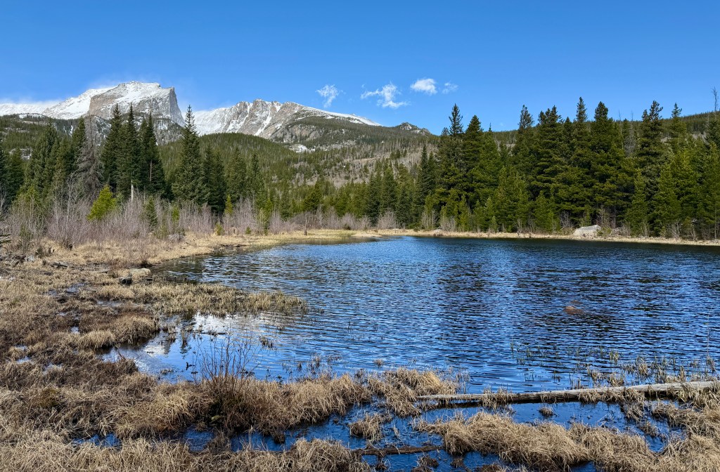
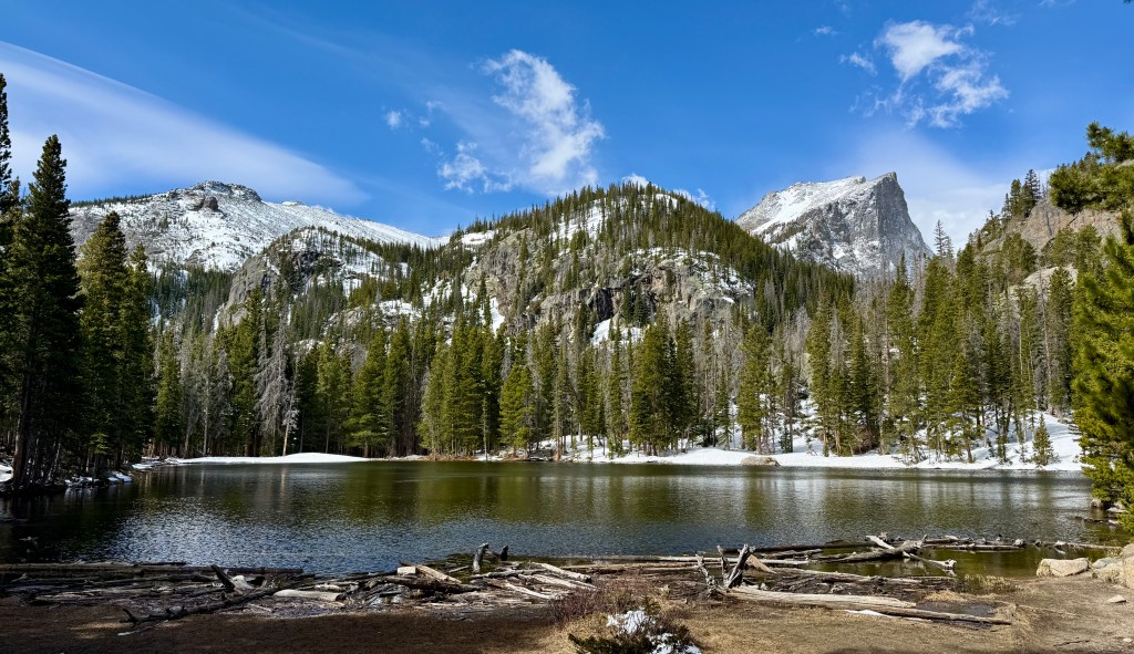
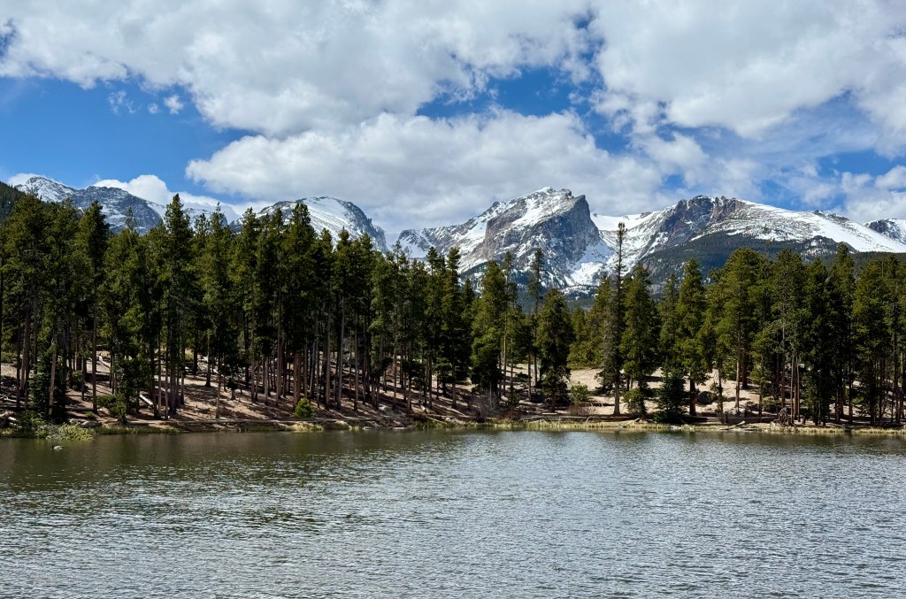
- Visiting Sprague Lake for the first time. Of all the hours and days spent in RMNP, I’ve never been to Sprague Lake!
- Playing in some snow. Not as much snow as there should be for this time of year, but snow nonetheless
- Using my microspikes for the only time this season
- Taking a harder, longer way to Emerald Lake
- Enjoying solitude on a lesser-traveled trail
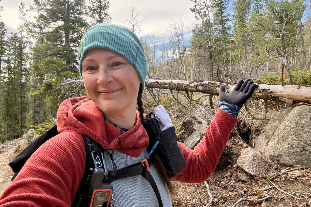
A Thursday in mid-April meant a quiet journey up Big Thompson Canyon to Estes Park and no entrance line. Sprague Lake’s large parking lot had just a handful of cars as I parked shortly before 9am. The sun was hidden behind some easterly clouds and the wind was whipping. I panicked ever so briefly that I had not prepared for cold-weather hiking, but calmed myself down when I reminded my brain I had a puffy, rain jacket, extra fleece, a hat, and gloves with me. Plus I like hiking in cooler temperatures?!
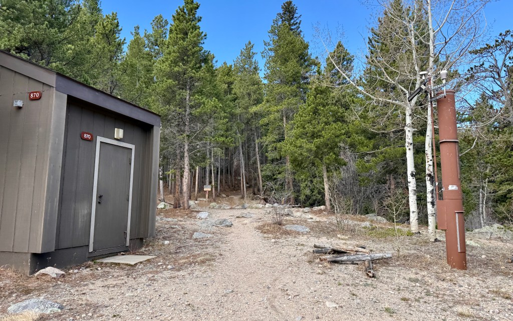
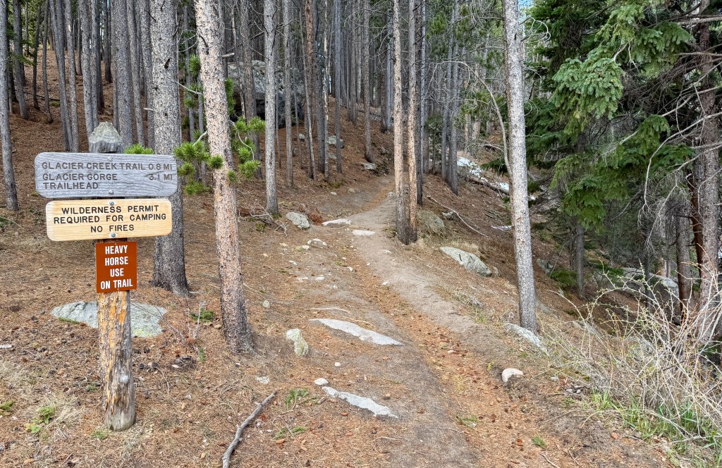
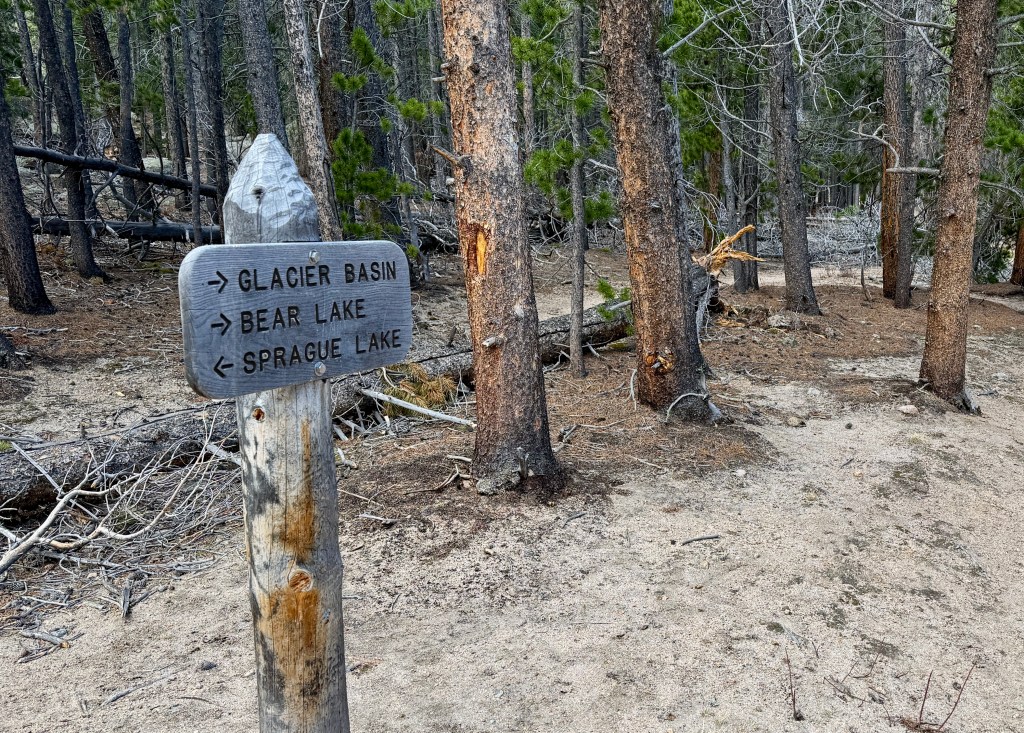
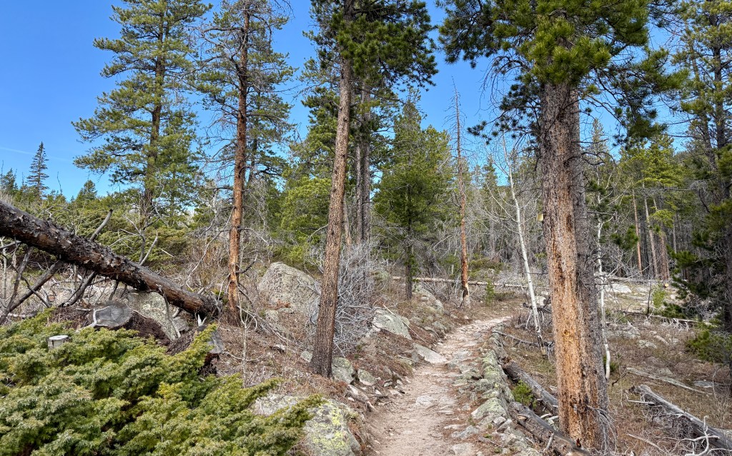
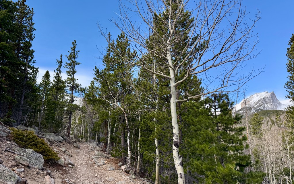
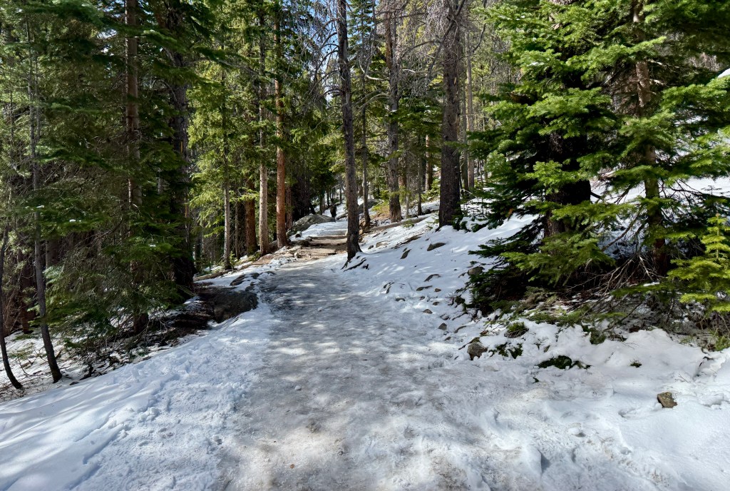
At 9:05am I sent out from the west end of the parking lot. The first mile or so there are a lot of trail intersections and junctions which can make things confusing, but the park service has signed them well (I still pulled out All Trails from time to time just to make sure I was heading in the right direction). Glacier Creek Trail starts out rather wide and very cruisey. Overall the elevation gain is not strenuous, as you just steadily gain the elevation without any dramatic, steep climbs. You’re slightly working, but not really. All-in-all, a nice relaxing trail in the forest!
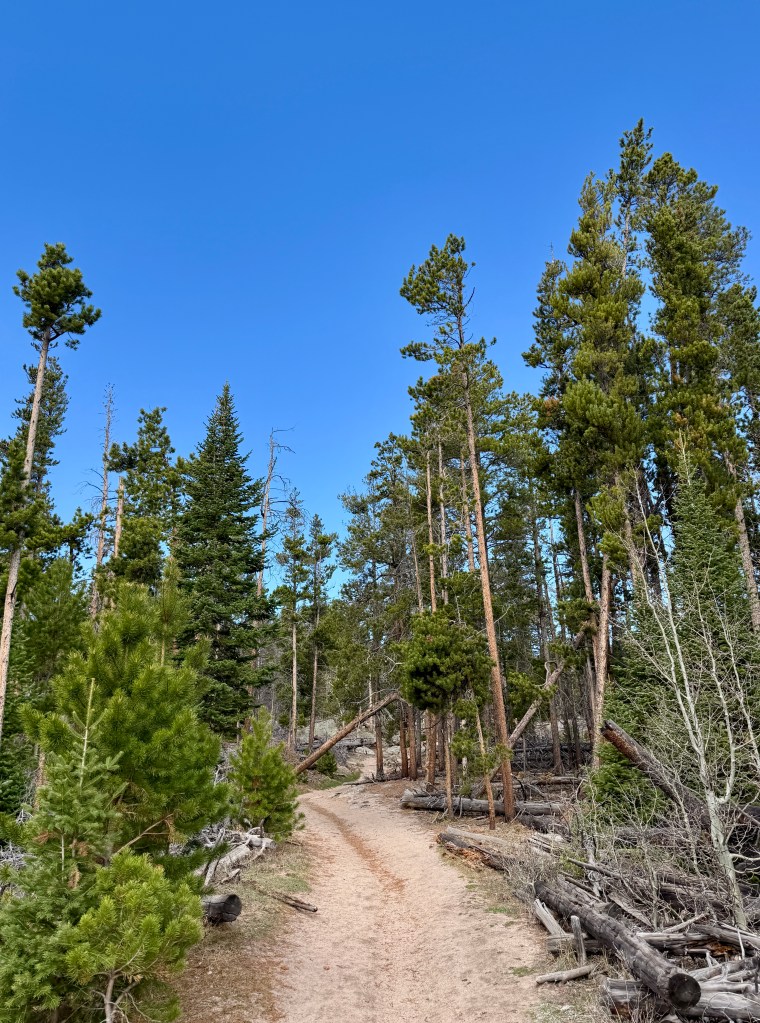
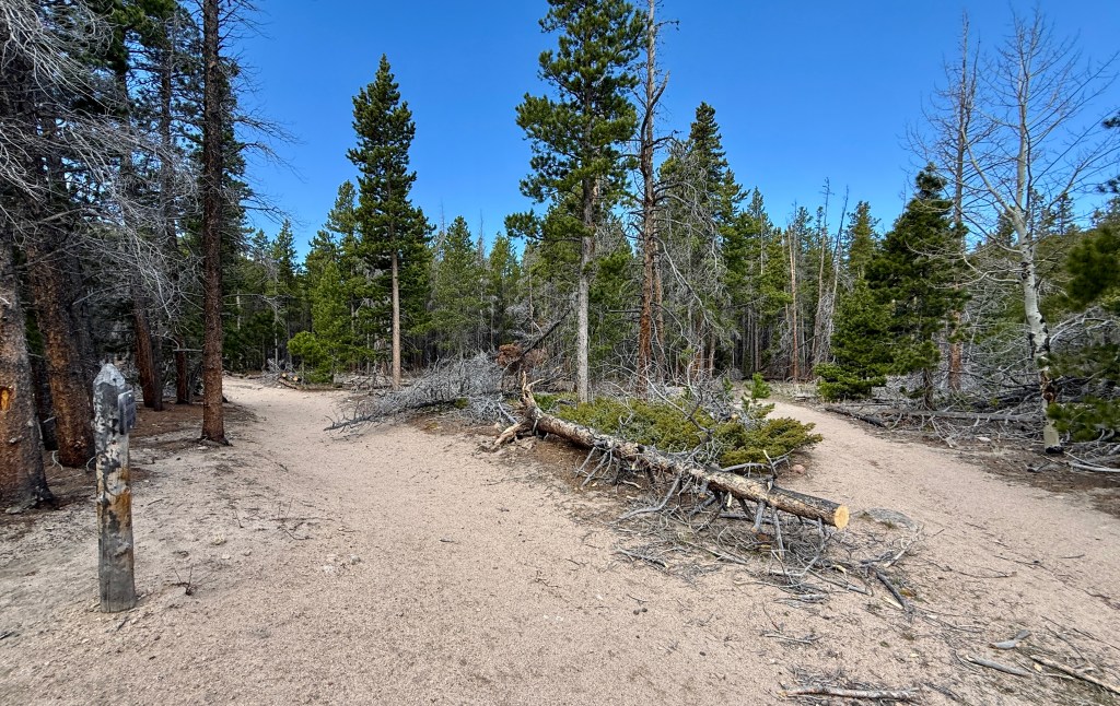
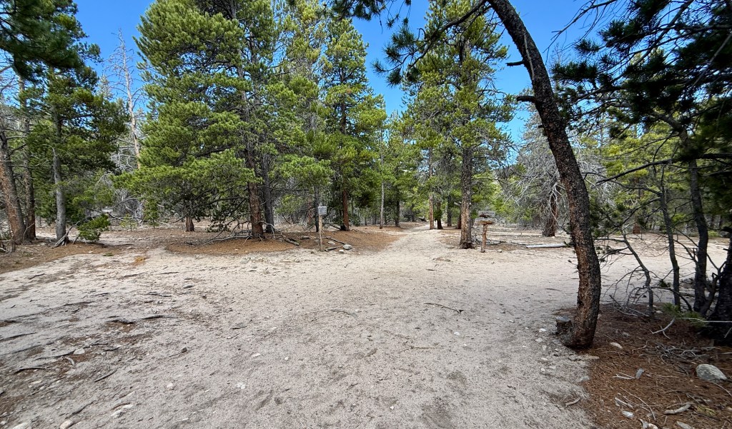
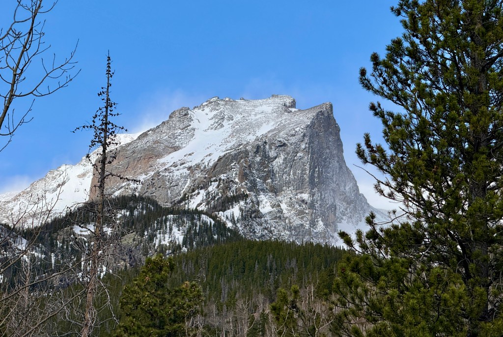
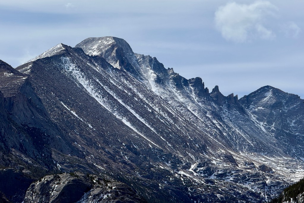
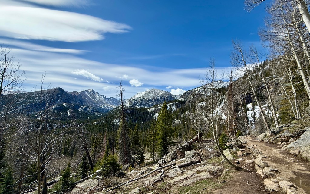
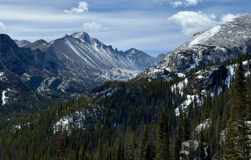
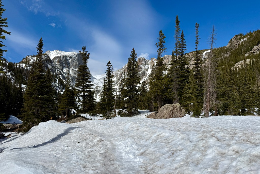
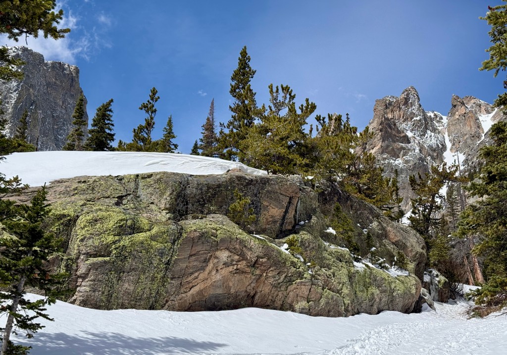
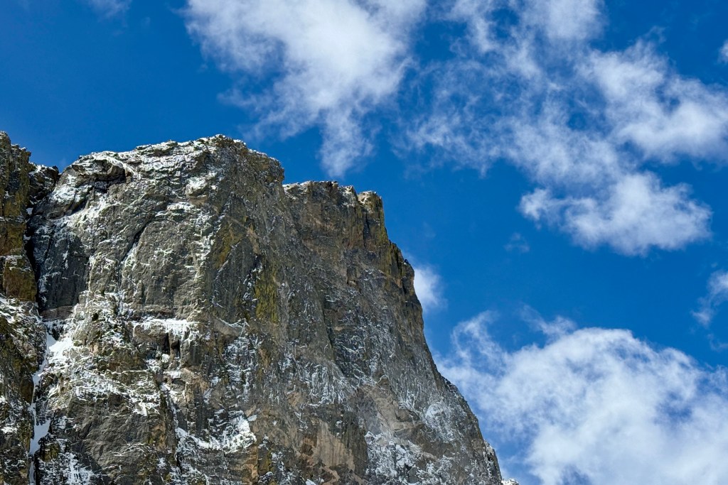
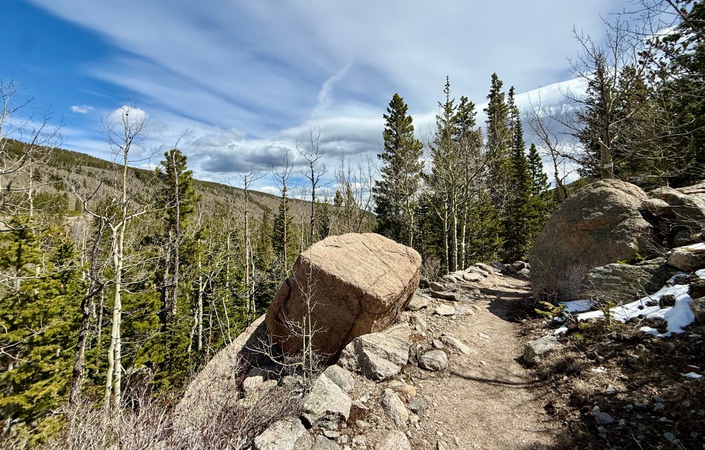
Eventually the trail narrows into singletrack that alternates between smooth and rocky. Occasional glimpses to the high peaks of the Continental Divide happen between the trees. Though this trail does not have expansive views, I love the solitude (I never saw another person on it!) and the smells of fresh pine.
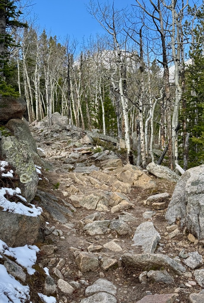
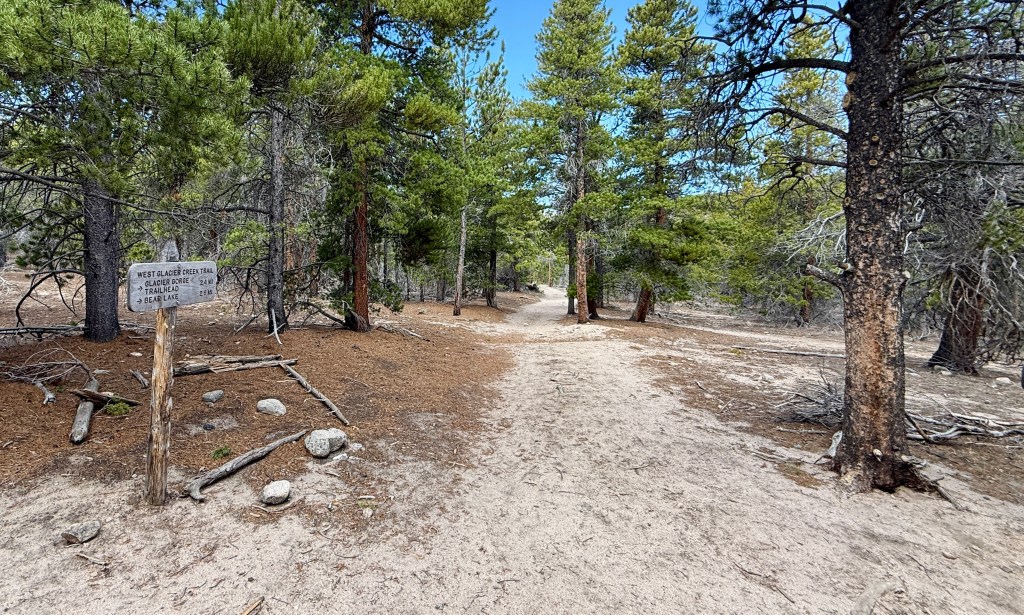
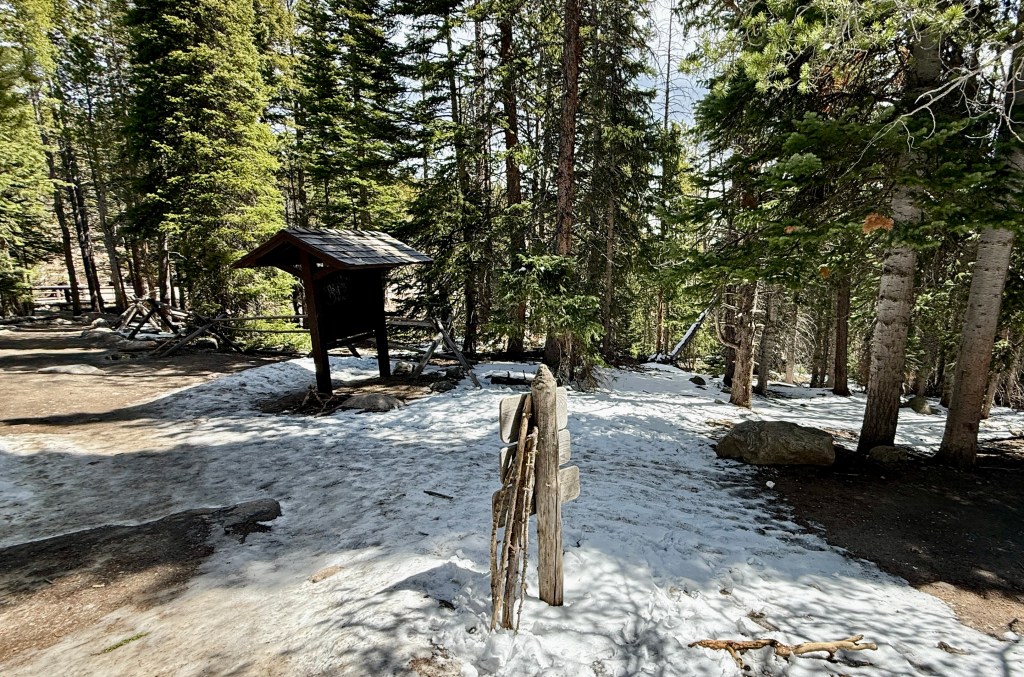
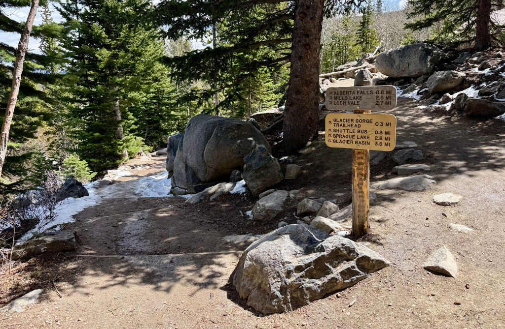
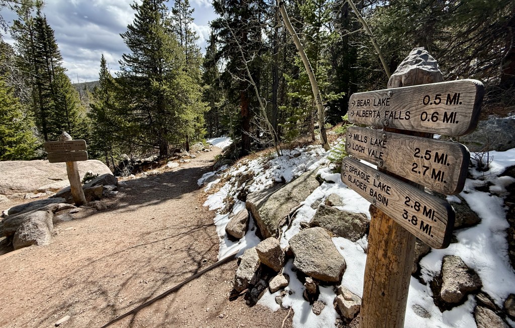
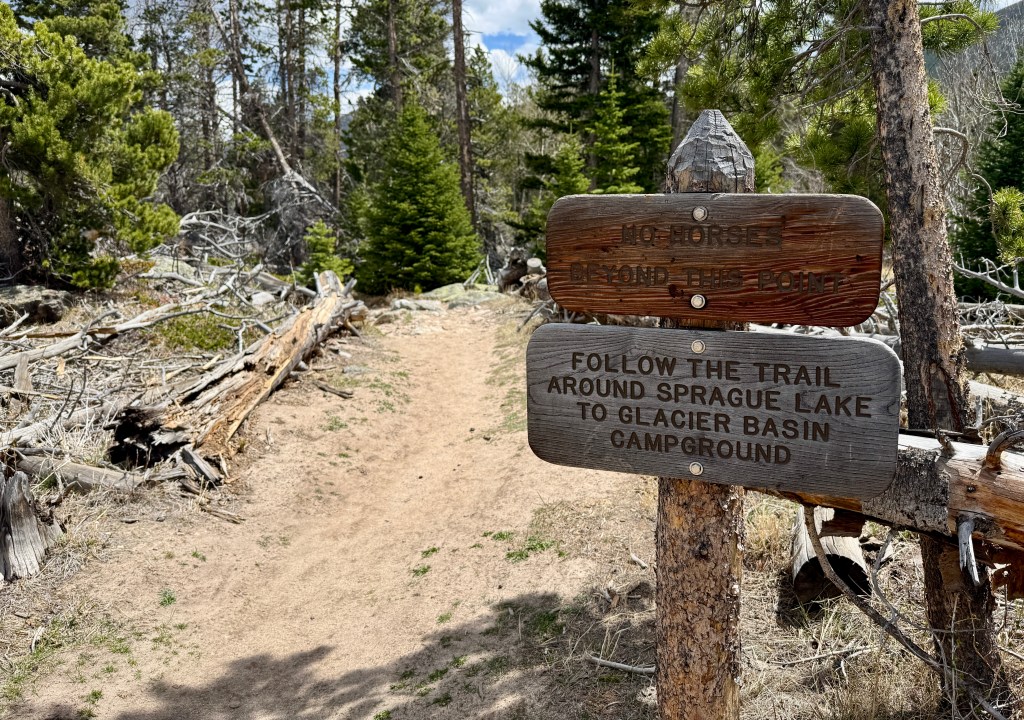
After 2.6 miles I reached the trail junction with the trail leading to the Glacier Gorge Trailhead, and saw my first people since starting the hike. This is also where the climbing stepped up a notch as the gains came rapidly as I climbed towards the trail junction at Bear Lake. I was feeling a bit puny, as this was my first big hike in a long time, so I took to reasoning that I could turn around whenever since it was an out-and-back hike.
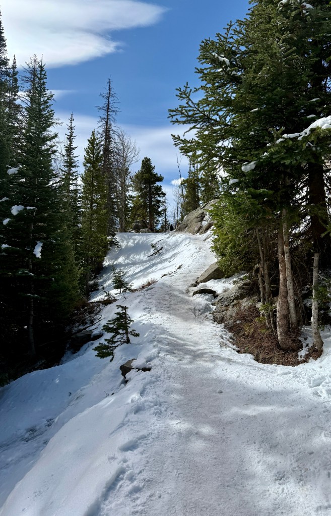
Once reaching the trail that heads up to Nymph, Dream, and Emerald Lakes, I decided to keep chugging along. While there were patches of snow and ice, I was able to stay to the edges and had good grip. I had one of those silly moments of thinking, “Look at me, I’m a badass with proper tread on my trail runners, I don’t need no stinkin’ microspikes!” as I watched the tourists slip and slid in mostly terrible footwear choices (how these people do any sort of hiking in the shoes they tend to wear is beyond me!).
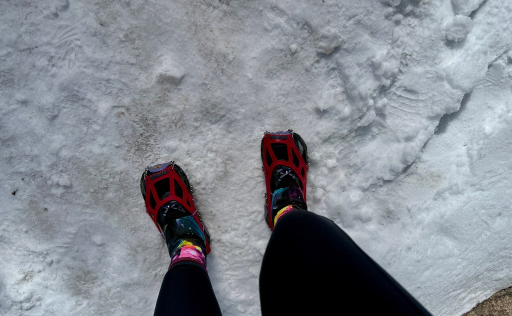
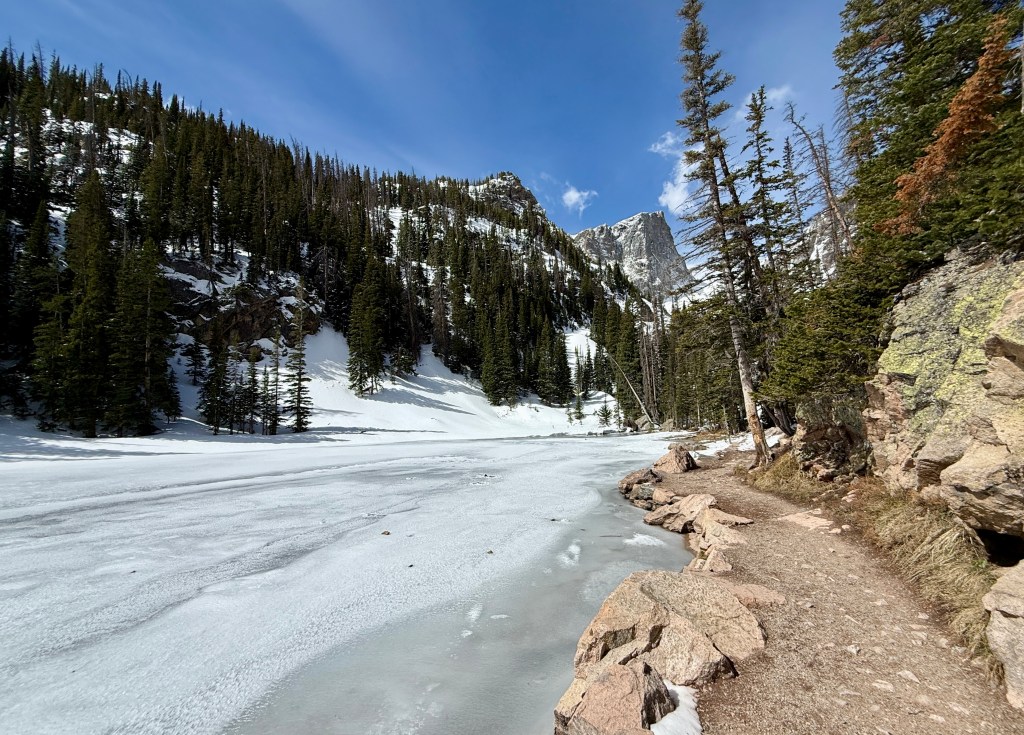
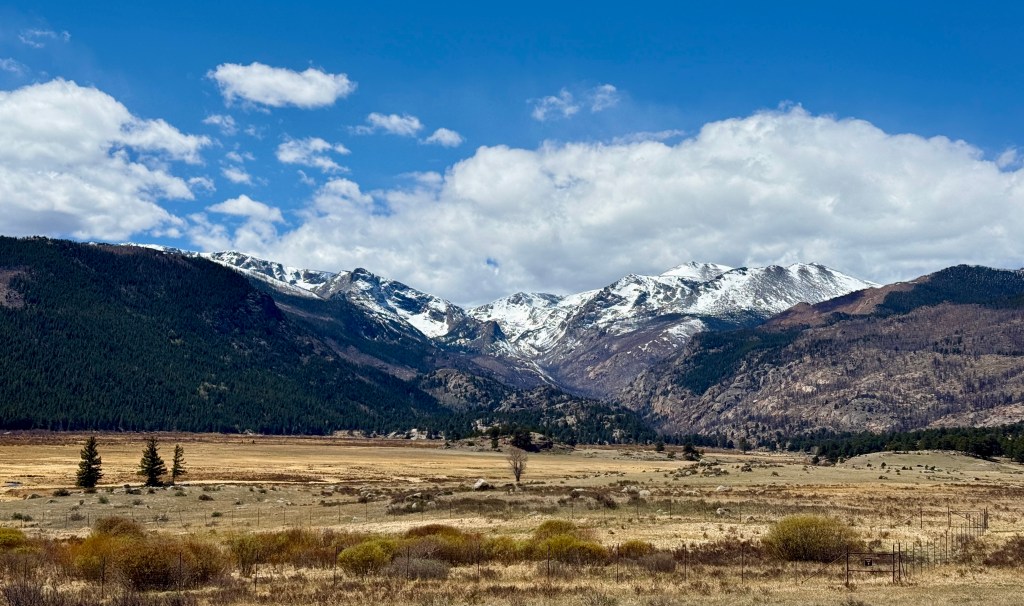
Shortly after passing Nymph Lake, I resigned to putting on my microspikes (I hate wearing microspikes on anything but a mountaineering boot as they eventually start hurting my feet – today was no exception), even though the trail was still dry in patches. The hills were much steeper now, and I had the realization that I really could not be falling as I was only a month out from surgery on my elbow. I was excited to see snow, but still so disheartened at how dry the mountains are (we are in an absolutely historic drought in the Rocky Mountains after the warmest and driest winter on record).
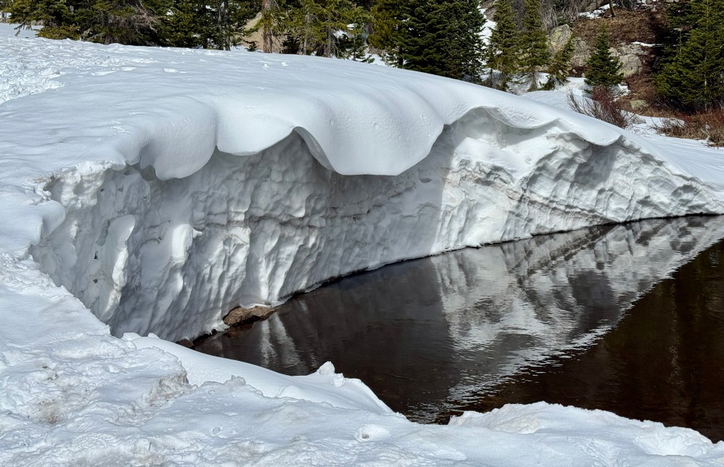
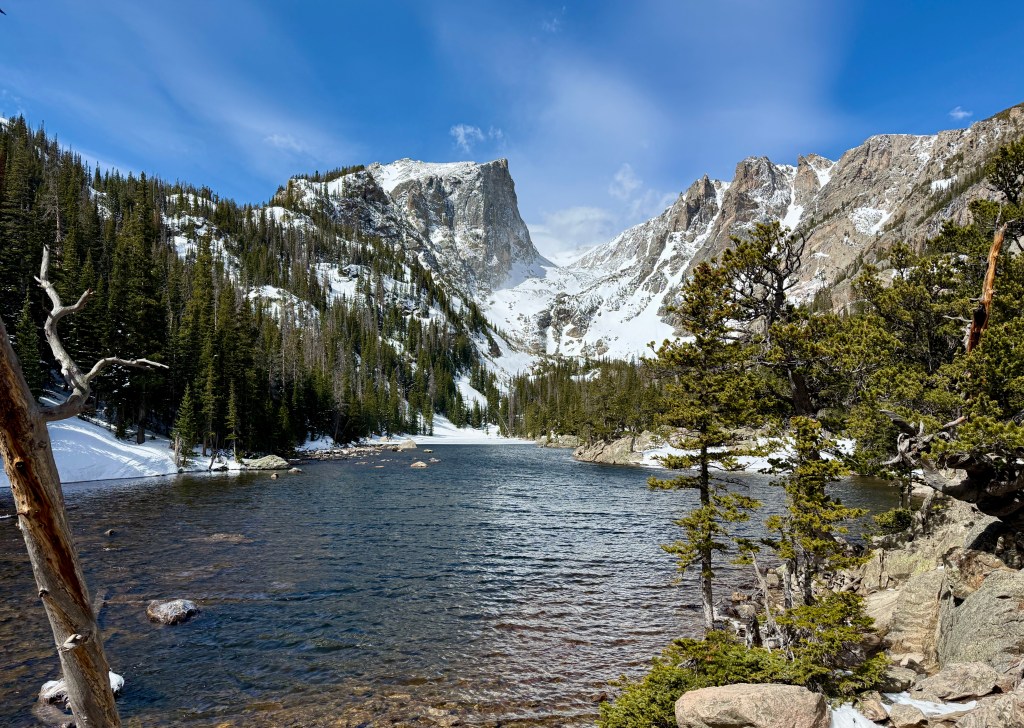
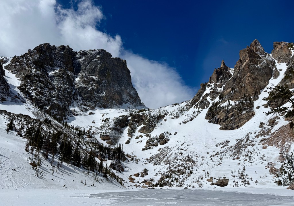
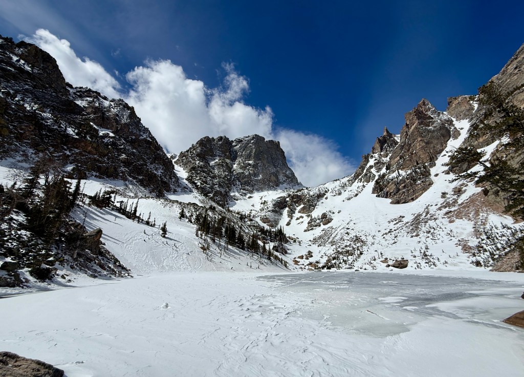
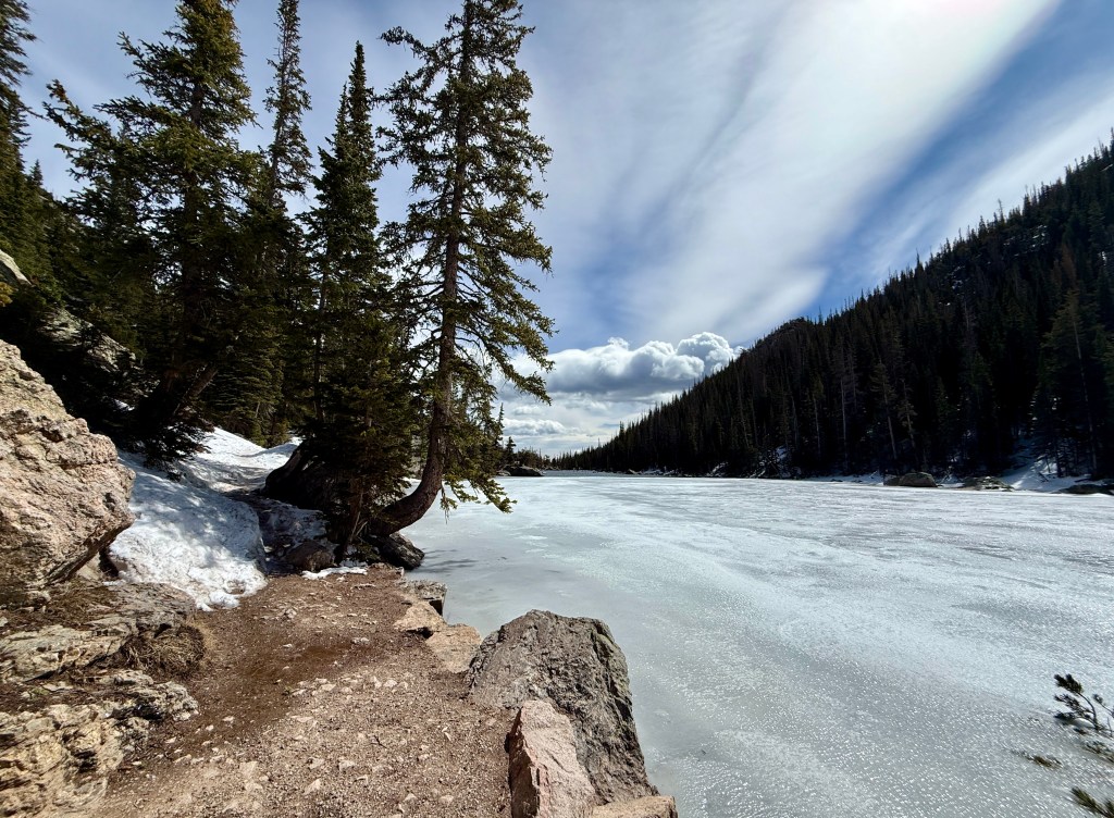
The snow was here to stay by the time I reached Dream Lake. It was about this time I realized I did not have sunscreen with me, so I crossed my fingers that my face would not get sunburned from the harsh sunlight reflecting off the snow. Dream Lake was about half thawed, and people were gushing about seeing fish. There were a lot of people everywhere, but I liked the fact so many were out enjoying a nice, sunny April day in the outdoors!
Committed to just doing my planned hike of the day now that I had reached Dream Lake, I bargained with myself that I could eat my Uncrustable and take a nice break at Emerald Lake and then it would be all downhill back to the car. Up the steep hills I went, so thankful for microspikes as I watched others slide all around. One guy told me I was cheating, and I smiled and replied, “Four wheel drive all the way!”
Reaching Emerald Lake, I quickly found a rock to relax on, and donned my rain jacket to help against the cold wind. I had never been to Emerald Lake in winter (spring?) conditions, so I enjoyed the snowy views as I mowed down my Uncrustable and some dried mango. I did not linger long due to the wind, and after five minutes or so I headed back down the trail, which was quickly softening in the warm temperatures.
Reaching my junction, I peeled off the microspikes much to my feet’s relief. Now just time to make the miles back to the car! Once I was back to the solitude of Glacier Creek Trail (where I would not see any humans once again), I was lost in my own thoughts over the 2.5 miles back to Sprague Lake. It is a great trail for this I suppose!
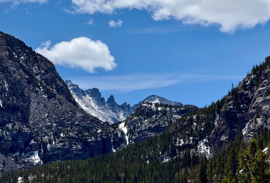
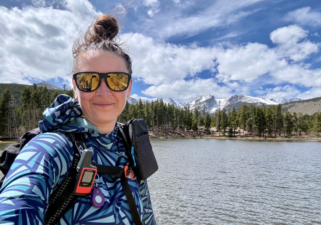
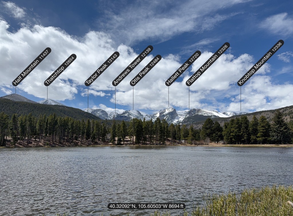
Since I had never seen Sprague Lake before, I headed to the lakeside trail (which circles Sprague Lake 0.75 mile in distance). I did not feel like I wanted to hike another three-quarters of a mile, but I walked out to the part that gives the best view towards the peaks of the Continental Divide and snapped a few photos. I got some strange looks since I still had my pack, but I guess I at least looked very prepared for a 0.75-mile hike 😀
10.04 miles and 2047 feet of up later, I was back at my car! Overall, my adventure took 3 hours 51 minutes total. Yay, I did the whole darn thing! What a great day out in the pine smells and big mountains!
Details:
Date Hiked: April 16, 2026
Trailheads: Sprague Lake
Total Mileage: 10.04 miles (Garmin Enduro 3)
Total Elevation Gain: 2,047 feet
Total Time Spent: 3 hours 51 minutes
Weather: Windy but sunny
Trail Conditions: Dry or snowpack/icy, just depending!
Cell Service: 5G service at Sprague Lake… whoa! Spotty service elsewhere (I put my phone into airplane mode eventually)
Special Considerations: This hike is located within Rocky Mountain National Park and an entry fee is required. During the busy season timed entry reservations are in place. This trail begins in the Bear Lake Corridor, which has extended timed entry requirements. This area is incredibly popular, and often parking will be full by the early morning hours. There is a free shuttle available for Bear Lake Corridor, and it is recommended to park there if arriving in the later morning hours in the summer. Microspikes are highly recommended if hiking in the fall, winter, and spring months as trails at higher elevations will hold snow and ice and make things not so fun without traction devices.


Leave a comment