

Chasing the highpoints of each state are definitely something I do not seriously chase, with only Panorama Point (Nebraska) and Mount Washington (New Hampshire) checked off on my list. Much like the Colorado 14ers, I’ve taken a very non-serious approach… I’ll do them, but they’re not my focus of outdoor and adventure activities. Yet, despite this casual approach, in the past few months I really started think about how to work in Black Mesa in Oklahoma into this year’s travels…. and this would be the day! Even better, I’d get to cross Oklahoma off my list of states visited, leaving only Alaska, Hawaii, North Dakota, Wisconsin, Arkansas, Tennessee, and Rhode Island left!
With a long day ahead of us, we departed the hotel well before sunrise and breakfast service, stopping for McDonald’s and gas before heading north from Amarillo. We mused at conspiracy theories about contrails as we were solidly in flyover state territory, and debated what a move to a little north Texas town with a funny name would be like. Golden hour seemed to play forever in this flat territory as the sun took forever to rise.


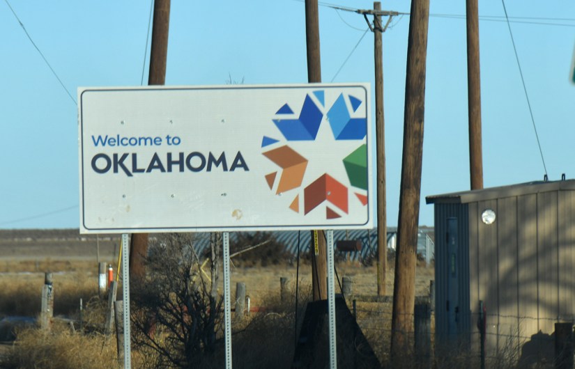
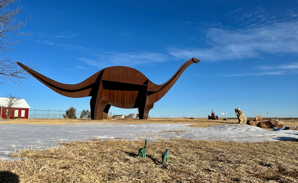
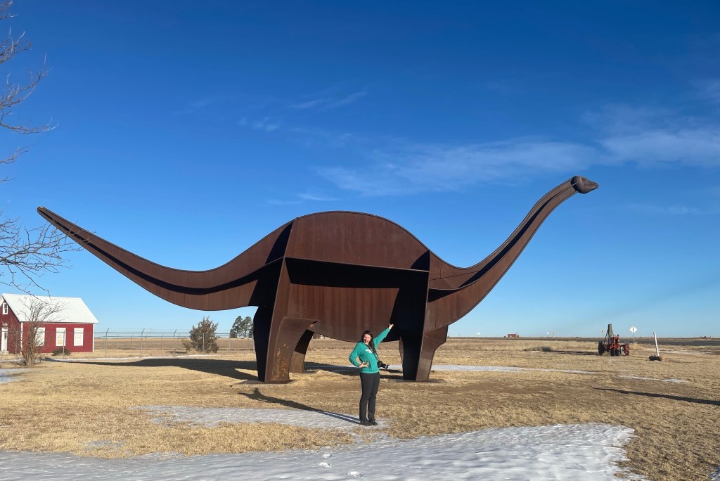
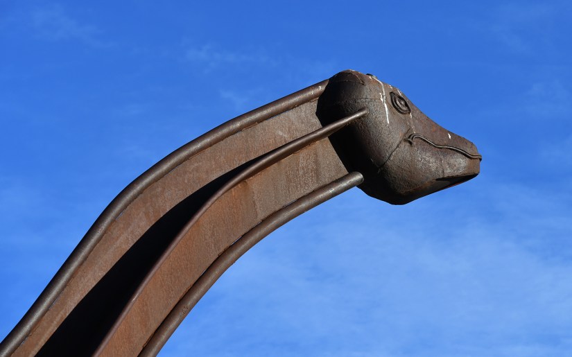
We blasted through the border of Oklahoma and my 53rd state, managing to snap a photo of the border sign at 75mph. It had been a few hours in the car, so I directed us to Cimmy the Brontosaurus in Boise City. Located at the Cimarron Heritage Center, Cimmy is really a model of an apatosaurus and came to fruition thanks to Bob and Norma Gene Young in 1990 who dreamed of building a life-sized dinosaur (my kind of folks!!).

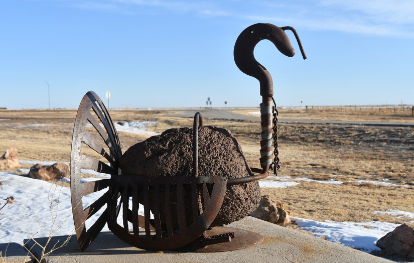
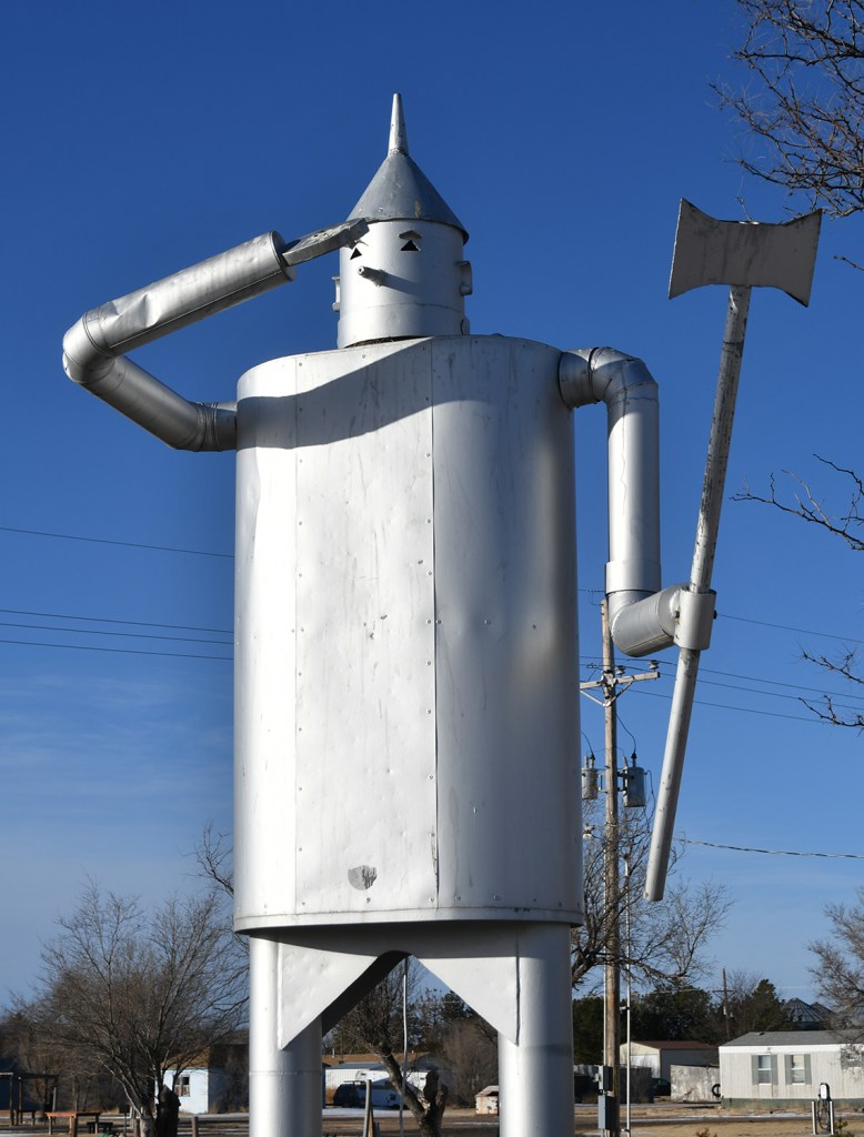
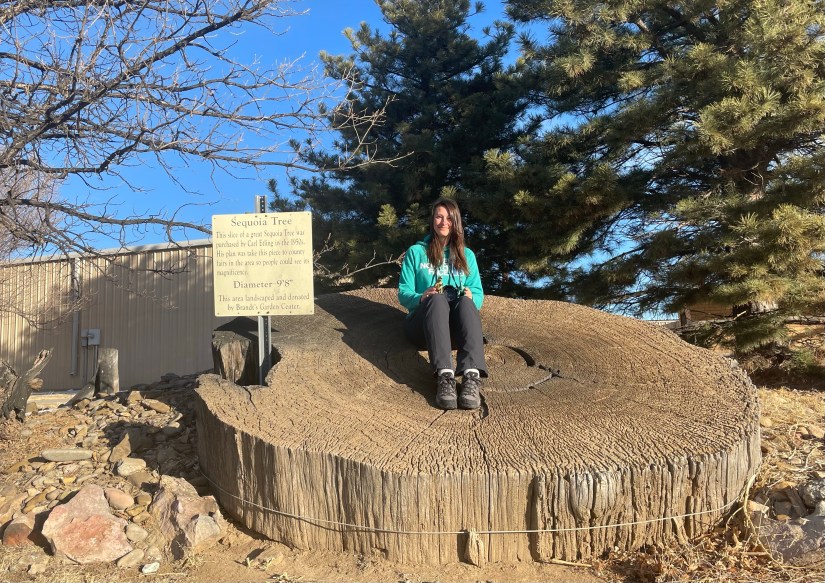
Though the Cimarron Heritage Center was not opened on this early Sunday morning, we explored the other wonders located outside, which include the Tin Man, a Wizard of Oz replica built in 1989. We were curious about the bomb on display, and upon arriving home I learned it is from when the military accidentally bombed Boise City in 1943. I kick myself for not taking a photo of it! And then there was the cross section of a sequoia tree that was purchased by Carl Etling in the 1950s.
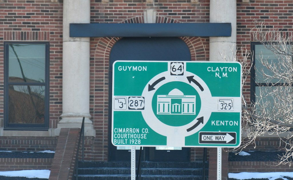
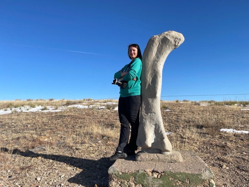
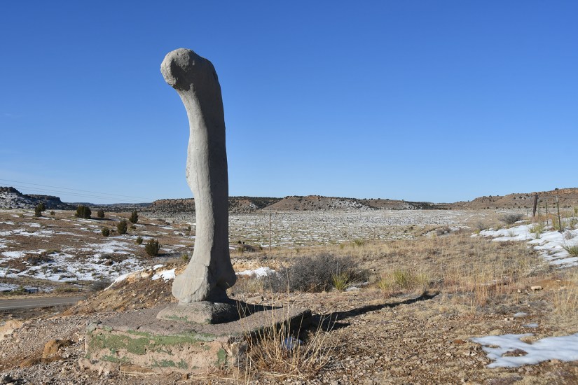
Small town roadside wonder satsified, we turned onto the narrow backroads to make our way towards Kenton and the Black Mesa Nature Preserve. Cimarron County is a fascinating place when it comes to dinosaurs (and other history – Cimarron is the only county in the U.S. that touches five states: Kansas, Colorado, New Mexico, Texas, and Oklahoma), so we had to make another quick stop on the side of Highway 325 at the replica of a brontosaurus femur that is mounted near a dinosaur bone quarry.

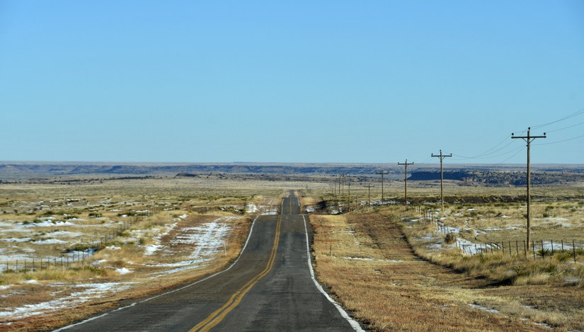

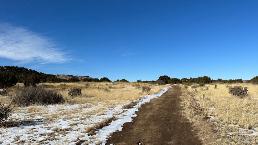
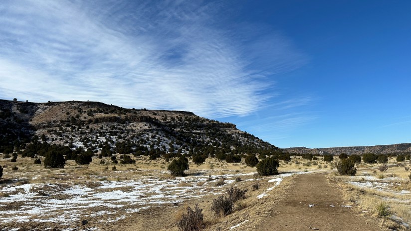
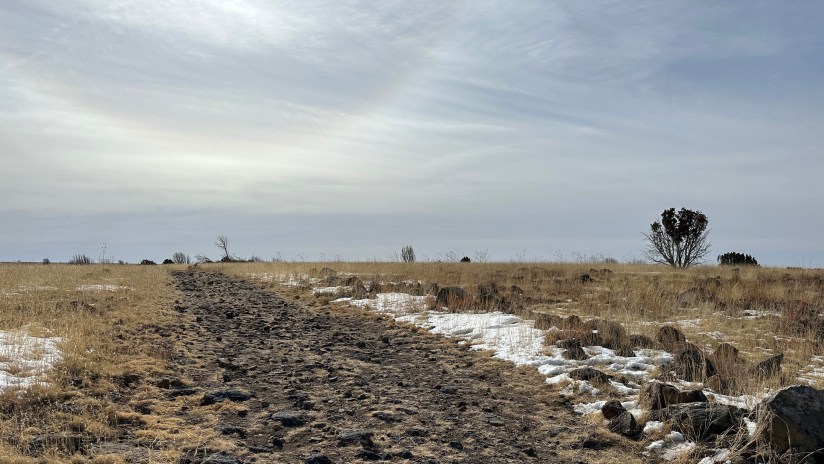
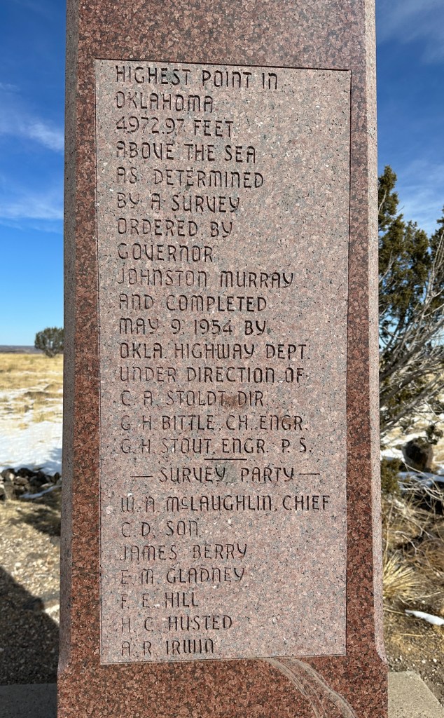
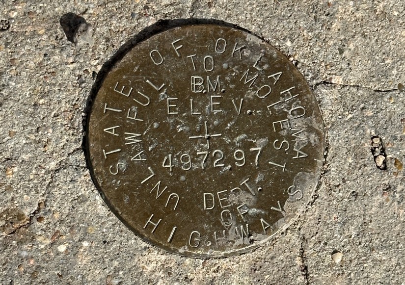
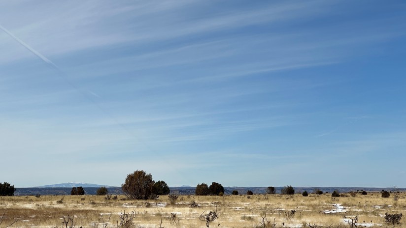
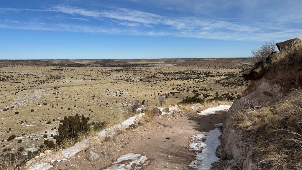
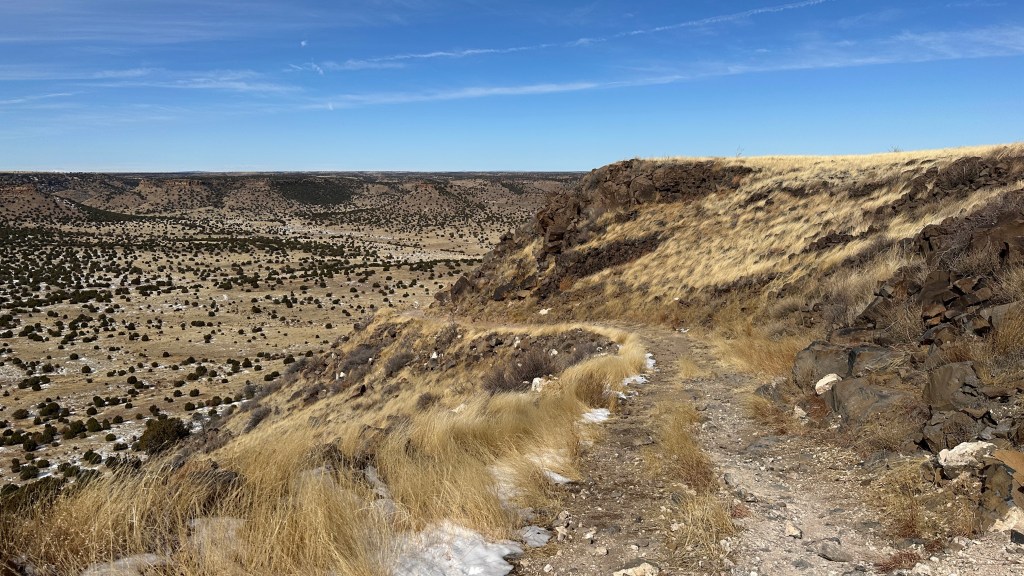
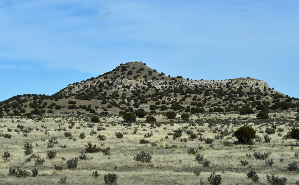
Marking the point where the Rocky Mountains meet the shortgrass prairie, Black Mesa Nature Preserve was our big destination of the day. Located just a bit north of Kenton, a bit south of Colorado, and practically in New Mexico, this would be start of our 8.4 mile hike to the highest point in Oklahoma at 4,973 feet. Black Mesa consists of a layer of black lava that is 30 million years old, reminding us of the volcanic past of this region.

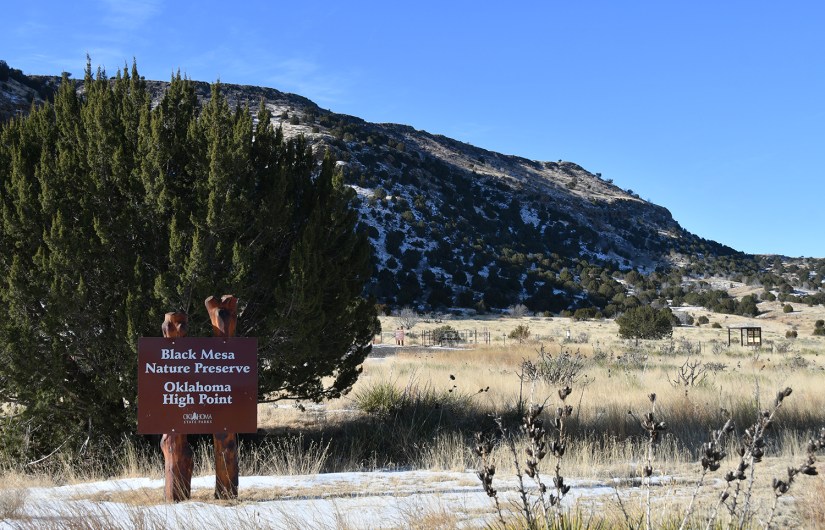
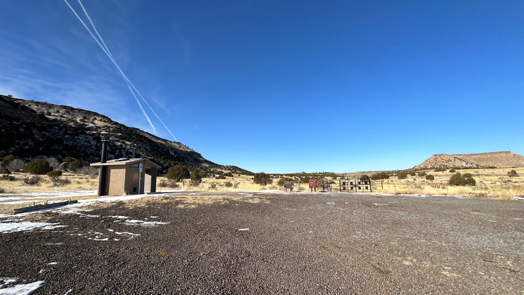
The trailhead for Black Mesa is roomy and has vault toilets on site. There are great information boards with shaded pavillions along the summit trail, and even a water cache and first aid supplies at mile 2/mile 6. Overall, this hike is pretty flat, with minimal elevation gain and loss until mile 2, when the trail starts to ascend Black Mesa, gaining about 600 feet in a mile.
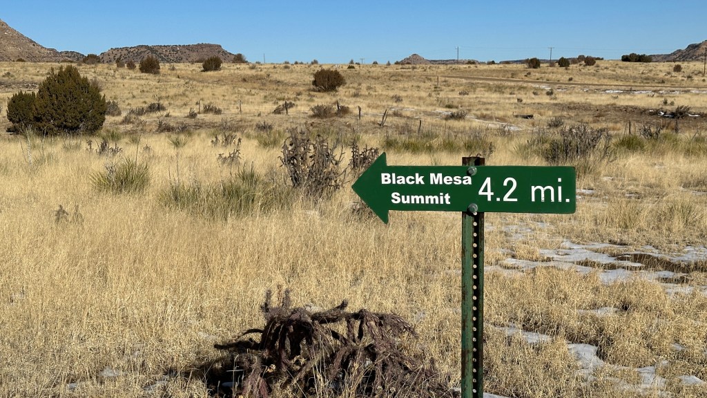
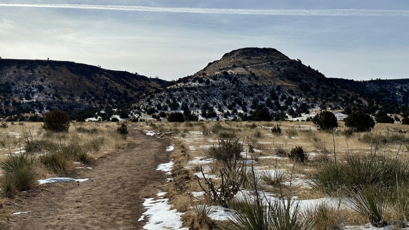

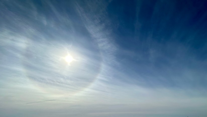
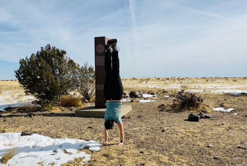
Once on top of the mesa, there is another mile to go to get to the granite marker marking the official high point. I found the top of Black Mesa eery, as the thin clouds, sundog, and “top of the world” views just created a weird atmosphere. “This is when we get abducted by aliens,” I remarked as we hiked along in the occasional snow and mud.
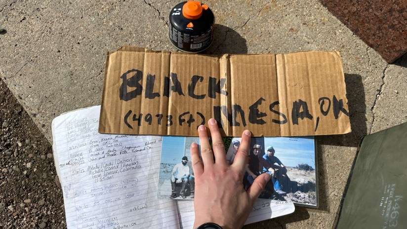
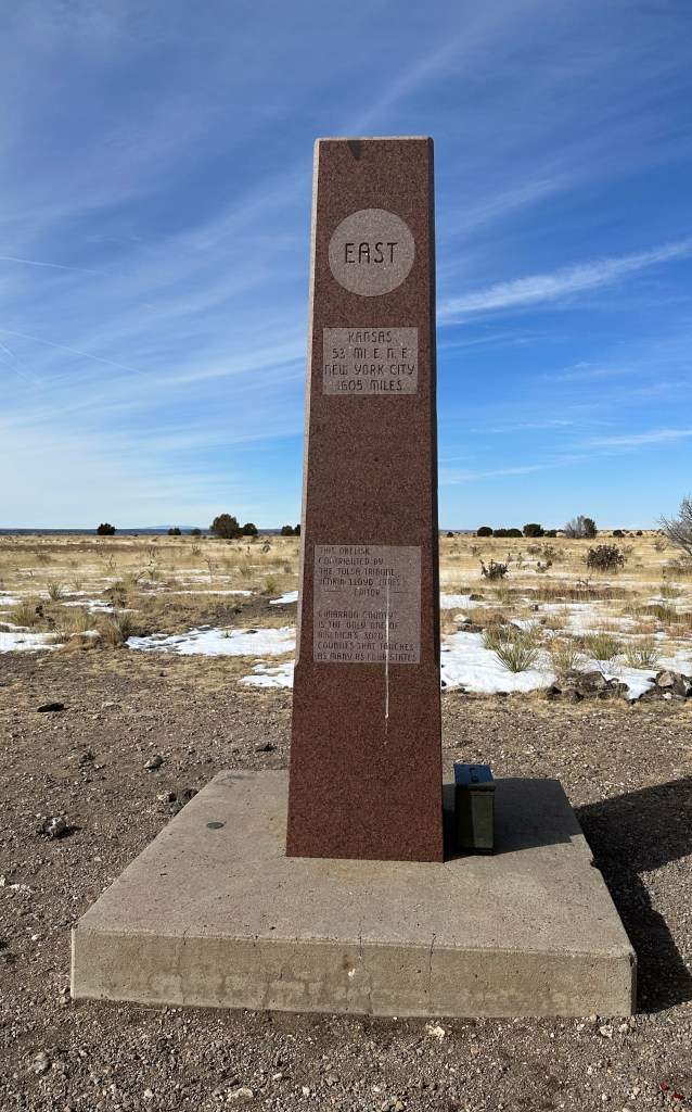
Once at 4,973 feet and on the summit of Oklahoma, we explored the granite marker, which has distances to various places such as New York City and neighboring states on it. There is also a geocache with summit register, so I took time digging through it and reading register entries. Third state high point reached, and I’m pretty smitten that this one did not involve driving to the top!


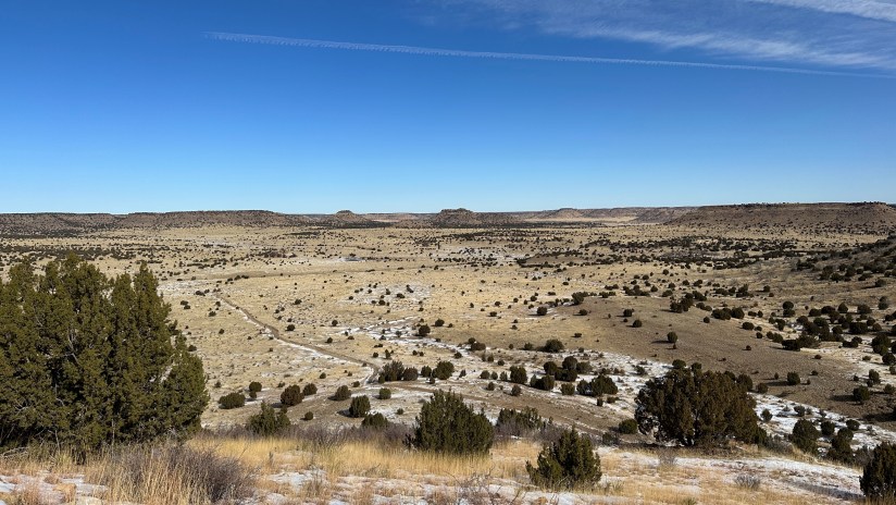
We had the summit to ourselves, but on the way back to the trailhead there was a steady stream of people hiking up. I was definitely thankful for our 9:50am start time, as we had beat the trail traffic! In total, the hike took us 3 hours 8 minutes total with our goofing around on the summit, and covered 8.4 miles and 804 feet of elevation gain. Not a bad day in the sunshine – I was even able to hike in a tee shirt!
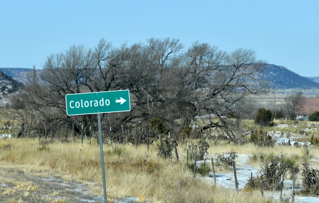
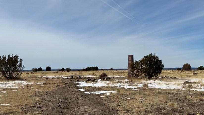
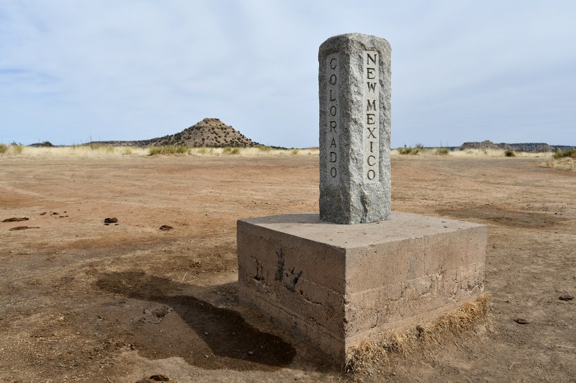
Without cell service and not being smart enough to think ahead to download Google Maps for offline use in this region, we headed north, figuring we’d just figure out the roads as we went along. We made a brief stop at the Preston Monument, which marks the tri-point border of New Mexico, Colorado, and Oklahoma. There are 38 tri-points for state borders found on land, and this was the second one I have visited (the WY-CO-NE one being the first back in December 2021). I realized at this time that I had forgotten about the dinosaur tracks across from Black Mesa, but we decided to not turn back.

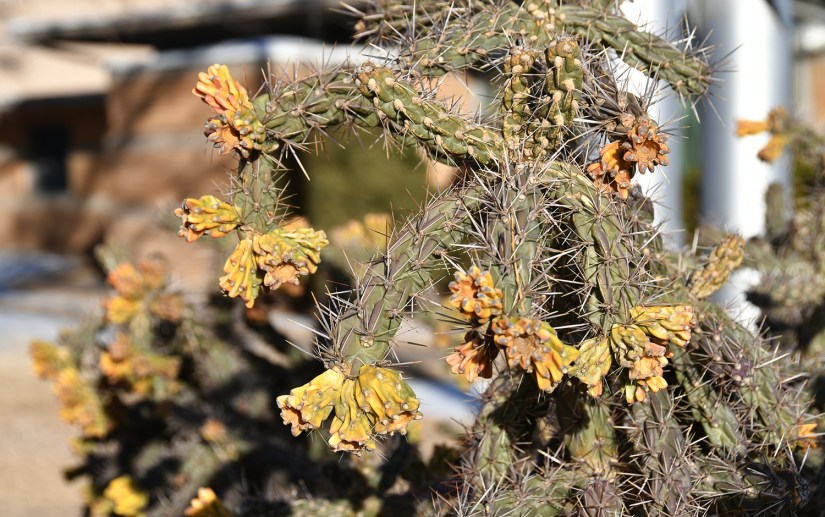
North we drove on Road 8, a smooth gravel road that led us through the pinyon trees, cholla cactus, and grasslands to US Highway 160. Feeling energized, we initially discussed visiting Bent’s Old Fort National Historic Site and Sand Creek Massacre National Historic Site so we drove towards La Junta, CO. However, energy levels began to fade and as I checked drive times, I realized we’d be pushing a long day and have to rush through Sand Creek, which I did not want to do. Also, this would leave Amache NHS orphaned, so I rationalized that it was just better that I stuck with my plans for my May trip, and visit these three units together then.


After something like thirteen hours, I arrived home in Cheyenne, utterly exhausted from a whirlwind three days exploring a new corner of the world! 2023’s Presidential Adventure done and dusted! Where to next year?!


Leave a comment