

The second day of this year’s rendition of the President’s Day weekend adventure came as I stirred awake about 6:30am after a fitful night’s sleep in the hotel. With a jammed packed agenda, it was quite alright I suppose, as we needed to start early. I quickly dressed, and we waited in the lobby for fifteen minutes until breakfast service began at 7am. With a Hilton waffle in the tummy and a coffee mug filled with mediocre hotel coffee, we attempted to get on our way. It would take about three tries to actually get on our way after running back to the hotel for forgotten items, turning around to get the cheaper gas at Sam’s Club, and finding a truck stop to buy some water (Amarillo water was gross tasting, what can I say?). The morning would start with some good ol’ Route 66 sightseeing. I have always wanted to drive the historic Route 66 from Chicago to Los Angeles, but so far have only managed to accomplish very piecemeal things around the route.
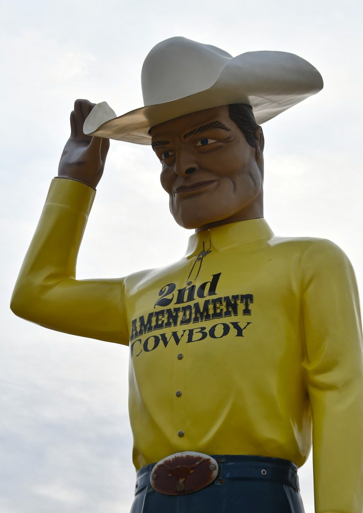
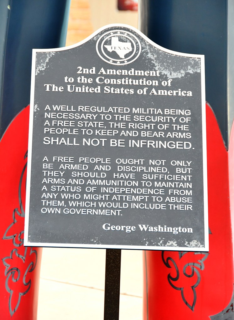
Moved to this location at the Cadillac Ranch RV Park and re-purposed in 2014, the 2nd Amendment Cowboy was our first quick stop. This giant fiberglass man is a “muffler man.” These were designed and built between 1963 and 1972 by International Fiberglass and stood outside typically muffler shops, but also other types of businesses, to help call attention to the business. Also here is several Cadillacs (in much much much better condition than those down the road at Cadillac Ranch), and a gift shop which was not open at the early hour was visited. A very quick stop, but one of those roadside attractions we had to see. (Fun fact, we actually found the cowboy the night before while being horribly confused on how to get headed east on I-40 from our hotel on the westward frontage road.)

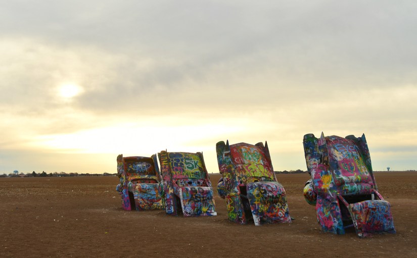
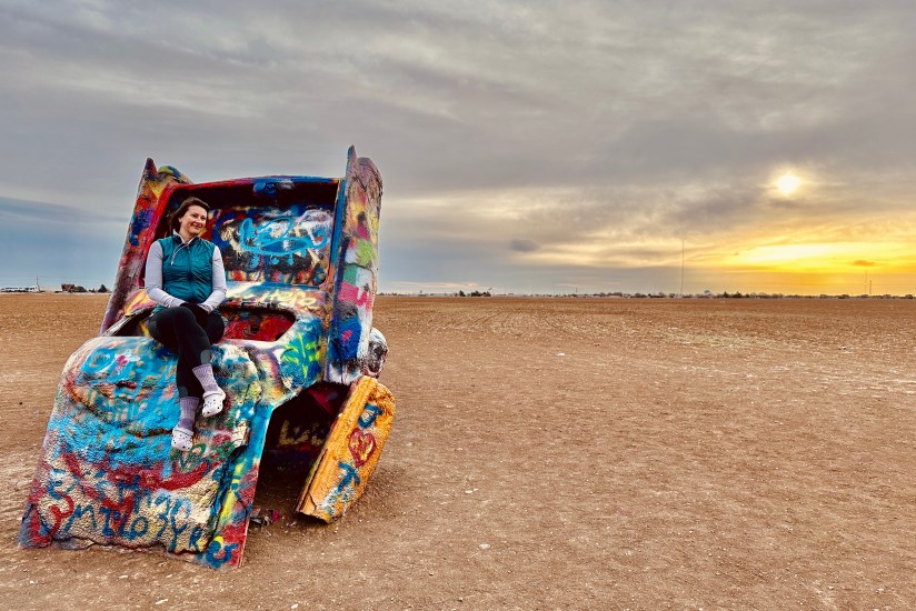
Next up was just a minute or so down the road, Cadillac Ranch. Built in 1974 by the art group Ant Farm (and backed by local billionaire Stanley Marsh 3), Cadillac Ranch consists of ten Cadillacs (model years 1949-1963) buried nose-down in the ground allegedly at the same angle as the Great Pyramid of Giza. In 1997 the art installation was moved to its present day location by I-40. Visitors are allowed to paint on the Cadillacs, as the creators had planned for the whole thing to slowly be destroyed (the tailfins were some of the first things to get stolen…). Armed with some old spray paint I found in a box in my basement, we headed into the chilly wind ready to leave our mark.
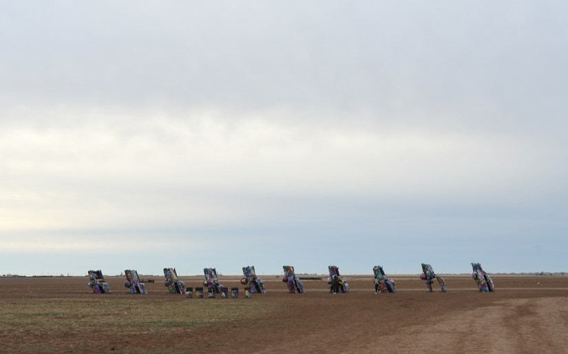
Luckily our decently early morning meant only three other people were present, though by the time we were leaving fifteen minutes later cars were lining the frontage road and a decent crowd had formed. The sun was barely coming awake over the flat horizon, creating some great morning light. As someone who has never graffitied anything before, it took me awhile to figure it out, eventually spraying my initials and “WY” on a car with some dark pink paint I had used to paint the valve cover of the car I built up and raced “back in the day.” Tom was not as lucky in his efforts, as I had given him a can of Nissan K23 touch up spray paint and really it is best suited for painting bumpers, not graffiti. My mom told me I should paint “Wyoming” on a car, so I found a good place and also left my mark for her.


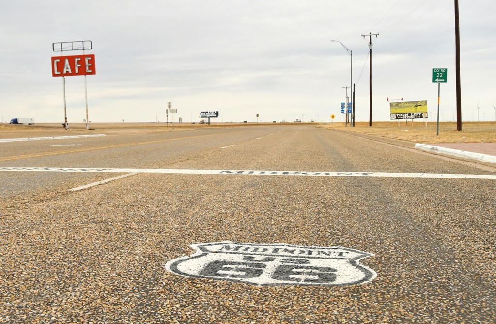
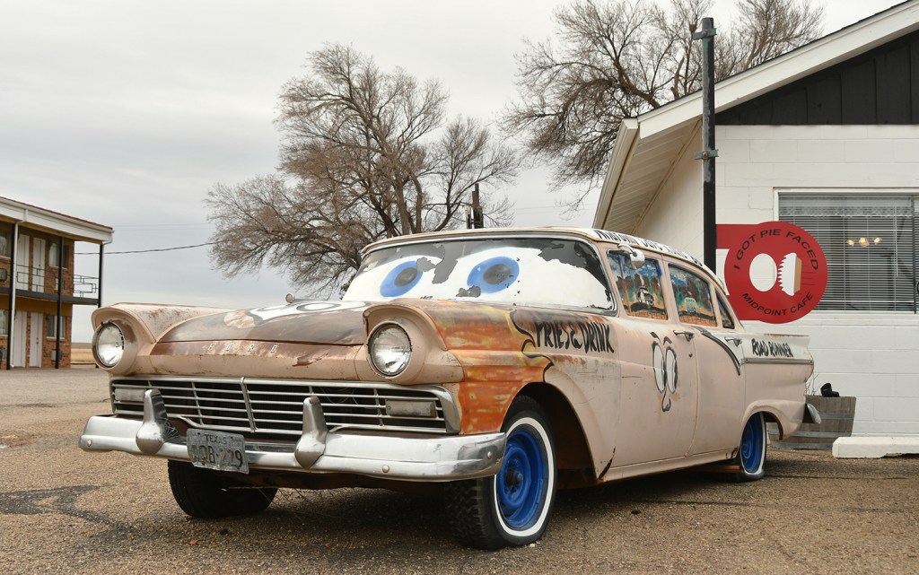
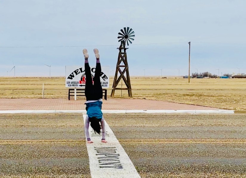
Contribution to art installation complete, we headed west on I-40 towards the small town of Adrian. This small town (population of 128 per the 2020 census) is the geo-mathematical midpoint of Route 66 – halfway between Chicago and LA, each 1,136 miles in either direction. In this small little corner hanging on after I-40 bypassed the town is the Midpoint Cafe. Built in the 1950s, it operated 24 hours a day in the heyday of Route 66, and has continuously stayed open since it was opened.


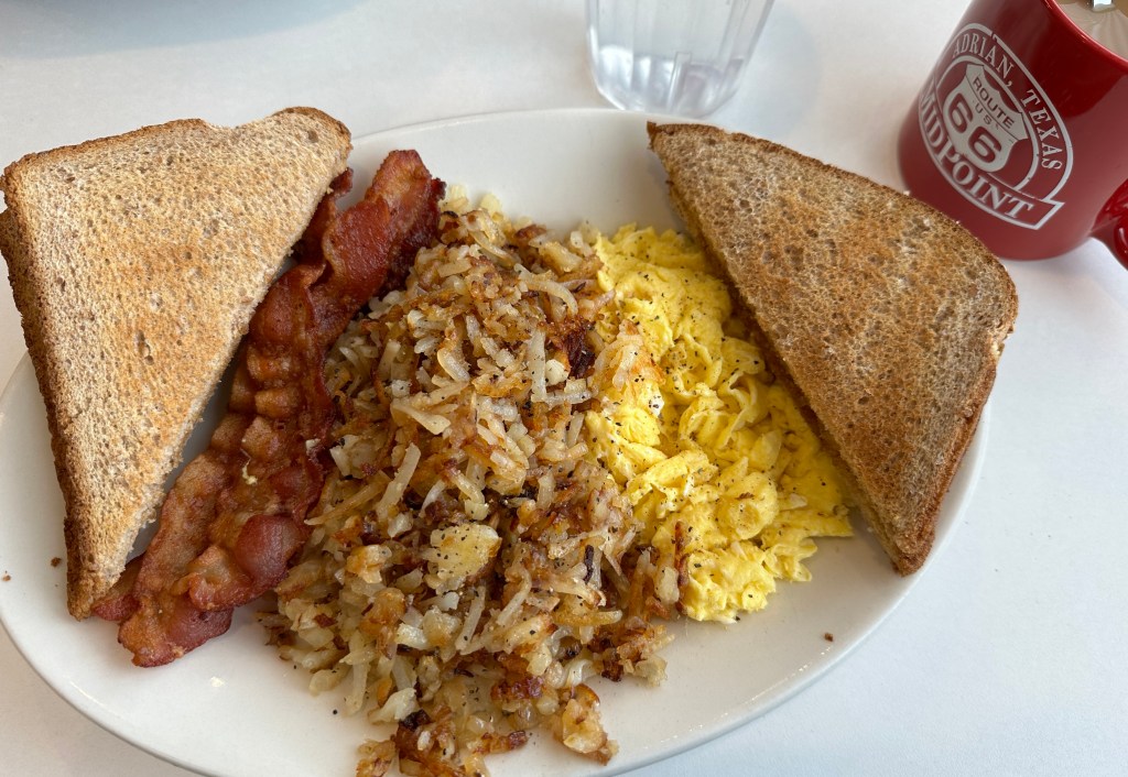
We were immediately greeted by our friendly server (I really wish I got her name!) and served up some coffee as we poured over the menu. Since we had breakfast at the hotel, the original plan was to just get some of the infamous “Ugly Pie,” but the breakfast offering led me to having a second breakfast of scrambled eggs, bacon, hashbrowns, and toast. Tom held strong to the plan, ordering up the last slice of the chocolate cream pie. The cook/baker came out to apologize for the pie being two days old, explaining that they do not normally have pie over the winter months, and brought out some peach cobbler and ice cream just ‘cuz. We both enjoyed our food, conversation, and atmosphere!


Route 66 nostalgia completed for the day, we turned northeast towards Lake Meredith National Recreation Area and Alibates Flint Quarries National Monument. We would have about ninety minutes of flat prairie, getting distracted by a Buddhist temple and missing our turn, pondering copper refineries, and counting cows. Oh, and wind. Yes, the wind. Fingers crossed our 1pm tour at Alibates would still happen!
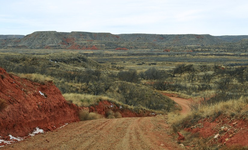
The day’s National Park Service units are nestled side by side, making it easy to see both. With about forty-five minutes to spare before we needed to check in for our ranger-led tour, we cut off to see McBride Canyon in Lake Meredith National Recreation Area.
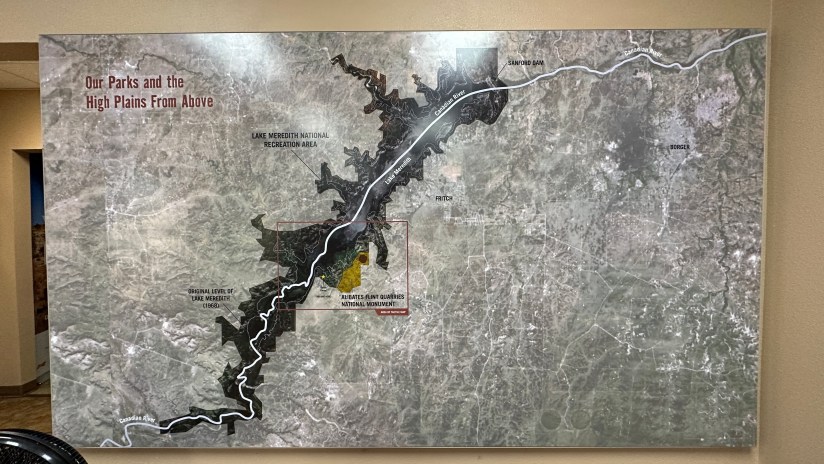
This NPS unit was created in 1990, and its namesake is a reservoir formed by the Sanford Dam on the Canadian River, which carved a 200-foot canyon in the area. Drought has drastically impacted the lake, and water levels are trending lower and lower. However, it is still a popular area for boating, fishing, hunting, hiking, camping, and off-road driving, though visitation is far less than in its peak water levels. I’ve read a lot of debate about whether or not this area should be a NPS unit, and if it is more suited to be a state park. After my brief visit to both Lake Meredith and then Palo Duro Canyon, I agree it seems like they got the management backwards for these two areas.
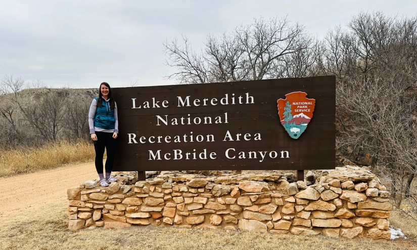
After a stop at the entrance sign, we explored a few of the dirt roads in McBride Canyon and emtpy campground. We definitely had some good views, and enjoyed our entirely too brief visit. (I’ll admit, this was a bit of a quick checkmark to knock this particular NPS unit off the list.)


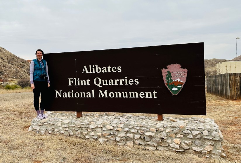
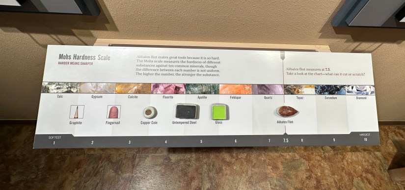
Time for the main show! We turned towards Alibates Flint Quarries National Monument, Texas’ first national monument. Designated in 1965, this unit preserves flint quarries used by native peoples for 13,000 years. So what is Alibates flint?
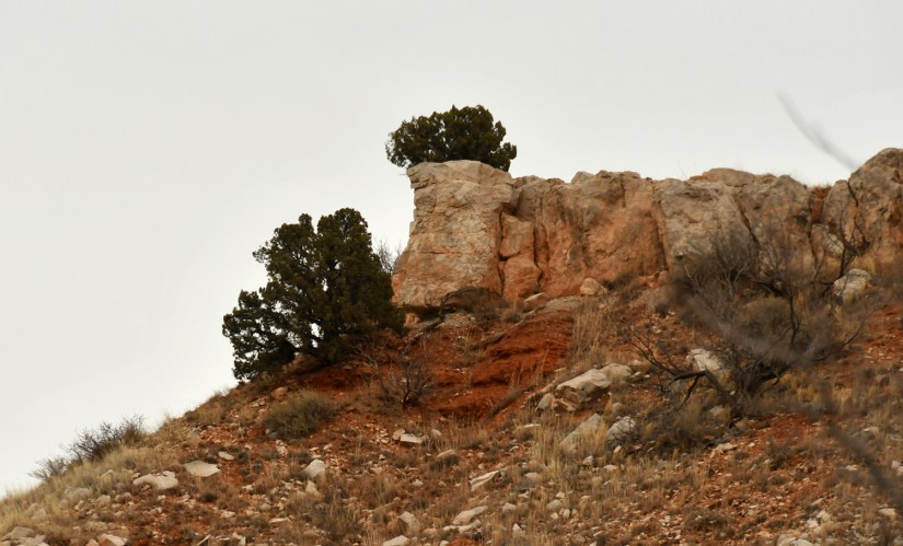
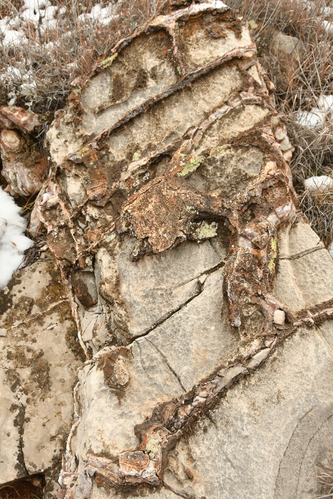
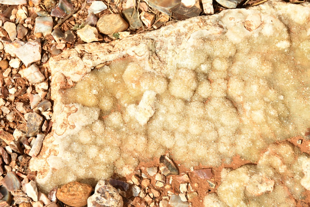
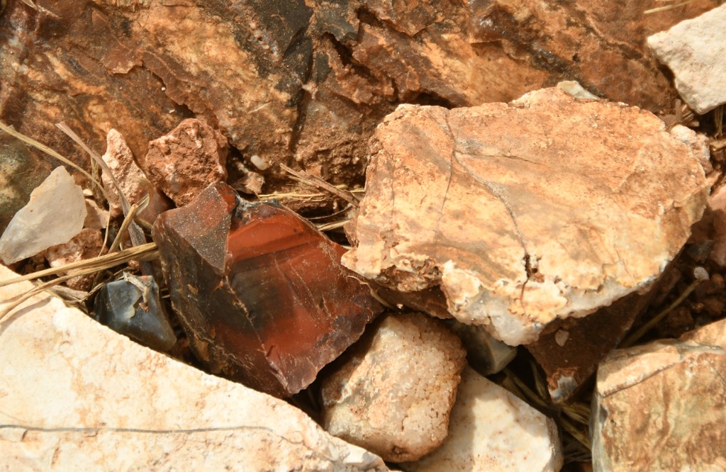
Alibates flint is found on the tops of mesas and is multi-colored. This special flint is known as agatized dolomite, or chert. The minerals in the dolomite have been replaced with quartz crystals from silica-rich water. The quartz crystals are small and can’t be seen with a microscope. These crystals create the steel-like hardness of Alibates flint. The variety of colors in the flint is due to the trace elements and minerals found in the original dolomite. The silica-rich water in the dolomite can turn fossils into Alibates flint. When cracks or voids in the dolomite developed, the quartz crystals became larger. These larger crystals make poor quality flint for stone tools. Indigenous people discarded the “garbage” and used the best quality stones for their tools. There are three primary theories of the source of the silica-rich water. The first theory is an eruption of the Yellowstone super-volcano around 675,000 years ago provided silica in ash. A three-foot bed of Yellowstone ash can be found in several locations around Lake Meredith. When rain fell on the ash, some of the ash dissolved into a silica-rich solution. A second theory is a silica rich material was brought here during the Ogallala Formation. A third theory is Alibates Flint formed the same time as the original dolomite. In each case, Alibates flint filled the cracks and completely replaced portions of the dolomite. This geological process is complex and would require perfect conditions to form the flint. Alibates flint formed along a small section of the Canadian River Breaks in a very specific area.
National Park Service
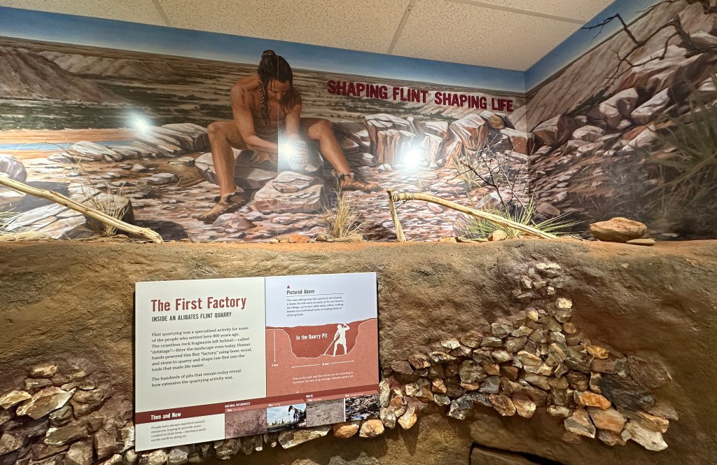
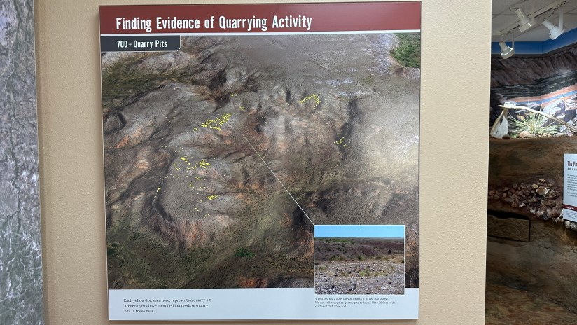
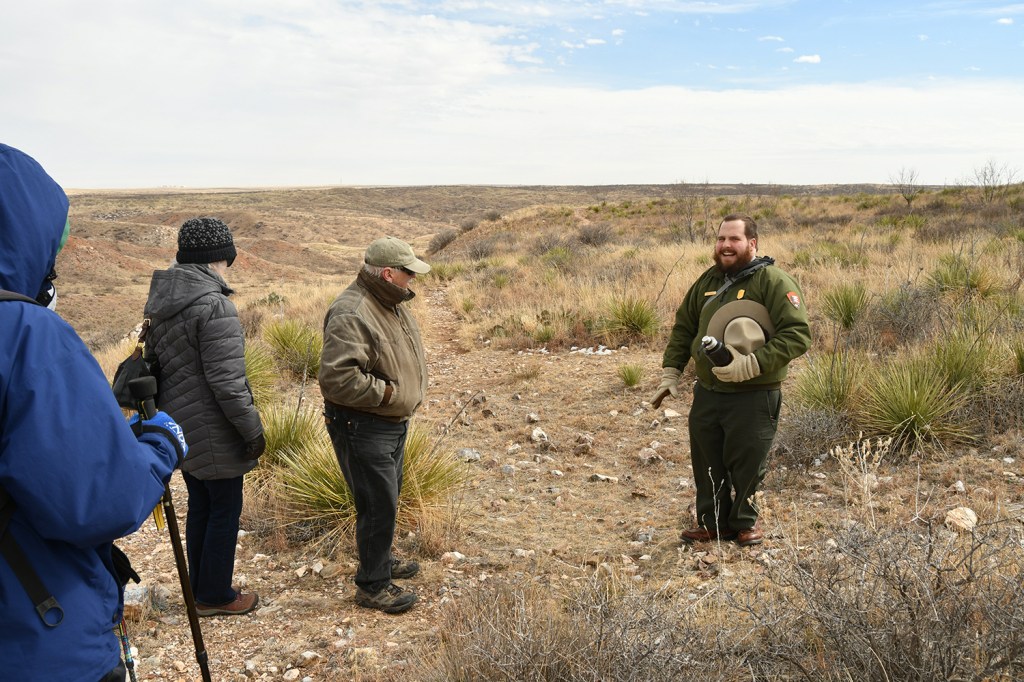
At the end of the last Ice Age 13,000 years ago, Paleo-Indians (such as the Clovis) quarried the Alibates flint. This incredibly hard material was perfect for creating spear points used to hunt mammoths, bison, and other beasts of that time. Then around 1200-1450 AD, the Antelope Creek settled in the area, building homes close to the flint outcroppings. Many shallow quarries were dug in the area, marked by piles of waste flint. As we learned on the tour, the Antelope Creek then suddenly abandoned the area, and historians have not quite figured out why – whether it was reduced food, drought, or being pushed out by rival tribes.

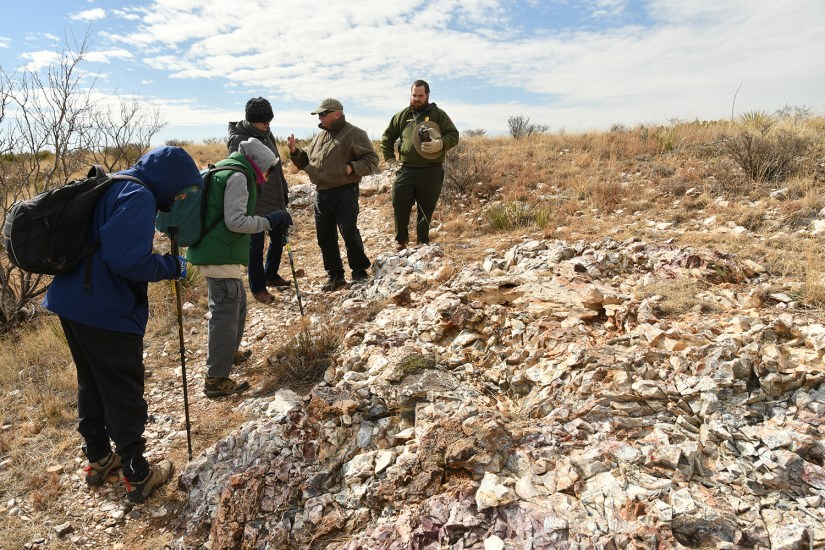
The only way to access the national monument is on a ranger guided tour (the visitor center sits in Lake Meredith NRA). I called about a month in advance, and was happy to find out a 1pm tour would be offered on the day of my visit, so I added our names. Even better, despite the wind, Range Dave assured us when we arrived that the tour would happen as long as the wind didn’t pick up to 60mph. Typically during April through October tours are offered at 10am and 1pm, but it is best to call regardless of the time of year to reserve a spot.

In the meantime, I stamped the passport books, browsed the gift shop, and watched the park video before heading to the car for some extra layers and to put on my hiking shoes. We would be joined on the tour by a group of four who were well versed in archeology and history which added a good dynamic to the tour. We followed Ranger Dave in our own vehicles through the locked gates, and to the small parking area (which has vault toilets and great views!).

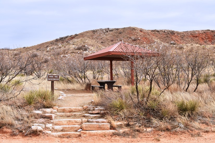
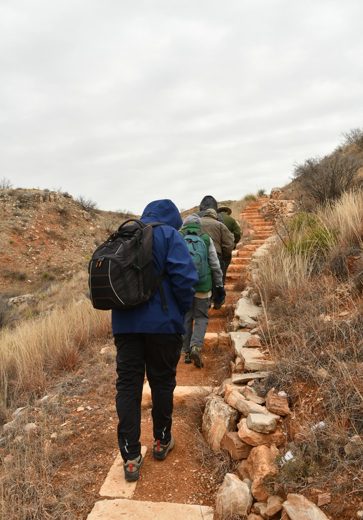
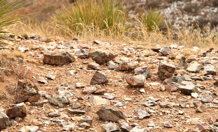
The tour of Alibates Quarries is typically about two miles and two hours long, and involves ascending the bluff with 170 feet of elevation gain. NPS has built a lovely trail with stair steps, and there are multiple shaded pavillons were we gathered for our educational tidbits. Because of the wind gusting over 40mph, our tour was shortened slightly. Ranger Dave started out by describing the geology of the area and how the flint forms, doing a great job despite his disclaimer that he has a history degree. I got a bit giddy hearing about the Yellowstone ash bands! As we ascended to the top of the bluff, he gave more details on the Antelope Creek and their settlement of the area. He passed around some of the Alibates flint for us to handle (but otherwise touching and picking up flint, let alone keeping it, is unlawful).


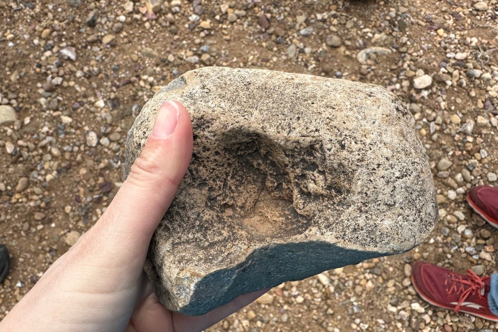


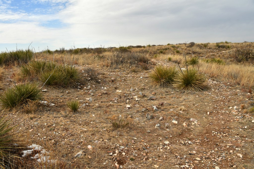


The tour wrapped up with a great panoramic view towards the Canadian River (described more as a “creek” by the ranger in order to tamper our expectations of a mighty river) after ninety minutes and 1.3 miles of casual walking. We stopped back at the visitor center so I could turn in my Junior Ranger book, which is for both Lake Meredith and Alibates. Ranger Dave swore me in, adding a nice line about promising to pay my taxes, which I chuckled and said I wish NPS got more money than they did! He then showed us a small pile of flint pieces that are leftover from flintknapping demonstrations and that visitors can take one piece of since the flint is sourced from outside of the national monument boundaries. I was definitely excited to take a piece of flint home!


Though off the beaten path, Alibates Flint Quarries National Monument was definitely worth the time we took for a visit, especially participating in the tour. This unit only sees about 8,000 visitors per year according to the ranger (contrasted to Capulin Volcano from the day before, which can see over 1,000 per day in the busy season!), so it is a great way to escape some crowds. Though I lean towards the geology side more with my personal interest, I still greatly enjoyed learning about the history of the peoples who quarried the beautiful rocks I was geeking out over. I am happy I have begun a quest to see as many NPS units as I can, as I otherwise probably would have never known about this great national monument!

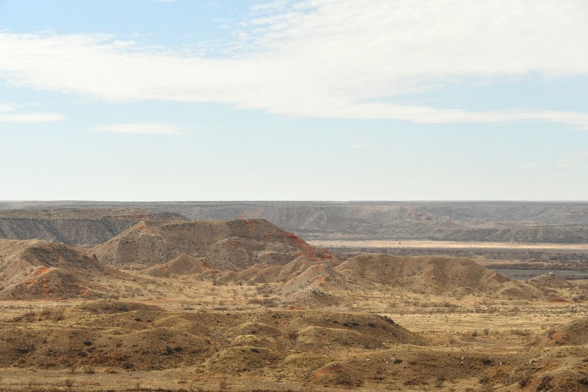
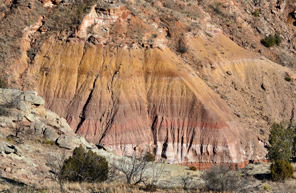
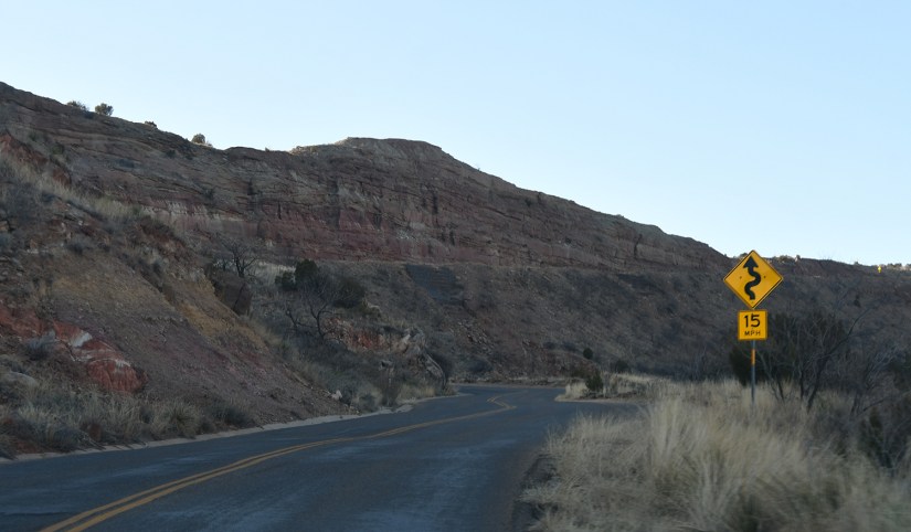
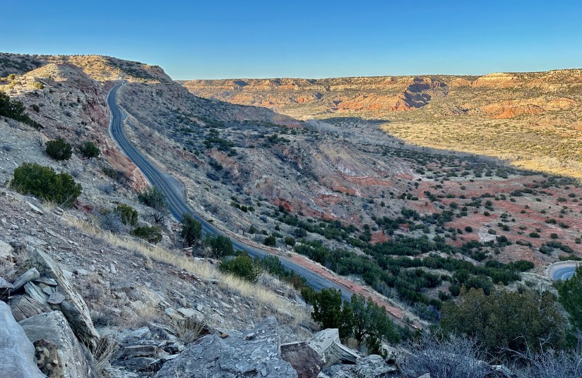
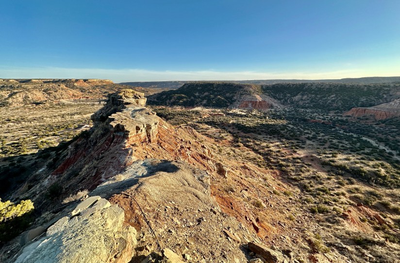
We still had some daylight hours left to burn, so we turned south to head to Palo Duro Canyon State Park. This canyon is the second largest in the U.S. after the Grand Canyon in Arizona. Palo Duro Canyon is about 120 miles long and 20 miles wide, up to 800 feet deep and is formed by the Prairie Dog Town Fork Red River (that’s a mouthful of a name!). Four geologic layers are visible as you descend. There is a multitude of recreational activities available at Palo Duro, such as mountain biking, hiking, and camping. Entry fee is $8 per person.

A stop was made at the visitor center first, which has great exhibits on the geology of the canyon and also the indigenous peoples that lived in the area and the work the Civilian Conservation Corp did on trails and other facilities in the canyon.


We then drove the whole loop down through the canyon. I was a bit jealous of seeing the mountain bikers enjoying the trails (this is why I know of Palo Duro!). There are camping facilities, an amphitheater, convenience store, and even glamping in Palo Duro.


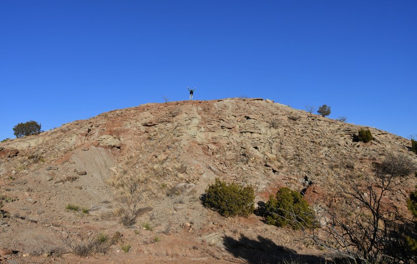
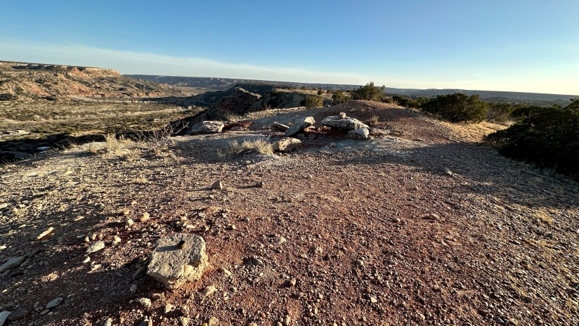
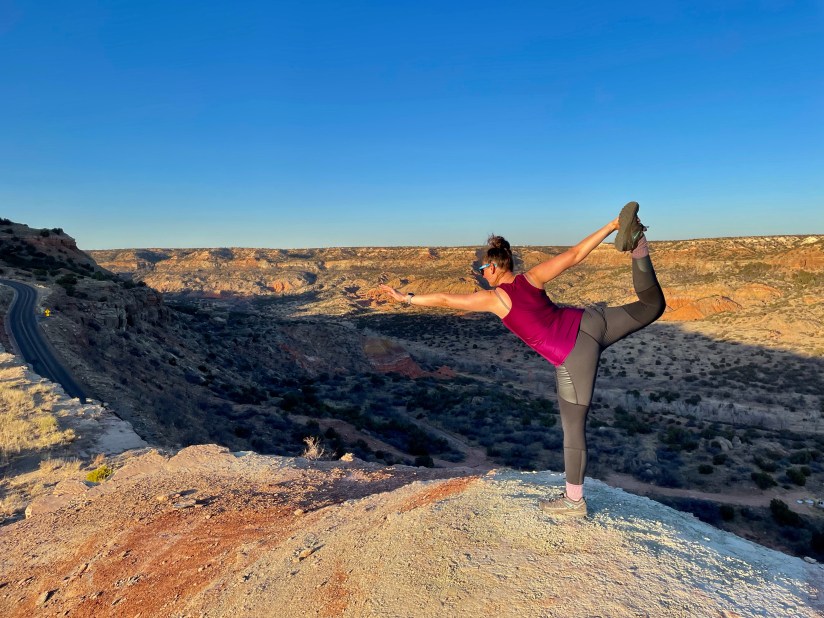
Antsy to get out of the car and outdoors for the last time on this day, I decided on hiking to Goodnight Peak, as it would be just about 1.5 miles roundtrip according to the trail map. Originally I had planned on hiking out to the Lighthouse, but a nearly six mile hike would’ve been a rushed affair with our late arrival time.
We parked off the road and started off on the Triassic Trail, which connected to the CCC Trail, and then the Goodnight Peak Scenic Loop. The terrain was a bit rocky, but overall the hike was mostly flat. Because it takes place on a mesa, the views are pretty outstanding over the canyon, especially in the evening sun! Don’t let the idea of a “summit hike” discourage you, the entire hike was pretty flat with only 64 feet of elevation gain!


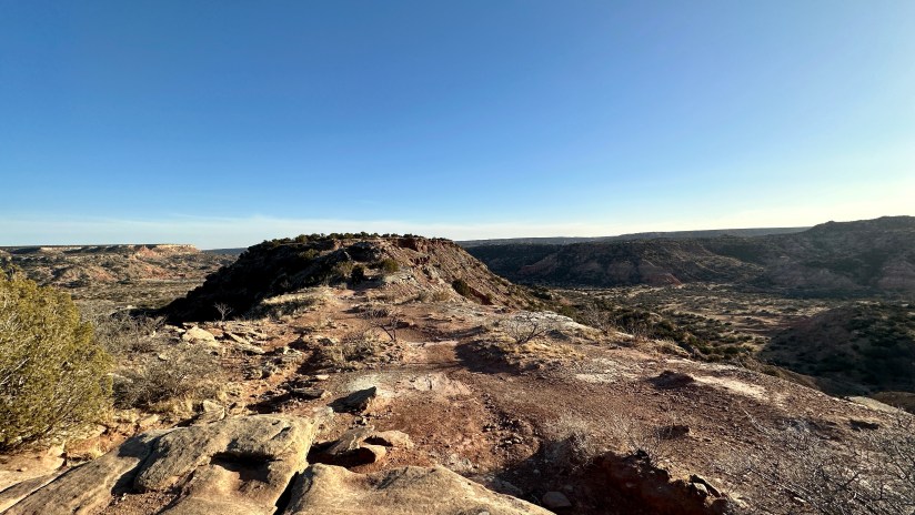


I’m happy I was able to pop briefly into Palo Duro Canyon, especially after hearing so much about it over the years. However, I must admit, I was not completely blown away. I even told my friend “If this was in Colorado or Utah, it would just be another standard scene.” But because this canyon literally appears out of nowhere in the horrendously flat terrain of the Texas panhandle, it is quite special – along with the whole being the second biggest canyon thing as well. Maybe if I had not spent so much time in southern Utah I would feel different about Palo Duro. Eek, please don’t hate me!
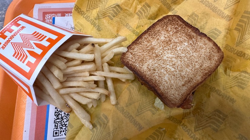
Racing a setting sun, we sought out a Whataburger for dinner as we had never eaten at one and had to see what the fuss was about. Then it was back to the hotel for some solid rest after a busy day of adventuring.

Read Part 1 of the Presidential Adventure here


Leave a comment