

Laramie Peak “is, at this day, covered with snow, which glitters in the sunshine like a diamond in the dark,” emigrant Dan Gelwicks writes in his diary – May 28, 1849.
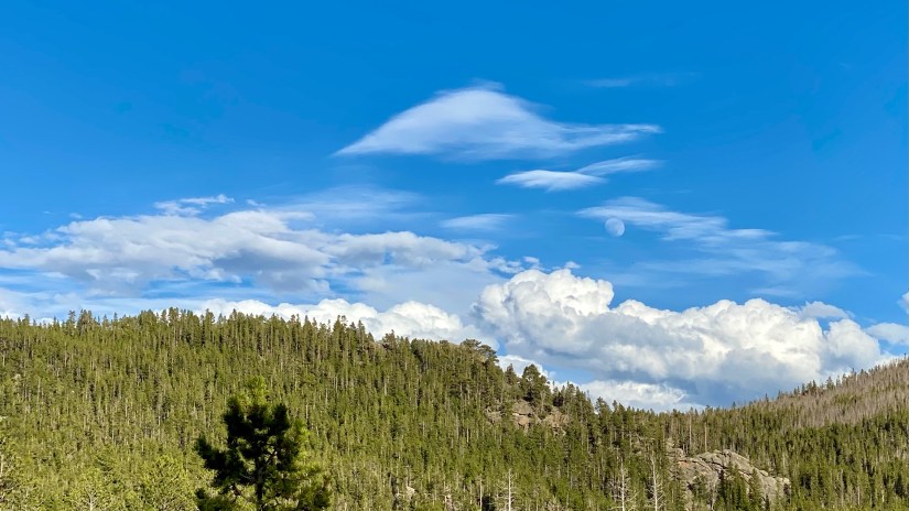
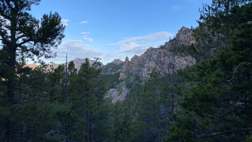
Treating emigrants to a view of its 10,275 foot summit for over a week as they made their way from western Nebraska into Wyoming, Laramie Peak was both awe-inspring and anxiety-inducing. Laramie Peak marked the start of the Rocky Mountains and difficult trails ahead as emigrants left the flat plains for rougher territory. Laramie Peak is the highest and most prominent peak in the Laramie Range, and only one to top out over 10,000 feet. It is one of the most prominent mountains in both Wyoming and the southern Rocky Mountains – Scottsbluff, Nebraska is over 100 miles away and you can see it from there!

I remember driving into Laramie as a kid, and watching Laramie Peak disappear and reappear due to mirage effects off in the distance. And of course, anytime I’ve traveled I-25 north from Cheyenne I’ve been captivated by this peak, vowing one day to hike to its summit so I could say “I stood up there!” Finally this was the time to make it happen!
Laramie Peak is not an easy mountain to get to, which is honestly probably a good thing because otherwise I feel like the trail would be overrun and crowded. To reach the trailhead from Cheyenne, I drove 100 miles north on I-25 to Glendo, and then traveled 40 miles of gravel roads west/southwest. It was a three hour trip, and I definitely was not quite aware how long those gravel roads would be!


Because an early start is always good in summertime, I drove to Friend Park Campground, which is right next to the trailhead the night before I hiked so I could camp and get a super early start. I was worried the campground would be full, but I was pleasantly surprised to find most of the campsites available on a Saturday evening. This beautiful and lightly used campground has eleven sites, three of which are tent-only walk-in sites, and clean vault toilets. I chose the walk-in site #5 after checking out all three tent options. The eight “normal” sites were too close to each other for my liking, and desire for an early bed time (I also have to avoid any campfire smoke due to reactive asthma – I visited before the fire ban, and other campers had fires). Site #6 is definitely the most hidden and private and would be another great option. I paid my $10 camping fee and set up my small backpacking tent to try it out for the first time and boiled water for a Mountain House meal.


After enjoying dinner on a rock with a magnificent view of Friend Creek and surrounding mountains, I read a book for a little while until sunset. I climbed into the tent for an early night and 5am alarm.

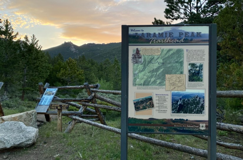
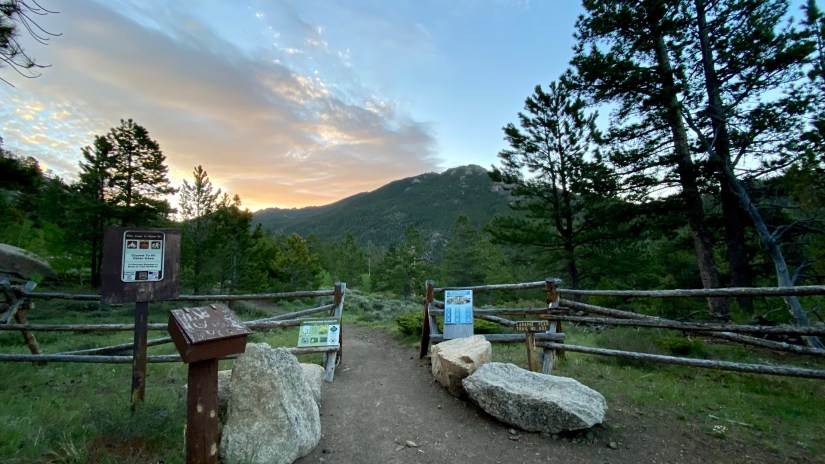
Morning came after a solid night of sleep, and I boiled water for coffee and scarfed down a bagel before tearing down camp. You can reach the Laramie Peak Trail through a connector at the campground, but I decided I wanted to check out the actual trailhead, which is less than a half mile from the campground. The road up to the trailhead has a very steep, rocky portion, but my Subaru Forester did just going up it with attentive driving (I utilized the X-Mode hill descent mode on the way down). On went the boots and pack, and I set off at 5:35am!

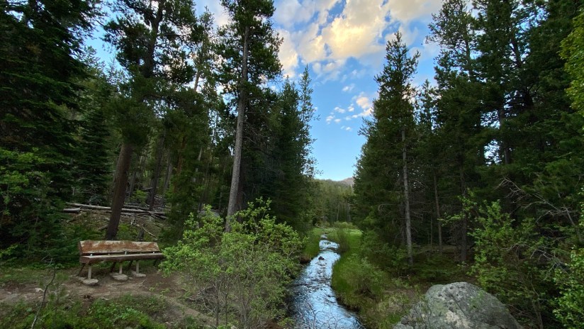
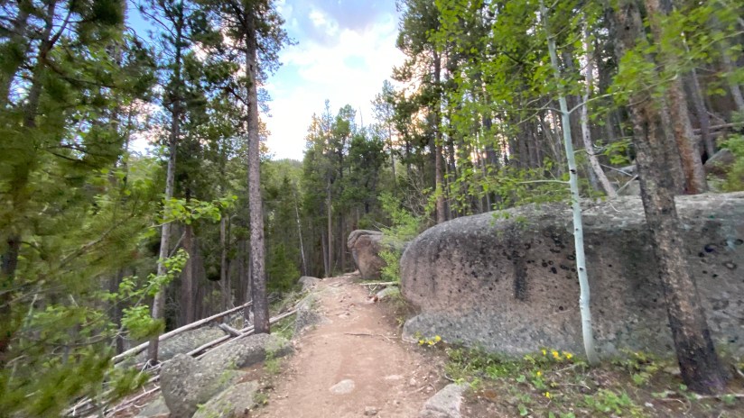
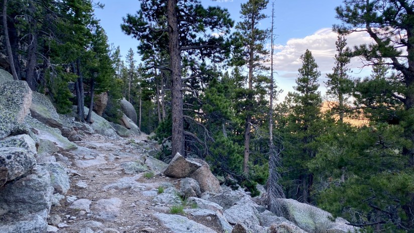
I was worried the Laramie Peak Trail would be pretty torn up since OHVs are allowed on the double track width trail, but I was surprised to find the trail was beautifully maintained, and for the most part, you cannot tell that OHVs drive it. There is elevation loss from the trailhead down to the crossing of Friend Creek (always the worse on the way back), and then the trail starts steadily climbing all the way to the summit. As a side note, mountain bikes are also allowed on the trail!

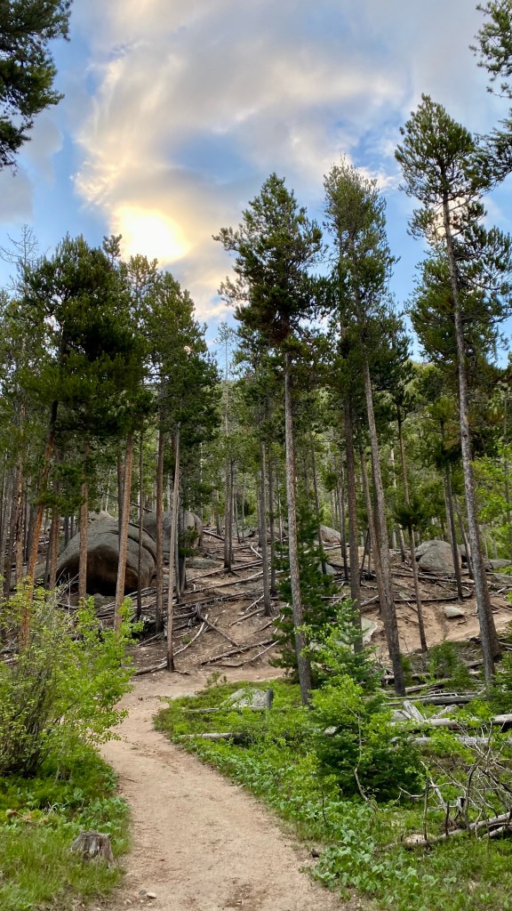

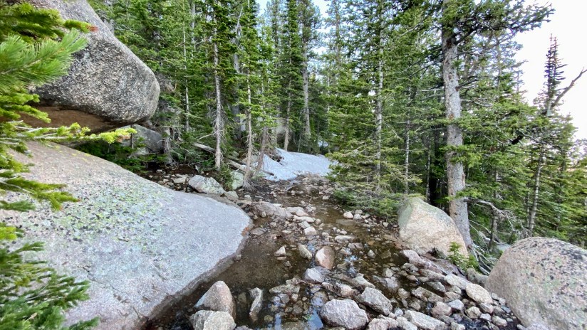
This is a wonderfully built trail, and the grade is very mild compared to most climbs up a mountain. There’s culverts and good water diversion, but of course with it being early season, there were patches of water and mud. I did notice that throughout the hike, there was plenty of running water sources (at least in mid-June… end of summer will be a different story) to filter additional drinking water if needed (or if an overnight trip was done).

About two miles up the trail you arrive at Friend Park Falls, a good destination for those wanting a smaller hike. I enjoyed the falls (I love any sort of waterfall) – they’re a long series of cascades on Friend Creek. Definitely a worthy spot for a break to soak in the sights and sounds, have a snack, etc.


I was lucky that warm temperatures rapidly melted the lingering snowpack from the trail in just the previous week or so. As I reached the start of the snow, I think I only had to cross maybe less than twenty feet total of snow, and never postholed. Otherwise the trail was clear!
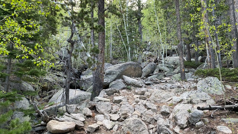
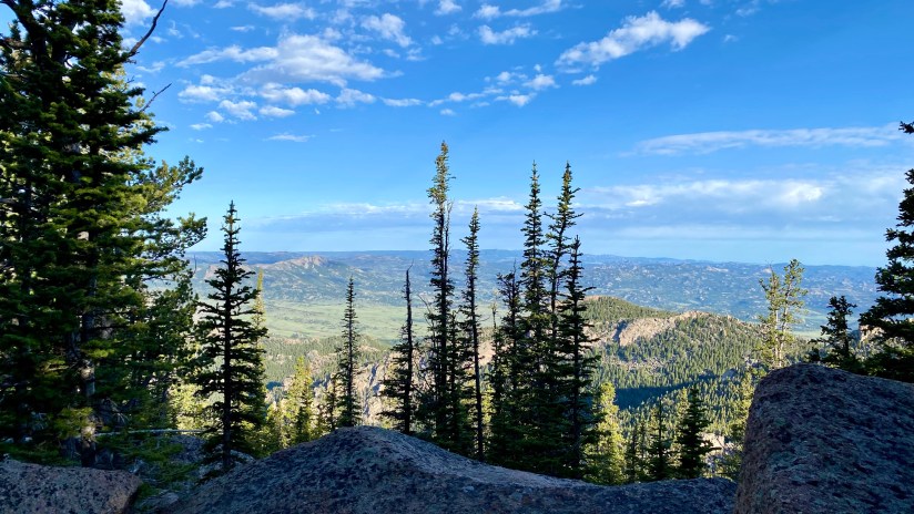
I finally reached the summit area at 7:50am. Unfortunately Laramie Peak does not have the most beautiful summit, as there are several radio and communication towers and resulting infrastructure, and frankly, a long of debris. This does distract from the summit I think, but I can also understand why communication towers are located here. I first went around the south side of the boulders, but quickly realized that would not get me closer to the summit block, so I backtracked and found a much more workable line for the scramble up. Definitely lots of opportunities to scramble and put some rock climbing moves to work!

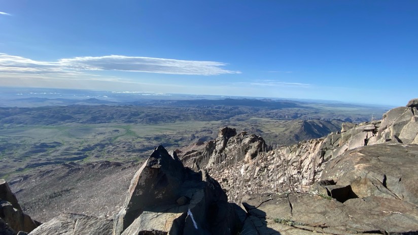


I stayed long enough to grab some photos and send out some “I’m still alive” texts. I descended off the rocky summit and ate a snack before hauling butt down the trail. I was super thankful for my early start, as it had already started to get a lot sunnier and warmer. Though nearly all the trail is tree lined, there is still plenty of sunshine to leak through! I like cooler temperatures, what can I say? I ran into one other party about halfway down that was heading up, but otherwise, those were my only humans of the day!


I reached my car just shy of four and a half hours after I started my hike, a smidge past 10am. I was so ready for some shade and air conditioning by then! There are vault toilets at the trailhead, so I took advantage of those, and changed into clothes for the long drive back. I also updated my trail register entry with the current conditions. Overall the hike came in at exactly ten miles.
I LOVED this hike. I am so happy I finally did it after staring at this mountain for over thirty years! The trail is well maintained and gorgeous in its own right. The careful building of the trail also means it is a rather friendly climb up a mountain as nothing is ever unbearably steep, though it can get quite rocky. The downside is how remote it is, and the commitment to reaching the trailhead. I’ve decided that this hike would be better done as part of a long weekend, so the area can be fully enjoyed and to spend less time in the car. My “turn and burn” method of arriving the evening before and being on the trail at 5:35am did not leave a lot of downtime.
Details:
Date Hiked: June 12, 2022
Trailhead: Laramie Peak
Total Mileage: 10 miles (Garmin Vivoactive 4s/Strava)
Total Elevation Gain: 2,789 feet
Total Time Spent: 4 hours 28 minutes
Weather: Clear, sunny, and warm
Trail Conditions: Dry, small snow patches, and small wet patches. Handful of downed trees that are easy to bypass. Plenty of running water sources to filter for drinking this time of year.
Cell Service: Service on the summit (Verizon)
Special Considerations: $5 day use fee at trailhead (America the Beautiful annual pass, and other interagency passes, accepted). There is a mosaic of private land in the area, so if attempting dispersed camping, pay close attention to national forest boundary signs and perhaps consult a map of the area to ensure you are on public lands. No dispersed camping is allowed within a quarter mile of Friend Park Campground.


Leave a comment