
Day 3 – March 28, 2022
The take aways…
- Secure your water jugs before rallying through the desert
- Off the beaten path is worth it, and Capitol Reef is always worth it
- The fajitas are hot, and the walls are plywood
- Check the elevation of the campsite choice for the night before driving to 9600 feet in a snowstorm

Another pre-sunrise wakeup greeted us. After a semi-late arrival, the campsite did not disappoint, and was hands down my favorite of the trip! We took to breakfast and coffee, and I added another thick layer of dry shampoo to my hair (thank you Venture Wipes and Dove dry shampoo for keeping me at least smelling good this trip!). On an eleven day trip, there ends up being some days you get more excited about than all the other days you’re excited for… this was one! Silly enough, Eric and I accidentally left Capitol Reef National Park an early draft of the itinerary, but we did remedy that quickly.


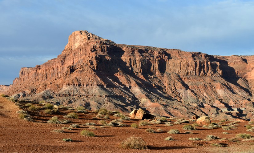
The drive north to Hanksville was crazy beautiful, and I was happy we did it during daylight hours instead of pushing on the previous night to Goblin Valley. Is it just me, or is the geology just so much more in Utah?! BAM, in your face… geology!!


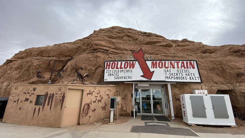
In Hanksville we restocked at the unique Hollow Mountain gas station is that is built into a rock. We had a small shopping list, and we were able to grab more water, wet wipes, ice, and snacks. In the parking lot, Eric made friends with someone who was interested in a GFC tent, and we got some good tips on places to go before heading to Capitol Reef National Park. I grabbed a selfie with the Sinclair dino, and discovered there was no cell service in the bathrooms deep inside the rock as I was attempting to brag to coworkers about not being at work and waking up in beautiful places.

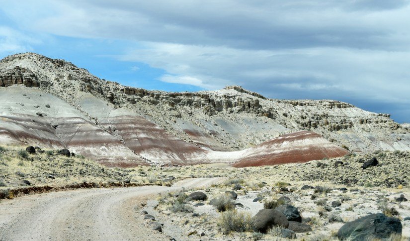
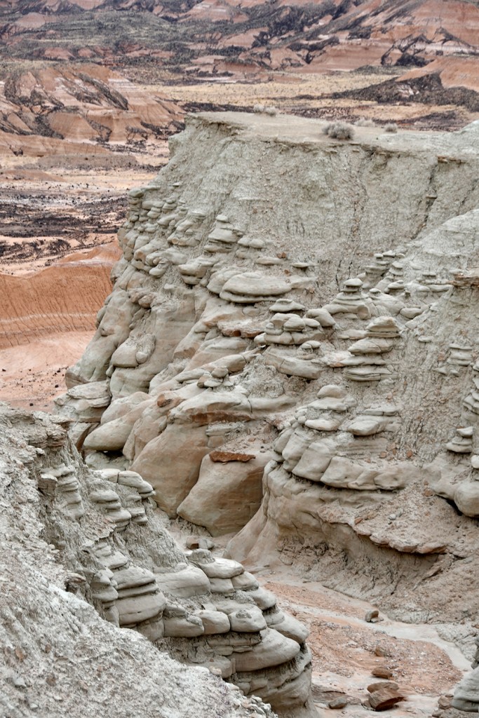
First up would be checking out some bentonite hills near the Mars Desert Research Station along Cow Dung Road (no, I did not make up that name). The road leading up to the research station is BLM land, so Eric was able to play with his drone a bit before we reached the boundary of research station.

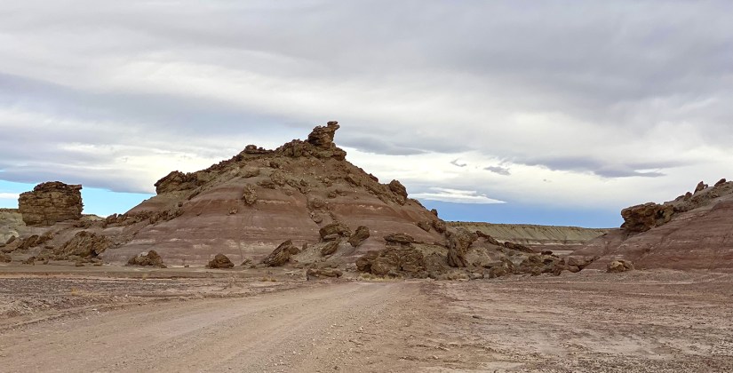


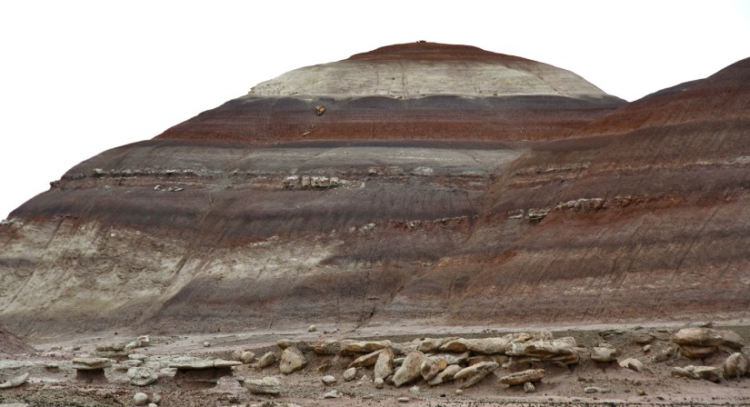
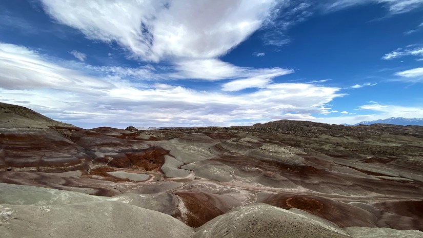
These colorful hills, which are usually so photoshopped beyond belief on social media, are composed of Brushy Basin shale of the Morrison Formation. This layer was formed in the Jurassic era when mud, silt, sand, and volcanic ash were deposited in swamp and lakes. Bentonite clay is simply altered volcanic ash, and is actually a main ingredient in most cat litters since it absorbs water and other fluids and becomes gummy and clumpy. This property also makes it awful to drive on if it gets wet – food for thought as we chased rain clouds later in the day.

The Mars Desert Research Station does what it sounds like, and provides research opportunities into human exploration and living on Mars, at least in Mars-like Utah. It is not open to the public, but there is a small parking area where you can view the various buildings from a distance. Flying drones are also not allowed over the research station.


After snapping some photos of the research station, we stopped briefly at some other bentonite hills, and then decided to take the more adventurous way back to Cow Dung Road and the highway, versus doing an out and back. I mean, the GPS said it was a road, so fair game?!


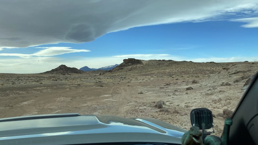

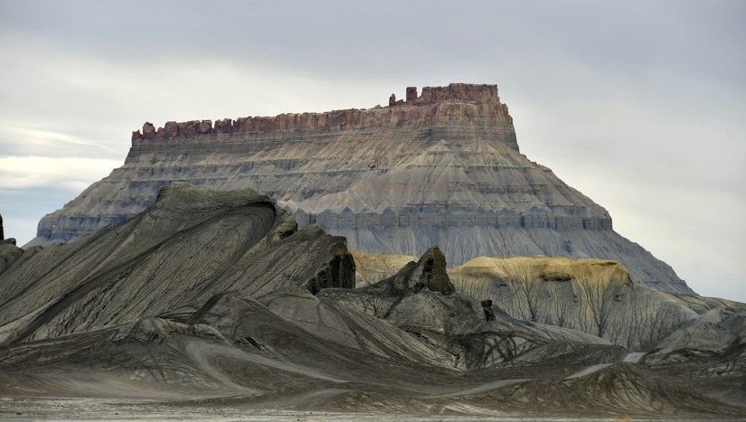
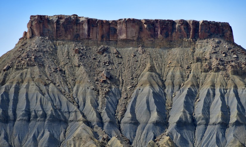
After getting back on Highway 24, we took a short jaunt look at Factory Butte and then continued onto Swing Arm City, an OHV recreation area used in a Ken Block video fairly recently. This off-road playground is made up of more bentonite clay, and really looks quite moon like. This is also where our brand new two-gallon jug of water broke open in assumingely dramatic fashion in the bed of the truck. Whoops.


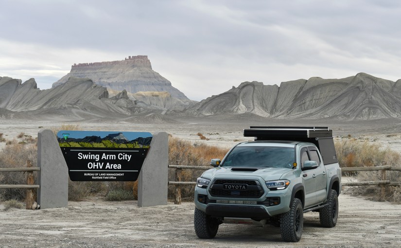


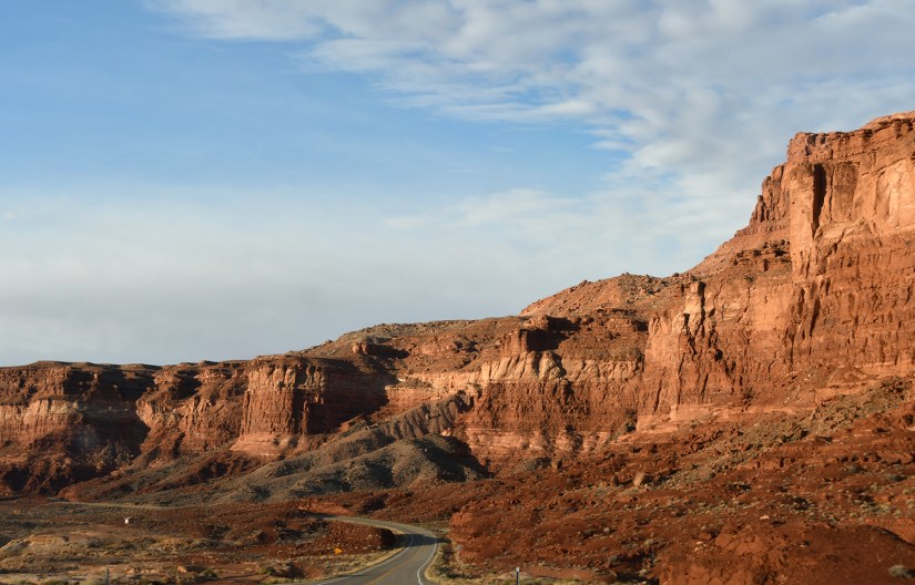
Once Eric got his fix in Swing Arm City (oh hell, I enjoyed it, too!), we continued west to Capitol Reef National Park, a new one for both of us.


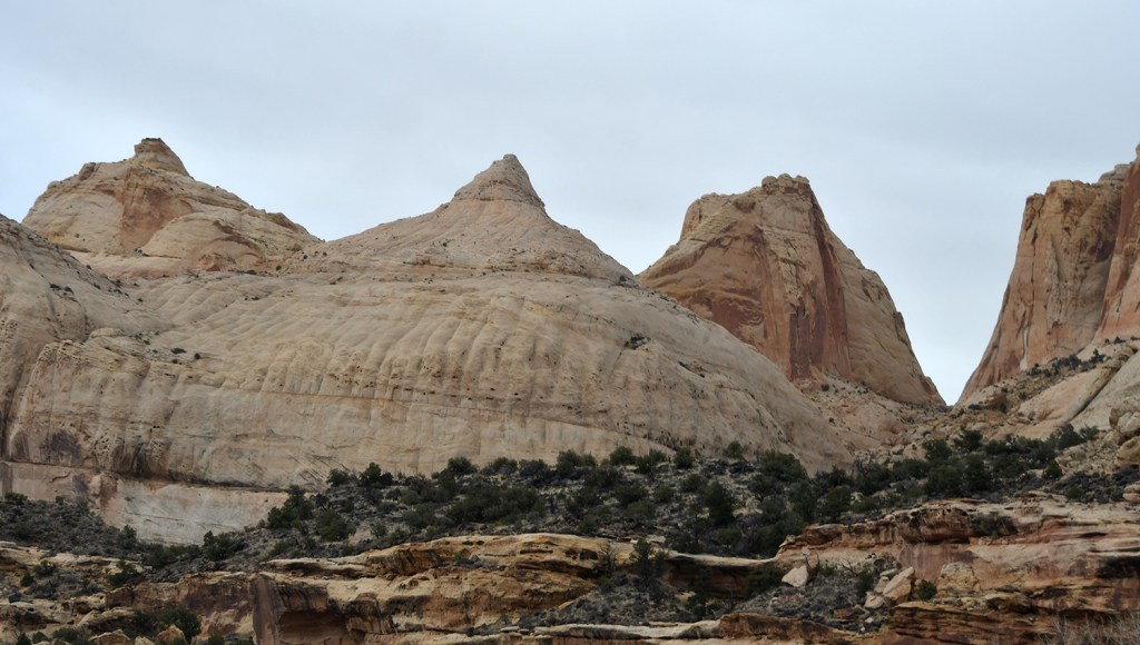
Capitol Reef National Park, in my opinion, is really underrated compared to the other national parks found in Utah. The overwhelming majority of visitors visit the Fruita and Waterpocket Districts, and really only taste a bit of what the park has to offer (which allows room for plenty of one-star quality reviews on it being overrated and boring). However, there is also the Cathedral Valley district, which is quite remote. I’ve seen statistics that only 1-10% of Capitol Reef visitors go to the Cathedral Valley district! Any guess where we were headed?

Capitol Reef is rife with geology, of which would be hard for me to summarize here… so here is a snippet, and those geology nerds can explore the link for more information:
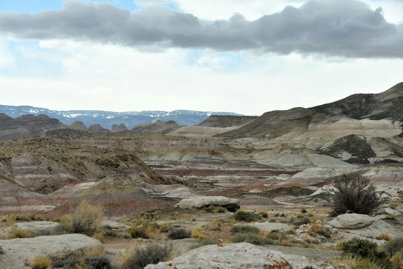
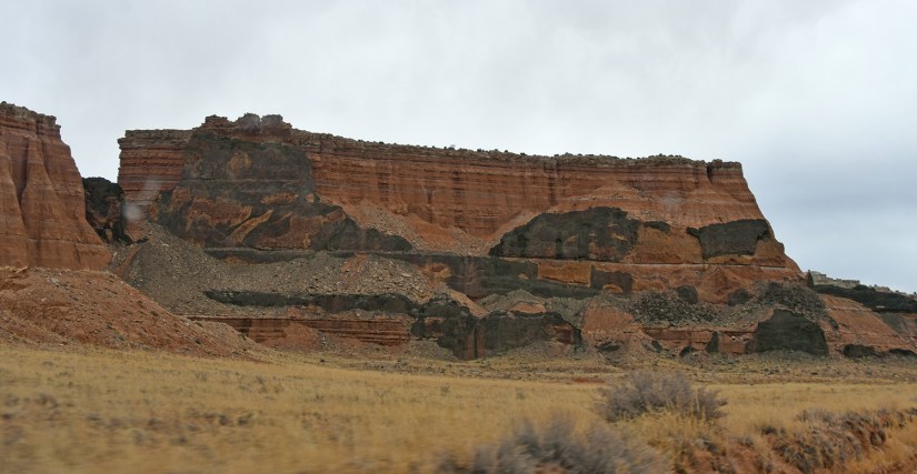
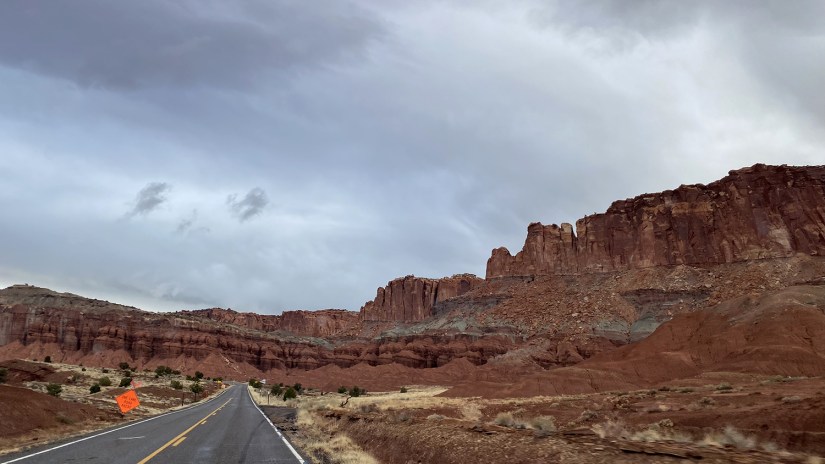
The Waterpocket Fold defines Capitol Reef National Park. A nearly 100-mile long warp in the Earth’s crust, the Waterpocket Fold is a classic monocline, a “step-up” in the rock layers. It formed between 50 and 70 million years ago when a major mountain building event in western North America, the Laramide Orogeny, reactivated an ancient buried fault in this region. Movement along the fault caused the west side to shift upwards relative to the east side. The overlying sedimentary layers were draped above the fault and formed a monocline. The rock layers on the west side of the fold have been lifted more than 7,000 feet (2,134 m) higher than the layers on the east.
More recent uplift of the entire Colorado Plateau and the resulting erosion has exposed this fold at the surface within the last 15 to 20 million years. The name “Waterpocket Fold” reflects this ongoing erosion of the rock layers. “Waterpockets” are small depressions that form in many of the sandstone layers as they are eroded by water, and are common throughout the fold at Capitol Reef. Erosion of the tilted rock layers continues today forming colorful cliffs, massive domes, soaring spires, stark monoliths, twisting canyons, and graceful arches.
National Park Service


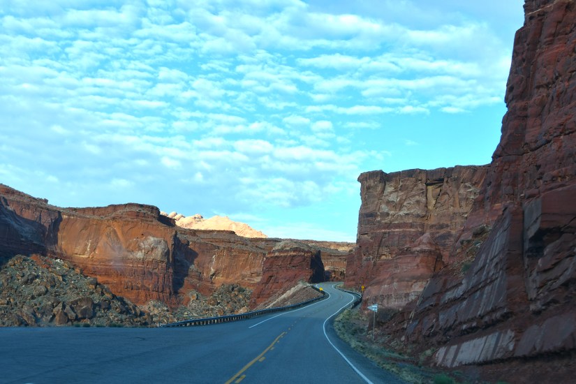
After visiting the visitor center, chatting with the ranger on the river ford conditions, and obtaining the precious passport stamps and souvenirs, we filled up on water at the campground before heading back to east to Harnet Road, where we would ford the Fremont River and begin the 58-mile Cathedral Valley loop.


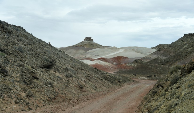
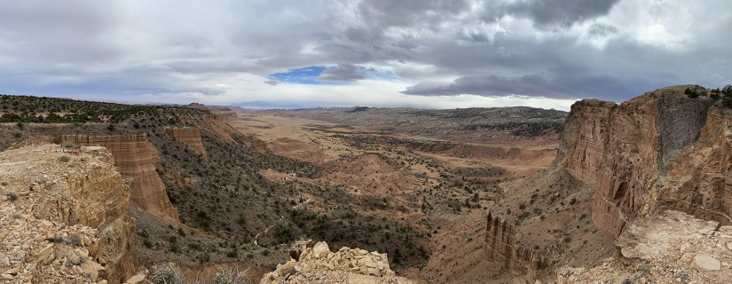
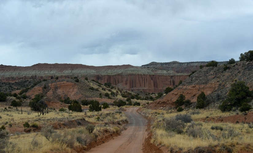
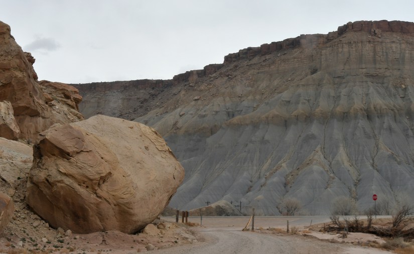
The Cathedral Valley loop pops back and forth between BLM land and Capitol Reef National Park as it winds through the desert. The loop road is entirely dirt, and high clearance is recommended (but not necessarily 4WD/AWD, though I’d say that could be weather dependent). In our experience, the road varied from smooth and fast by the Temples on the east end to narrow, rocky, and washed out in the more remote areas. Saying it is lonely and remote is not an exaggeration – we went hours upon hours without seeing another vehicle… in fact, it wasn’t until the end near Temple of the Sun that we ran into others (and then it was one sprinter van and one truck on the road)! If you want away from the crowds and beaten path, I cannot recommend Cathedral Valley enough if you have the proper vehicle and preparedness – there is rarely cell service, no gas, no food, and no water on this route.


The first big “sight” along the loop are the Bentonite Hills, colorful hills of bentonite clay similar to what we saw earlier in the day outside of Hanksville on simulated Mars. Ideally we wanted to take some drone footage here (you are outside of the national park boundaries here), but the wind was insane as the storm front bore down, so we settled for quick photos from the ground. We also had worked up an appetite, so we found a safe place to pull on the side of the road, and I hopped in the truck bed and fixed up some sandwiches for Eric and I. (Side note, and totally wasn’t paid to say this – it’s not even my truck after all – the GFC camper was perfect for this, as I was able to make those sandwiches and stay out of the wind and dust that was blowing all around!)


Bellies full, we continued on, turning off to the Lower South Desert Overlook and crossing into the national park. Various places are well signed, though I did have a road guide with mileage with me. I ended up stashing it away thanks to the signage, and just the overall attitude of “we’ll just see what we run into!”


It is just a short walk from the parking area to the overlook. The South Desert is a valley that is parallel to the Waterpocket Fold. The main feature to gaze at is Jailhouse Rock, a 500 foot tall eroded Entrada Sandstone monolith.


Onward!

Shortly before Harnet Junction is the Upper South Desert Overlook. Another short path leads from the parking area. You can climb up a steep hill for a view, but we found great views on the flat part of the path.


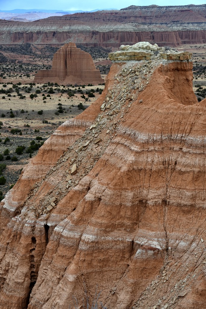
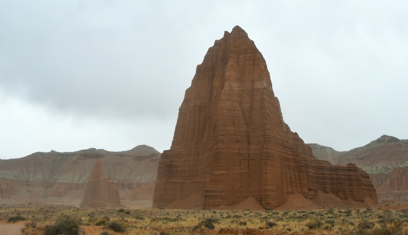
We were barely back in the truck before it was time to turn off to the Upper Cathedral Valley Overlook. Here was a stunning view of the Cathedrals, which are more towering Entrada Sandstone monoliths. There is also a great picnic table with an outstanding scenic view.


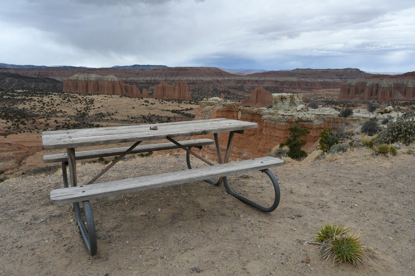
By now it was getting stormier looking, and the winds kept blowing. While there is hiking opportunities in Cathedral Valley, we didn’t plan on any hiking, and if we were, the weather was nixing it. The only campground in this part of the park is located in this area as well. Cathedral Valley Campground is primitive and available on a first-come-first-served basis. During our brief glance at it, it looked completely empty. (Camping is only allowed in this campground in the national park in the Cathedral Valley district – “wild” camping is not allowed.)


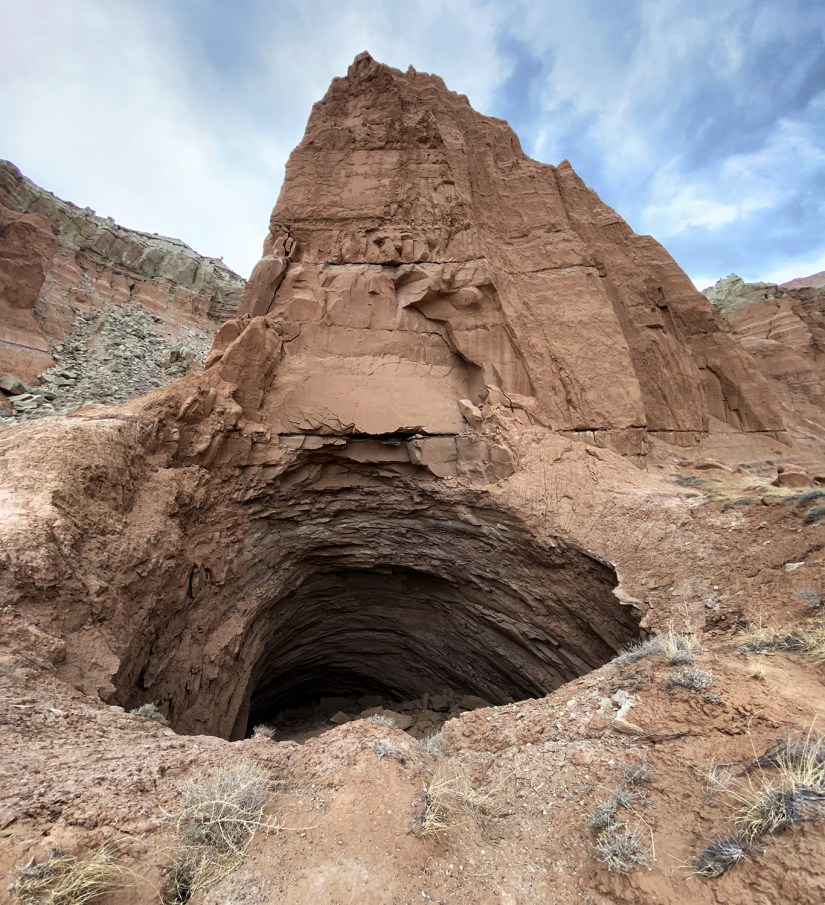
Shortly after Cathedral Junction we turned towards Gypsum Sinkhole. I geeked out on the volcanic dike was on display on the road towards the sinkhole. Gypsum Sinkhole was formed by water dissolving a buried gypsum plug and is 200 feet deep. Eric walked around the side of the sinkhole, and realized where I was standing was not solid ground, but over part of the sinkhole. Yikes! I will say, it is refreshing to visit remote places that do not have safety railings in place, keeping it more natural and spicy.
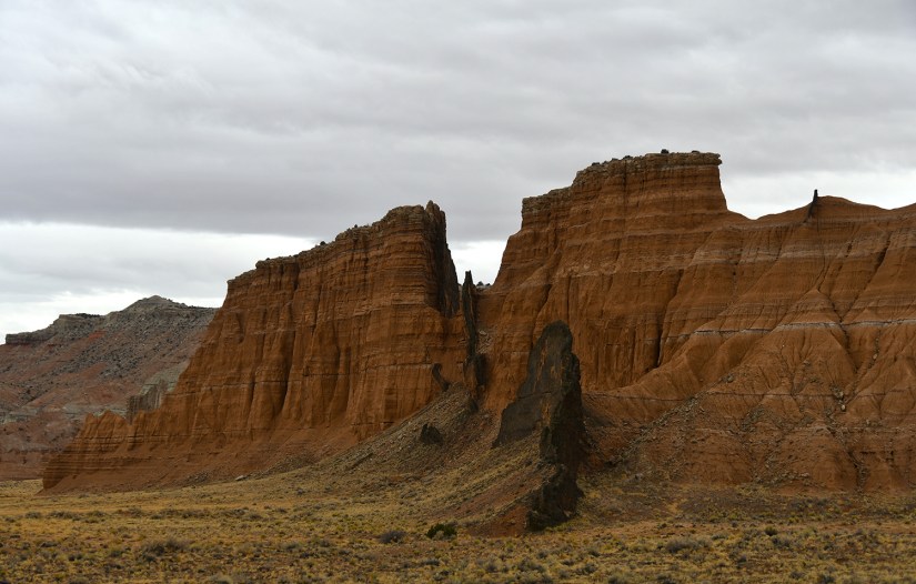


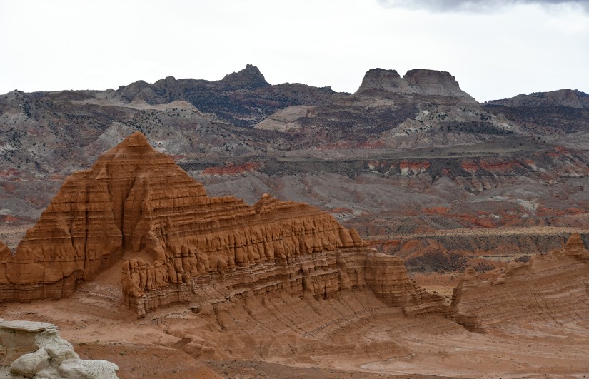
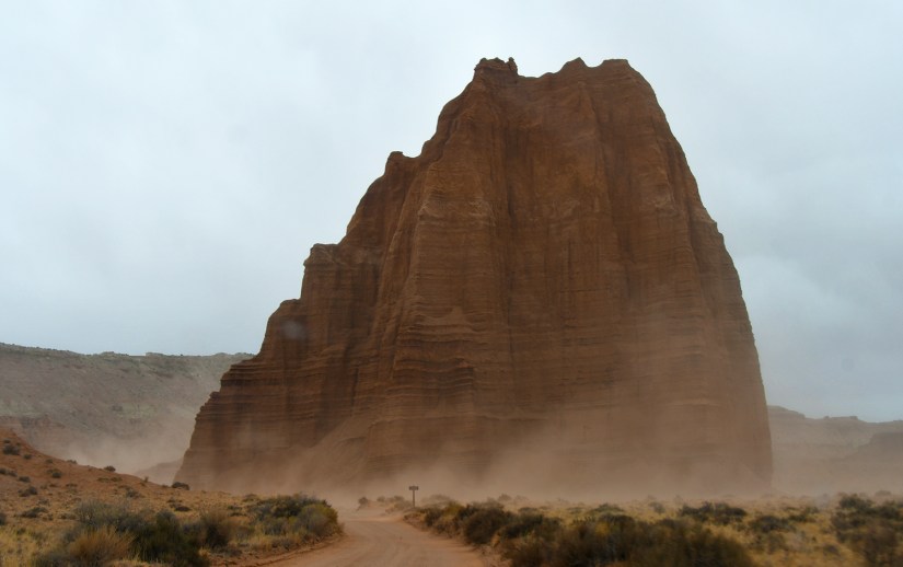
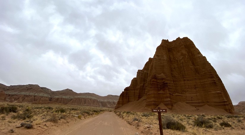
Now we only had one more stop to make on our tour of Cathedral Valley, which was Glass Mountain, Temple of the Sun, and Temple of the Moon. It had gotten increasingly stormy, so we shot photos from the truck, and encountered our first people in hours (who also stayed in their vehicles).
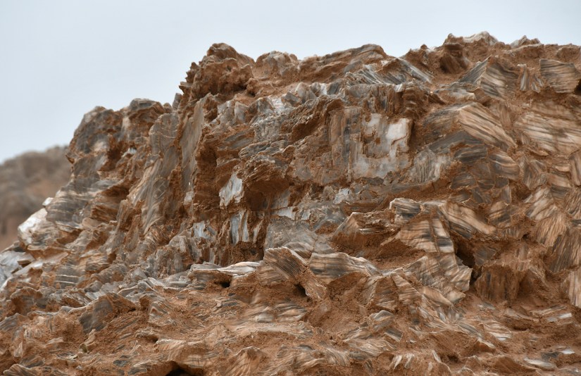
Glass Mountain is a large mound of selenite crystals, which is a variety of gypsum. Glass Mountain is actually the opposite of Gypsum Sinkhole – instead of water dissolving a buried plug, this plug is being exposed as the sandstone erodes away.


Luckily the rain held off as we made our way through more bentonite clay in Cainesville Wash, and we popped out on Highway 24, completing the loop after all those hours!


We made our way back west, passed the now closed visitor center. It was approaching sunset, so we stopped at Panorama Point and the Goosenecks Overlook for a look at this part of the park. It had dumped rain in the area, making everything smell and look fresh. Alas, we did not see a spectacular sunset, but it was worth the stop.


Overall, I feel like we left a lot on the table to explore at Capitol Reef! We did not even see the heart of the Waterpocket District, and left so many gravel, 4WD roads unexplored (we originally was going to drive through on Scenic Drive and leave the park on South Draw Road, but we ended up scratching that idea when we realized we had no idea what we would encounter when it came to river crossing depth, mud, snow, etc.). Heck, we didn’t even get fresh pie at the orchard, which is what most people do! But compared to our other experiences at the national parks this trip (aside from Natural Bridge National Monument), it was refreshing to spend the day in solitude, and not in the hustle of crowds, influencers with fancy hats, cell phone service, and full parking lots. This is one park that is on my list to return to!
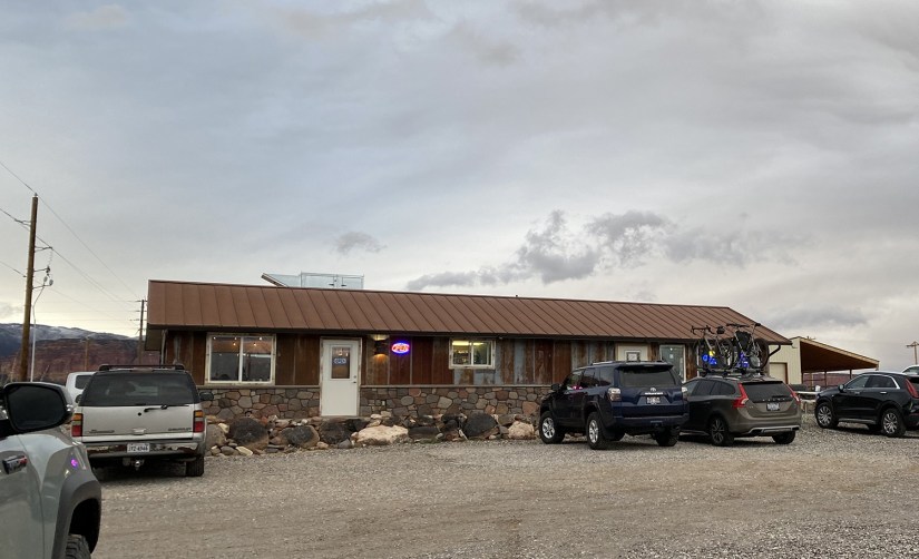
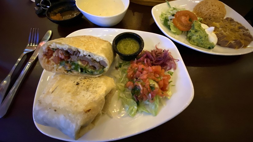
Our park for the day done, we decided we’d grab some dinner in Torrey before continuing on to camp for the night, figuring we earned a night of a meal made by someone else (wait, it was only our third day?!). From blogs I had read, I remembered Chak Balam was a highly rated Mexican restaurant so we headed there. Chak Balam definitely has a unique atmosphere, which you shouldn’t allow to scare you off. The tables are close, it’s loud, the walls are plywood, and there will be industrial fridges in the same room as the dining room. I opted for the California burrito, which turned out to be amazing, and Eric had the shrimp fajitas which he also enjoyed (and in which our server gave a stern warning about the sizzling temperature of, stating “I have to tell you this”). My only negative really is you do not get any free refills on chips and salsa, so eat them with that in mind – we solved this by ordering queso, which came with additional chips!
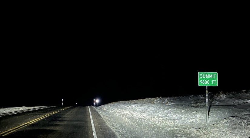
After dinner it was dark and trying to rain some more. We knew we had a bit of crappy weather coming our way over the next day as a cold front moved in, so we headed south towards Boulder hoping to find a cozy campsite. Eric had picked out a few sites that seemed promising… but as we drove, snow appeared, and we realized we were climbing WAY up in elevation. While at the Larb Hollow overlook for a bathroom break, we stared around at the snow and freezing temperatures and realized our campsite choice would be above 9000 feet. We’ve spent plenty of cold nights outside camping before, but really wasn’t feeling freezing rain and snow, so we made the decision to continue on down the road to hopefully a warmer campsite, despite it turning into a late night.
As we descended off the pass, the landscape changed from forest back to desert as we approached Boulder. After a bit of searching we found a campsite, popped the tent, and crawled in the sleeping bag. We really had no idea where we were or what it all looked like. Here is to seeing what the morning would bring, both in terms of views and weather as we explored Grand Staircase Escalante National Monument!


Leave a comment