

Day 2 – March 27, 2022
The take aways…
- Becoming a Junior Ranger is hard work
- The short cut might not be a short cut after all
- Fuel up before venturing to the Needles district of Canyonlands
- Desert air is dry
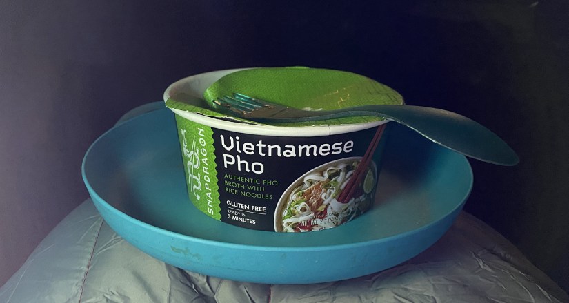
- Have a stocked camp kitchen when traveling with me
- Fall asleep in places that really excite you

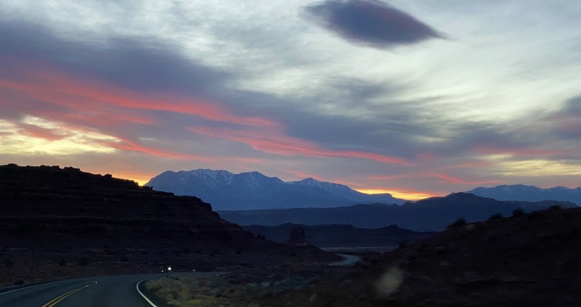
Let’s get the party started! We awoke early before sunrise at our campsite above the Dolores River, and took our time eating our oatmeal, enjoying coffee, and playing with the drone before setting out on our epic adventure.


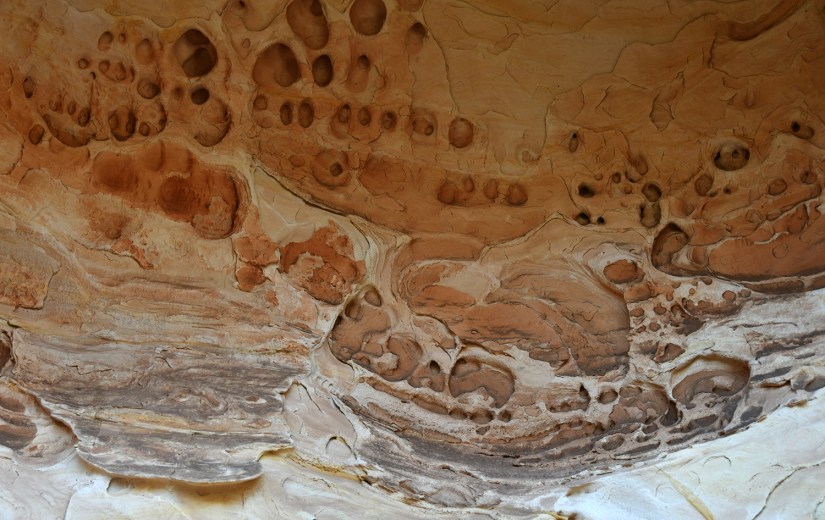
First stop wasn’t far from camp – the abandoned town of Uravan, CO. This was a uranium mining company town, and supplied part of the uranium for the Manhattan Project and first atomic bombs. The town was shuttered in 1985 after a decline in uranium needs (and cheaper sources found elsewhere). The buildings were torn down, the mining areas deemed a Superfund site and cleaned up, and all that remains really is an interpretive sign along the highway. We pulled off and ventured a bit on the gravel road, but did not see much aside from signs warning about radioactivity and some of areas buried under gravel.


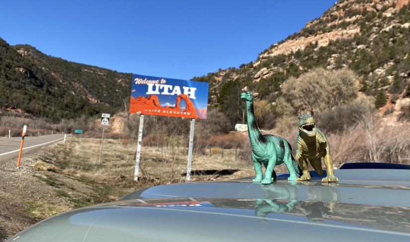
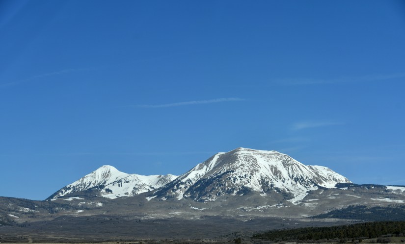
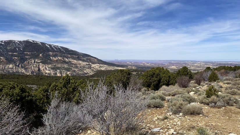
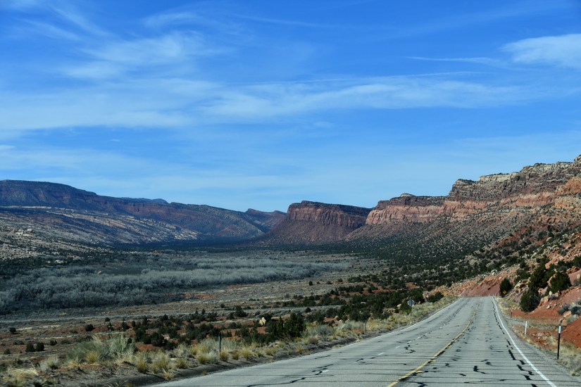
West we headed, driving past the La Sals (my first time seeing them from this direction), crossing into Utah, and soon entering the familiar desert scenes common to the Moab area.
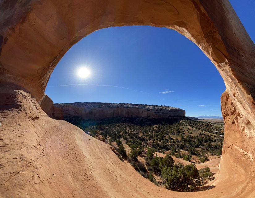
Our first stop was at Wilson Arch, which is right along US Highway 191. It’s not too often there is just a giant arch you can climb up to right off the highway, so it was a chance to stretch the legs, test my healing sprained ankle, and grab some muffins to munch on during the journey into Canyonlands’ Needles district.


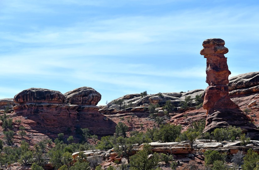
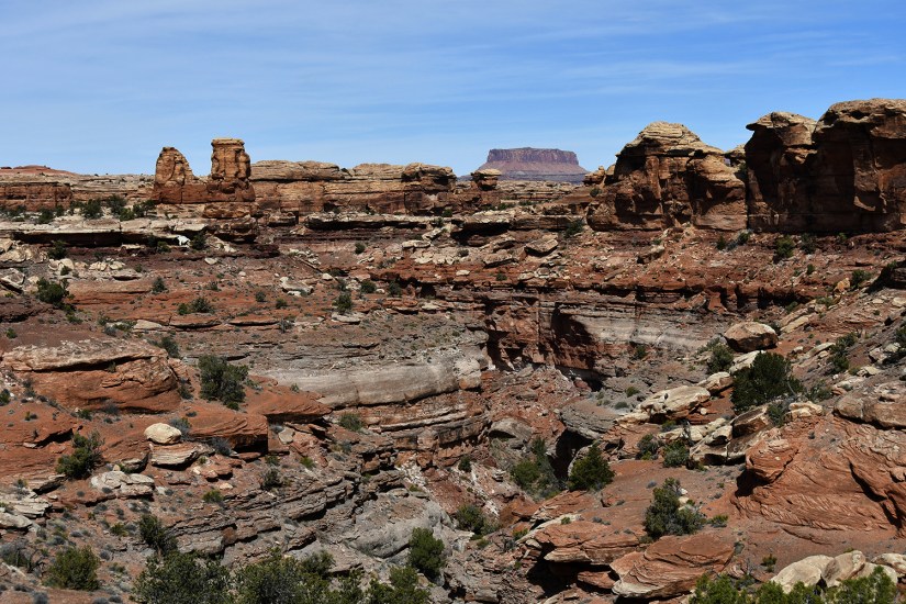
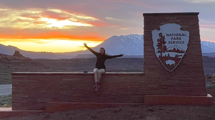
Canyonlands National Park is one of the “Utah Five,” and is divided into three districts: Island in the Sky (the closest to Moab, therefore most visited district, and the one I visited in 2021, Needles (definitely in the middle of nowhere), and Maze (pretty much 4WD access only). Needing to see something new, but not missing going to every national park in Utah on this trip, Eric and I settled on popping into Needles for a quick visit.
Needles district is really off the beaten path, with the visitor center lying about 35 miles one way from US Highway 191. Turning onto the road Eric nervously giggled and started calculating if we could make Monticello on the amount of gas we had left. Whoops! It should go without saying there’s no services in the area…


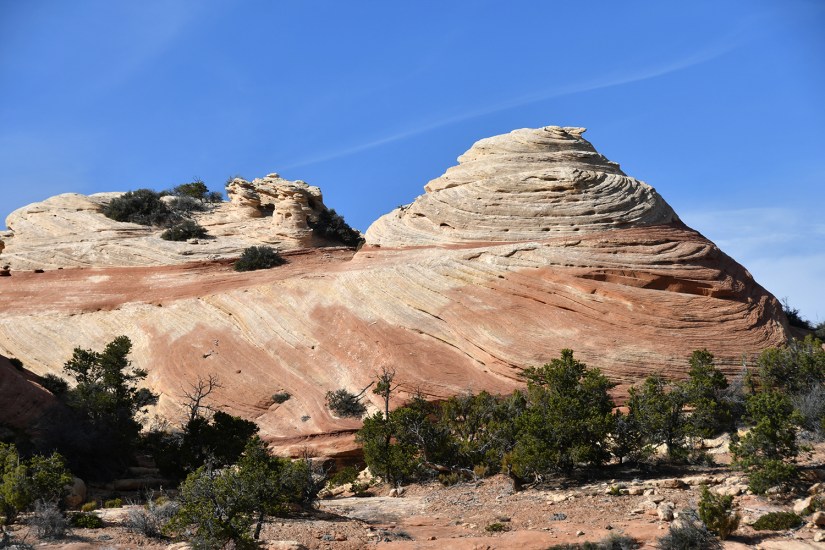
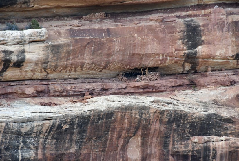
The drive into Needles is great in its own right as you meander through the Indian Creek Unit of Bears Ears National Monument (administered by the BLM and US Forest Service, not NPS) and past several points of interest like Newspaper Rock. There are camping spots, and trailheads for hiking, backpacking, and more along this stretch of road. Bears Ears is a newer monument surrounded in controversy (Obama created, Trump taketh away, Biden reinstated, for the cliff notes…), and the land managers are still working through how the monument will be administered and infrastructure, so alas, there was no entrance sign to photograph. Nonetheless, a gem of protected public land with plenty of exploring to be had!

Of course the visitor center at Needles was our first stop after the entrance station, and we shopped for souvenirs, and then stamped our passport books outside at the ranger’s desk. The ranger noticed I had the Junior Ranger stamps in my passport book, and asked if I do the Junior Ranger program. I quizzically looked at her, and replied that I was not a child, and she laughed and explained the Junior Ranger program is for all ages.
HOW COME I NEVER KNEW THIS!?
Naturally, I eagerly snatched up the Junior Ranger book to earn my badge. “Looking at your height, I’m going to ask you to complete all the pages,” the ranger told me.
Five pages in, I gave up. That was way too much homework to try to accomplish in one hour! One of the moments I’ve hated being 5’10″… (Only if I had known in Yellowstone, as eight days would’ve been enough to do my homework and earn my badge, terrible sketches of wildlife and all!)


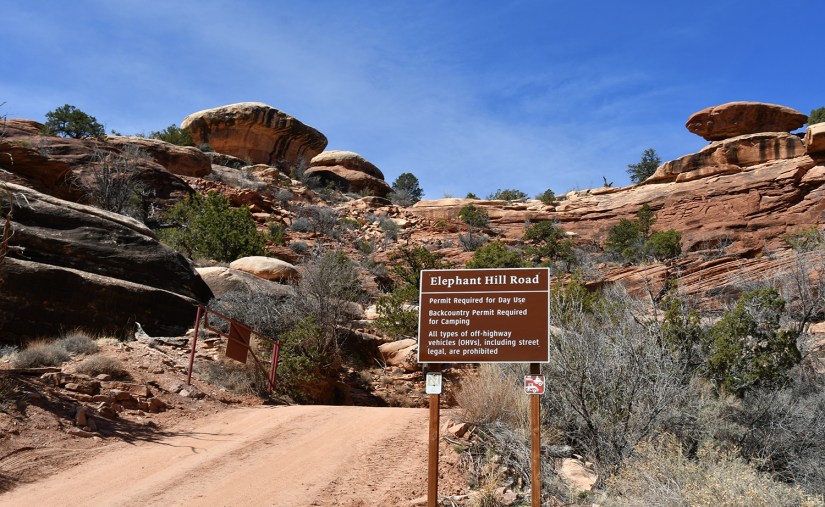
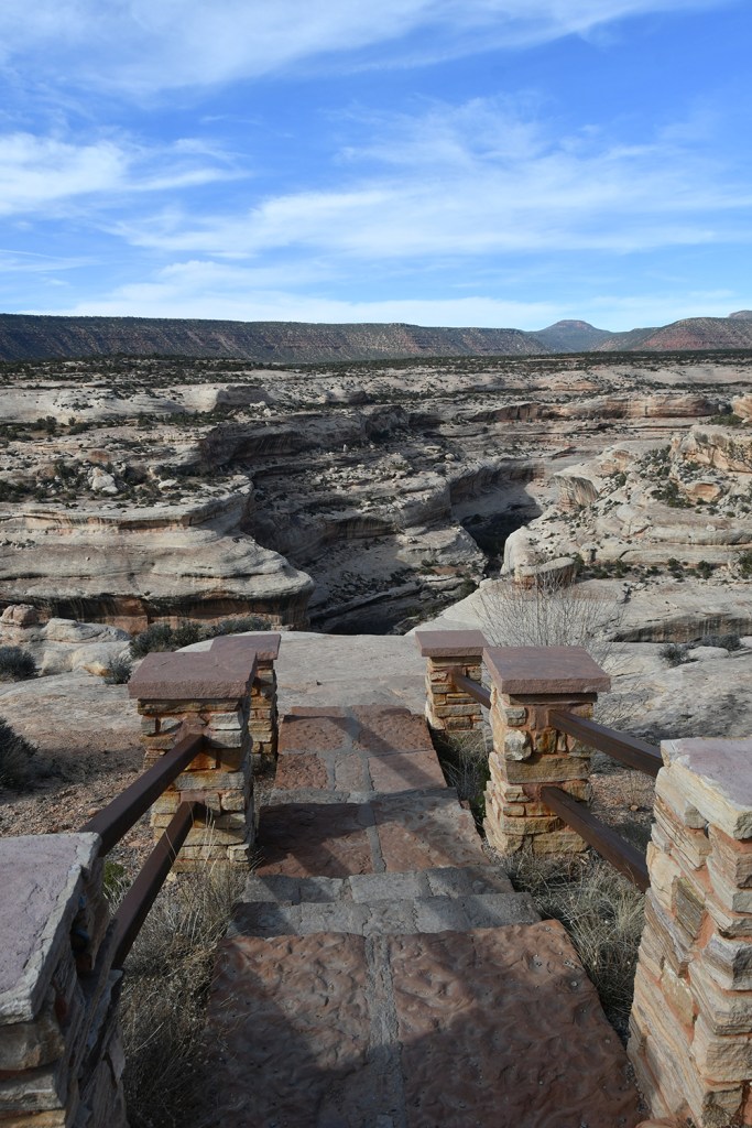
Eric and I really probably didn’t do Needles justice, as all we did was drive the paved scenic loop plus take the dirt road out to Elephant Hill. But we had a busy itinerary for the day with brand new sights to see, and limited gas to explore Needles. And to be fair, it is in a corner of Utah I feel like I’m at fairly regularly so I could always come back for a visit… We came, we saw, we headed out!


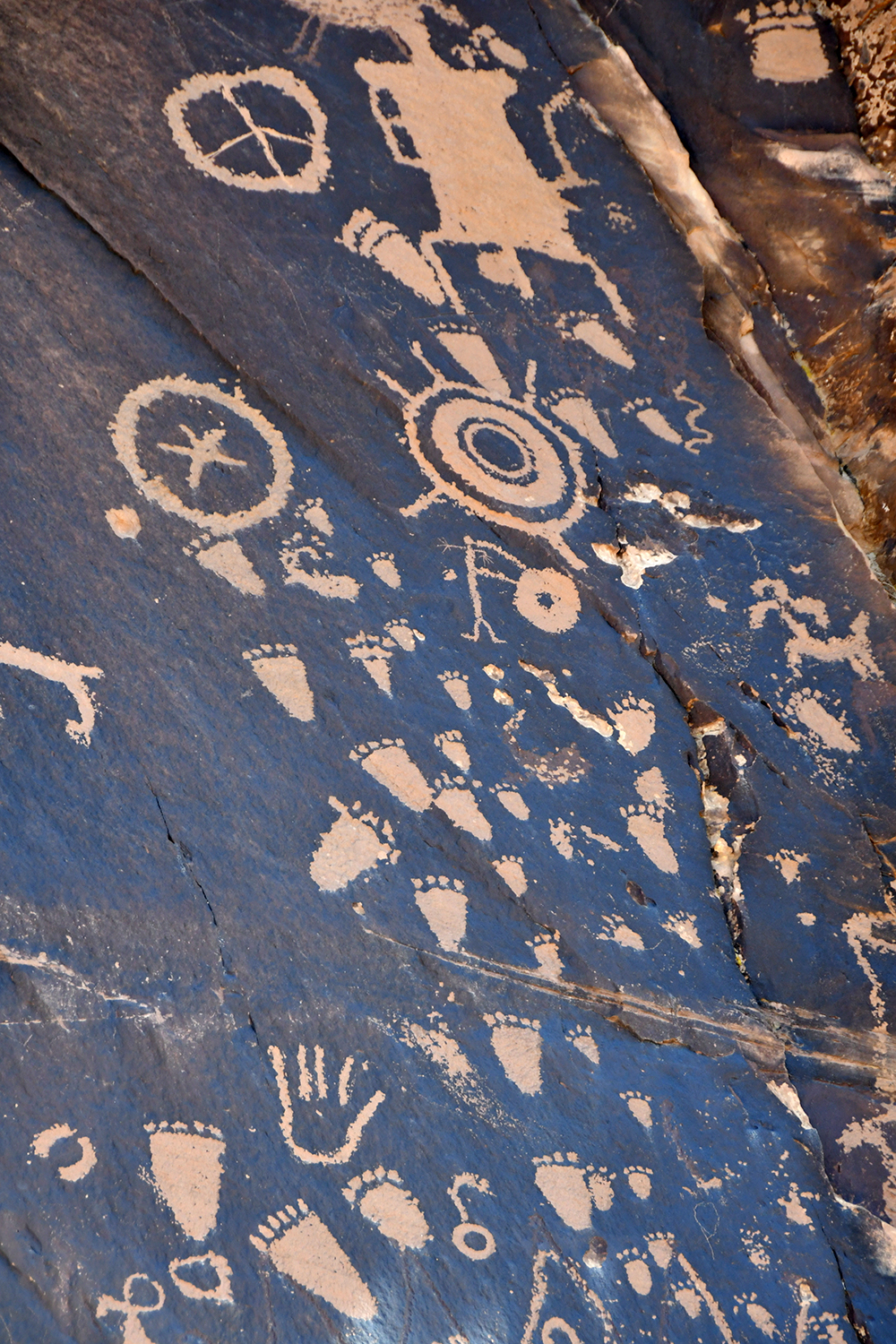
On the way back out to the highway we made a quite stop at Newspaper Rock State Historic Monument. Here is one of the largest collections of petroglyphs in the country, and is a nice spot to stretch the legs again (apparently my motto of the trip… stretch all the legs all the time, especially the ouchy ankle) and use the restroom. What I found most interesting is the petroglyphs of feet all seemed to have six toes…


In order to save on gas and hopefully get a time cushion to make it to the Natural Bridges National Monument visitor center before it closed at 4pm, we eyed a forest road that turns south from UT Highway 211. I announced, “it’s paved!” and Eric quickly turned. “Oh, it’s only 10 miles to Monticello, this is great!” he announced andaway we went on this seemingly deserted road that took us from the desert landscape into the Manti-La Sal National Forest and trees.
Up. Up some more. Hmmm… We hit above 8000 feet in elevation and snow covered the road. Hmmm. The snow and slush got deeper, and then we saw a Hyundai SUV absolutely buried in the snow up ahead. We decided to get out and investigate and found Bruce and Colette, a sweet couple from Salt Lake City who had a tow truck on the way to get them out of their predicament (they managed to get stuck in the one spot with cell phone service!). We offered to help get them out but they cheerfully declined.
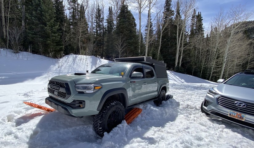
Weren’t we just in the desert, and now we’re standing in snow in sandals?! Eric aired down the tires and we gave the road a go with the Maxtrax, and I dug out some more appropriate footwear since Chacos and snow make a chilly combo. Just as we passed their car, Colette put Eric on the phone with the tow truck driver, who warned us not to try to continue (we are unsure if he knew we were in a capable vehicle, or was a local who was in the know on what lied ahead). We sighed, admitted defeat, and turned around after exchanging phone numbers and making sure our new friends had water and snacks.
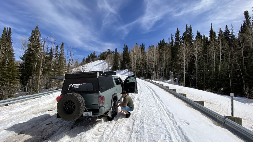
Okay, here’s to hoping we could make Monticello! Oh, and that sign saying 10 miles to Monticello? It was for Monticello Lake. The town was really 18 miles… ha! It’s not an adventure without some unplanned adventures….
Needless to say, we rolled into Monticello with some sips of gas to spare, but sadly not enough time to make the Natural Bridges National Monument visitor center before closing. Bruce called to let us know they were freed of the snow and continuing on their adventure, and Eric let them know we fed the truck (and we filled up gas can, too, so we wouldn’t have this happen again). Eric had seen a Taco Time on Google Maps, but we realized it was closed permanently, so we turned towards the monument.


Nineteen minutes. That is how much after closing we arrived at Natural Bridges National Monument’s visitor center. I looked longingly in the windows of the center, hoping maybe an employee would take pity on me. No luck. (On the bright side, I emailed the monument after returning home, and they mailed me a unigrid, a postcard, and two passport stamp cancellations for the date of our trip! Thank you so much, Natural Bridges NM for taking care of us!)
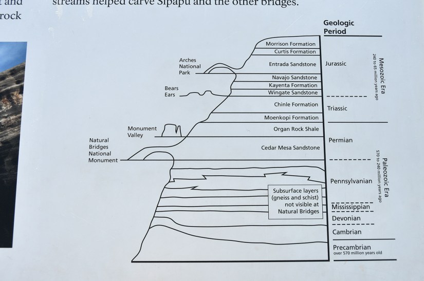
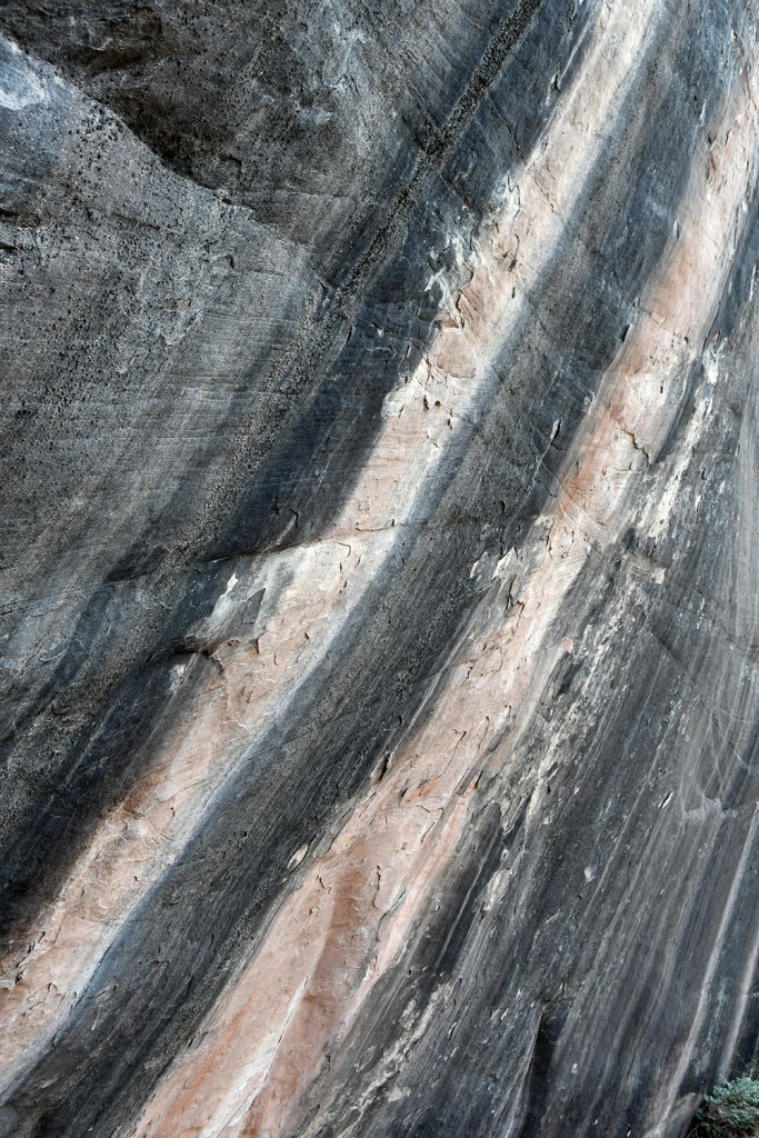
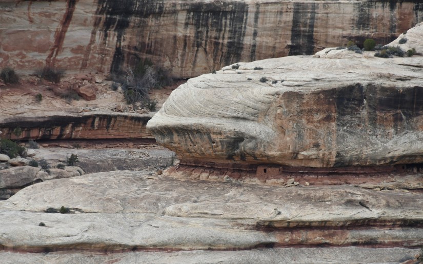
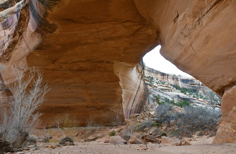
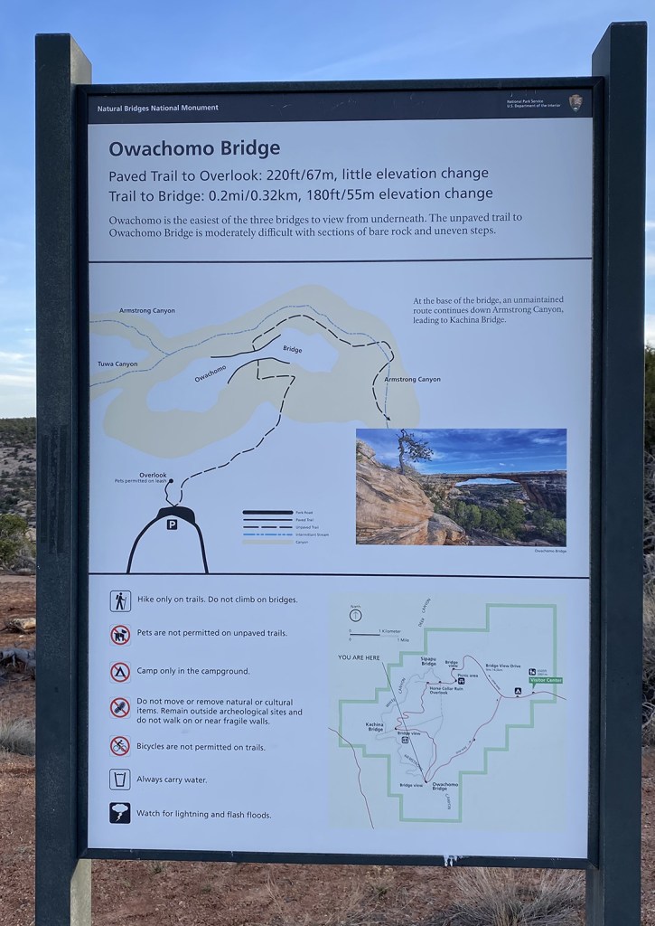
Natural Bridges National Monument was Utah’s first national monument, declared in 1908. Off the beaten path, the monument was the first park designated as an International Dark Sky Park, and has some of the darkest night skies in the United States. Unlike the famous arches of other parts of Utah, the three bridges in the monument were formed by running water.
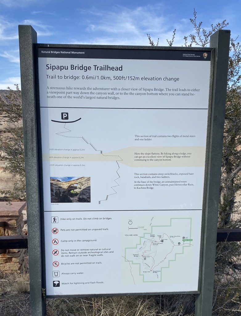
To explore Natural Bridges, you follow a one way scenic loop that has various viewpoints and trailheads. We stopped at Sipapu Bridge viewpoint, and I made some sandwiches since we had not eaten lunch yet. Not the ugliest place I’ve made a sandwich by far!

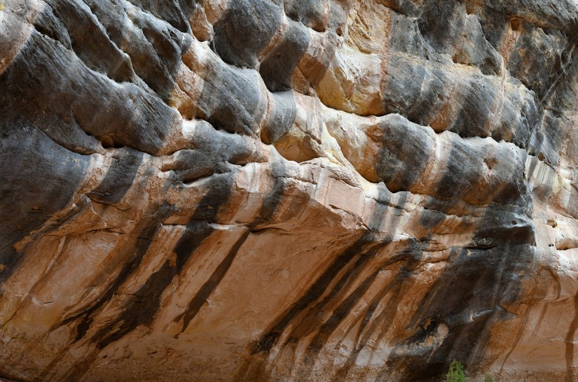
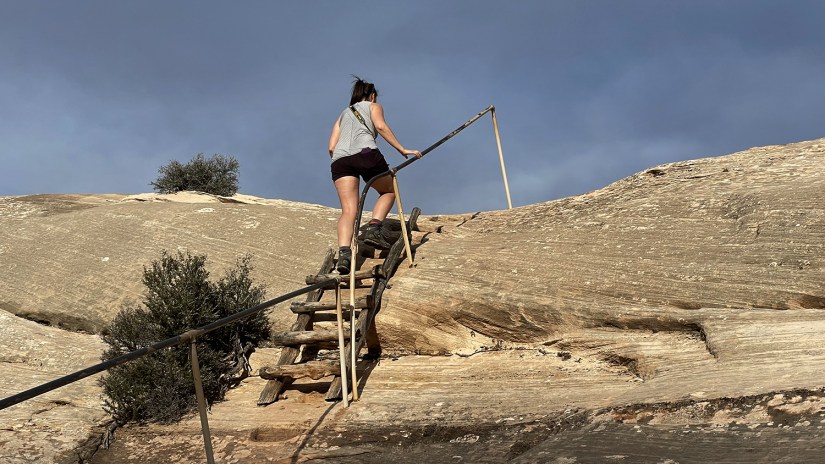
I wanted to hike a bit, so we drove on to the trailhead for Sipapu Bridge and set out on the hike down to the bridge. The hiking in the monument is kind of limited compared to other larger NPS units, but also a bit of choose your own adventure, as you can hike to each bridge individually in short chunks of 05.-1.5 miles, or do a 12-mile long loop to see all three. Sipapu Bridge is about a 1.5 mile round trip hike, but with 500 feet or so of elevation gain to climb on the way back to the car. Both Sipapu and Kachina hikes involve ladders and some steep stuff.
Sipapu Bridge is the second largest natural bridge in the United States. The views on the hike down were gorgeous. We opted to explore more out on a ledge overlooking the bridge than going all the way to the bottom. No fear, that was still a workout heading back up! Also, we learned that if you breath hard climbing back up from the bridge, the sound is amplified by the cliff walls and everyone will hear your dramatic breathing!


Kachina Bridge was next hike, with another 1.5 mile round trip and about 400 feet of elevation to gain on the way back up. This bridge is probably the youngest in the park as its the biggest and thickest (natural bridges get thinner and thinner the older they are).

We first walked out to the overlook, and then backtracked to take the trail. This was quite the hike down the narrow switchbacks and ladder, but so worth it to stand under the giant bridge! And hey, the shade wasn’t so bad, either!


The hike back up was hot with the sun that reappeared from behind the clouds, and I started feeling wonky. Knowing it shouldn’t be an elevation thing, I kind of just kept trudging along, figuring I just needed to drink lots of water when I got back to the truck (I left my pack in the truck for this bridge since it was a seemingly short hike… don’t be me… 5% humidity is killer and you need to hydrate!). Once back at the truck, my nose started gushing blood! Ack! I get a nosebleed maybe every five years at best, so this was an unexpected mess as I screamed for tissues, and said my favorite phrase of the last twenty hours, “You know what my camp kitchen has? BABY WIPES!”
(So… Eric and I squared off on whose “camp kitchen” to bring. My camp kitchen tote is quite impressive, but we left it behind after Eric reassured me we had all the essentials. By the first night we realized my camp kitchen definitely had things we could’ve used, like a sponge, wipes, a spatula, dish towel, citronella candle lantern… and the phrase “You know what my camp kitchen has?” was coming out of my mouth more than Eric wanted it to! To be fair, my camp kitchen has everything but the kitchen sink in it!)
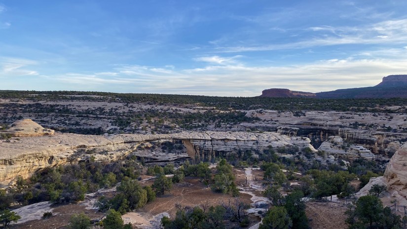
Anyways, I shoved a wad of tissue up the bleeding nostril, tried to scrub the blood off my pale gray shirt (and hands, face, chest…), and chugged some water as we headed to Owachomo Bridge. This is the most accessible and visited bridge in the park, and the hike down to it is mild and only 0.5 mile round trip. It is also the thinnest and oldest bridge in the park, and one of those things that could just collapse anytime, so I’m happy I got to see it. We hiked a short bit for some photos, but didn’t go all the way. Bleeding nose and all thwarted that.

By now we had spent a wonderful evening on this quiet, hidden gem of the National Park Service and it was time to find camp for the night. The next day had a packed itinerary, and we took to pondering if we should settle on our first camp choice along the Colorado River, or continue on for a late night drive to outside of Goblin Valley State Park. This led to debates on if we should scratch Goblin Valley since we wouldn’t be able to give it the attention it deserved before heading to Capitol Reef National Park.


We pulled up to the originally planned campsite, and I got so incredibly giddy that I declared there in the fading light that we would continue no further as I HAD to see it in the daylight, and the landscape beyond it! Eric was quite amused by my excitement, and we decided then and there we’d camp at this spot, scratch Goblin Valley, and head out on our epic day three early next morning.
Time to fall asleep at the most amazing campsite of the trip! I crawled up into the tent, and passed out promptly while Eric grabbed Milky Way photos.


Leave a comment