
Day 1 – August 22, 2020
Ever wake up on the morning of a grand adventure, so darn excited?!
That was me. Though I didn’t need to get an early morning start, I was still filled with anticipation. My grand 2020 adventure would take me to corners of Wyoming I had not visited in 29 years an 8-day road trip and I was SO. DARN. EXCITED! Planning this trip was overwhelming at times, as I was really naive about what to see in Yellowstone, and it was topped with the original plan of racing Pierre’s Hole 100 mountain bike race being cancelled about a month out. However, the race cancellation meant I’d have more time to explore, so I put my knack of trip planning to work and set my itinerary.
Into the thick wildfire smoke I drove, which obscured the landscape. Hours and hours went by, and I grew antsy just to get to my destination. I decided to make a quick pit stop at Split Rock off of US Highway 287, as there are restrooms and nice views to take in while I stretched my legs.
Split Rock was a prominent landmark for emigrants on the Mormon and Oregon Trails, and is located about ten miles north of Muddy Gap. There is a BLM interpretive site, with some educational signs, and some nice bathrooms as I had mentioned. I also believe there are some picnic tables as well. Not a bad spot for a quick rest before continuing on!


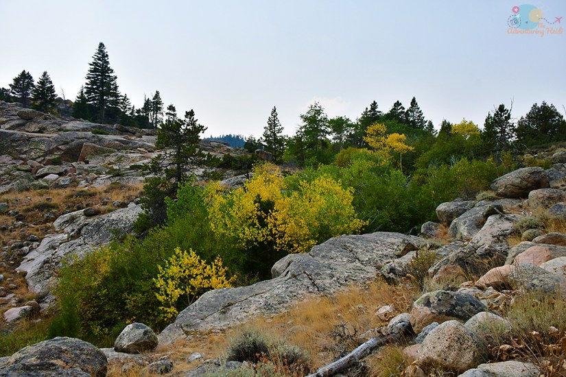
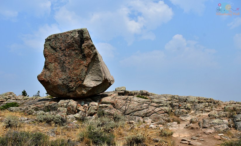
This terrain always amazes me, as I find it troublesome to cruise along at 70mph at times, so I cannot even begin to imagine walking around it all in a wagon train! Those pioneers were something else for sure!
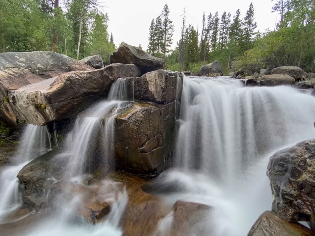
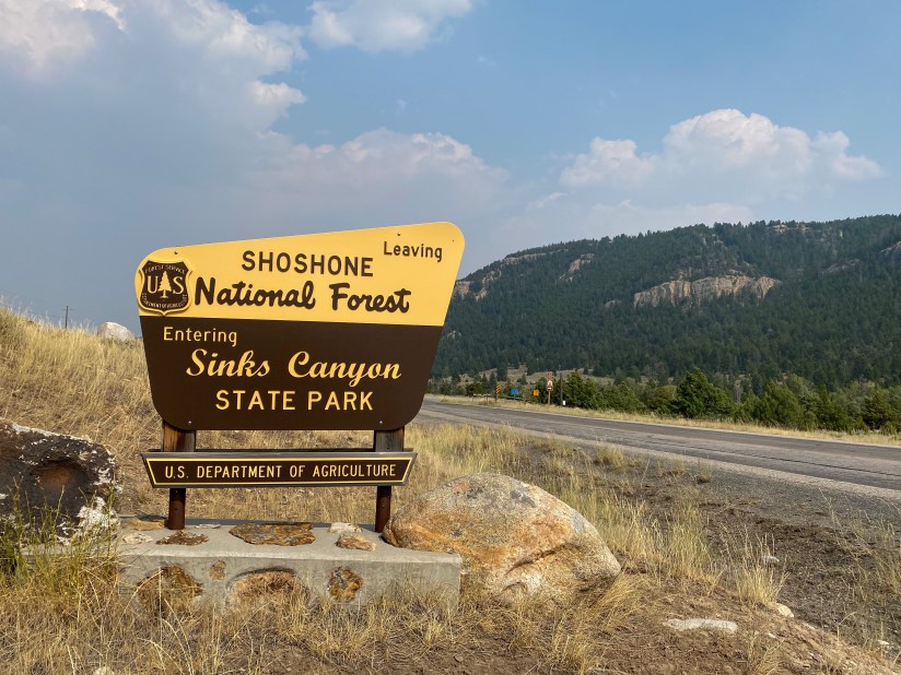
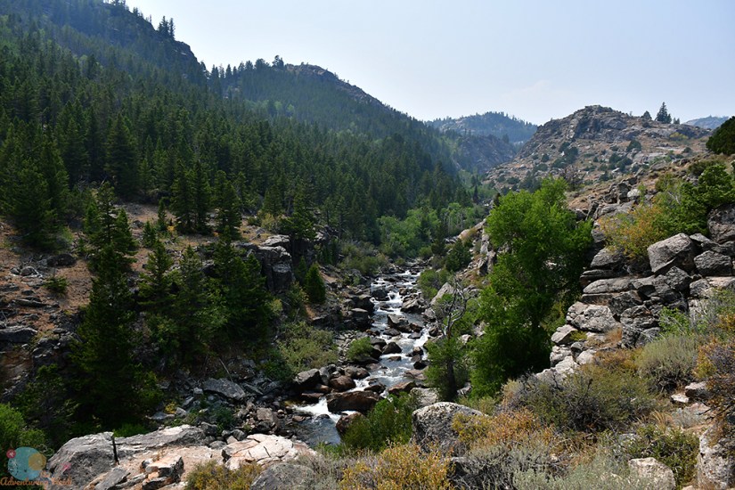
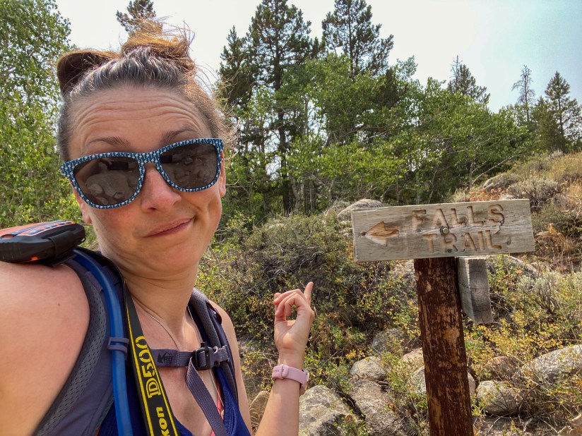
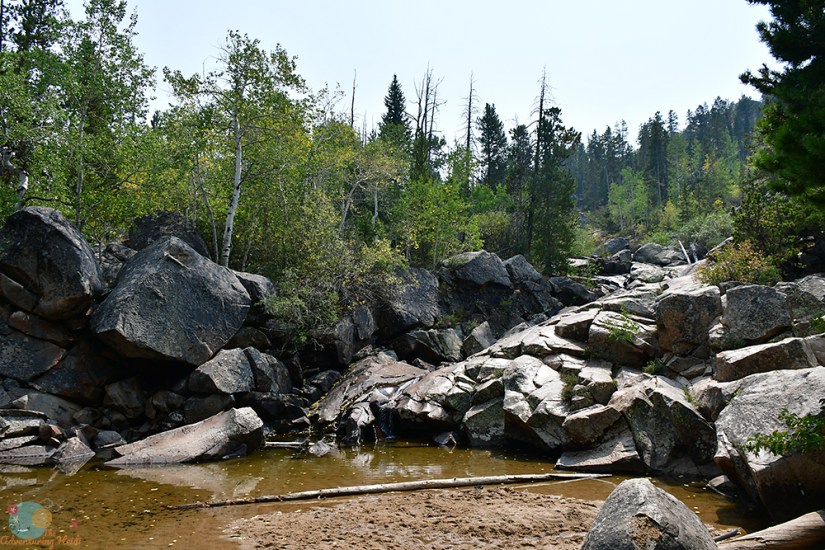
Next up was my first waterfall chase of my adventure – Popo Agie Falls outside of Lander in Sinks Canyon State Park. I had visited here a few years back on a fall evening, but it’s a pleasant hike and gorgeous falls, so I didn’t mind a repeat visit!
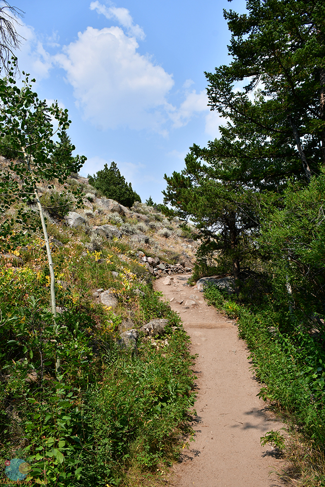
Popo Agie Falls are a series of cascades on the Middle Fork of the Popo Agie River. It’s actually pretty impossible to see the entirety of the cascade, but you can get close to a couple portions, including one part that is used as a swimming hole and waterslide in the warmer months. The hike is roughly 3 miles, and does gain a good chunk of elevation, but I saw plenty of young kids doing it if that gives you an idea on ease of hiking it. The hike begins at Bruces Parking area in the Shoshone National Forest, and follows the Middle Fork of the Popo Agie Trail into the Popo Agie Wilderness. It’s well signed at the junction to split off.
By the way, Popo Agie is pronounced “Puh – Po Shuh,” which is nothing how it looks!
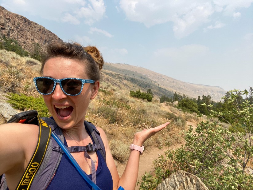
I strapped on my hiking boots and pack, and grabbed my camera and set out on the hike. Sadly it was quite hazy from the wildfire smoke, but that would just all be about making lemonade out of the whole western U.S. being on fire.


I headed down to the spot I had visited back in 2017, and decided it was a good place to have a snack and just enjoy the spray from the falls. There’s a theory that waterfalls are good for you as the rushing water releases ozone… not sure about that theory, but either way, sitting next to a waterfall, with the loud roar in your ears, is just the best!
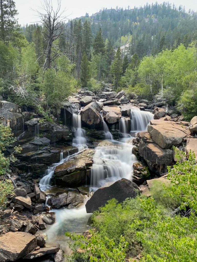


I hadn’t gone any further up the trail during my last trip (was running out of daytime, and it is a wilderness area after all!), so I decided to head up to the swimming hole portion. It was quite crowded, so I didn’t grab any photos, but I imagine the water is a bit darker when the run off is higher in the earlier summer months.

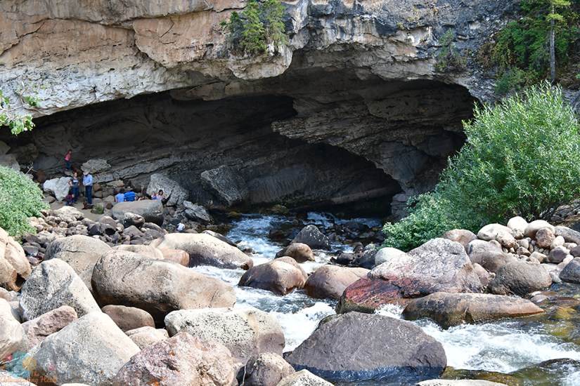
I stopped briefly at the Sinks Canyon State Park Visitors Center, picking up one of the free Wyoming tourism decals, and checked out this year’s winners of the annual photo contest. Sinks Canyon gets its name from the mysterious feature “The Sinks,” which is where the Popo Agie River disappears underground for hours before appearing further down the canyon about a quarter of a mile at “The Rise.” It is still a mystery how this all happens, as dye tests only tell a bit of the story, as it shouldn’t theoretically take hours for the water to reappear at that distance. Definitely worth a stop to see, and there’s parking at both The Sinks and The Rise.
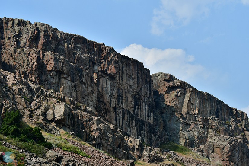
My exploring around Lander complete, I continued north through the Wind River Indian Reservation and onto Dubois. When looking for a place to stay before entering Yellowstone, I explored a lot of options, including going all the way into Idaho and Montana (such a longgggggg drive), but settled on Dubois as I could get reservable camping on short notice at the KOA, and I could do some day hiking in the Wind River Range. Last time I had been in Dubois was probably in young childhood, so once again so fun to explore something again as an adult! Dubois is a cute little town of about 970 residents, and serves as a gateway community for the Wind Rivers and Teton & Yellowstone National Parks. The geology around Dubois is fantastic, uniquely shaped by tectonic, volcanic, and glacial forces (I’ll always be a geology herd, pardon me!). Also, remember the TV show Lost? Matthew Fox lived here in childhood. Dubois is also home to the National Bighorn Sheep Center, but more on that in day 2!


Stay tuned for Days 2-8!!


Leave a comment