

May 21, 2023
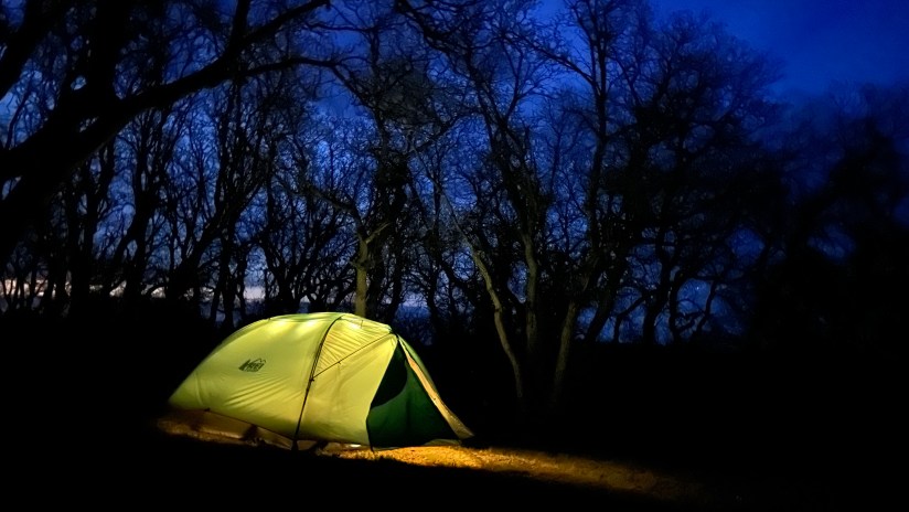
It simply cannot be explained… I struggle with the snooze button and push waking up until the last minute on a workday. Vacation? Oh, I’ll be up before the sun, ready to go! Don’t have to ask me twice! Another dawn wakeup in my glorious tent, excited to get going! I did not have the most restful sleep, as my campsite neighbors rolled in about 11pm and were incredibly noisy up until midnight (when I worked up the courage to please ask them to be respectful of the other campers). This led to a crazy dream that the woman in that campsite sealed me in my tent with duct tape, and then a bear came over and sat down, squishing me. Regardless, I was ready for today’s adventure!
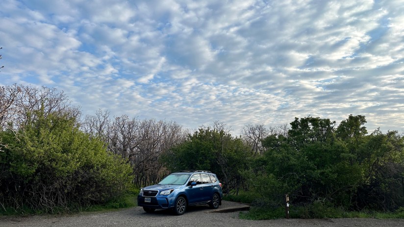
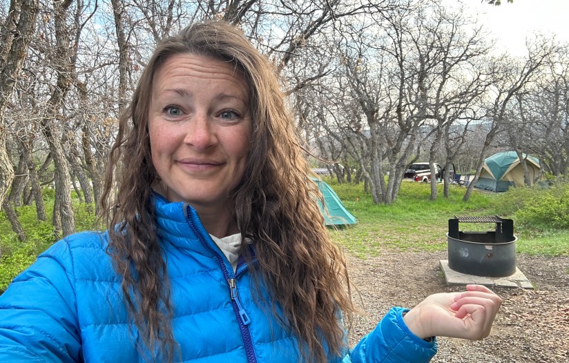
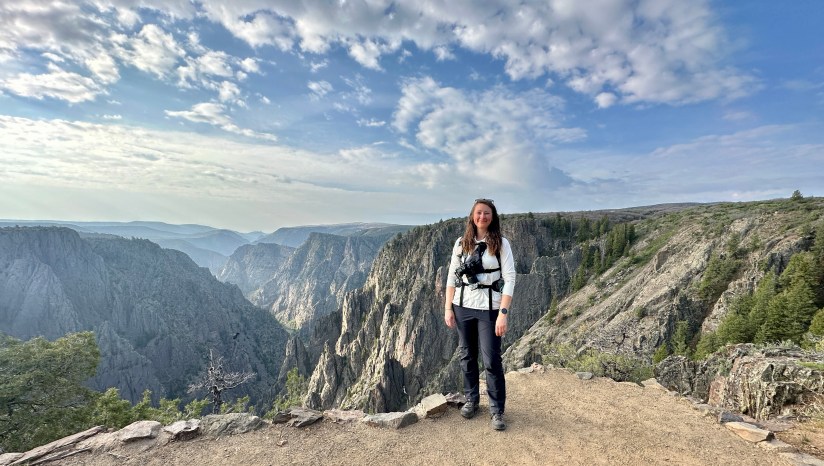
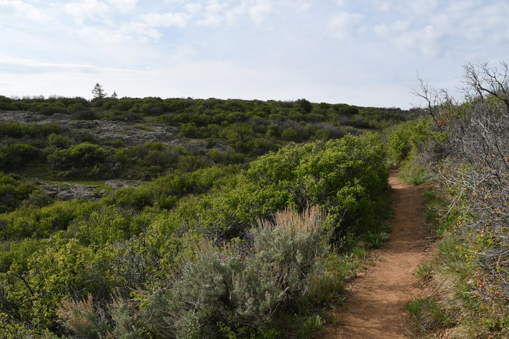
After some oatmeal and getting coffee ready in my French-press mug, I strapped on my backpack and hiking shoes, and set off for the first significant hike of the trip at about 7:13am. I passed Moe from Atlanta a few campsites down, and he remarked that I was getting an early start, to which I smiled and held up my coffee cup as I wandered by.
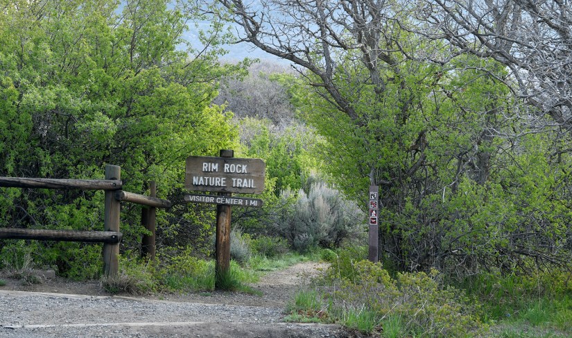
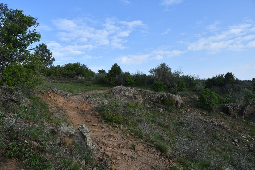
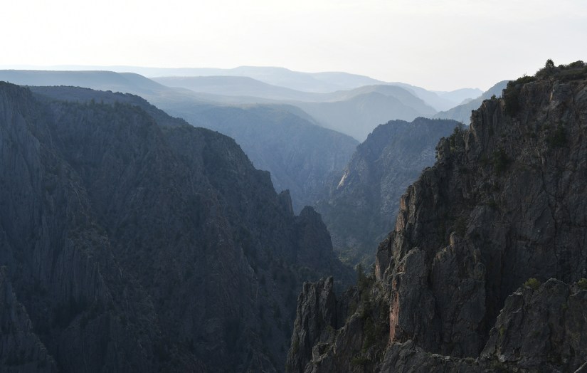
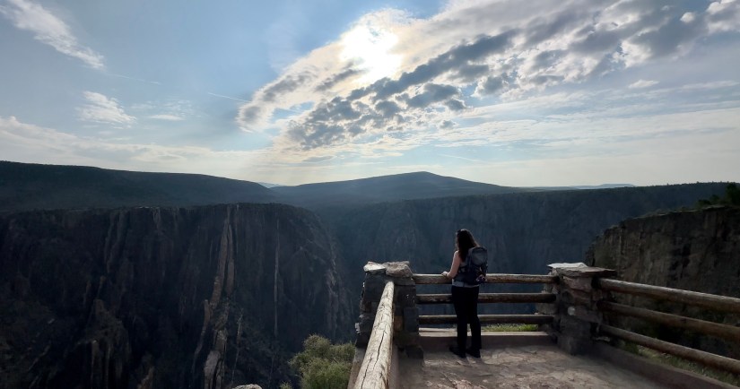
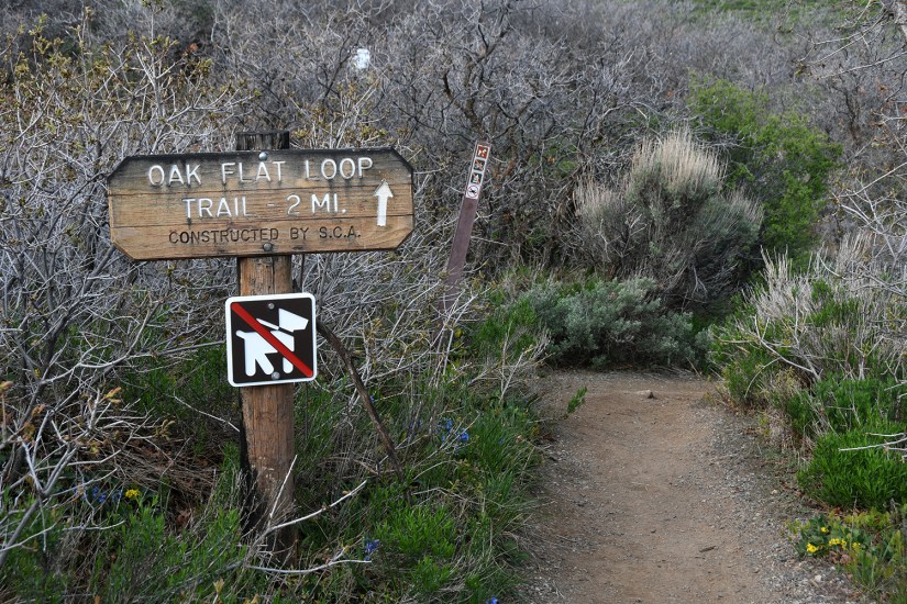
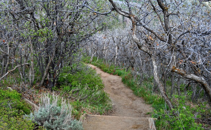
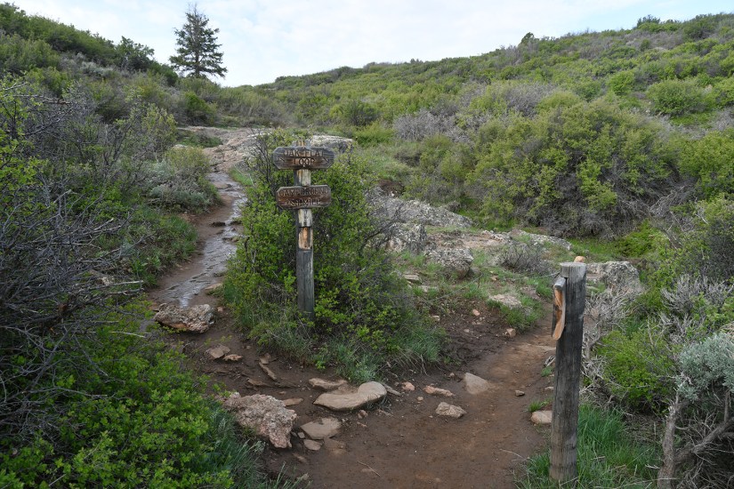
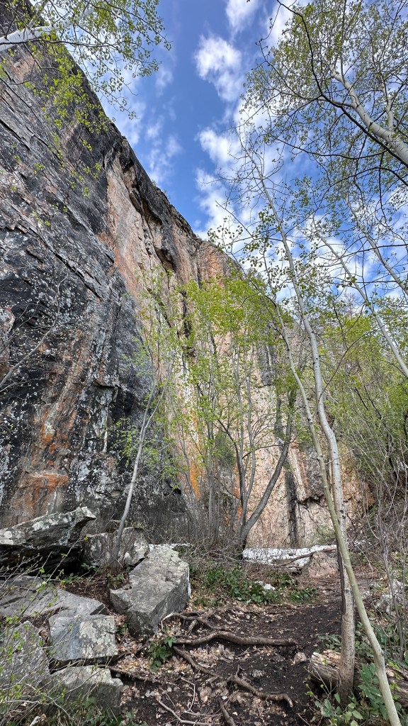
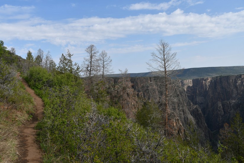
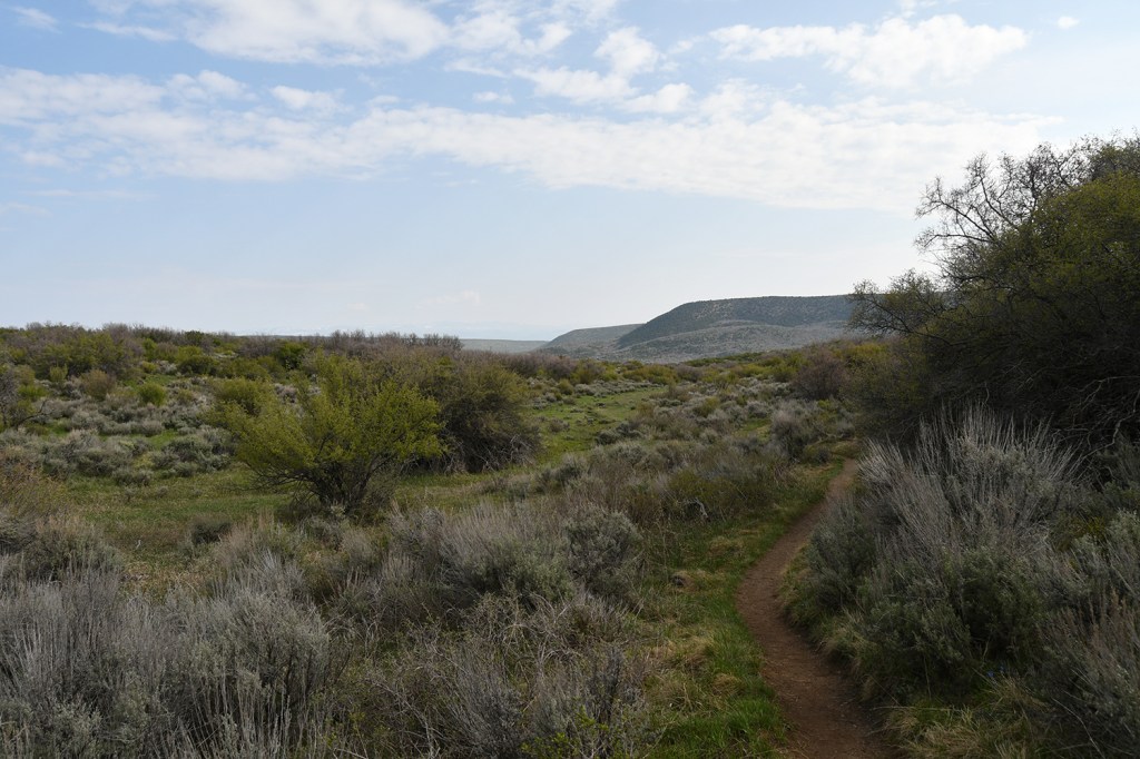
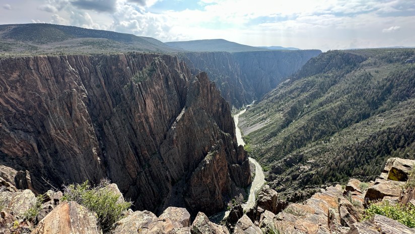
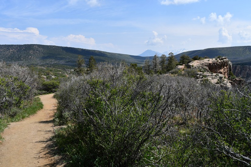
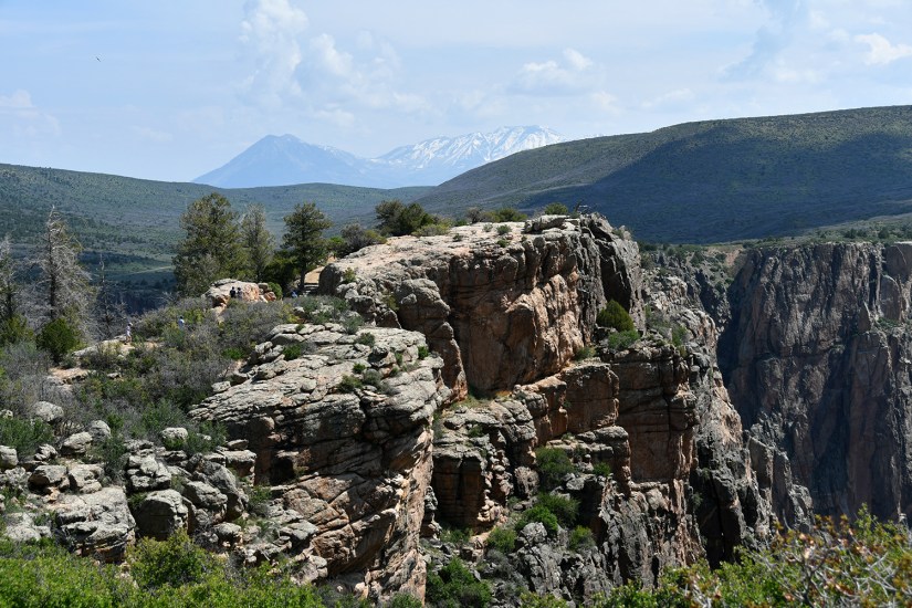
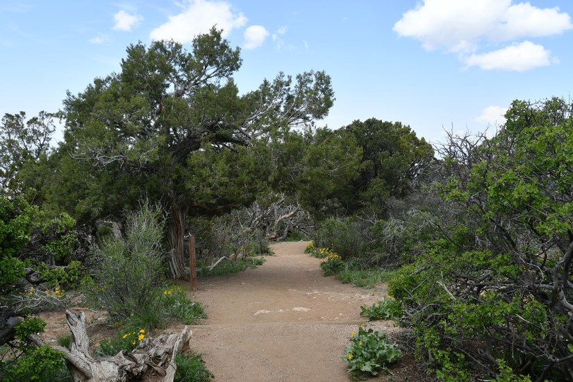
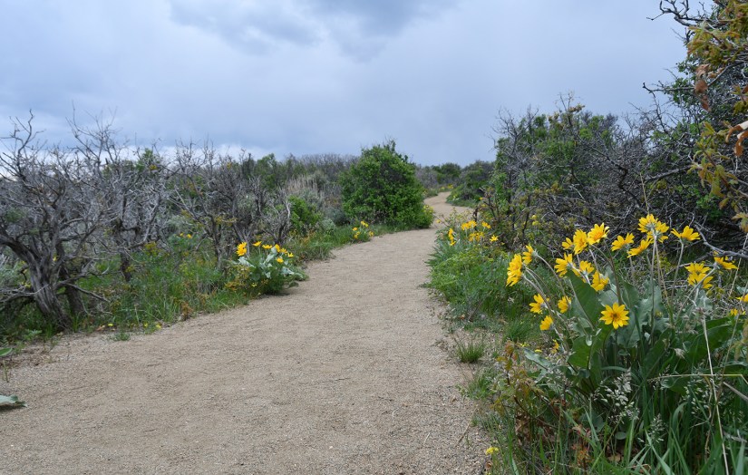
Leaving from the campsite, the Rim Rock Trail leads you past Tomichi Point and to the visitor center, about one mile in distance. From there I would revisit the Gunnison Point Overlook before continuing on Oak Flat Loop, which is the only trail that goes below the rim of the canyon that does not require a inner-canyon backcountry permit (however, it does not lead down to the river like the other canyon access trails do). Then I’d head back to the campground on the Uplands Trail. Overall, this hike would come in at four miles and would take me a smidge over two hours to complete at my casual, picture takin’ pace. (Information on hiking trails at Black Canyon of the Gunnision National Park can be found here.)
After arriving back at my campsite I took a quick camp bath with a Venture Wipe, sprayed on some dry shampoo, and relaxed in my chair a bit. The rest of the day I had planned to tackle the South Rim Road, which leads to many overlooks. One thing I did not realize is how most of the overlooks require quite a walk, so I still had a lot of activity coming up in the day! I headed out shortly after 10am.
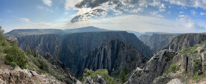
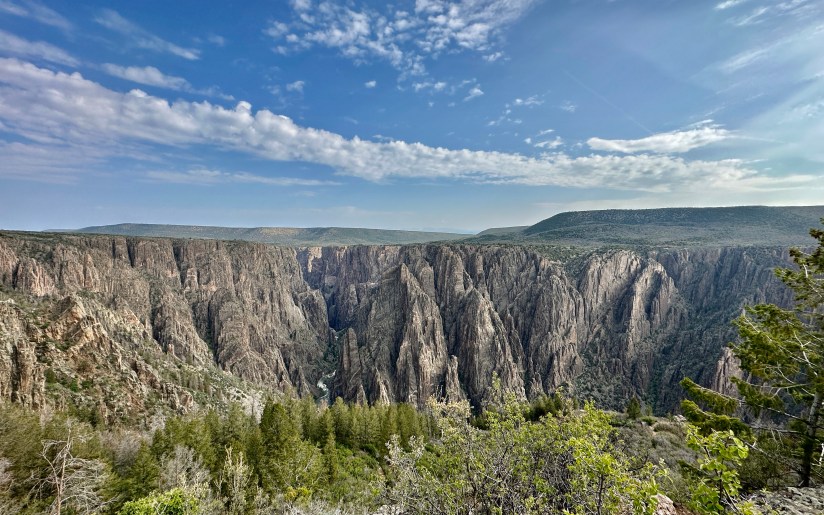
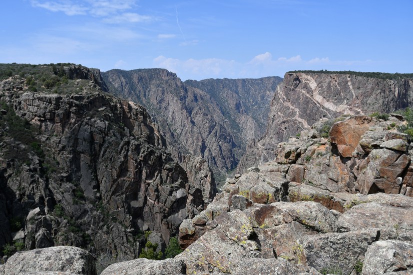
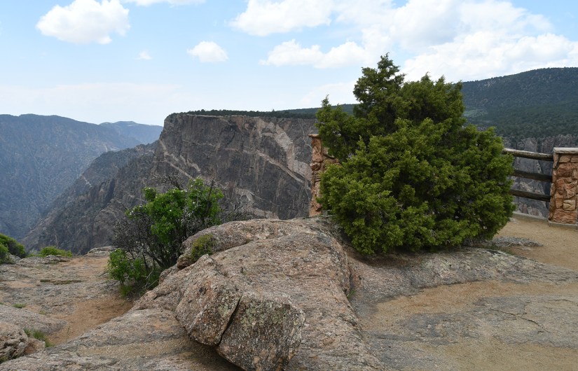
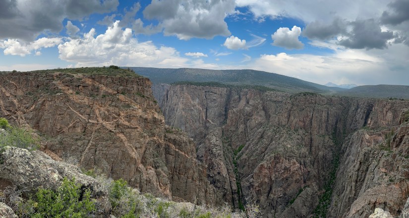
South Rim Road is seven miles long, and overall includes twelve overlooks. It is two-way, so the great thing is if you skip an overlook on the outbound drive, you can catch it on the return trip. I ended up doing this with a few overlooks. Some of the views can be seen right from the parking area, but most involve a bit of walking, up to a third of a mile one-way. Most of the parking areas are close together, so it becomes that annoying “get in the car, drive a minute, park, get out” routine. But with no sidewalks or trails connecting them, this is the most feasible way as the road is way too narrow to walk along in my opinion for most of the overlooks (Chasm View and Painted Wall are two that are walkable between them).
Pulpit Rock Overlook was my first stop, and one of the busiest as this is a very popular viewpoint and picnic area and is close to the visitor center.
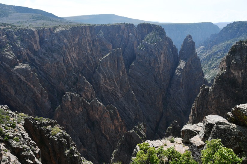
Cross Fissures View was next, offering up views of the spires and fissures of the Black Canyon.
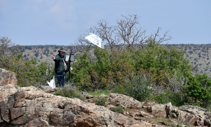
Rock Point intrigued me as you hike towards a rocky outcrop. In my pursuit of standing on things, I was excited to go stand there, haha! Hey, it was on Peakbagger.com sooo….
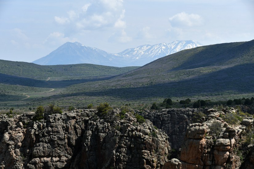
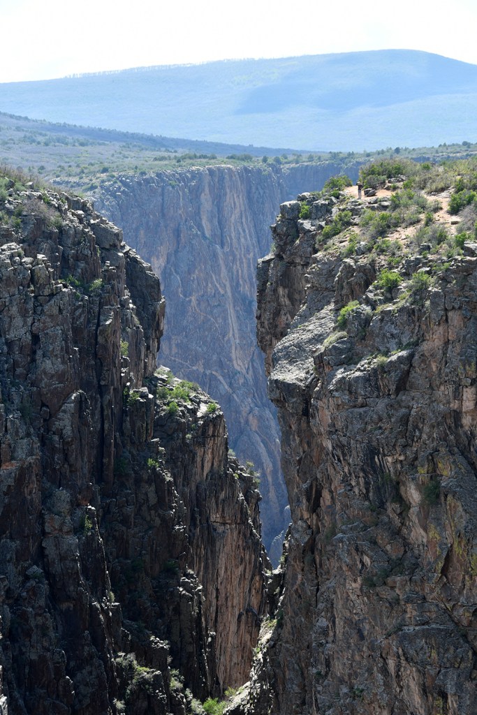
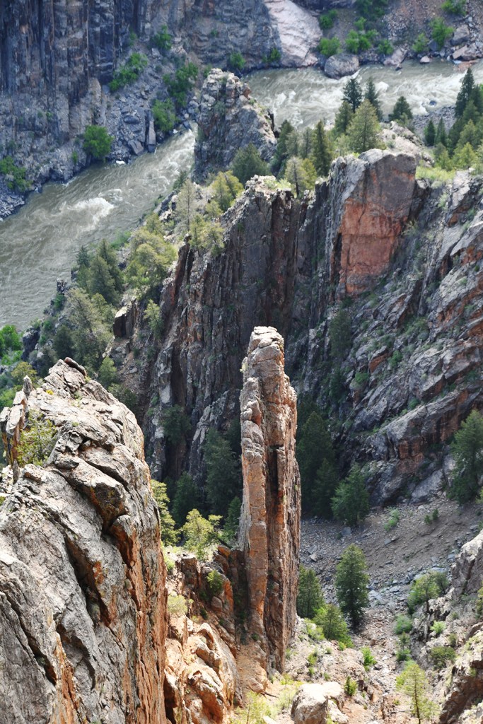
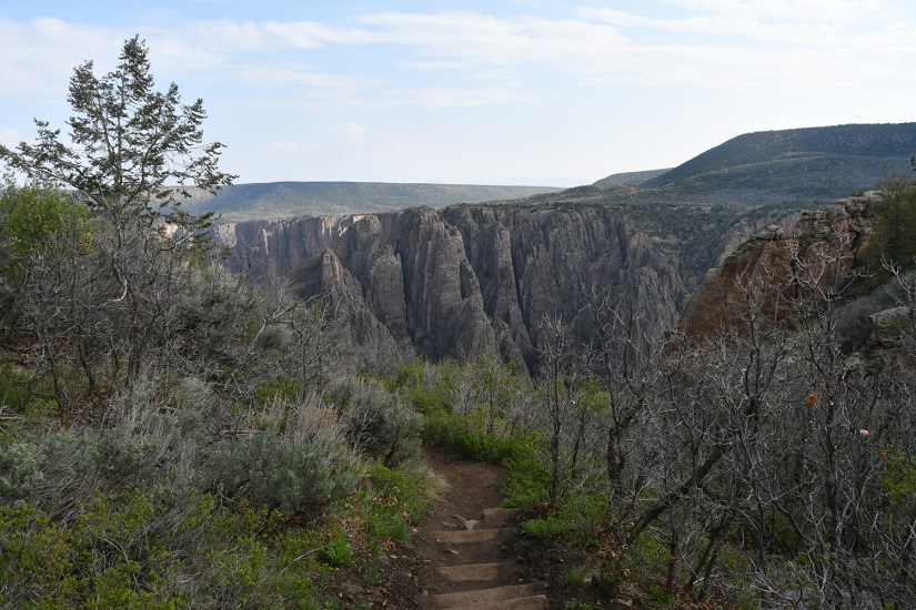
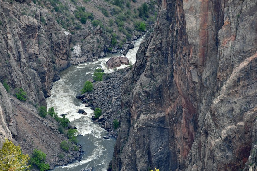
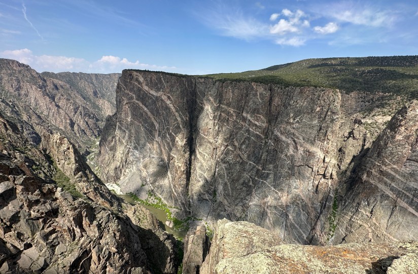
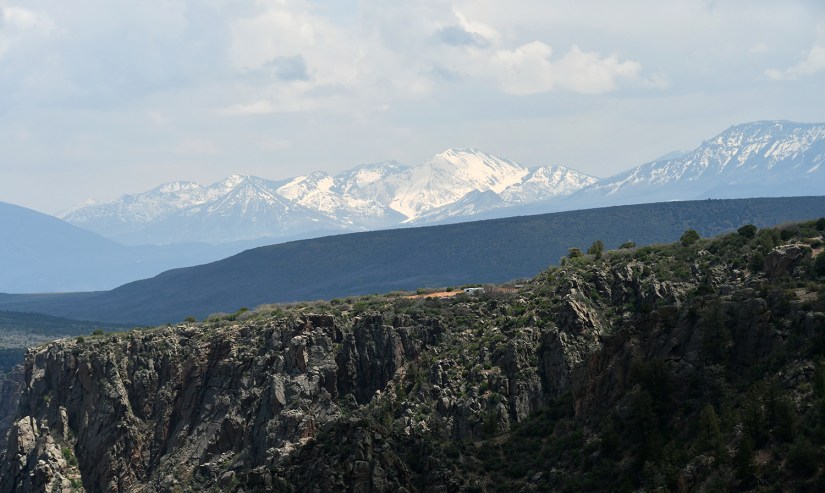
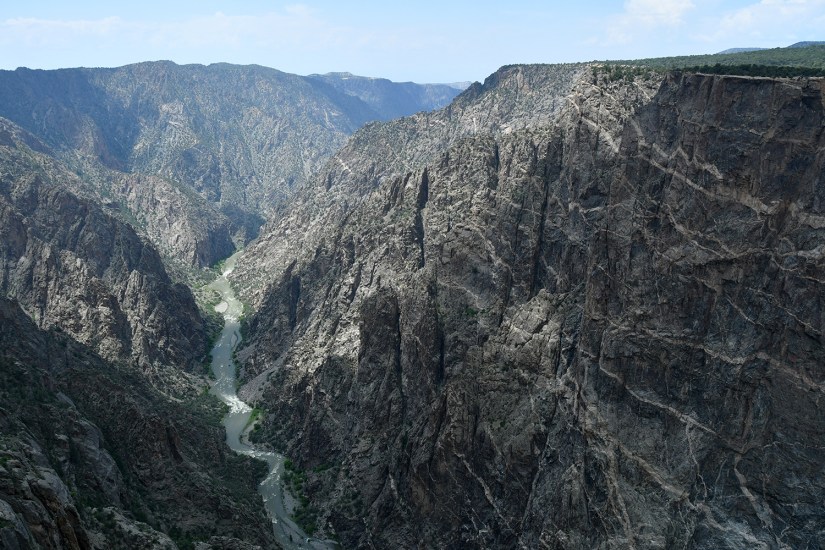
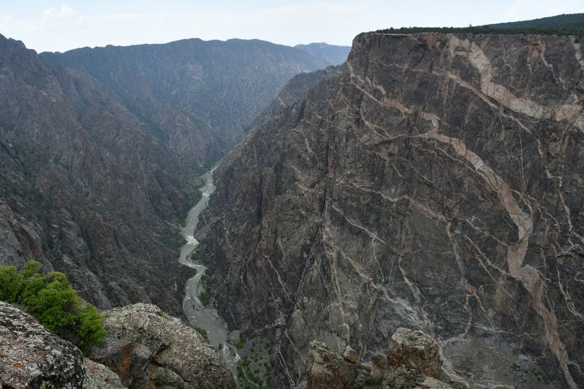
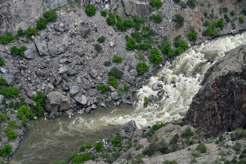
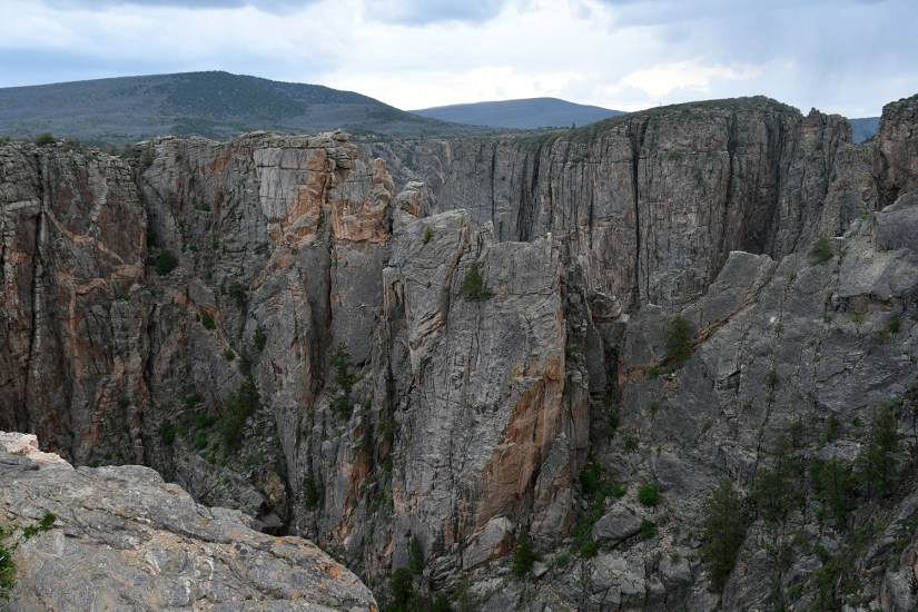
Chasm View is the narrowest part of the Black Canyon, with the north rim just 1,100 feet away. The river also has its greatest descent at this point, dropping 240 feet per mile. There is a viewpoint and trail for this part on the north rim as well.
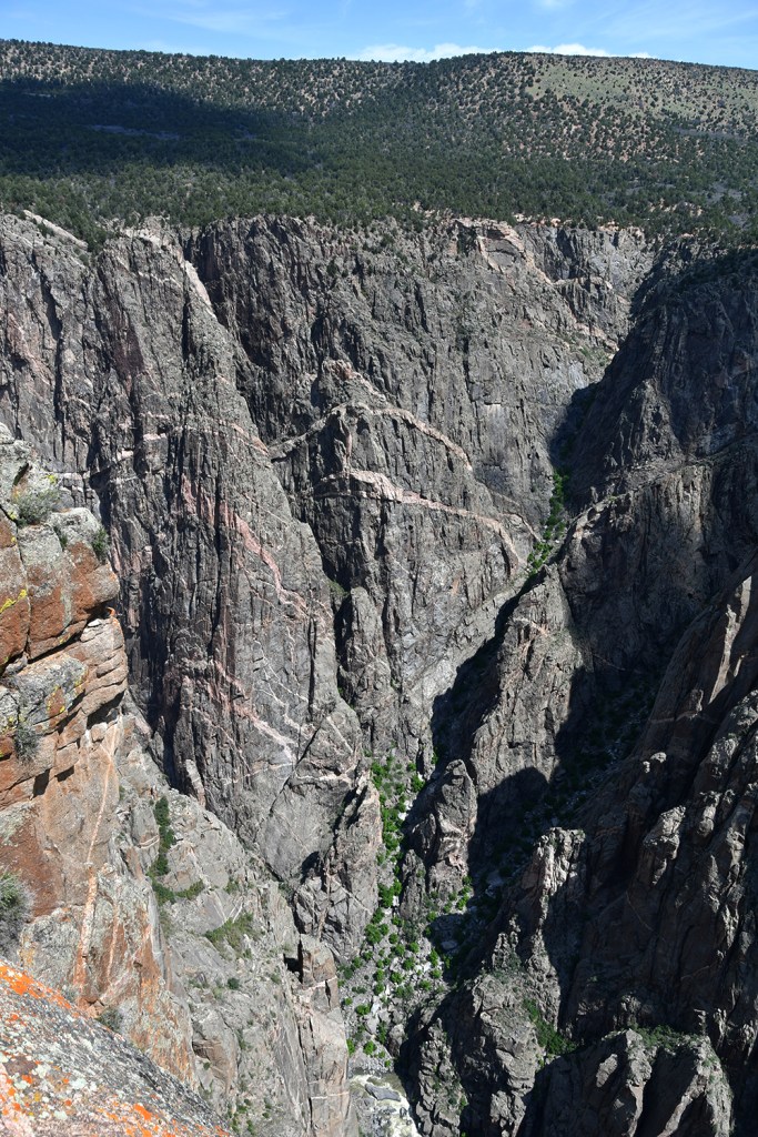
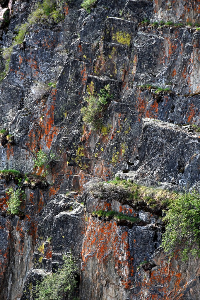
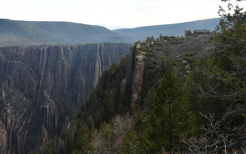
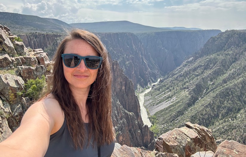
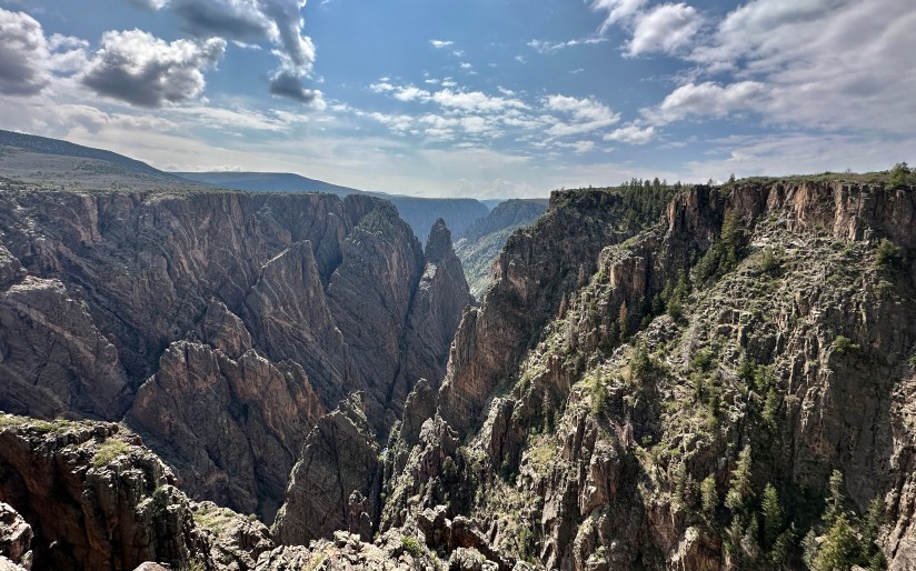
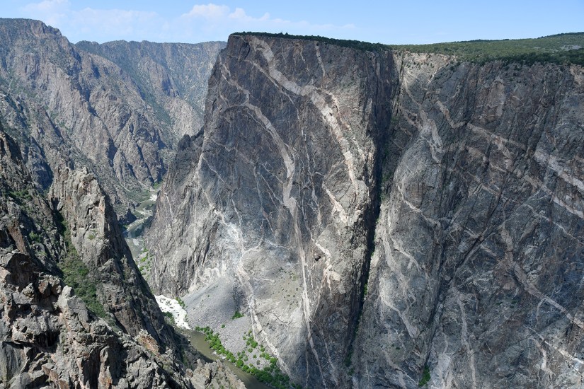
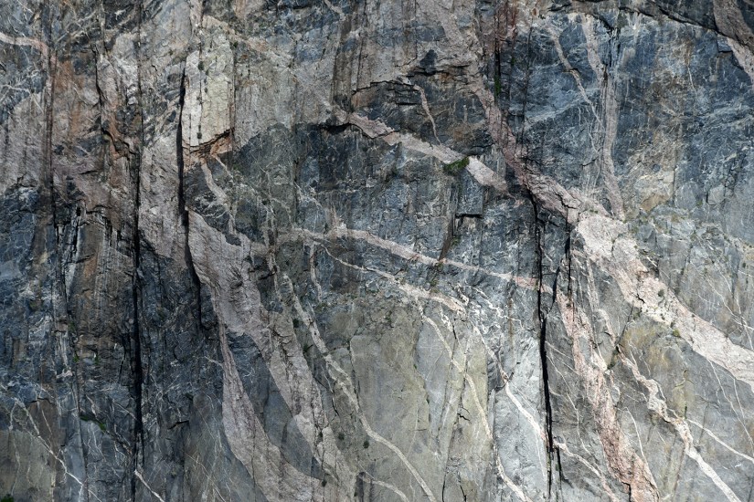
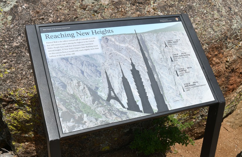
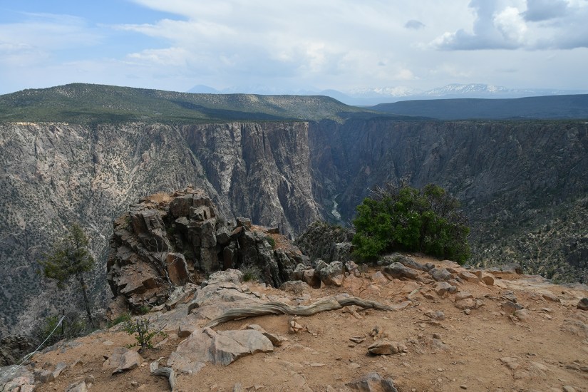
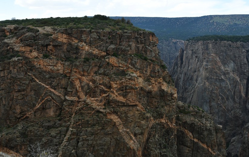
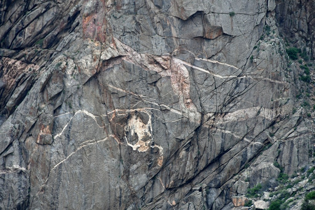
Painted Wall was my favorite stop of the day, and I was able to get a good five minutes or longer all to myself here (I feel like that can be so rare in national parks – solitude!). The tallest cliff face in Colorado at 2,250 feet,
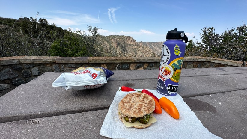
Sunset View is one of the viewpoints where you really don’t have to leave the parking area to see the sights. There are also picnic tables and toilets here, so I chose this as my lunch spot. On trips like this, you tend to see the the same people at the stops, so I was joined by a couple I had been passing all day, Karen and her husband from Texas (his name escapes me – my toxic trait is I can never remember names). We swapped travel plans, and they marveled at my apparent “flexible job” that allows time off (it is called using the leave time I earn!). Single serving trip friends!
Sunset View itself does not have the most spectacular views of the drive, but is apparently a good place to watch the…. wait for it… sunset! 🙂 I snapped a few quick photos before continuing on.
At High Point the South Rim Road terminates in a one-way parking loop. This is a popular area for a picnic lunch, and also is the starting point of two hikes – Warner Point Nature Trail and the Warner Route down to the Gunnison River. Because it was the noon hour, parking was nonexistent and I made about eight circles around the loop waiting for a car to leave (I finally just came to a complete stop and waited as while I was circling cars that arrived after me would nab spots). A group remarked after I parked that I was making them dizzy with my circling! So travel tip… time your High Point stop to sometime not during the lunch hour for better parking ease!
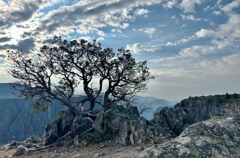
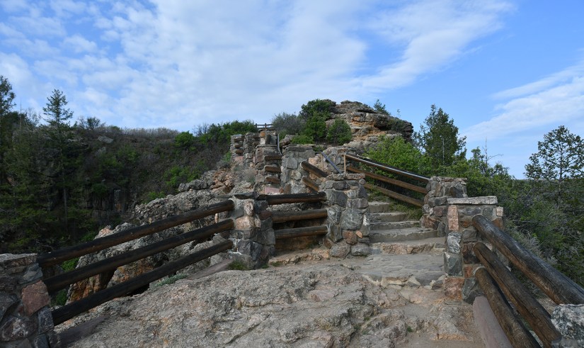
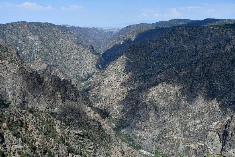
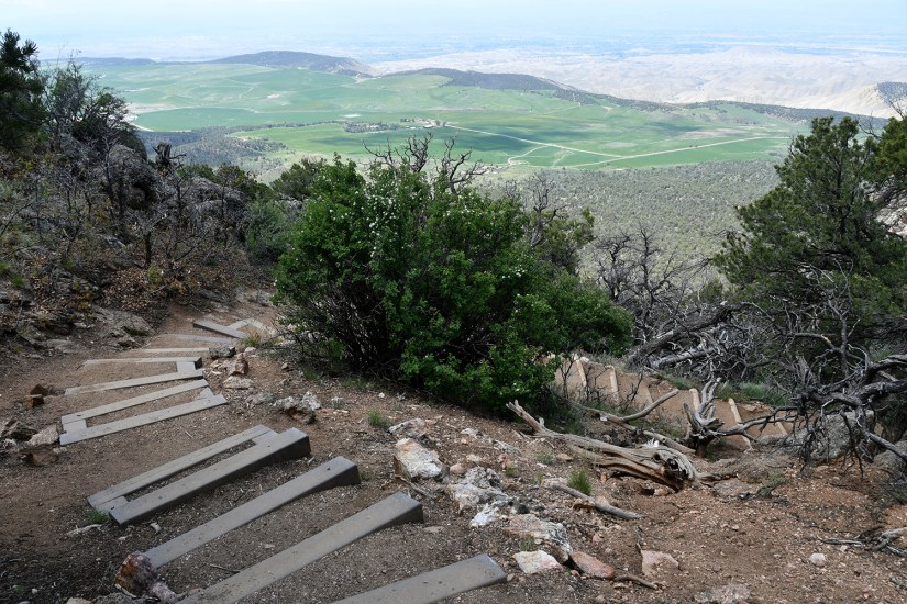
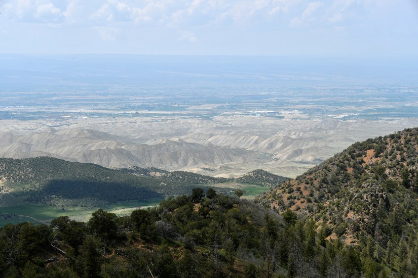
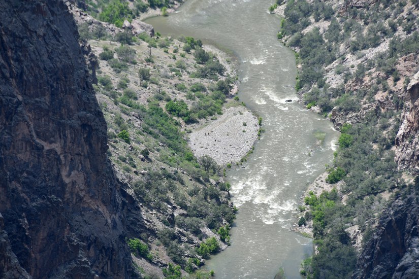
For my second hike of the day I headed up to Warner Point, a 1.75 mile round trip hike to this 8,302 foot point that offers up panoramic views of the Black Canyon and also the Uncompahgre Valley and town of Montrose. Here the canyon is also at its greatest depth, with the Gunnison River 2,722 feet below! There are signed posts along this hike, and the Warner Point Nature Trail Guide is found online (a fact I learned once I was home and writing this post!). Fun fact… High Point (the parking lot) is actually higher than Warner Point!

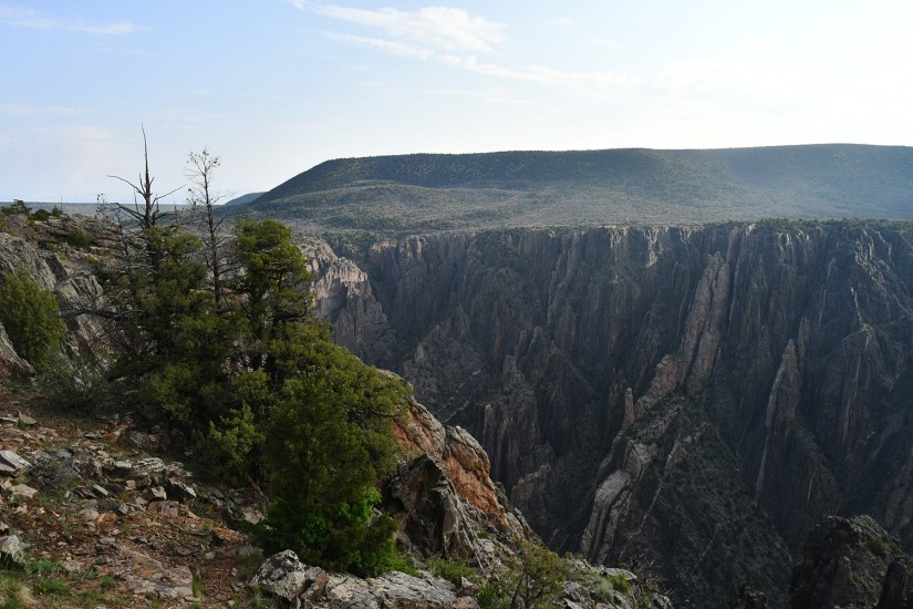
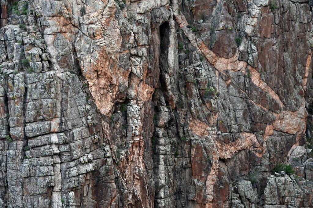
Last little hike wrapped up, now it was time to see the three viewpoints I skipped on the outbound drive. Dragon Point was up first, which offers great views to the Painted Wall.
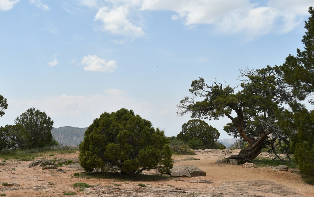
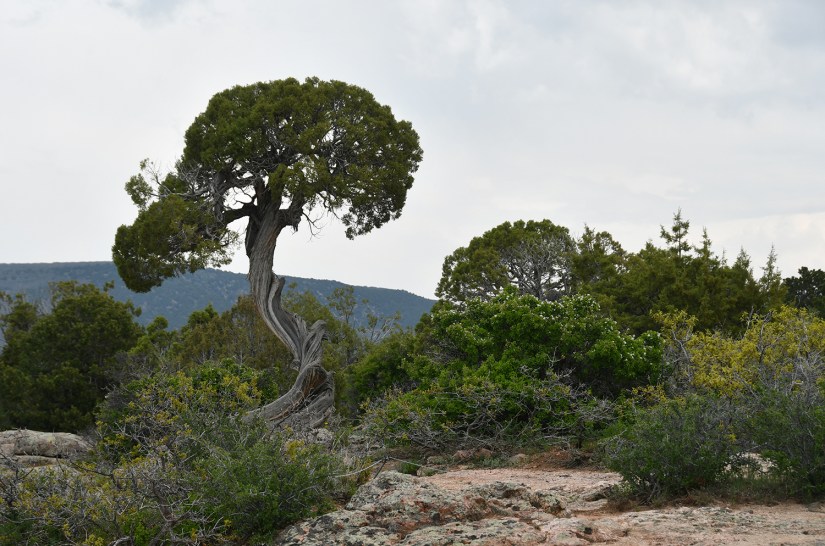
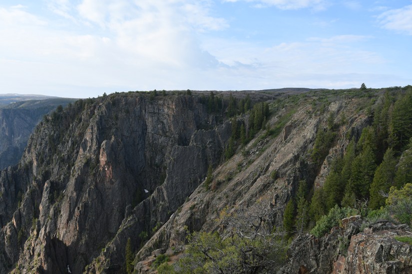
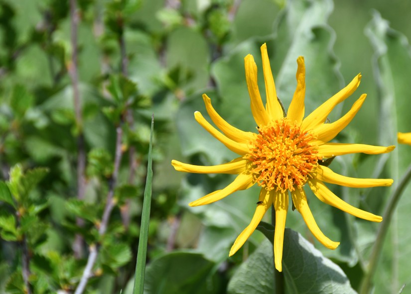
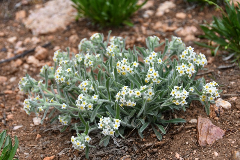
Cedar Point is another stop that gives great views to the Painted Wall. This two-thirds of a mile round trip is called the Cedar Point Nature Trail on the NPS website and in some guides. There are informational signs along the way, mostly identifying the plants found along the trail.
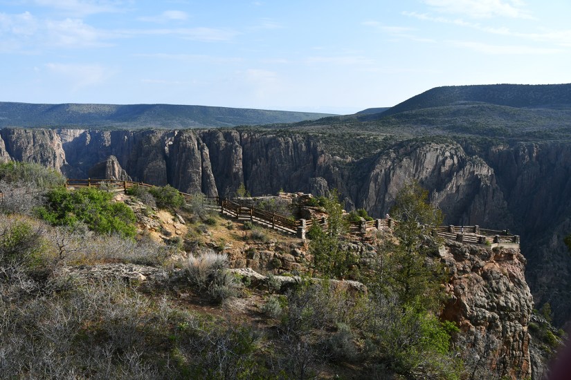
Devils Lookout was my final stop as the storm clouds built in the late afternoon. Here the rock striations give some unique patterns, and it was fun listening to people debate what shapes they were creating.
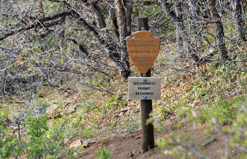
Because I had a full day to spend in the park, I think it was worth it to stop and see every view point. However, I can see how it can get redundant for some people. I think my favorite stops were Painted Wall, Dragon Point, Cedar Point, and Warner Point. For those short on time, stopping at every point is probably not necessary, especially since some involve some walking. I wish I could’ve journeyed down to the Gunnison River on one of the inner-canyon routes, but I was not comfortable doing such an adventure solo. I know I probably would’ve have been okay, but for some reason it was a line I drew for solo activities. Maybe I just really wanted someone else to suffer along with me on the 1800 foot trudge back to the top, ha!
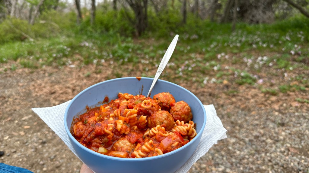
On the way back to camp I stopped at the visitor center to turn in my junior ranger book. The ranger did not even sign the book or swear me in, which was a first (I don’t mind skipping the swearing in but at least sign!). Then it was back to my campsite to unwind, hope the rain held off, and cook up a big pasta dinner.


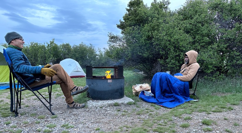
This must’ve been my Single Serving Friends day of the trip, as I wrapped up the evening by chatting with Phil from North Carolina for about ninety minutes as I headed to get water. He, along with Moe from Atlanta and Dennis from Quebec, invited me along to sit around the campfire (and the site had a spot of cell service so I could check in with my parents). Dennis cracked me up as I was telling him where I had visited in Quebec and he went, “How did you find that place?” I explained I just picked a place on the map! About 9pm I bid farewell to the group and made my way to my tent as I had an early morning ahead of me as I said goodbye to Black Canyon of the Gunnison National Park and headed south to Utah.
Stats:
- 15 miles driven
- 22,909 steps / 10.8 miles walked
- 1 NPS unit
- Black Canyon of the Gunnison National Park – $30
- **I have an annual America the Beautiful Pass, so no entry fees had to be paid
- Campsite
- South Rim Campground
- Site A7
- $16 (total was $32 for two nights)
- South Rim Campground


Leave a comment