
October 2, 2022
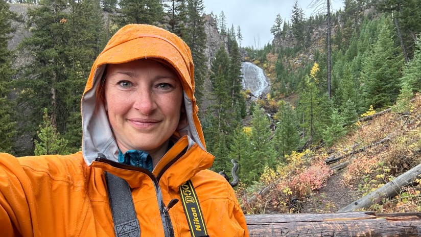
The weather was not willing to play nice during this trip to Yellowstone. Upon waking up to another chilly, rainy day with precipitation forecasted throughout the day, Eric and I took to debating the day’s itinerary I had planned. Ideally, we would be heading to Dunraven Pass to summit Mount Washburn in the morning… in a perfect world. So I adjusted on the fly, deciding to do the loop backwards from intended, so we could play the weather by ear and still do the hike in the afternoon if weather held out.
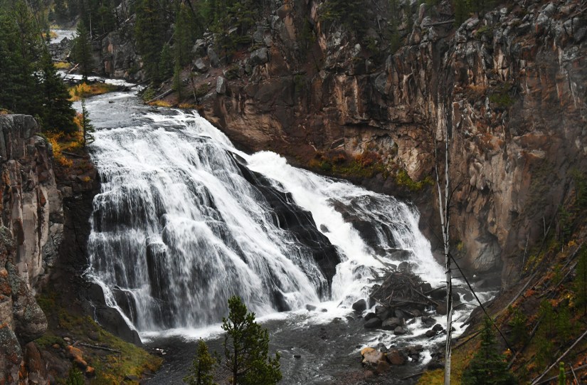
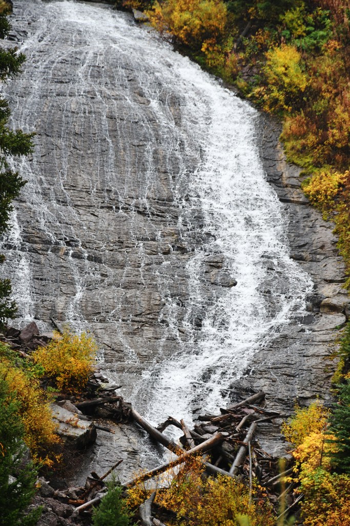
We hit the road with some snacks in the belly, heading into the fog towards Norris Junction, where we’d then turn north towards Mammoth Hot Springs. First stop was Gibbon Falls for some moody morning waterfall views. Gibbon Falls drops 84 feet over the caldera rim formed from an eruption of the volcano about 631,000 years ago. Volcanoes and waterfalls… just two of my favorite things!


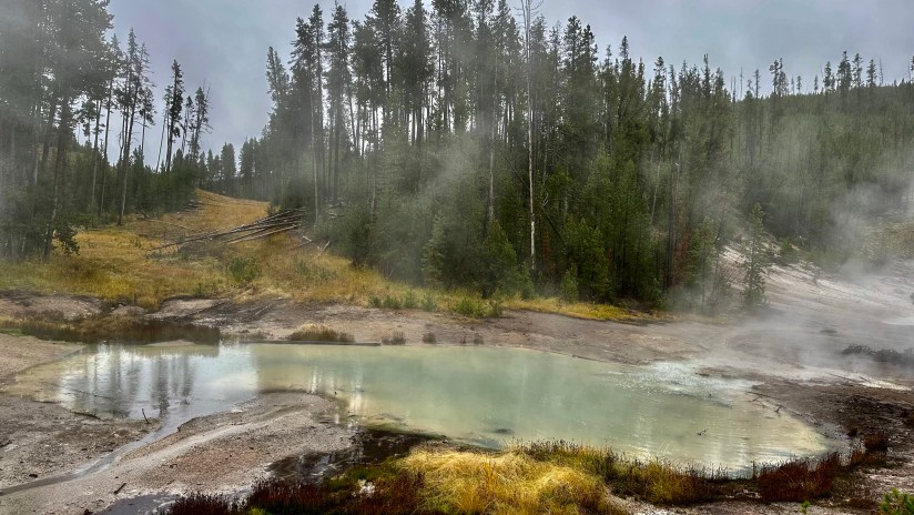
The rain continued as we headed north, though it did not stop us from making quick stops at Frying Pan Springs, Nymph Lake, Clearwater Springs, Roaring Mountain, and Sheepeater Cliffs. No bad weather if you make good clothing choices!


I had hoped to squeeze in a hike to the top of Bunsen Peak on this trip, something I had not been able to do so far on my Yellowstone trips. Bunsen Peak is named for Robert Bunsen, who pioneered research into geyser systems in Iceland, and yes, invented the Bunsen burner. Sadly, the mountain was enveloped in clouds and we decided not to hike. Darn!
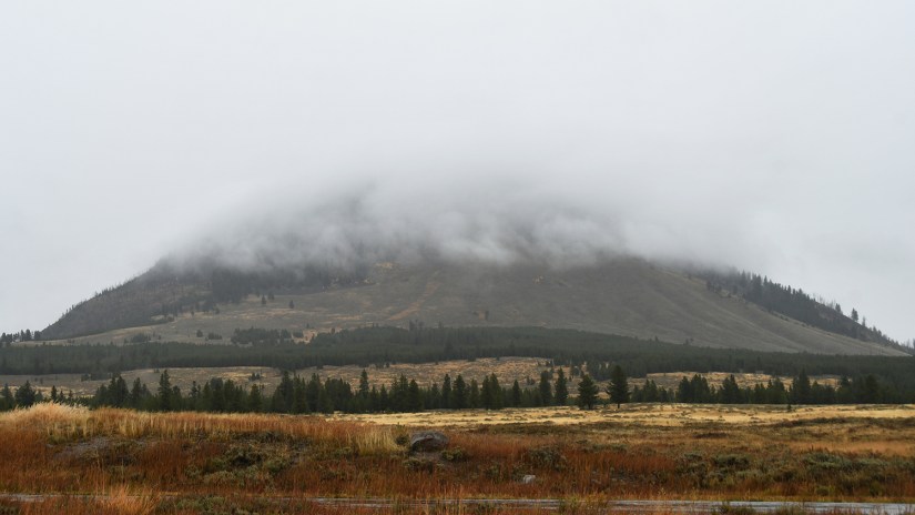
It never seems like I am driving for long in Yellowstone before stopping at another viewpoint, hot spring, waterfall, or whatever. This is why it takes me so long to get anywhere! Luckily my traveling companion did not seem to mind, so quickly after leaving the viewpoint of the Gallatin Range and Bunsen Peak, we swung in to check out Rustic Falls.

After the quick stop at Rustic Falls, we descended towards Mammoth Hot Springs, taking the one-way Terrace Drive. It was dumping rain, but Eric and I scrambled out to Canary Spring (new to me!). I then jumped back into the car while Eric went to another overlook. Ugh, this weather!

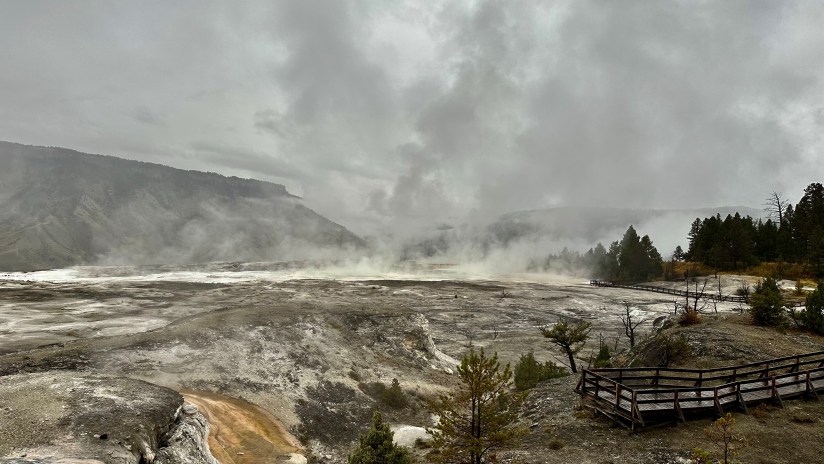

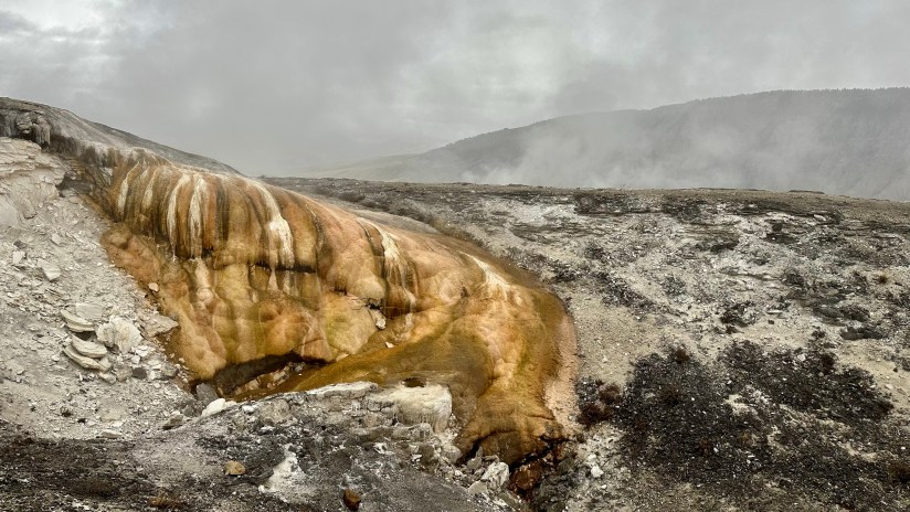

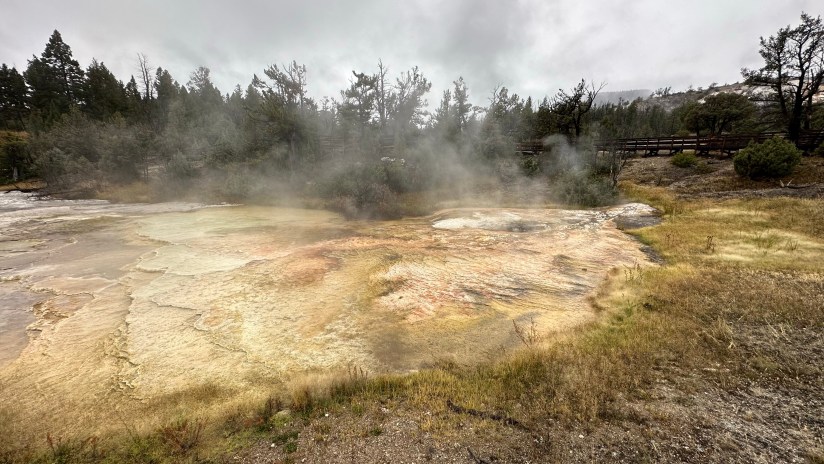

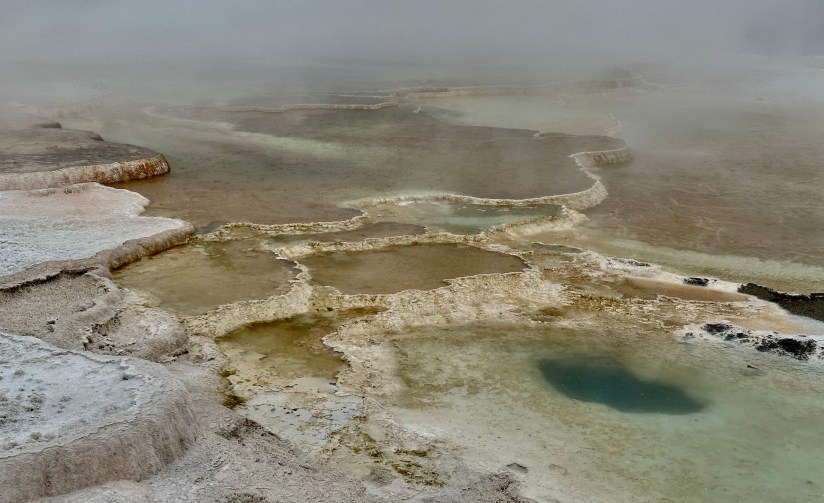

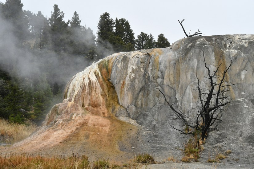


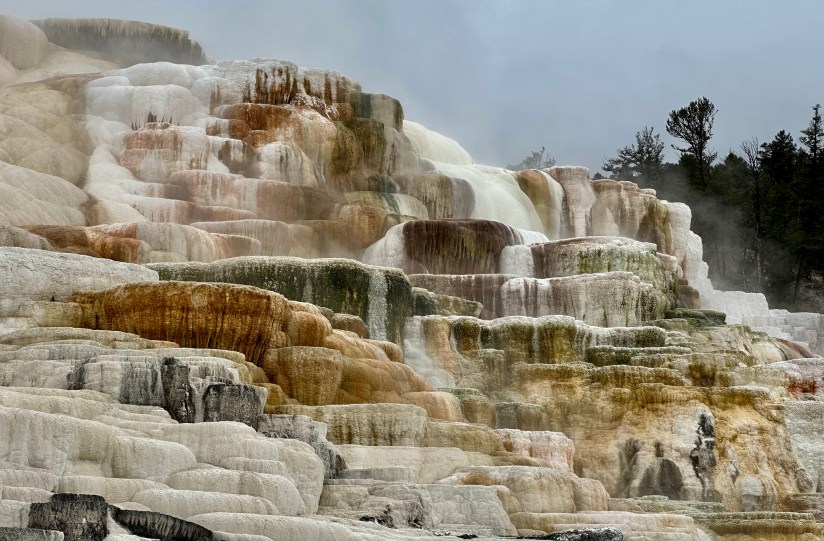
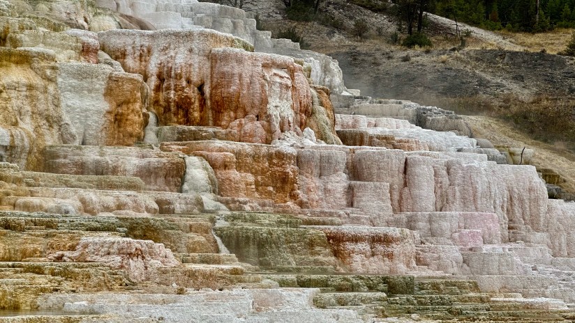
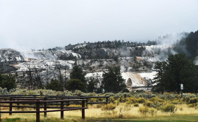
Mammoth Hot Springs is always an absolute zoo when I have visited, but this time it was eerily quiet. With the northern entrance from Gardiner still closed due to the June flooding that wiped out the road, crowds were less as they would’ve had to come through the south. No parking hassle, no crowds chasing after elk… even got a front row parking spot at Palette Spring.

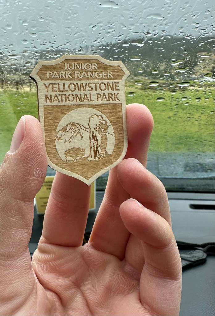
We stopped for morning coffee at the general store and then headed to the Albright Visitor Center to turn into our Junior Ranger books (and learn all about biomass foam donuts from the ranger) and obtain the passport stamps.
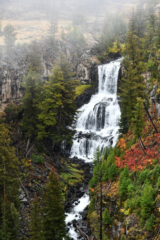
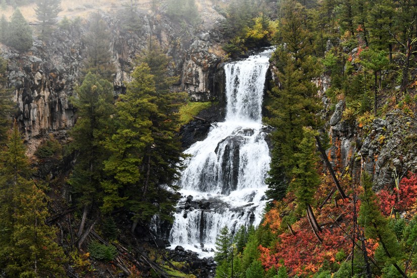
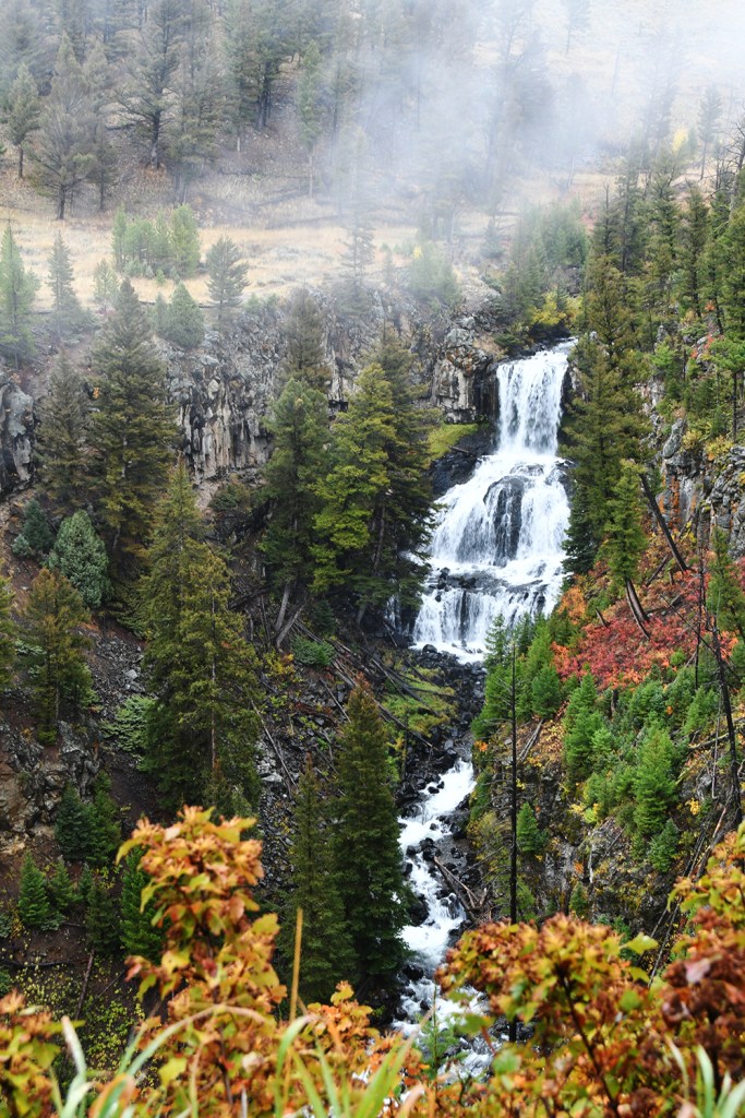
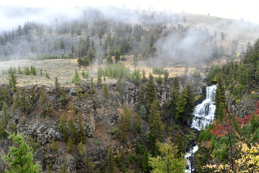
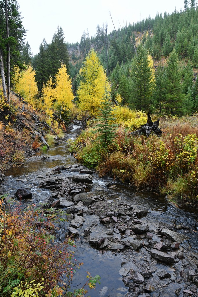
Leaving Mammoth, we drove east on the Grand Loop Road, catching glimpses of the flood damage along the Gardiner River. Traffic stayed light, and the rain kept falling (although there were times it would slightly clear off). A stop at Undine Falls was definitely on the schedule, since it was one of my favorite waterfalls (therefore I will post many photos!). Undine Falls is a tiered waterfall on Lava Creek, and you guess it… it has some basalt!
I hiked out to Wraith Falls in 2020, and was utterly disappointed in this waterfall with the late-summer flow and harsh sun. I proposed the idea to Eric that we check it out again since the hike is super short, at about one mile roundtrip. What a great idea, as it was a better view in the dampened light! The waterfall was still very light flow, but overall I enjoyed it more this go ’round.

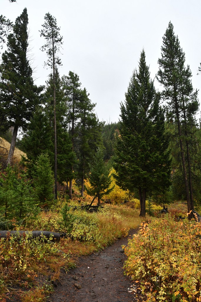

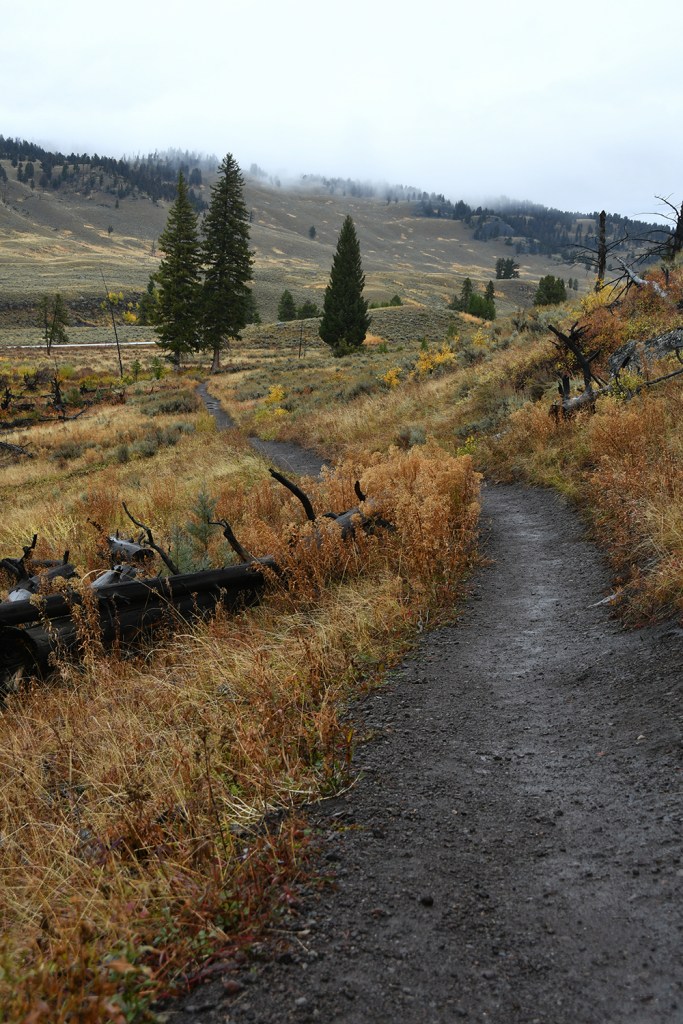
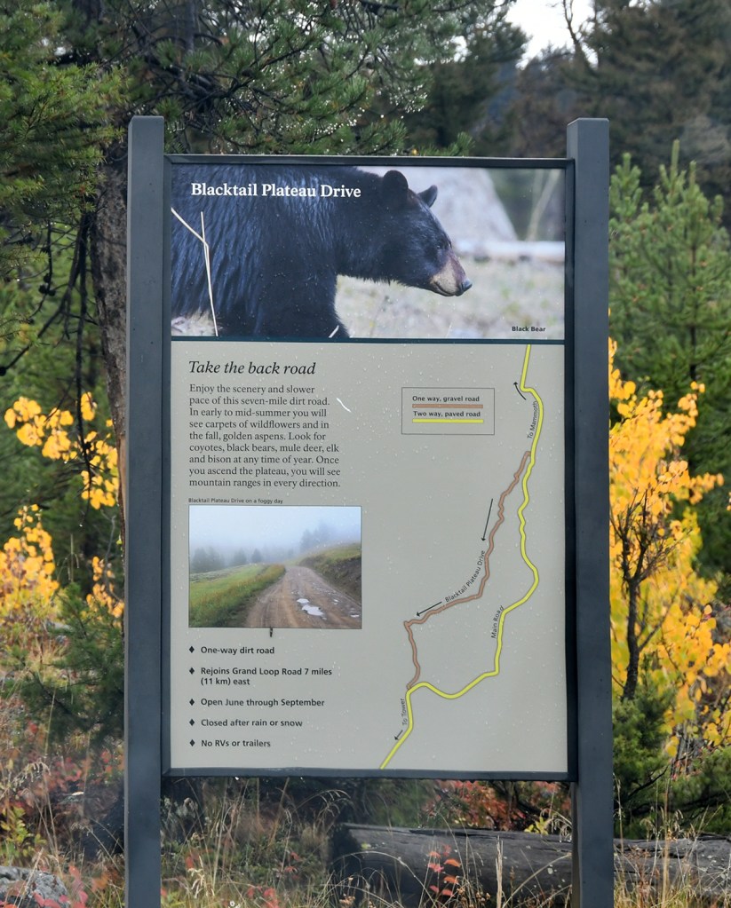
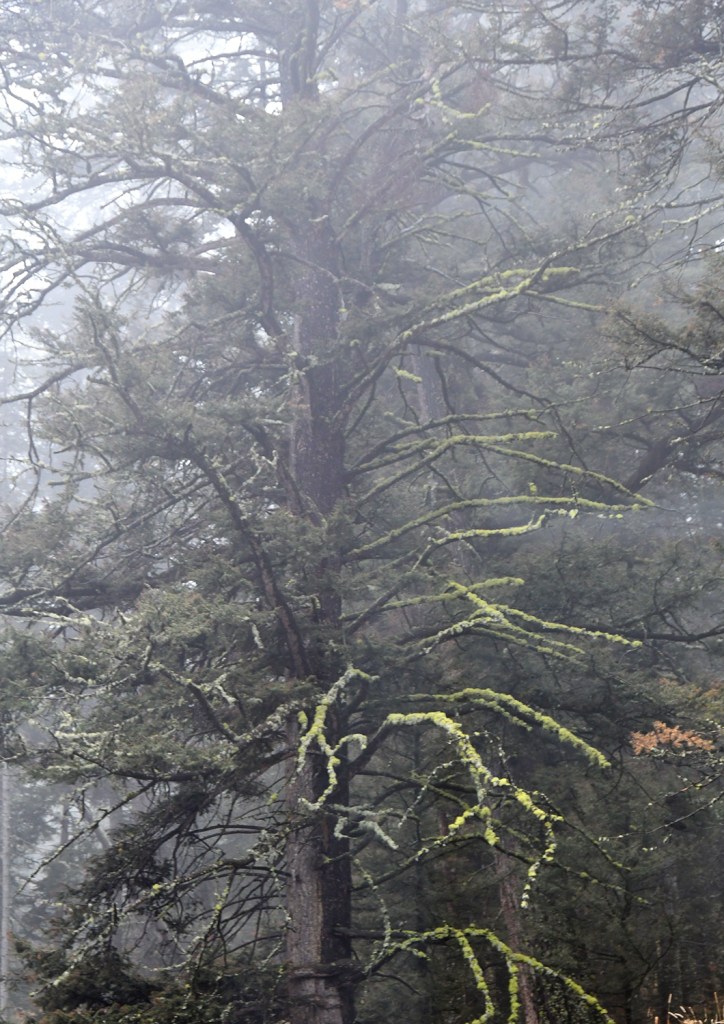
After the short jaunt to Wraith Falls I fixed up some sandwiches before we continued on our way (no photos of sandwiches, I know I know… I dropped the ball! Photographing my meals is like my trademark at this point). Blacktail Plateau Drive came up next, and we decided this one-way six-mile gravel road adventure was a must do. Though the views weren’t quite there due to the low clouds and rain, it was still lovely to get off the main road and get Fozzy all sorts of muddy. As we descended to meet the main road, I felt like scenes with dense, moss-covered trees wasn’t very Wyoming-like. I ended up not taking a lot of photos, and instead just enjoyed the drive and splashing through mud puddles.


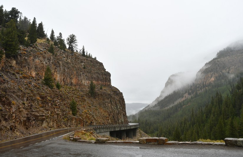
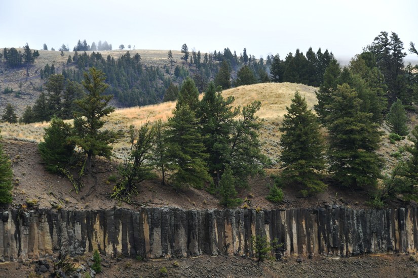
During my previous two visits Dunraven Pass was closed for construction, so the next stretch of road would be brand new to me with new sights, new basalt, and a new waterfall! After swinging by to discovered at the Tower Ranger Station was closed, we turned south to head up Dunraven. All I can say after driving the road twice on this trip is that this road is WELL WORTH IT! The views are downright gorgeous!
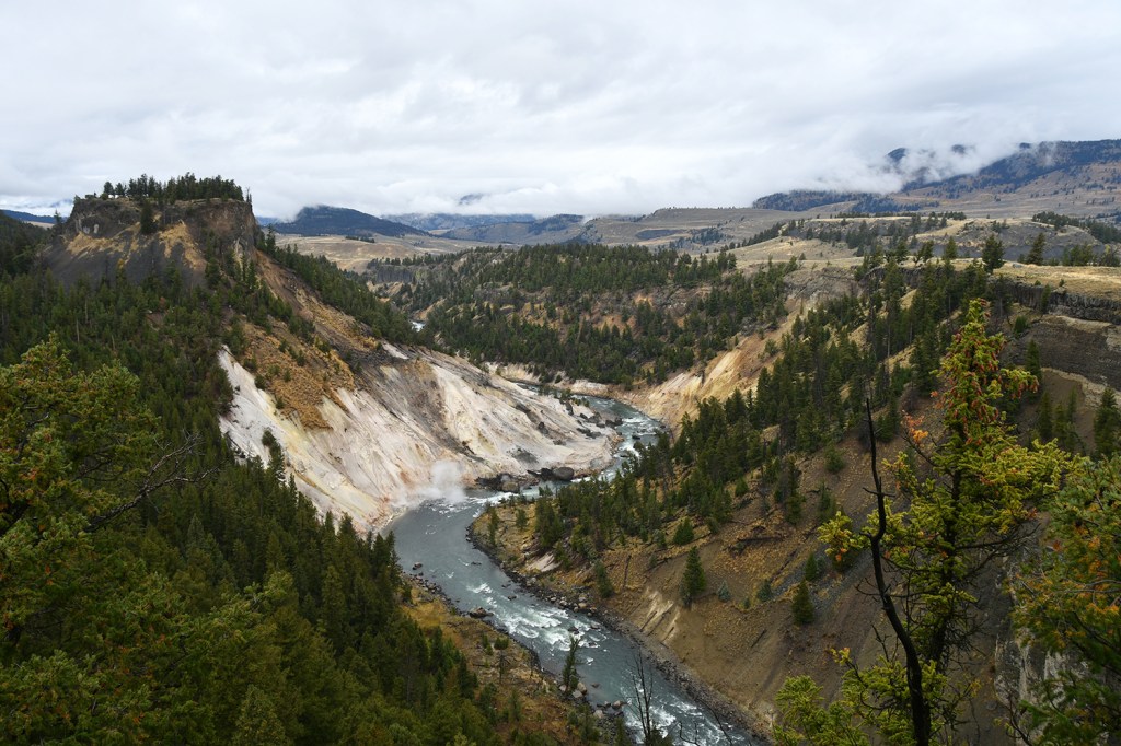
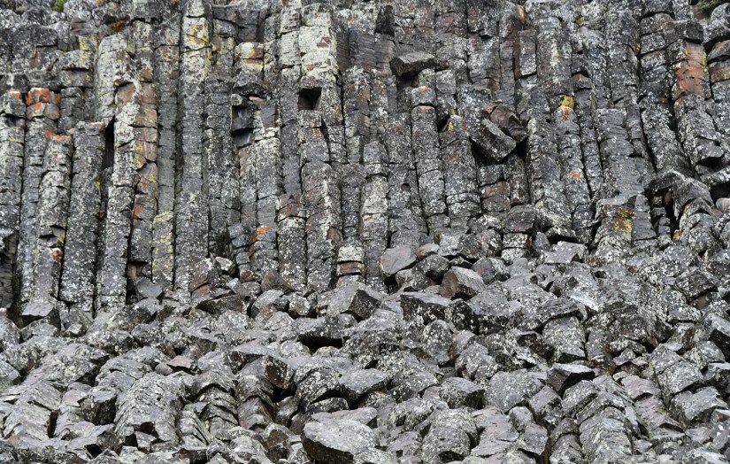
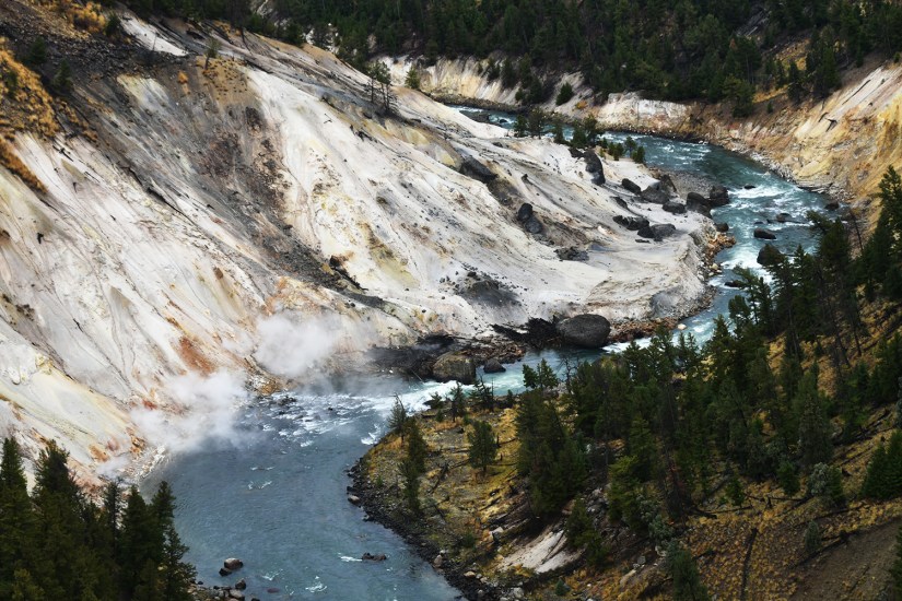
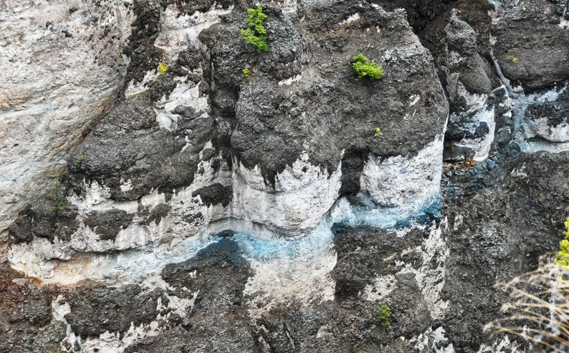
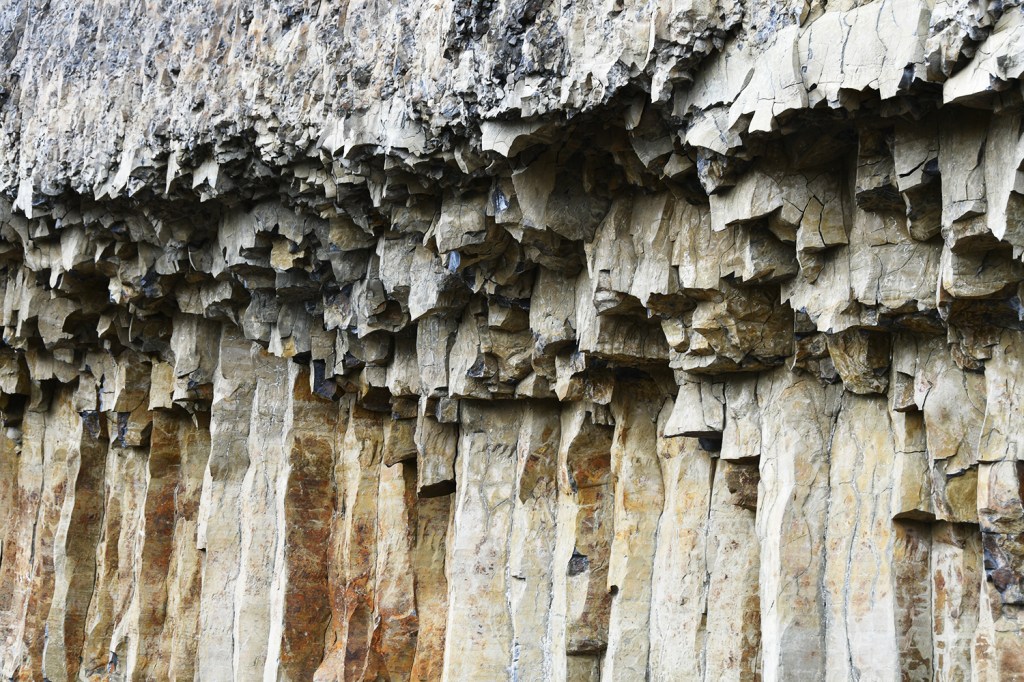
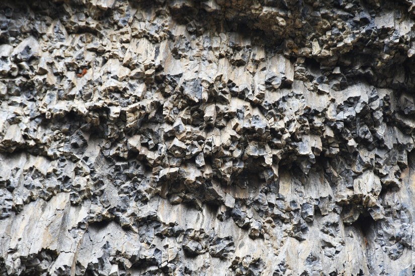
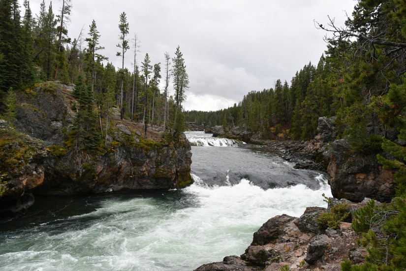
Calcite Springs Overlook was our first stop. A short, quarter-mile long boardwalk leads you around various viewpoints. Calcite Springs is a colorful thermal area along the Yellowstone River, and sometimes molten sulphur comes to the surface here (it is an area closed to the public). And, as a bonus, the canyon walls opposite the boardwalk is a layer of basalt columns.

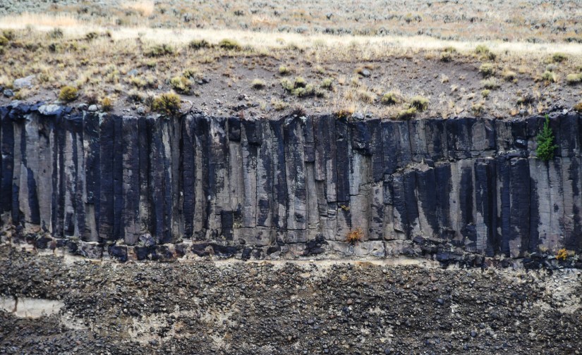

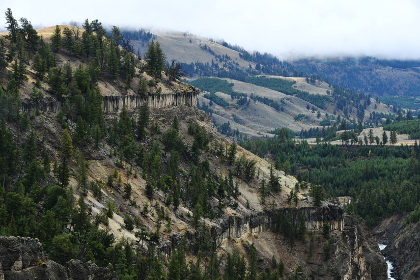
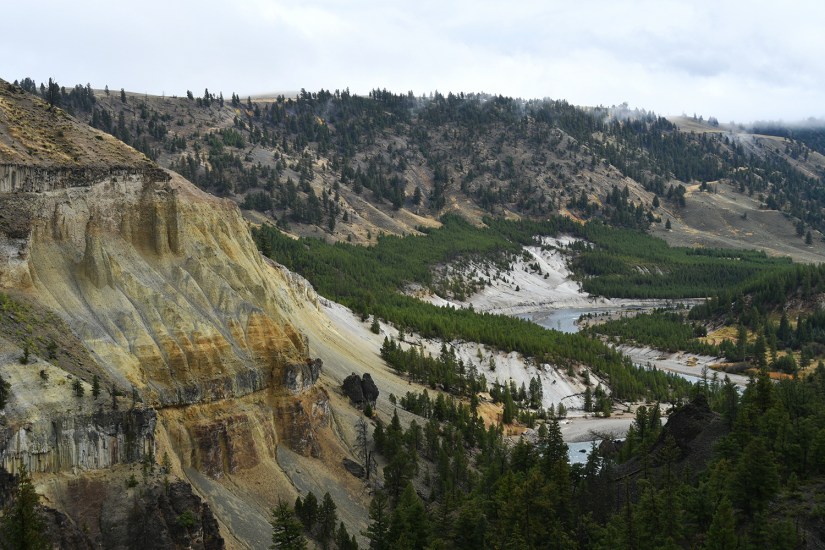
We were not on the road long before we pulled over for another view of the Yellowstone River… and the most amazing basalt I have ever found in Wyoming! Overhanging Cliff is just wow, and I quickly crossed the road to get up close and personal with this amazing basalt.


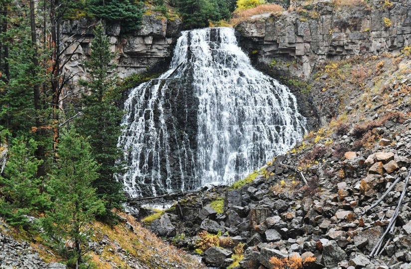
Tower Falls is one of the more popular sights on the Dunraven Pass, judging by the gift shop (closed for the season) and large parking lot (apparently newly built during the recent construction). Back in the day there was a trail that lead down to the base of the falls, but sadly it has been closed so the most we could do was journey out to the overlook. The 132-foot waterfall on Tower Creek is flanked by large… wait for it… towers – volcanic pinnacles. Honestly, this ended up being a very quick stop for us… walk out, snap a photo, leave. (I do want to note the trail you see leaving the overlook does not go down to the falls nor provides a better view, it just goes to where Tower Creek flows into the Yellowstone River.)

Now it was decision time. The sun was coming out a bit and weather seemed to be holding out. We stopped at an overlooked and watched some clouds roll in, but as we drove up towards Chittenden Road, the starting points of one of two ways up Mount Washburn, things cleared off again. Up Chittenden Road we went!
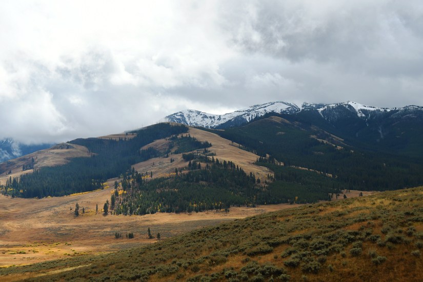
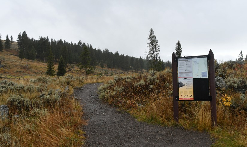
The parking lot at the end of Chittenden Road offers expansive views, and was worth the trip alone. We read the trail signs and I took advantage of the very clean restroom while we debated hiking. Finally, Eric and I decided we should hike up Mount Washburn the next day when there was less of a forecast of rain. This would also give us a chance to check out the other trailhead at Dunraven Pass, and debate which route we would take up the mountain. (There are two trails to the summit of Mount Washburn – the Mount Washburn Trail that leaves from Dunraven Pass, and Chittenden Road. Chittenden Road is the shorter route, but is a bit steeper.)


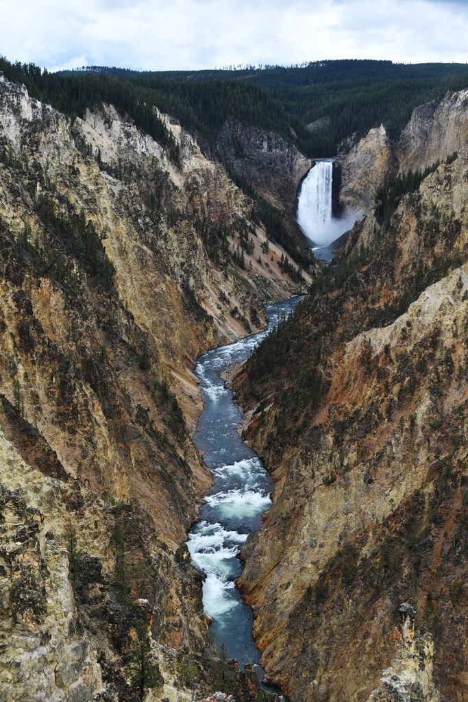
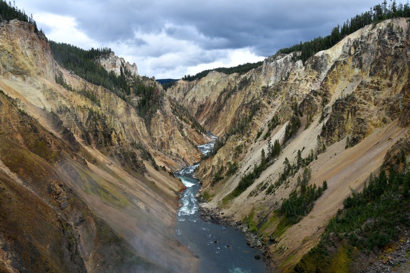
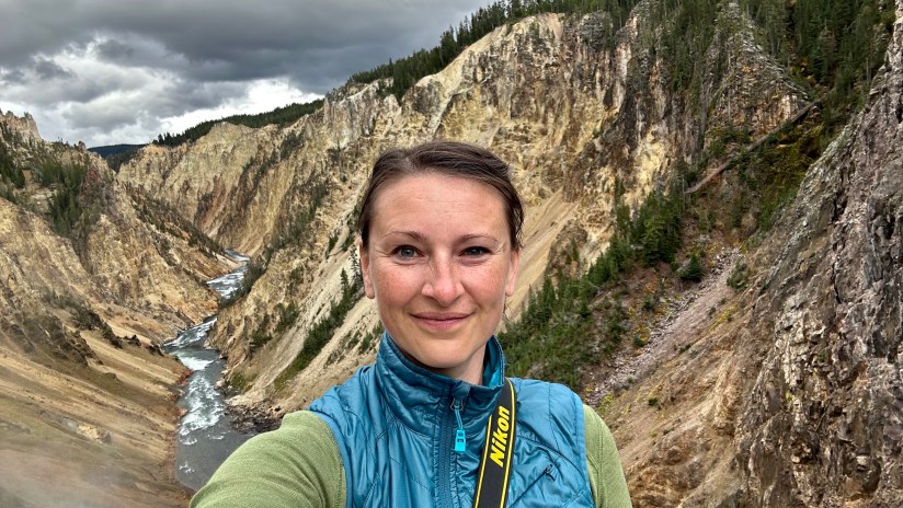
The final big destination of the day, which is indeed big, was the Grand Canyon of the Yellowstone area. We first headed to the visitor center for passport stamps and to visit the volcanic exhibit. In Canyon Village there is a lot of infrastructure, so we popped into the general store to replenish some snacks (the bag of huckleberry popcorn did not last long once we opened it) and I grabbed some my favorite regional beers to try. I decided we would explore the south rim of the Grand Canyon first, stopping at Upper Falls and Artists Point.

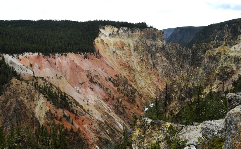
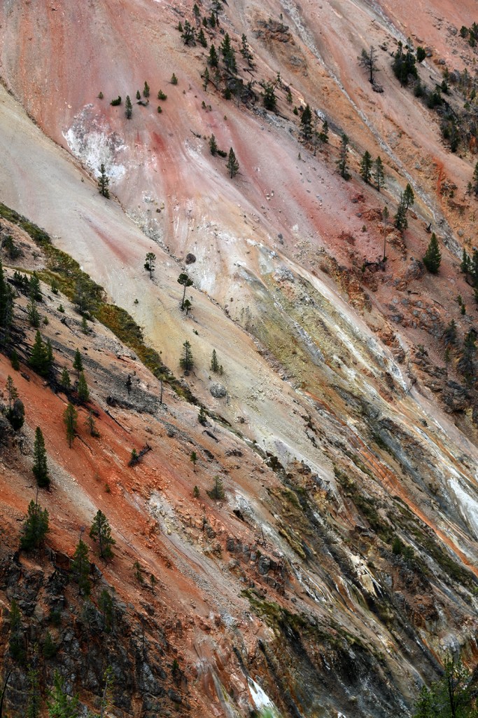
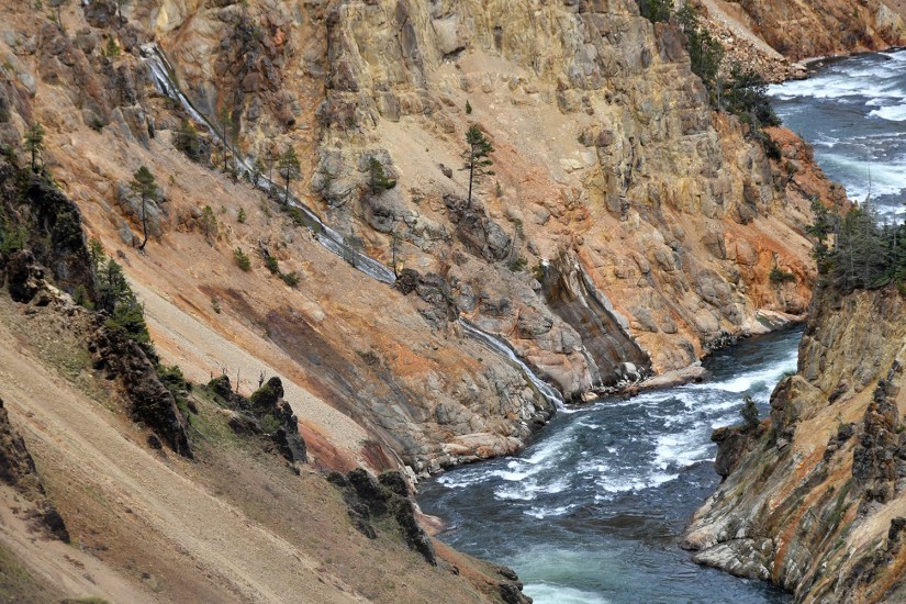
The Grand Canyon of Yellowstone is quite the sight. This twenty mile long canyon formed as the Yellowstone River ate through volcanic tuff and rhyolite, and is more than 1000 feet deep. Two of Yellowstone’s most famous waterfalls are in this canyon – the Upper Falls and Lower Falls. I’ll admit it… I’ve always been more wowed by the Yellowstone version of the Grand Canyon than I was at the Grand Canyon Grand Canyon… scary to admit, but yeah… (maybe it’s my weird love of rhyolite?)
We first headed to the south rim and the view point for the Upper Falls, and then continued onto Artist Point for a famous view of the Lower Falls.


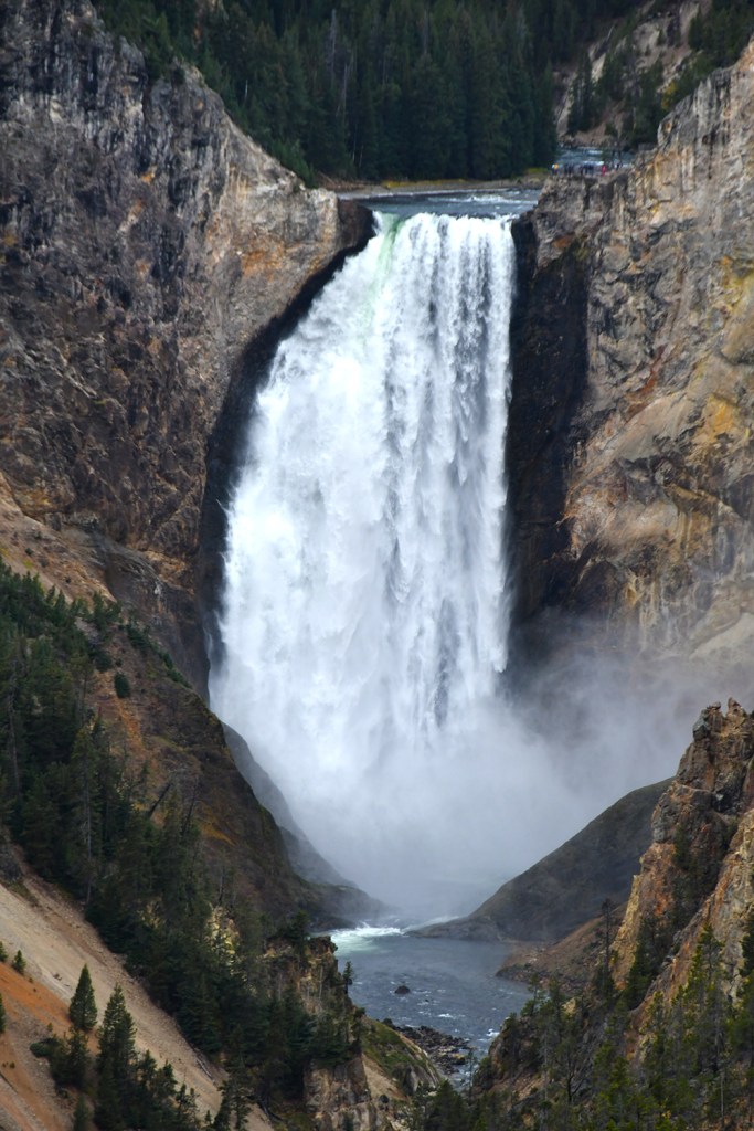

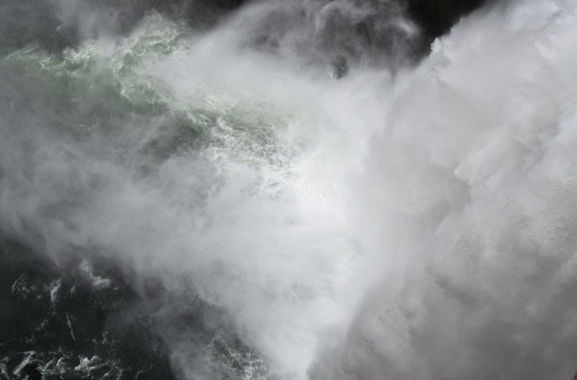
A visit to the north rim of the Grand Canyon, which is served by a one-way road, always means two jaunts to the “brink” of both the Upper and Lower Falls. These are viewpoints located at the top of the waterfalls, showcasing the raw power of all that water as it tumbles. First up was the Brink of the Upper Falls, which is a short, albeit gentle downhill, walk from a large parking lot.

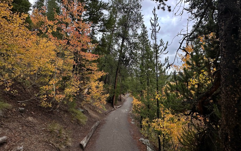
The hike down to the Brink of the Lower Falls is a beast… both ways! Going down is hard on the knees, and I really don’t think I have to explain why hiking back out is hard! The trail switchbacks steeply down the canyon, and it is about 0.8 mile roundtrip.


After the last brink, I was feeling my clogged sinuses, so Eric ran around to other viewpoints while I relaxed in to the car. We would drive all the way out to Inspiration Point, as I wanted to have Eric get that view before we headed back towards the campsite. (Traveling with a sinus infection sucks…)
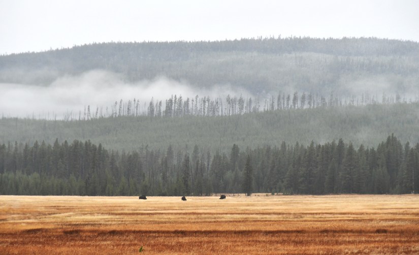
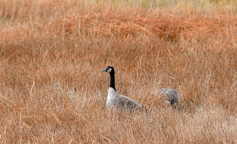
I do not think I’m capable of just driving straight to any location in Yellowstone, so the twenty-five mile drive back to the Madison Campground took some time. First there was the massive jam of cars due to a moose. But wait, also bison! But there’s more – majestic Canadian Geese! Okay, I was the only person taking photos of the geese, but man was there a lot going on in one area. Moose are a bit more elusive to see in Yellowstone, so there was definitely some craziness going on. Eric headed out with his 300mm lens to capture the moose, and I took to snapping some bison photos and blabbing on about the majestic geese.


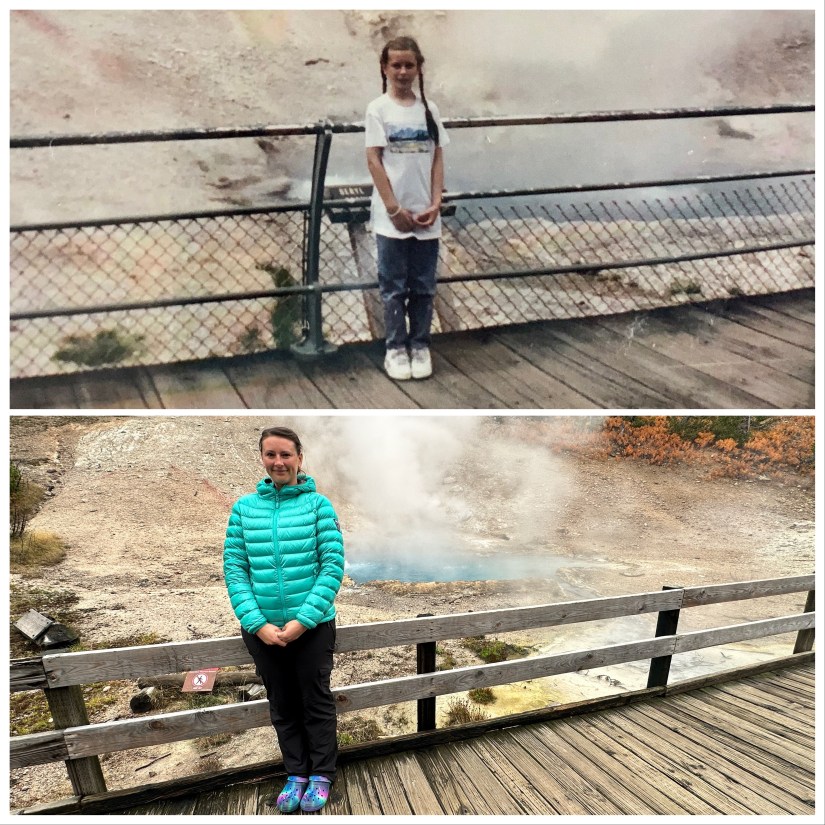
The final stop was at roadside Beryl Springs. Finally I was traveling with someone, so I could get a full body shot to match my 1991 pose at this same springs!

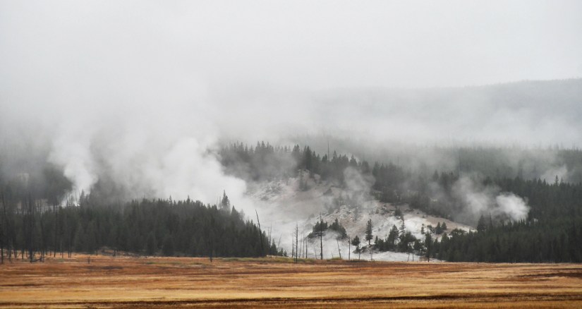
Finally we were back in camp after our large loop around the northern end of park and day of driving. Though plans weren’t exactly how I had envisioned, it was still a great day of exploring a lot of new stuff for both of us. Luckily it looked like the weather would play a bit better the next day, so we made plans to see Norris Geyser Basin in the early morning and then head back to the trailhead on Chittenden Road to nab the summit of Mount Washburn. Good (waterproof) clothing and flexibility – the key to shoulder season and places with tricky climates!


Leave a comment