
Day 5 – March 30, 2022
The take aways…
- Don’t crash the drone into a tree
- All the orange, all the spiky
- Bless our park rangers
- VORS are not easily googled using the term “Mexican hat in the Nevada desert”
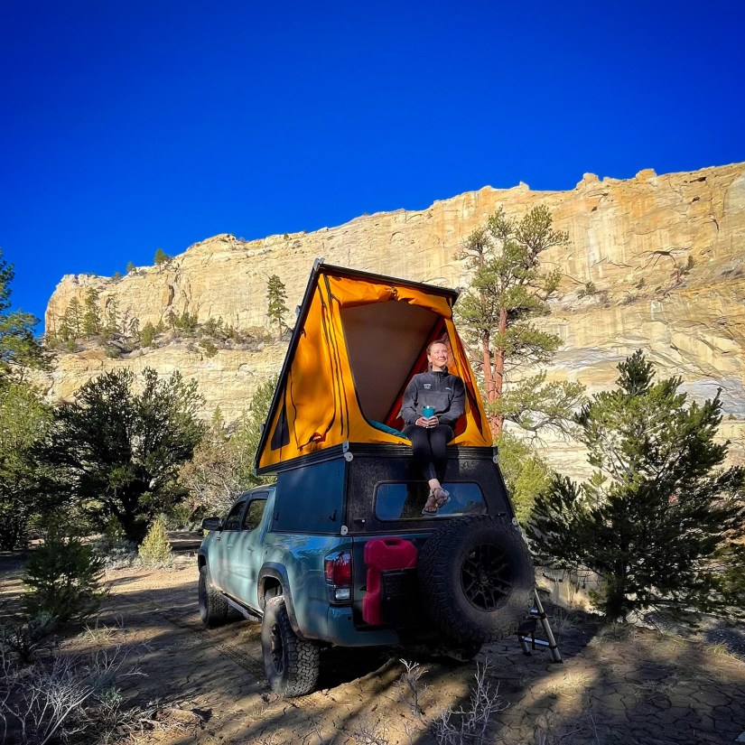
Another day of waking up in strange places, and we found ourselves this morning by the Escalante River. This was one of the chillier days of our trip, so we piled on the layers and sipped our coffee… and flew the drone into a tree in a dramatic crash. Oh, and confirmed in the daylight that the strange bag hanging from the tree at the campsite really was like some experimental bug gathering thing or something.
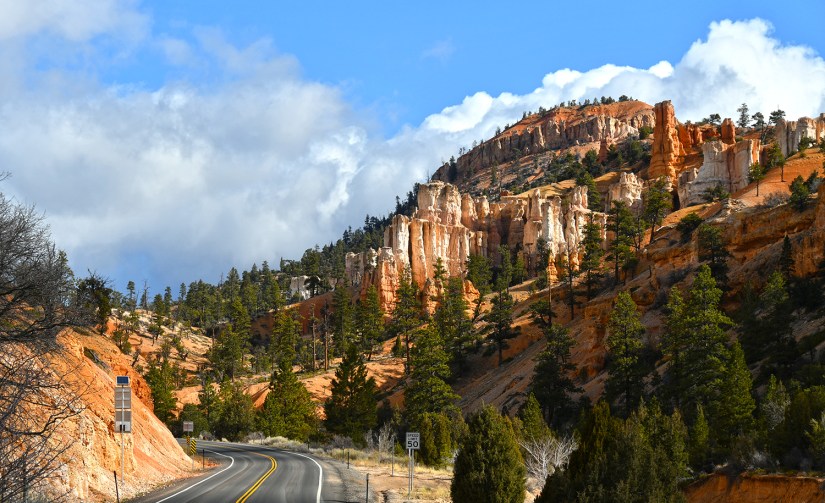
We set out towards Bryce Canyon National Park, our main destination for the day before heading south to Nevada.

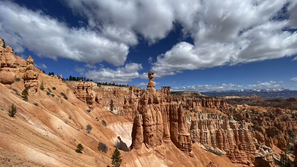
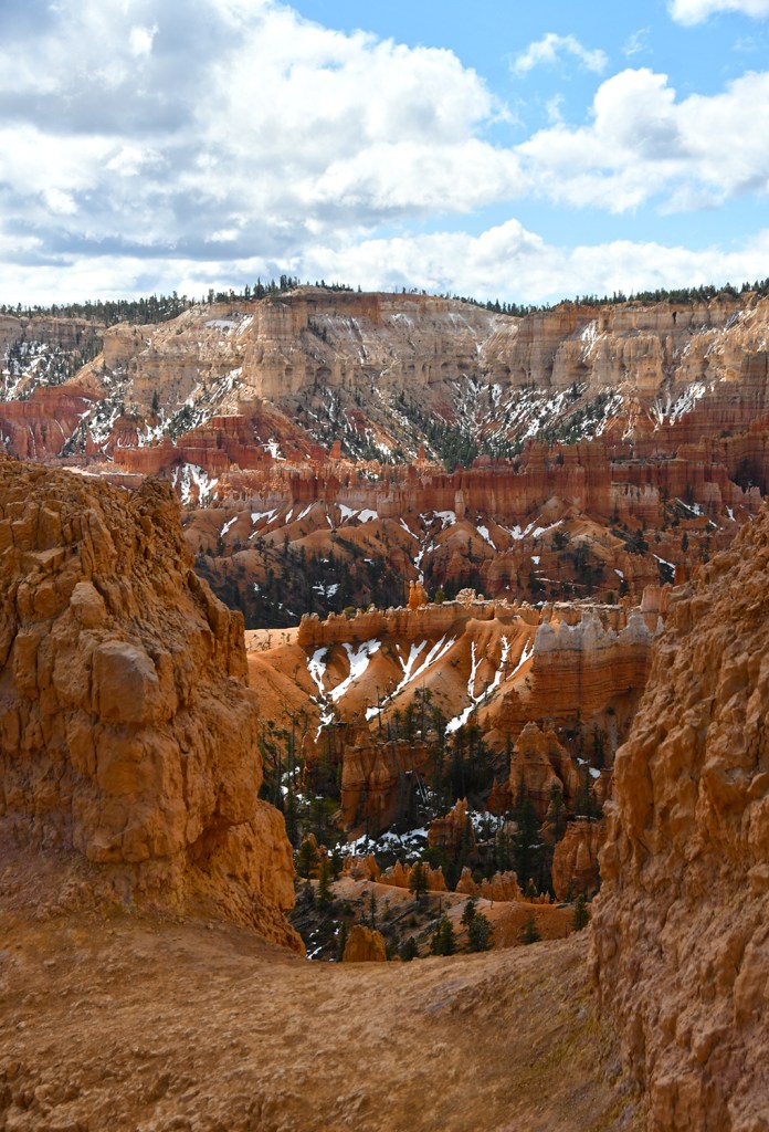
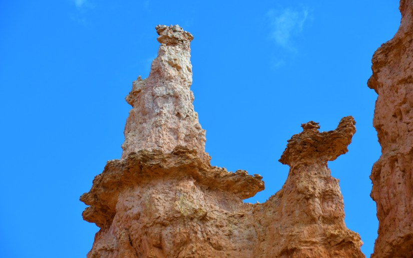
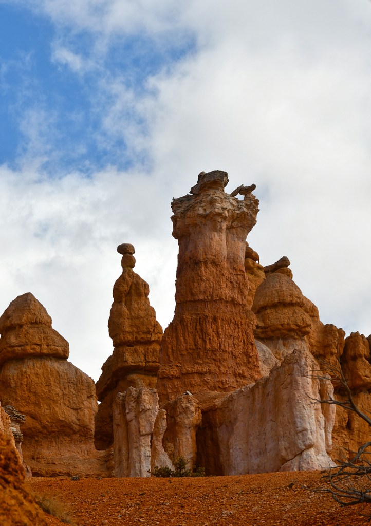
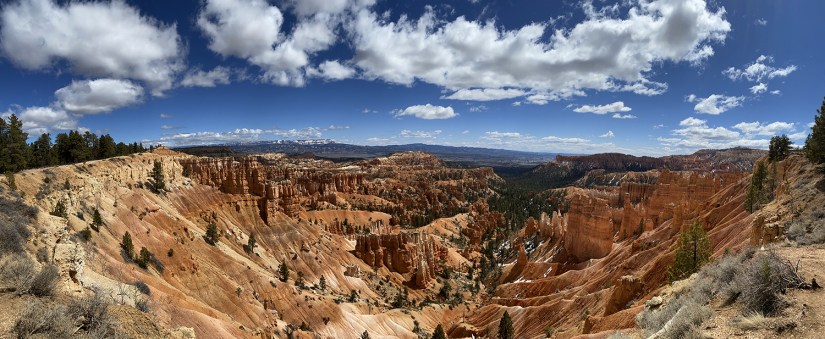
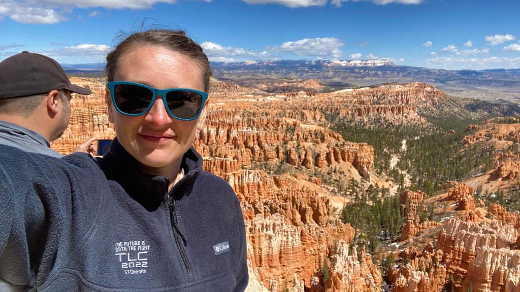
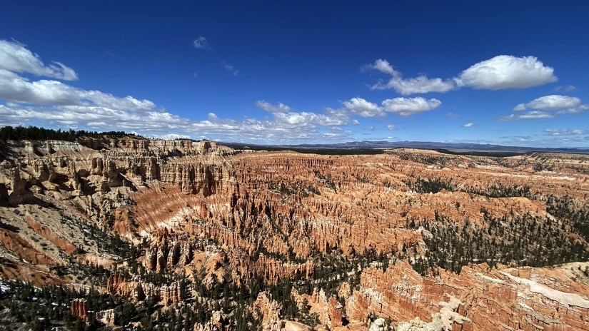
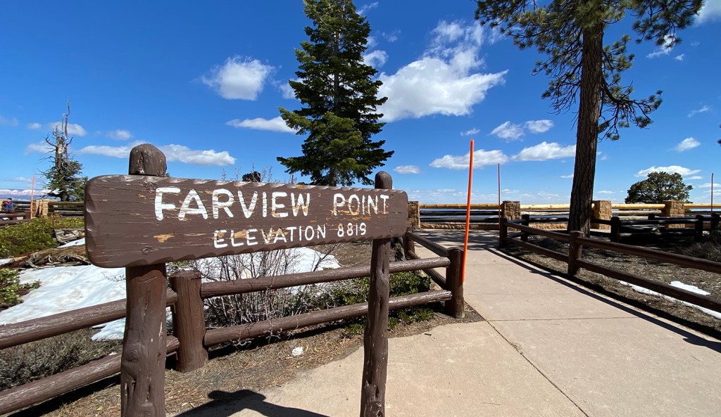
Bryce Canyon National Park was first established as a national monument in 1923 and received park status in 1928. Bryce Canyon is actually not a canyon at all, but we can forgive them for messing up the geological name since it’s “one heck of a place to lose a cow.” Instead, this is an area where large amphitheaters have been eroded out of the rocks, resulted in bright orange hoodoos. The hallmark of the park is Bryce Amphitheater, which is twelve miles wide (that’s wide!) and 800 feet deep. This is also the top step of the Grand Staircase, which I discussed a bit in the previous blog post.
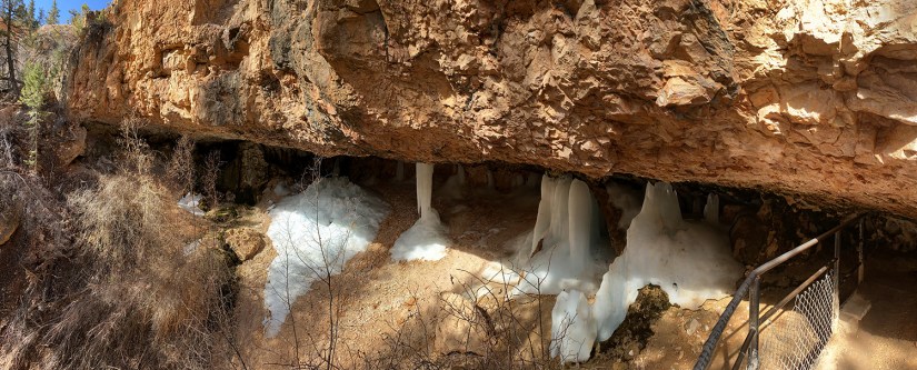
To stretch our legs, we stopped at the trailhead for Mossy Cave, a part of the national park that isn’t at the heart of the rest of the park. This is an easy less-than-a-mile-round-trip hike to a cave that is mossy (hence the name). It also moseys past Water Canyon, which pioneers dug out to create an irrigation ditch. There is a seasonal waterfall here, but it was a trickle when we visited. This area is insanely busy, so expect a full parking lot during peak hours (parking along the road is not allowed). Luckily our morning visit meant we could get a spot and visit before the hoards awoke.


Time for the main show!
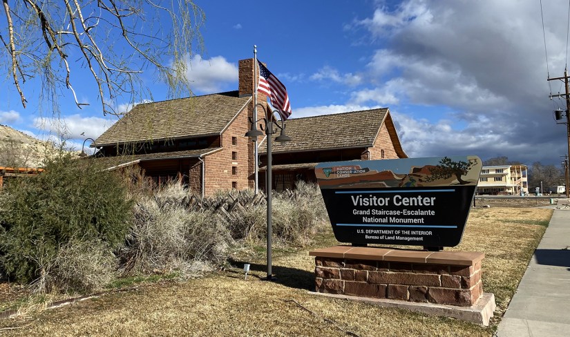
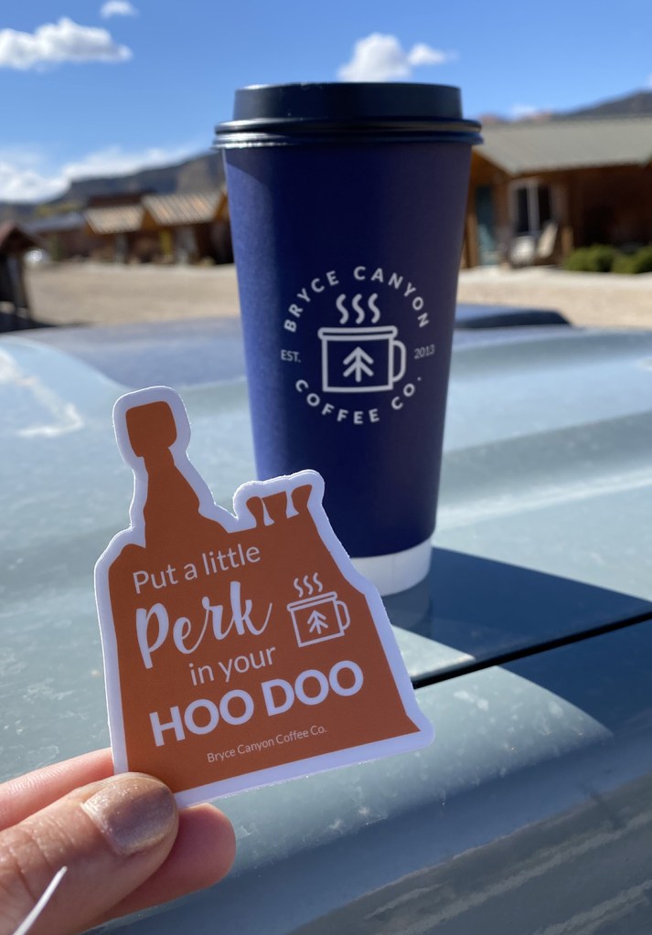
Our first stop was the visitor center, where we checked out the exhibits (all the geology) and perused the gift shop for goodies.

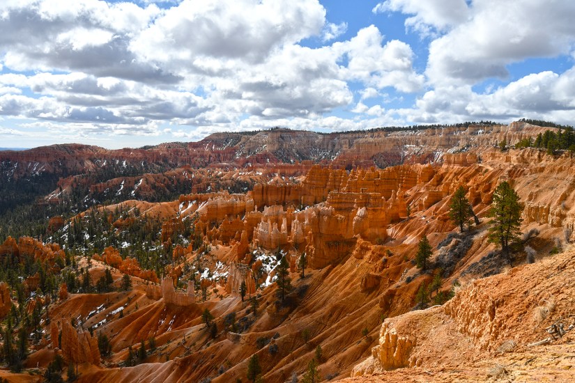
There is one main road in the park, Scenic Drive, which is eighteen miles long. We decided we would first check out the Bryce Amphitheater, which is the most stunning and popular attraction in the park and knock out a hike before exploring the rest of the overlooks on the scenic drive.
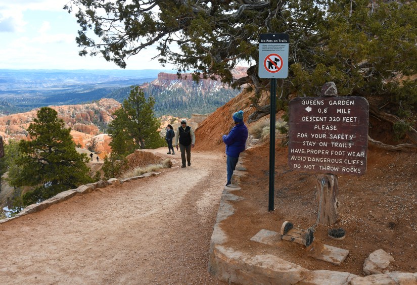
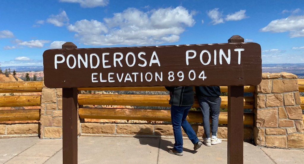
We made our way to the Sunrise Point and found a parking spot near the lodge. Because some trails were still closed due to winter conditions (Bryce Canyon is quite high in elevation… 7500-9000 feet!), we opted to do the loop of Queen’s Garden and Navajo trails, which is about three miles total. We opted for clockwise, which is the direction recommended by NPS for the best views and experience with descending and ascending. This is touted as the most popular hike in the park, and the crowds made it seem that way for sure!


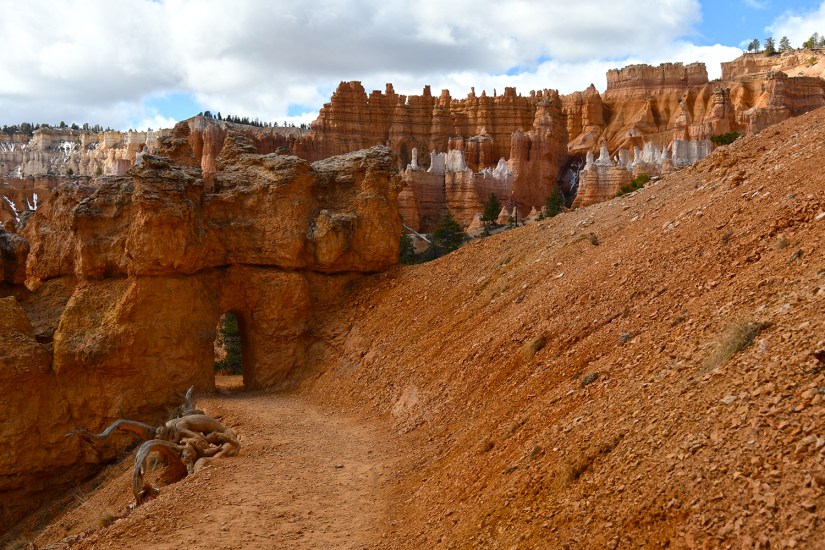


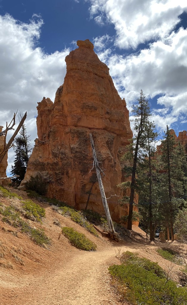


Navajo Loop definitely climbs, and you leave the trees behind to reenter the hoodoo magicalness. The trail switchbacks like a folded spaghetti noodle. For some reason I found myself running up the switchbacks – can’t explain that, but hey… it’s a thing I do, ha!


We meandered over to an overlook at the top of Wall Street, which was still closed during our visit, and then did the final climb up to Sunset Point. I had a girl stop to compliment me on my Kula Cloth, which made me quite happy as I’m sure Eric is sick of hearing about my “super amazing pee cloth” by now, ha!

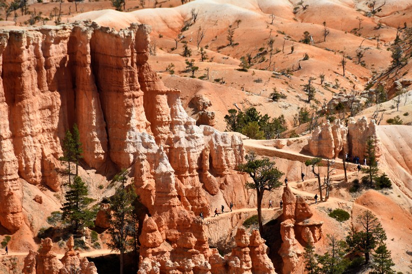
Overall this hike took us about 1 hour 40 minutes to complete with our photo breaks. I’d love to come back and complete more of the hikes, and find all the Hike the Hoodoos benchmarks for sure! Several of the trails were still closed during our visit, so I’m venturing a guess pushing a visit out a little later in spring is more ideal if hiking all the trails is on the itinerary. (I do feel like this is one national park I could actually hike all the trails at!)
I won’t lie, after the awesomeness that is the Bryce Amphitheater, the rest of the exploration was a bit bland. But I feel bad saying that… it’s all beautiful. It’s just that Bryce Amphitheater is one of my favorite places I’ve ever been to!


Scenic viewpoint-ed-out for the day, we headed back to the visitor center to get our special prize for the Hike the Hoodoos program. There was a big line for the ranger, and we watched a woman get sworn in as a junior ranger after being grilled by the real ranger on every page of the book (eek, becoming a junior ranger is a serious endeavor!). Then the woman in line in front of us took to asking about ten times over the best area in the park to view sunset, and the ranger, bless her heart, patiently explained each time that the park faces east, and therefore is better at sunrise (so much patience for the questions!!). Finally it was our turn, and we told the ranger where we hiked and flashed our GPS tracks. We were rewarded with a special “I Hiked the Hoodoos!” decal and were probably the easiest customers of the day!

There was a long drive ahead of us once we left Tropic. Over four hours, to be exact. After days of backroads and lonely two-lane highways, popping on I-15 was a bit tedious in a way. Though the scenery was beautiful, and it is interesting to watch it change from forests back to pure desert from Cedar City to St. George, it was still filled with a lot of cars and billboards.

Long road trips always lead to the most random thoughts. Thanks to good cell service along I-15, this meant we could actually explore our random thoughts and curiosities. Upon spotting a VOR (Very High Frequency Omni-Directional Range device), Eric and I took to trying to figure out what they were called. I always assumed these random white sombrero looking things were part of gas lines or something, but Eric insisted they were part of airplane navigation. So began the googling… and I learned googling “Mexican hat in the Nevada desert” led to instructions on how to buy a sombrero in Mesquite. Eric had better luck with his keywords, and we landed on an article about VORs and learned all about basic airplane navigation, and I laughed way too hard about the results of my failed google search.
What exactly did we do before Google?!

Upon arriving in Las Vegas, we met up with a couple of Eric’s friends for dinner at SkinnyFATS before heading to Boulder. We grabbed groceries at Albertsons, and then took to packing for our two-day kayak adventure in the parking lot, spreading clothes, food, and gear everywhere. Finally we headed to Best Western, and I jumped into the shower, washed ten pounds of dry shampoo out of my hair, and hit the sheets in an actual bed.
Here’s to “fear and floating in Las Vegas” in a mere eight hours!


Leave a comment