California, Hiking, Manzanar National Historic Site, National Parks & Monuments, State Parks, United States

Salt, Sand, and Sierra Mornings: Day 3 – Alabama Hills & Manzanar

March 2, 2026

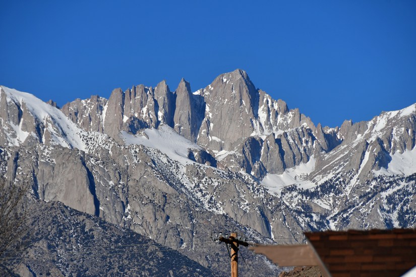
I awoke refreshed after a hard sleep, and scampered over to the window, and pulled back the curtains to a clear and vivid view towards the mountains. “Oh my god, meowtains!” I half whispered, before waking up Lindsey.

Snow-capped mountains under a clear blue sky, showcasing rugged peaks and rocky terrain.
The view from the Best Western… WELL HELLO, MOUNT WHITNEY!!

First, a list of things:

  • The Best Western in Lone Pine is a great little hotel. Affordable rates, great breakfast, and Mount Whitney is right there. I highly recommend it for anyone staying in the area, and I would definitely stay again!
  • Lone Pine itself is a great little town with a lot of great restaurants. Usually I can feel a bit indifferent about towns that I am in for adventures, but I really enjoyed Lone Pine and I hope I have a reason to come back someday.
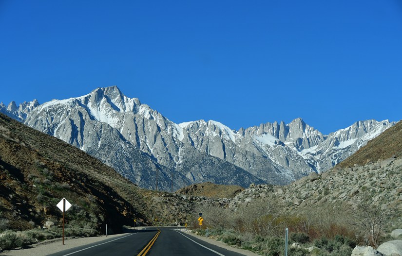
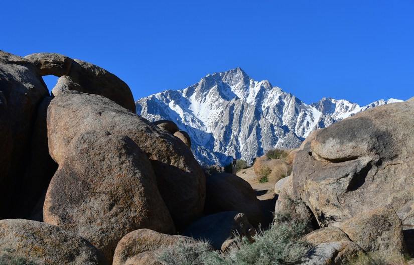
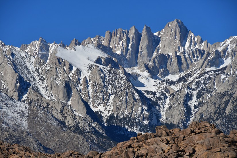
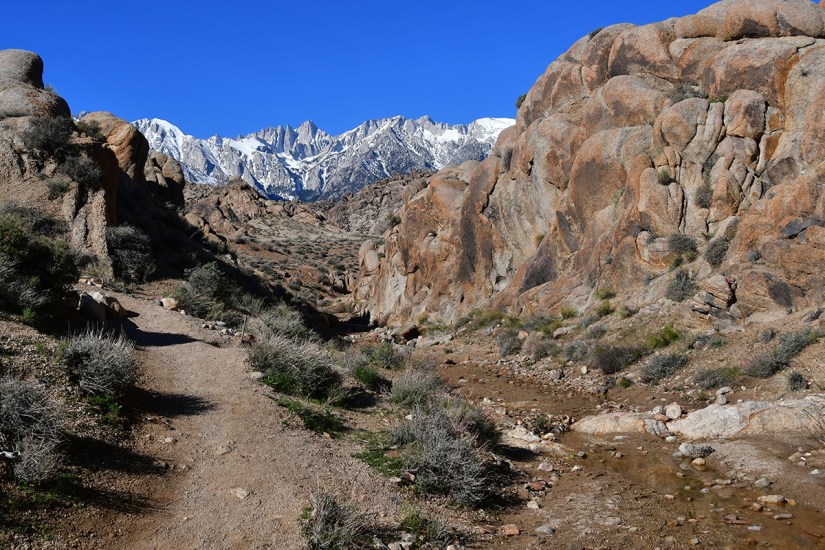
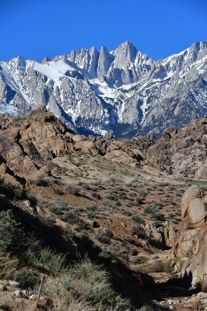
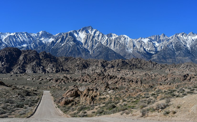
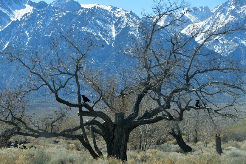
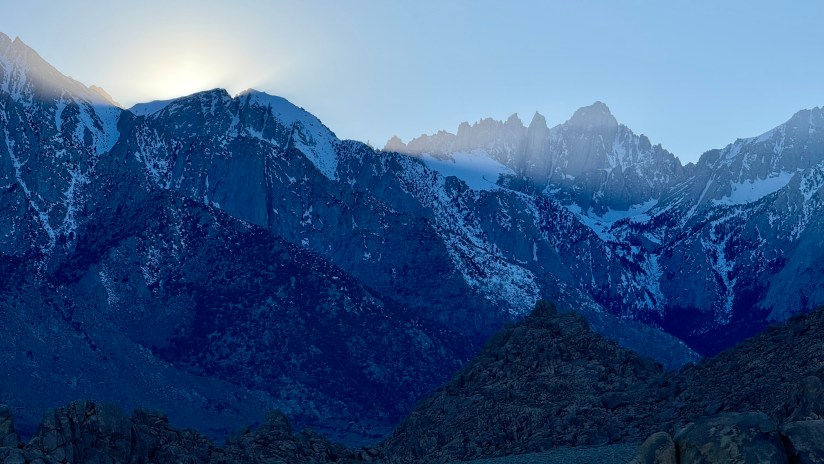
  • Mount Whitney is, like, always in your face here. I am not sure why I was thinking it would be hidden away like Mount Elbert’s summit, but nooooo… in your face, taunting one constantly.

When planning this trip, I expected Death Valley to be the top experience, and everything else just filler, but I ended up not feeling that way, and our day in the Lone Pine area was right there sharing the top spot!

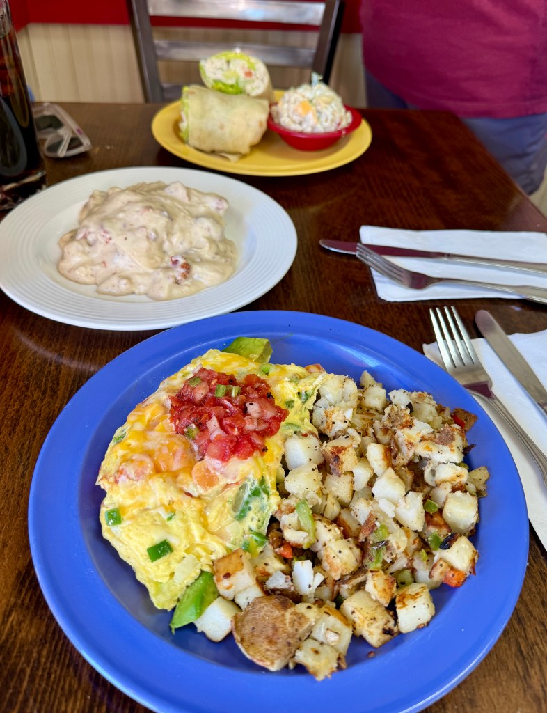
After a great breakfast of a plate full of tater tots piled with cheese and salsa (and breakfast tacos if you were Lindsey), I took to sweet talking Mount Whitney, and offering to send a list of references from mountains in the Rockies (if I had listened to the ranger I had tried to bribe the day before, my efforts really should be on sweet talking and bribing the lottery wizardy of recreation,gov… *spoiler alert: I would win the lottery two weeks later on my fourth year trying!). Oh, and we headed for Alabama Hills!

Billboard displaying the message: 'Artists need to create on the same scale that society has the capacity to destroy.'
Nice billboard in Lone Pine
Scenic view of a winding road leading towards snow-capped mountains under a clear blue sky.
Driving up Whitney Portal Road, which you turn off onto from the only stoplight in town

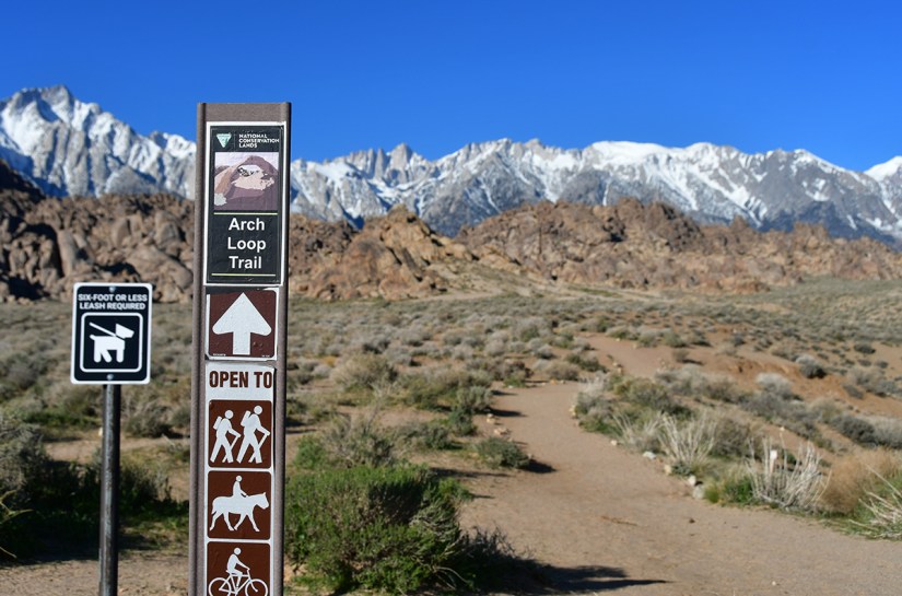
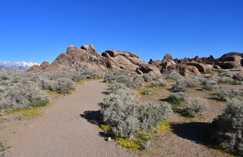
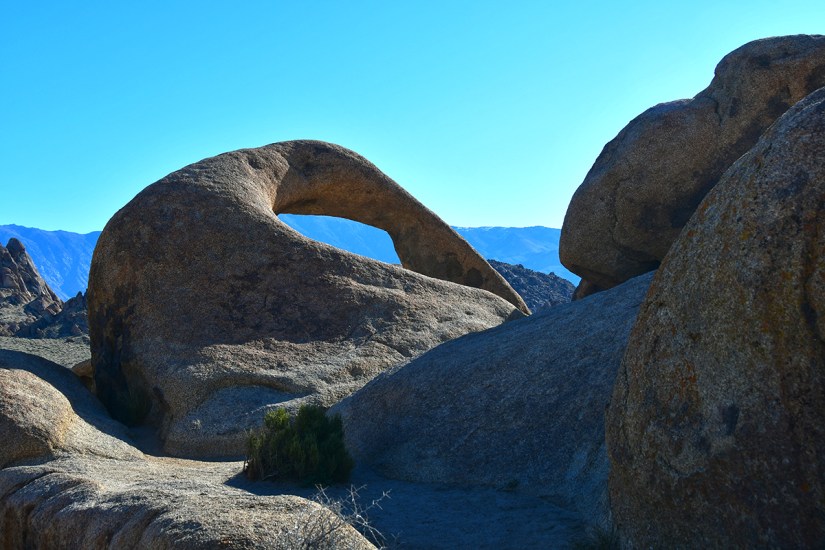
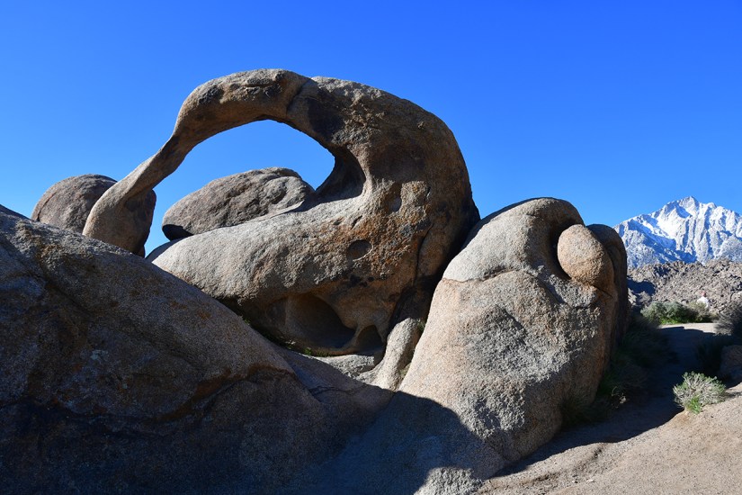
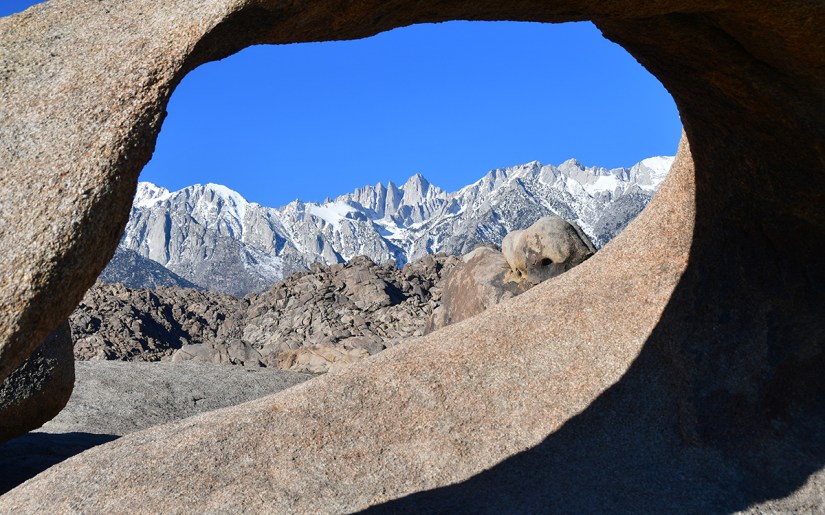
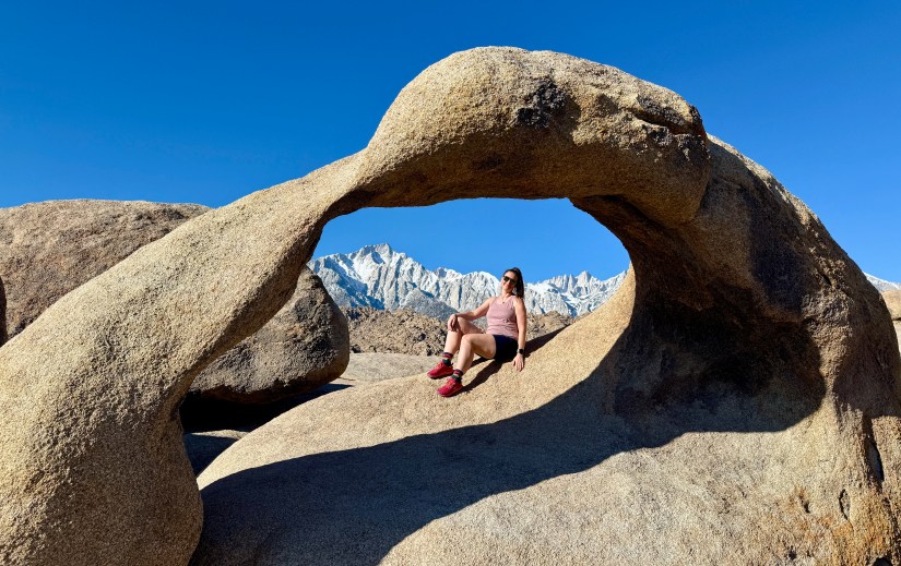
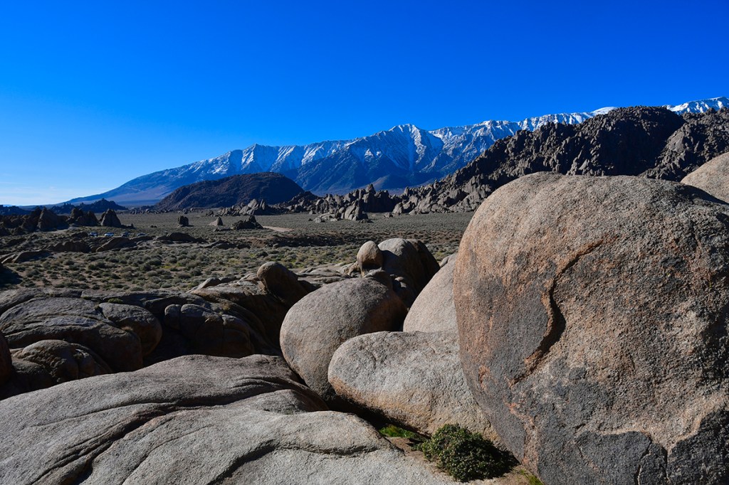
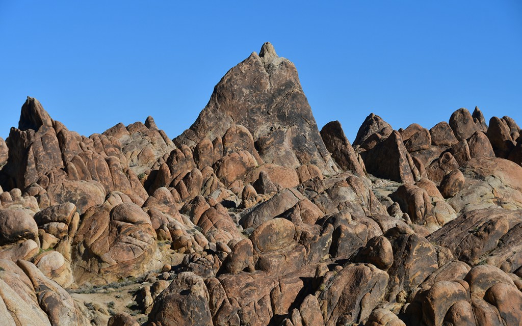
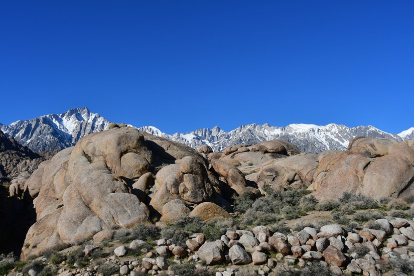
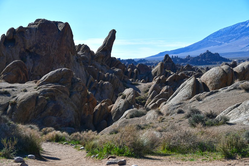
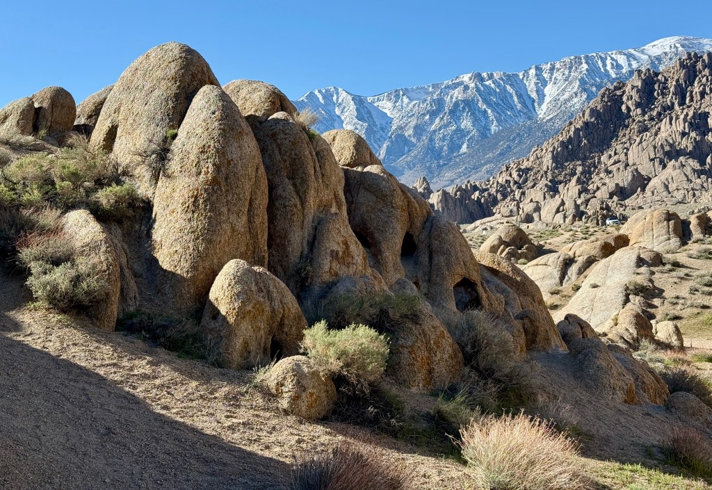
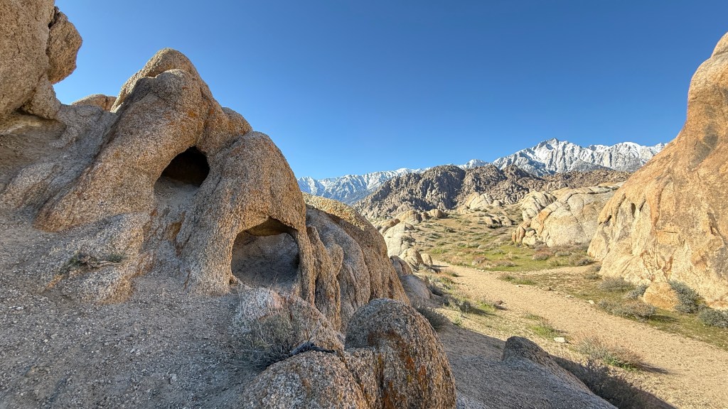
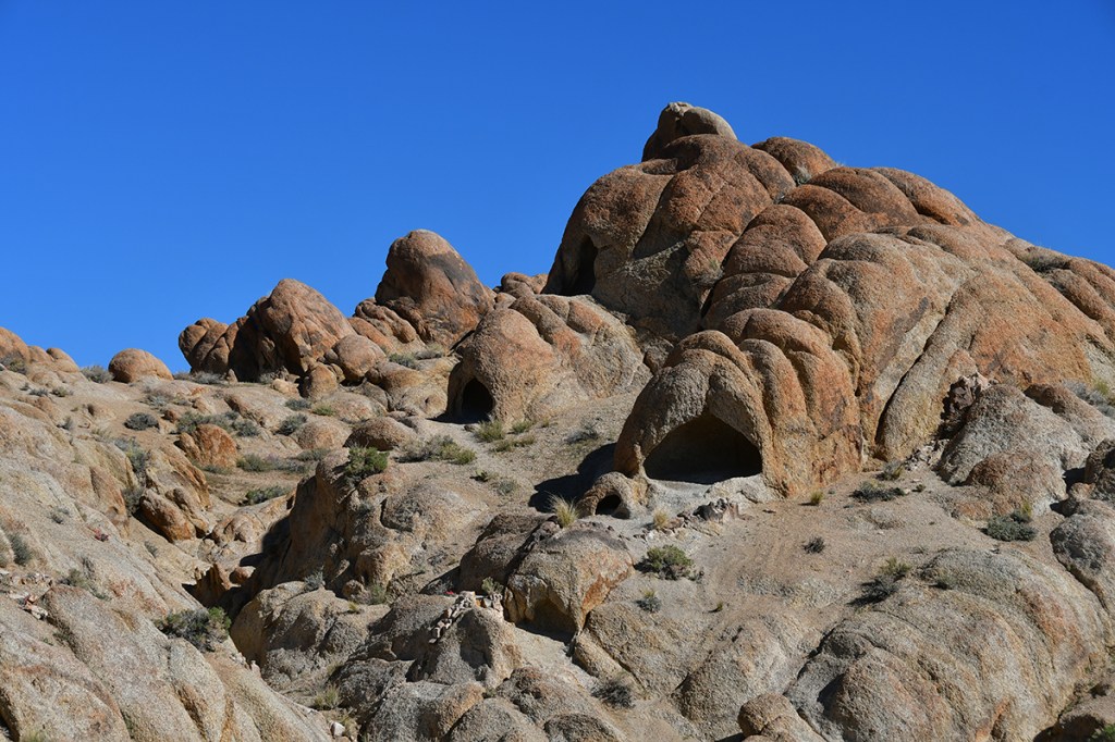
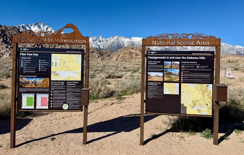
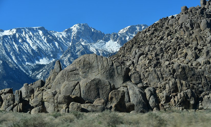
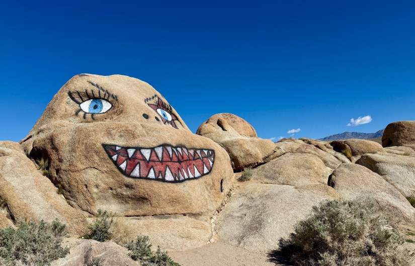
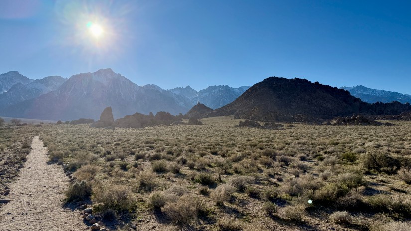
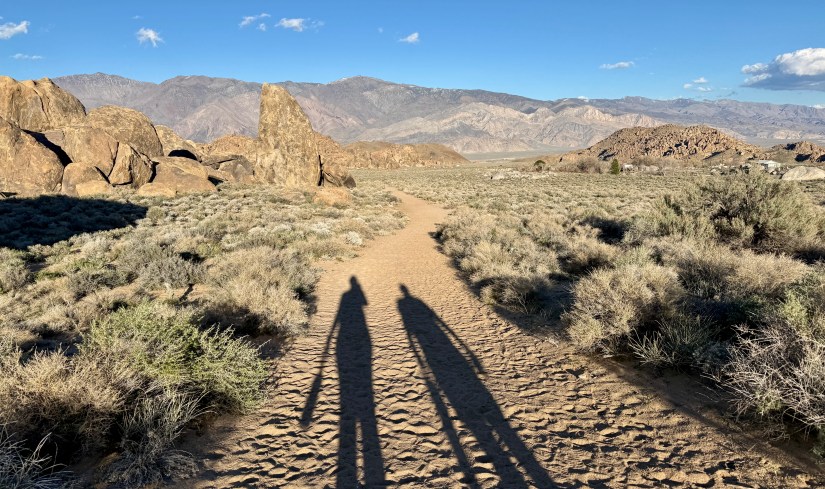
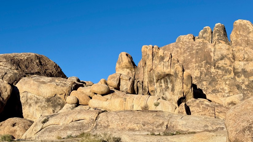
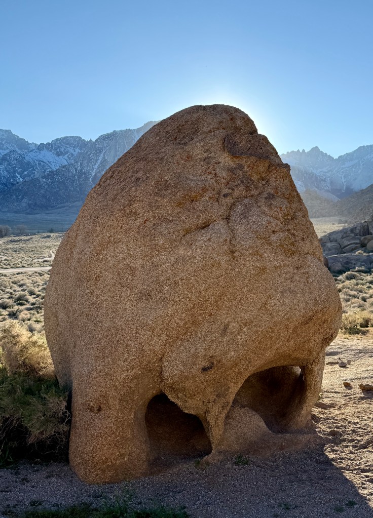
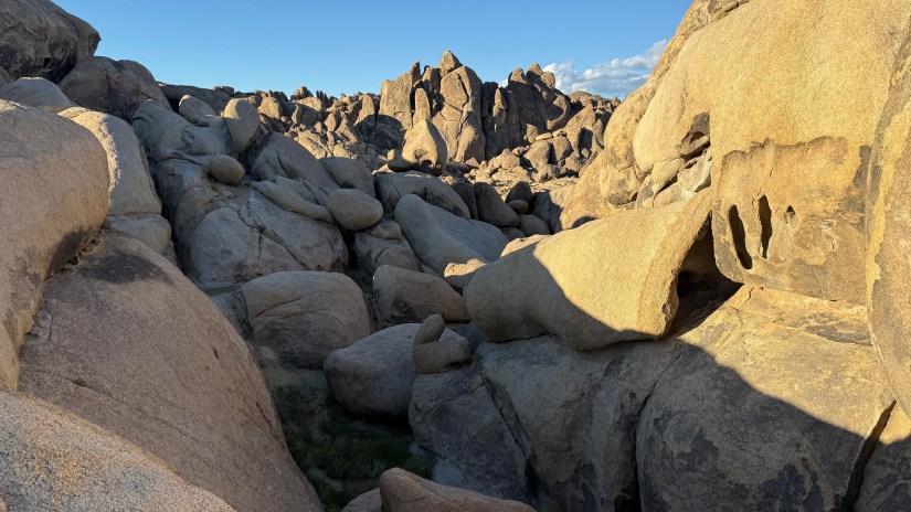
The Alabama Hills National Scenic Area is a wonderland of granite rock formations that offer up hiking, rock climbing, and camping opportunities. As a bonus, many movies were film here, so movie aficionados love to scout filming locations. The most popular hike is the short, 0.6-mile loop to Mobius Arch, a small granite arch that perfectly frames Lone Pine Peak and Mount Whitney in the background. And that is exactly where Lindsey and I were headed to first!

Signpost for Arch Loop Trail with directions for hikers, horseback riders, and cyclists, surrounded by rocky terrain and snow-capped mountains under a clear blue sky.
The short loop trail to Mobius Arch is well marked

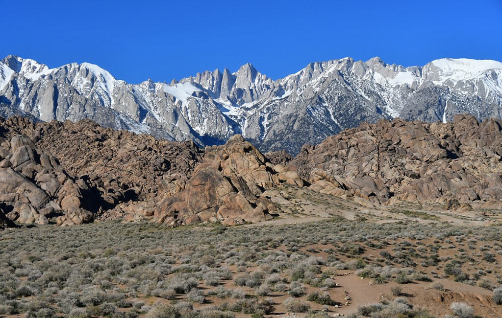
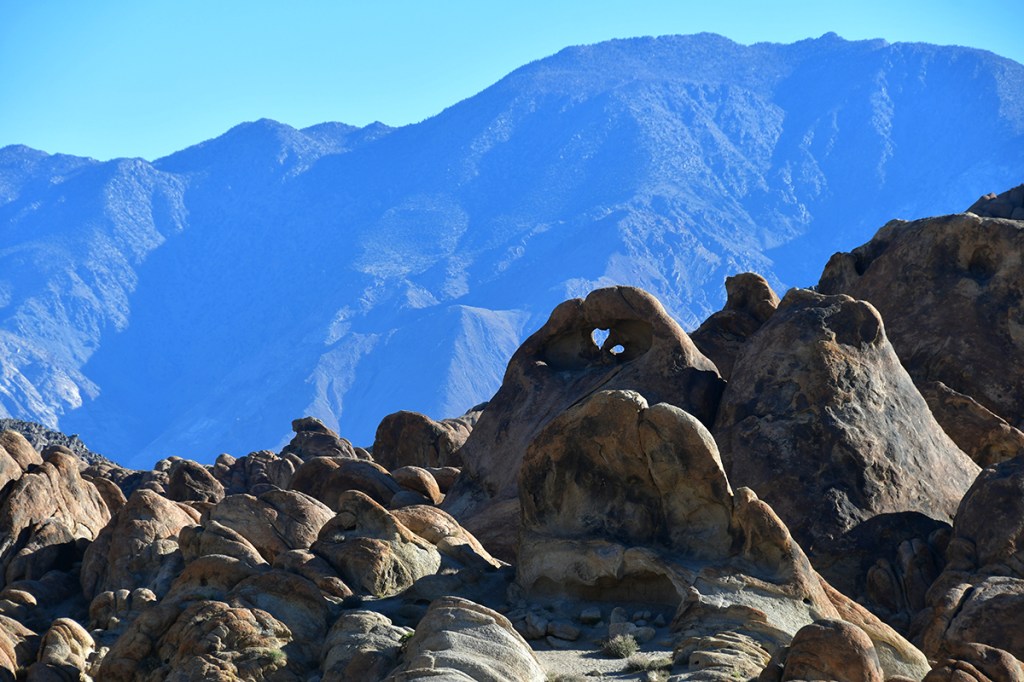
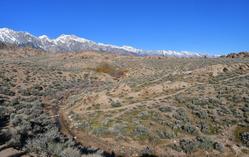
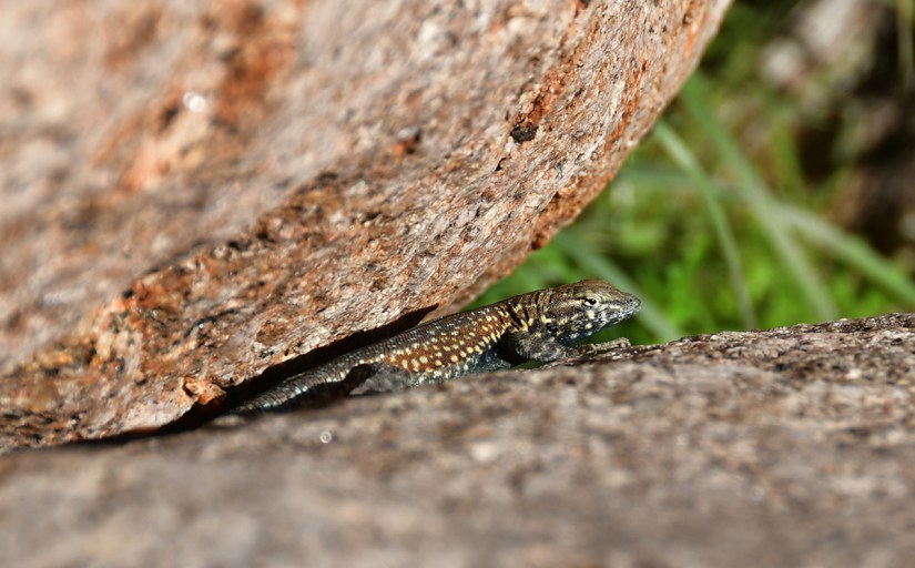
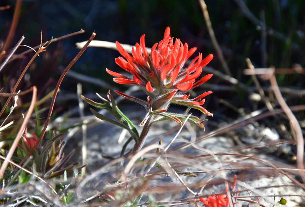
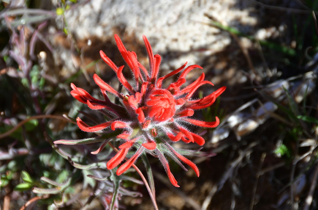
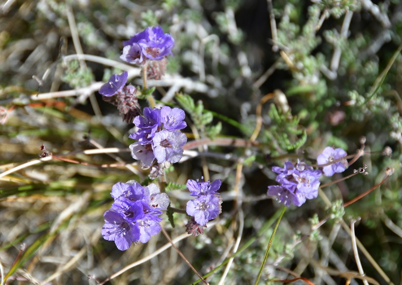
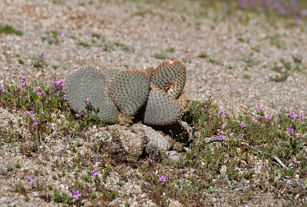
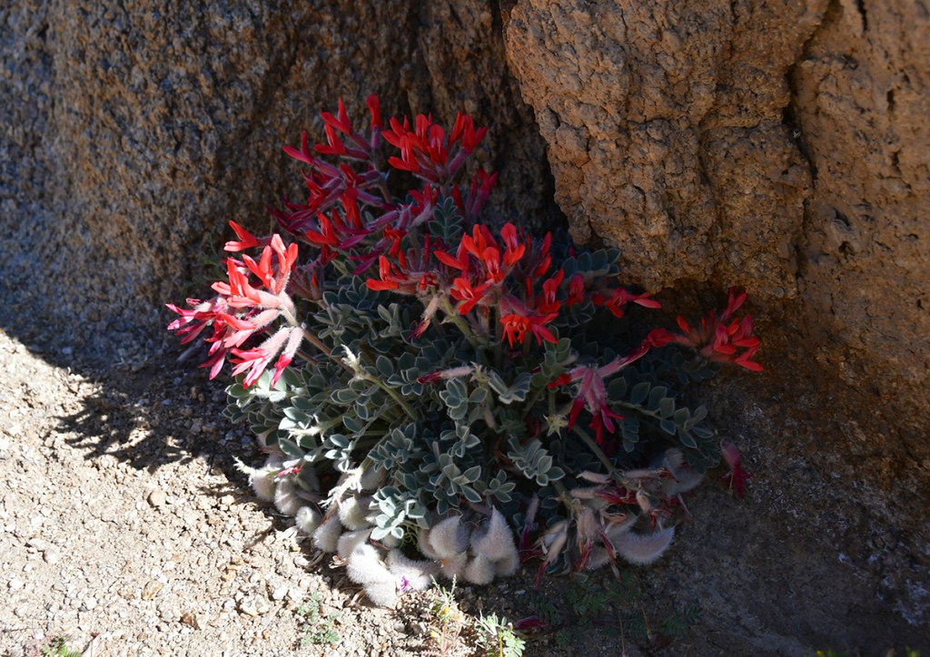
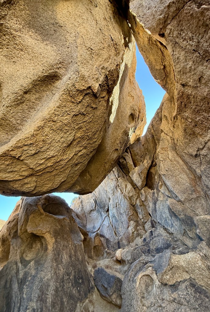
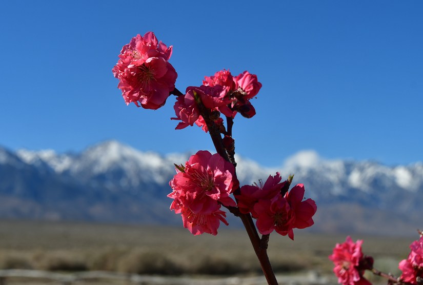
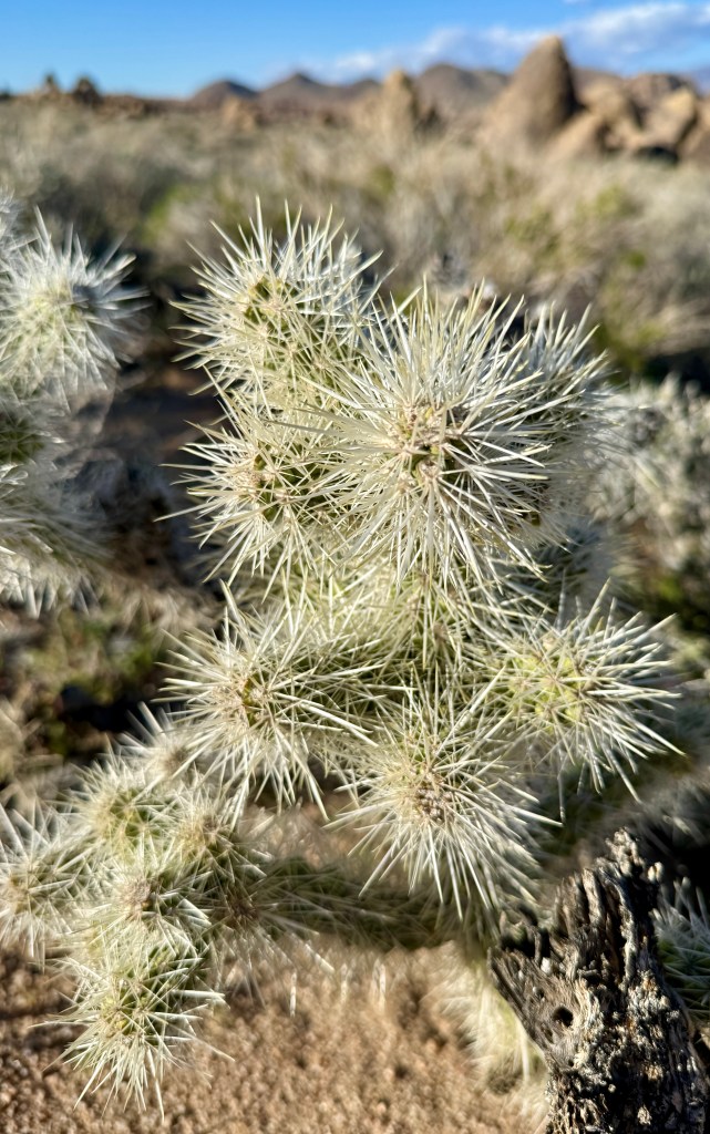
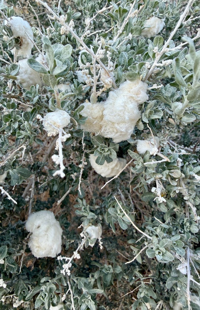
After battling the high temperatures in Death Valley, the upper 50s were a welcomed relief as we started on the trail. Immediately I felt like I was in Moab (with a side of Vedauwoo), with the variety of arches, fins, and eroded rock monoliths all around… except for the massive mountains to the west. Though we were nearly 5000 feet above the superbloom of Death Valley, the wildflowers were waking up, and I was able to spot my first Indian Paintbrush of the season.

A panoramic view of a desert landscape featuring green shrubs, a winding stream, and snow-capped mountains against a clear blue sky.
Descending to a small stream and a trail junction
A rocky trail diverging into two paths, with large boulders and sparse vegetation under a clear blue sky.
Stay right for Mobius Arch
A sandy path leading through a field of sagebrush and boulders, with distant snow-capped mountains under a clear blue sky.
Yellow flowers popping
Close-up view of a textured rock formation against a clear blue sky.
The rocks are granite in Alabama Hills

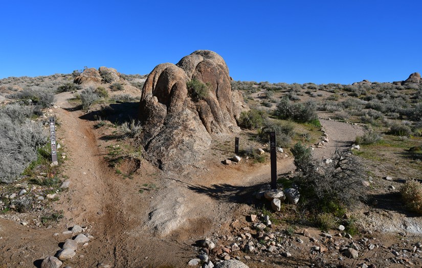
Mobius Arch appeared fairly quickly, and we had it to ourselves until the end when a guy appeared. This was nice as we could trade picture taking duties before we continued on our way. I am happy we got an early start and had a bit of solitude, as we begun to pass other hikers near the end of the hike.

A natural granite rock formation with a distinct arch shape, set against a clear blue sky.
Is this Mobius Arch I spy?!
Rocky landscape featuring large, smooth boulders under a clear blue sky.
Getting distracted by the other geology
A scenic landscape featuring large, uniquely shaped rock formations under a clear blue sky, with snow-capped mountains in the background.
Now time to scramble up to get the “famous” photo angle…
View through a rock archway framing snow-capped mountains against a clear blue sky.
There it is! A lot of people make the mistake of framing Lone Pine Peak, and calling it Mount Whitney since it does look taller from this vantage point.
A woman sitting on a rock formation with an arch, surrounded by boulders and mountains in the background under a clear blue sky.
Got my obligatory photo!
A person stretching one leg while standing under a large rock arch in a desert landscape with mountains in the background and a clear blue sky.
Getting bendy with a bendy rock
A person sitting inside a natural rock formation with a hole, against a clear blue sky.
Lindsey’s first “home” she found
Scenic view of rocky formations with a snowy mountain peak in the background under a clear blue sky.
Looking back on the trail we came from at Lone Pine Peak. This is NOT Mount Whitney… a mistake so commonly made online!

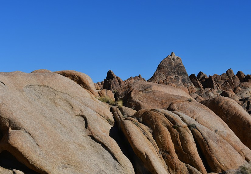
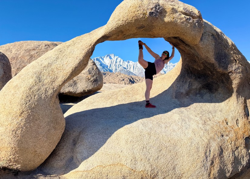
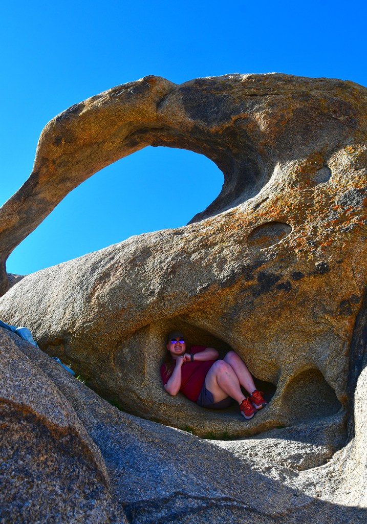
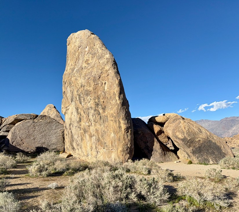
We continued on the loop, exploring some of the rock features, and laughing about Lindsey’s housing options she kept coming across.

A lizard partially hidden between two rocks, blending into its natural environment.
Hey there, little dude!
Rocky landscape with large boulders in the foreground and snow-capped mountains against a clear blue sky in the background.
Rocks, rocks, and more rocks
A desert landscape featuring large rock formations and sparse vegetation, with a clear blue sky overhead.
Area of restoration work at a trail junction. It looks like some shrubberies have been planted to try to fill in the social trails. Pretty neat!
A rocky landscape featuring large boulders and rugged terrain under a clear blue sky.
Ahem.
A cluster of delicate purple flowers growing amidst green foliage and dry grass.
More wildflowers
Snow-covered mountain peaks under a clear blue sky, with rocky terrain in the foreground.
Oh, another view of this mountain. No, I’m not obessesed.
A person sitting on a rocky path between two towering rock formations under a clear blue sky.
“I’ve gots little legs!”
A scenic view of a rocky canyon with a dirt path, surrounded by shrubs and boulders, leading to snow-capped mountains under a clear blue sky.
One final stream crossing. The water was super cold
A scenic view of snow-capped mountains under a clear blue sky, with rugged rocky terrain and sparse vegetation in the foreground.
I can’t help myself at this point.
Information signs for Alabama Hills and National Scenic Area against a backdrop of mountains and blue sky.
I walked across the road to use the porta-potties (once again learning my lesson the hard way to check for toilet paper BEFORE doing anything), and so I photographed the trailhead signs.

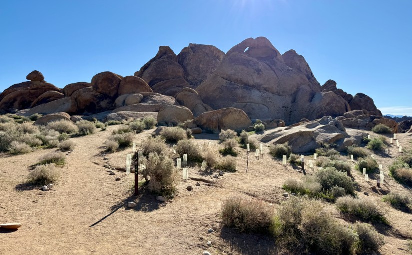
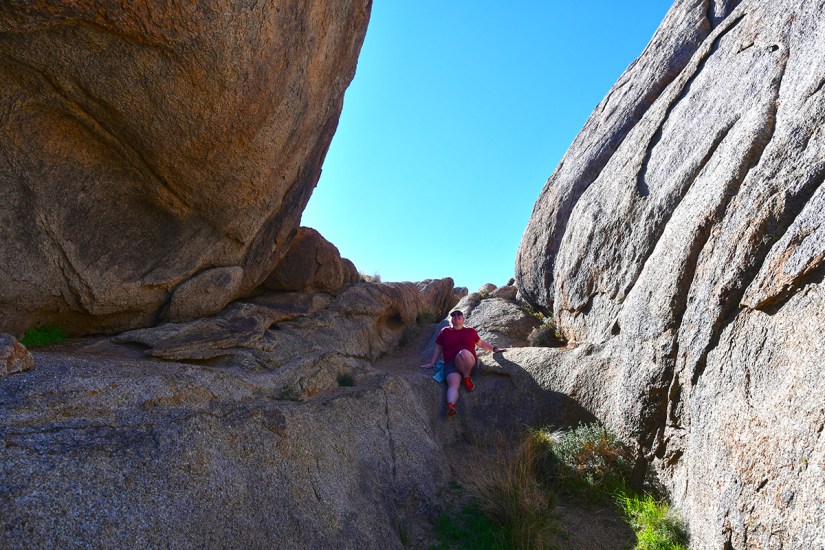
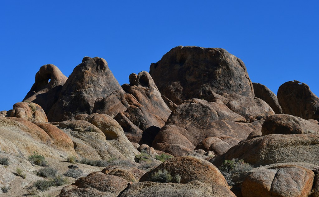
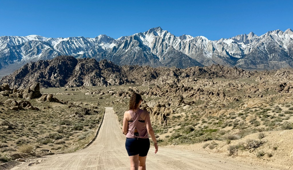
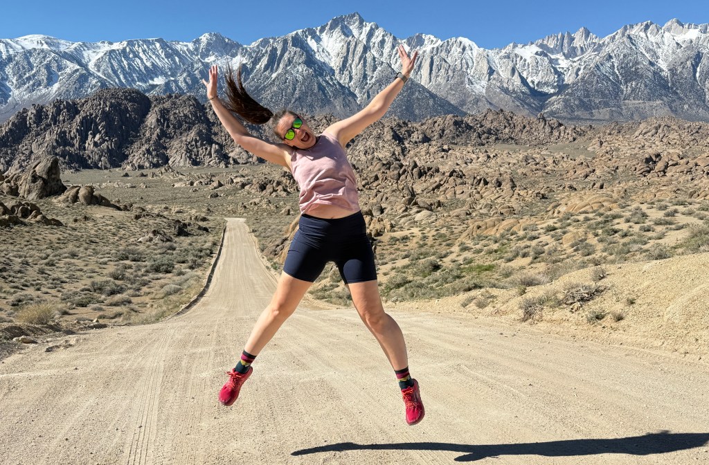
With our detours, the hike came in at 0.9 mile. Great little morning hike! We set out on Movie Road, exploring more and seeking out the spot that is all Instagram famous. We found some great rock formations to scramble around in, before turning around so I could “walk all whimsically” down the road towards the mountains while Lindsey took no fewer than 500 photos of me doing so.

A view of rugged granite rock formations with a narrow opening that reveals a clear blue sky above.
Rock formation that we scrambled up into
A dirt road winding through a rocky desert landscape with snow-capped mountains in the background under a clear blue sky.
Stereotypical shot of Movie Road
A scenic view featuring rugged boulders in the foreground and snow-capped mountains under a clear blue sky in the background.
These formations where the fins are just beginning to develop look like feet with a lot of toes

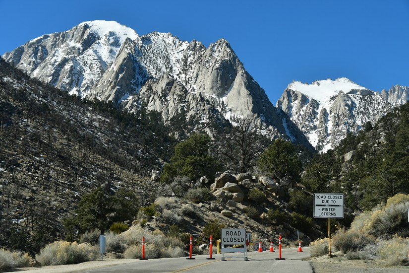
One final side quest Lindsey and I came to the decision of doing was driving up to Whitney Portal, which is where the main hiking trail to Mount Whitney starts. I figure I could continue my pleas to the mountain for a permit (this is all kind of funny looking back on now that I have a permit in hand!), and it seemed like a lovely drive. And Lindsey loves trees, and there’s trees there. Whelp, we were thwarted by a road closure…. side quest cancelled.

Snow-capped mountains with a closed road sign indicating winter storm conditions, surrounded by trees and rocky terrain.
Well, we tried. *Sad face*
A scenic view of a road leading into a mountainous desert landscape, featuring dry terrain, large rocks, and sparse vegetation under a clear blue sky.
Looking down towards Alabama Hills
A large rock formation painted with a cartoonish face, featuring blue eyes and a wide, toothy grin, against a clear blue sky.
Stopping to say hi to Brenda

By now it was brunch-time, so we headed back down to Lone Pine, and the Alabama Hills Cafe. Once again, as the norm of this trip, we had fantastic meals! I definitely will be coming back here to eat (and hopefully buy the “I Hiked Mount Whitney & Ate at the Alabama Hills Cafe” decal).

A colorful breakfast plate featuring an omelette topped with tomatoes and green onions, served alongside golden-brown home fries. In the background, there are two additional dishes: a wrap and a bowl of salad.
Amazing meal at Alabama Hills Cafe! I ate entirely too much, but the bloated tummy was worth it!
A hand holding two postcards, one featuring Alabama Hills and the other Eastern Sierra, near an 'OUT OF TOWN' mailbox.
Dropping a few postcards off at the post office. It is so rare to see an “out of town” mail slot anymore!

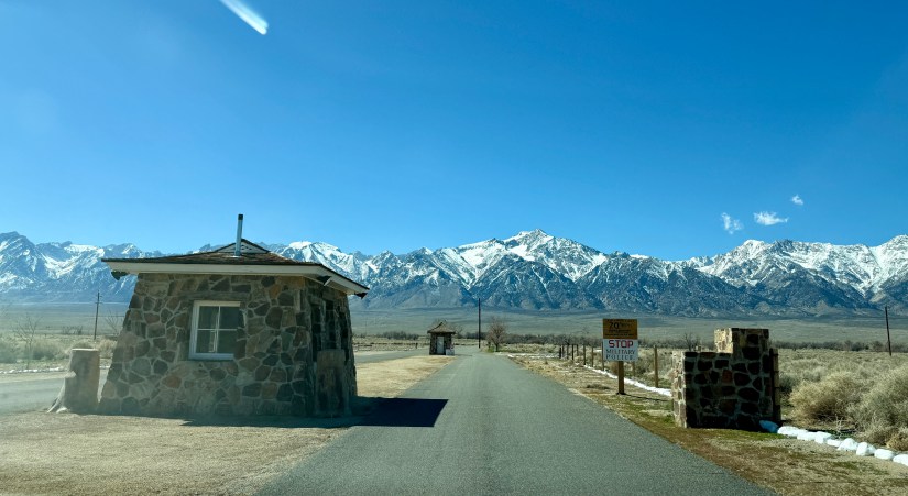
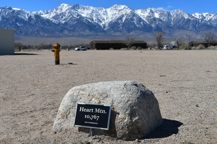
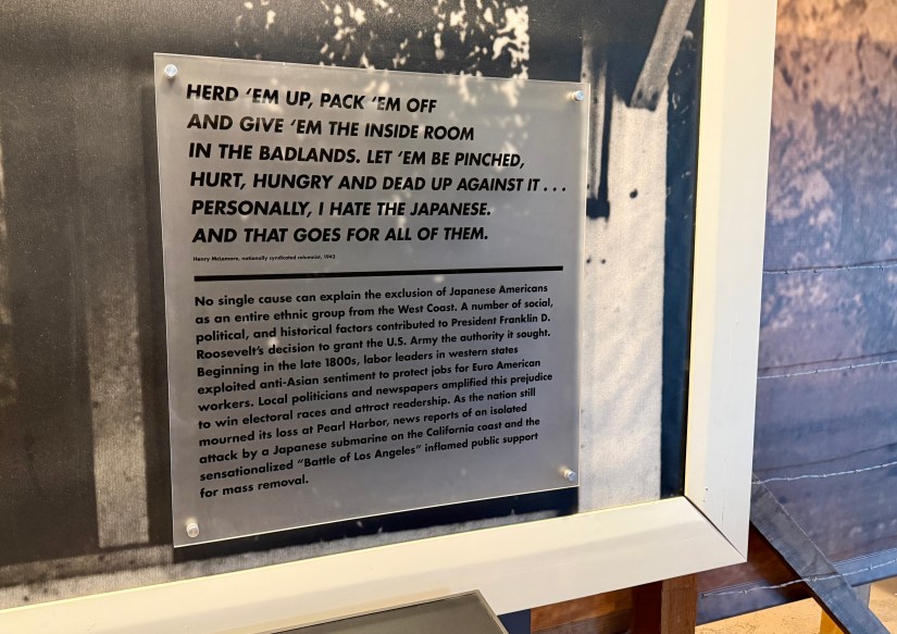
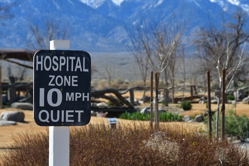
Now for the main reason we came over to Lone Pine to stay: a visit to Manzanar National Historic Site. A part in an absolutely disgusting chapter of United States history, Manzanar would be the first internment camp either of us had visit. (I have driven by the Heart Mountain Camp in northern Wyoming a dozen times, but it has never worked out where I had a chance to visit.)

Sign for the Manzanar War Relocation Center with mountains in the background and a clear blue sky.
96th National Park Service unit. Normally I take a selfie with the entrance sign, but I was not feeling it for this location (there is a more traditional sign on the frontage road to the north, but I like this original sign better).

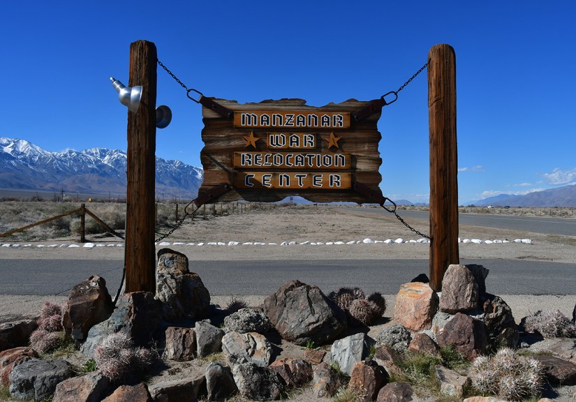
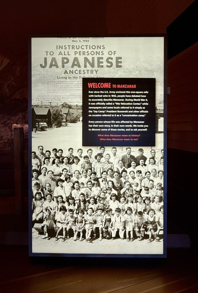
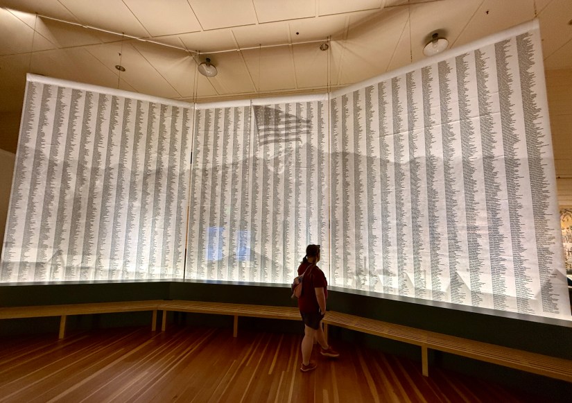
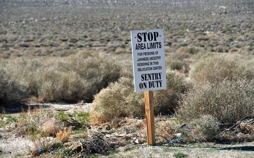
In 1942, the United States government ordered more than 110,000 men, women, and children to leave their homes and detained them in remote, military-style camps. Manzanar War Relocation Center was one of ten camps where the US government incarcerated Japanese immigrants ineligible for citizenship and Japanese American citizens during World War II.

National Park Service
View of a stone entrance gate with a small building, leading to a road surrounded by snow-capped mountains under a clear blue sky.
Entering through the original guard shack

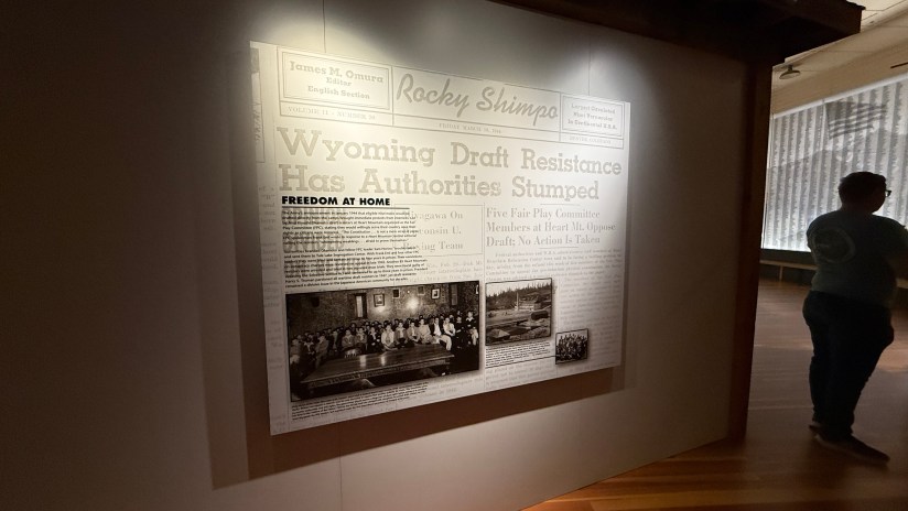
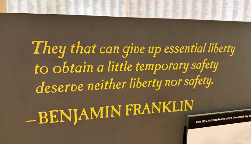
Whatever I want to write will not do Manzanar, or any of these camps, justice. The vile racism is just tough to comprehend (but sadly, not really, honestly). Yes, we were at war with Japan. But we were also at war with Germany. Where were the camps for those of German ancestry? Oh yes… that’s right… I digress. But this visit was very emotional and very uncomfortable. I found myself tearing up several times in the visitor center, trying to get ahold of my emotions.

Close-up of cherry blossom branches with pink flowers against a clear blue sky.
Cherry blossoms
A rock with a sign marking Heart Mountain at 10,767 feet, set against a backdrop of snow-capped mountains in Wyoming.
Outside the visitor center was a boulder for each internment camp.

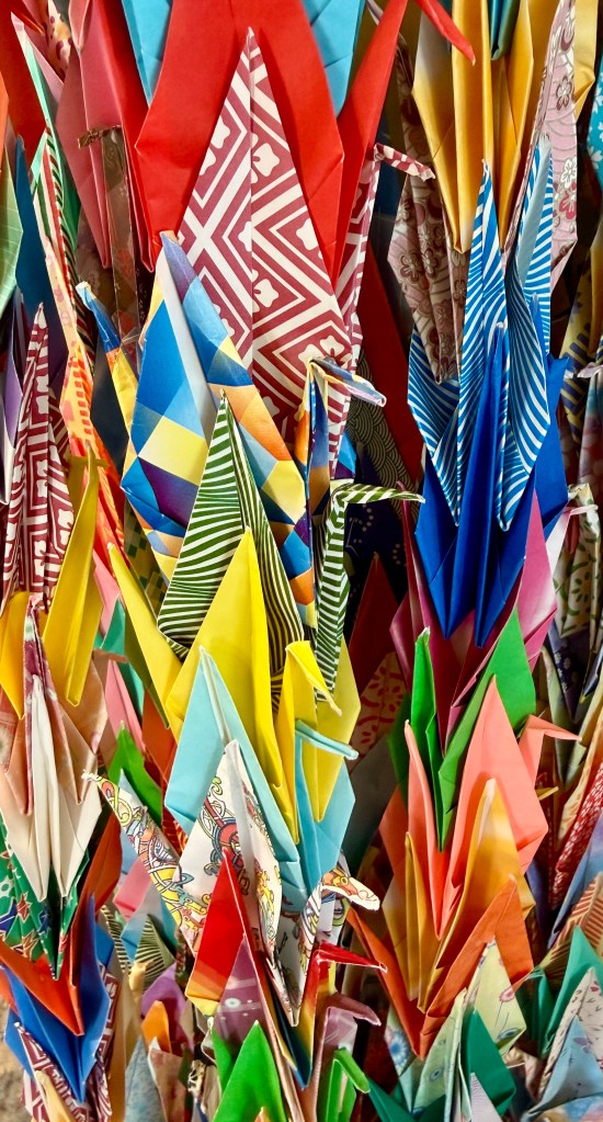
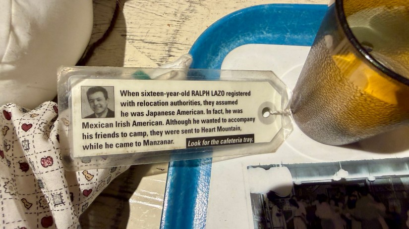
Lindsey and I started our visit with passport stamps and the gift shop, where I purchased training chopsticks which I have wanted for years. The cashier had great humor about it, and told me about all the adults that end up buying them. I also bought a tiny paper crane ceramic figurine for my bookshelf. Then we headed into the museum exhibit hall, which provided a thorough and comprehensive overview into the camps.

A historical display at Manzanar featuring a large black and white photograph of a group of Japanese Americans, with instructions for individuals of Japanese ancestry and information about the internment during World War II.
A sign with historical text discussing the exclusion of Japanese Americans during World War II, featuring a quote by Henry McLemore and contextual information on social and political factors behind this action.
I’d like to think people today don’t have this same sort of sentiment, but history repeats itself over and over
A close-up of a tag with a text about Ralph Lazo, a sixteen-year-old who registered with relocation authorities. The text discusses assumptions about his background and his desire to accompany friends to camp. A glass and tray are visible in the background.
A historic newspaper display featuring the headline 'Wyoming Draft Resistance Has Authorities Stumped' with a photo collage below, showcasing people involved in the draft resistance movement.
A person standing in front of a large illuminated wall displaying names arranged in vertical columns, with a faint image of a mountain in the background.
Powerful wall with all the names of those imprisoned in Manzanar
Quote by Benjamin Franklin: 'They that can give up essential liberty to obtain a little temporary safety deserve neither liberty nor safety.'

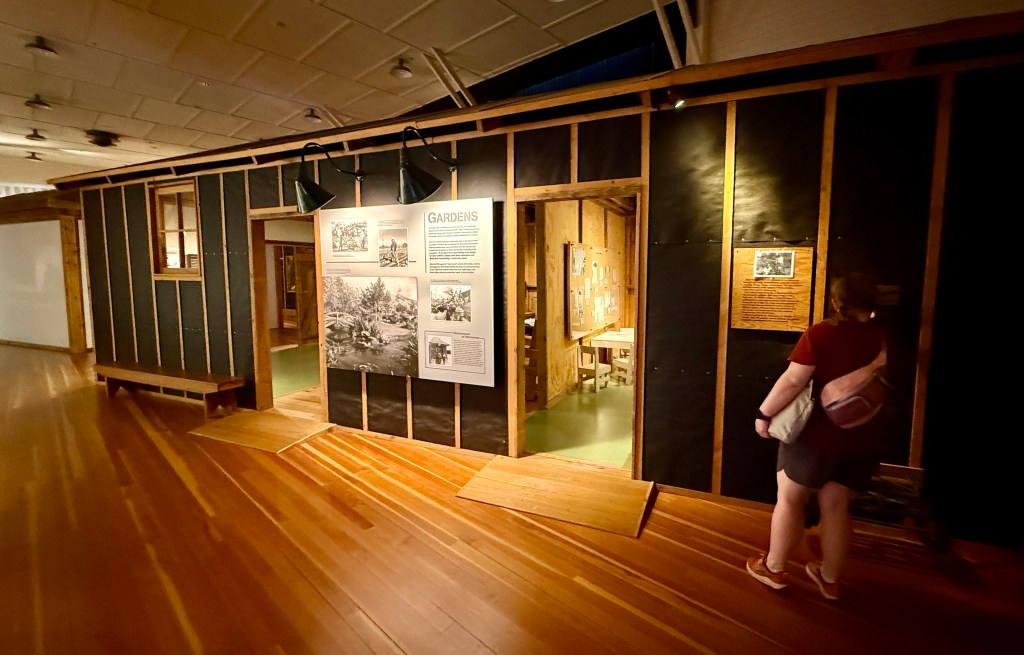
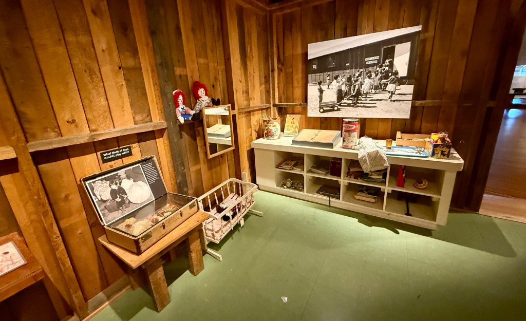
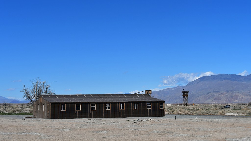
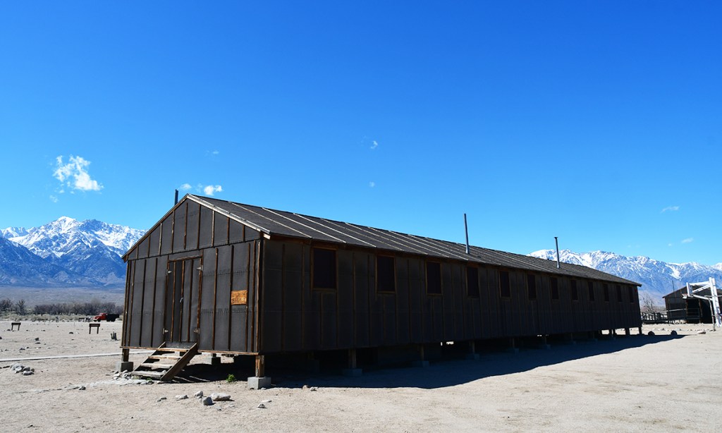
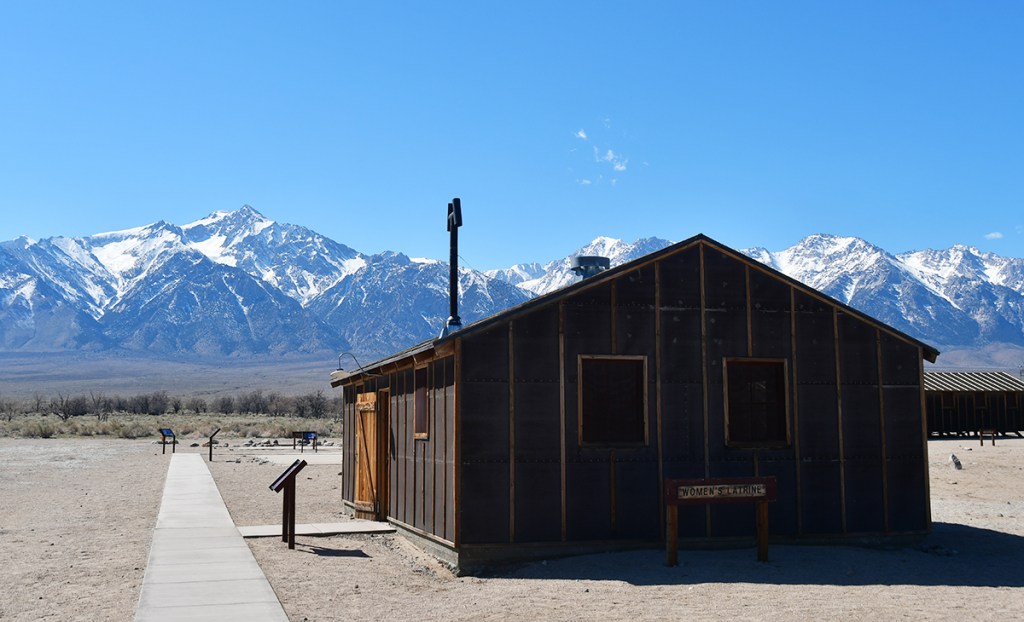
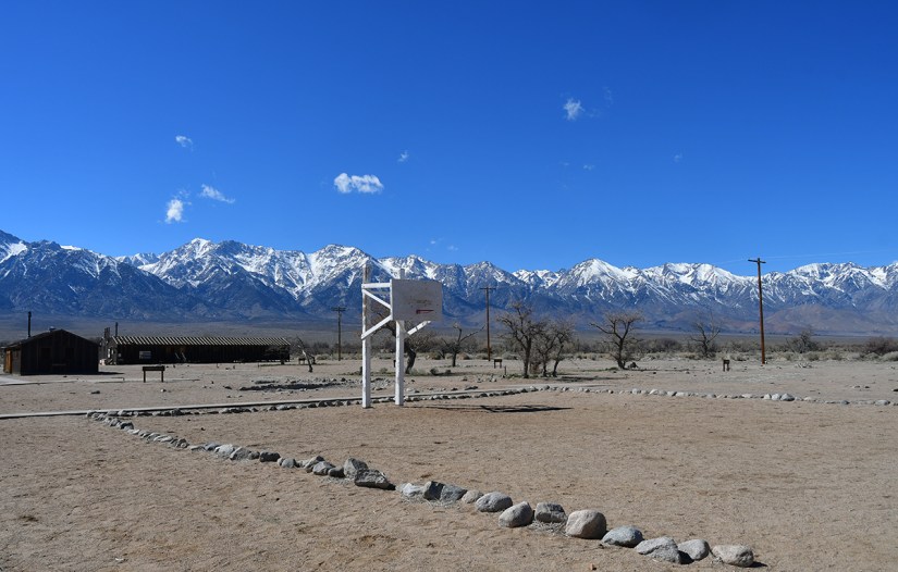
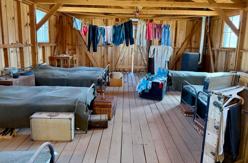
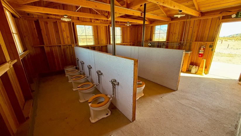
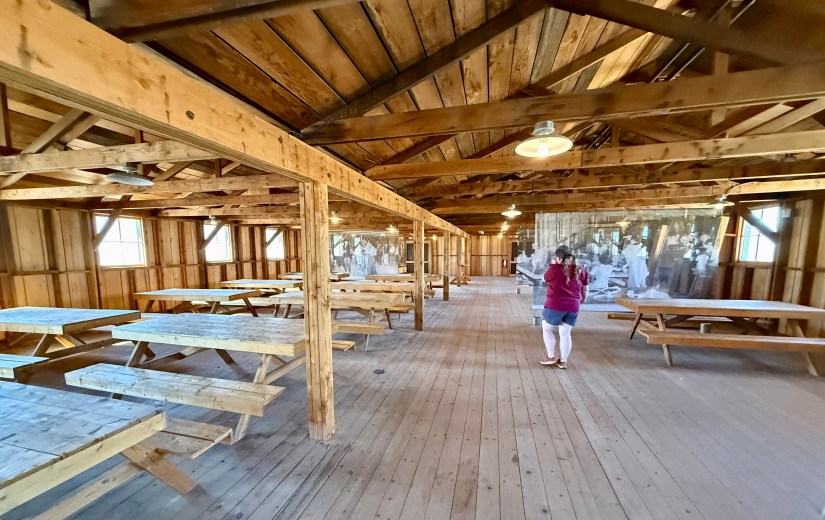
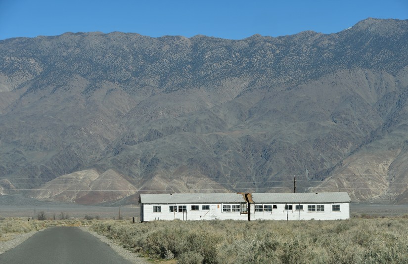
We exited into the bright sunshine, hearts and minds heavy. We stashed our visitor center goodies in the car and set out to walk around Block 14, a reconstructed example of the living situation consisting of a mess hall, women’s latrine, and barracks.

A basketball hoop stands in a dry landscape surrounded by a stone boundary, with snow-capped mountains and a clear blue sky in the background.
The basketball course
A barren landscape featuring a dry, sandy foreground with scattered rocks and sparse vegetation, contrasted by a majestic mountain range in the background covered in snow, under a clear blue sky.
Signs mark the sites of buildings
A wooden shelf displaying various bathroom items, including rolls of toilet paper, a box of tissues, and several bars of soap labeled Lifebuoy, Pakoilive, and Lava.
Interior of a rustic cabin with wooden walls and floors, featuring several beds covered with gray blankets, and clothing hanging on a line. Various items, including suitcases and a small table, are also visible.
Replica barrack
Interior of a rustic bathroom with multiple toilet bowls separated by low partitions, featuring wooden walls and a ceiling.
The women’s latrine.
Interior of a wooden hall with picnic-style tables and a person taking a photo of a historical display.
Mess hall

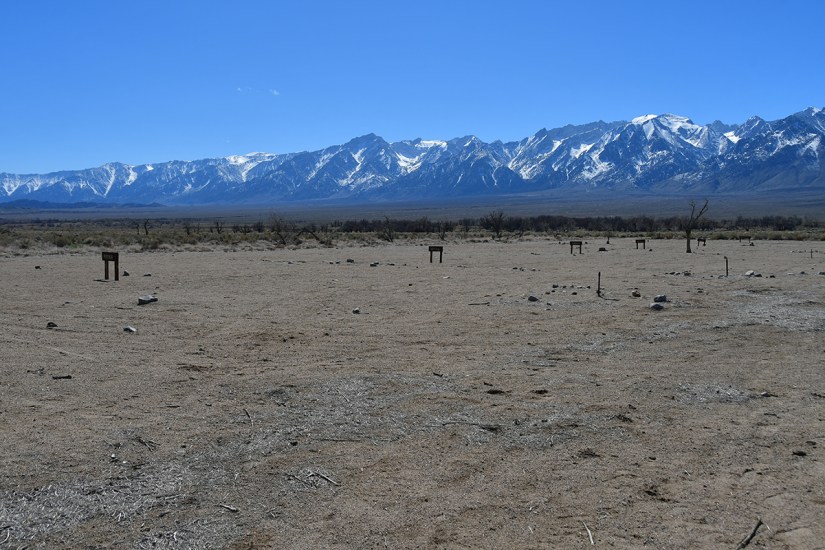
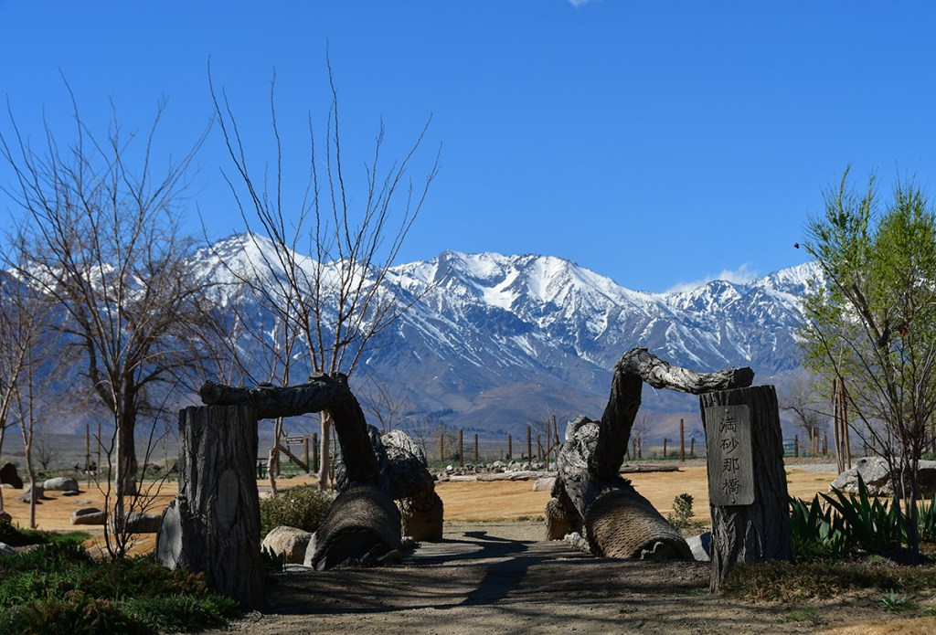
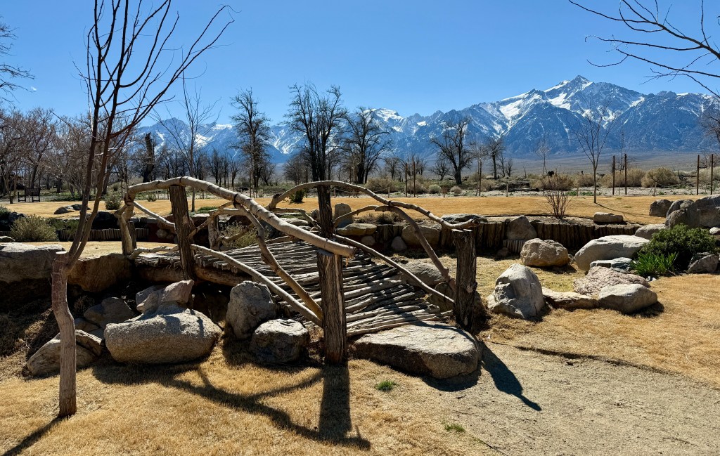
Wrapping up Block 14, we hopped in the car to finish out the 3.2-mile auto tour, setting out for Merritt Park, the orchards, and the cemetary. We were originally going to walk, and then realized the sheer size of the camp.

A bare tree with some scattered branches and two dark birds perched, set against a backdrop of snow-capped mountains and clear blue sky.
Well, this tree and crows are not creepy at all…

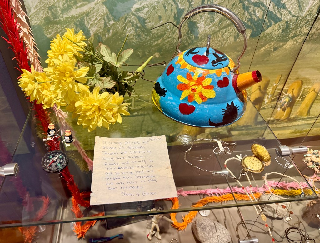
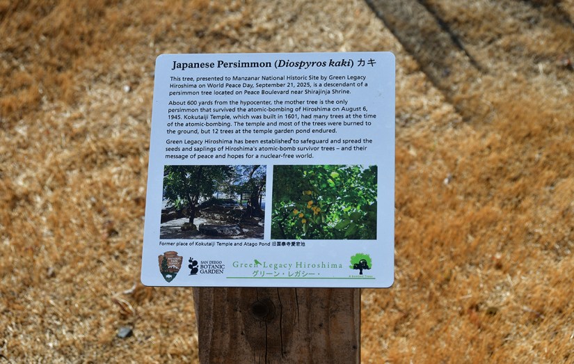
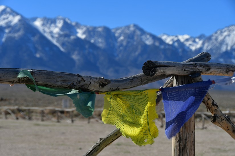
The people incarcerated at Manzanar left a lasting legacy by creating more than 100 Japanese gardens. The most elaborate of the gardens was Merritt Park, named for the camp director, Ralph P. Merritt. Merritt Park served as community refuge from the hardships of camp. After Manzanar closed in 1945, many of the gardens disappeared as debris from demolished barracks, sand, and vegetation covered them. Recent archeological excavations have uncovered and stabilized some of these gardens including Merritt Park. Today you can view what’s left of this symbol of beauty and the resilience of the human spirit.

National Park Service
A memorial stone with inscriptions, surrounded by large rocks, in a landscape featuring snow-capped mountains and sparse vegetation under a clear blue sky.
Merritt Park
A sign indicating a hospital zone with a speed limit of 10 MPH and the word 'Quiet,' set against a backdrop of mountains and a landscaped area.
Information sign about the Japanese persimmon (Diospyros kaki) planted by Green Legacy Hiroshima, detailing its historical significance and connection to the atomic bombing of Hiroshima.

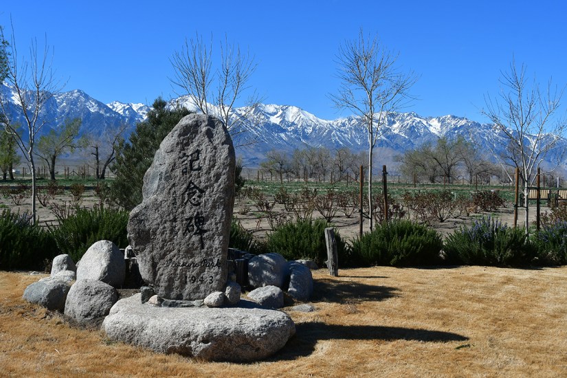
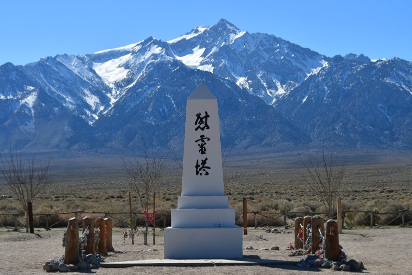
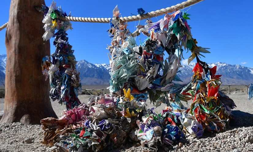
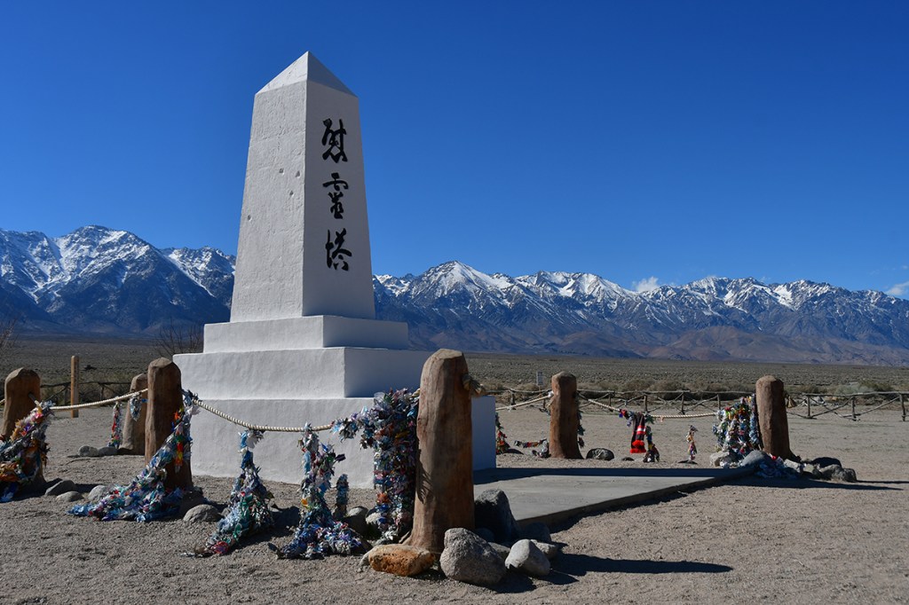
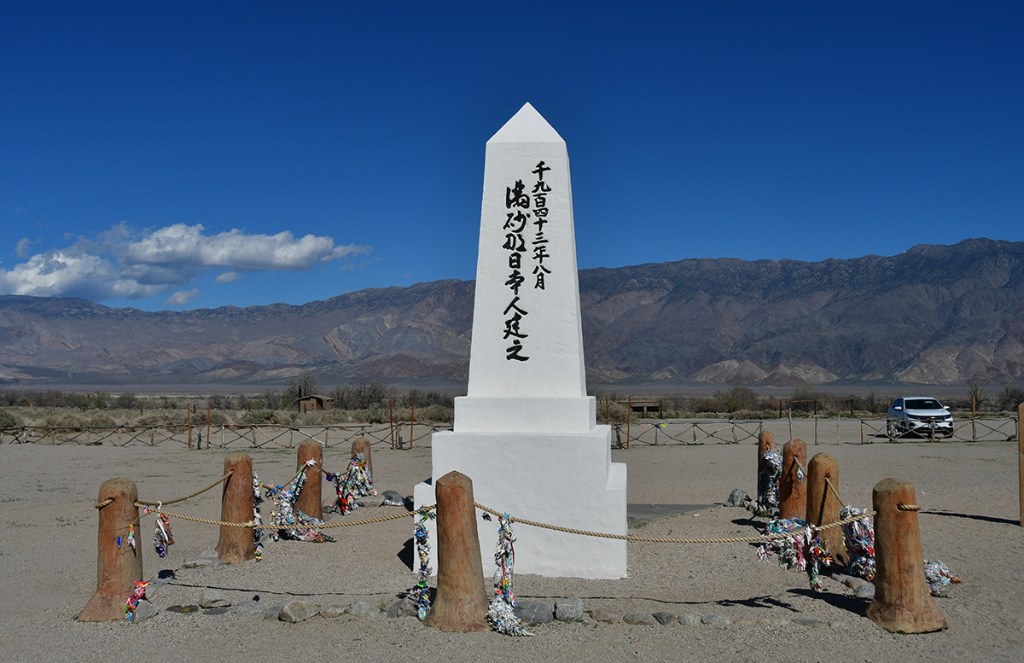
In 1943 the people in Manzanar decided to erect a monument to honor their dead and skilled stonemason Ryozo Kado was recruited to supervise the work. The cemetery serves as a poignant reminder that some of the over 11,000 Japanese Americans incarcerated at Manzanar never saw freedom again. One hundred and fifty Japanese Americans died while confined in Manzanar during World War II. Many were cremated, in the Buddhist tradition, and some were sent to their home towns for burial. Fifteen people were buried in a small plot of land just outside the camp’s security fence. When Manzanar War Relocation Center closed, the families of nine of the deceased removed the remains of their loved ones for reburial elsewhere. In 1999, NPS archeologists confirmed that six burials remain at the site. The three characters on the front (east side) of the cemetery monument literally translate as “soul consoling tower” ( I REI TO ). The inscriptions were written by a Manzanar Buddhist priest, Shinjo Nagatomi.

National Park Service
A tall monument with inscriptions stands in the foreground, framed by snow-capped mountains under a clear blue sky.
The cemetery monument
A close-up of pink flowers against a backdrop of snow-capped mountains and a clear blue sky.
A close-up view of colorful paper cranes hanging from a rope against a backdrop of snow-capped mountains and clear blue sky.
These paper cranes are so beautiful! I’ve never seen them made into chains before.
A sign stating 'STOP AREA LIMITS FOR PERSONS OF JAPANESE ANCESTRY RESIDING IN THIS RELOCATION CENTER SENTRY ON DUTY,' near a barren landscape with sparse vegetation.
Camp boundary
Colorful prayer flags hanging on a wooden post with snow-capped mountains in the background.
An abandoned white building with a flat roof in the foreground, set against a backdrop of rugged mountains and clear blue sky.
I believe this building may be an original?

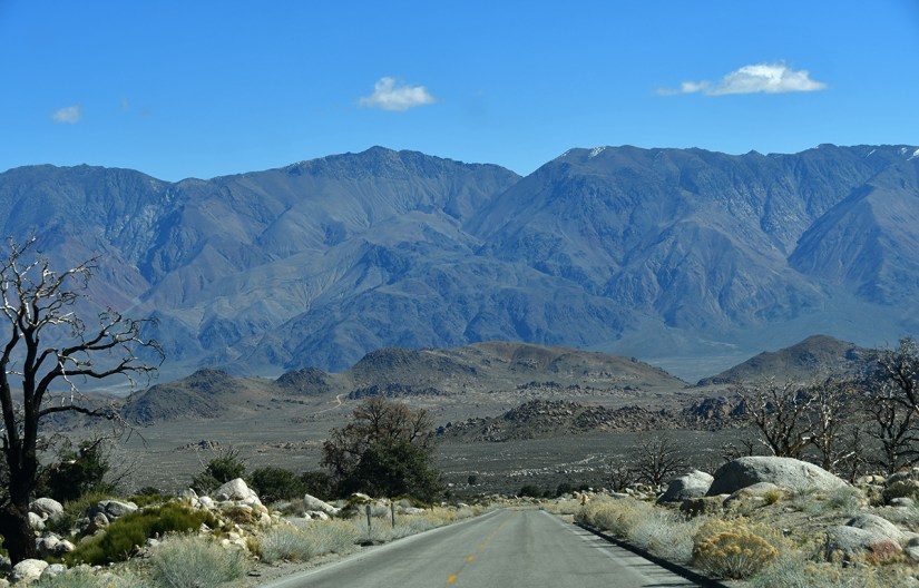
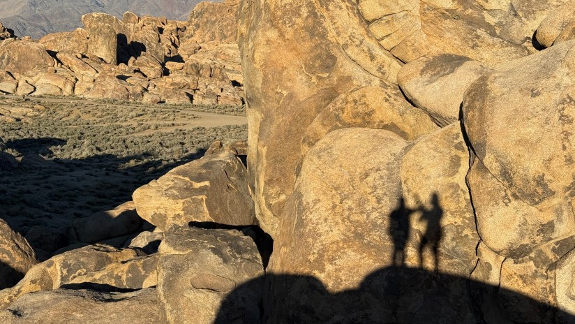
After a few hours we emerged from Manzanar a bit stunned and low on energy. We did not really know what to do with the rest of the afternoon, so we headed into Lone Pine to grab gas (as the U.S. just went and started a new Middle East war, and gas was jumping up in price in mere hours), and then turned around and drove north a bit through Independence. Though Mono Lake was just a few hours north, I think we both subconsciously felt tired of sitting in the car, so I suggested we head back to Alabama Hills to take a short walk to the Shark Fin.

A yellow road sign indicating 'END' next to a gravel road, with mountains and sparse vegetation in the background under a clear blue sky.
Forever photographing the “End” signs in California… harkening back to The Ataris’ album cover for “End is Forever.” Just one of those little things I have done for decades!
A scenic view of a desert landscape featuring a sandy path, sparse vegetation, and rugged mountains under a clear blue sky with the sun shining.
Back in the Alabama Hills
A tall, narrow rock formation stands amidst boulders and sparse vegetation under a clear blue sky.
The Shark Fin. Aptly named!
Silhouettes of two people walking on a dirt path surrounded by shrubs and rocky terrain under a clear blue sky.
Enjoying the sun not being in our eyes on the way back to the car!

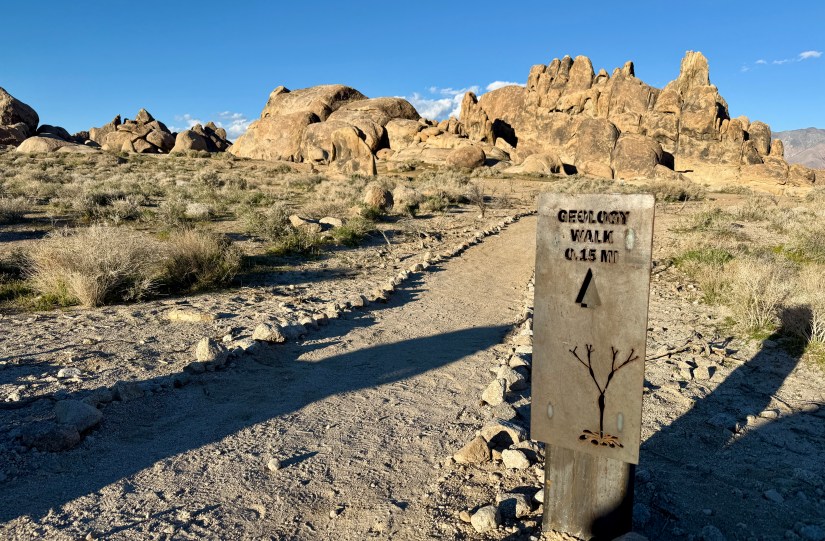
After wrapping up the Shark Fin, we stopped to walk the very short geology interpretive trail. I found the most impressive rock formation for Lindsey to move into (an ongoing side quest from this morning), in which she dubbed the Phallus Palace as it was quite phallic indeed. The afternoon ended with watching the sun set behind Candlelight Peak.

A sign for a geology walk indicating a distance of 0.15 miles, surrounded by rocky terrain and sparse vegetation under a clear blue sky.
Geology walk?! Don’t mind if I do!
Large rock formations resembling a hand, set against a clear blue sky.
Another “foot” with too many toes! There is also a bowling pin laying on its side.
A large, rounded boulder with natural openings at its base, set against a backdrop of snow-capped mountains and a clear blue sky.
Skull rock without the Joshua Tree National Park crowds?!
A rocky landscape with large boulders and formations under a clear blue sky.
The Phallus Palace
Shadows of two people standing on rocky terrain during sunset, surrounded by large boulders and sparse vegetation.
Sunrise over snow-capped mountain peaks with a rugged foreground.
Goodnight, sun!

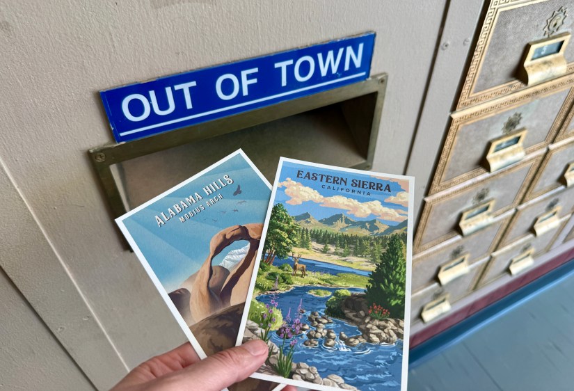
It was back to the hotel for Lindsey and I to unwind and continue a postcard writing marathon (we are both Postcrossers!). Finally we decided on the Mount Whitney Restaurant for a late dinner. And for once, I forgot to photography my meal! But we chowed down on amazing homemade tortilla chips, and I enjoyed the “mustang burger,” which was mildly spicy but hit the spot.

Whelp, this adventure is just about wrapped up! Alarms were set for early the next morning so we could get a start on the long drive back to Las Vegas – but don’t worry, adventures were had along with the way, including terrifying caterpillars, calling out bad tourist behavior, and pondering how low Lake Mead can get!

1 thought on “Salt, Sand, and Sierra Mornings: Day 3 – Alabama Hills & Manzanar”

  1. Wow, a little bit of everything here. Absolute heartbreak. Amazing mountain (good to know which peak is which, I can see why it’s so easy to mistake Lone Pine for Whitney). And cool rocks!

    Like

Leave a reply to Diana Cancel reply