

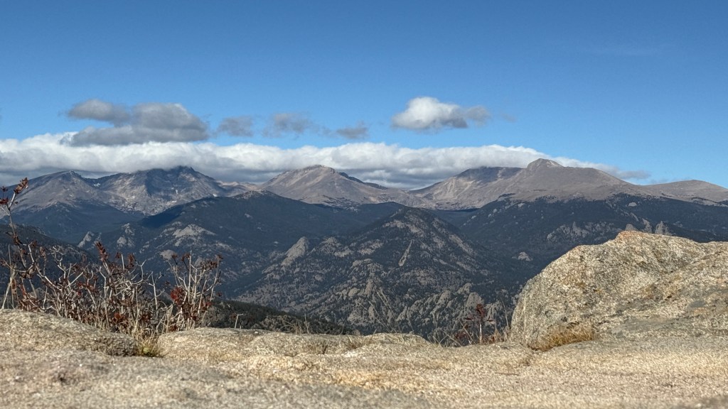
An opportunity for 360-degree views without having to climbing up above 10,000 feet or enter into Rocky Mountain National Park?! Sign me up!
Hiking to Kruger Rock has been on my radar for awhile now after seeing photos of friends summiting with the gorgeous views in the background. While most accomplish the hike in under 4 miles, I opted to take the Limber Pine Trail which would stretch my adventure over 8 miles and give me a good 1700 feet of elevation gain… just what I needed!

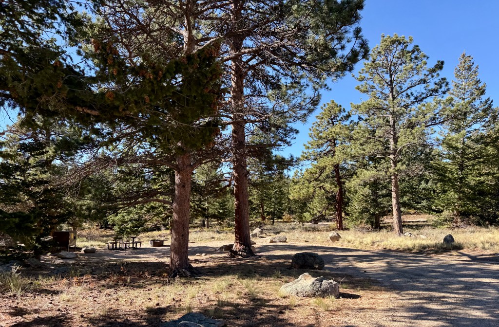
After paying my entrance fee (finally a Larimer County pay station that worked smoothly for me…), I made my way up the steep, switchbacked road to the Saddle Trailhead. It was completely empty at 9:40am on this October Friday morning, so I had my pick of spots before checking out the very clean vault toilets.


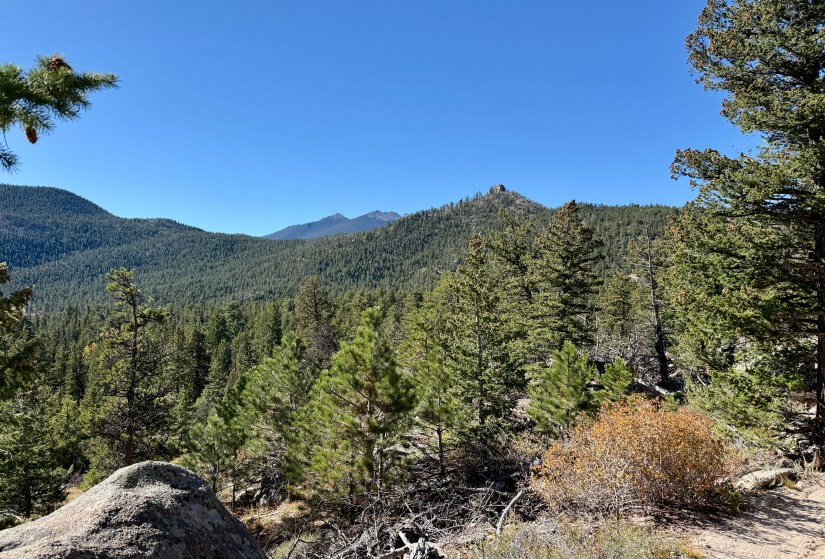
While the trail is all uphill to Kruger Rock, the first several miles are easy cruising and I found my mind wandering far away from the task at hand. Occasionally views towards the Continental Divide brought me back to reality, but otherwise it was a lot of rocks and trees and my lonesome dreams as I made the miles.


At 2.6 miles I reached the junction with Kruger Rock Trail, and turned right. Aside from a pair on mountain bikes, I had not seen any other people. This would change on the Kruger Rock Trail, though I’d hardly say the trail was crowded (I imagine a weekend, or summer, would be an entirely different story). The bulk of the elevation gain also starts on Kruger Rock Trail, with several super steep portions.


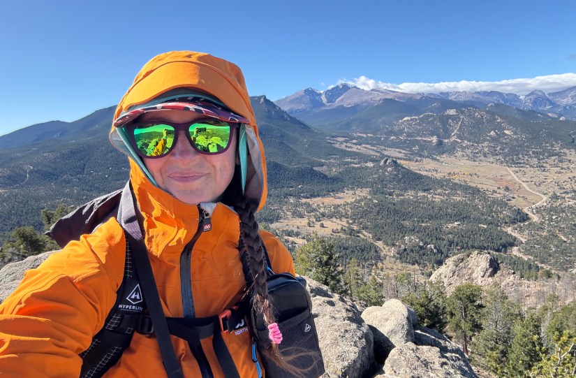
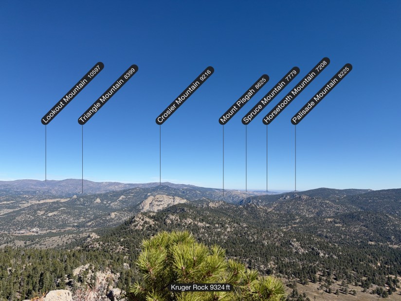
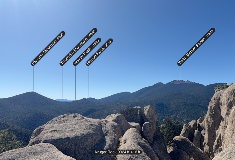
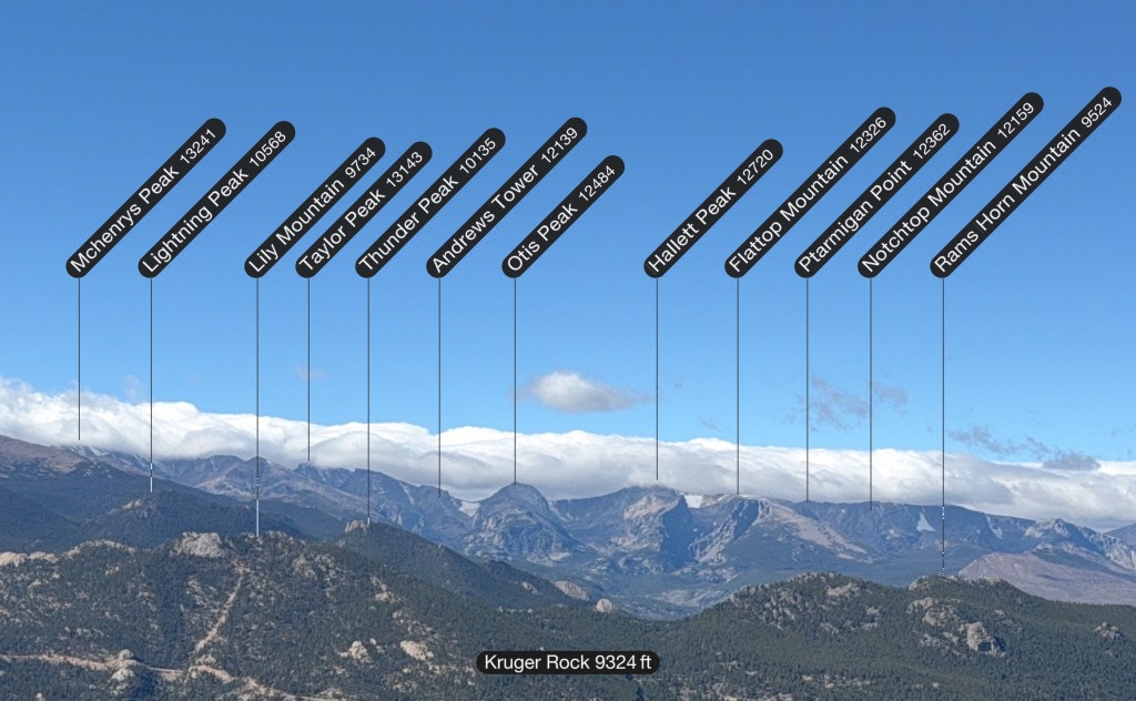
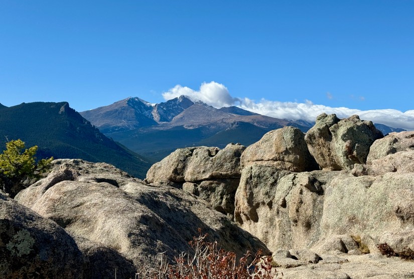
Reaching the summit of Kruger Rock at 9,338 feet involved a very short scramble through a granite rock cut. I found it easy enough at 5’10” tall, but those shorter may have bit longer reaches. The wind was howling, and I carefully walked along the exposed ridges for some photos before hunkering down out of the wind to have a snack.


After a snack, more photos, and chatting with a group from Missouri, I headed down to the return to the car on the same route, finishing out this out-and-back hike. I don’t always mind out-and-backs, as it provides different scenery on the way back. Once again, my mind wandered and I took to just walking fairly quickly.

Three hours and thirteen minutes later, I found myself back at the car, feeling accomplished with my hike and elevation gain. Though my brain was often not on the hike, it was another great morning spent in the trees and sunshine, which I sorely needed (I had to cancel a week-long trip to eight National Park Service units in New Mexico along with the Trinity Site Open House due to the federal government shutdown, so I was a bit down to say the least).
All in all, I enjoyed my hike to Kruger Rock. It provided insane views without committing to higher elevations hikes like Twin Sisters Peaks, Estes Cone, or Deer Mountain, and it was nice to have a shorter drive and empty trailheads – something not found when going all the way into Rocky Mountain National Park. The region around Estes Park offers up many great hiking opportunities that I am guilty of forgetting about due to the lure of the high alpine within the national park… here’s to getting out and exploring more of these gems!
Details:
All Trails Link
Date Hiked: October 17, 2025
Trailhead: Saddle
Total Mileage: 8.21 miles (Garmin Enduro 3)
Total Elevation Gain: 1703 feet (Garmin Enduro 3)
Total Time Spent: 3 hours 13 minutes
Weather: Sun and windy
Trail Conditions: Dry
Special Considerations: This hike starts in Hermit Park Open Space, and has a $10 entrance fee (2025). There are electronic fee stations at the entrance. Saddle Trailhead has vault toilets. Limber Pine Trail is a multi-use trail open to hikers, mountain bikers, horses, and dogs. Kruger Rock Trail is only open to hikers and dogs. Kruger Rock itself is in Roosevelt National Forest.

The view from Kruger Rock is gorgeous. Beautiful landscape and beautiful photos. Hiking 8.21 miles going upward in only a little bit more than 3 hours seems very fast. I am not sure I could do that.
LikeLiked by 3 people
Sometimes I just get in a groove and go fast! 😀 And usually I pay for it by being tired the rest of the day.
LikeLiked by 1 person
I love the beauty of the Estes Park landscape! Thanks for sharing. Peak storytelling with zero mud in the plot twist. 👏 A Cannon climb that stayed dry, dodged the tourist circus, and finished with a magnificent panoramic view! That’s how you summit in style—high gains, cool heads, and a sweet descent all the way around.
LikeLike