

“The Grand (Mis)Adventure” is a blog series chronicling my fourteen-day-turned-seven-day adventure in July 2025 through the rugged, awe-inspiring northwestern corner of Wyoming. From hiking and backpacking along the Continental Divide to paddle boarding on alpine lakes and camping under the stars, I’ll be sharing the highs, challenges, and misadventures from my summer vacation that didn’t go quite as planned.
July 17, 2025
Last March I decided on a whim to enter the advance access lottery for Yellowstone National Park backcountry camping permits. I’m notoriously unlucky when it comes to winning permit lotteries (looking at you, Mount Whitney, and your pals The Enchantments and Mount Rainier National Park), so I didn’t think much of it until I received an email I hadn’t before:

With a decent time slot awarded (roughly midway through the lottery period), I took to researching my options out of Yellowstone’s 293 backcountry campsites. Since only one itinerary can be booked with the early access time slot, I settled on a three-night, four-day journey across the north shore of Shoshone Lake and up through Lone Star Geyser Basin. Because the start and ending were at two different trailheads about 2.5 miles apart, I took to reckoning with myself on hitchhiking like proper hiker trash (it would help that the CDT thru-hiker bubble would be ramping up, so plenty of hiker trash with thumbs out in the park!). Several weeks later, I made the ill-fated invite to someone to join me on my trip (no hitchhiking needed anymore… or so I thought…).
I have to set the scene... Picture it, Yellowstone National Park, 2025... Have you ever been on your own vacation, and had the person you invited, along with the person they invited without confirming it was okay to invite someone else, make you feel like you weren't welcomed on your own vacation? Yeah... though rumblings of the misadventure had been increasing for over twenty-four hours, biting the bullet and all heading out on the backpacking trip was probably not a smart idea. But the day had arrived, and lesson learned, I was too nice to be like "whoa, this isn't cool, you both are no longer invited to my own vacation!" Into the wilderness we shall go...
Ahem. Now that that piece is off my chest…
This backpacking adventure’s planned itinerary was as follows:
- Day 1
- Start at DeLacy Creek Trailhead
- Hike down the DeLacy Creek Trail to the North Shore Shoshone Lake Trail
- Campsite: 8S3 Coyote
- Day 2
- Hike across the North Shore Shoshone Lake Trail
- Campsite: 8R5 Basin Bay Point
- Side quest: Shoshone Geyser Basin
- Day 3
- Hike up the Continental Divide National Scenic Trail (CDT)
- Campsite: OA3 Upper Firehole
- Day 4
- Hike through Lone Star Geyser Basin and onto Spring Creek Trail
- Exit the Divide Trailhead
(For ease of writing this post and the ones that follow – SPOILER ALERT! The trip ended after staying at Basin Bay Point, and Day 3 would consist of hiking out on the CDT to the Lone Star Geyser Trail and exiting at the Lone Star Geyser Trailhead.)

Hoisting my 35-pound backpack (and to think I dropped seven pounds from my base weight with upgrades this spring…), I immediately encountered the second deathiest part of the entire backpacking trip: crossing the highway from the parking lot to the start of the DeLacy Creek Trail! (If you’re curious about the number one deathiest part, stay tuned for the next blog that details the trail through Shoshone Geyser Basin!)

The DeLacy Creek Trail is a well-traveled trail, as many day hikers will do the out-and-back trip down to see Shoshone Lake. The trail descends through lodgepole pine forests before opening up over meadow views of DeLacy Creek, with teases of a distant Shoshone Lake. It was easy cruising, and I even found myself trail running a bit, because why not?


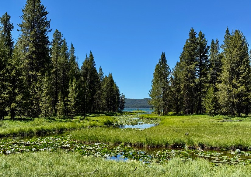
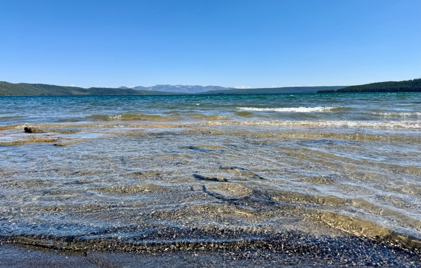
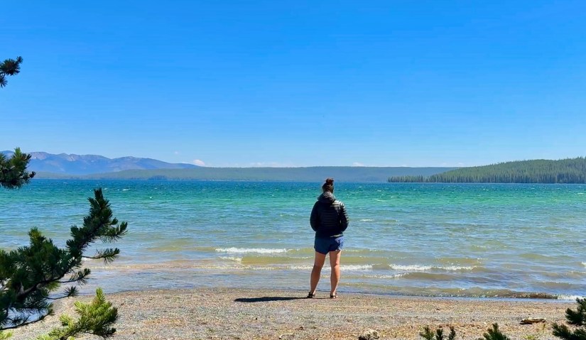
Three miles later, DeLacy Creek Trail ends at a junction with the North Shore Shoshone Lake Trail on the shores of Shoshone Lake. (At six miles round trip, reaching Shoshone Lake as a day hike is doable!).

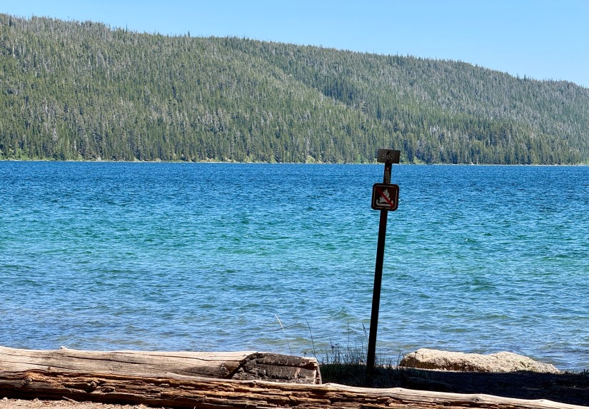
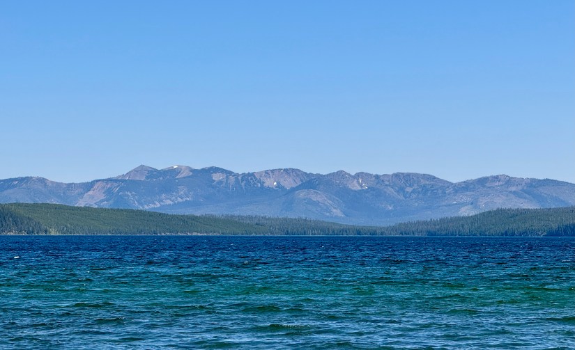
Shoshone Lake is the largest lake in the contiguous U.S. that cannot be reached by road (a.k.a. backcountry), and is the second largest lake in Yellowstone National Park. It is a popular backpacking destination, reachable by several trailheads and near a section of the CDT. Non-motorized watercraft can reach the lake via Lewis Lake and the Lewis Channel, and many boat-in backcountry campsites dot the shore. Other claims to fame include being the headwaters of the Lewis River (which drains into the Snake River) and Shoshone Geyser Basin, which lies on the southwest shore and contains one of the highest concentrations of geysers in the world – more than 80 in an area 1,600 feet (490 m) by 800 feet (240 m).

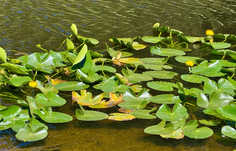

After snapping photos of the first views of Shoshone Lake, it was time to head west along the North Shore Shoshone Lake Trail to my backcountry campsite for the night, 8S3 Coyote. I decided to follow the map and trail, which landed me in a very marshy area thick with willows, with a a crossing of DeLacy Creek that was at least chest deep (I’m 5’10” for reference). Regular readers of this blog know I hate water, and since I was alone during my on-trail jaunt, I decided I would backtrack to the junction with the lakeshore, and see if there was a way to find the trail. I ended up doing a water crossing that was up to my shorts (I guess I’ll be seeing how fast trail running shoes dry on a trip!), but after walking up the shore a distance, and bushwhacking, was able to rejoin the trail.


After my bonus mile, it was an easy walk through the forest, with glimpses of the lake through the trails. Though this is a fairly “flat” backpacking itinerary, the terrain rolls up and down (plenty of “PUDs,” or “pointless ups and downs”), and has some surprisingly steep sections, though they remain fairly short. By the time I ran into the sign marking the path down to the campsite, I was ready to ditch my pack and enjoy some hammock time!


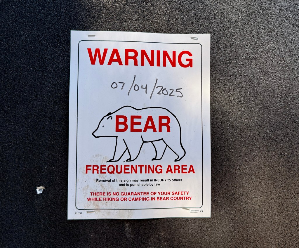
All backcountry campsites in Yellowstone are equipped with a food hang pole (most common), or a bear box (rare). All food and smellies (like toiletries, chapstick, soap, etc) should remain near the food hang pole. Tent pads are set back a significant distance from the food area (and for the love of all things holy, don’t whip out your bag of potato chips and start chowing down in the tent area!). If you are not using a hard sided grizzly-rated bear canister (like a Bear Vault), you will need to hang your food & smellies at least ten feet off the ground on the food hang pole (my favorite ultralite hang kit is from Hyperlite Mountain Gear, and I like to use a Hilltop Packs dogbone to hang using the “PCT method“).

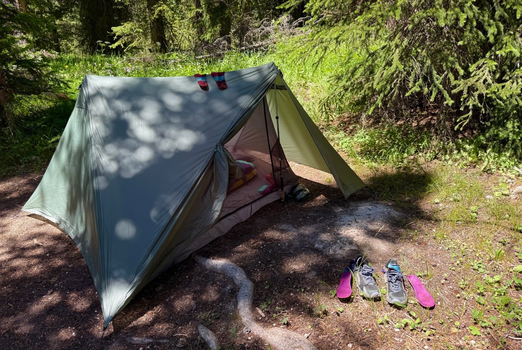
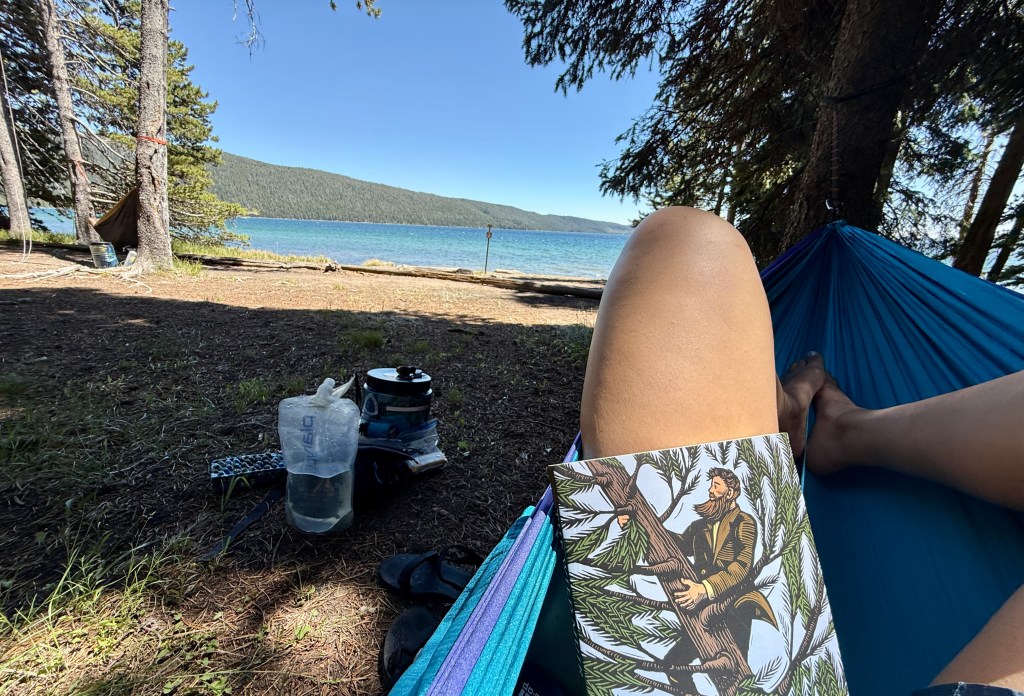
8S3 Coyote is a beautiful backcountry campsite in my opinion! It is right on the shores of Shoshone Lake, and there are great rocks on the shore which makes it easy to sit back and enjoy the expansive views across the lake to Mount Sheridan and other mountains.
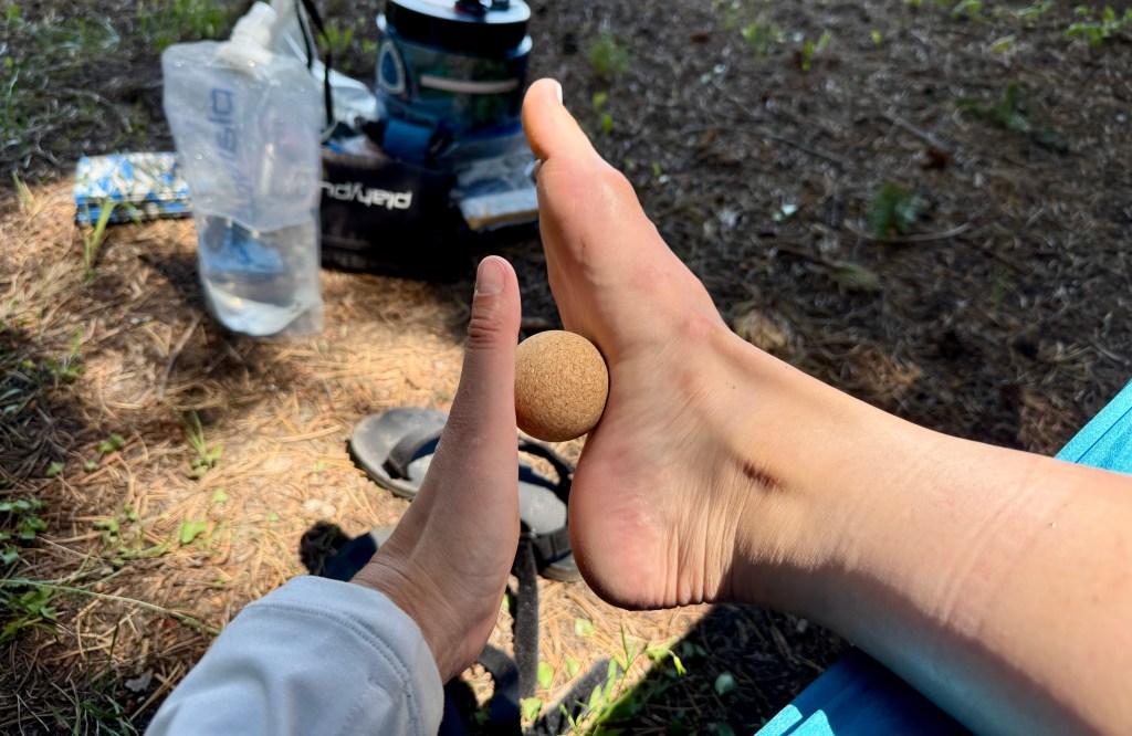
I hauled my atrociously heavy hammock (all 2.5 pounds of it… definitely some luxury weight!), and it was well worth it for this day. I chose a spot where I was shaded by the tall lodgepole pines, but still had a view to the lake. I read, rolled out my feet with my cork massage ball, and took time to just stare at the sky after a lunch of a tuna wrap. I honestly have come to love just doing nothing out in the woods. I’m content just staring at the sky or roof of my tent. I know it is not for everyone, but damn it was nice to have no cell service and just be faced with nothing to do or worry about.


The mosquitos turned increasingly aggressive, so I prepared an early dinner of an experiment suggested by a friend of pre-cooked pasta, packets of Italian dressing, packet of olive oil, and packet of pre-cooked chicken. It wasn’t bad, but definitely did not hit the spot like a warm Mountain House would’ve. As I dabble with thru-hiking thoughts, I am trying to think outside of the box on meals. Maybe I’m not ready to be hiker trash quite yet…

After dinner I retired to my tent, though I occasionally ventured out of my tent to look at the lake and to take pee breaks (I was well hydrated apparently!). It was a fairly early bedtime, and I decided to sleep with ear plugs to block the sounds of every snapping twig from letting my brain run wild!


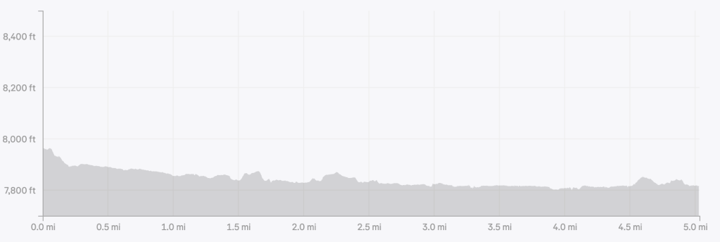
Trip details (all data recorded on Garmin Enduro 3):
- Mileage: 5.03 miles
- Elevation gain: 200 feet
- Time: 2 hours 6 minutes
- Start: DeLacy Creek Trailhead
- End: 8S3 Coyote backcountry campsite
For more information on backpacking in Yellowstone National Park, please check out their official webpage which will have all the details on permits and regulations!

PUDs. I’m totally stealing that, I love it!
Also, how did I not know that Shoshone Lake was only 6 miles roundtrip? How have I never been there? Clearly this must be remedied. It’s so pretty!
LikeLiked by 1 person
Right?! It’ll at least get you down to the shore to see it! Shoshone Geyser Basin is a much longer hike, like 10 miles each way from the nearest trailhead, which is also must-see IMO, but probably best as an overnight. I got the PUDs thing from a CDT thru-hiker I am following this year!
LikeLiked by 1 person