

Two Girls Roving: The tale of a 16 day, 3522 mile road trip to the Pacific Northwest in celebration of my friend’s college graduation! Follow along for all the shenanigans through thousands of miles, eight National Park Service units, night after night of camping, and even some coastal backpacking!
August 30, 2024
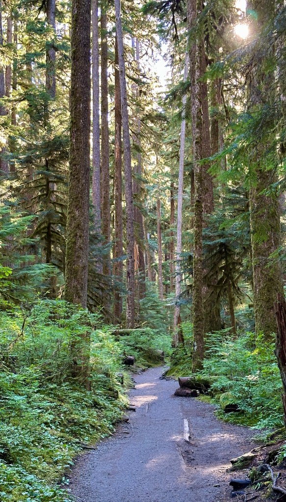
Waking up in a lush forest calls for a slow morning with a full breakfast. We didn’t always have the privilege on this trip of a “sit down” breakfast, so a big batch of hashbrowns with sausage was cooked up as we lazily packed up camp. Before check out at 11am Janice and I had one hike we wanted to complete before heading out – chasing Sol Duc Falls!

There are several ways the hike to Sol Duc Falls can be accomplished. The first is the shortest and most straight forward, being 1.6 mile round trip from the trailhead at the end of Sol Duc Road. Another popular option is the Lover’s Lane Loop, coming in at around 6 miles and one that can be started from numerous spots, including the official trailhead, or the hot springs resort, or campground. The route Janice and I took was an out-and-back on the B-Loop Trail right from our campsite.
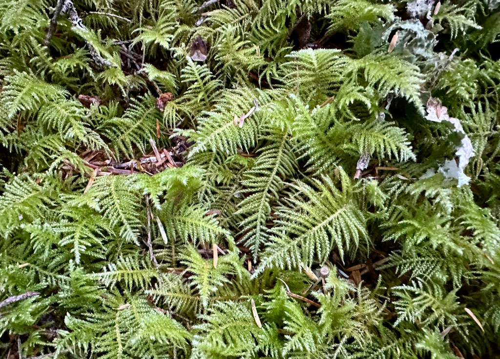
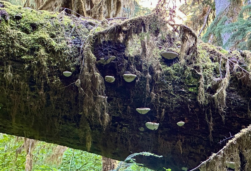
With our morning start, Janice and I had complete solitude in the old-growth forest as we headed towards the falls until we joined with the trail from the trailhead (then the crowds appeared). We waded through thick, lush ferns, and stop all too often to admire various fungi. Sometime during the trip Janice decided she was Fern Woman, and I decided I was Moss Lady, so much of our chatter was about finding various homes for ourselves amongst the foliage.


Sol Duc Falls sits on the Sol Duc River. While not the largest waterfall you can come across in Olympic National Park, it is still well worth the hike, whatever route! This waterfall reminded me of a miniature, and much greener, version of Kolugljúfur, which is in northern Iceland.


Waterfall successfully chased, we hiked back to our campsite on the same route as we came in. A highlight was Janice spotting a banana slug on the trail – our first! I am not a fan of slugs whatsoever, but the little creatures grew on me by the end of the trip.

What a great way to start the morning! Overall our hike was 4.4 miles with 446 feet of elevation gain, taking just about two hours. Since we had packed up camp before starting our hike, all we had to do was use the restrooms one last time before jumping in the car and heading on our way.
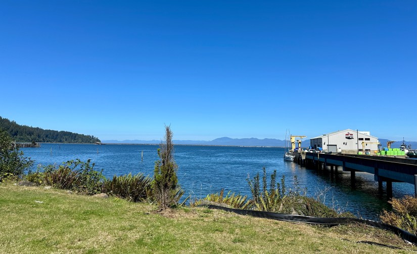
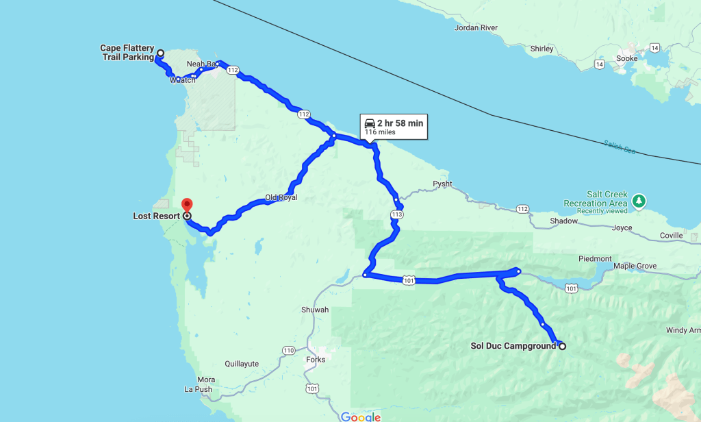
Now it was time for a long bit of driving as we headed towards the furthest point northwest in the Lower 48, Cape Flattery. The highway turned more and more narrow as we hugged the Strait of Juan de Fuca. I do not think Janice enjoyed driving this road, but I was giddy at the thought of how much fun my turbo Subaru would’ve been to drive. For some reason I took no photos during the drive, so imagine a narrow road with water next to it!

In Neah Bay we stopped at the visitor center for some souvenir decals, and the gal working there suggested we grab Indian tacos around the corner of the building at Pat’s Place. This sounded like a great idea, so we headed there. I think Janice would be disappointed if I did not tell the tale of the Indians tacos, so here we go…
We wander in the front door, and Janice cheerfully asks what they serve. The Unimpressed Woman at Counter barks at us that we need to read the menu that is behind the building. Okay… so we head out there, decide what we want after reading the menu, and go back in to order. Janice orders up a supreme, and because I hate sour cream, I ask for “a regular taco.” Unimpressed Woman at Counter looks me dead in the eyes and goes “Clearly you did not read the menu.” For one of the rare times in my life I was rendered speechless by another human. The cash transition was completed without another word said between Unimpressed Woman at the Counter and I. Janice was saved from having to break up a fight. It has now continued to be a running joke between Janice and I that I am unable to read, per some woman in Neah Bay, WA because I dared to call the “Plain Indian Taco” a “Regular Indian Taco.”

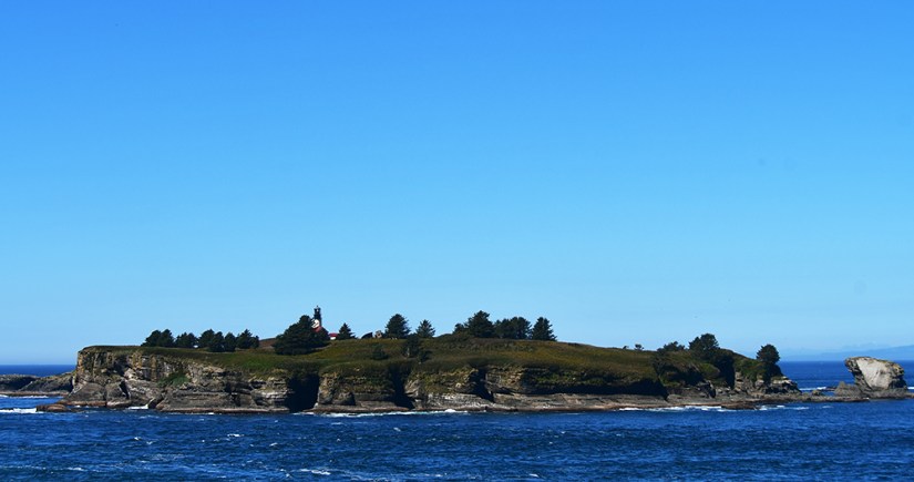
Bellies now full of plain and supreme tacos, we headed towards Cape Flattery, the further northwest point of the Lower 48. I love visiting “furthest” (or highest) points, so I had been eying visiting for several years (Janice and I had to skip this in 2021 as the tribal lands were still closed due to the Covid pandemic, and I could not visit in 2022 because Covid vaccination was required and not everyone in the group was vaccinated). We cruised through the checkpoint as I had purchased our Makeh Recreation Permit on line (required for entering Neah Bay and Cape Flattery), and luckily found parking in the crowded parking lot.


A soggy, rooty, and sometimes steep-ish trail leads you to the tippy-tip, where I turned around to admire that the population of rest of the Lower 48 was to the southeast of me. Technically Tatoosh Island (with its Cape Flattery Lighthouse) is the most northwest point, but I decided for the purposes of my trip it doesn’t count as it was in the ocean and not physically touching the rest of the contiguous U.S.
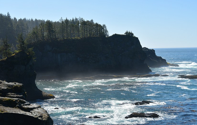


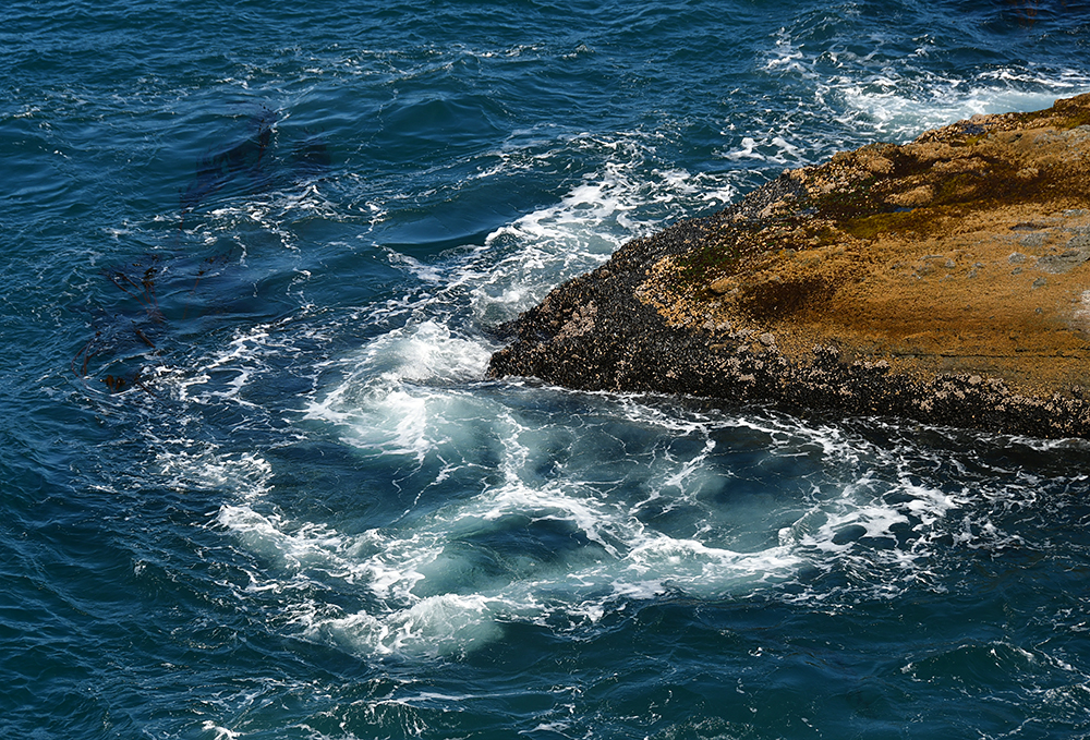


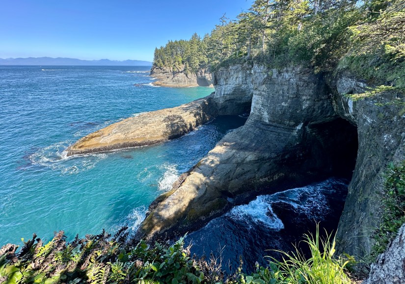

The crowds were a bit insane, and I do not think either of us were having a lot of fun. It is rare that I am let down by something I had been excited for, but I think Cape Flattery did let me down. Not because it is not beautiful – it is! – but the crowds, gag-inducing parking lot restrooms, and the taco experience kind of soured my experience. We were ready to get back on the road and head to camp for the night.
Back along the sometimes crumbling and narrow road along the Strait we drove (with my eyes on swivel looking for otters for Janice… this whole trip would be ruined if she did not see an otter at least once!). We turned off on Hoko-Ozette Road, and drove into what felt like the most isolated, middle-of-nowhere place we would experience on this trip. One of those drives that makes me eye the occasional house with a bit of suspicion of “what exactly do they do for jobs out here?!”
With brief glimpses of Washington’s largest natural lake, Ozette Lake, through the trees, we turned off just shy of the Olympic National Park boundary to the Lost Resort, our home for the night. We could’ve looked to see if the park’s campground had some spots open, but it was nice to be close to the Lost Resort store. We checked in, and had our pick of spots (which I am so happy we arrived early as the place really filled up after dark!). Janice and I had some packing to do, as the next day we would head out on a two-night backpacking trip on the Ozette Triangle route.

Travel states, facts, & things with no context from Janice and I:
- ~116 miles and 3 hours
- 1 NPS unit visited
- Olympic National Park
- $30 fee (good for 7 consecutive days) or use an annual federal lands pass such as the America the Beautiful pass
- Olympic National Park
- Makeh Recreation Permit
- Required to enter Neah Bay and Cape Flattery
- $20 – can buy online in advance or in Neah Bay. Good for one year
- Chase the waterfalls
- Read the menu, Heidi
Accommodations for the night:
- Lost Resort at Lake Ozette
- $40 for tent site (2024)
- No cell service (Verizon)
- The good:
- General store and pay showers on-site
- I believe it was $3 or $5 for a shower since we stayed at the campground, and the host honored the stay price when we showered after our backpacking trip days later.
- Beer by the can from local breweries!
- Close to Ozette Coastal Trailhead
- No reservations needed
- Cabins are available to rent
- General store and pay showers on-site
- The bad:
- Outside of the national park, and allowed campfires. This was the only time on the trip I had to treat my allergy to campfire smoke. This is a big bad for me, but I get a lot of people like campfires.
- The campsites were of varying quality. We were happy we arrived early and could get a good pick.


Leave a comment