

A sign of a good vacation is when you come home even more exhausted than when you left, right? My latest adventure to Washington sure felt like that! The main objective of the trip was summiting Mount Adams, but my bestest adventure bud, Eric, and I were just not just going to stop at a volcano climb. Here’s a part two of the little wrap up of the whirlwind adventure we had! (Read part one here.)
Takhlakh Lake
After summiting and then descending down Mount Adams, our adventure was hardly over. Refreshed by body wipes and cold Gatorade, we headed north to find new views and mountain tops. We made a quick detour to Takhlakh Lake to feed the mosquitos (they were so BAD!) and gawk at the volcano we had been on top of just hours before. There is a campground here and hiking, but things were busy and the mosquitos (and campfire smoke) had us heading for greener pastures.


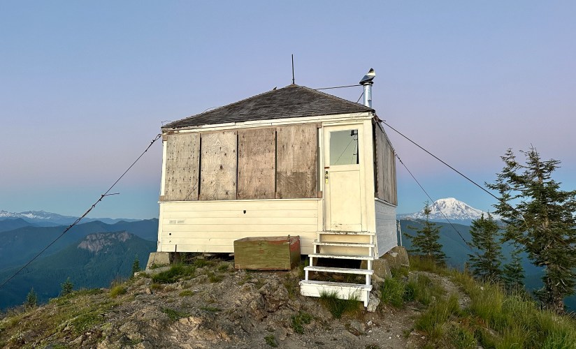
Burley Mountain Lookout
With the trip’s mountaineering objective behind us, apparently Eric pivoted us to fire lookout chasing, which was fine by me as I gain more and more of a fascination with these disappearing pieces of history. As one of only three fire lookouts remaining in the Gifford-Pinchot National Forest, the lookout on top of Burley Mountain would be our stop after a busy day of climbing. We followed the rough and bumpy 4WD road, racing sunset.

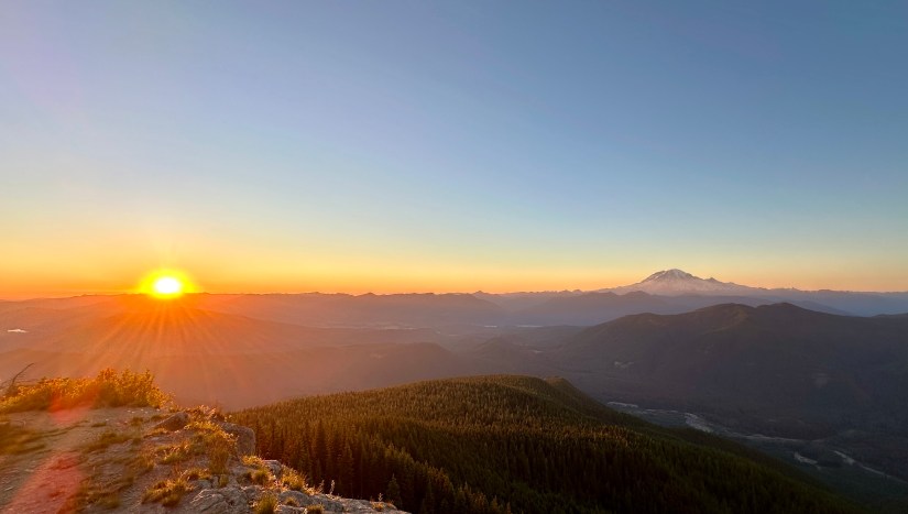
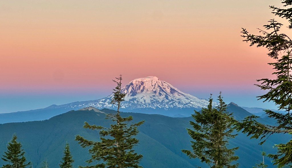
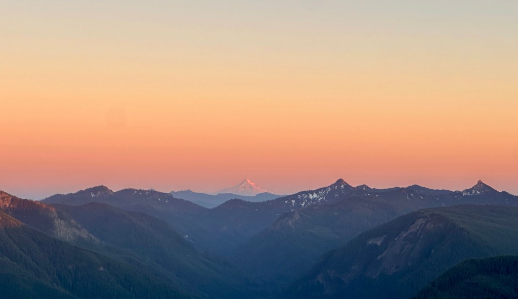
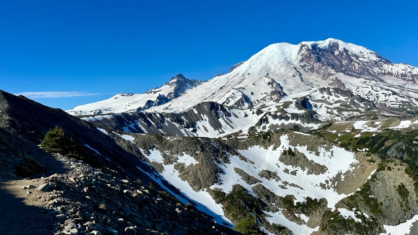
And what a sunset it was at 5,130 feet! Hands down one of the best sunsets of my life as I spun around to take in Mount Rainier, Mount St. Helens, Mount Hood, and Mount Adams in one fantastic 360-degree view. There was another couple enjoying the view, and we chatted them up as the darkness crept across the horizon.


Eric and I found camp for the night just below a newly installed gate, signaling changing times (we never did get a clear answer on what the gate was for when we stopped in at the ranger station in Randle).
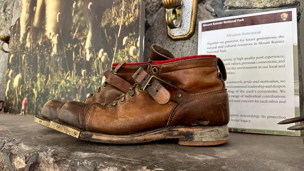
Mount Rainier National Park – Ohanapecosh
After a morning of remote work and breakfast served up to me in the tent, Eric and I packed up and headed out to find more adventures to wrap up an exhausting few days (well, weeks in Eric’s case). As record crowds brings timed entry reservations across the National Park Service system, we wouldn’t have been able to enter the Paradise or Sunrise Corridors of Mount Rainer National Park until late afternoon. Thankfully the Ohanapecosh area was outside of reservations, and at least would whet my appetite for passport stamps!
We eventually found parking along State Highway 123, and walked in the heat down to the visitor center, where I found my precious passport stamps and loaded up on souvenirs. We took a quick peek at the Ohanapecosh River before heading back to the truck. Did we do this area justice? Heck no. But parking, crowds, and heat meant it was a big enough adventure for the moment.


Stepping foot on the PCT
I’ve been known to binge watch YouTube documentaries on thru-hikes of the Pacific Crest Trail (or PCT) from time to time, and I realized I had never actually stepped foot on the PCT in all my travels. As we drove from Ohanapecosh to outside of the Sunrise Corridor, we took a quick side trip to the Naches Peak Trailhead by Tipsoo Lake so I could walk about a quarter-mile of the PCT. Check this off the list!


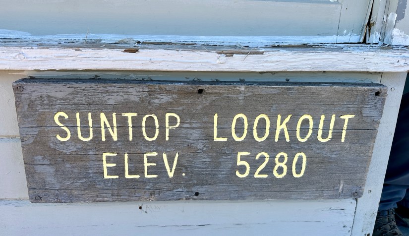
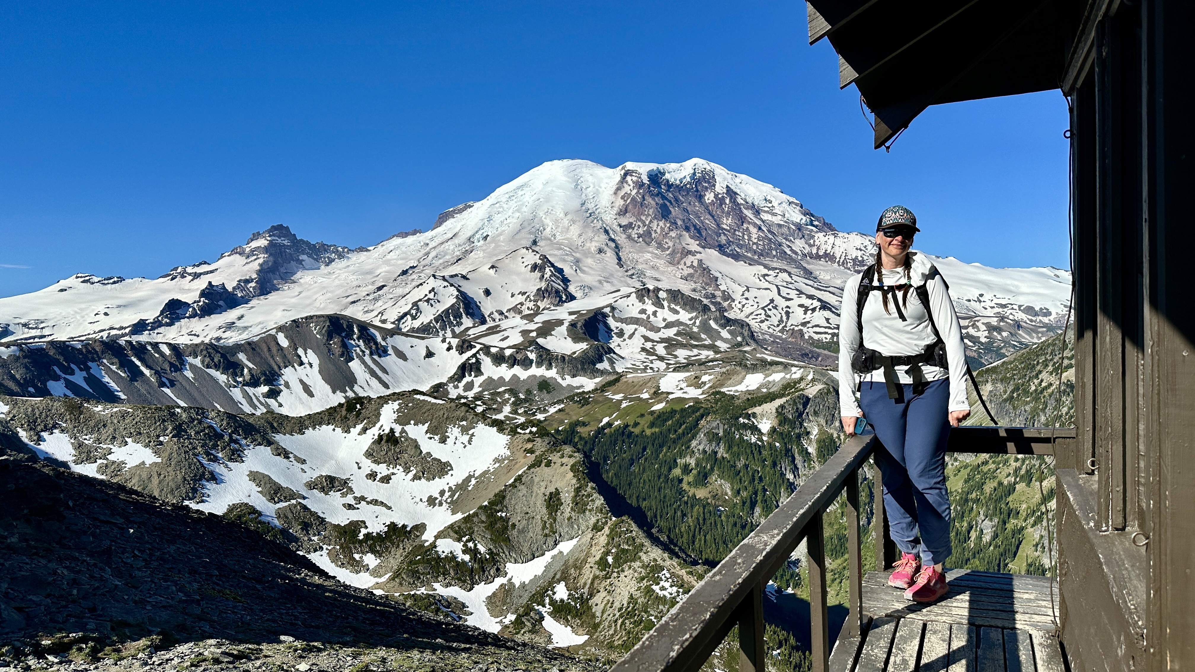
Suntop Fire Lookout
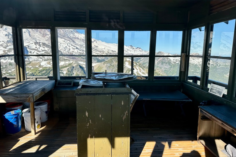
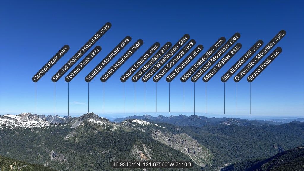
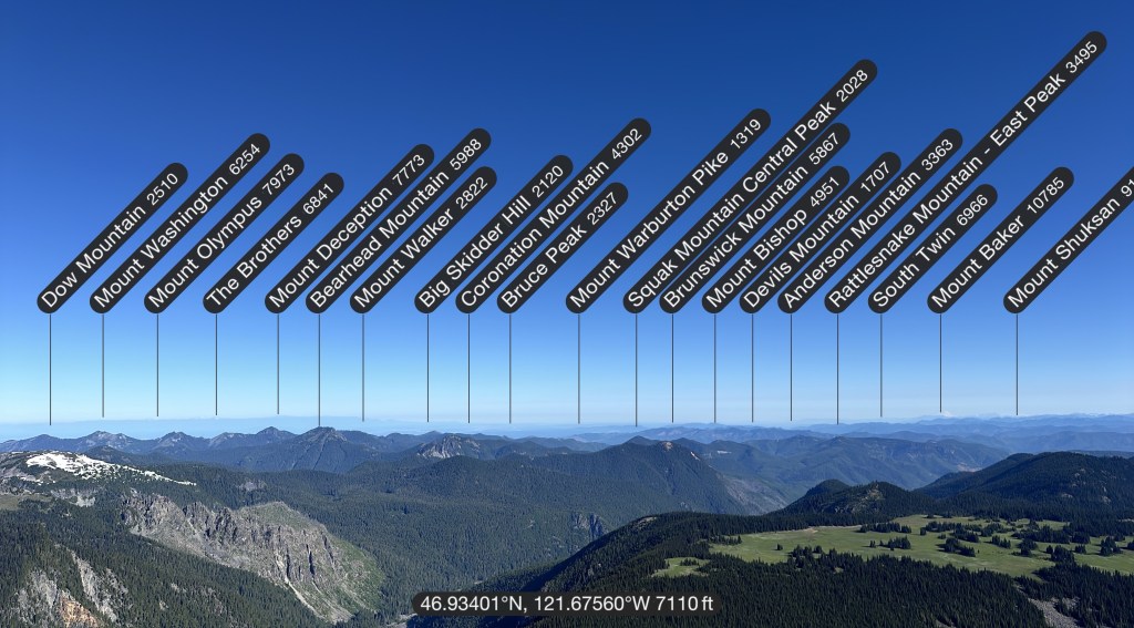
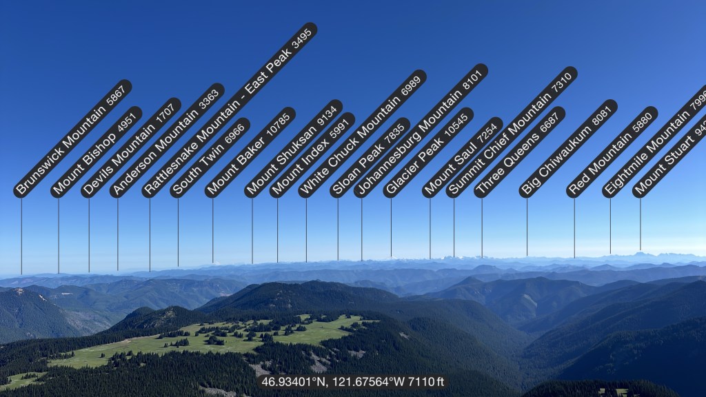
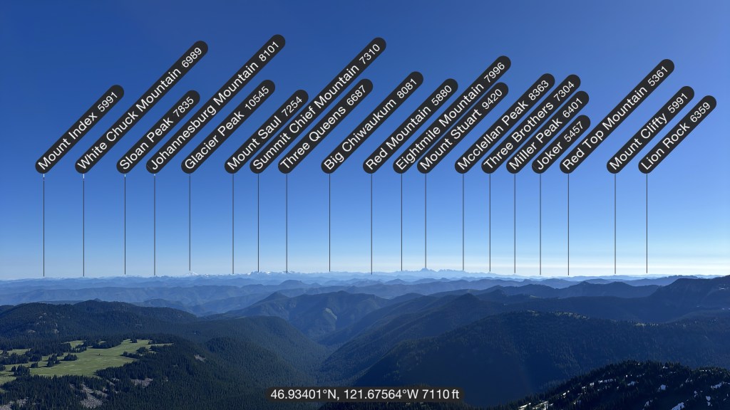
Happy surprises are always the best, and as we rounded the corner on the road and realized the gate to drive to Suntop Fire Lookout was open, I’m pretty sure Eric squealed a bit in delight (and I was happy I got to avoid a mile walk… I mean, we did summit Mount Adams the day before!). Built in 1933 and located in the Mt. Baker-Snoqualmie National Forest, Suntop is one of (if not the only) fire lookouts that had been made ADA-accessible (which I find to be incredibly cool!).

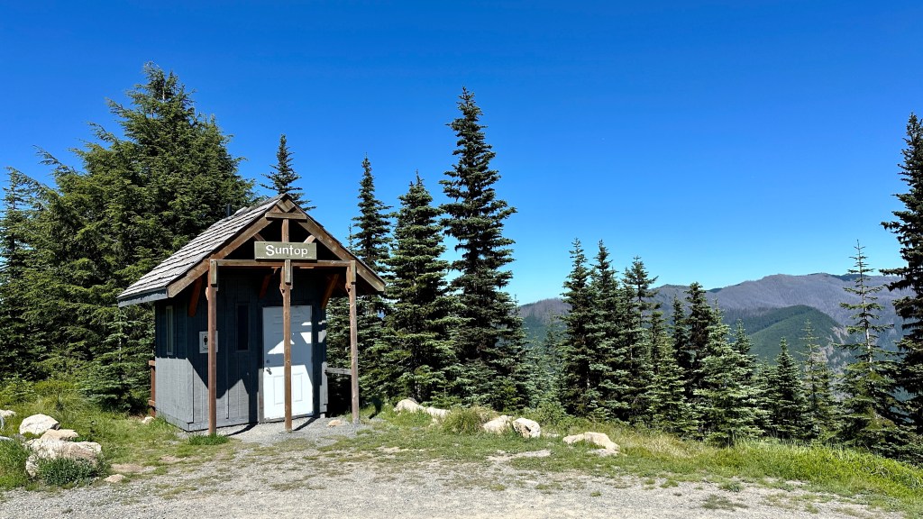


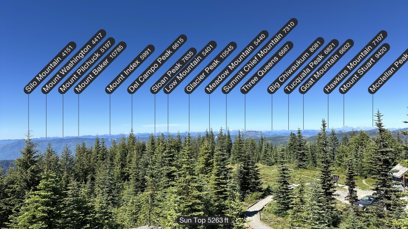
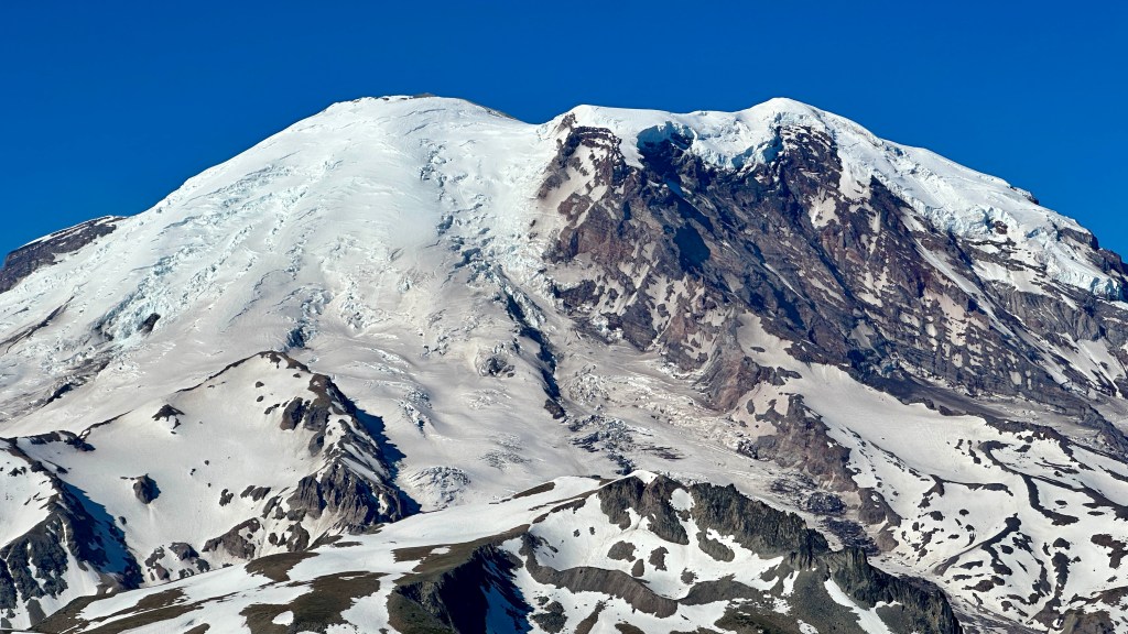
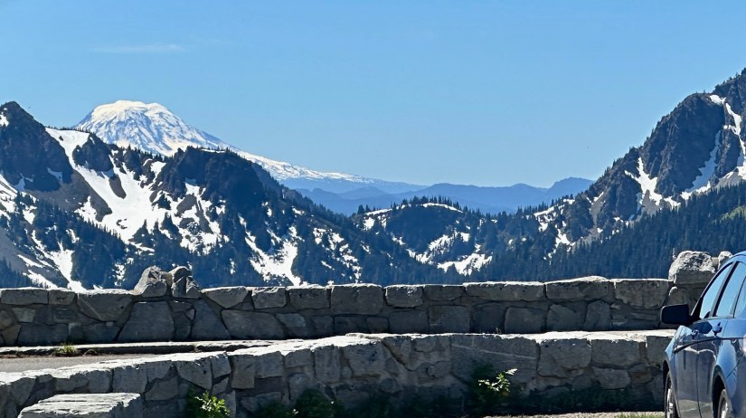
The lookout was staffed, so we enjoyed chatting with the volunteer, and Eric traded patches with him. I took to marveling at how I could see Mount Baker and Glacier Peak in the background (and not to be forgotten, Mount Rainier which is only ten miles away).


We found camp for the night just down the road from Suntop, and enjoyed views of Mount Rainier throughout the evening. The campsite was crawling with hoverflies, but luckily they weren’t trying to eat us so we survived.


Mount Rainer National Park – Sunrise & Mount Fremont Fire Lookout
Timed entry reservations begin at 7am in Mount Rainer National Park for the Sunrise Corridor, so early morning alarms were set on our final day of adventuring so we could aim to be through the entrance station at 6:30am. One more fire lookout was on tap, the Mount Fremont Fire Lookout.

Sunrise is the highest point one can reach in the national park by vehicle, sitting at 6,400 feet (I managed to come to Washington and stay at my “normal” home elevation the entire time practically!). The road is late to open (opening just the day before we visited), but this doesn’t stop Sunrise from being the second most visited area of Mount Rainier National Park. Even with our early arrival, the parking lot was teeming with people heading out on various day hikes. We eyed Eric’s crazy blisters, begrudgingly put on our backpacks, and set out on one last hike (when I say we were “rode hard and put up wet” over this whirlwind of an adventure, I’m not being dramatic… we were tired!).


With 1,200 feet to gain on this 5.8 mile hike, my legs protested but I was soaking in the views of the Emmons Glacier and Mount Rainer in general. Eric’s hiking legs had finally found him, so he was leaving in the dust as I wheezed and puffed in an effort to keep up. Built in 1934, the Mount Fremont Lookout is the highest of the four lookouts located in Mount Rainier National Park at 7,181′.


After we knocked out the hike we headed into the visitor center for customary passport stamping activities (including nabbing the 125th park anniversary stamp!) and I finally bought a toy banana slug I had been eying since Bonneville Dam. We enjoyed views of climbers through the binoculars, and eventually killed enough time that the big gift shop opened so we bought all sorts of souvenirs.


That sunset is gorgeous, oh my gosh! And yay for Mt. Rainier! Will you be climbing that one someday?
LikeLiked by 1 person
I want to! I just am leery of doing it guided as I worry about being in a group of non-acclimated people and having that impact my climb (downside to solo travel), but finding mountaineering friends in our area that are experienced in glacier travel is a rarity. I’ll probably do Mount Baker sometime soon, and keep trying to find mountain buddies!
LikeLiked by 1 person
Totally understandable. I have almost no mountaineering experience so I think I’ll have to go with a guide, but I’ve definitely worried about that too. It’s total luck of the draw.
LikeLike
Sounds like we are hatching a plan… if we pack the trip with people from Colorado who do 14ers (therefore can handle the elevation), we’d be golden!!!! 😀
LikeLiked by 1 person
Ooh I love it! Perfect!
LikeLiked by 1 person
Wow so many beautiful mountains. I have not been to Washington yet, well Washington DC, but there are no mountains there. I have to visit Washington state. Gorgeous photos.
LikeLiked by 1 person
Washington state is so beautiful, I hope you get to visit one day!
LikeLiked by 1 person