

Sometimes you just need a wee lil’ mountain to climb! Luckily there was such a mountain tucked up Poudre Canyon in the Cache La Poudre Wilderness Area: Mount McConnel. With a summit elevation of 8,008 feet, Mount McConnel seemed to me like a great way to gain some elevation without committing to a longer drive, logistics, early alarm, high altitude, and just all the other things that usually come with climbing a mountain December.
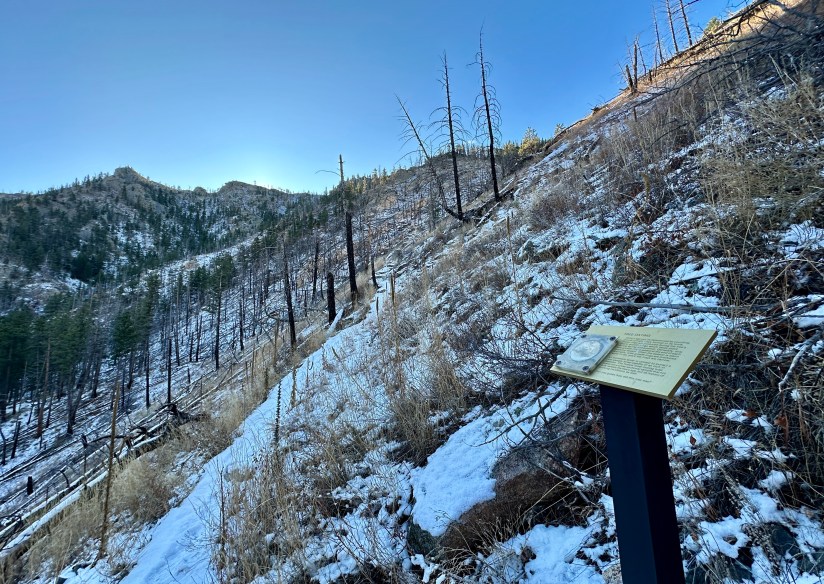
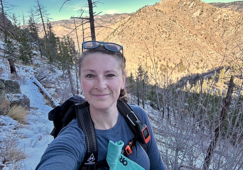
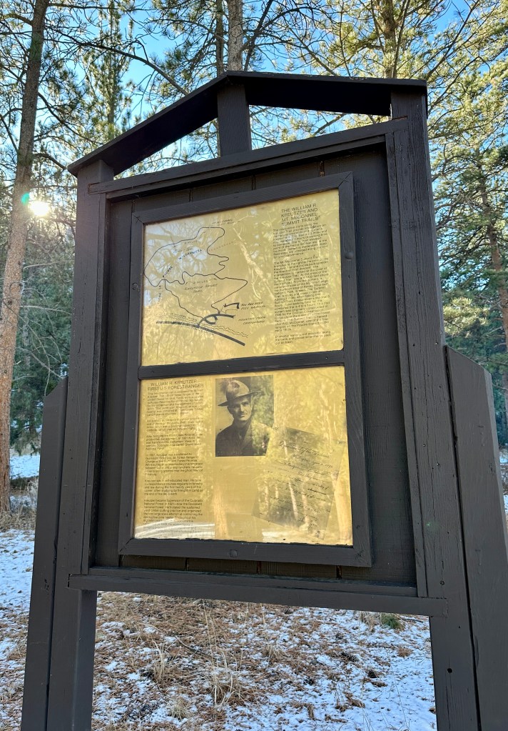
I arrived outside the Mountain Park trailhead about 9:30am. Closed during winter months, there are a few limited parking spots outside the gates. I joined one other car on this Saturday morning (about four or so more cars were parked when I finished). Mount McConnel can be hiked variety of ways, including as an out-and-back and loop. I chose to complete a loop, going clockwise and starting out on the Kreutzer Nature Trail immediately to the left after the bridge. For some fun history facts… Kreutzer Nature Trail is named for William Kreutzer, the first forest ranger in the U.S. (1898), and Mount McConnel is named after RC McConnel, one of the first rangers in the Poudre District in the early 1900s.


Though not a particularly long hike (4.85 miles total), there is definitely some stout elevation gain. The eastern leg of the loop is definitely the steepest, and I found myself thankful to be going up versus navigating the thin snow and ice descending. While I did not use microspikes because I felt confident in the boots I was wearing, they could definitely be helpful the snow has consolidated a bit more into ice, or if descending.

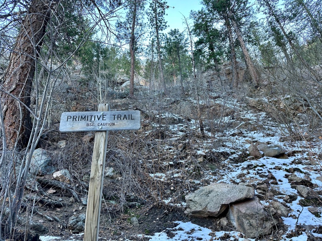
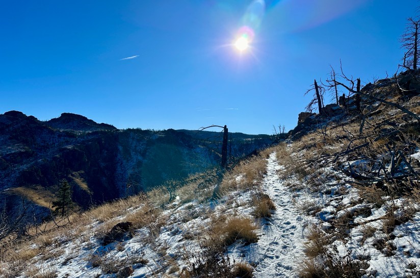
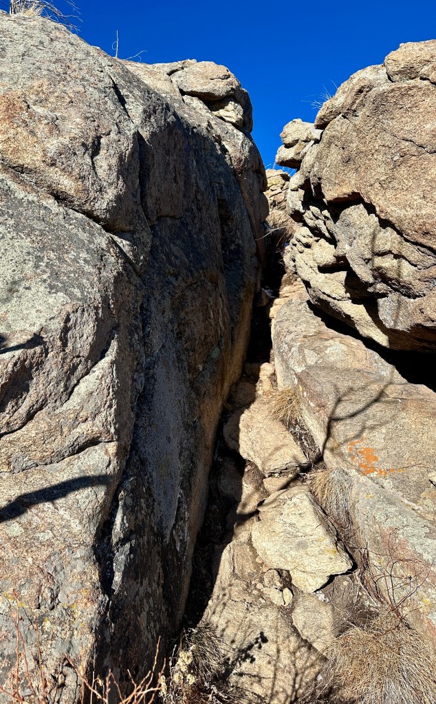
After about a half of a mile, Mount McConnel Trail splits off to the left from the Kreutzer Nature Trail. This portion is referred to as the Primitive Trail, and many online reports will lead you to believing there is death and destruction awaiting those who tempt it. Though there is a lot of exposure and some stupidly steep portions, I feel like it maybe isn’t has primitive as I was expecting, and way-finding was simple (never had to actually find the trail – maybe snow helps?). I will say this is not the best trail for children and those wary of exposure and heights. And I was very happy to be going UP, not down it.

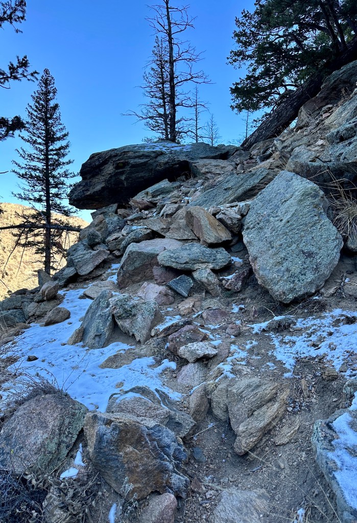

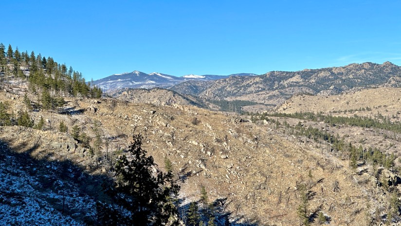
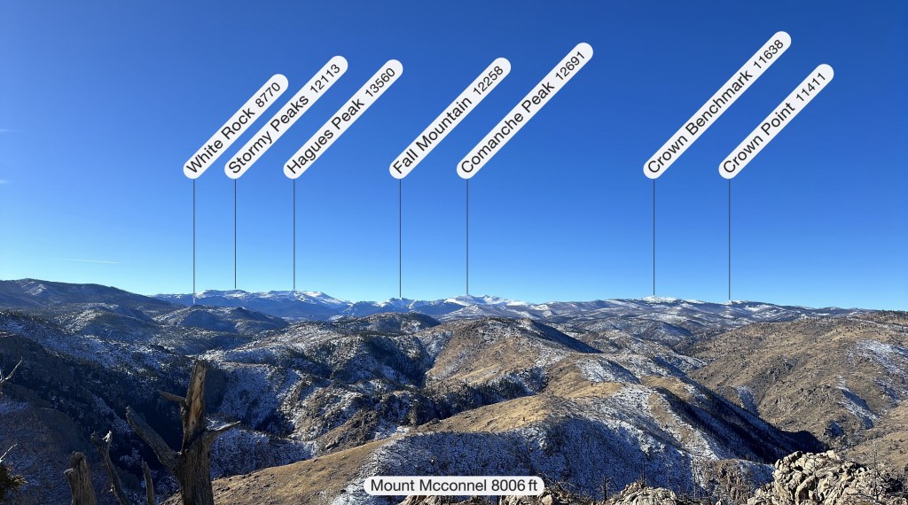
The steep climbing does eventually level out to more moderate grades, and I was able to cruise along in the sunshine relatively quickly. The views were pretty, to boot!
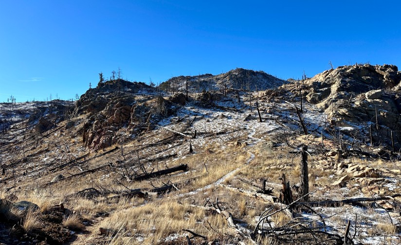

At 2.5 miles there is a split to go to the actual summit of Mount McConnel. I had read a recent review that the sign had been knocked over, but luckily someone had righted it, so I had no problem seeing the spur trail. By now the wind was really ripping, and the short scramble to the summit was made a bit more interesting (didn’t blow away, yay!).


Thanks to the wind I did not hang around long on the summit, and headed back down, turning left so I could complete the loop. This side is more gradual in its grade, and has nice switchbacks (and less exposure). The trail rejoins with Kreutzer Nature Trail about 0.8 miles from the trailhead.


A short and sweet one on this day, but I was pleased by the trail and views. Mount McConnel seems like a good winter option for a bit of elevation gain without dealing with the things that come with higher altitude. Though I cannot speak for what the trail is like in peak season (I’d imagine it can feel quite hot in the summer months with lack of shade, though), Mount McConnel appears to be a quieter option compared to nearby Hewlett Gulch and Greyrock Mountain, which often fill their trailheads even in the winter months.
Details:
Date Hiked: December 16, 2023
Trailhead: Mountain Park
Total Mileage: 4.85 miles (Garmin Forerunner 255s)
Elevation Gain: 1525 feet
Time: 2 hours 26 minutes
Weather: Sunny and wind (especially strong on the summit)
Trail Conditions: Few inches of snow or dry
Special Considerations: Day-use fee is in affect when Mountain Park Campground is open. During the winter months, limited parking available outside of closure gates (but do not block gates with vehicles). There are many steep drop offs along the trail, which can be unnerving to those fearful of exposure, and may be inappropriate for young children.
