
Oh man, where do I even start on this one?! (It is going to be long, so get comfy!)
To say it was a long time coming with a lot of weird anxiety around it would be an understatement. Leading up to it I was 0 for 2 on attempts in 2022… heck, never even got to start (weather the first time, COVID the second time). When I got the invite about five weeks out for a May 6th attempt, I begun my every-six-hours ritual of refreshing mountain-forecast.com and not even saying the name of the mountain out loud for fear of jinxing the whole thing. Very few people even knew where I was heading on that early morning flight May 5th…
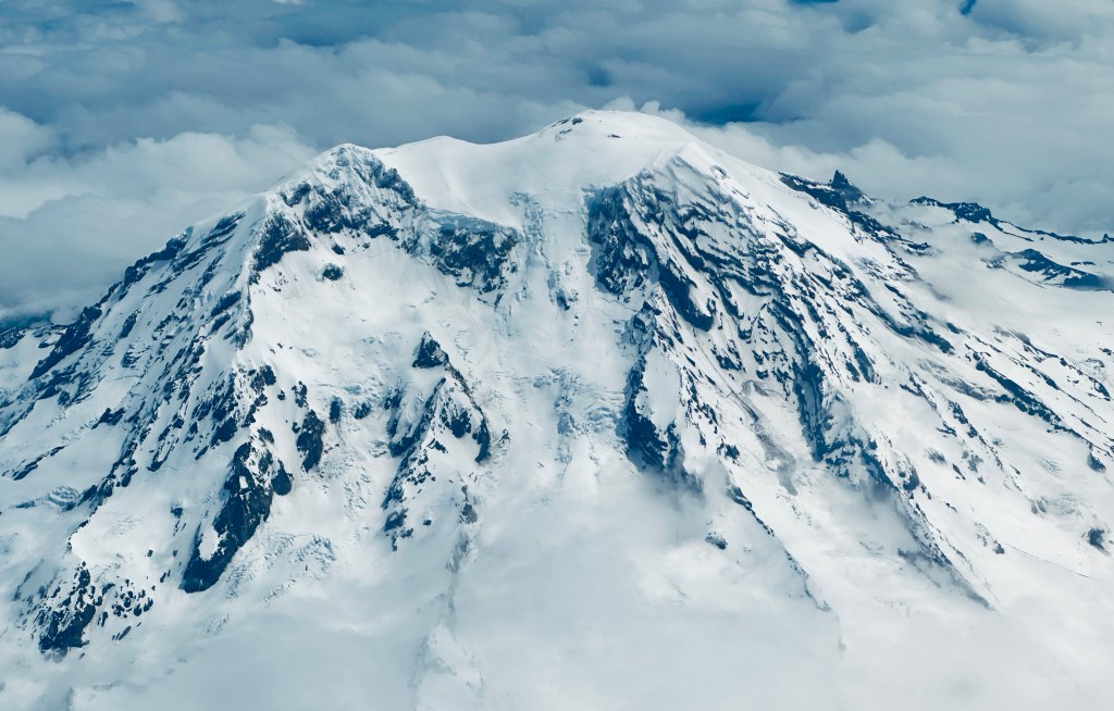
Mount Saint Helens. The topic of the very first National Geographic magazine I read as a child, and a stratovolcano that once was Washington’s fifth highest peak… until it blew its top off on May 18, 1980. A volcano muse, and the one that made me gasp when I first caught glimpse of the north side from Johnston Ridge in 2021. Maybe time to finally do this?
A 3am alarm came early, but I had managed a full night’s sleep, and quickly made coffee, showered, and headed out to the airport for my 7:30am flight to Seattle. I made the mistake of placing an AirTag in my checked bag, which led to me anxiously refreshing that app, all the while refreshing mountain-forecast. (Yes, the bag made it on the plane!)

My pilot must’ve known I was off to an exciting adventure, and we landed thirty minutes early – impressive since we were flying west and usually don’t make up time going into the jet stream. SeaTac baggage was slow like always, which gave Eric and his cousin, Brad, time to make it to the airport to fetch me. We quickly stopped by Eric’s house to pick up snowshoes, and then it was time for the long drive. We broke up the drive with a stop at the Nisqually National Wildlife Refuge to finally get the passport stamp (of course when I didn’t have my Blue Goose Passport with me), watching conspiracy theory videos, and watching a semi truck explode on I-5 (literally engine pieces flying).
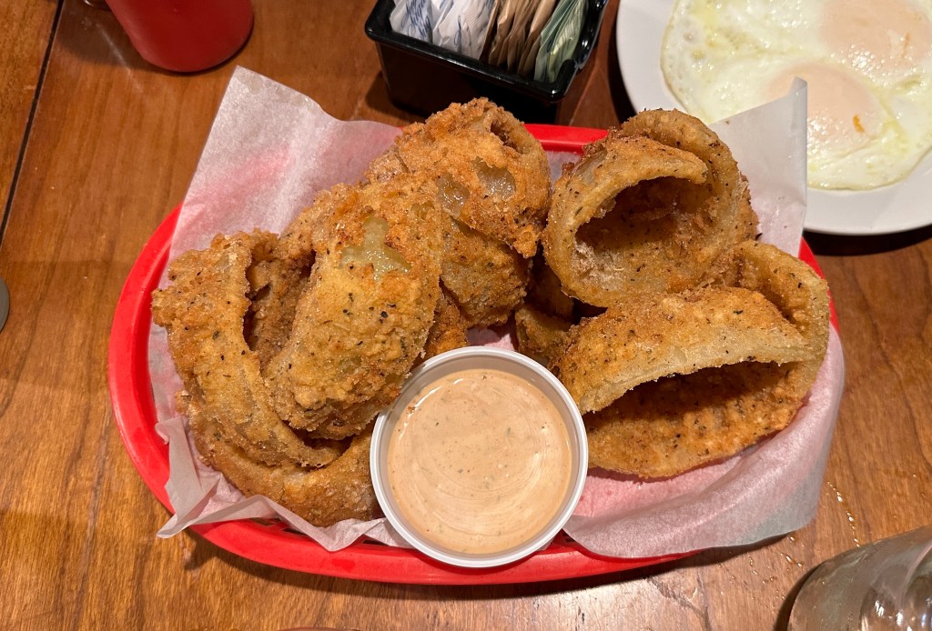
Late lunch was at Jeremy’s Farm to Table in Chehalis, which also allowed for Jen, Meredith, and David to catch up to us. This was an amazing stop, and we all highly recommend it. I love gluten, but their gluten free onion rings were the best I’ve ever had!

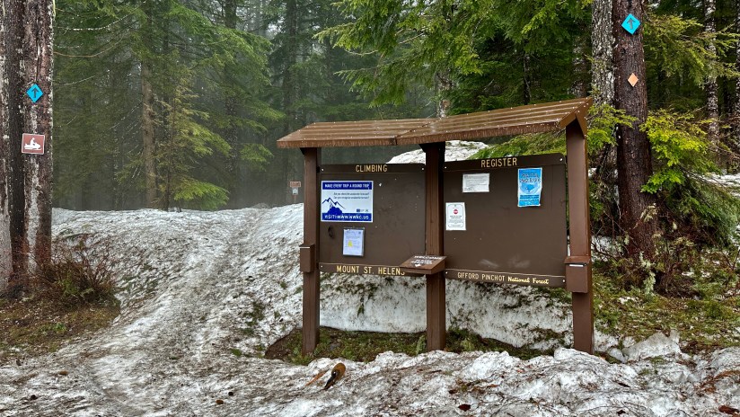
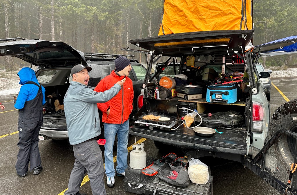
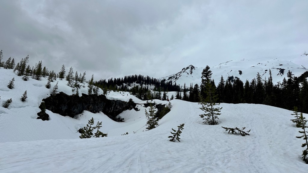
Well, now it was time to make it further than I ever had before when it came to climbing Mount Saint Helens – arriving at the trailhead! We climbed up in elevation towards Marble Mountain Sno-Park, the start for the winter climbing route. The snow started piling up higher alongside the road, and excitement was high. Except for the rain. Sigh. After setting up for the night, packing the packs, and a Cinco de Mayo celebration with al pastor and other yummies, we hit the sleeping bags for a few precious hours of sleep before our 2:30am alarms.


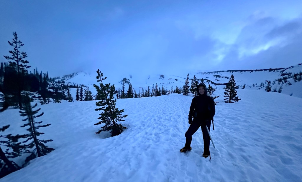
2:17am I awoke to what I thought was the sound of horse hooves clopping through the parking lot. Really it was some other climbers walking on the pavement with their snowshoes (why?!). Layers came on, one Red Bull was downed, one gas station Danish consumed, and final items were packed. 3:15am we put boots (in my case, snowshoes) to the trail in the pouring rain.

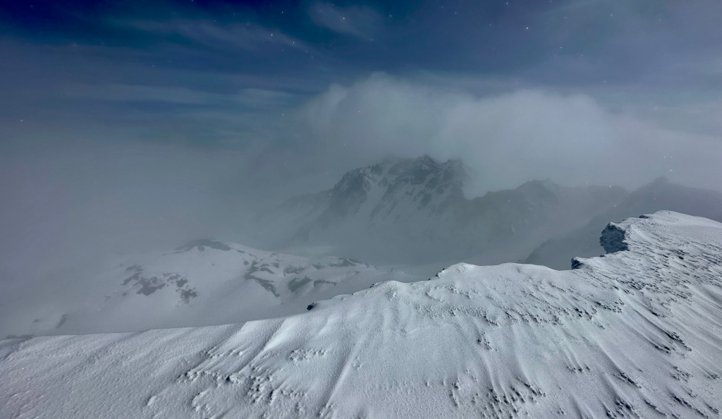
We would be climbing the Worm Flows Route, or winter climbing route. Longer than the summer route (which leaves from a different trailhead) and starting at 2,800 feet in elevation, Worm Flows traverses along Swift Creek and Swift Glacier until meeting the summer route on Monitor Ridge before the final, stupidly steep pitch to the summit of the crater rim at 8,363 feet (compared to the original 9,677 foot elevation pre-1980 eruption). The route comes in at 12 miles, which isn’t too bad… it’s just the 5700 feet of elevation gain that will get you! The first three miles start up mildly up hill, and then at miles 4 through 6 you’ll gain 1300-1400 feet per mile. That is steep! The perk to the winter route is no ash. I’ll climb snow any day over ash!
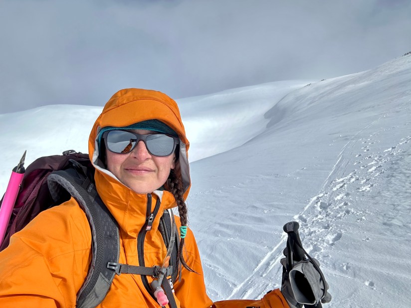
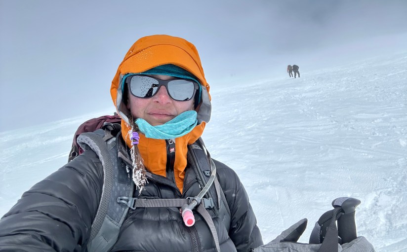
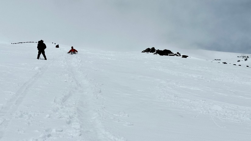
The rain continued pouring down as Jen and I led out front, saving a salamander along the way (which I proclaimed originally to be a lizard). Just as we began to approach Chocolate Falls at 3,700 feet did the sky begin to ever so lighten (we originally were going to try to summit for sunrise, but the cloudy forecast afforded us a bit more sleep). “Whoa, are we at Chocolate Falls?!” I asked, thankful to finally be popping out of the trees and beginning the true climbing of the day. Just above Chocolate Falls we stashed our snowshoes and donned crampons for the rest of the climb.


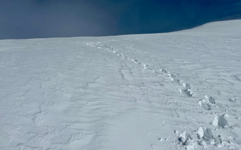
So it began. I really cannot describe it more than being on an endless stairstepper where you have to support your full bodyweight and any pack weight, all the while kicking into the slushy snow. The stairsteppers at the gym are quite deceiving! I followed Jen as we made our way along the rocky ridge to 4,800 feet, the point at which a permit is required. I took the chance to take off my rain pants (thankfully the damn rain had stopped) and my fleece for the second or third time (both of us apparently were really indecisive about our clothing choices). I marveled at the bit of bergschrunds on the snow (or were they crevasses?! Damn these unfamiliar mountains!), swiveling my head back and forth to take it all in. I was doing the thing… finally! This would be a DNF (did not finish) versus a DNS (did not start) at the very worse.
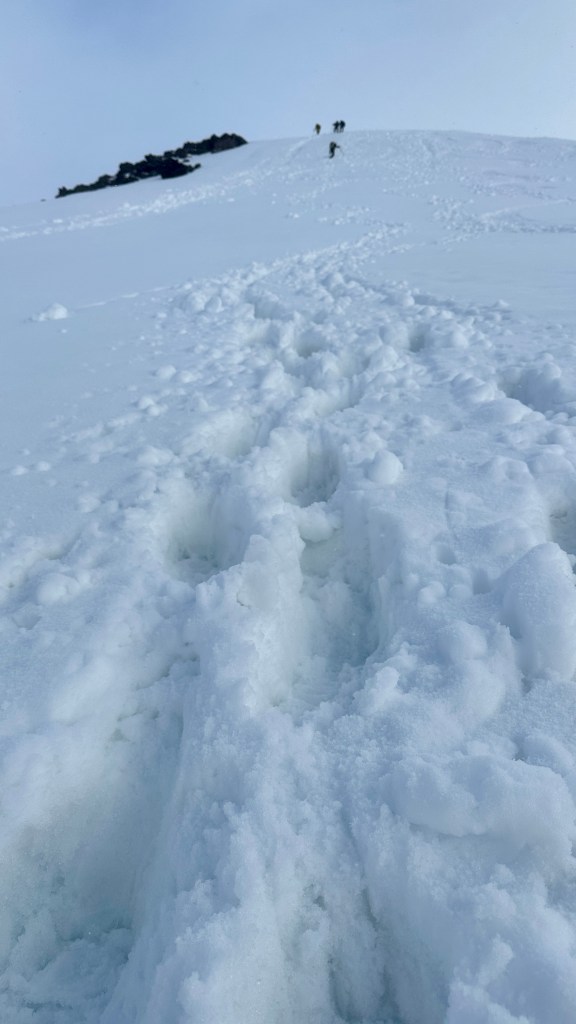
What gets ya on Helens are the false summits. Though I initially was avoiding checking progress on AllTrails as I knew it was painfully slow, I finally pulled it out to check. Then I looked at the elevation at my watch. Damn, so much more to go!

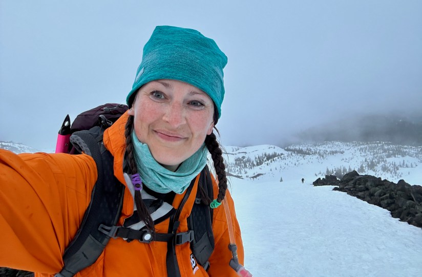
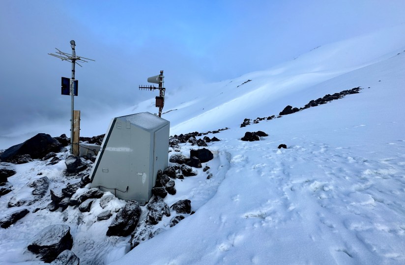
I caught up with Jen at the seismic station at 6,200 feet, where we had a group take our photos before we separated into our respective paces (aka me being slow and Jen being the fit badass that she is). I already knew the answer, but I asked, “Uhhh, so is that the summit?” to which Jen snorted and gave me a firm no. Worth a try!


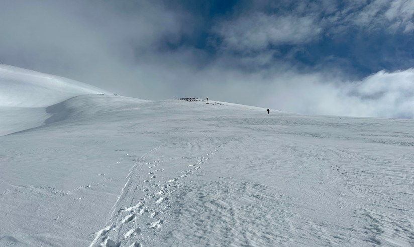
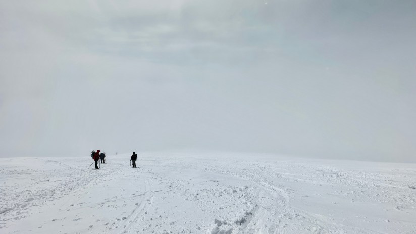
The low clouds came and went, and sometimes visibility got pretty bad which made me nervous as I fought to see Jen ahead of me. By now we were the first two heading up for the day on foot (one skier was alongside Jen), with Jen breaking fresh trail. From the group we passed at the seismic station, a girl caught me and said “I think your friend is standing up there on the summit!” This time I got to be the heartbreaker and tell her we still had 2,000 vertical feet to climb before reaching the summit. Her face wrinkled, and she whipped out her phone to check the map as I continued the upward trudge.
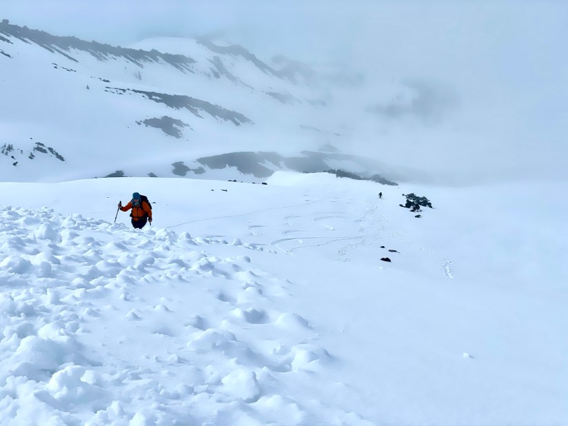
The final 2,000 feet, which would take a few hours to trudge up, were when things turned mental. Of course my body was hurting from the endless stairsteeper, and my feet had started screaming in their stiff mountaineering boots (I thankfully walked away with zero blisters, though I could’ve swore my feet were hamburger by the summit). My ankles ached, presumably from the heavy boots and crampons. I took to giving myself pep talks out loud, cussing myself out and telling myself it was mind over matter and that I could do hard things. Then I’d switch to “OMG, I am doing this and it is so awesome and look at the pretty scenery!” and then next thing I knew I’d be getting choked up and I’d have to remind myself to save the tears for the summit. I thought back to Ken Chlouber of Leadville 100 fame (a mountain bike race I gave up on 76 miles in), and his eternal “You are tougher than you think you are, and you can do more than you think you can” advice. Kick, step, rest, repeat, kick, step, rest, repeat. Count 1, 2, 3, 4, 5, 6, 7… all the way to 100. Start over. 1, 2, 3, 4, 5, 5, 6… At some point I resolved I do not have enough personal demons to work out to be a mountaineer. I’d turn around at times to take in the marine layer behind me, and get a sense of vertigo from the steep slope and winter landscape. “Woah there, don’t fall down the mountain!” I’d warn myself as my brain struggled to right my body in the endless white landscape.

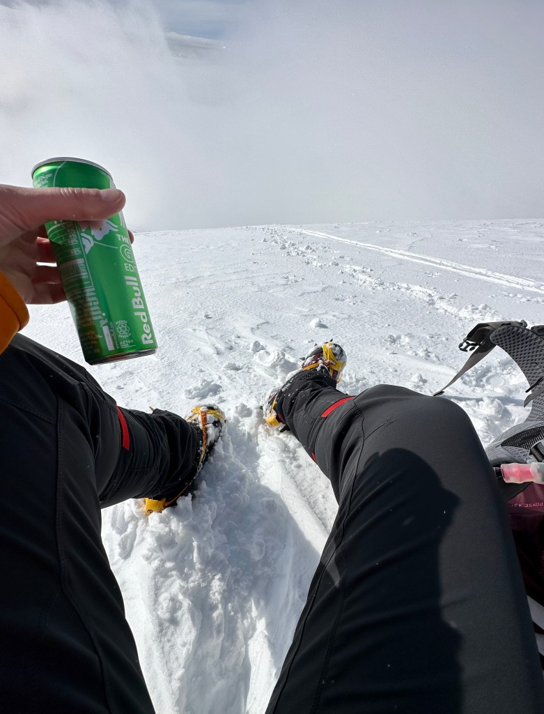
With about 1,300 vertical feet to go, I took a break to sit down for the first time all day, eat a snack, drink a Red Bull, and apply sunscreen. Let’s go do this final hour and change!

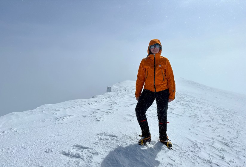
With varying conditions with ice and slush, I winced every time I could not place my foot straight into a kickstep. Any pressure on my heels made me gasp and cuss. I exchanged greetings with some skiers bootpacking their way up, and took to following their more straight up approach than Jen’s switchbacking path. I took to side steeping. Within sight of the summit the sobs came, which I had been suppressing for hours. Let’s get this sh!t done I thought, and I power walked up the last bit until I hit the crater rim, where I sat down to dramatic sobbing (which I don’t suggest doing without warning, as you’ll freak out your climbing buddy!). FINALLY.
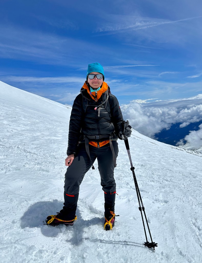
Mount Saint Helens. Check! I summited at exactly 10:00am. 6 hours and 45 minutes after leaving the trailhead.


After assuring Jen I was not mortally wounded and it was happy crying (okay, maybe just a massive emotional release, not so much pure happiness, that the mountain that taunted my thoughts for a year was finally summited), we commenced with photo taking. Jen had already been sitting on the summit for thirty minutes and wanted to move around, so we headed to the true summit, weaving around some scary cornice cracks and fissures to kill time waiting for the next round of our peeps to reach the top.

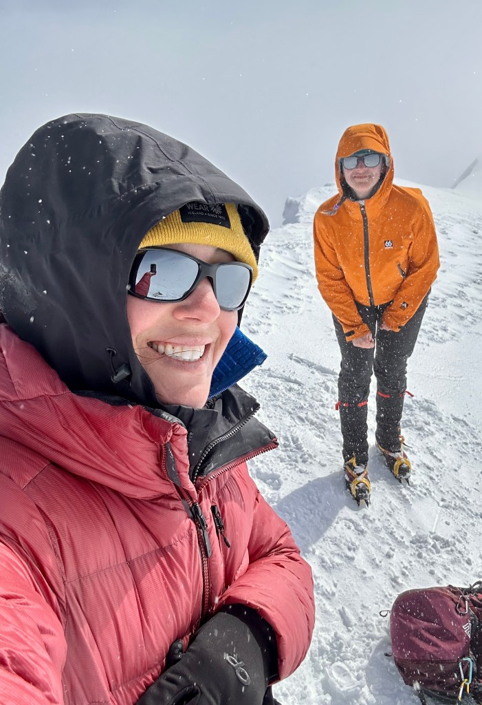


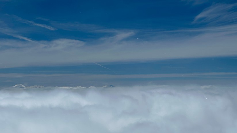
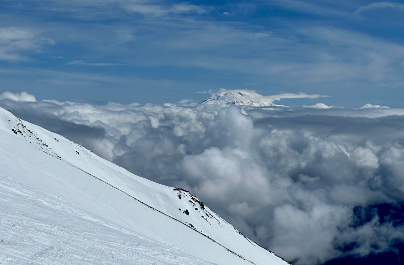
My dumb butt forgot my puffy jacket in the truck (a mistake I realized about a mile into the hike), but thankfully Jen had packed two, so I bundled up and we took to snacking and taking in the lack of views. Thankfully the clouds moved out ever so slightly so we could see the lava dome that is rather rapidly rebuilding, and I even caught some steam coming off of it. After texting my parents I had made it, I decided to give them a call, to which my mom asked the random question, “Is everybody getting along?” like we were preparing sacrifice someone to Pele (actually, Eric had threatened to throw me in the crater as a sacrifice, but I digress). Still cool to call my parents from the top of Mount Saint Helens!
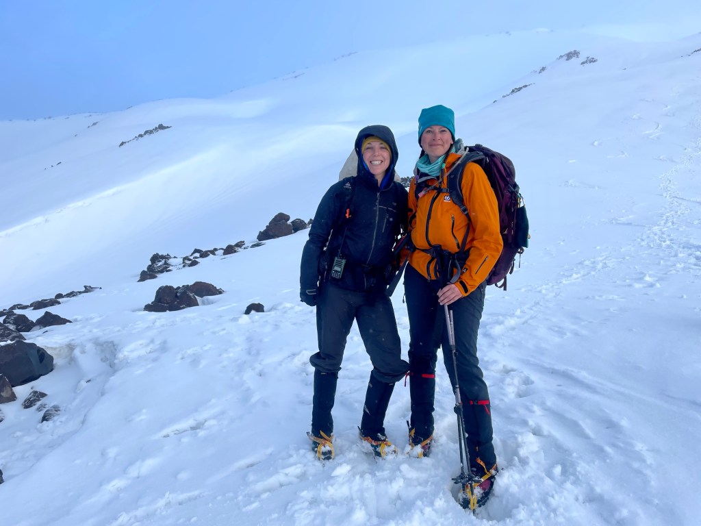
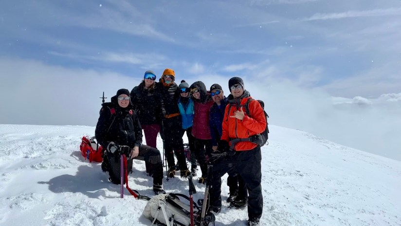
Eric, Brad, Meredith, Steve, and Lana joined us on the summit, so we took the opportunity for an abbreviated group photo (Christy, Logan, and David were still climbing). I had started getting cold, with rime ice forming on one of my braids, so I prepared to head back down.
By now the hoards were ascending the mountain, and what was two sets of footsteps coming up turned into dozens going every which way as several hundred more people headed up. Since it was still a bit firm up top, glissading would wait until False Summit #4 was reached (yeah, there’s four damn false summits… ignorance was bliss on the climb up!). The sun came out, and probably when I was 100 feet below the summit I turned around to see it had cleared out. Dammit, I proclaimed as I ever so briefly considered going back up (it clouded up again fairly quickly). Then I caught a glimpse of Mount Adams to my left, so took to musing that as Meredith, Steve, and Lana caught up to me. “Mount Adams, you’re next!” I yelled. (Type 2 fun in which I was already planning the next one before off the one I was on… is it still Type 2 at that point?)


At the top of False Summit #4 I took my first pee break of the day, oogled a raven that was circling, and removed my crampons so the butt sliding fun could begin. Pure and utter shenanigans, and it had been such a long time since I had laughed that hard. (Mixed with one episode of pure terror where I thought I was heading for a crevasse and screamed at the top of my lungs “Is that a f—ing crevasse?! I wasn’t swallowed by the mountain, in case I needed to clarify.). Though we were not incredibly speedy, it was so much fun.

We finally reached our ditched snowshoes at treeline, still safely stashed in a treewell. Now the nearly three mile march back to the parking lot… always the worse part of the hike, but more so after this whole adventure. I thanked myself for flying with my snowshoes to make it easier. I quickly caught up to Meredith and Eric after Chocolate Falls, and we walked steadily with purpose back to the parking lot.


12.06 miles and 12 hours 33 minutes later I was standing back in front of the trailhead sign. Third time was indeed a charm!
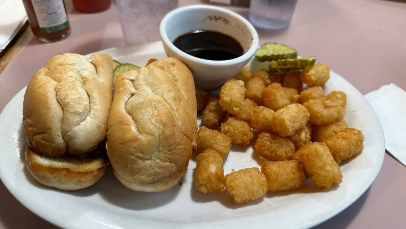
The mountaineering boots were ripped off and I gingerly trained my toes on how to bend again before climbing up into the tent to change into dry layers (even with a Scooty Booty, my bum got wet glissading). We opted for chips, bacon, and guac in the parking lot as we waited for our whole group to return. Eric and I also drank our Crowne Royal Washington Apples that we took to the summit in honor of Kyle. I taught everyone prayer squat as a way to stretch out the muscles. Soon enough, everyone was off the mountain and accounted for. Phone numbers and photos were exchanged, and a random guy even showed up with Meredith’s missing microspike that came off while glissading. Spirits were high, despite exhaustion.

Now it was just the long journey home. We were thwarted from eating at Jeremy’s Farm to Table for dinner (it was that good we were going to eat there two days in a row!), so settled on Main Street Cafe in Centralia before all parting ways. By the time we were back to Eric’s we all had a hollow stare and we lugged into gear and I decided I’d just pack in the morning before my flight.

I seriously cannot express this day into adequate words. It was hands down the hardest thing I’ve done… and I’ve raced a mountain bike for 8 hours straight solo, rode/raced a bike up two 14,000 foot mountains, and completed several 100 mile gravel races. What I am most proud of, and what still makes me tear up (no, you’re the one crying, not I as I write this), is that I pushed through mental barriers. I CAN hike 12 hours. I CAN do really hard things. I truly believe I left Mount Saint Helens and this experience a new person. As I joked to a friend, this was the perfect training hike for the Boulder Skyline Traverse, a hike that will be much easier. I immediately knew I had to return to Mount Adams for redemption for the horrific summit attempt last summer. I feel like so many other doors suddenly opened to me now that I proved to myself that I am capable for pushing on when things get tough. Mountains have a funny way of teaching you things… and Mount Saint Helens taught me a lot of lessons over the past year.
A mountain is not capable of love. Whatever love is there begins and ends with you, so you must love well and without fear. You must not go to the mountain seeking salvation because salvation is not a thing to find, it is a thing to inhabit. Salvation is not the swing of an ice axe, it’s the altitude we achieve with whatever thin air we’re given.
Details:
Date Hiked: May 6, 2023
Trailhead: Marble Mountain Sno-Park
Total Mileage: 12.06 miles (Garmin Forerunner 255s)
Elevation Gain: 5,759 feet
Time: 12 hours 33 minutes 1 second
Weather: Mixed bucket of rain, clouds, sun, wind, calm
Cell Service: Enough for a voice call on the summit (Verizon)
Trail Conditions: Snow
Special Considerations: There are a lot… permits, conditions, avalanches, equipment…


Leave a comment