

“The weather sucks, let’s hike” I told my very best bicycle friend, Tom, in a text message. With a ridiculously windy spring shaping up in Colorado and Wyoming, I was seeking out other ways to stay active, and most importantly, to still get outdoors despite the daily hurricanes that were occurring. Tom, being new to exploring life off of a bicycle, eagerly agreed to try this “hiking” thing I was suggesting, and plans were made. This would be my first hike after the big 11-day “BeaUTAHful” adventure, I was still impatiently trying to heal my ankle sprain, but worth a try!
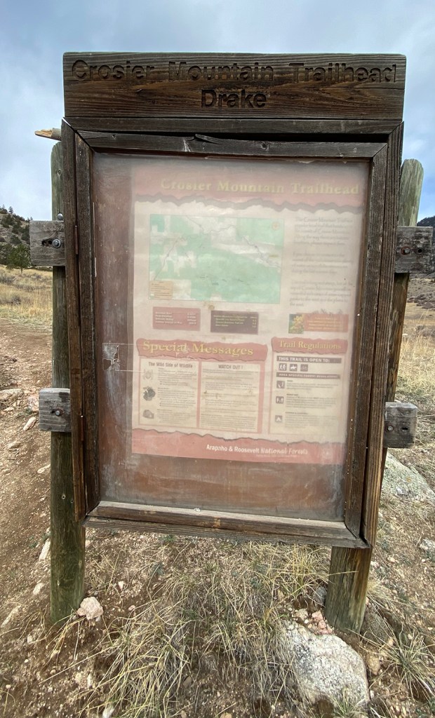
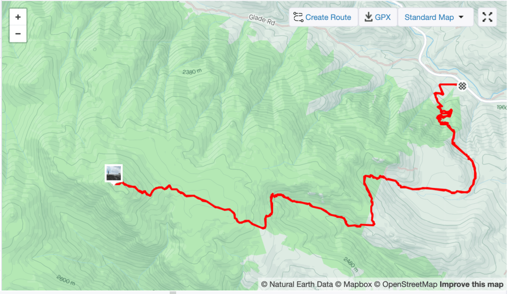
In an effort to explore more of my own area, I settled upon hiking up to Crosier Mountain, a 9,250 foot summit between Drake and Glen Haven. There are three trails leading up to the summit: Garden Gate, Rainbow (Gravel Pit), and Glen Haven (with their trailheads all called the same thing). Garden Gate was the closet when it came to driving since the trailhead is a handful of miles from Drake, and what I settled upon. This would be a roughly 11 mile day, which seemed gigantic once Tom and I got to thinking about it, but we stuck to the plan.
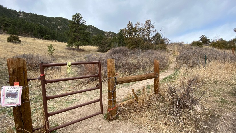
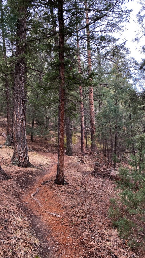
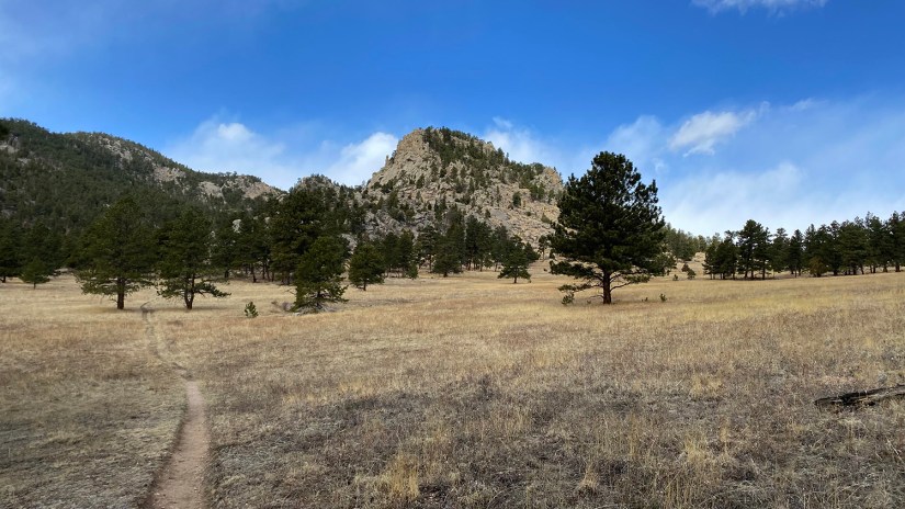
After parking at the small trailhead on the side of the road, we started on the trail, which immediately got down to business climbing up the slope. Because neither of us truly knew which mountain that surrounded us we would be summiting, we took to surmising “Oh, that must the summit!” only to be proven wrong over and over.


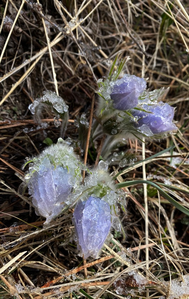
After a bit of uphill, the trail flattened through a meadow, and we enjoyed the pasque flowers that were blooming, albeit a bit frozen thanks to a light dusting of snow overnight and the cold temperatures. There’s just something about the first wildflowers of the spring!
The meadow was deceiving, and soon we climbed again, only to begin a decently long descent. “This is going to suck on the way back, ” I exclaimed. After all, it’s never a good deal with the trail goes downhill on the uphill!

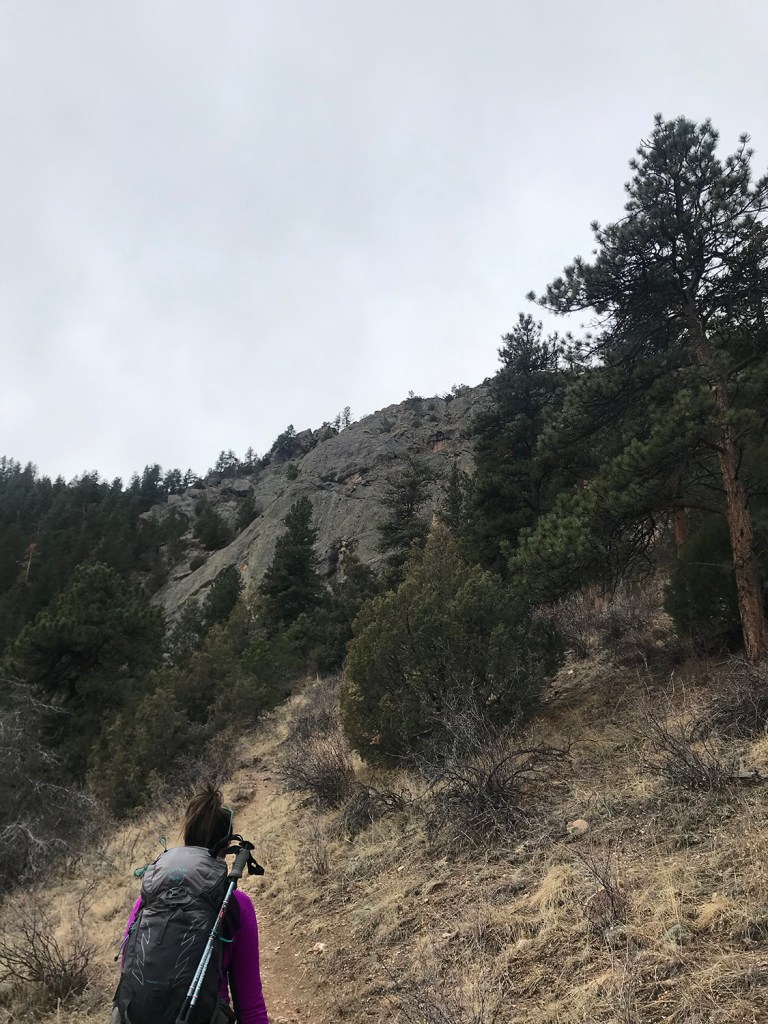
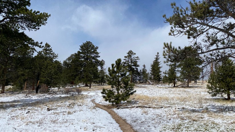
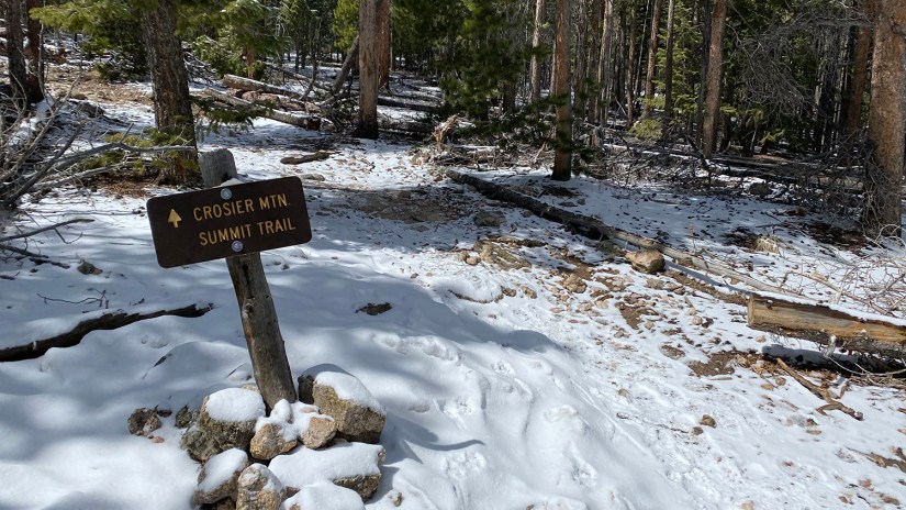
We began climbing again, with the grade a bit more relentless. Open patches in the trees blasted us with the cold wind, reminding us of the hurricane going on, and we we made our way through the fresh snowfall. Eventually the trail merged with the summit trail, which we turned off on to begin the final steep pitch to Crosier’s 9,250 foot summit.
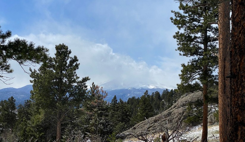
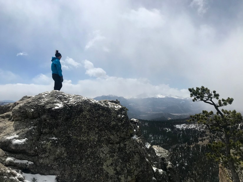
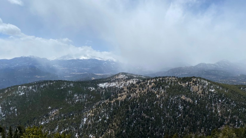
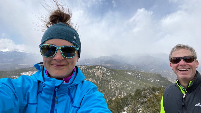
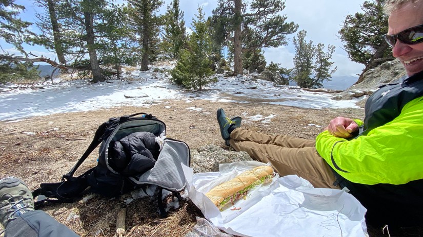
On the summit we scrambled to the very top, tapped the geodetic marker, and snapped some photos of a storm-enveloped Longs Peak. By now I was feeling a bit wiped out, maybe from the elevation or the fact it was a very long hike for me. Just when I was about to get real sad, Tom whipped out a massive two foot long sandwich from Obee’s in Fort Collins out of his pack!
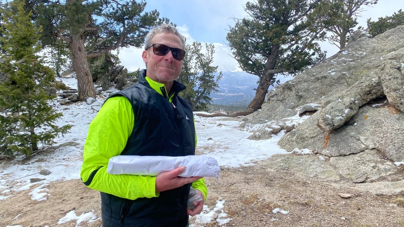

Summit sandwich for the win!
And this is why Tom is one of my very favorite people, as he has a way of rewarding me with food when I need it the most! Mostly it is Snickers and peanut butter cups on long bike rides, but now sandwiches were involved. We sat down and enjoyed our impromptu picnic, fueled up for the long hike back to the car.

Like any hike involving a mountain summit, getting to the top is only half the battle, and there’s usually a (somewhat) trudge back to the car once the summit high is worn off. Being wary of my ankle, I had to take the descent decently slow on the rocks and roots, but we enjoyed our time down and the rolling terrain, which made things slightly easier on the knees. I actually took no photos on the way back to the car, but I guess that means I was enjoying the sights around me too much to worry about fiddling with the phone!
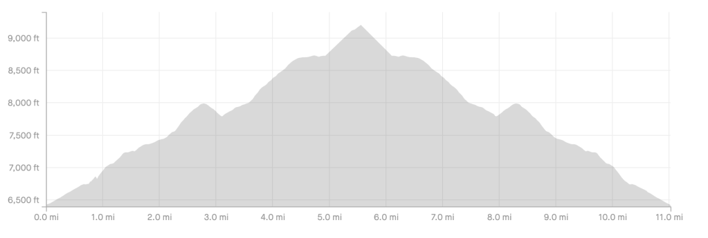
Overall, we ended up at 11 miles with over 3,200 feet of elevation gain in about five and a half hours, which was a good hike to kick off my final weeks of preparation leading up to a Mount Saint Helens summit attempt. Tom was please with his whole hiking experience as well, which was a win (even if a bike remains his favorite thing ever :P). He plans on joining me on a Longs Peak attempt later this summer, so always good to figure out we can stand hiking with each other, even after hundreds of miles of bike training together.

Though I sometimes hate repeating hikes, I definitely want to give the other two options a go to reach the summit. Rainbow/Gravel Pit Trail is supposedly significantly steeper as it just goes straight up the mountain versus the rolling meadows of the other two options. Regardless of route, this hike can be hot in the summer months, and there really isn’t any water available so bringing plenty is advised. Because the trail never is above treeline, it is a safer bet during the summer season. Bonus – mountain bikes are allowed!
Details:
Date Hiked: April 10, 2022
Trailhead: Garden Gate
Total Mileage: 11 miles per Garmin Vivoactive 4s/Strava
Total Elevation Gain: 3,214
Total Time Spent: 5 hours 28 minutes
Weather: Windy!
Trail Conditions: Mostly dry, light snow in other parts
Cell Service: Unsure, I put my phone in airplane mode for the hike!


Leave a comment