
Day 8 – April 2, 2022
The take aways…
- The serial killers did not come back for their dirt
- I agreed with the one-star review of the Grand Canyon
- Give the Grand Canyon a chance, or at least give me some ice cream
- Instagram vs. Reality at Horseshoe Bend
- Some phone conversations you really shouldn’t have loudly in a gas station parking lot
The early alarm went off, and Eric and I congratulated each other on surviving the night and not ending up under the dirt in that fifty pound bag a wee bit up from our campsite. Today’s big event was exploring the south rim of the Grand Canyon, followed by traveling north towards Page, AZ, and onto camping around Kanab, UT.
Starbucks breakfast was grabbed, and we cruised through the south entrance without traffic (yay early mornings!). Our early arrival meant we scored a parking spot at Verkamp’s Visitor Center.

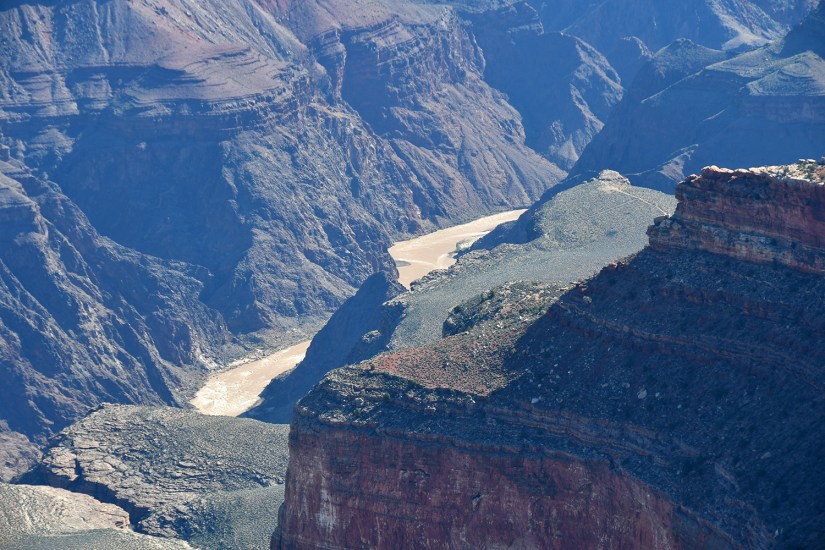
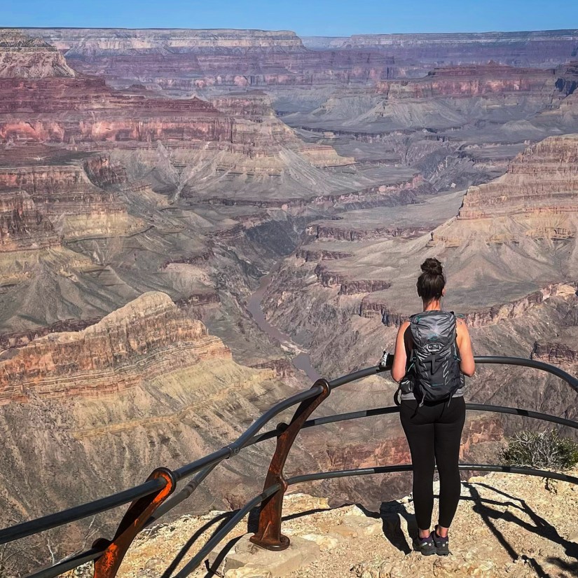
I gotta admit, I walked up to the viewpoint by Verkamp’s, and was utterly disappointed. “It’s literally a big hole, like other big holes I’ve seen,” I stated. I’ve flown over the Grand Canyon, and was impressed. I’ve been impressed by photos. But in real life? Something was lacking. Realizing I was literally giving THE GRAND CANYON a 1-star review, I became a bit upset with myself. Maybe it’s been this was day eight of an exhausting, mind-blowing adventure, and my brain couldn’t process?! “Well, at least California kept their air pollution to themselves this morning, so I can see the things…”


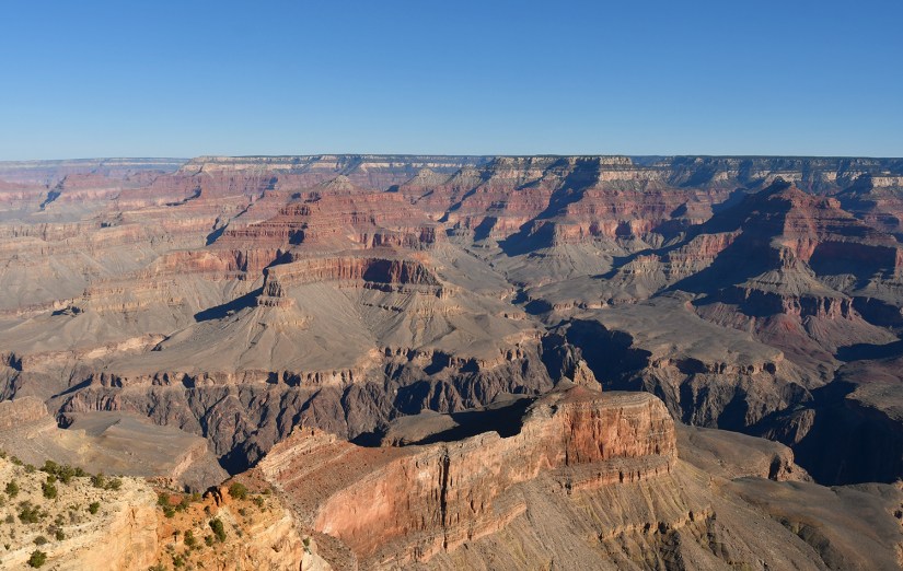
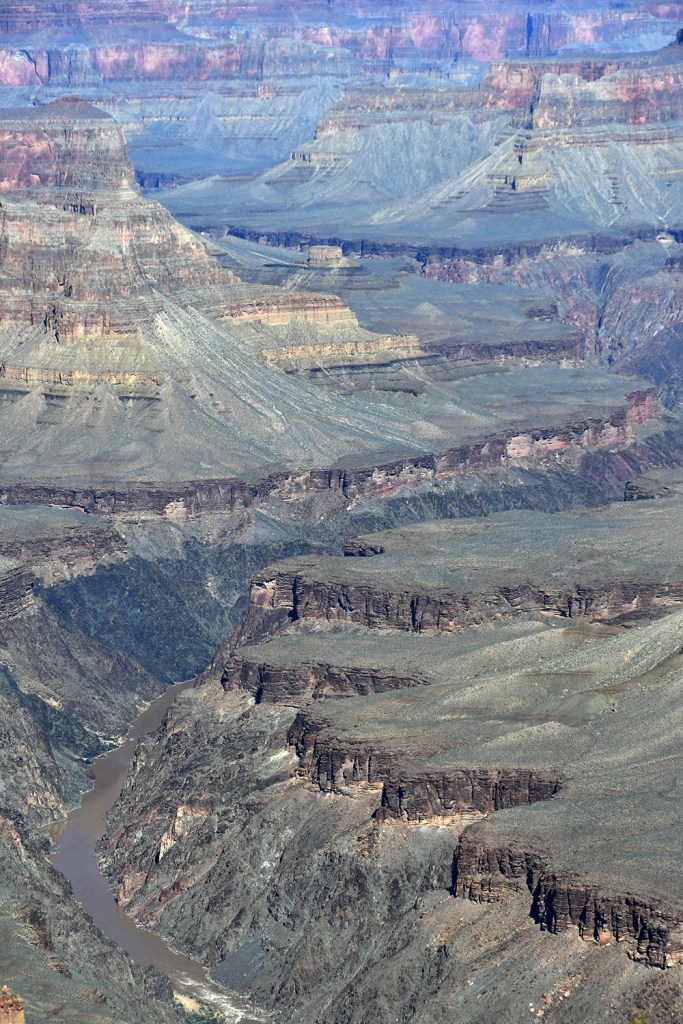
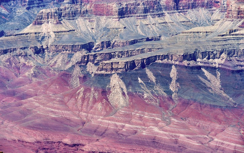
Luckily, as we made our way west towards Hermit’s Rest by foot and bus the views became more and more impressive, and my 1-star review turned into more stars. Apparently I was far too judgey, and just needed to warm up to this large hole in the ground! However, I’ll admit it was hard to photography since the landscape was so immense, so strangely enough I did not walk away with a ton of photos.


We quickly snagged a passport stamp at the Hermit’s Rest gift shop and boarded the bus back to the beginning. From here we wandered in and out of the various building and gift shops, buying souvenirs and collecting passport stamps. I realized that the same exact magnet will cost something different depending on where you buy it (Desert View has the cheapest ones, for what it is worth!).


After some tailgate sandwiches, we headed east to the main visitor center for more passport stamps and souvenirs before continuing on on Desert View Drive. Honestly, Grand Canyon, at least the South Rim, is far too peopley, so we skipped other viewpoints since parking was impossible.

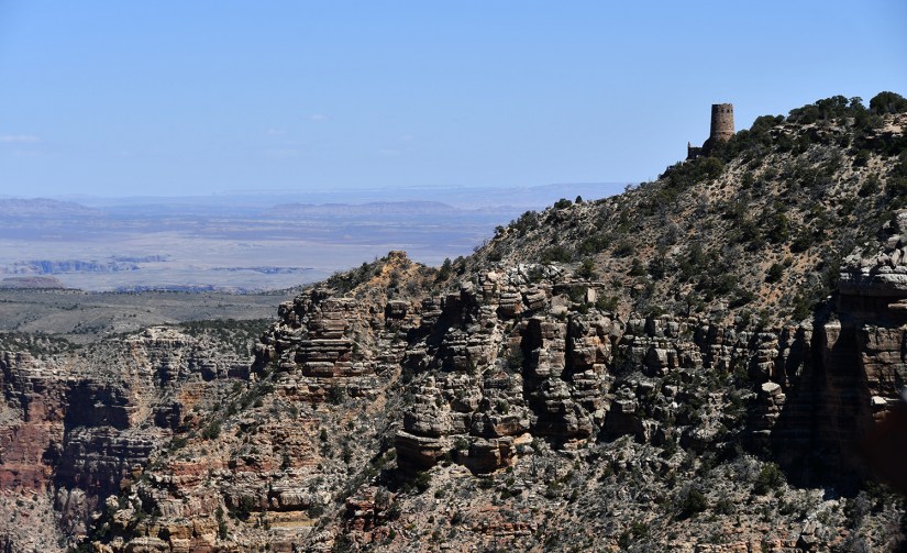
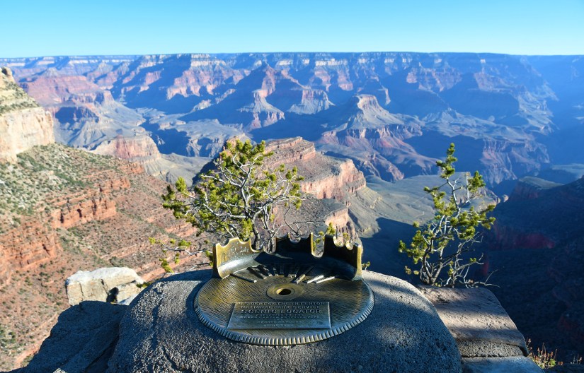
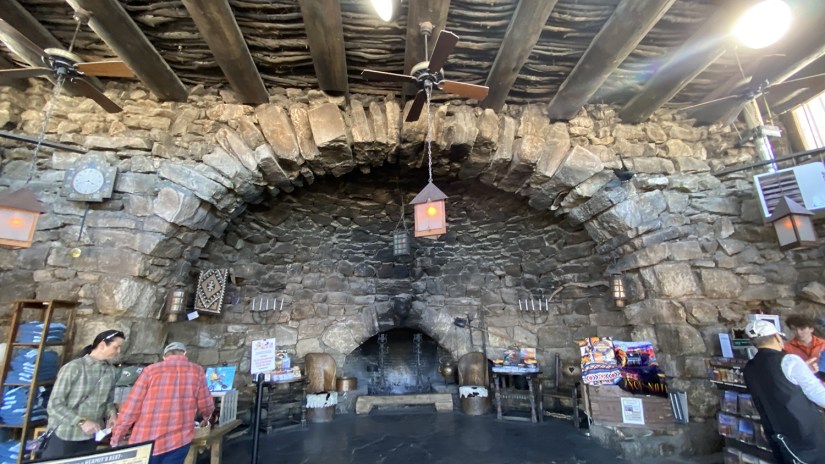
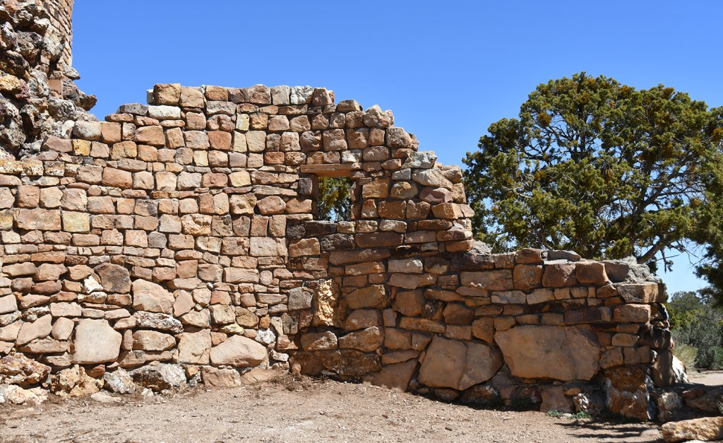
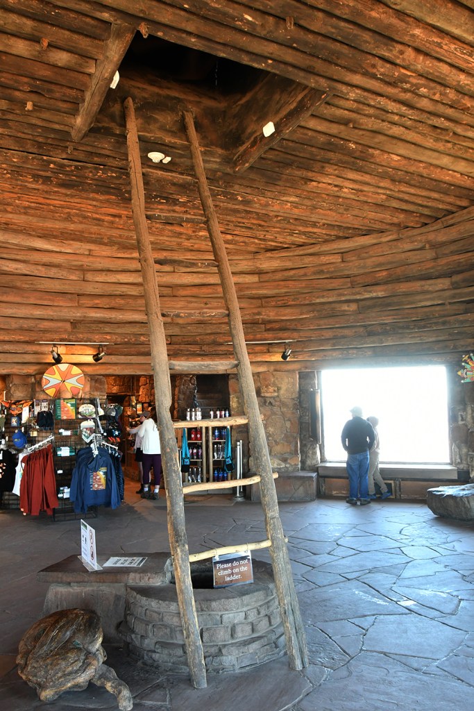
Desert View was our final Grand Canyon stop, and probably the most enjoyable part of this short taste of the park. First, the magnets are cheaper here than anywhere else. And there is ICE CREAM! The Watchtower was closed to climbing up it, but we still wandered around the inside and outside, and admired the scenery (which was more impressive than just a hole in the ground). And I got my coffee and ice cream I so desired.


Did we do the Grand Canyon justice at all? Not really. We didn’t hike, and North Rim was still closed, so we were unable to explore that area.
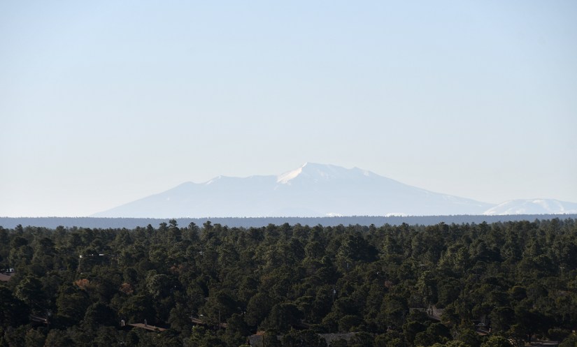
Now it was time to begin the drive up to Page, and then back into Utah and over to Kanab. Finally getting putting the Utah back into the Utah adventure, ha! The drive to Page was pretty, as we had distant views of Arizona’s highest mountain, Humphreys Peak (a long dead volcano!), watched the desert landscape change as we climbed “the staircase” again, and pondered exactly what timezone we were in as our phones took turns bouncing back and forth between Mountain Daylight and Arizona. (Arizona the state does not go on Daylight Savings in the spring, but the Navajo National does.)


Page, Arizona, has lots of spectacular places and things to do, but alas, many have gone to a lottery/permit process due to crowds, so we did not see things like Antelope Canyon or The Wave on this trip as it was planned too short-term to secure permits. But by now it was obvious I could spend every year coming back to Utah (and northern Arizona, ahem), and still not see or do a fraction of the things that there are!
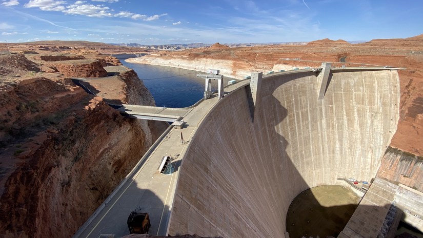
Our first stop was the Glen Canyon Dam, which is the second-highest concrete-arch dam in the United States after the Hoover Dam. There is a great visitor center here, the Carl B. Hayden Visitor Center, which houses a gift shop (yay, even more souvenirs! By now I had collected about twenty pounds of magnets), passport stamps (the important thing), and a great exhibit area about the Colorado River. The dam created Lake Powell, a 186-mile reservoir which completely filled in 1980. In 1972, Glen Canyon National Recreation Area, was created by the National Park Service.

A few years ago I read a book about the development of the western United States in terms of land development, water rights, usage, and damming, so I took quite in interest in the exhibits on usage of the Colorado River’s water and electricity. I can get quite soap-boxy about water going to keep grass green for Scottsdale golf courses, but I tried to keep it in check! At the very least, I hope the exhibits open eyes to why the Rocky Mountains, particularly Colorado and Wyoming, need heavy snowpack for other reasons than just ski areas… it’s literally keeping Arizona and California watered… (In case you’re curious and want to read a long book with tiny font on the whole issue, Cadillac Desert by Marc Reisner was the book.)


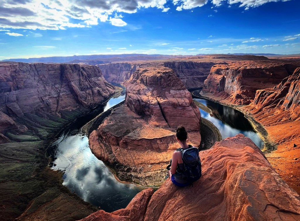
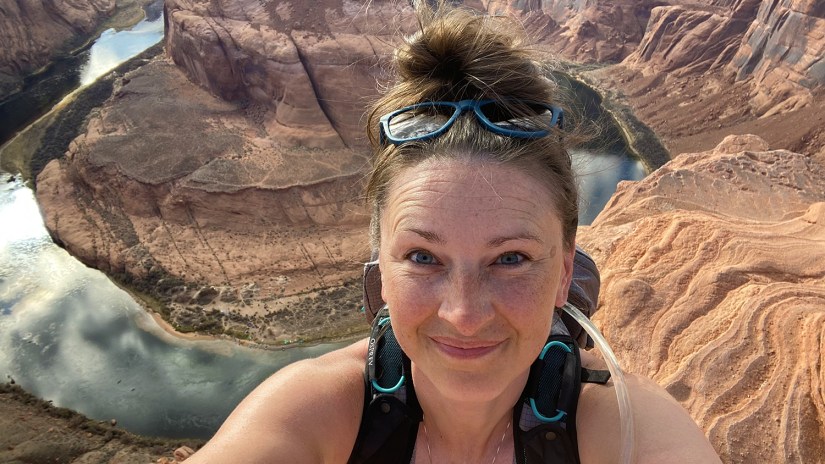
So moving on from my personal feelings on green lawns in the desert… we wrapped up the Glen Canyon Dam, and headed back south to Horseshoe Bend, the Instagramer’s heaven! This spot use to be nothing in terms of infrastructure, but popularity has lead (quite recently) to developed parking lots, $10 entrance fee charged by the City of Page, developed path down to the viewpoint, and safety railings. Though I had not been to Horseshoe Bend before the infrastructure was built, it left me remembering Kirkjufjellsfoss, where in a year span between visits I saw it go from a tiny dirt lot on the side of the road to a huge parking lot for tour buses and walking paths.

Horseshoe Bend itself is spectacular, and it is easy to just dangle your feet off a cliff thirty feet to the left or right of the safety railings to get better photos. But otherwise, I wish I could’ve visited just a few years prior. The crowds, noise, and hundreds of cairns were just not my jam. (I did get to make an Instagram vs. Reality reel at least!) Oh, and we did see girls in sundresses and floppy hats, so I apologized to Eric for not bringing my influencer get up. On another thought, we saw kayakers below, and I stated I wanted to kayak it!


It was evening now, and though we had wanted to see sunset at Horseshoe Bend originally, we decided it wasn’t worth waiting a few more hours for, so we grabbed gas and more ice and prepared to start driving west. While I was repacking the cooler, the guy parked next to us started shouting on the phone about “if you don’t start cooking me dinner, I am going to revoke your Green Card!” and we found ourselves in what appeared to be an episode of 90 Day Fiancee. Awkward.

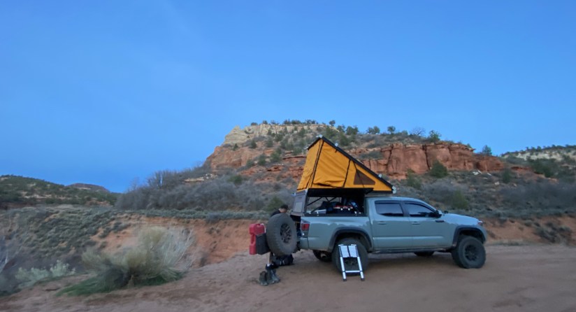
The next day we had permits for Angel’s Landing in Zion National Park, so we wanted to camp close so our morning drive would be a bit shorter. At just about dusk we found a spot outside of Kanab which was perfect and quiet.

We overcame my fear of water on this trip, now in twelve hours we’d see how Heidi does walked on the edge of a cliff a thousand feet above the valley floor with only a chain to hold onto…


Leave a comment