

February 28, 2026
Let’s get the adventure started! After what I perceived to be a lull in adventuring, it was time to put new dirt on old shoes. A sale from Southwest months earlier compelled my friend, Lindsey, and I to seek warmer pastures for a late winter getaway. The original plan was Tucson, but flights (even with the sale) were more than we wanted to pay. I had a lightbulb go off and we settled on flying to Las Vegas so we could visit Death Valley National Park. Naturally, I found all the other fossil beds, weird desert stuff, and even Mount Whitney views along the way to fill our four-day itinerary! Some girls’ trips to Las Vegas involve… not national parks, rocks, dirty feet, passport stamps, and trinkets. But this is exactly this trip!
Our 7:55am flight was smooth, and I didn’t even really mind the fact that I woke up at 3am excited and rearing to go. We landed shortly before 9:00am, and much to my surprise, our luggage was quick to pop out at luggage claim (NOT my usual experience at LAS). Before we knew it, we were in our rental (Chevy Equinox, which I got confused with a Ford Escape, until I realized it was much nicer than the hunk o’ crap Escape I had in December for Joshua Tree), and heading north on I-15.
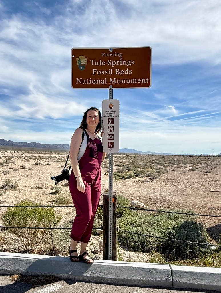
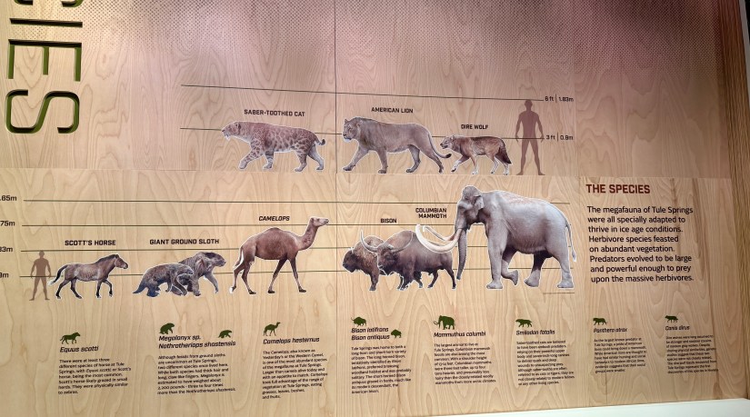
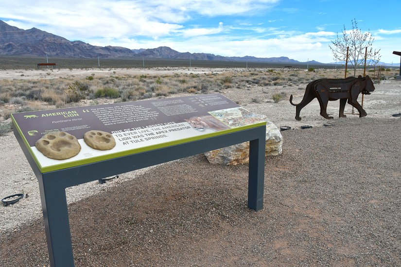
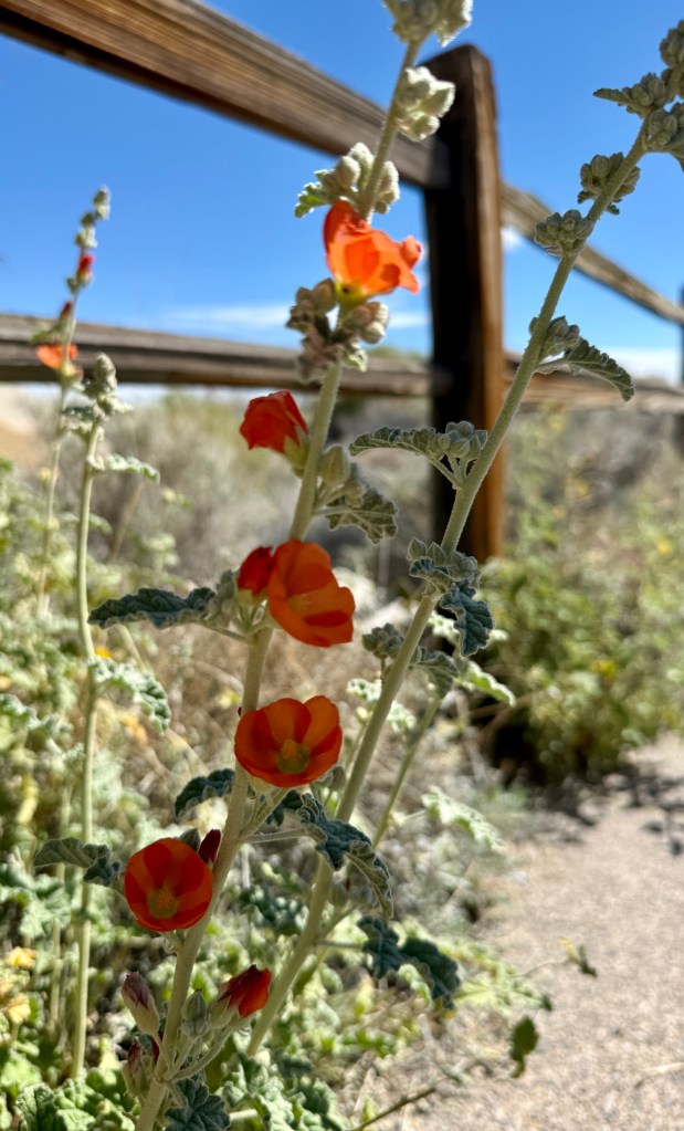
Home to the dire wolf, saber tooth tiger, ground sloth, mammoth, American lion, and ancient bison, to name a few, Tule Springs Fossil Beds National Monument was our first destination. My 94th National Park Service unit!
This national monument was established in 2014, and really does not have much infrastructure in place as of 2026 – no visitor center, restrooms, etc (the park is still undergoing the planning process). There are two areas with hiking trails: 1) Durango Drive & Moccasin Road in Las Vegas and 2) Aliante Parkway and Moonlight Falls Avenue in North Las Vegas. Luckily there are two nearby visitor centers, Ice Age Fossils State Park and Corn Creek Visitor Center, that partner with this national monument.
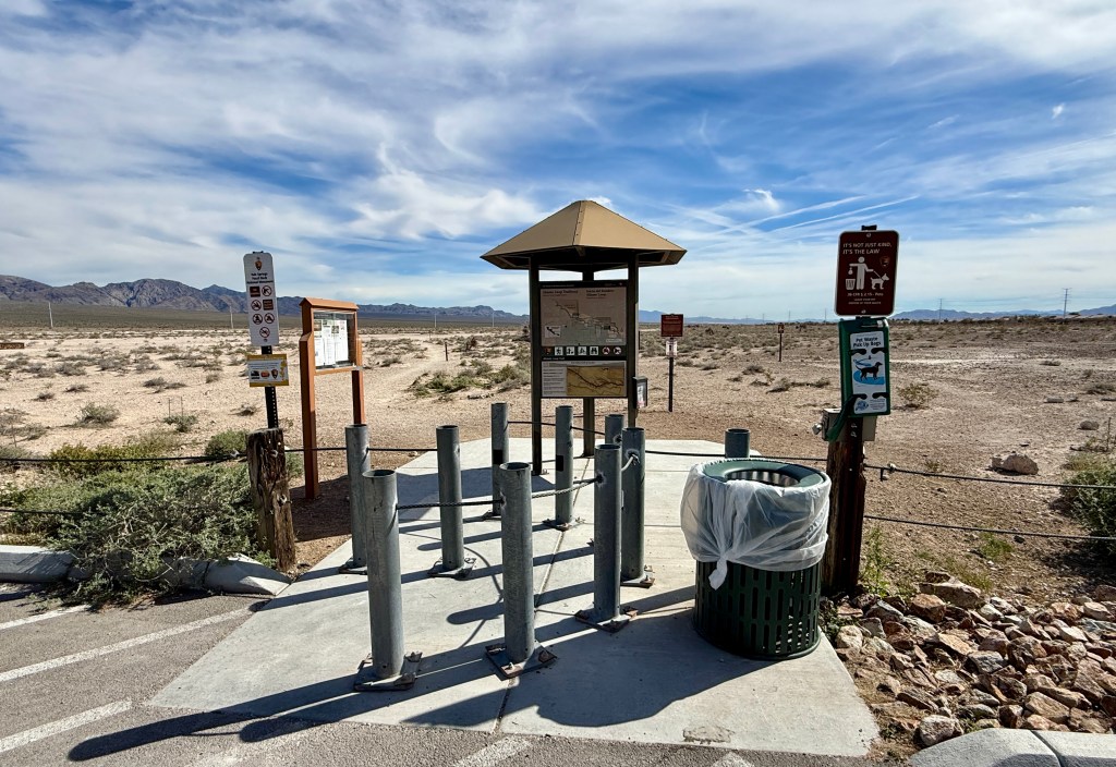
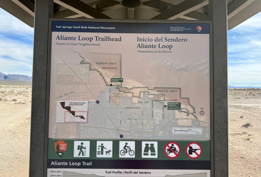
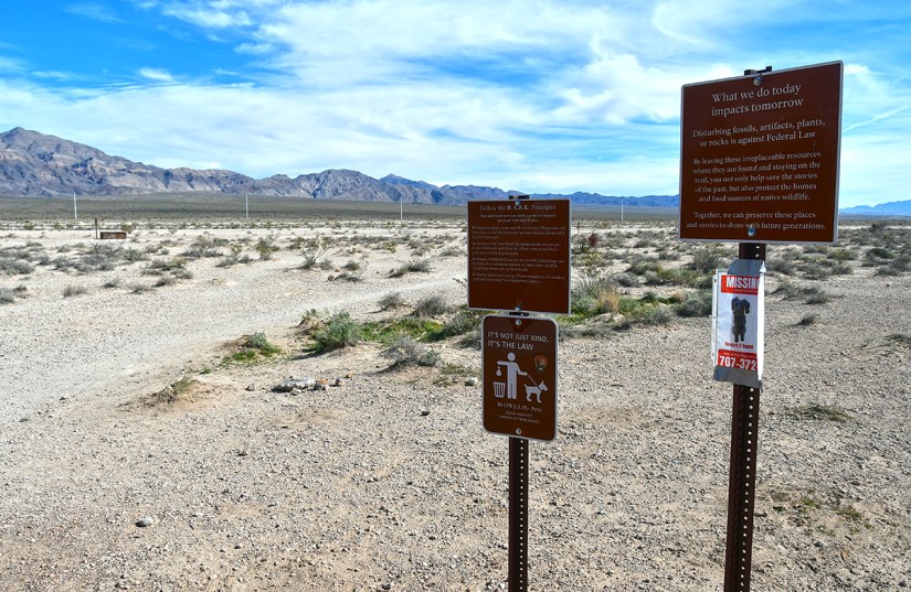
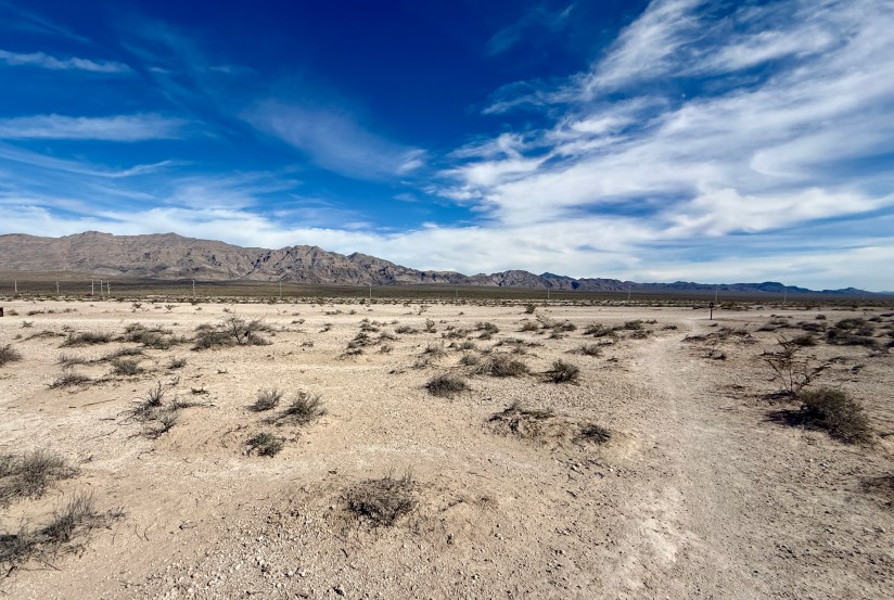
Since Lindsey and I had both partner visitor centers on the agenda, our (my?) goal was to step foot within the boundaries of Tule Springs Fossil Beds National Monument so it would count as an actual visitor. I chose the trail off of Aliante Parkway to get us into the monument. We read the trailhead sign, and walked the tiniest amount on the trail. A local rode his mountain bike up to us looking to chat as he saw the California license plates. He was originally from California and wanted to meet us… ha! Much to his surprise, he ran into two girls from a state where being asked if you’re from California is considered an insult. We still enjoyed a nice short chat before he continued on his mountain bike ride (which are allowed on the trails in the national monument).

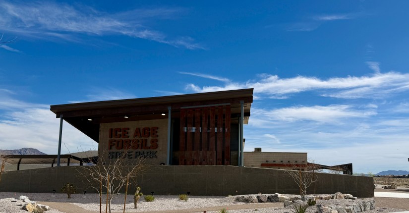
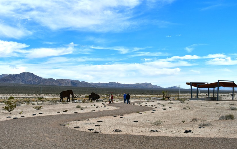
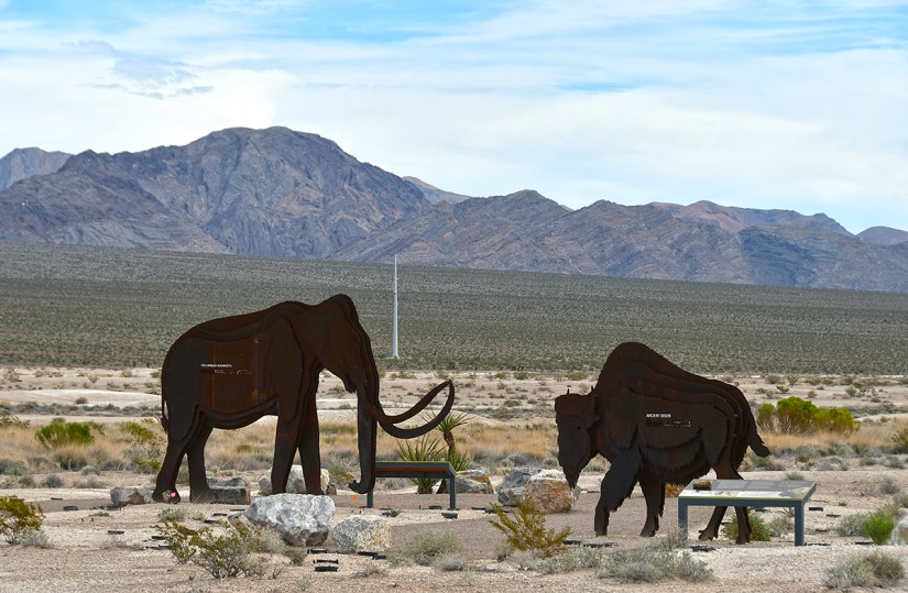
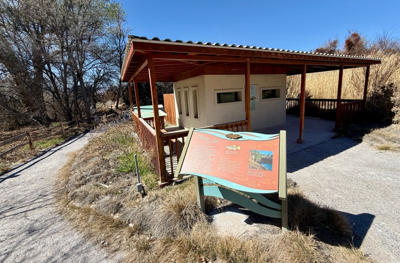
A longer visit than Yucca House National Monument for sure, but still a brief one! Time to move onto Ice Age Fossils State Park, one of Nevada’s newer state parks. This 315-acre park helps preserve the same fossil beds as the national monument, and has a fantastic visitor center with great exhibits that help give an idea to the type of mammals that inhabited the area before it became a dry desert. After we paid the entrance fee ($3/person), we took to the exhibits, watched the park film, and shopped at the gift shop. They do have the passport stamp for Tule Springs here (a second location is the Alan Bible Visitor Center at Lake Mead National Recreation Center), along with the passport stamp for the Nevada state parks program.
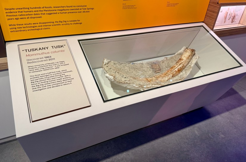
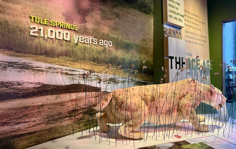
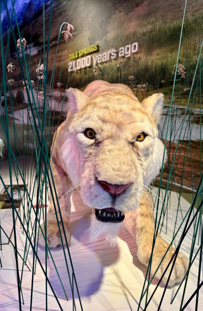
To wrap up the visitor, we walked the short 0.3-mile Megafauna Trail, which has life-sized sculptures that of the massive animals that once roamed Tule Springs.
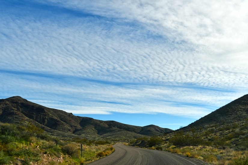
Our next destination would take us away from civilization so we grabbed a quick lunch at McDonald’s before leaving Las Vegas behind. While the fossil beds were fun, I was itching to get out into the desolate desert scenery that has captured my imagination for decades now.
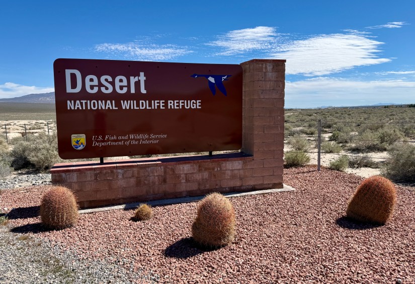
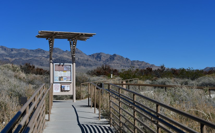
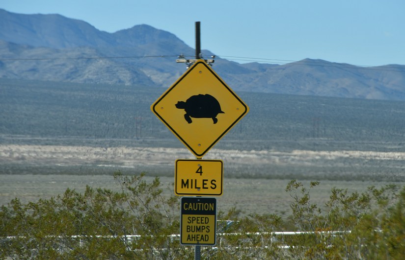
The largest national wildlife refuge in the Lower 48 was up next, Desert National Wildlife Refuge, specifically the area around the Corn Creek Visitor Center. I love a good wildlife refuge!
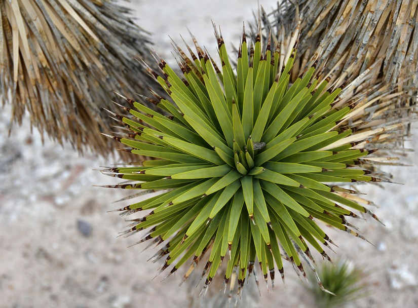
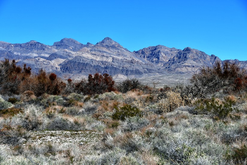
Created in 1936 to provide habitat and protection for desert bighorn sheep and other desert wildlife, Desert NWR is the largest wildlife refuge outside of Alaska. At 1.6 million acres (643,000 hectares), the refuge can cover Rhode Island twice – and still have enough room left over for a quarter of a million football fields. Teeming with diversity over a vast landscape, Desert NWR boasts over 500 plant species as it transitions from the Mojave to the Great Basin Desert.
Rhode Island is literally so small, ha!
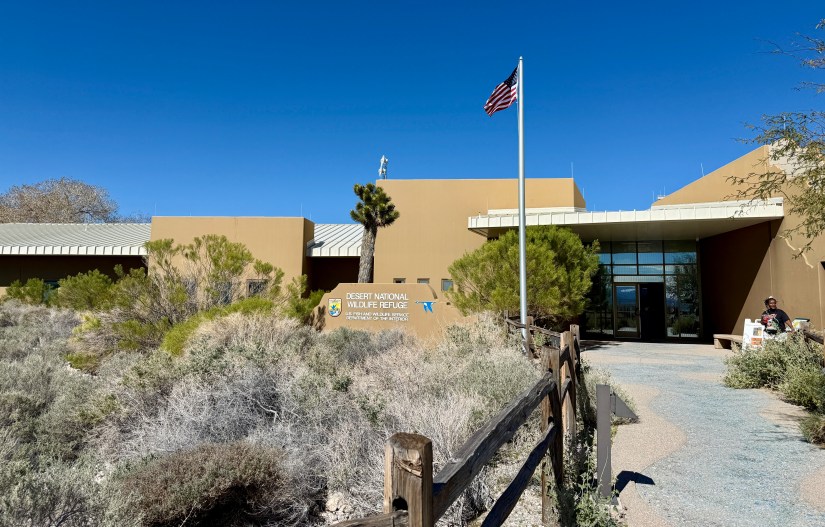
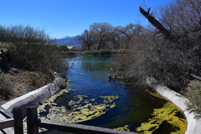
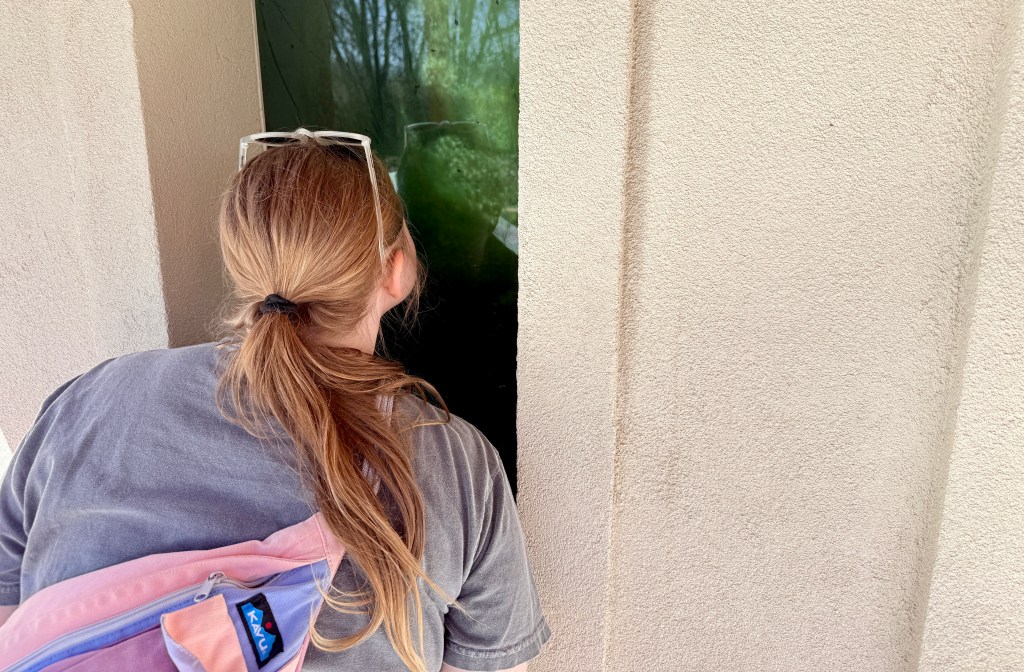
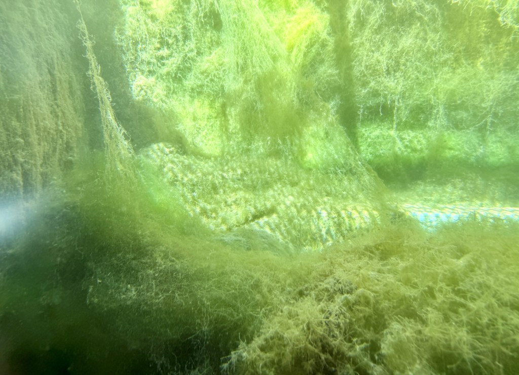
Of course, an obligatory spending spree at the gift shop was first order a business, followed by passport stamping (finally another stamp in my lonely Blue Goose Passport!), and romp through the visitor center exhibits. I was very excited to see the Pahrump poolfish, which is a critically endangered species that is fortunately protected in a refugium near the visitor center.
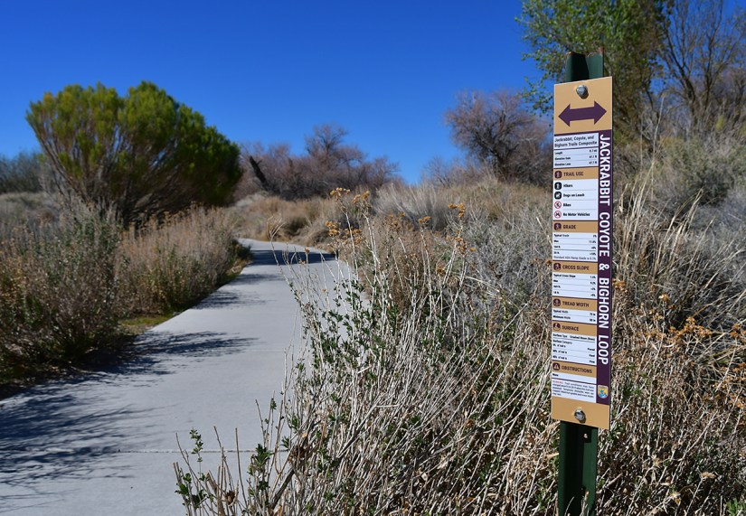
There are five hiking trails that leave from the Corn Creek Visitor Center, totaling about 1.5 mile in length (the backcountry has many more opportunities for hiking). Lindsey and I hiked a little less than a mile along the Jackrabbit, Coyote, and Bighorn Loops, with the poolfish refugium at the top of our list to see.
What a great way to kick off a desert adventure!
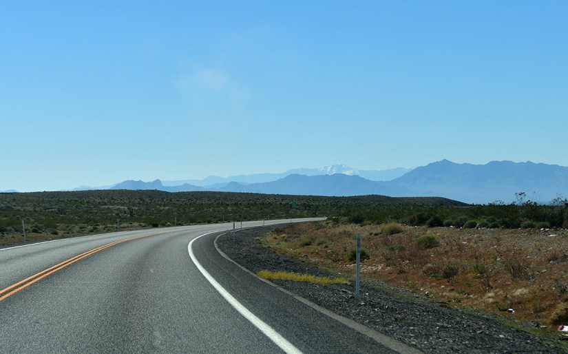
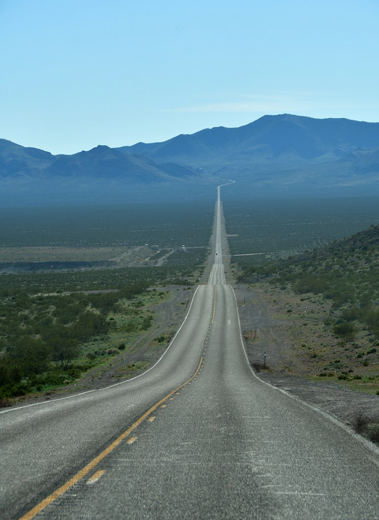
Now we just had a few hours of driving across nothingness to get to Death Valley National Park. We took to snacking and chatting, with me occasionally having to research the obscure military bases we kept stumbling across in the middle of nowhere (seriously… who has heard of Creech Air Force Base before?!). There was surprisingly good cell service along our route, which surprised me… but hey, came in handy for the research into top secret military installations!
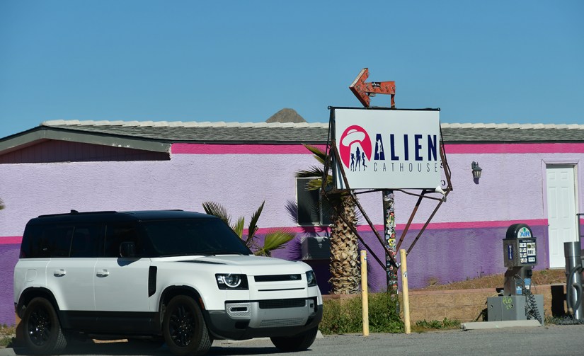
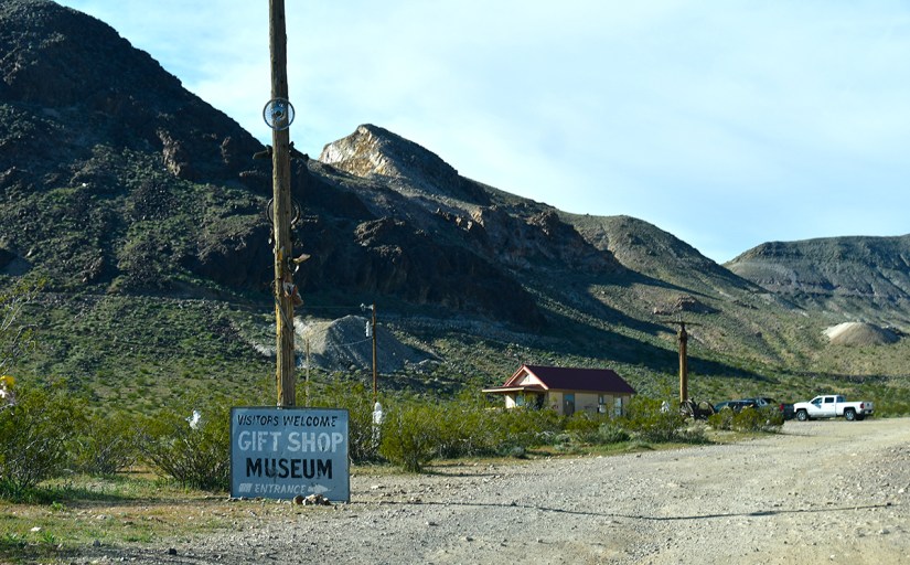
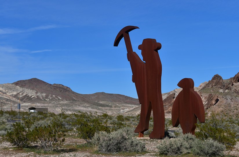
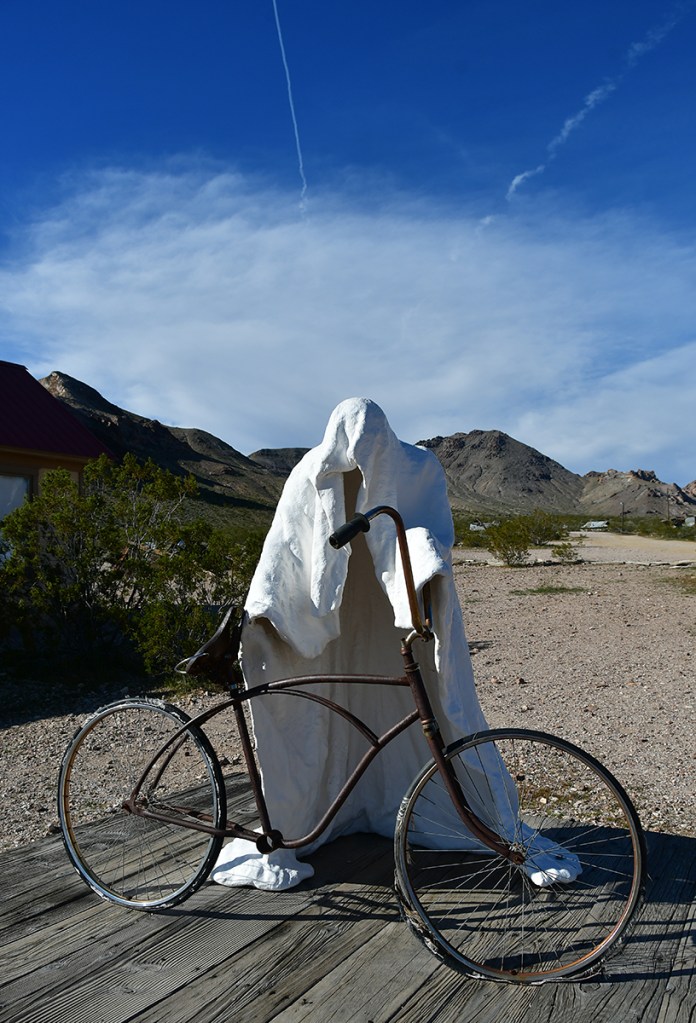
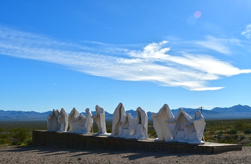
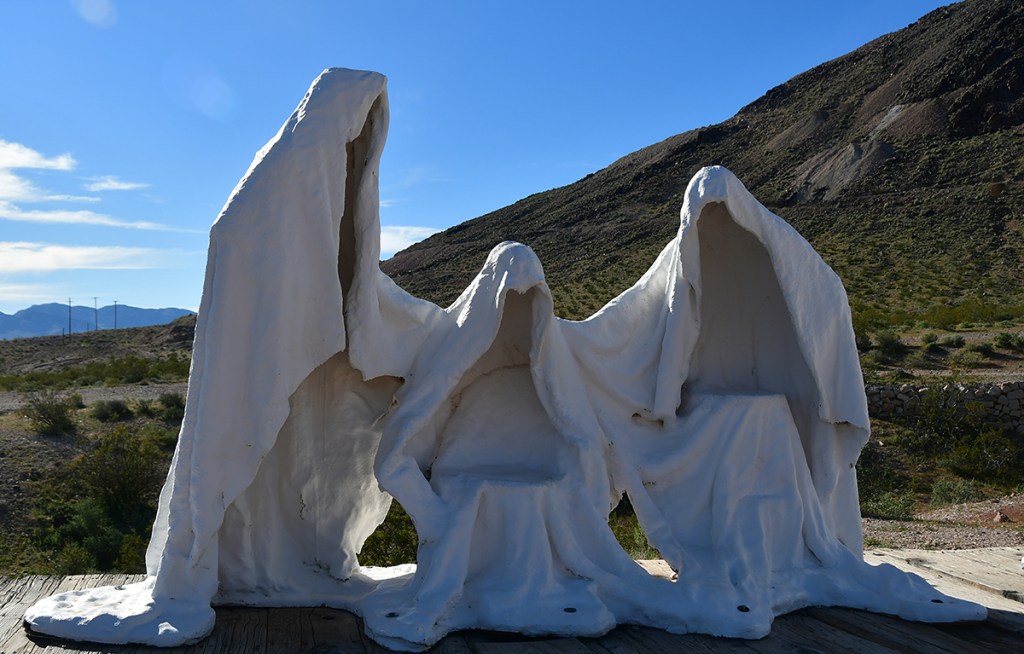
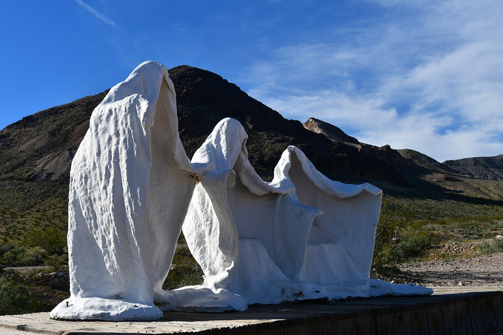
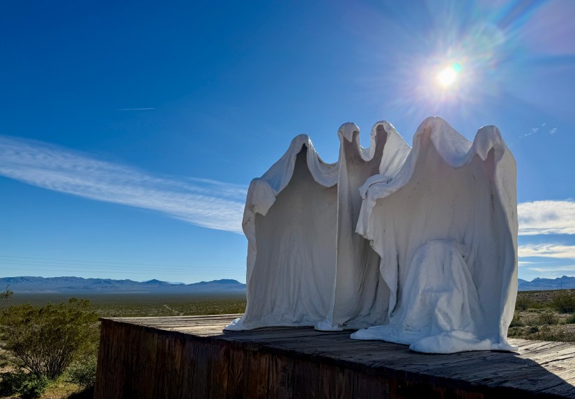
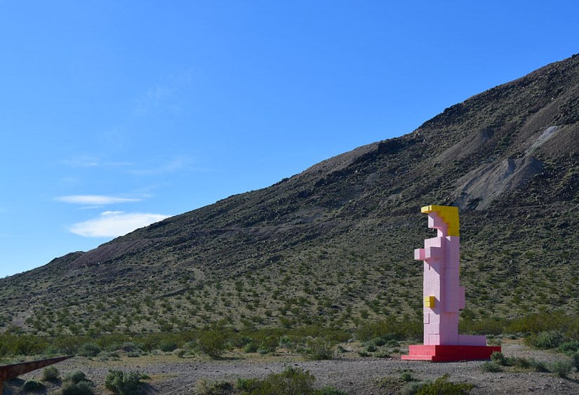
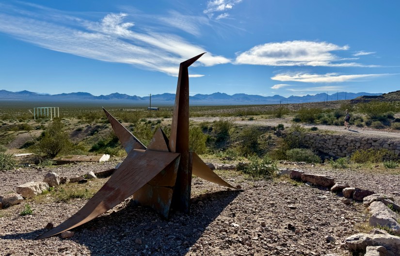
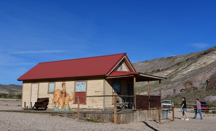
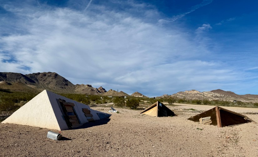
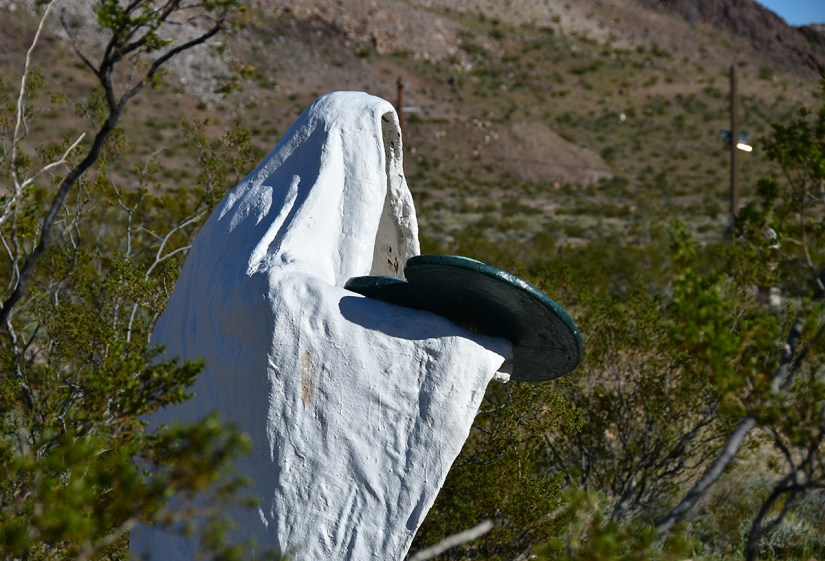
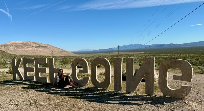
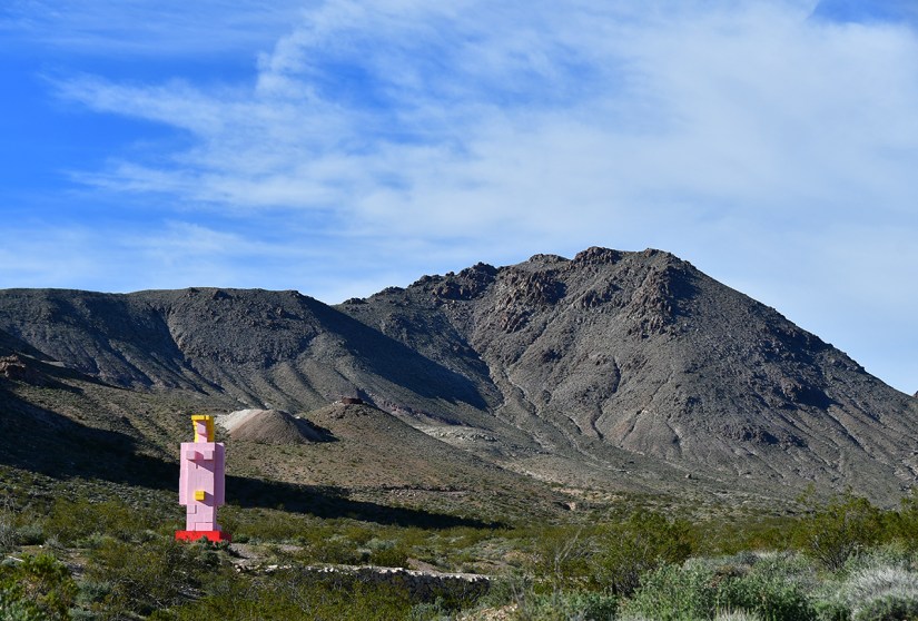
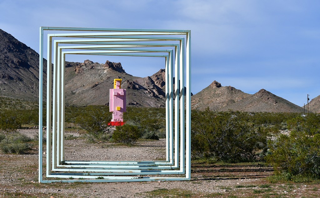
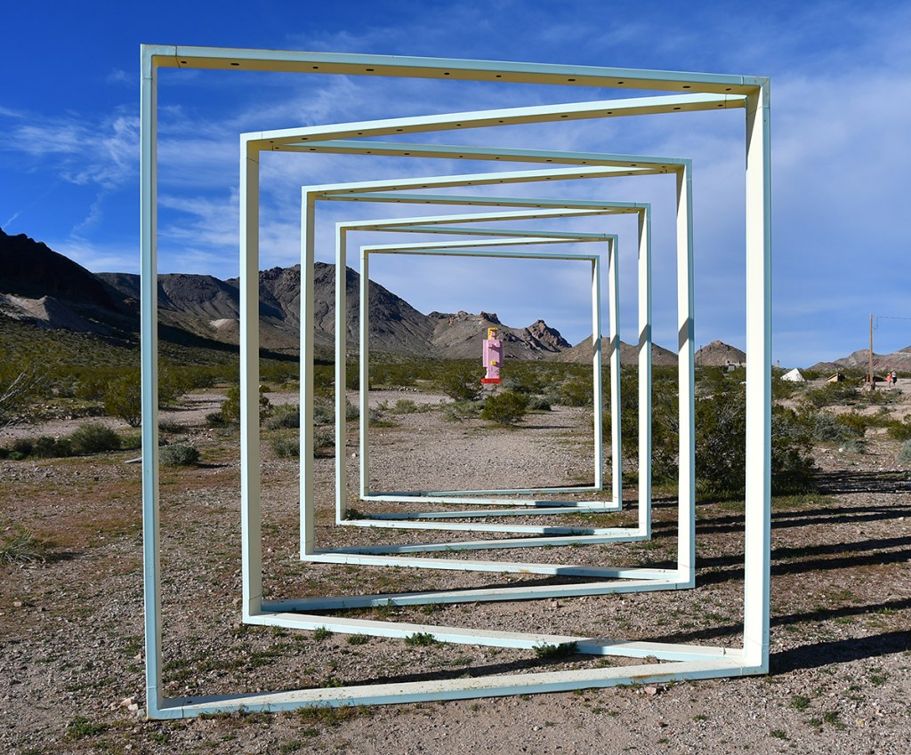
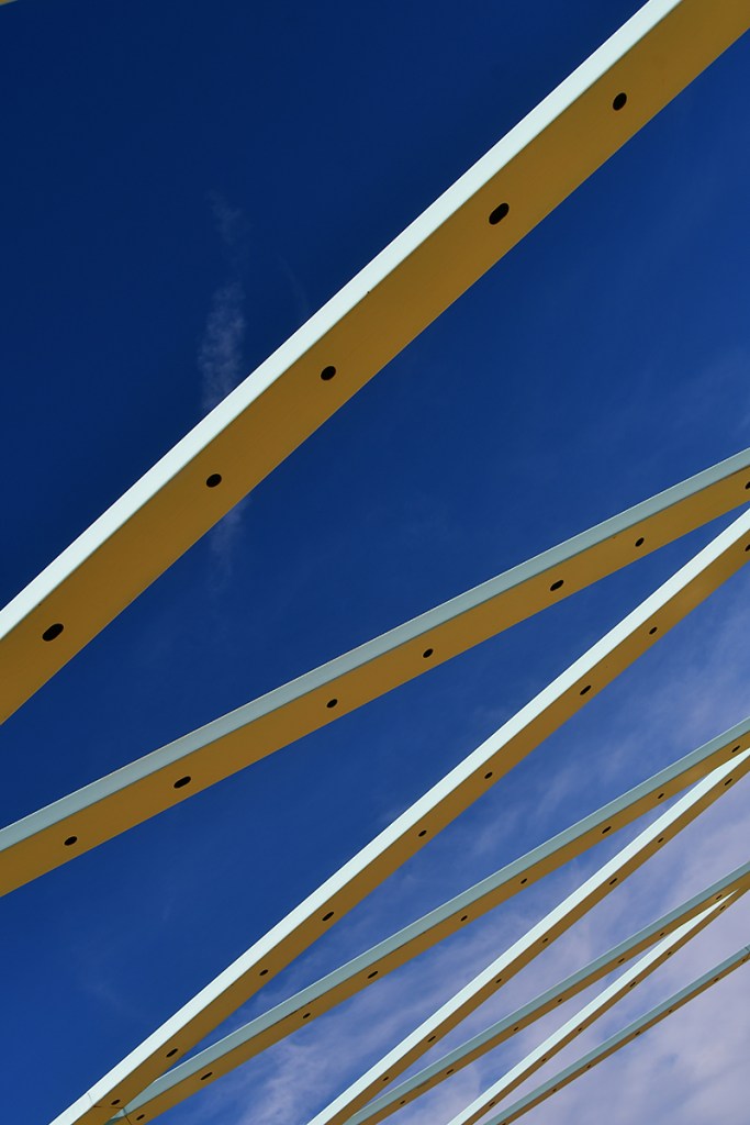
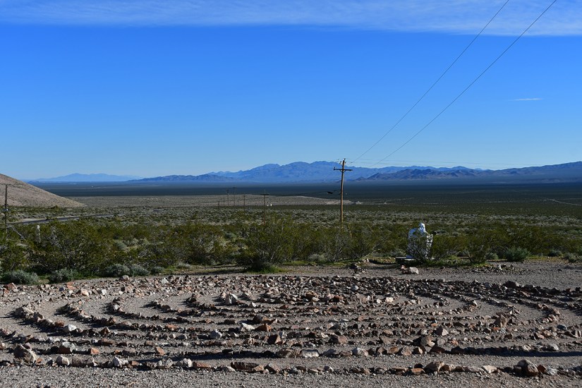
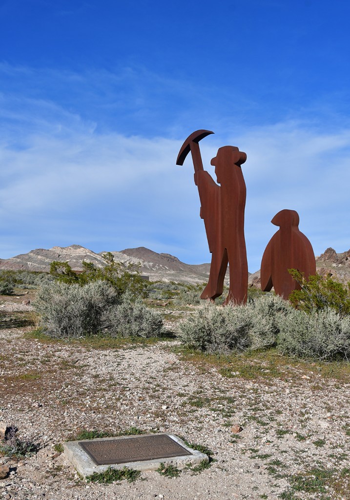
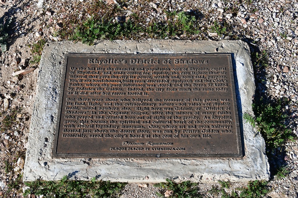
I promise we’ll eventually make it to Death Valley, the crown jewel of the trip. But first… weird stuff in the desert! (Well, maybe not as weird as the alien-themed truck stop and brothel we were just at.) I learned about the Goldwell Open Air Museum on an Instagram post, and immediately added it to the itinerary as it is just the type of thing I love stumbling across on a road trip! Not to mention that there is a Kcymaerxthaere installation on site, of which I have visited other locations in Hellnar, Iceland, and Shoshoni, Wyoming.
Just outside of Rhyolite, Nevada, a spectacular ghost town off the road leading to Death Valley, California, a group of prominent Belgian artists, led by the late Albert Szukalski, created a self-described art situation consisting of seven outdoor sculptures that are colossal not only in their scale but in their placement within the vast upper Mojave desert.
Oh, and there’s a gift shop! Lindsey and I are all about the trinkets and postcards! 😀
I really liked the “art situation” at the Goldwell Museum! I said it before, but it is just up my alley. I like weird stuff in the desert.
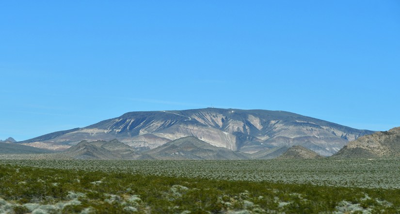
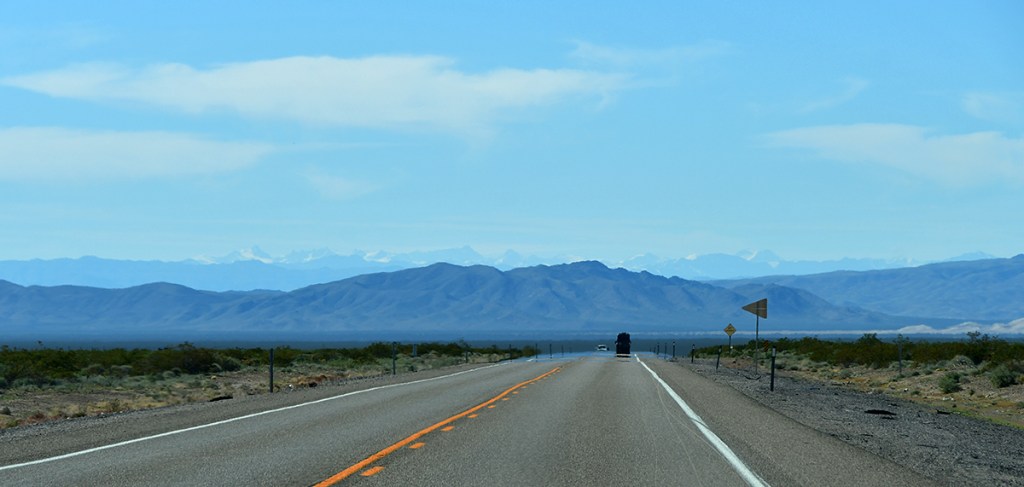
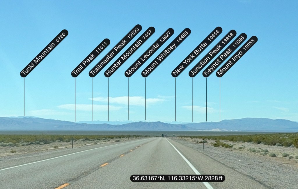
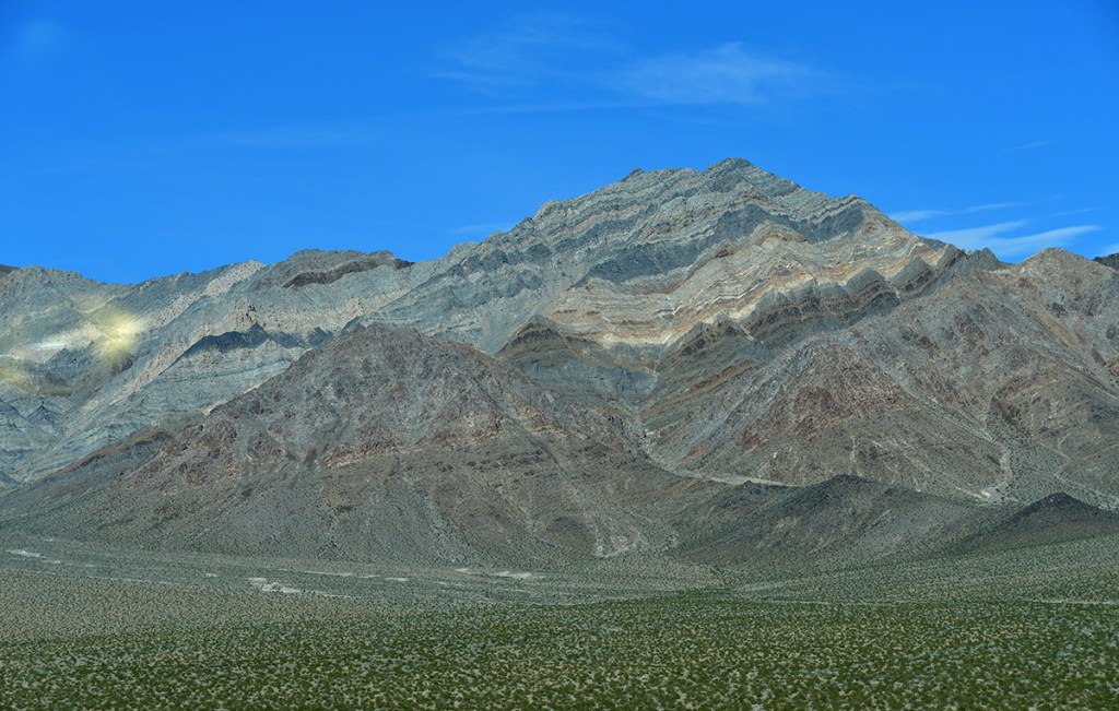
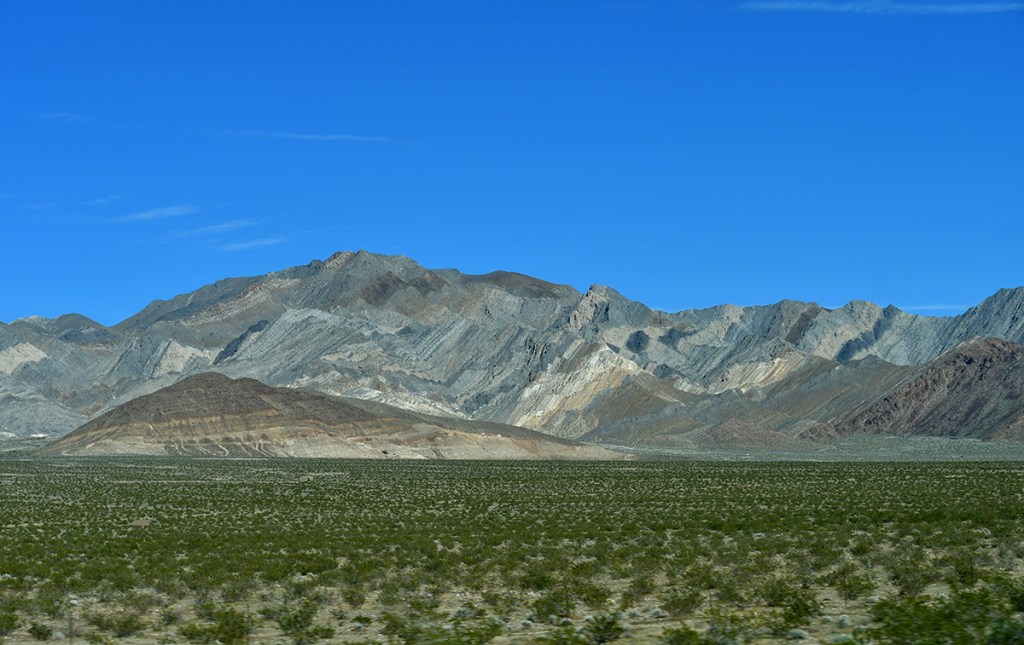
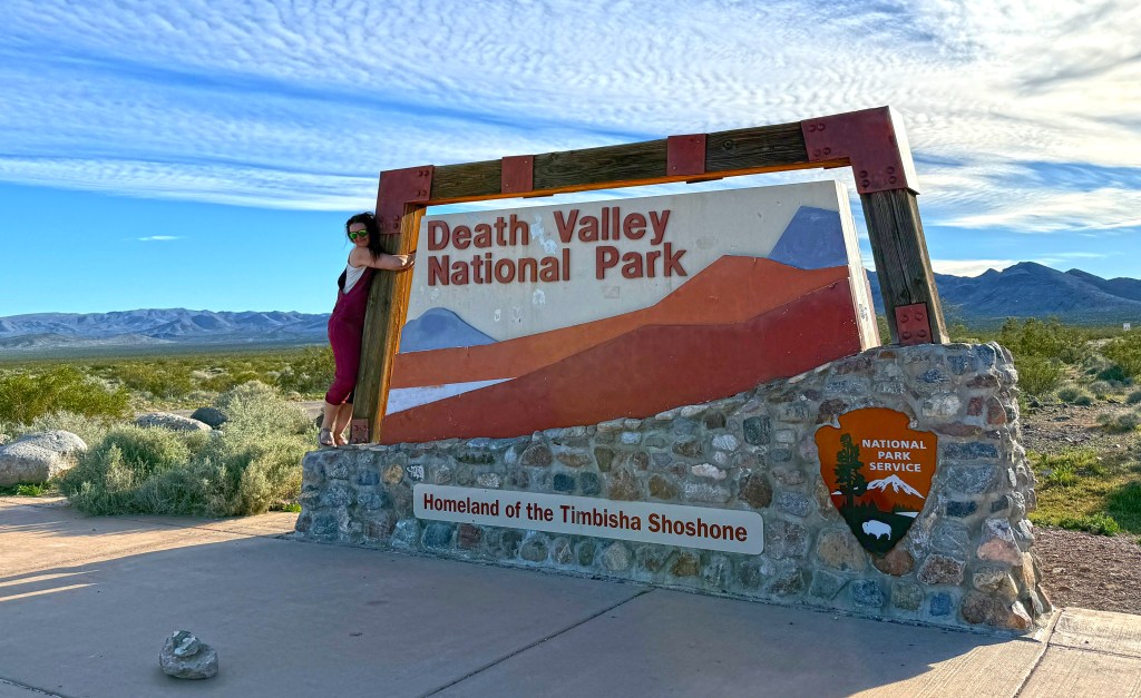
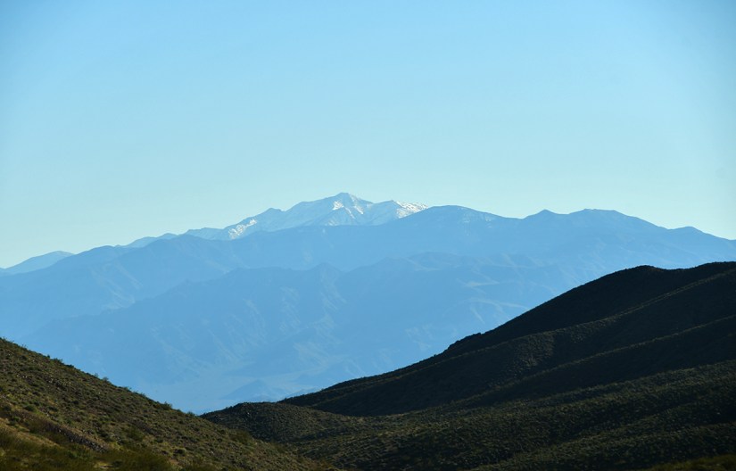
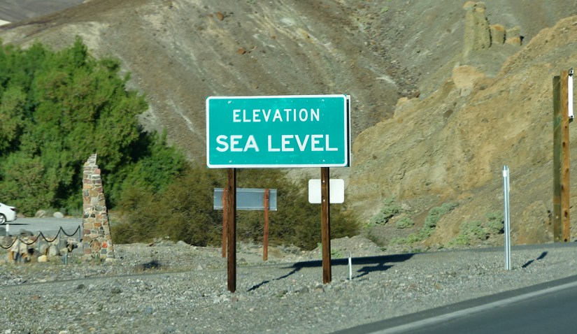
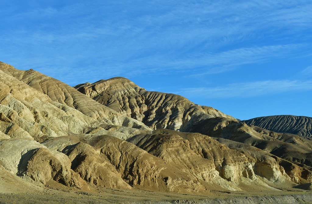
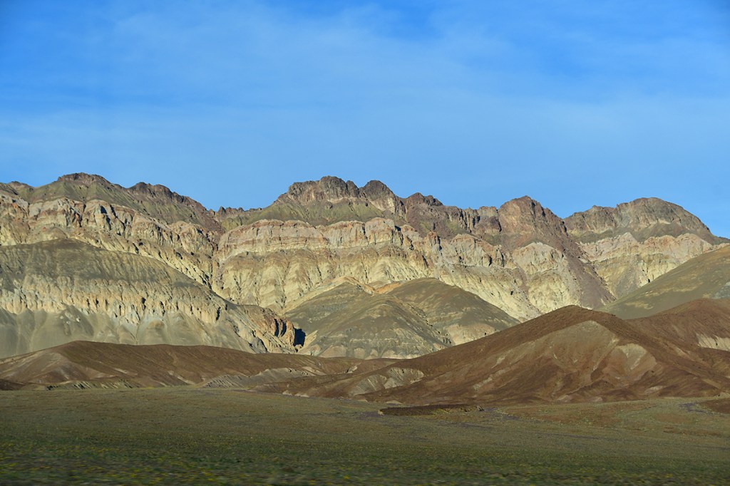
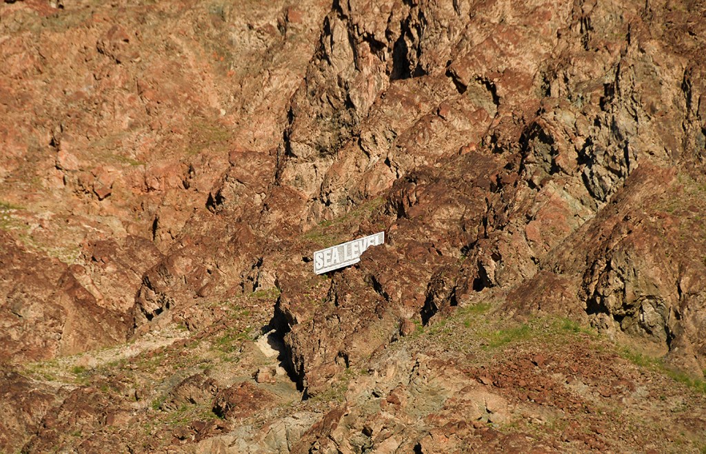
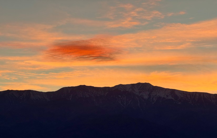
Finally… we were on the road, and crossing the boundary into my 95th NPS unit (and 21st national park) – Death Valley National Park! The hottest, driest, and lowest U.S. national park. The largest national park outside of Alaska. The second-lowest point in the Western Hemisphere at Badwater Basin, which sits at 282 feet (86 meters) below sea level. The greatest elevation gradient in the Lower 48 (Mount Whitney, the Lower 48’s highest point at 14,505 feet is only 85 miles away). Home to Basin and Range topography, ancient volcanoes, and experiencing one hell of a wildflower superbloom currently. Home to the highest ambient air temperature ever recorded on this planet – 134 °F (56.7 °C). On and on I could go… I already knew before this trip started that this would just be an introductory trip, and that I would try to make an effort to come back again for a visit. After all, Telescope Peak is sitting there, calling to me! But here’s to seeing what we can cram in during this short visit!
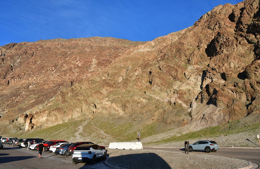
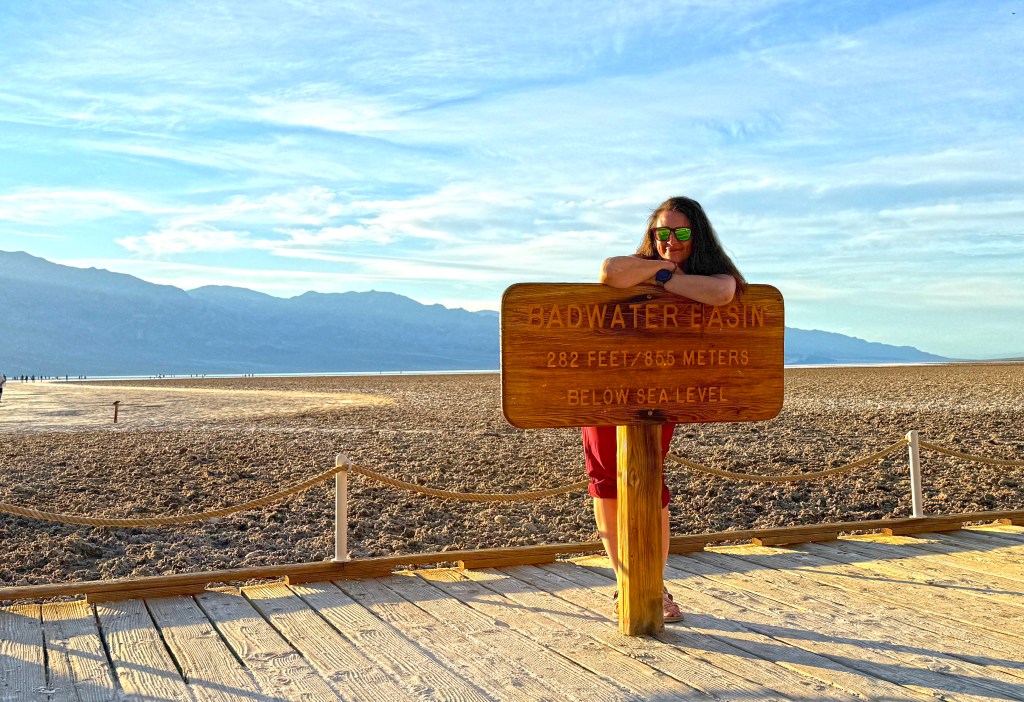
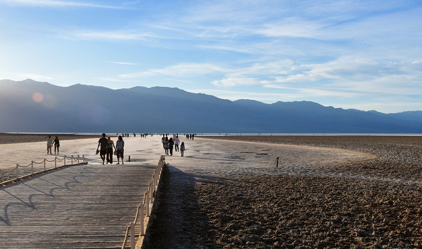
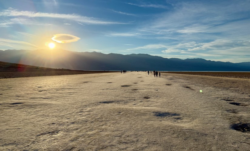
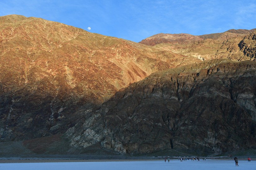
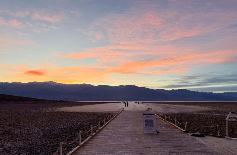
We cruised over Daylight Pass (4,315 feet at the summit), and then rapidly plunged towards Furnace Creek, which sits at -190 feet. My ears popped as I snapped away from the passenger seat (thanks for driving me around the whole trip, Lindsey!). With about an hour until sunset, we set our sights on Badwater Basin, which is the lowest place in North America (-282 feet).
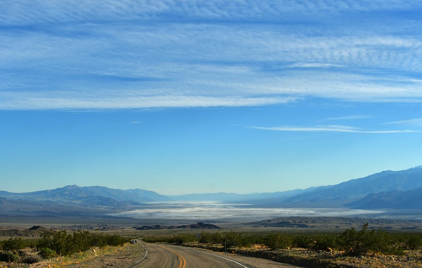
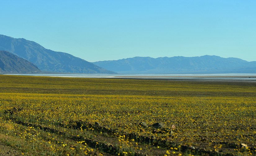
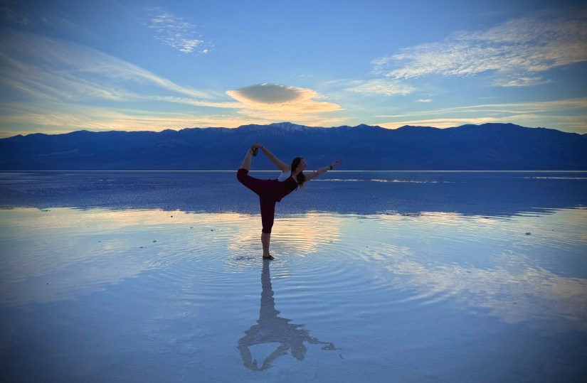
Badwater Basin covers almost 200 square miles, and typically is covered in salt flats and salt polygons (sodium chloride, calcite, gypsum, and borax make up the salt flats, I later learned). However, after very heavy rains, Lake Manly reforms (Lake Manly was a massive, prehistoric lake in the past), covering the salt flats. And wouldn’t you know, heavy rains in the last few months meant I would get to experience Lake Manly! Though the salt polygons are beyond awesome, I think I can settle for a rare lake of salty water in the driest place in the country!
After a quick restroom break, it was time to get low.. low… low… low… apple bottom jeans, boots with the fur, the whole club was looking at her…
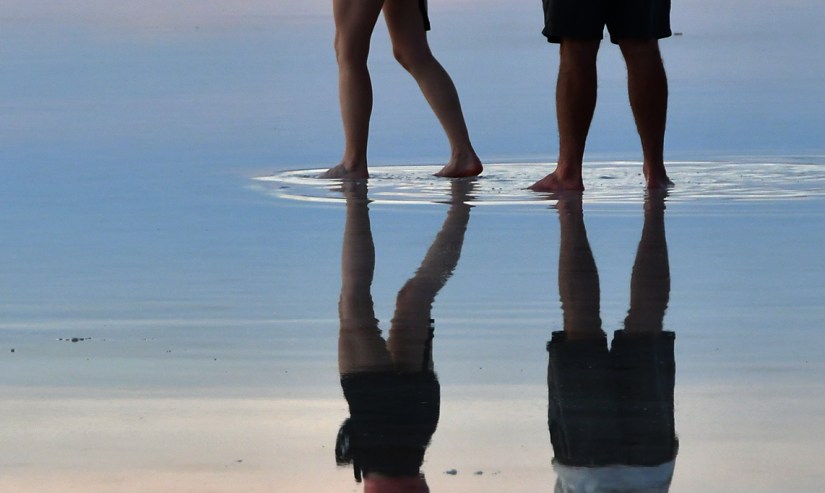
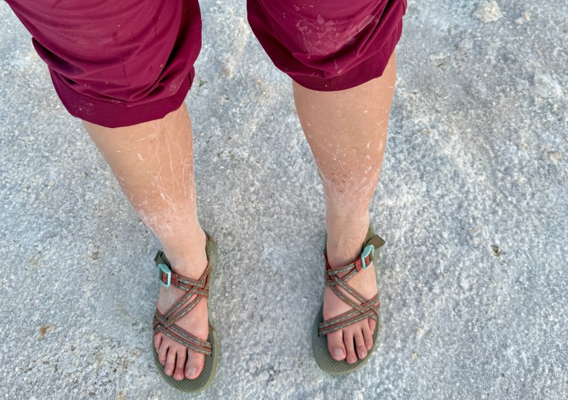
Okay, one thing I was not expecting was breaking through the rather thin salt crust into thick sticky mud! Lindsey almost became stuck for the rest of her life, but managed to pry her right foot loose. So thankful for Chacos! Also, the water was beyond salty. You think you know what salt water is like until you get in Lake Manly. To top it off, I noticed my Chacos easily floated when I took them off to clean out salt clusters.
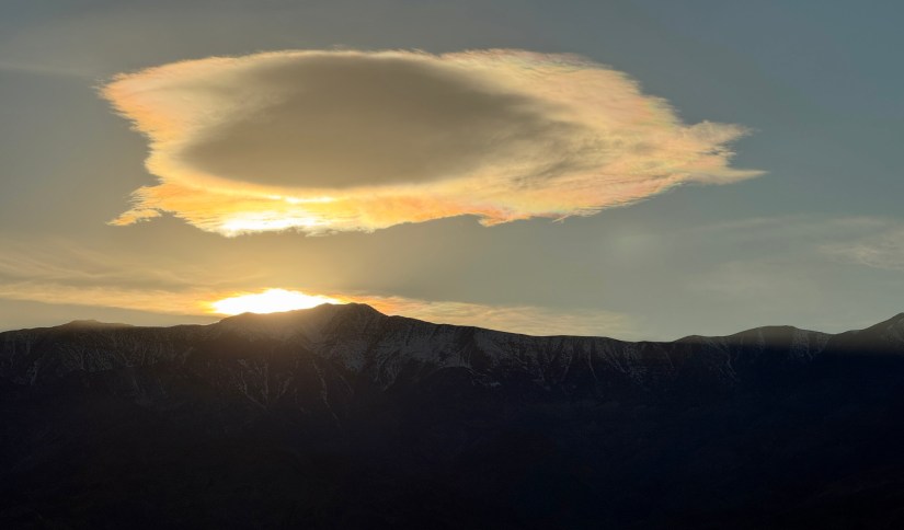
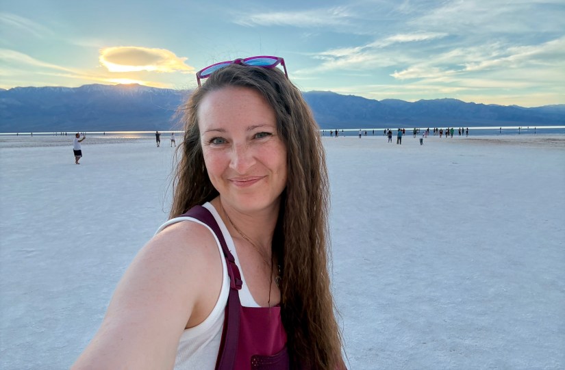
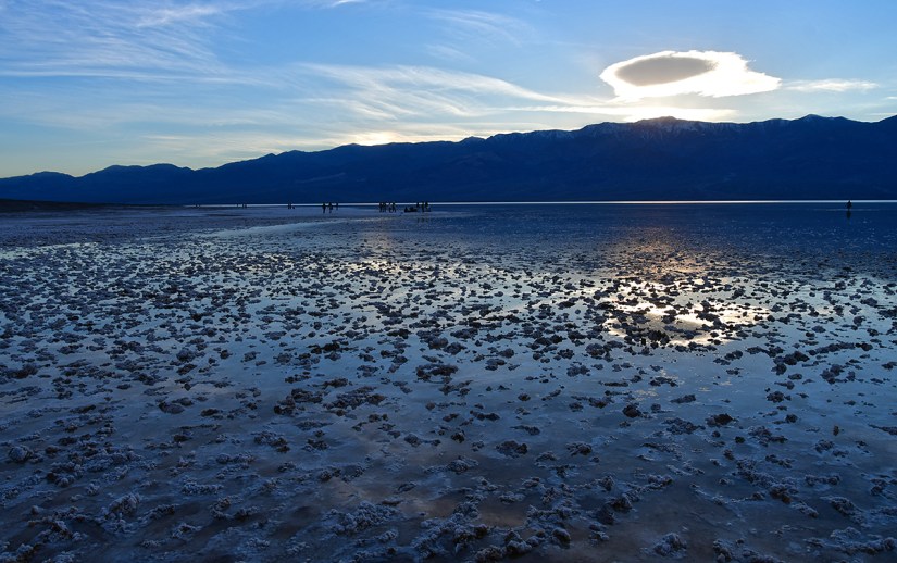
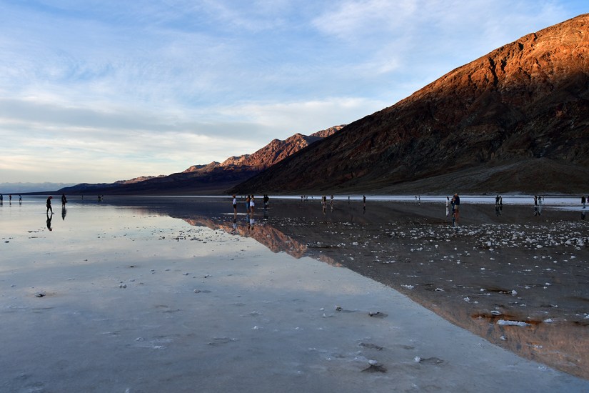
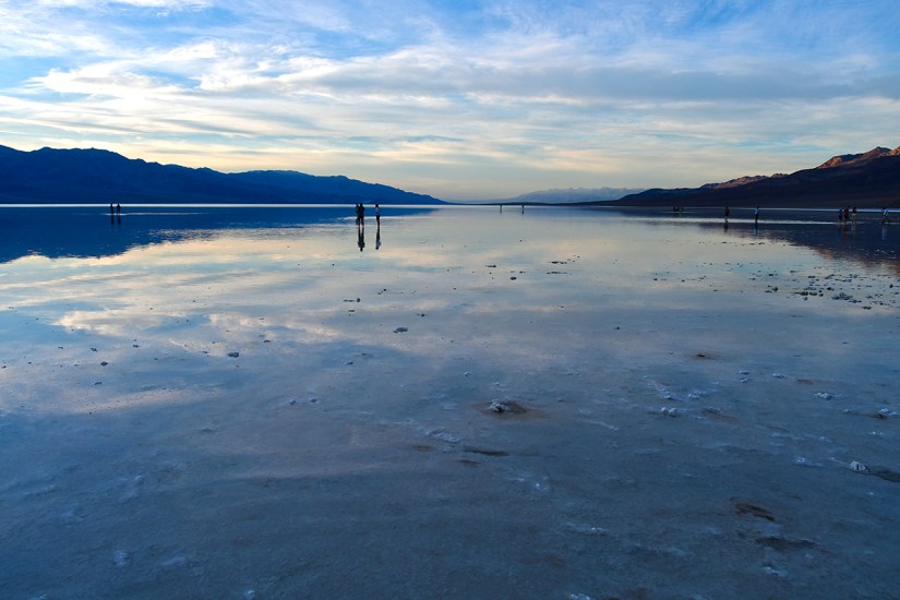
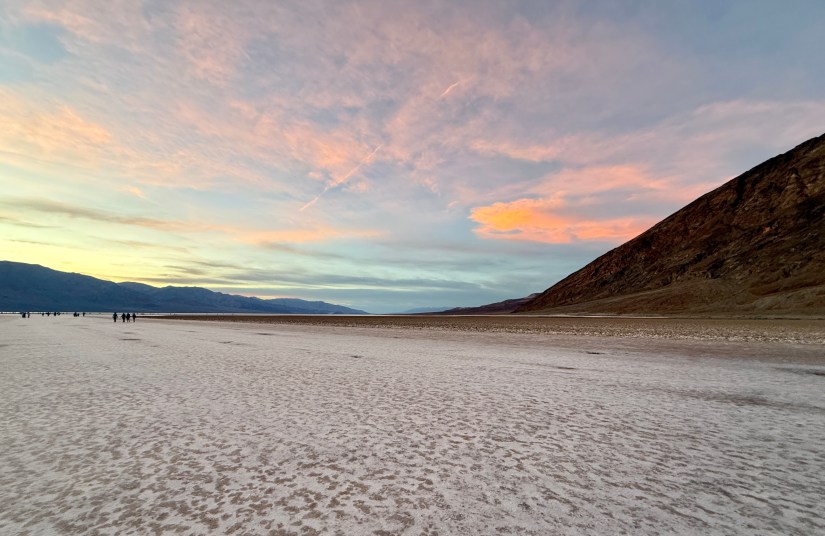
The sun set, and we were treated to a pink sunset as we headed back to the car. What a special time to visit Badwater Basin!
Our “home” for the night was site #40 in the Furnace Creek Campground, which I reserved shortly after we secured our airfare. It was dark when we set up, so I did not take any photos – in fact, I completely failed at photographing anything in this campground! The overnight low was suppose to be in the mid-60s, which is crazy hot… but don’t worry, I brought an R value 6.2 sleeping pad (my new Nemo Eclipse, which I am testing out since my ultralite Thermarest was not making the grade and went back to REI) and a 15-degree comfort rated sleeping bag! (Yes, I sweated all night long.)
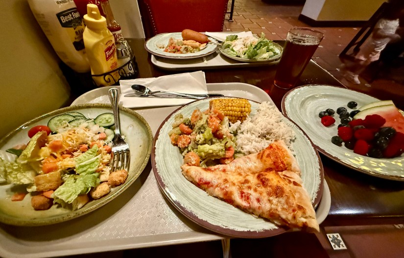
After throwing up the tent, we set out to find some dinner, knowing we’d be stuck paying crazy national park prices. We opted for The Ranch 1849, which is a buffet restaurant. I think it was $25 per person if I recall correctly, but there was plenty of options and I highly doubt we could’ve eaten cheaper in Furnace Creek! Afterwards we got trapped by yet another gift shop… whoops.
A long day lured us to our sleeping bags after attempting to clean off the rest of Lake Manly from our legs and feet. Here’s to seeing how I sleep at -190 feet (which is 12,950 feet lower than the highest place I have ever camped)!

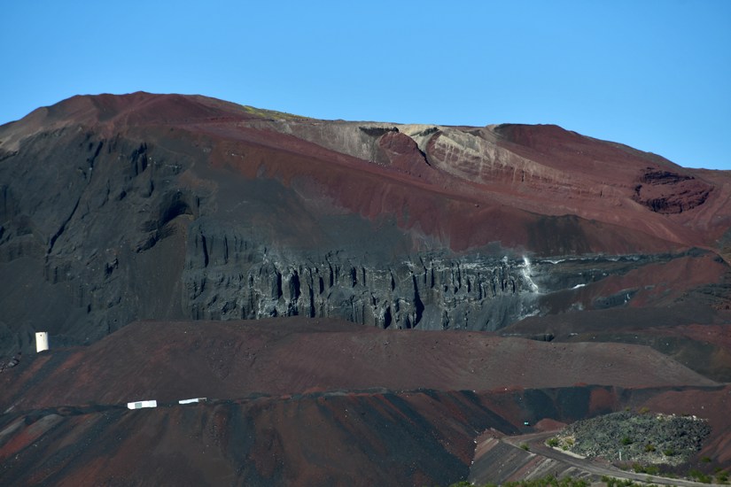
Okay first of all, whoa! That red mountain?? And those reflection photos?? GORGEOUS!
Second of all, I laughed really hard at the name Pahrump poofish 🤣
Third, I’m bookmarking this so I don’t miss any of these cool and/or weird stops when I go to Death Valley (maybe later this year… fingers crossed)!
LikeLiked by 1 person
I kept singing “The Little Drummer Boy” every time I saw the word Pahrump LOL!
You are going to LOVE this area! I am sad my trip was so brief, but then again the heat was a bit much for me so I think I’ll have to come back in the dead of winter next time.
LikeLiked by 1 person