

August 24, 2025
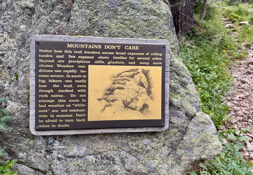
The day I had been most anticipating had arrived! After a day of side questing to Lakes Nokoni and Nanita, I’d be heading back on the Continental Divide Trail (CDT) section through Rocky Mountain National Park. Anticipation was high because I’d have nearly 2,900 feet of elevation gain in my day as I’d leave the forest behind to spend most of the hike way above treeline in the alpine environment – and because at 11.2 miles, this would be my longest day of backpacking ever. This was not going to be a walk in the park (ha, I made a pun!)!

Trip itinerary (day discussed in this blog is italicized):
- Day 1: North Inlet Trailhead to Pine Marten wilderness campsite
- Day 2: Lakes Nokoni and Nanita
- Day 3: Pine Marten wilderness campsite to Tonahutu Meadows wilderness campsite
- Day 4: Tonahutu Meadows wilderness campsite to North Inlet Trailhead
A 6am alarm woke me from my slumber. I set a firm deadline of departing camp by 7am, as I would be racing weather most of the day. Knowing the best way to will myself to get a move on, I quickly deflated my sleeping pad upon waking up, and packed away my sleeping quilt. I gagged down bites of granola in between chores… breakfast was not going well, so I settled on Breakfast Essentials added to my coffee and resolved to catch up on calories as I hiked (is that even a thing?).
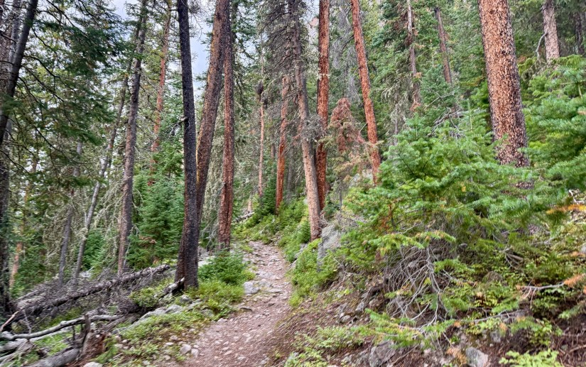
At 6:54am I hit the trail! Whew, I cut that a bit close to my deadline! There was about a half-mile of descending down to rejoin the CDT/North Inlet Trail, and the climbing immediately began with ten switchbacks. Back to my old ways, I took to counting off each switchback in German, and willing myself to just keep moving forward.

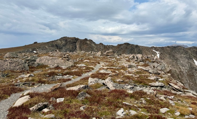
Shortly after the tenth switchback the views broke a bit to the high alpine I’d be traversing in a short while. It was exciting – and daunting – to see where this day’s hike would take me.


At Hallett Creek I ran into Kent, who I met the day before at Lake Nokoni. I sat down for a short break, stuffing snack after snack into my face as my body was now ready to eat food. I really wish I had waited to eat my granola at Hallett Creek! Lesson learned for future backpacking trips (I’ve never been one who could eat too early in the morning). As a side note, I started out with two liters of water from my campsite as I was unsure of water sources as I crossed above tree line. FarOut is not consistently updated with comments on water sources since most thru hikers skip this section, and I think most doing the CDT Loop have no idea what FarOut is. Hallett Creek definitely could have been a fill up point, but I had barely drank any water by the time I reached it.
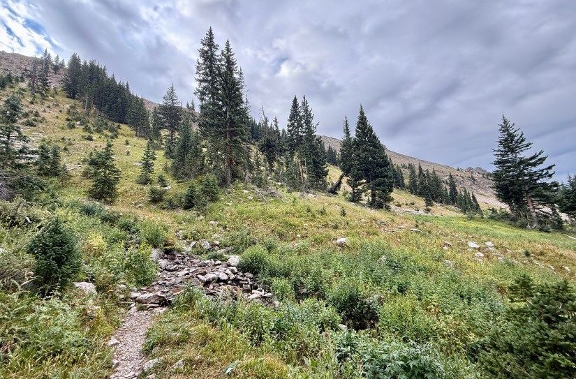
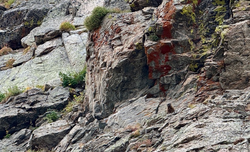
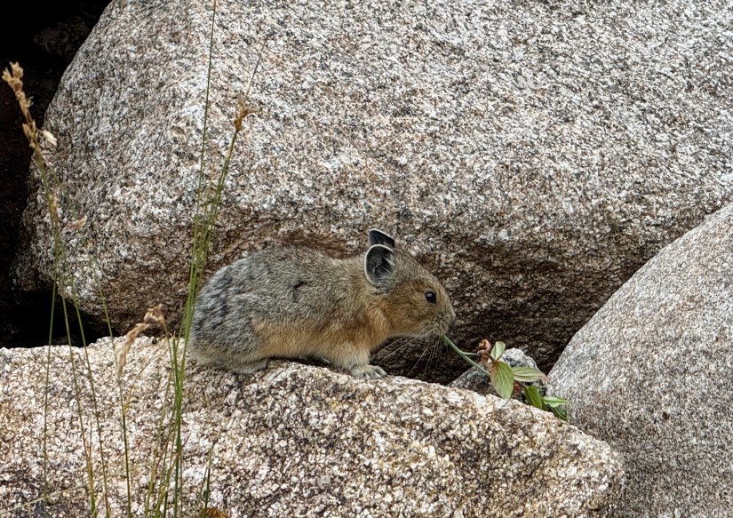
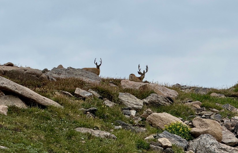
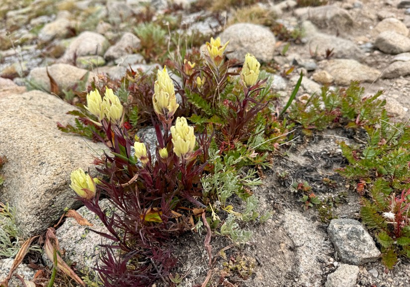
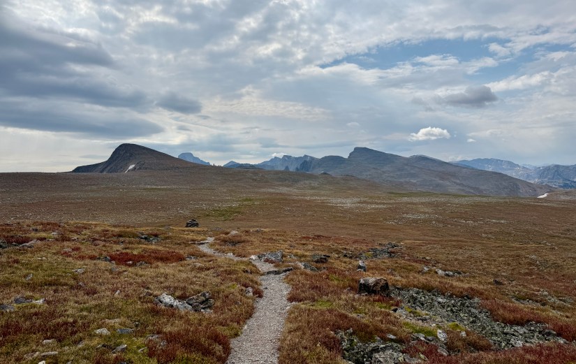
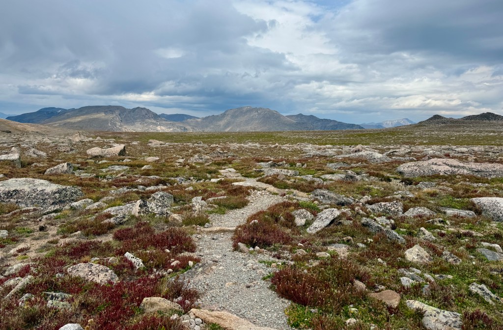
With pep in my step, I set out to accomplish the next set of switchbacks that would take me above the trees, and into the alpine tundra for the next seven-ish miles. Marmots and pikas chirped their warning cries as I walked through wildflowers hanging on in late August. The views opened up behind me, and I took to worrying that I was seeing sheets of rain approaching (no worries, it was just wildfire smoke instead…). The biggest smile was plastered on my face, and I felt strong.


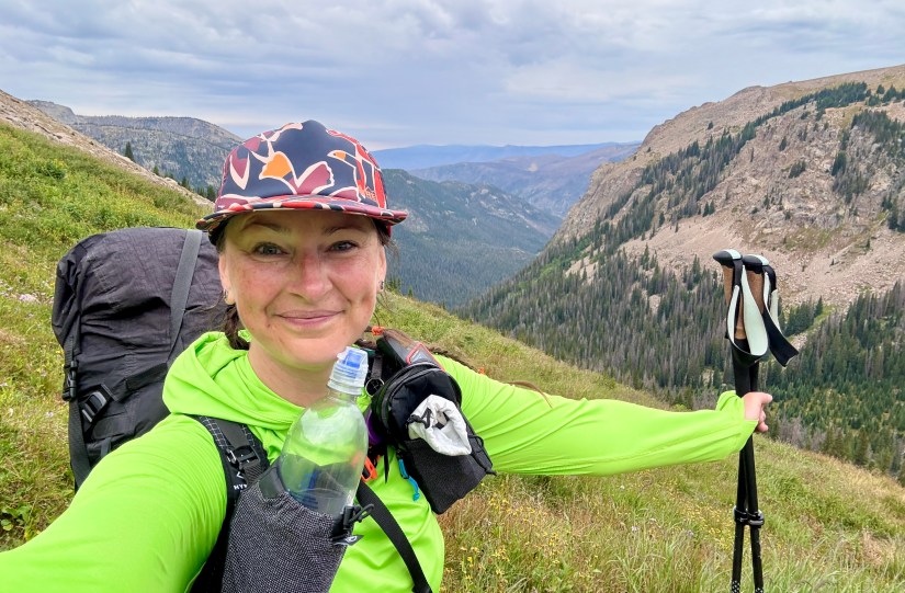


For two miles I traversed across the alpine tundra, and I could not stop smiling. This is my happiest of happy places. It was hard to not take a million photos as I took in the mountains and views around me. I did take a moment to call my parents while I had cell service to check in, which went something like:
Mom: “You sound out of breath!”
Me: “I’m hoofing it above 12,000 feet, of course I’m out of breath!”
The lack of oxygen was real, what can I say?


At 5.7 miles I finally reached the junction where the North Inlet Trail ends at the Tonahutu Trail and Flattop Mountain Trail. I was so excited to see the trail marker, as I knew this would be my snack spot.

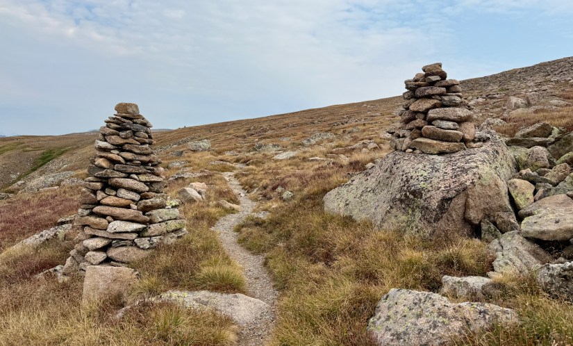
The weather was taking a turn in the chilly direction, or maybe it was just all my sweat sticking to me in the strong, cold winds that made the temperature seem like it dropped. I tucked behind the large cairn at the trail junction, and put on my rain jacket for good measure to try to block the wind. I loaded up on snacks… and plastic (the wrapper on my rugged Snickers bar that had seen some stuff in its life got stuck on the chocolate in small bits, and well…. I just ate it with the plastic pieces on it), and took a small nature break. Then the hustle began again (but not before I took a trail that was NOT the trail, and added in some bonus miles to get back on the Tonahutu Creek Trail).
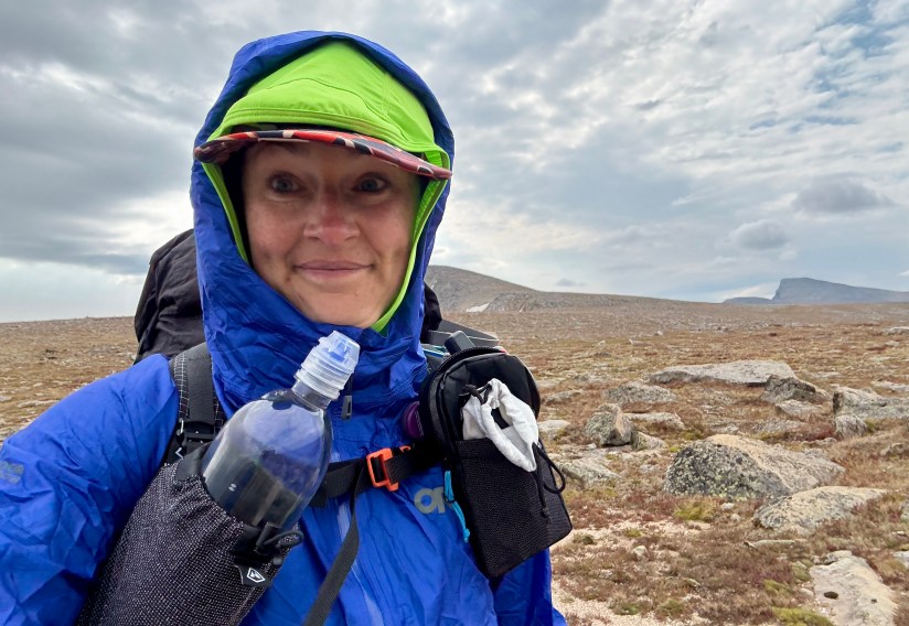

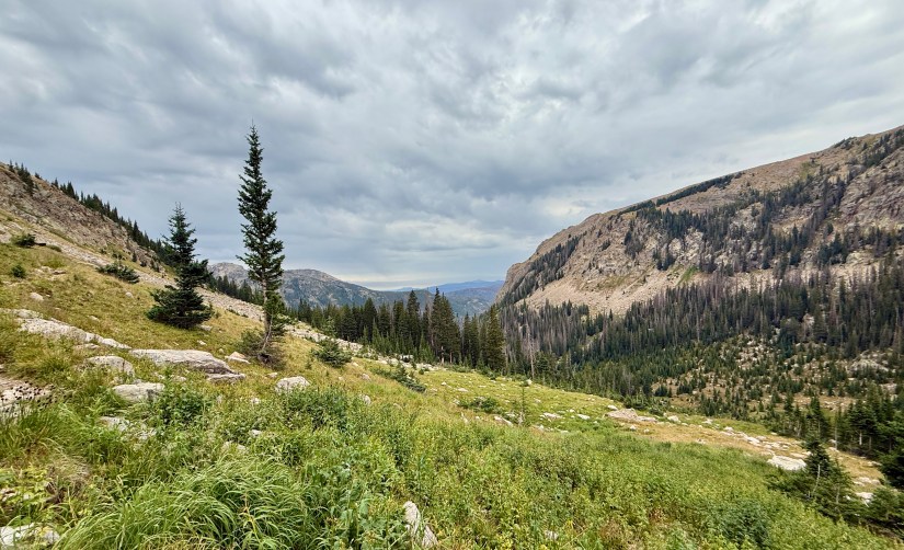
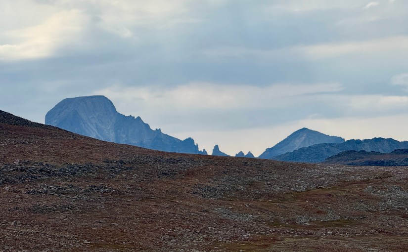
It was really cold, and I hustled hard on the trail up the shoulder of Ptarmigan Point in efforts to stay warm. Ideally I should’ve put on my gloves and rain pants, but I made due! I am happy I glanced a moment behind me, as Longs Peak enamored me with its unique shape. I also could see all the way to Grays and Torrey Peaks to the southwest. Arghhhh, SO. DAMN. HAPPY!


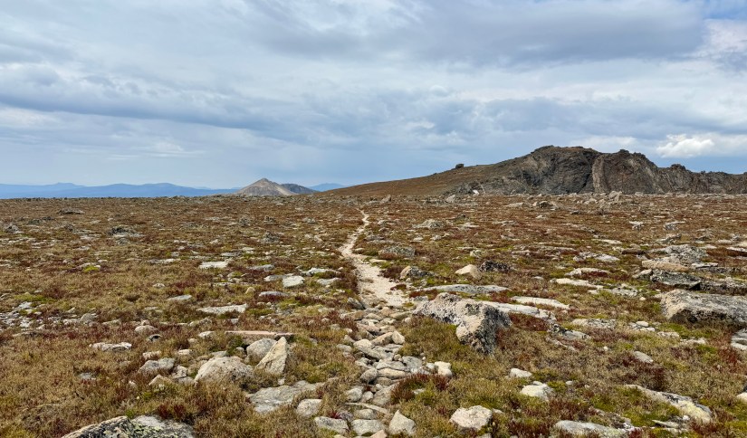
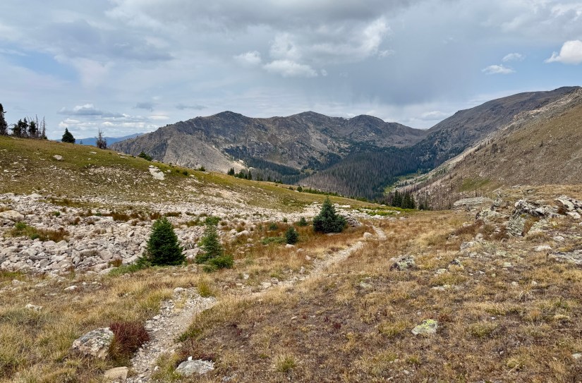
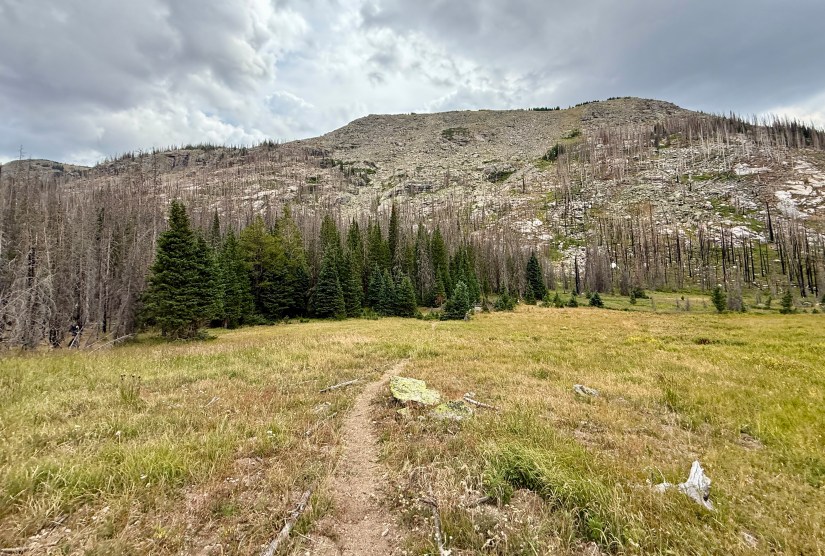
If I had to talk about one thing that took me by the most surprise on this entire trip was the time spent well above tree line. I am not sure why I had the notion in my head that once I left Ptarmigan Point I’d quickly be below tree line, but that notion was incredibly false! I would have another 3.5+ miles of traversing across the alpine before the tundra gave way to krummholz and willows, and finally to pines.
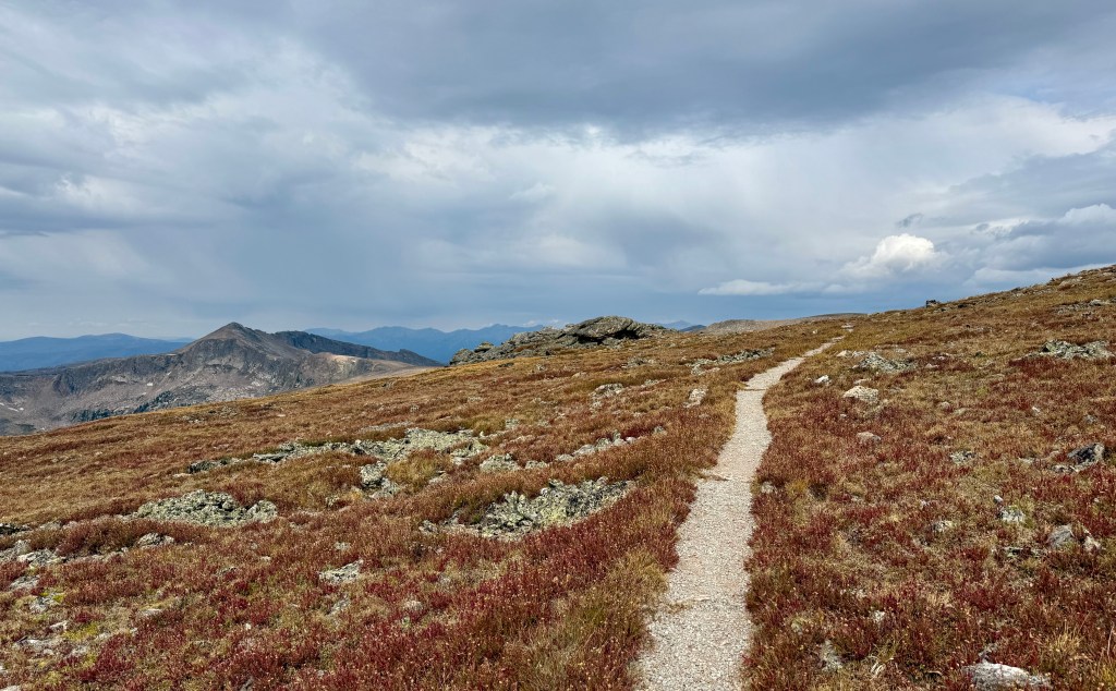


The weather held, aside from a few random sprinkles, but I still wanted to get in the trees as quickly as I could. Unfortunately the trail was anything but a smooth cruise as I lost elevation, and degraded quickly into small boulders and loose conditions, which was mentally draining as during every foot step I had to concentrate on my foot placement. The last thing I wanted to do was badly sprain an ankle (or worse) all the way out here!


My alpine smile and joy turned into grumbles and a frown as I slowly picked my way down the trail, wishing for things to smooth out so I could stop thinking so much about my ankles. I was very thankful when I finally hit the tree, though it hardly meant the descent was over (as what goes up must come down… I would lose most of the 2,900 feet I gained before reaching my campsite).

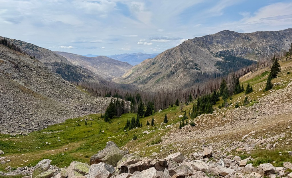

I began crossing in and out of the East Troublesome Fire burn scar, and once again I was thankful for the cloud cover to help keep temperatures on the cooler side.


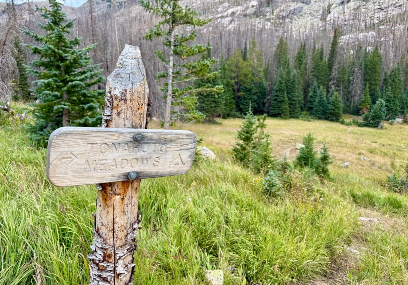
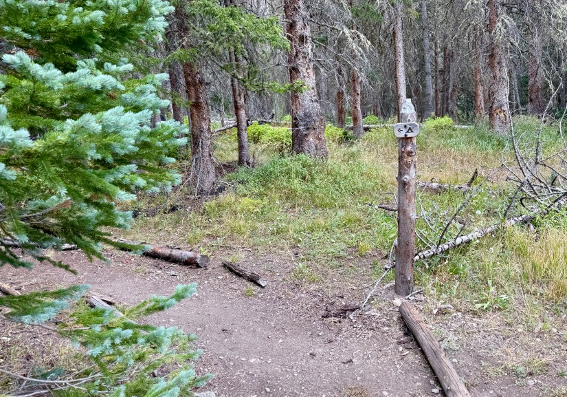
Arriving at my campsite for the night, Tonahutu Meadows, was a relief after almost exactly six hours and 11.2 miles of hiking. I was ready to sit down, get the pack off, and most of all, get off the ankle-breaking trail! Tonahutu Meadows, though surrounded by the burn scar, manages to have the campsite in a bit of trees, which was nice. A quick descent through thick grass (is it still tick season? Gosh I hope not!), and turning left at the sign took me to the quiet and private campsite around a quarter-mile off the trail. With thunder overhead, I took to quickly setting up my tent (with regrets, because I think I could’ve squeezed the tent under trees that would’ve provided more protection from the rain).

Racing the rain, my final camp chore was filling up my three liter CNOC bag so I wouldn’t have to get out to filter the rest of the evening. The access to Tonahutu Creek that was closet to my tent was a bust as the shore was several feet down, so I went back to the signed split off. Here is where I had a total dumb moment… I FORGOT I was still wearing my shoes, and walked right into the shallow flow of Tonahutu Creek. What the heck, Heidi?! Feet soaked, I rolled my eyes at myself, stuck the bag in the water, and headed back to camp. Wet socks and shoes it is…
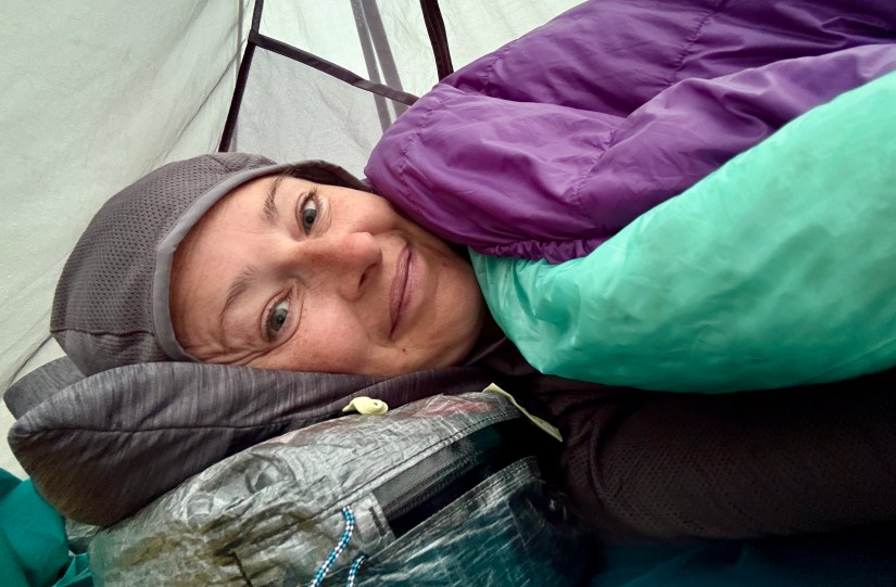
I made it back in the tent as the rain started falling, so I took to setting up my sleeping pad and quilt, and hung the wet socks up to dry (I would successfully get my toe sock liners dry, and just hiked the next day in my spare set of socks I was sleeping in). I had an epiphany, and realized I could do whatever I wanted, so I cooked up my Peak Refuel chicken pesto meal for lunch – there was no rule that I had to save it for dinner!
Early in the evening after the rain calmed for a bit I heard a “Hello! Heidi?” through the trees, followed by “It’s Kent!” I scrambled out of my tent, and Kent and I had a lovely chat about various travel plans (he was heading to Iceland right after his backpacking trip wrapped up!). It was a nice way to spend a few minutes in the evening, and savoring those “single serve friends” I have made during my travels and adventures.
The rest of my evening consisted of reading, trying to dry out my toe socks, and huddling in the tent as the rain continued. Bedtime came quickly as the gloomy storm clouds brought darkness ahead of sunset. I settled in for a damp, chilly evening with the sounds of elk bugles nearby. Tonight was the night for sleeping in my fleece, with a hat on my head!
What an absolutely magical day on the Continental Divide! It was exactly what I needed to make myself realize that I can do this whole backpacking thing with longer miles than I was use to (or thought I was capable of). The doors of possibility begin to open…
Trip details (all data recorded on Garmin Enduro 3):
- Mileage: 11.19 miles
- Elevation gain: 2,884 feet
- Time: 6 hours 3 minutes
- Trail: CDT 1381.5-1391.75 / North Inlet & Tonahutu Creek Trails
- Start: Pine Marten wilderness campsite #1
- End: Tonahutu Meadows wilderness campsite
Read about Day 1 here and Day 2 here
For information on obtaining wilderness camping permits in Rocky Mountain National Park, please visit my guide!

2 thoughts on “Rocky Mountain National Park CDT Loop: Day 3 – Across the Great Divide to Tonahutu Meadows”