Backpacking, Colorado, Hiking, National Parks & Monuments, State Parks, Rocky Mountain National Park, United States

Rocky Mountain National Park CDT Loop: Day 1 – North Inlet Trailhead to Pine Marten

August 22, 2025

Stretching roughly 3,100 miles from the Mexican border to the Canadian border, the Continental Divide National Scenic Trail (or CDT) has been an object of my obsession for quite awhile now. While I have chewed off small bits here and there on foot and mountain bike over the years, recently I have desired to get out and knock off more and more sections.

Map showing the route of the Continental Divide National Scenic Trail (CDT) across the Rocky Mountains, with highlighted states including Montana, Idaho, Wyoming, Colorado, and New Mexico.
Overview of the Continental Divide Trail, which stretches 3,100 miles from Mexico to Canada along the Continental Divide in the U.S.

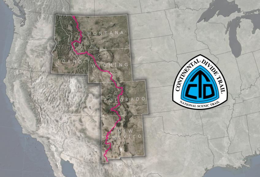
In Rocky Mountain National Park, the CDT forms a misshaped sideways “U” of about 28 miles. Because of the red tape involved with backpacking in RMNP – meaning very competitive wilderness campsite permits and bear canister requirement, most long-distance thru-hikers skip this section (unless they’re one of those badasses that don’t blink at a 30+ mile day), taking a short alternate to quickly journey through the park before departing into national forest land where the red tape disappears. The loop is a very popular backpacking route for visitors of all types, but I jumped at the chance to complete my longest backpacking trip to date and check off some CDT miles!

For information on obtaining wilderness camping permits in Rocky Mountain National Park, please visit my guide!

Trip itinerary (day discussed in this blog is italicized):

  • Day 1: North Inlet Trailhead to Pine Marten wilderness campsite
  • Day 2: Lakes Nokoni and Nanita
  • Day 3: Pine Marten wilderness campsite to Tonahutu Meadows wilderness campsite
  • Day 4: Tonahutu Meadows wilderness campsite to North Inlet Trailhead
A winding road leading through a scenic landscape with mountains in the background, partially burned trees, and fluffy clouds in the sky.
This was my first time visiting the western side of Rocky Mountain National Park, which is far less busy than the eastern side. It was a quiet evening drive to my campground!

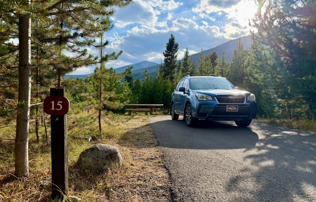
With a nearly three hour long journey to get to the western side of Rocky Mountain National Park, I decided to drive down the night before my trip started so I could sleep more and not stress about making an early start. I was able to reserve a lovely campsite in Timber Creek Campground just a few weeks out, which proved to me how less busy the western side of the park is. For the ease of everything, I picked up Chipotle for dinner on the way out of Laramie, and opted to sleep in the car. I slept crazy well, with just a brief wake up at 3:30am to pee and peep at the Milky Way.

A person reading a book while relaxing inside a car with an open hatchback, overlooking a campsite with picnic tables and a forested area under a cloudy sky.
Getting caught up on reading in my bed on wheels!

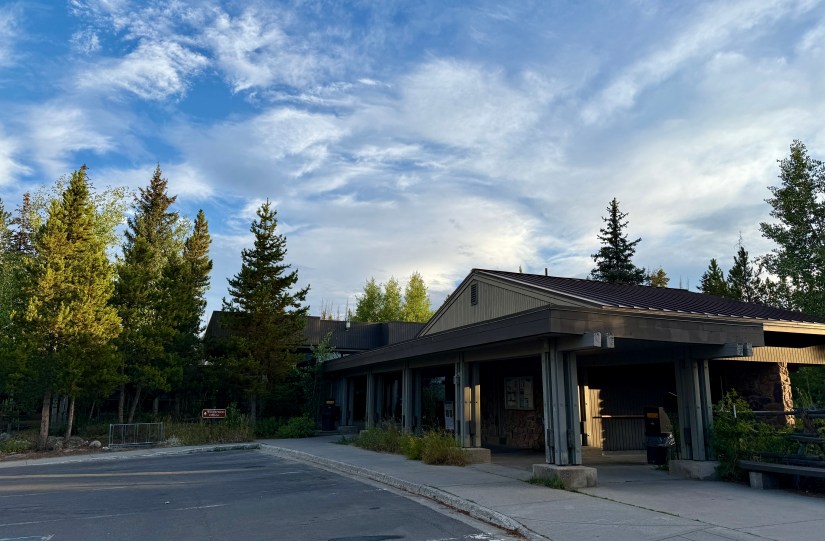
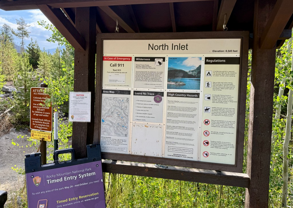
When I awoke, I really did not feel like eating the freeze-dried breakfast meal I had brought along, so breakfast in Grand Lake it would be! I beat the ranger to the wilderness office at the Kawuneeche Visitor Center at 7am, which I felt bad about as I repeatedly told her I was only there that early because it was on the way out of the park, and that I wasn’t in a big rush (she had a bird in her house she had to shoo out!). Once again, I was proved that the bear education at Rocky Mountain National Park is about 500 times more stringent than Yellowstone National Park, as I rattled off my type and brand of bear canister.

A visitor center building surrounded by green trees under a blue sky with scattered clouds.
Kawuneeche Visitor Center

Permit in hand, I headed through a sleepy Grand Lake, stopping at Jumpstart Coffee for a large latte and a breakfast burrito ($22 total in this pricey mountain town, for those curious). The North Inlet Trailhead is located down a narrow dirt road, and arriving at 7:30am, I nabbed the last parking spot! (There is an overflow parking lot just down the road. No parking is allowed along the narrow road.). Every car had a backpacking dash tag, proving how this area is mostly popular for those staying overnight in the backcountry.

A hand holding a partially eaten breakfast burrito wrapped in foil, with trees and a parking area visible in the background.
This burrito was expensive, but delicious!
A blue SUV parked on a gravel surface, with a backpack and trekking poles leaning against it, surrounded by trees in a natural setting.
Goodbye, Fozzy! See you in four days!

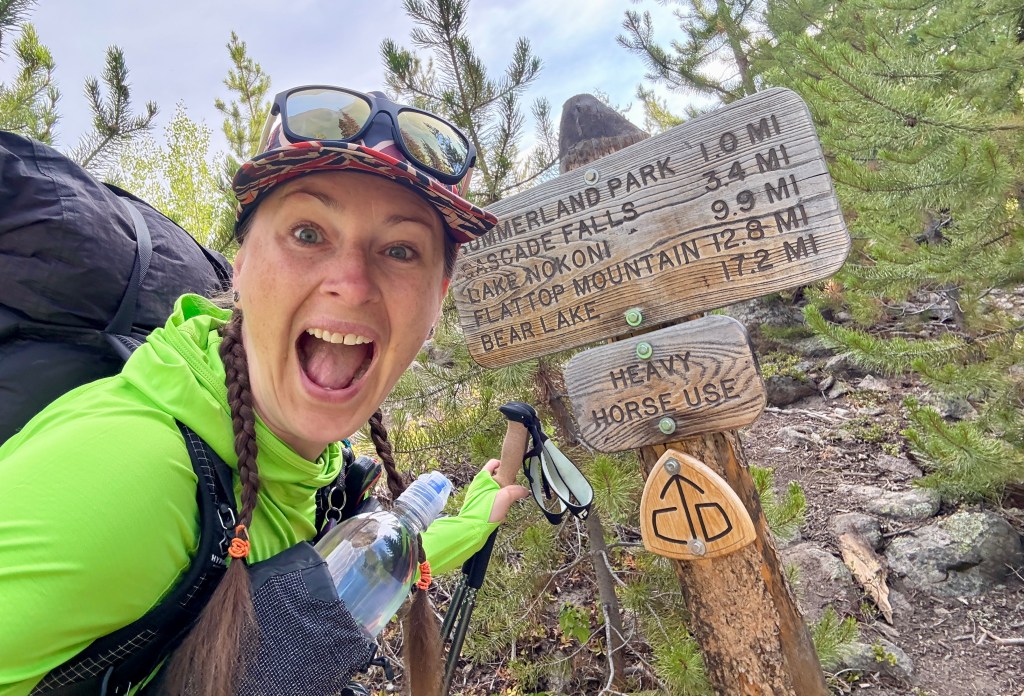
I ate my burrito, drank my latte, and enjoyed my last few moments of cell service. I knew I didn’t have to rush to start hiking… but then again, I couldn’t just sit in my car for hours. Finally around 8:30am I hauled my 32-pound pack (down a few pounds from my last backpacking trip, go me!) out of the car, locked up, and hit the North Inlet Trail.

A sunlit path through Rocky Mountain National Park, surrounded by charred trees from a recent wildfire, with lush greenery and distant mountains visible under a clear sky.
There is a short descent from the trailhead to start the hike

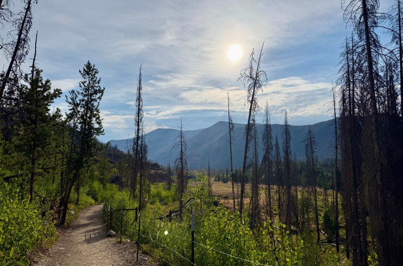
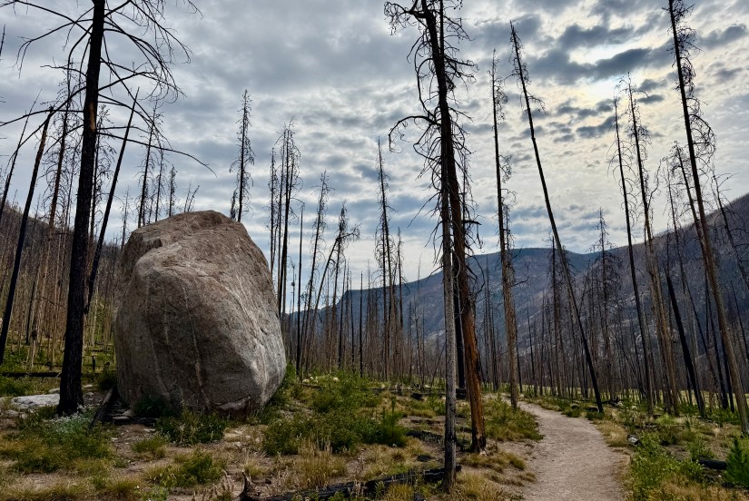
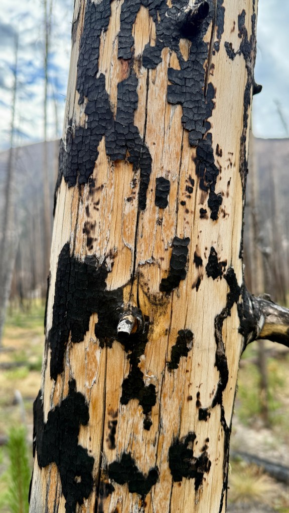
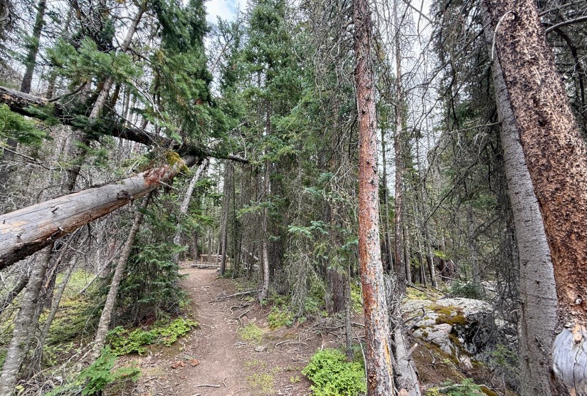
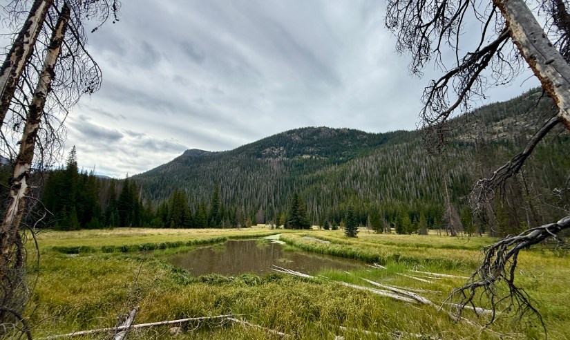
The portion of the CDT through Rocky Mountain National Park gets a bad rap for being “all burned” and “not worth the time to see, because it is all burned.” While many miles are in a burn zone (and 100% of the alternate, which is what most long distance thru-hikers take), it is far from being all burned! Plenty of lush sub-alpine forests and tundra await hikers on this portion. After five years of recovery, the burn zones are teeming with new life – wildflowers, wild berries, aspens, and little two-foot tall pine trees. Maybe it is just me, but I love seeing life go on after devastation in these burn zones.

The East Troublesome fire was reported on October 14th, 2020. The fire burned nearly 194,000 acres due to several contributors such as dry weather, beetle kill, and lack of humidity. This fire was not huge to begin with but after burning for over a month, the East Troublesome became the second largest wildfire in Colorado’s history behind the Cameron Peak Fire [which was concurrently burning].

A sign marking the U.S. boundary of a national park, standing near a dirt path surrounded by green vegetation and distant mountains.

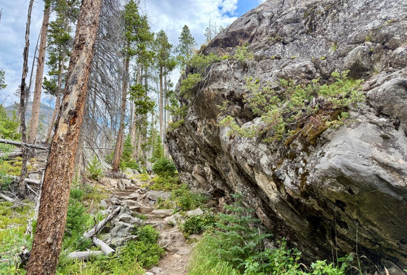
After criss-crossing some private property, the North Inlet Trail enters RMNP for good and the gentle climbing begins. I was hiking in a window of cooler weather and cloud cover, which I was grateful for as I’ll readily agree that the burn zones would be HOT on a typical summer day. The trail is beautifully maintained, though rocky and far from “cruisey.” And then there was me, being distracted by berries and wildflowers and giant rocks. I felt like I was constantly stopping, though honestly… why not? I had all day to to get to my destination!

A scenic view of a hiking trail winding through a post-fire landscape, with charred trees and new green vegetation emerging, set against mountainous terrain under a cloudy sky.
The trail starts out wide before narrowing into singletrack.
A close-up image of wild plants, featuring clusters of blue berries among green leaves and some dried foliage.
Oregon grape
A trail meanders through a burn zone in Rocky Mountain National Park, surrounded by blackened trees and green undergrowth under a cloudy sky.
As I had never visited this part of the park before, it is hard to imagine it was all forest until October 2020.
A close-up of a vibrant red berry growing on a green bush, set against a background of blackened tree bark, indicating a recently burned area.
So many rosehips in the burn zone!
A large boulder sits along a dirt path surrounded by charred tree stumps in a forest recovering from a wildfire, with a cloudy sky overhead.
I was super excited to spot this HUGE rock along the trail!
Close-up of red berries growing on a branch with green leaves, set against a background of charred trees and cloudy sky.
My phone told me these were plums… ha! So not sure what these berries are!
A landscape view of a burned forest area featuring blackened tree trunks, a large boulder, and green grass in the foreground, set against a mountainous backdrop under a cloudy sky.
A small wetlands. This trip would be unlucky for moose sightings, as I saw none! Other backpackers reported seeing lots.
A view of a rocky landscape in a burn zone, with charred trees and mountains in the background under a cloudy sky.
Gaining elevation on a knoll
A rocky trail winding through a burn zone, with charred tree trunks and lush green vegetation recovering from a wildfire.
Bridge over a small stream. Water sources were plentiful, and I carried only one liter at a time as opportunities to filter were plentiful!
A narrow hiking trail winds through a landscape marked by blackened trees and rocky terrain, showcasing recovery after a wildfire.
Gaining elevation more rapidly, and passing under this rock crop
Close-up of a ripe raspberry surrounded by green leaves, with some yellowing foliage in the background.
Finally some raspberries! They grew plentiful as I ascended in elevation

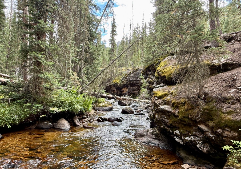
After around 3.5 miles, I came to a great resting place, Cascade Falls. Who can deny a snack brake at a waterfall, right? I scrambled down to the side of the cascades, and loaded up on snacks and filtered some more water.

A wooden sign for Cascade Falls surrounded by lush greenery and trees in Rocky Mountain National Park.
A waterfall? Don’t mind if I do!
A cascading waterfall flowing over rocky terrain in a forested area affected by fire damage, with green trees and a rocky landscape in the background.
Part of Cascade Falls
A close-up view of a water filtration system in the wilderness, featuring a collapsible water bag hanging above a Smart Water bottle, with a person's muddy shoes and colorful, galaxy-patterned socks visible in the foreground.
One of the best things I did was change to a Sawyer Squeeze water filter! So simple and easy to use, especially for fill-ups along the trail! I use a 3 liter CNOC bag as my dirty reservoir.

After Cascade Falls the trail becomes forested, though would continue to meander into and out of the East Troublesome Fire burn zone. The skies darkened with rain-laden clouds, though aside from from a few stray sprinkles, I was staying dry. I hit the point in the hike where I put my head down and just tried to get the darn thing over with.

A narrow dirt trail lined with green foliage and trees in Rocky Mountain National Park, with a fallen tree arching over the path.
Back into (some) living trees!
Close-up view of moss-covered rocks with twigs and small plants scattered on the surface.
Yes, finally some moss! My fave!
A small bird perched on a branch amidst a dense backdrop of green leaves and twigs.
Cute little bird
A scenic view of the trail alongside a mountain stream in Rocky Mountain National Park, surrounded by coniferous trees and rocky terrain.
The trail closely follows North Inlet briefly before departing for awhile
A rocky hiking trail winding through a vibrant forest, with tall pine trees and a large boulder on one side.
I was loving this pretty section!
A tranquil scene showing a small pool of water surrounded by rocky terrain and lush green trees, likely in Rocky Mountain National Park.
Big Pool, which looks like a very inviting place for a swim! There is a wilderness campsite located nearby.
A hiker with a large backpack walks along a dirt trail surrounded by green pine trees in Rocky Mountain National Park.
I set up my tripod to get a quick photo of me walking. Solo backpacker problems…
A scenic view of a grassy meadow with a small water pool, surrounded by tall, green trees and distant mountains under a cloudy sky.
Another area I would expect to see moose
Wooden trail sign marking 'Ptarmigan Creek' with a notice about catch and release fishing regulations, surrounded by a forested area.
Ptarmigan Creek is a great place to refill on water if needed

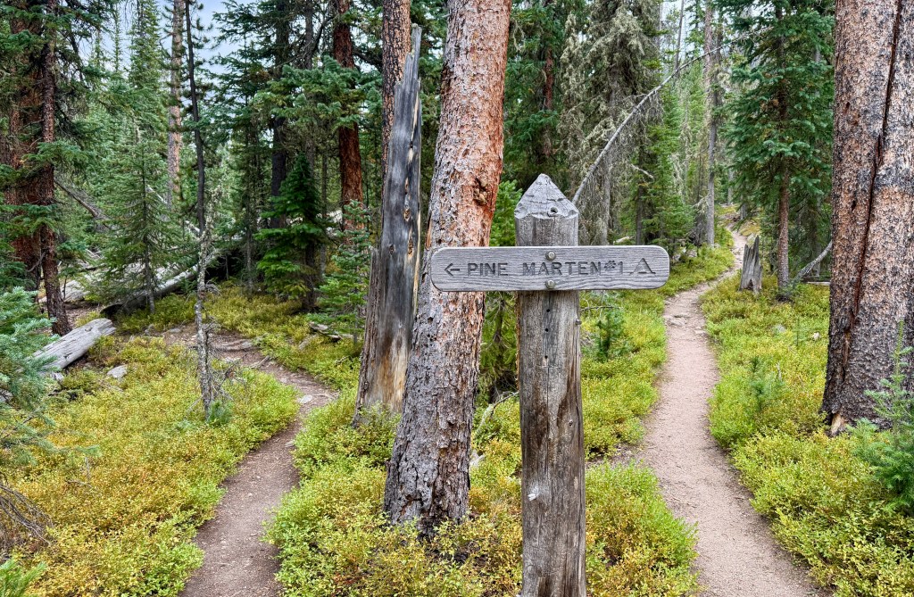
Finally the most amazing view came into sight: the junction with the Lake Nokoni Trail! My home for the next two nights, one of the Pine Marten campsites, was located about a half-mile-ish off down this trail, and I was ready to get there! (First to peek at North Inlet Falls… why did I not try to get this campsite so I was near a waterfall?!)

Wooden trail sign indicating distances to Flat Top Mountain, Bear Lake, Lake Nokoni, and Lake Nanita, surrounded by pine trees and rocky terrain.
Finally!!!
A wooden bridge spans a small creek in a forested area, surrounded by tall pine trees and rocky terrain in Rocky Mountain National Park.
Lovely bridge over North Inlet.
A scenic view of a waterfall cascading over rocky terrain, surrounded by lush green trees and a mountainous backdrop under a partly cloudy sky.
North Inlet Falls
A wooden trail sign pointing towards 'Pine Marten' with a fork in the path leading through a forested area filled with tall trees and green underbrush.
Arrow pointing the way to my home for the next two nights! What a magical, green little spot with this brilliant ground cover!

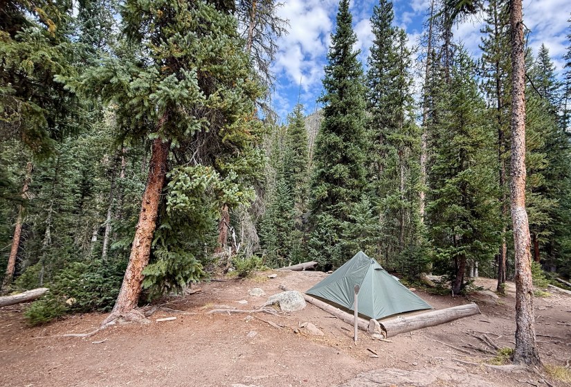
Ready to sit down, I chose the first Pine Marten campsite I came to, and turns out, it was an awesome choice! This campsite is my most favorite of the ones I have backpacked to in RMNP so far! Trying to beat the rain, I quickly set up my tent and had lunch before an afternoon storm rolled through, which lulled me into a short nap.

A green tent set up in a forested campsite surrounded by tall pine trees in Rocky Mountain National Park.
Pine Marten #1. This campsite felt super remote and private, though there are many wilderness campsites in the general area.

The rest of the day was spent relaxing, reading (“On The Road” by Jack Kerouac… one of the lightest books I had in my stack to bring), soaking my feet in North Inlet, dinner… and then a fairly early bedtime!

A deer resting on the ground among trees in a forested area.
I opened up my tent after the storm and was scared half to death by this lady peering back!

Trip details (all data recorded on Garmin Enduro 3):

  • Mileage: 8.14 miles
  • Elevation gain: 1,503 feet
  • Time: 4 hours (3 hours 38 minutes moving time)
  • Trail: CDT 1374-1381.5 / North Inlet Trail
  • Start: North Inlet Trailhead
  • End: Pine Marten wilderness campsite #1

Next up on the agenda: a chill day side questing to Lakes Nokoni and Nanita!

9 thoughts on “Rocky Mountain National Park CDT Loop: Day 1 – North Inlet Trailhead to Pine Marten”

  1. That looked like a tough hike and lots of burned trees. You said “The fire burned nearly 194,000 acres due to several contributors such as dry weather, beetle kill, and lack of humidity.” and the Cameron Peak Fire was even bigger. That is kind of shocking. The photos are amazing.

    Liked by 1 person

    1. The fire was huge! And burning at the same time as the Cameron Peak fire, which reached over 200,000 acres. On top of it, just north in southern Wyoming was the Mullen Fire. It was apocalyptic. I had ash all over my car in Cheyenne, and the skies were just dark and orange. Truly a terrible couple of months!

      Liked by 1 person

  2. Oh yay! I did this part of your loop as an overnight back in 2021, so this post brought back some fun memories. We even stayed at Pine Marten, though I can’t remember which site. There was a deer, though… maybe the same one? Also, it’s nice to see how it’s continued to recover after the fire.

    Liked by 1 person

Leave a comment