

“The Grand (Mis)Adventure” is a blog series chronicling my fourteen-day-turned-seven-day adventure in July 2025 through the rugged, awe-inspiring northwestern corner of Wyoming. From hiking and backpacking along the Continental Divide to paddle boarding on alpine lakes and camping under the stars, I’ll be sharing the highs, challenges, and misadventures from my summer vacation that didn’t go quite as planned.
July 18, 2025
First night camping in the backcountry of grizzly country survived! *places check mark!
However, some sort of critter pooped on my hammock. Yes, pooped on it overnight! (I think it was a pine marten, as they are roaming around the area of this campsite apparently.). Definitely not bear scat, but yeah… there was a visitor!

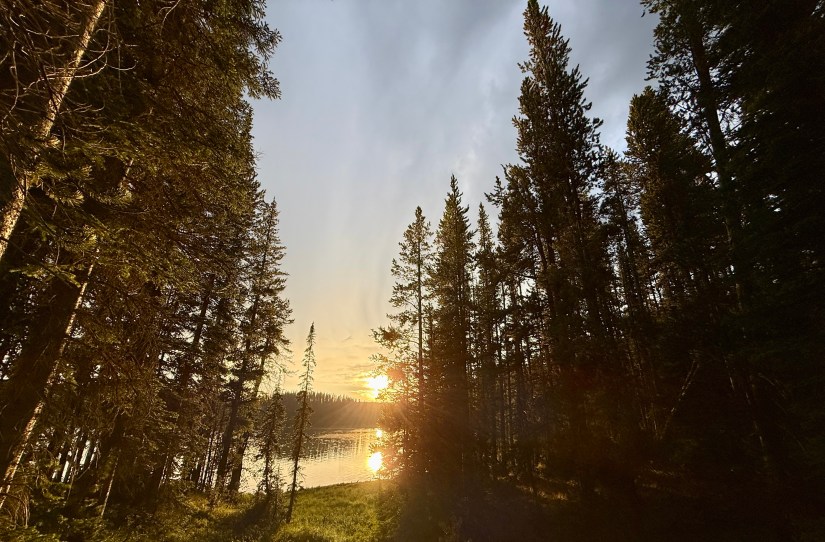
With a hike of over seven miles and a backcountry geyser basin awaiting me, I was antsy to get out of camp. I downed my biscuits & gravy and coffee after tearing down camp, and before long was setting out across the North Shore Shoshone Lake trail to the western side of the lake, where home for the night at Basin Bay Point. I noted high cirrus clouds in the sky – a sign of changing weather.
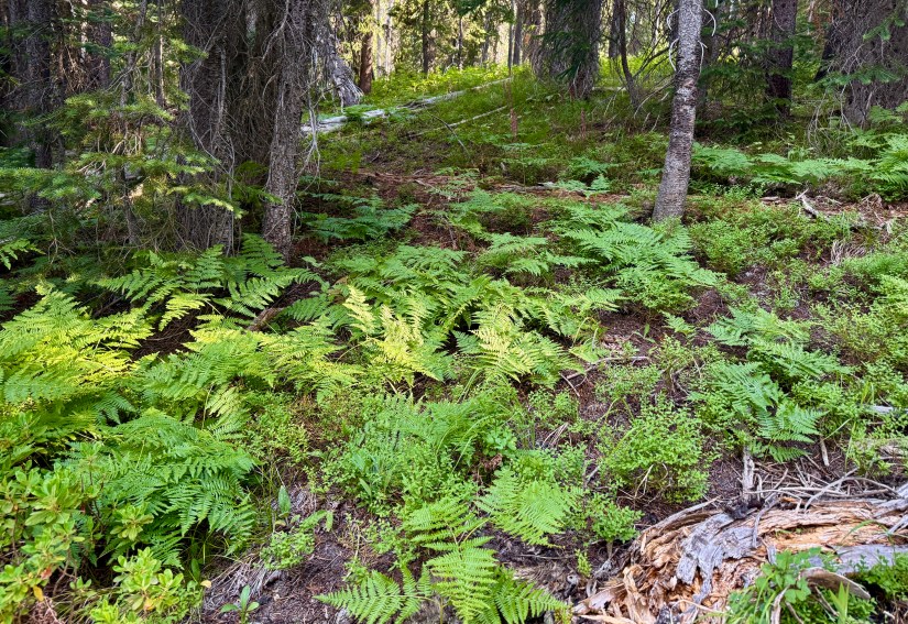

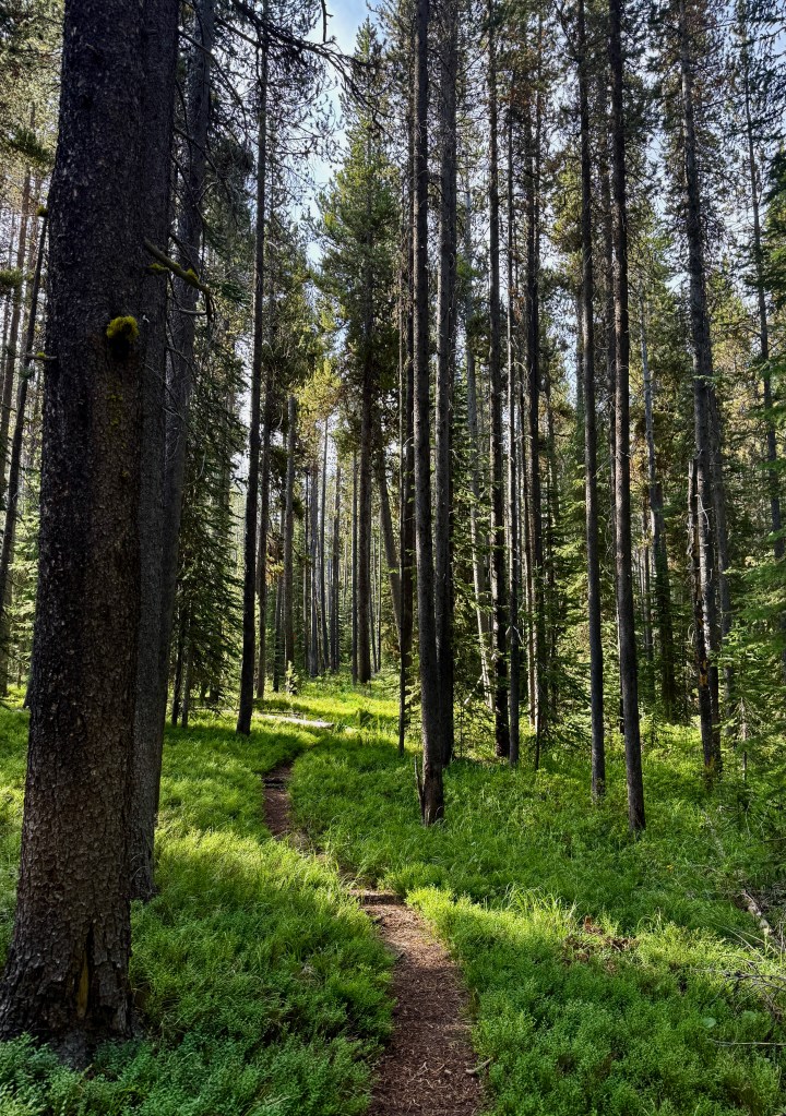
The trail quickly turns away from the shores of Shoshone Lake, and meanders through the forest. There are a LOT of PUDs (pointless ups and downs) on this trail, which can be tiring, with a few steep sections. I spent the time singing little songs in my head and just trying to cruise as fast as I could towards camp.

There were a lot of stream crossings along this section of trail, so I decided to try filtering another liter. I learned my Platypus GravityWorks filter sucks to try to use trailside, and kicked myself for not being my Sawyer Squeeze, which works a lot better for trailside use and when there are no helping hands (or tree branches) to hang a gravity-fed filter from.

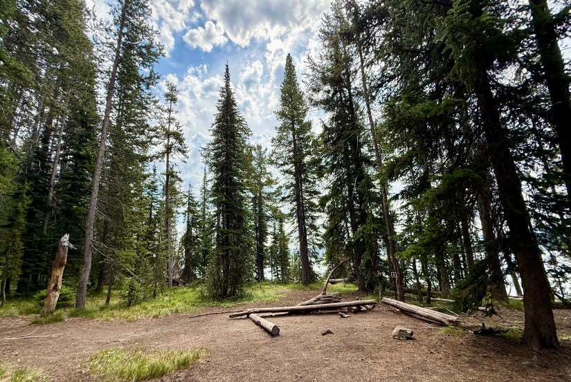
Backcountry campsite 8R5 Basin Bay Point is located about a half-mile off the trail, and pretty much campers with this campsite get a whole little peninsula to themselves! This campsite was super hyped up, so I excited I could nab it as part of this itinerary.


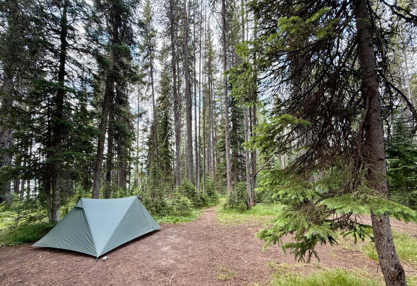
I did not like Basin Bay Point as much as the campsite the prior night, 8S3 Coyote. The designated tent area had a lot of dead trees (“widow makers”), including one that recently broke in half and crashed down. As evening storms rolled in with strong winds, I actually ended up moving my tent down to the main camp area, though it was a little close to the food hang (it was a choice between death by widow maker, or death by carnivore… I chose the bear, ha!).

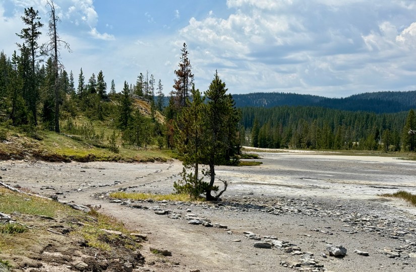
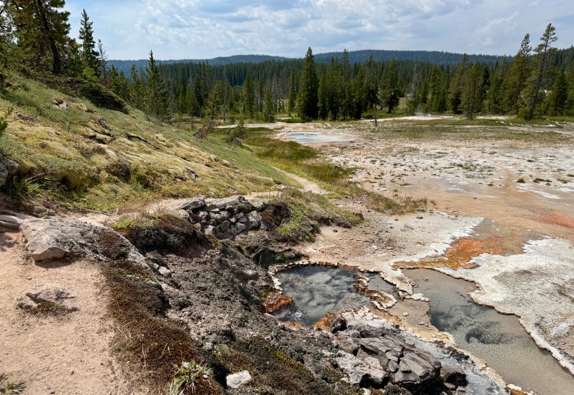
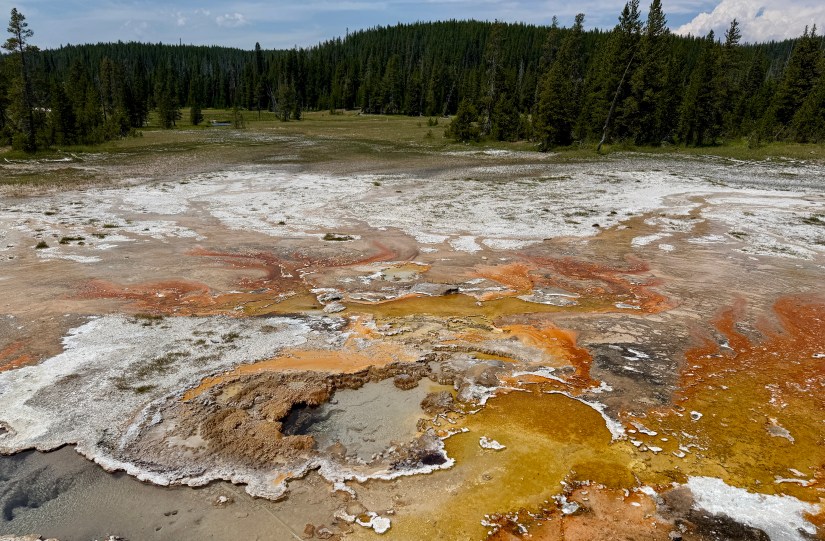
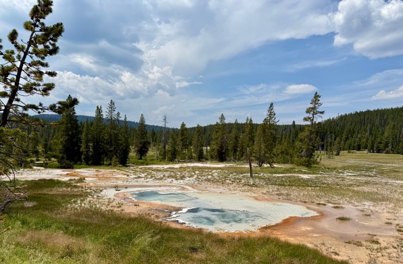
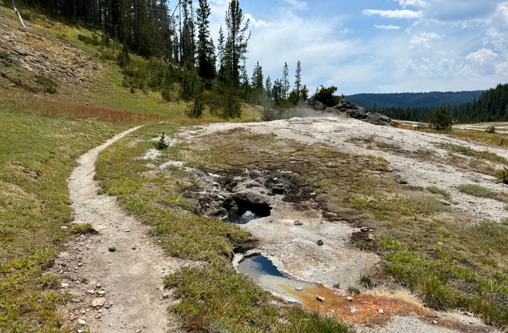
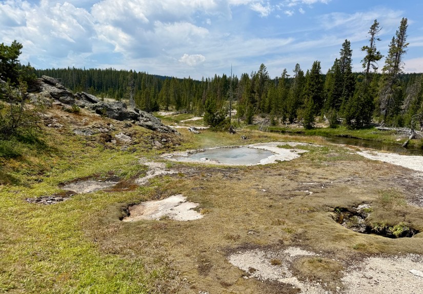
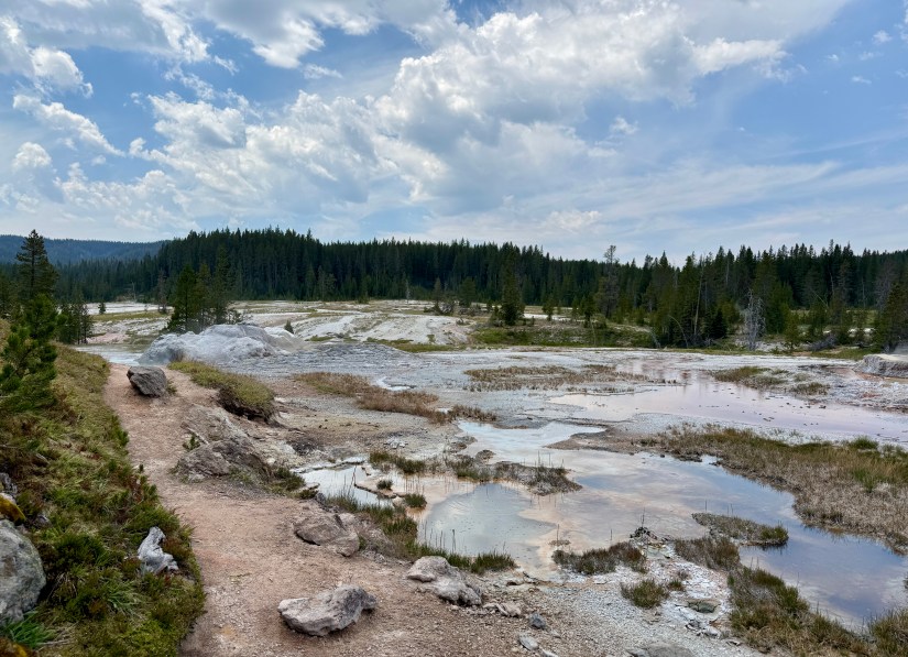
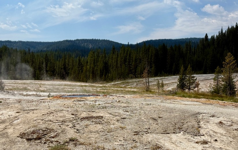
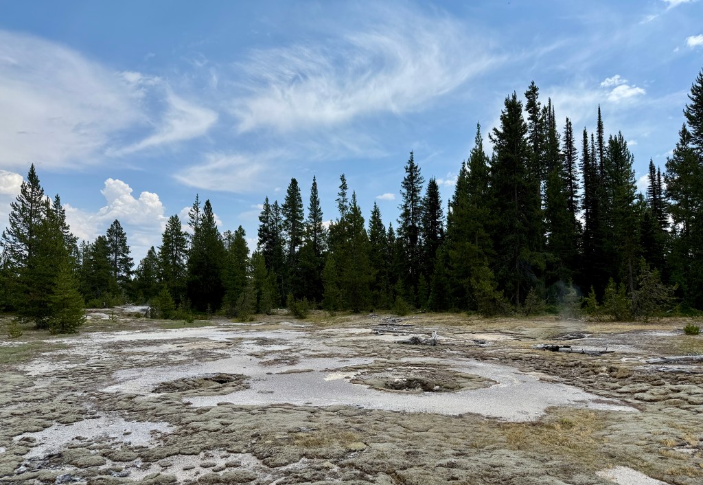
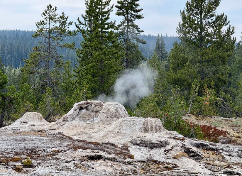
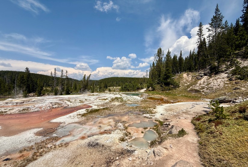
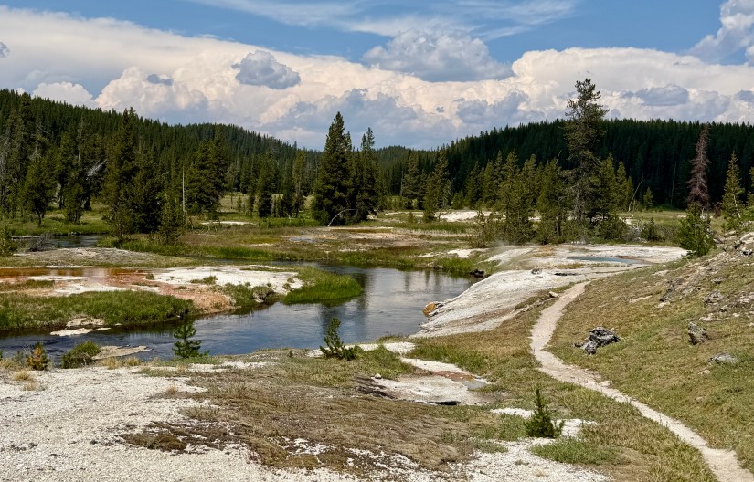
After setting up my tent (getting a great pitch!) and eating some lunch, I decided to make the trip over to Shoshone Geyser Basin. I was beyond excited to experience this backcountry geyser basin. Time to nerd out with hydrothermal features!
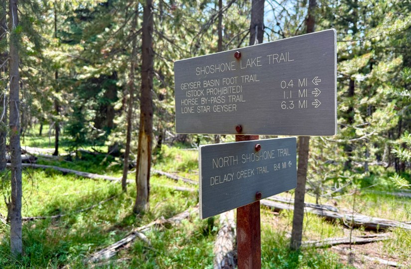
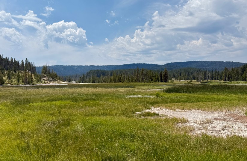

Shoshone Geyser Basin is the largest backcountry geyser basin located in Yellowstone National Park, and has one of the highest concentrations of geysers in the world is found here, with more than 80 in a 1,600 x 800 foot (488 x 244 m) area. The west side of the geyser basin has been closed to the public since 2016; however, the east side is accessed via the Continental Divide National Scenic Trail (CDT). You will not find safety railings or boardwalks while walking through the geyser basin, so it is very important to mind your surroundings and not stray from the trail!
And now for a billion photos!!


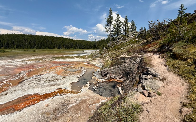
Overall, my jaunt through Shoshone Geyser Basin was just shy of 2.5 miles round trip, making it an easy and awesome side quest from the campsite. I was back to camp with some time to relax before I realized some really nasty storm clouds were rapidly approaching. Taking the chance to boil water and get dinner underway before the skies unleashed, I scarfed down some chicken pesto pasta. I was mostly successful, and was able to escape into the tent by the time the heavy rain started.
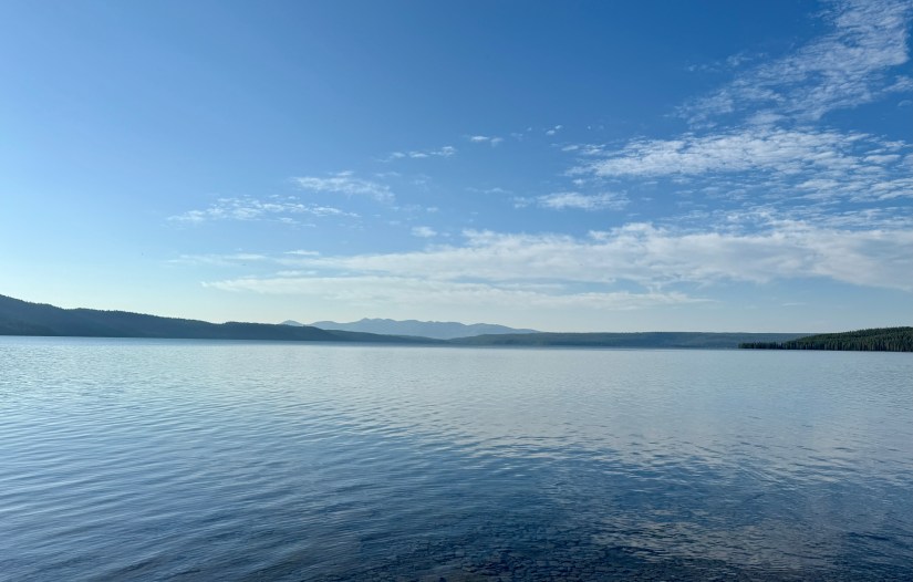
Luckily it did eventually clear up, so I climbed out of the tent to grab some water to filter and to peep Shoshone Lake during golden hour.


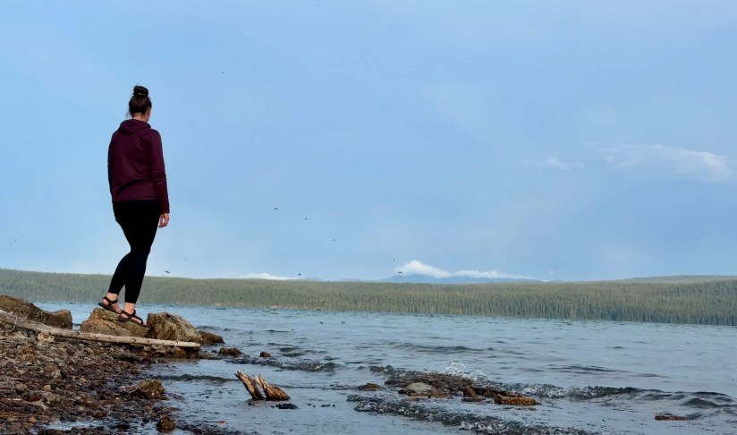
Basin Bay Point felt really lonely and isolated. I realized I hadn’t seen humans (aside from the ones backpacking with me) in over 24 hours. The closest I got was all the shoe tracks heading south on the CDT in Shoshone Geyser Basin. I guess considering I was 9.5 miles from the nearest trailhead, I was a bit out there. The realization had occurred days early, but I was not having fun and I couldn’t be me. What is the point of an adventure if it wasn’t fun and you can’t be yourself? As much as I wanted to stay out and enjoy my trip I had been so eager for, I decided that the next morning I would hike out to Lone Star Trailhead and call it quits while ahead on this backpacking misadventure (the rest of the group had also come to this conclusion as well).
Trip details (all data recorded on Garmin Enduro 3):
- Mileage: 7.43 miles
- Elevation gain: 948 feet
- Time: 3 hours 11 minutes
- Start: 8S3 Coyote backcountry campsite
- End: 8R5 Basin Bay Point backcountry campsite
The side quest to Shoshone Geyser Basin was 2.46 miles round trip from the campsite.
For more information on backpacking in Yellowstone National Park, please check out their official webpage which will have all the details on permits and regulations.

This is so cool! Though I would be terrified to be walking so close to the geysers. I’m curious, do the letters in the unnamed pools have a meaning, or is it just random? I never knew there were unnamed thermal features.
LikeLiked by 1 person
It was terrifying, especially as a clumsy person!! And then you see a fumarole that undermines the trail… yeahhhh. Eep! The letters denote the geyser basin (so ones in Black Sand Basin are “BSB” which is also the Backstreet Boys, which is how I remember that!) and then the numbers I am not too sure about. If it wasn’t for a great website called http://www.volcanic-springs.com/ , I’d be clueless on what everything is!
LikeLiked by 1 person
Well this is my new favorite website!
LikeLiked by 1 person
I believe I’ve been to Shoshone Geyser Basin but I am not sure, but I was hiking around that area. It is an amazing adventure and your photos are great!
LikeLiked by 1 person
Wow, this looks like a fantastic backcountry adventure, especially as it involves remote trails, steaming geysers, and pristine campsites. Witnessing a geyser eruption, where boiling water and steam are powerfully ejected from the Earth’s surface, is a truly spectacular and unforgettable experience. Thanks for sharing, and have a good day 🙂 Aiva xx
LikeLiked by 1 person