

The first time I ever backpacked was in a national park – Crater Lake National Park in southwestern Oregon in the middle of winter. I was instantly hooked on traveling with everything I needed for my survival and comfort strapped on my back, with my car and comforts miles away. Since then, I have tried to live out of a backpack at least once every year.
Rocky Mountain National Park has become my go-to for summer backpacking trips since the eastern side of the park is a mere two hours from my home in southern Wyoming. Though I have not stayed in every wilderness campsite, or very many of them at all, I wanted to write reviews and details of the sites I have stayed in. One thing I have struggled with is finding solid information and photos online about the campsites outside of the official park website… I hope I can be of some help to all of you out there! (As I stay in new campsites I will update this post!)
Last Updated February 7, 2026

Wilderness Camping Logistics
Permits
A permit is required for all wilderness campsites in Rocky Mountain National Park all year-round. Camping is also limited to designated campsites, there is no dispersed wilderness camping allowed.
Wilderness camping permits cost $36 per trip, regardless of number of nights or people in the party (2026 pricing).
Reservations for ALL wilderness campsites from May 1 to October 31 of every year go on sale on recreation.gov on March 1 at 8am MST. To say that obtaining wilderness permits in Rocky Mountain National Park are competitive is an understatement, and some popular campsites will be booked for the summer season within minutes. My tips for a happier experience:
- Familiarize yourself with the website ahead of March 1.
- Know where to click and what details you will need to enter (date, party size, area of campsite).
- Be logged into your recreation.gov account before 8am
- Have several itineraries – dates and campsites – planned out
- If you can swing it, weekdays are less competitive
- Attempt the reservation for the most competitive campsites first.
- These tend to be ones in Bear Lake (especially Glacier Gorge and Andrews Creek) and on popular loops (like the CDT Loop/Tonahutu Loop on the west side).
- Nothing is “saved” until you hit “Book Now.” Once that is done, you have 15 minutes to complete any details and pay, so you can go nab other permits you want (the clock resets every time).
- I highly recommend booking from an actual computer, not a smartphone. Definitely ensure you are connected to a solid, reliable internet connection/wifi.
Groups of 1 to 7 people can stay in any wilderness campsite. Groups of 8 people or more will need to book group campsites.
Can’t plan ahead or don’t desire to? That is okay, just know your options may be limited in the more popular areas. Cancellations happen, as well! Recreation.gov can be used throughout the May 1 to October 31 season to book campsites, and also walk up permits may be available at the Wilderness Offices.
More remote campsites off the beaten path often are available throughout the season, so I highly recommend this if hiking in over greater miles is something you can do, along with driving to more remote trailheads.

From November 1 to April 30, permits can be acquired in-person at Beaver Meadows Center Wilderness Office (west of Estes Park on Hwy 36) or the Kawuneeche Visitor Center (north of Grand Lake on Hwy 34). Reservations are not accepted through recreation.gov for these dates.
Permits must be picked up in-person up to 30 days in advance of your trip. There is no electronic or digital option for the permits. There are two Wilderness Offices to pick up permits:
- Wilderness Office @ Beaver Meadows Visitor Center
- East side of park
- 1000 U.S. Hwy 36 Estes Park, CO 80517
- Phone: 970-586-1242
- Open year-round 7am-3:30pm
- Closed certain federal holidays, call in advance for arrangements
- Wilderness Office @ Kawuneeche Visitor Center
- West side of park
- 16018 U.S. Hwy 34 Grand Lake, CO 80447
- Phone: 970-586-1521
- Open May 15 to September 30 7am-3:30pm
The permit should be attached to the outside of your backpack while hiking. This allows easy access for rangers to check the permit (which does happen, I was stopped on the way to Lost Lake and at the Corral Creek Trailhead!). Once camp is set up, the permit should be attached to a tent. You will also be issued a permit to place in the windshield of the car (a “dash tag”) once parked at the trailhead. (For safety reasons, the dash tag will not have your full name or any dates listed on it – the rangers use a special code system!)
Last, but not least, all reservations are non-refundable. You can cancel (please do to release the site to others), but you will not receive a refund.
Bear Canisters
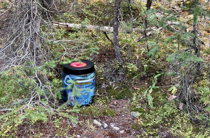
It is REQUIRED to secure all food items, scented items, and garbage inside a hard sided, lockable, commercially made carry in/carry out bear-resistant food storage canister in Rocky Mountain National Park between April 1 and October 31.
Other methods of food storage, such as hangs are not allowed. Ursacks are allowed if the aluminum insert is used. I was told by a wilderness ranger that they will request to see the Ursack when picking up the permit to ensure it has the aluminum insert.
Bear canisters not only help keep the park’s few dozen black bears from enjoying human food (and becoming nuisance and habituated bears – fed bears are dead bears), it also helps keep all the other critters out of your food: marmots, pikas, raccoons, and other rodents. Marmots can be especially ferocious with obtaining food, chewing through backpacks and tents to get to it!

Rocky Mountain National Park does not have a bear canister loan or rental system. However, they are available for rent or purchase at many sporting good shops, including shops in Estes Park and Grand Lake. The REI in Denver rents them as well (it appears that the Fort Collins REI no longer has rental service).
In my experience with picking up wilderness permits is the ranger will ask about the bear canister, and might also ask how it operates, locks, etc. Be familiar with what you have if you are renting or borrowing a canister. And of course, make sure you know how to use it, especially unlocking it before you embark on your trip. I have also had a ranger who checked my permit at the Corral Creek Trailhead ask to feel my backpack to ensure I had a bear canister in there (I was thankful he did not ask me to unpack everything at least!).

My preferred bear canisters are the ones from Bear Vault. I currently own the BV475, which is perfect for two people are shorter trips, or one person on longer trips (I tend to overpack on food, what can I say?). I do also have a grizzly-certified Adotec bag, but do not use it in the park due to the lack of an aluminum liner.
And… because we’re talking about bears… there are NO grizzly bears in Rocky Mountain National Park. Personally, I have not carried bear spray when hiking and camping in Rocky Mountain, but many chose to do so (remember, bear spray works on any mammal with mucus membranes!). There are estimates that just about 30 black bears total in RMNP, mostly found in the Lawn Lake and Wild Basin areas.
Campfires
Campfires are prohibited at all wilderness campsites. Only portable stoves can be used for cooking. The park is under Stage 1 fire restrictions at all times.
Park Entrance Fees
A valid entrance fee or park pass is always required to enter Rocky Mountain National Park, 24 hours a day, 7 days a week.
- This includes outlying areas such as Lumpy Ridge, Lily Lake, Longs Peak, Wild Basin, East Inlet, and North Inlet.
The fee is $35 for a 7-day pass (2025). The park does not accept cash for entrance fees.
Planning on visiting more than once, or multiple federal land sites? Buy an America the Beautiful annual pass for $80 and save some money! Or see if you qualify for an Access, Military, or Senior lifetime pass!

Privies & Bathroom Logistics
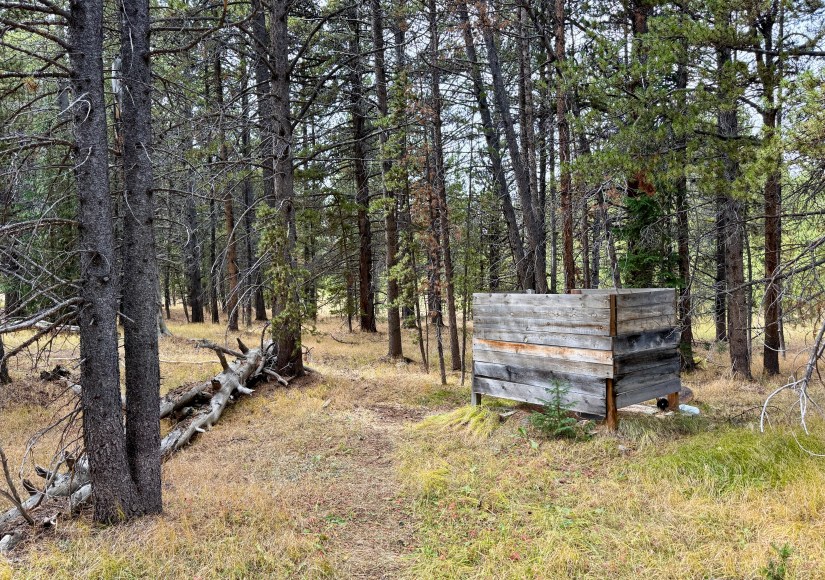
Each campsite has a Wilderness Designated Site Details page, and information on privies will be listed for each campsite. Many campsites have a privy, which is a simple toilet ranging from a hole in the ground (with a seat, of course) to fancy conveyer belt systems that the “poop llamas” come to empty. You will need to provide your own toilet paper for the privies. Do NOT put trash in the privies aside from toilet paper!

However, not all wilderness campsite have privies. To protect nature and to avoid human waste from literally piling up, some campsites require human waste bags (HWB), or wag bags as they are sometimes called. This means all solid human waste (that’s poop!) must be collected in a bag and carried out with you to be disposed of properly. There are several brands of commercial HWB available, usually all including a large bag you do your business in that has a gelling/deodorizing agent in it, a bit of single-ply toilet paper (I recommend packing your own of higher quality), packet of hand sanitizer, and a thick, zip lock bag for placing it all in to be sealed up.
I know using a wag bag and then carrying your poop out with you is very off-putting to some people (I’ll admit, it was weird to put a bag of poop in my backpack the first time I had to use one!). But this isn’t about you, it is about preserving the campsites and environment, keeping them safe and clean for everyone. If the idea of a HWB is a no go, I highly recommend utilizing one of the many wilderness campsites that has a privy, or allows for the burying of human waste.

For campsites with no privy and no HWB required, appropriately bury all human waste away from the trail and water sources at least six inches deep. Carry out all toilet paper with you. Using a HWB is an option all the time, of course!
For those who wipe when they pee, I highly recommend using a Kula Cloth to reduce toilet paper waste. These are antimicrobial, absorbent, reusable cloths for taking care of wiping away pee. The “outside” of the cloth is waterproof so nothing will leak through onto your hand, and it all fastens up with a snap. I have been using these for years, and Kula Cloths are definitely one of my favorite items of gear! So much better than “drip drying” or hauling a zip lock bag of used, wet toilet paper around!
Timed Entry Reservations
Your wilderness camping permit allows entrance to park in lieu of a timed entry reservation. Show the ranger at the entrance gate your wilderness camping permit.
I should note, you can only access the Bear Lake Corridor if your wilderness permit starts in that area; otherwise you will need an appropriate timed entry reservation for Bear Lake Corridor. Timed entry reservation goes in effect May 23, 2025 for the season (usually through mid-October).
Water Treatment
Most wilderness campsites are situated near a water source, usually a creek or lake. All water must be appropriately boiled, filtered, or treated before consuming to avoid gastrointestinal bacteria and parasites.
Boiling is the considered the most effective way to remove harmful microorganisms, but can be time consuming, and also can utilize a lot of fuel. Due to the elevation in Rocky Mountain National Park, the boiling temperature of water is lower, so boiling needs to occur for a longer time. Water should be boiled at a rolling boil for 3 minutes to ensure microorganisms are killed.
I find the easiest method is to use filtration to treat water. Not only will parasites and bacteria be removed, particulate matter is also caught by the filter. Filtered water can immediately be consumed, and depending on the filtration system used, you can treat a greater volume of water a time than boiling.

My preferred filtration system when sharing with a group is the Platypus Gravity Works system, which I have the 2 liter size. 4 and 6 liter bag sizes are also available. I found found this to be a very easy to use system, and very fast at filtering water! I have recently begun to use a Sawyer Squeeze filtration system with a CNOC bag when solo backpacking and when I may need to filter on the go for its ease of use. I absolutely LOVE the Sawyer Squeeze system! (Helpful tip, if a water filter freezes, it will not be able to be used anymore, so if you are camping in shoulder season or winter, bring a zip lock back along and sleep with your water filter in the footbox of your sleeping bag/quilt to help prevent freezing! Most of the time I sleep with my filter if overnight lows are expected in the 40s or lower as the last thing I want to have happen on a backpacking trip is losing my ability to have safe drinking water!)

I love this guide from the Minnesota Department of Health on backcountry water treatment. It will also talk more about chemical disinfection, which I am not going to discuss here (I do carry a few Aquatabs as a back up in case something happens to my filter in the backcountry, though it will not kill Cryptosporidium).
Rocky Mountain National Park Wilderness Campsite Reviews
These reviews are a mix of wilderness campsites I have personally stayed in on overnight trips, and those that I have passed while on hikes or backpacking trips, and popped into for photos (but did not actually stay in).
Bear Lake Area
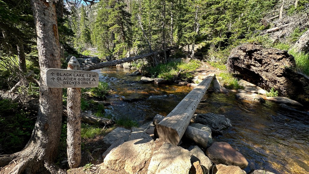
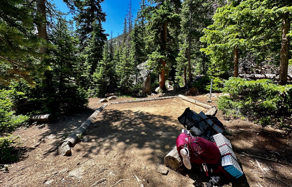
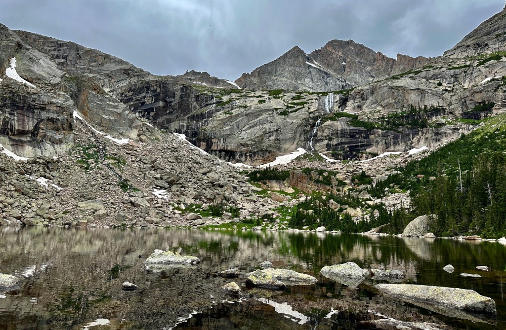
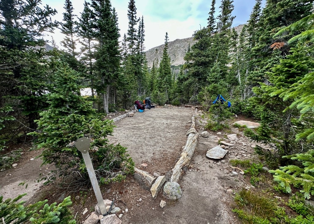
Glacier Gorge
Date Visited: July 29-30, 2023
# of Campsites: 1
Elevation of Campsite: 10,000 feet (3,048 meters)
Trailhead: Glacier Gorge (utilizing the Bear Lake Corridor Shuttle)
Mileage from Trailhead: 3.1 miles (utilizing the “Fire Trail.” Add 0.7 mile if sticking to trail going past Alberta Falls) (5km)
Elevation Gain from Trailhead: 1,004 feet (306 meters)
Privy: No (Human waste bags required)
Water Source: Glacier Creek (very short walk from campsite)
Cell Service: No
NPS Campsite Link
My blog link: A Night Out in Rocky Mountain National Park’s Glacier Gorge
Word on the streets this is THE most competitive wilderness campsite permit in all of Rocky Mountain National Park, selling out for the entire season mere minutes after permits are released for sale. If you want this one, you have to be quick with the fingers on March 1st at 8am! I managed to score a Saturday night in peak season somehow!
Located beyond Mills Lake in the breathtaking Glacier Gorge, it is easy to see why this campsite is so popular. Once day hikers make their way back to their cars, it is stunningly quiet and peaceful, with just the dull road of Glacier Creek and birdsong (and maybe distant bugling elk during rut). The downside were pretty crazy mosquitos that left us bundling up, and then retreating to the confines of the tent pretty early in the early.
After reaching camp, we explored further up Glacier Gorge, hanging out at Black Lake. There are alpine lakes beyond Black Lake one can explore as well, if so inclined. It is a remote and beautiful area – enjoy it while you are there!

Positives:
- It is just amazing to be the only person/people in Glacier Gorge at night!
- Easy base camp for further exploration of the alpine lakes and terrain of Glacier Gorge
- Super easy to access water source
- Fairly easy hike in to campsite, making it a friendlier option for beginners and those not desiring an exhausting hike to camp.
Negatives:
- Competitive permit
- Mosquitos and pine beetles aplenty
- Riding on the shuttle is very awkward with large packs as the shuttles are extremely crowded and you’d be surprised how annoyed tourists can get when you’re on it with a large pack (and smelling and looking like you’ve been in the wilderness). However, with parking so limited, the shuttle is still the best bet during summer months.
- No privy, HWB-only area
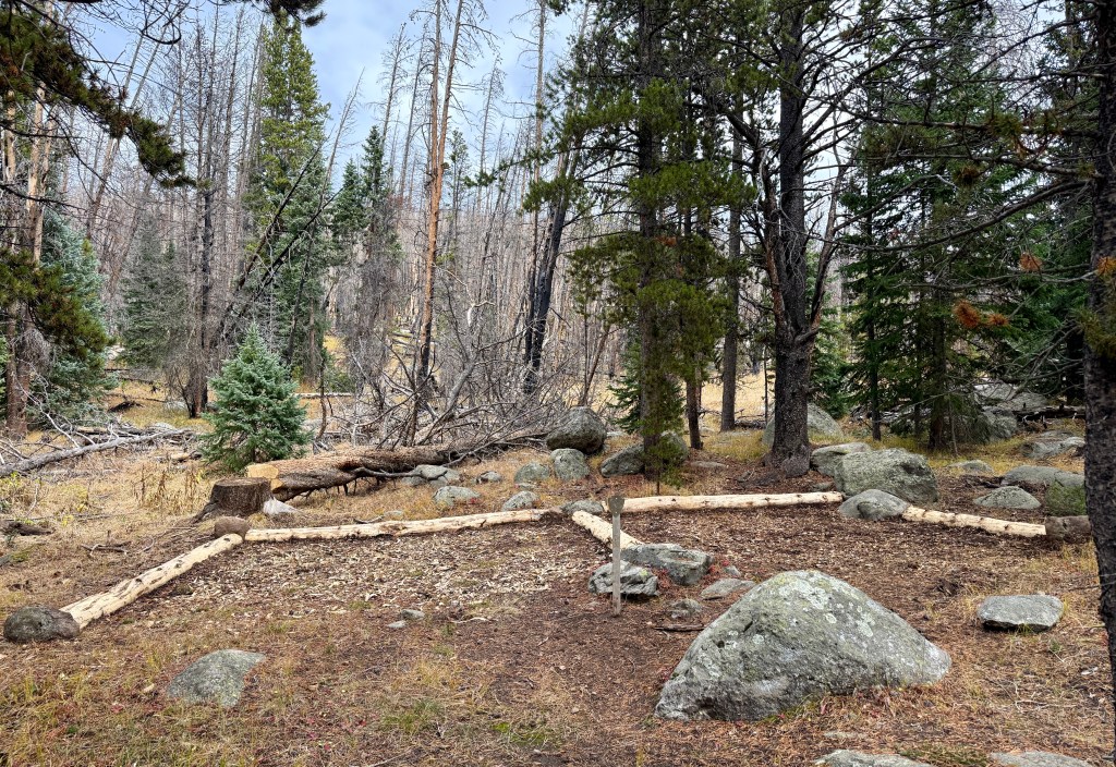
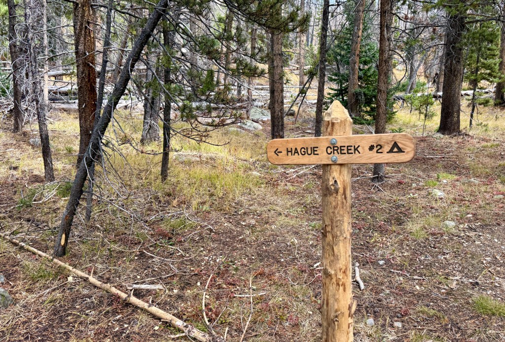
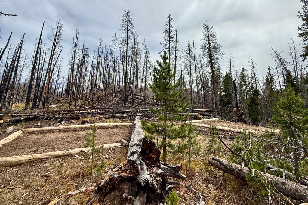
Hague Creek
Hague Creek
Date Visited: September 19, 2025
# of Campsites: 2 individual, 1 group
Elevation of Campsite: 9,720 feet (2,963 meters)
Trailhead: Coral Creek Trailhead or Poudre River Trailhead
Mileage from Trailhead: 1.6 miles from Corral Creek TH; 9 miles from Poudre River TH
Elevation Gain from Trailhead: 280 ft loss from Corral Creek TH; 1,030 ft loss from Poudre River TH
Privy: Yes
Water Source: Cache La Poudre River or Cache Creek, both short walks from the campsites.
Cell Service: No
NPS Campsite Link
My blog link: None
I have not actually stayed at Hague Creek, just wandered through the two campsites while backpacking to Mirror Lake. These campsites sit near the Cache La Poudre River. The Cameron Peak Fire burn scar is nearby, mostly impacting the second campsite. There appears to be remediation work that has been performed by NPS to get these campsites ready for use again, including clearing downed trees, rebuilding the tent pads, and installing new signage.
Honestly, I could totally see myself utilizing Hague Creek campsite #1 for a casual overnight trip with friends where maybe we wouldn’t have to worry about being lightweight with our gear that we pack in!

Mirror Lake
Date Visited: September 19-21, 2025
# of Campsites: 3
Elevation of Campsite: 11,000 feet (3,353 meters)
Trailhead: Coral Creek Trailhead or CSU Mountain Campus Trailhead
Mileage from Trailhead: 6 miles from Corral Creek TH; 7.9 miles from CSU Mountain Campus TH
Elevation Gain from Trailhead: Net gain 1,000 feet from Corral Creek TH (1,280 feet gain, 280 feet loss); Net gain 2,000 feet from CSU Mountain Campus TH (2,730 feet gain, 730 feet loss)
Privy: No
Water Source: Cascade Creek. Campsite #1 is closest to the creek, but all three campsites have trails that are a short walk down to the creek.
Cell Service: No
NPS Campsite Link
My blog link: A Hidden Gem: Backpacking to Mirror Lake in Rocky Mountain National Park
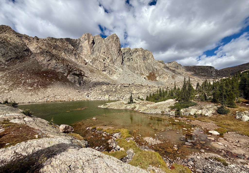
Tied with Pine Marten, Mirror Lake is my favorite wilderness campsite in RMNP! Actually, it may be my favorite, I just did not enjoy the hike in as much as I did for Pine Marten. But who can argue with distant 13,000-foot peaks, alpine lakes, and utter remoteness?!
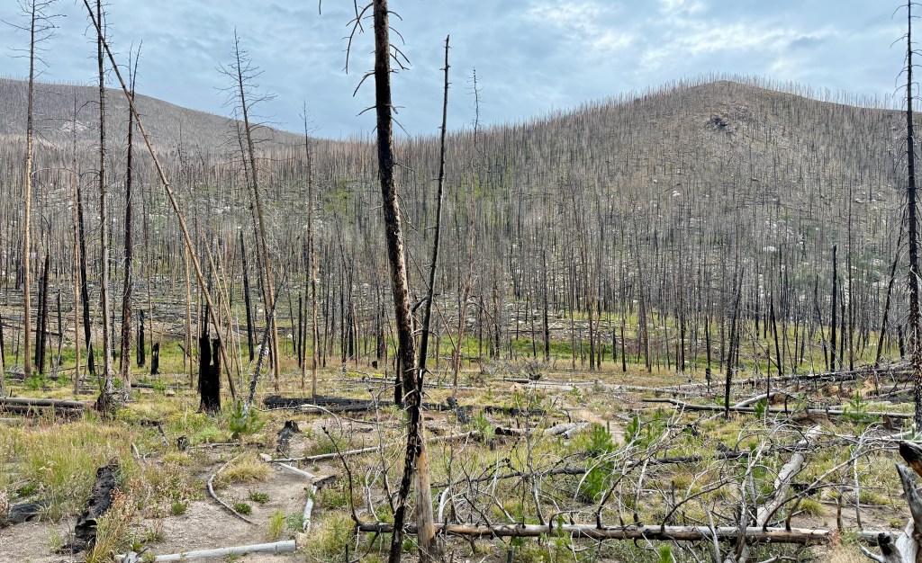
This little-trafficked alpine lake is one of the northernmost in RMNP, and is reached from outside of the park boundaries, the most straight forward being the Corral Creek Trailhead off of Long Draw Road (near the Cameron Pass area on CO Hwy 14). In the early autumn, this campsite felt absolutely out there!

We selected Mirror Lake campsite #2 for our home for two nights in September 2025. After exploring all three campsites, I completely believe #2 is the best campsite, as it has views and is spacious with several tent locations. The access to Cascade Creek is just a short stroll down from the campsite. But honestly, I am not sure one can go wrong with any of the three options in this gorgeous setting!


We used the second day at the campsite to take a very short hike up to Mirror Lake, and then onto Forever Pond. Overall, it was about a 1.5 mile round trip to see both of these downright gorgeous alpine lakes! For those seeking a longer adventure, the trail leading up to Comanche Peak is located near the campsites, and would provide an awesome summit adventure to 12,702 feet!


Positives:
- Remote with little foot traffic, especially later in the season. You will not be sharing the scenery with very many other people!
- Easy hike to Mirror Lake and Forever Pond from the campsites. Options for summiting Comanche Peak and other peaks in the area.
- Outrageous alpine views
Negatives:
- Remote. Positive and negative depending on how you can see it!
- Both approaches to the campsite (Corral Creek Trailhead and CSU Mountain Campus) are outside of RMNP. And neither are located near a wilderness office that issues the permits. This can either add a lot of driving depending on where you are coming free, or means, if possible, trying to pick up the permit ahead of the trip.
- Wilderness office at Beaver Meadows (east side, Estes Park) is located 2 hours 30 minutes from Corral Creek Trailhead
- Wilderness office at Kauwuneeche (west side, Grand Lake) is located 2 hours 10 minutes from Corral Creek Trailhead
- Most of the hike in will be through the Cameron Peak Fire burn scar, which can be very exposed to both sun and inclement weather
Longs Peak Area
Boulderfield
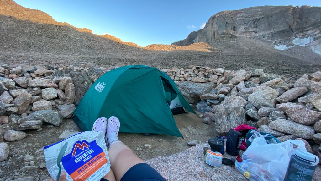
Date Visited: August 29-31, 2022
# of Campsites: 9
Elevation of Campsite: 12,760 feet (3,886 meters)
Trailhead: Longs Peak
Mileage from Trailhead: 6.2 miles (10km)
Elevation Gain from Trailhead: 3,320 feet
Privy: Yes, two at the Boulderfield. There is also one on the hike into the Boulderfield at Chasm Junction (highly recommended for having the most scenic view during a bathroom break ever!)
Water Source: Boulder Brook, which runs underneath the boulders of the campsites. Flow can be limited later in the year as it is dependent on snow melt. Flow is highest in the afternoon and evening. Having a filter or a container that can be used to reach down in between rocks will be very helpful.
Cell Service: No
NPS Campsite Link
My blog link: Colorado Hiked: Longs Peak
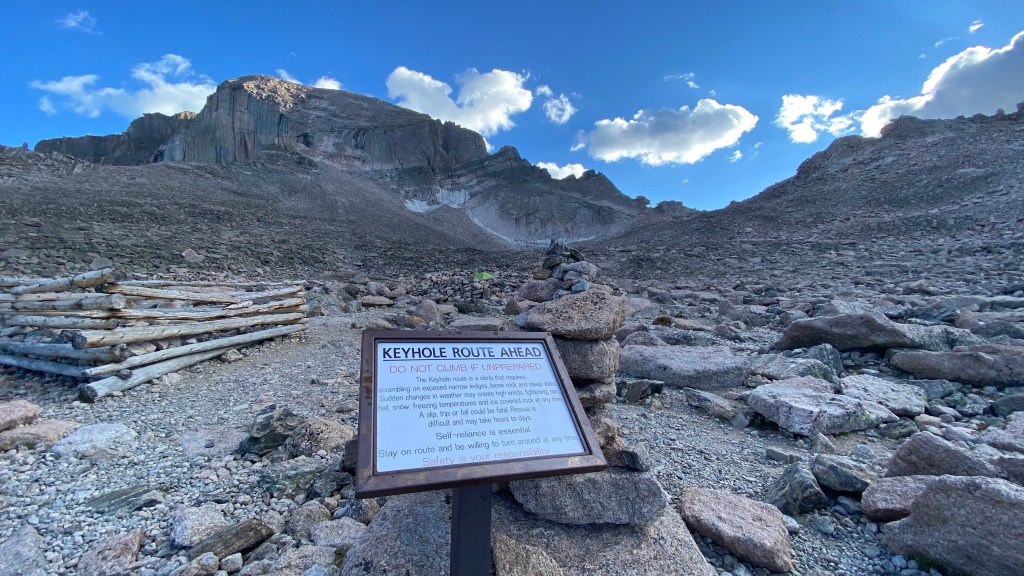
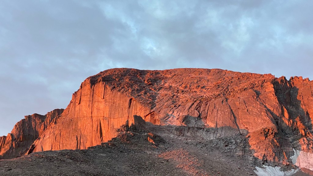
Most backpackers utilizing the campsites at the Boulderfield are attempting a summit of Longs Peak, Rocky Mountain National Park’s towering 14,259 foot summit, or other alpine climbing pursuits. However, it is a stunning campsite for those with no summit desires, but a longing to spend some time in the high alpine.
There are 9 campsites in the Boulderfield located within rock rings. There is no consistency among the rangers and anyone else on if you must stay in the campsite you reserved/were assigned. I was told we had to by the ranger issuing my permit. But when we got to the Boulderfield, someone was in our assigned campsite, and she told us the ranger said she could choose whatever site she wanted (mind you, this same woman starting throwing rocks at people after dark, so she wasn’t the type to argue with… its a whole story for another time!). So it is a bit of a free for all up there. The bad side of this is some campsites are much larger than others, so if you are in a larger party, I’d suggest arriving early so you can secure a spot with room for everyone and tents.
Positives:
- Sunrises and sunsets at the Boulderfield are some of the most amazing ones ever!
- Can be especially quiet and peaceful on mid-weekdays.
- Unique experience being able to camp far above treeline in the alpine.
Negatives:
- Day hikers attempting Long Peaks will be coming through the campsites at incredibly early hours pre-sunrise and for the most part, are not respectful about noise levels. Expect to be woken up.
- Weather can be atrocious with wind and storms. Remember, this campsite is well above tree line. While I had perfect weather during my two-night stay, this is not the normal. Lightning is also a very real risk.
- The altitude can be a struggle for some, especially those not altitude-acclimated, to sleep at. 12,760 feet is a high elevation for sleeping!
The one last thing I will write about I can’t say is a negative or positive – it will depend entirely on your own opinion. Is it easier to do Longs Peak as a day hike, or to haul overnight gear to the Boulderfield? Personally, I loved climbing Longs Peak as a two-night, three-day adventure. Our summit day was relaxed with a start after 6am, and I was rested and fresh for the Keyhole portion, which is technical and high-consequence terrain. I also recognized we had an uncharacteristic weather window with no storms or wind, making the stay in the Boulderfield so much nicer than many experience. I am also fairly use to packing in uphill for other mountain objectives. I cannot decide this for you, as it depends on so many factors.
North Fork Area
Lost Lake
Date Visited: August 18-20, 2023
# of Campsites: 4 – 2 on the north side of the North Fork of the Big Thompson River and 2 on the south side of the North Fork of the Big Thompson River. The north campsites are physically closer to the lake.
Elevation of Campsite: 10,710 feet (3,264 meters)
Trailhead: Dunraven Trailhead
Mileage from Trailhead: 9.8 miles (15.8km)
Elevation Gain from Trailhead: 3,255 feet
Privy: Yes, one on the southwest side of the lake
Water Source: Inlet/outlet of Lost Lake (North Fork of the Big Thompson River)
Cell Service: No
NPS Campsite Link
My blog link: A Weekend at Lost Lake in Rocky Mountain National Park
Rocky Mountain National Park encompasses 415 square miles, and there’s plenty of room to spread out. While the crowds congregate in the Bear Lake Corridor and on Trail Ridge Road, you can find lonely solitude in the further reaches of the park. Lost Lake is no exception! At nearly 10 miles from the nearest trailhead (which is not located within the park boundaries), expect only fellow campers (if all the campsites are full) and random trail runner or two in this northern side of the park.

Of course, to be rewarded with the solitude of Lost Lake, one has to put in some effect to get there. I fully admit I underestimated the challenge of reaching this campsite, and made assumptions in March that I’d be way more fit than I was come August. I survived (obviously), and haven’t learned my lesson as I plan for other crazy adventures. Just expect a long day reaching camp (which I recommend spending more than one night at if you’re coming that far), and even a longer day when it is time to head back to the car!
I specifically stayed in “Lower Lost Lake #2” campsite. The lower lake campsites are located at the first Y in the trail upon reach Lost Lake, and branch off to the right. #2 is the first one you will come to. I personally think this is the best campsite at Lost Lake! I definitely think it is the closest to the lake, as well.


Positives:
- Off the beaten path, and away from the hustle and bustle of tourists
- Great base camp for further exploration in the area, with Lake Husted and Lake Louise an easy jaunt over the tundra to reach.
Negatives:
- It is a commitment to reach this campsite, and it is very remote. You will be nearly ten miles from your vehicle.

North Inlet
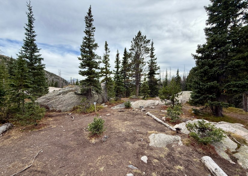
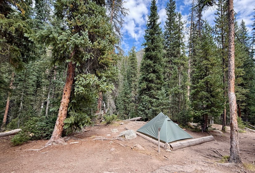
Pine Marten
Date Visited: August 22-24, 2025
# of Campsites: 2
Elevation of Campsite: 9,560 feet / 2,913 meters
Trailhead: North Inlet
Mileage from Trailhead: 7.8 miles / 12.55km
Elevation Gain from Trailhead: 1,020 feet / 311 meters
Privy: No
Water Source: North Inlet Creek
Cell Service: No
NPS Campsite Link
My blog link: Rocky Mountain National Park CDT Loop Day 1 – North Inlet Trailhead to Pine Marten
Spoiler alert: Pine Marten is tied with Mirror Lake for my favorite RMNP wilderness campsite! I spent two nights at this campsite while completing a section hike of the Continental Divide National Scenic Trail (CDT), utilizing the proximately to Lakes Nokoni and Nanita for a fun side quest. Overall my trip was 35 miles, which was a lovely loop through the west side of the park.

There are two campsites to choose from, and I selected the first. I was super happy with my choice, as it was privately located off the trail and right next to North Inlet, which provided amazing white noise my entire stay. North Inlet was just a short, steep descent away for obtaining water, soaking the feet, etc. There are plenty of living trees (becoming more of a rarity in the Rocky Mountains!) surrounding the campsite, with lush undergrowth. After a long day of hiking through a burn scar, it was nice to relax among tall, green trees!

Positives:
- While in a popular area for backpackers, campsite was quiet and private. The most I saw from other humans was a headlamp distantly through the trees at campsite #2.
- Great base camp for further exploration in the area, with Lakes Nokoni and Nanita situated relatively close by
- Campsite #1 is a large site with room for multiple tents. Water from North Inlet is very close by.

Negatives:
- I honestly struggle to find something, as I loved this campsite so much! But I’ll try…
- Permit can be relatively competitive as the CDT Loop is a very popular backpacking route in RMNP.


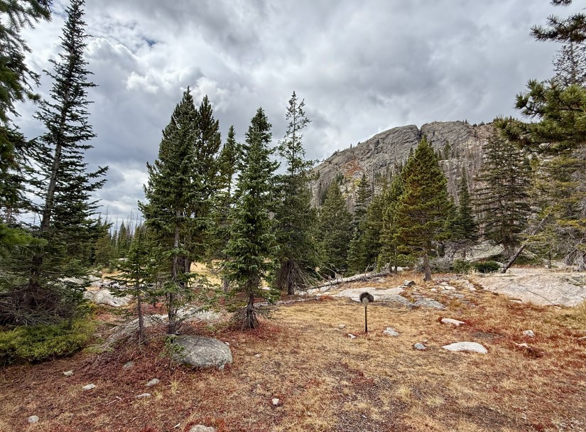
Tonahutu
Paint Brush
Date Visited: August 25, 2025
# of Campsites: 1
Elevation of Campsite: 9,320 feet / 2,840 meters
Trailhead: Multiple
Mileage from Trailhead: 2.9 miles from Green Mountain TH, 3.1 miles from Tonahutu TH
Elevation Gain from Trailhead: 550 feet gain from Green Mountain TH, 600 feet gain from Tonahutu TH
Privy: No (HWB required)
Water Source: Tonahutu Creek (short walk from campsite)
Cell Service: No
NPS Campsite Link
My blog link: None
Located in the East Troublesome Fire burn zone (Colorado’s second largest wildfire on record, which started in mid-October 2020), this wilderness campsite is within eyesight of the trail. I have not actually stayed in the Paint Brush campsite, I just noticed it while hiking past on the trail, and it was easy to grab photos of. I could see this being an option for those desiring a shorter hike into camp, but a big negative would be the lack of privacy – luckily the trail is not heavily trafficked, but still.


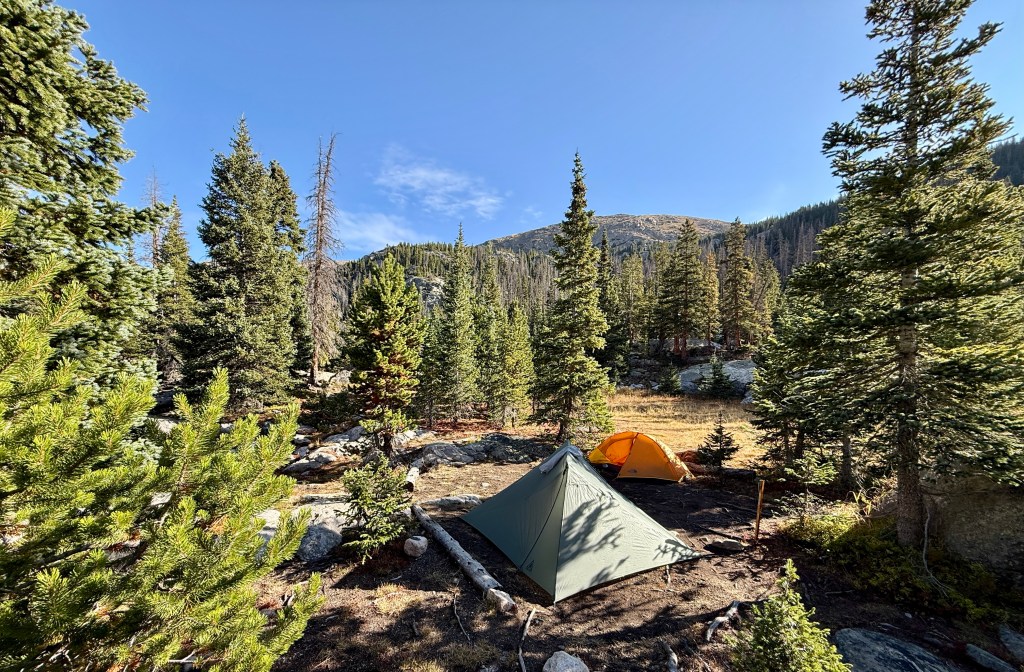
Tonahutu Meadows
Date Visited: August 24-25, 2025
# of Campsites: 1
Elevation of Campsite: 10,050 feet / 3,063 meters
Trailhead: Multiple
Mileage from Trailhead: 6.2 miles from Green Mountain TH, 8.5 miles from Bear Lake TH
Elevation Gain from Trailhead: 1,250 feet gain from Green Mountain TH, net gain 570 feet from Bear Lake TH (2,850 feet gain; 2,280 feet loss)
Privy: No
Water Source: Tonahutu Creek (short walk from campsite)
Cell Service: No
NPS Campsite Link
My blog link: Rocky Mountain National Park CDT Loop Day 3 – Across the Great Divide to Tonahutu Meadows
Tonahutu Meadows was my final campsite during my section hike of the Continental Divide National Scenic Trail (CDT) through RMNP (this popular route is called the CDT Loop). After traversing the Continental Divide high above treeline for most of the day, I was super eager to set up camp and lounge around!


Located near a lush meadow, Tonahutu Meadows is a great campsite for wildlife spotting opportunities. Moose occasionally frequent the area (I did not have any luck with seeing moose during my trip), and I heard bugling bull elk in the evening and morning hours. I also awoke to a family of deer grazing right outside of my tent!
Positives:
- While located on the popular CDT Loop backpacking route, campsite is very private and off-trail.
- Great base for possible wildlife viewing
- Compared to other options along the Tonahutu Creek Trail/CDT Loop, this is the only campsite that is not in a burn scar compared to campsites found further west (Granite Falls, Paintbrush, etc.).
Negatives:
- Permit can be competitive to obtain
- Campsite is surrounded by the East Troublesome Fire burn scar, but thankfully the campsite itself is in a small patch of mostly alive forest
- Short walk for the easiest access to Tonahutu Creek for water
Wild Basin
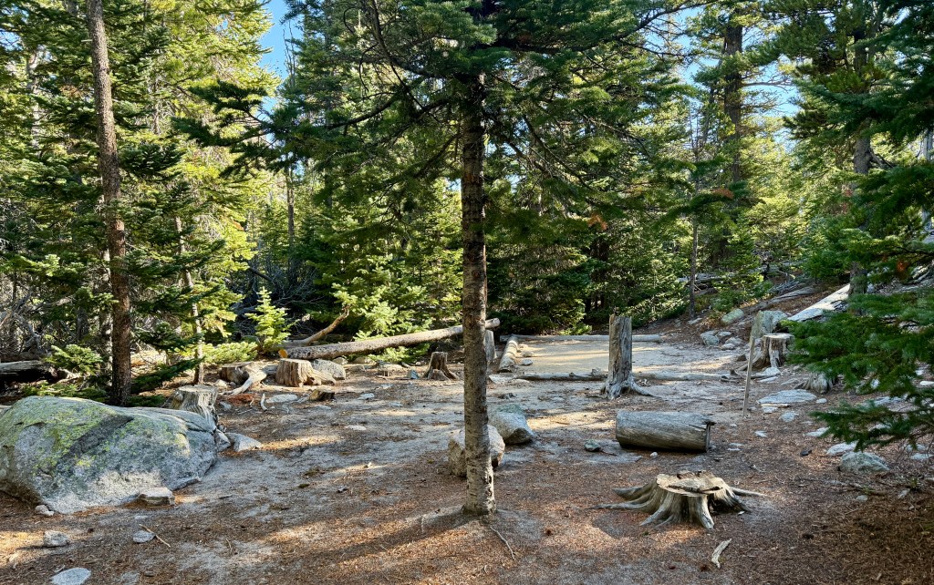
Beaver Mill
Date Visited: October 25, 2205
# of Campsites: 1
Elevation of Campsite: 9,640 feet (2,938 meters)
Trailhead: Sandbeach Lake
Mileage from Trailhead: 3 miles (4.8km)
Elevation Gain from Trailhead: 1,330 feet (405 meters)
Privy: No
Water Source: Hunters Creek
Cell Service: No
NPS Campsite link
My blog link: None

Located three miles up Sandbeach Lake Trail, the Beaver Mill campsite is located down a short descent that is not visible from the trail. This private site is surrounded by lodgepole pine trees. Some areas immediately surrounding the campsite are signed as closed due to restoration, which might limit how many tents can fit into the campsite. There are a lot of great options for hanging a hammock in this campsite!
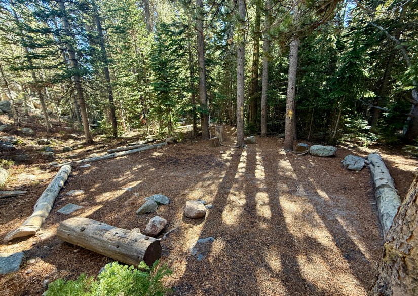
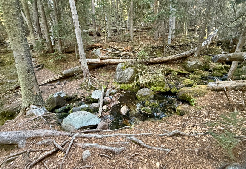
Hole In The Wall
Date Visited: October 25, 2205
# of Campsites: 1
Elevation of Campsite: 9,240 feet (2,816meters)
Trailhead: Sandbeach Lake
Mileage from Trailhead: 1.9 miles (3km)
Elevation Gain from Trailhead: 930 feet (283 meters)
Privy: No
Water Source: Campers Creek (which one crosses to reach the campsite)
Cell Service: No
NPS Campsite link
My blog link: None
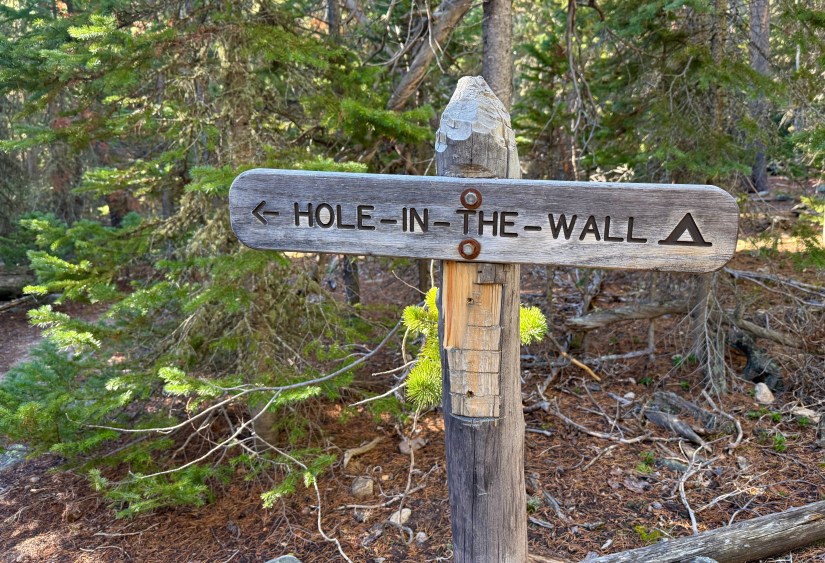
Hole-in-the-Wall campsite is an extremely private campsite located just two miles up the Sandbeach Lake Trail. I clocked it at about one-tenth of a mile off the trail. You must cross Campers Creek to reach the campsite, but it is an easy log and rock hop across it. Dense lodgepole pine trees surround the campsite. Though I haven’t stayed here (just popped in for some photos while hiking to Sandbeach Lake), I found it so peaceful and idyllic!

Siskin
Date Visited: August 31 – September 2, 2023
# of Campsites: 1
Elevation of Campsite: 9,600 feet (2,926 meters)
Trailhead: Wild Basin
Mileage from Trailhead: 2.9 miles (utilizing the campsite bypass trail. Taking the main trail will add 0.9 mile) (4.7km or 6.1km)
Elevation Gain from Trailhead: 1,100 feet
Privy: No
Water Source: North St. Vrain Creek
Cell Service: No
NPS Campsite link
My blog link: Colorado Hiked: Mount Alice
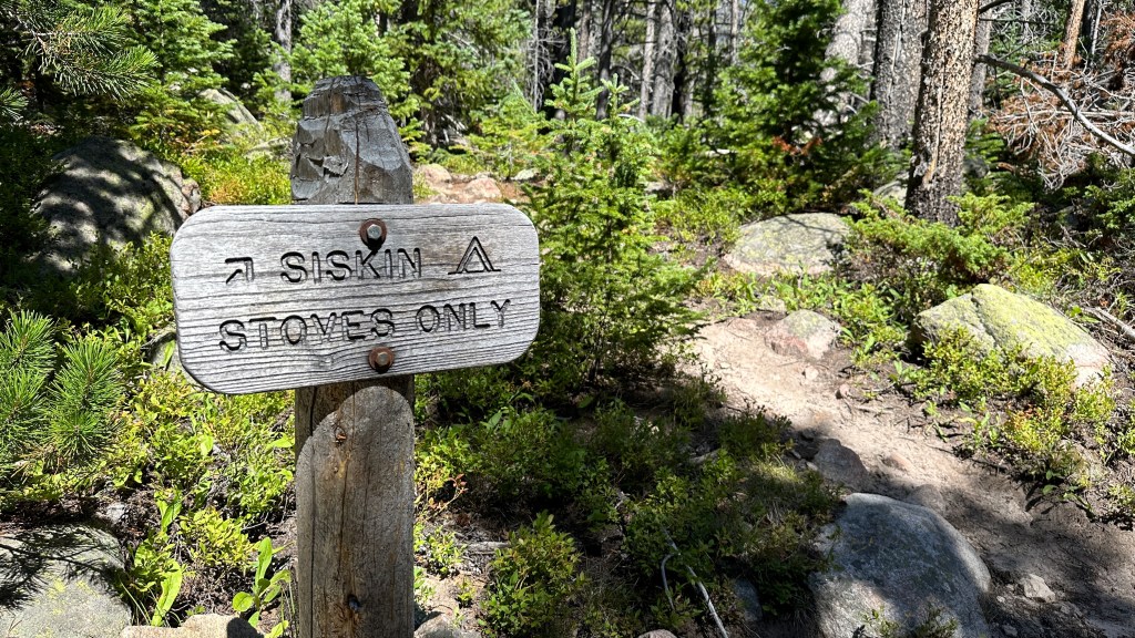
I used the Siskin campsite as a base camp for a summit hike of Mount Alice, but found myself loving this large, private, and peaceful campsite. The hike in is easy (especially if utilizing the campsite trail), making this a great site for those new to backpacking, children, or anyone just wanting a non-exhausting trek in to camp. To shorten the hike and to avoid crowds on the very busy trail through Wild Basin, I highly recommend taking the well-marked campsite trail.

Used as a base camp, Siskin provides a great central location for exploring other areas of Wild Basin such as Ouzel Falls, Thunder Lake, Bluebird Lake, and Lion Lakes. If seeking some of the remote 13,000 foot peaks, Siskin is great for this, too. Or just relax among the big trees, chill, and read a book!
Positives:
- Large campsite. My one person tent looked comically small in it!
- Easy to access water source
- Private and peaceful as it is set back from the trail
- Easy hike into campsite makes it beginner and kid friendly
- Great base camp for further exploration of Wild Basin
Negatives:
- I honestly could not drum up any really… except Wild Basin does indeed have active black bears. This fact helped my imagination run wild! 🙂


Last Thoughts
Upcoming Campsite Reviews
I haven’t begun scheming for 2026 yet, but I would like to get out for at least one overnight trip in the park! Any suggestions?
I am also trying to photograph wilderness campsites that I encounter while out on hikes in the park. While I may not pop into every one encountered (hey, I get tired and motivated to just get back to the car!), I hope this helps add more photos of campsites to this post.

This is such a great idea! I’m always struggling to find campsite photos, it’s so frustrating. The Lost Lake site looks like such a good one. That’s one of the ones we tried for and didn’t get 😭
LikeLiked by 1 person
Oh man, Lost Lake had two empty sites when I was there on a August weekend! I am curious if wilderness permits are up from people wanting to get out and enjoy the parks while we can? I definitely would watch it for cancellations!
I felt silly making a post just for four campsites, but I figure I can add to it as I go!
LikeLiked by 1 person
hi mrs heidi , just accidently visit your web because fossil cabin article and read this web about your adventure
may i know how manage time between family, work and your adventure?
(sorry for my bad english)
warm regards
LikeLike
Hi! Thanks for visiting! I luckily have a job with generous leave benefits and a good work-life balance so I am able to get away for a few adventures every year. However, most of my stuff is just done over the weekend, and does not take a big time commitment. I am very fortunate to live so close to outdoor recreation opportunities that do not require traveling very far!
LikeLike