

The long and short: This is one of my favorite hikes I’ve ever done!
End of post.

Ha, just kidding. But seriously, the hike to the summit of Black Elk Peak, which is South Dakota’s high point, blew me away. When my friends Janice and Taylor joined me in planning our Black Hills adventure weekend, Black Elk Peak stood out because of its claims to fame as a state high point, and also the highest point between the Rocky Mountains and the Pyrenees in France, making it an obvious choice for our day of hiking. What I’d come to find is the entire hike would be worth it even if it did not lead to the top of South Dakota!
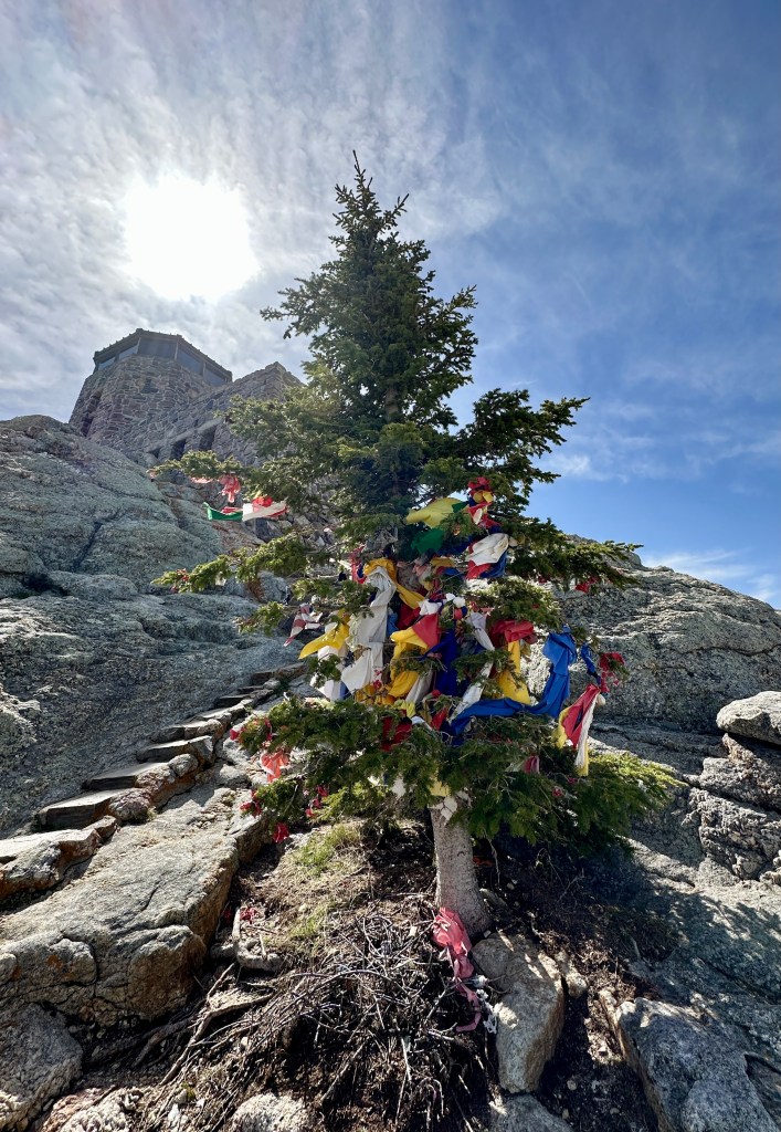
Known as Hiŋháŋ Káǧa by the Lakota Sioux, Black Elk Peak is named after Black Elk (Heȟáka Sápa), a notable Sioux medicine man who received his Great Vision on the summit. However, this summit was formerly called Harney Peak after US General William S. Harney. General Harney in September 1855 killed many Sioux in the Battle of Blue Water Creek, and continued atrocities against the native people during his command in the Black Hills. The Lakota tried for many decades to get the name changed, and after a renewed effort in 2015, the U.S. Board on Geographic Names officially changed the name to Black Elk Peak in August 2016 (with the South Dakota governor reluctantly signing off). The mountain remains a sacred site within the Black Hills, and ceremonial items can be found on the summit (please do not disturb these items if seen).
“I was standing on the highest mountain of them all, and round about beneath me was the whole hoop of the world. And while I stood there I saw more than I can tell and I understood more than I saw; for I was seeing in a sacred manner the shapes of all things in the spirit, and the shape of all shapes as they must live together like one being.”
Black Elk
While there are a few ways to accomplish the summit of Black Elk Peak, we chose the most straightforward: Trail #9 from Sylvan Lake in Custer State Park. We would complete a loop, utilizing Trail #9 to the summit, and then taking Trail #4 back to the trailhead. We made an early start from our campsite in Custer, hoping to beat the afternoon thunderstorms predicted to roll in.
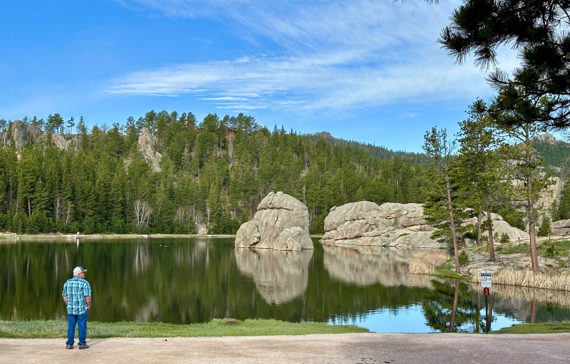
We luckily were visiting on a fee-free weekend, so we rolled into the Sylvan Lake Trailhead easily, and found ample parking (it would be packed full by the time we finished our hike). After nabbing some photos of picturesque Sylvan Lake, we set out on the wide trail.


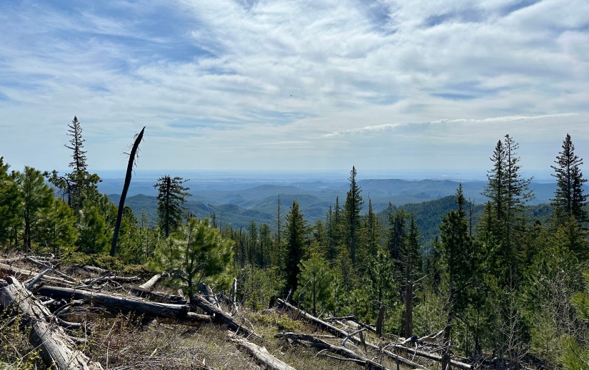
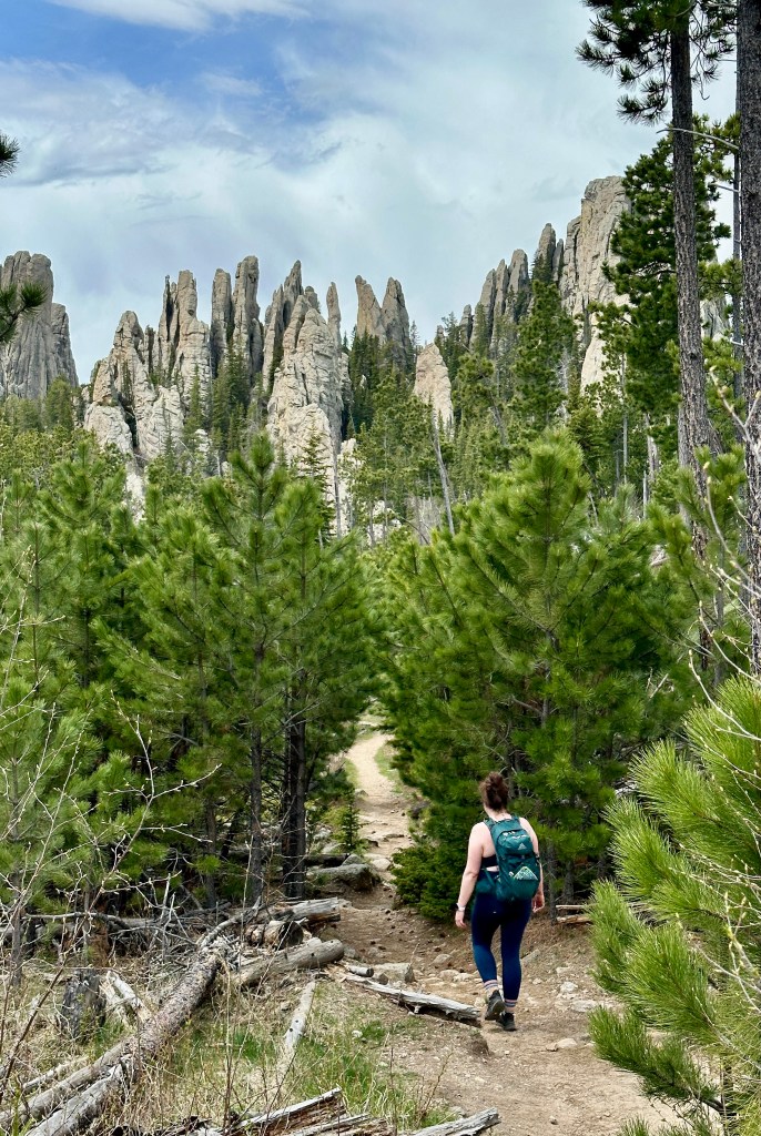
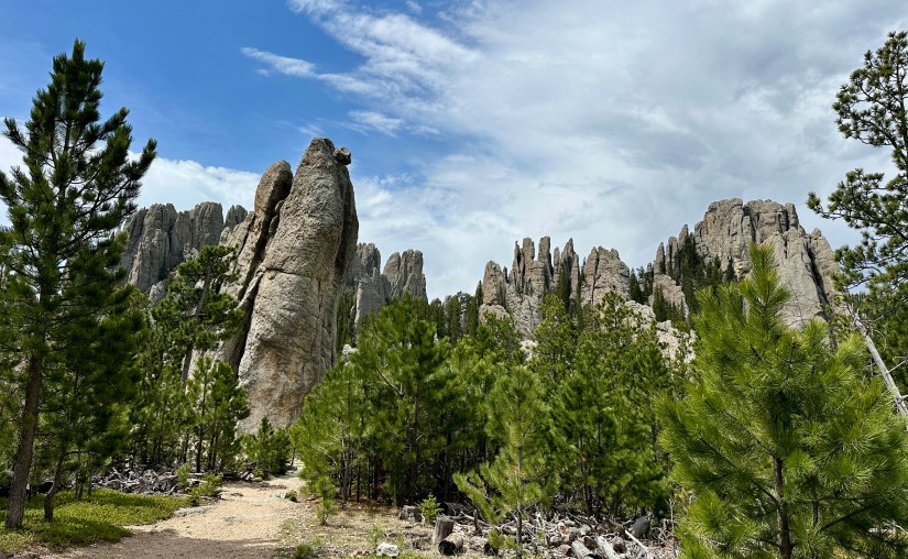
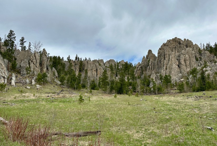
Naturally, this is a mountain summit so there is elevation gain to be had, but the grade was gentle and punctuated by rolling sections, and even some descents. A calm morning in the Black Hills National Forest unfolded around us, and while we came across other hikers occasionally, it was still a quiet experience. As we gained elevation, breaks in the trees lent views towards Black Elk Peak and the surrounding granite rock formations.


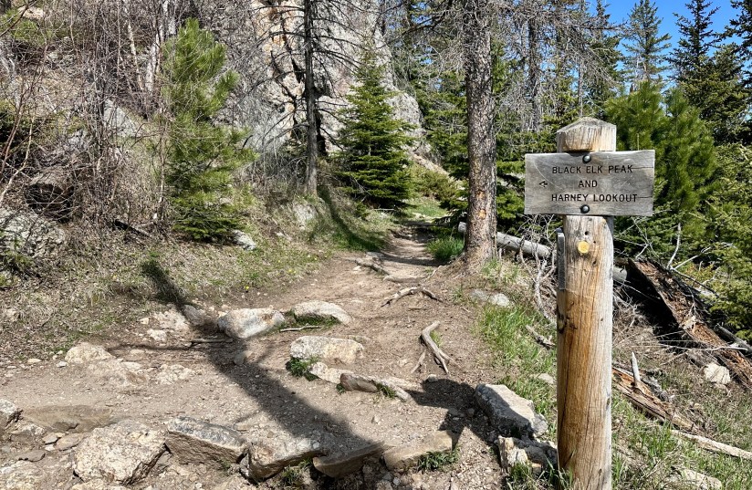
After 3 miles we reached the trail junction, with Trail #9 continuing to the left to the summit, and Trail #4 to the right that would loop back to Sylvan Lake. We proceeded towards the summit. This stretch was hot in the blazing sun, as trees became a bit more scarce, and we were quickly trying to shed layers and stay cool. The trail also became significantly steeper and rockier.


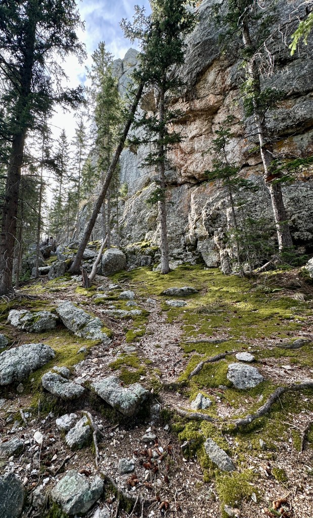
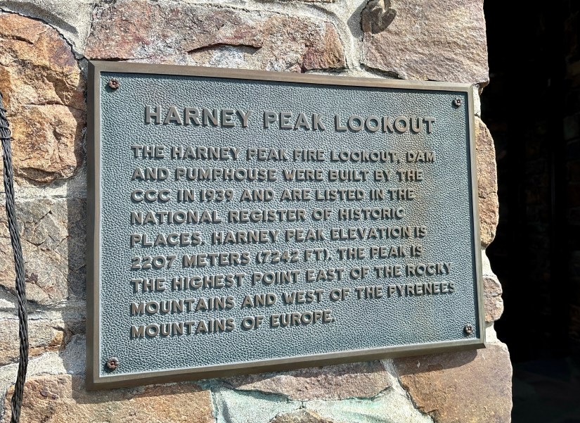
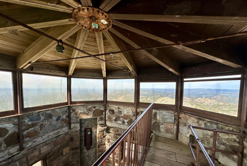
In 1938-1940, the Civilian Conservation Corps (CCC) completed a stone fire lookout near the summit of Black Elk Peak, along with a dam and pumphouse that held 5000 gallons of water. The CCC also constructed stairs and ramps to lead to the summit. The last little bit to the lookout is a beautiful constructed trail, and definitely one of the most unique sections of trail I have hiked.


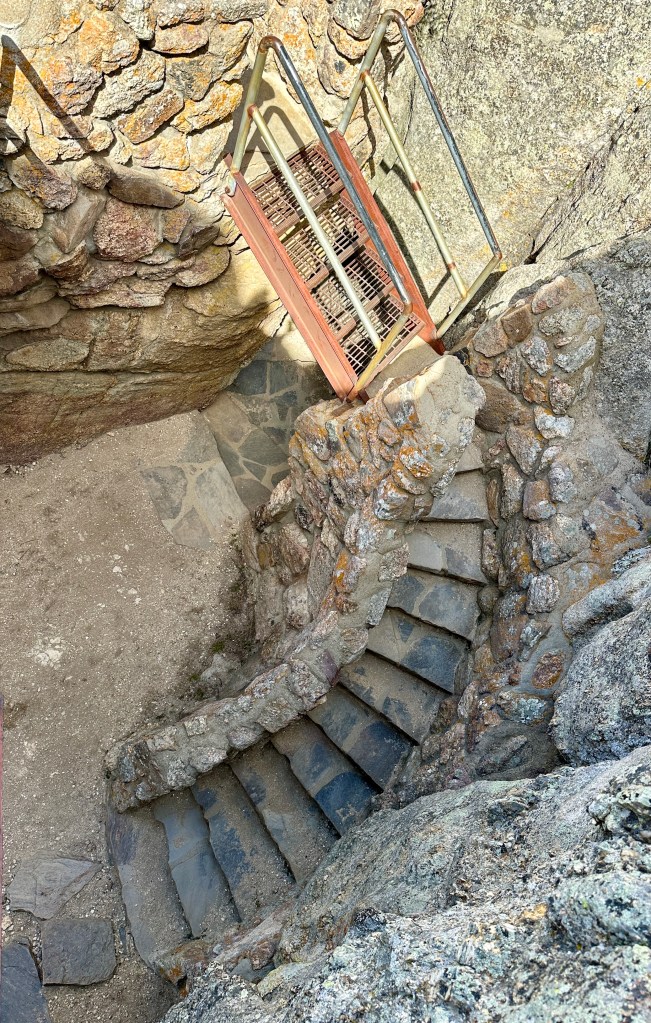
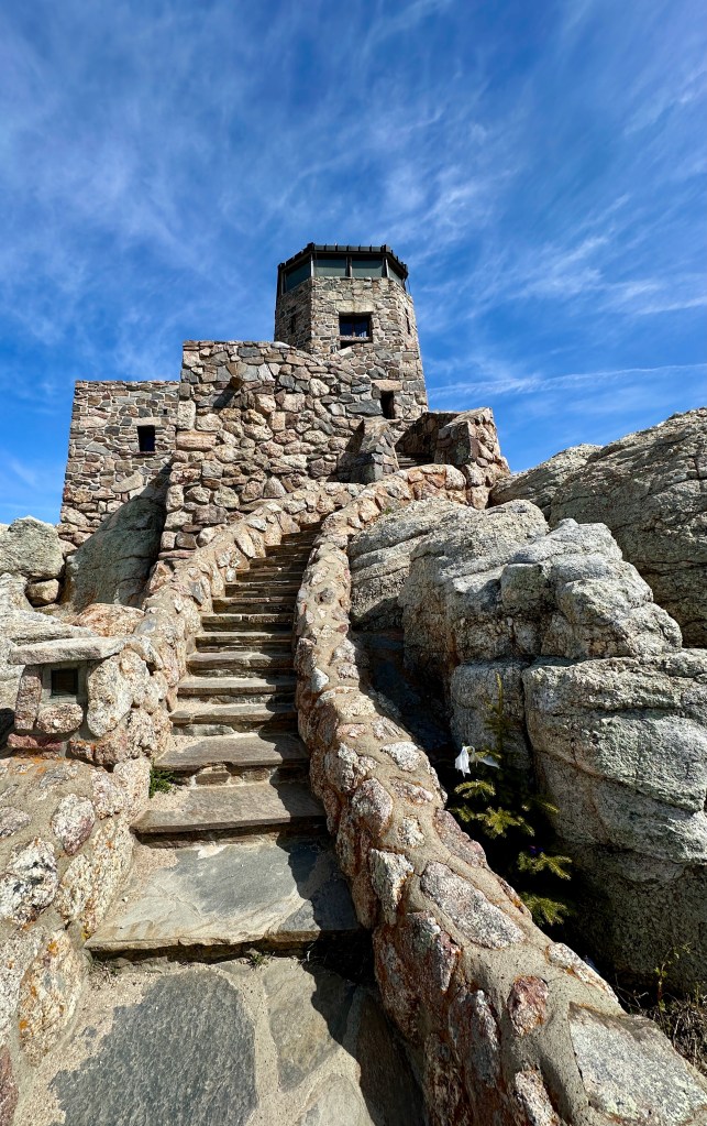

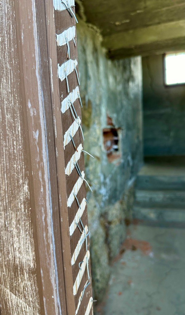
Last staffed in 1967, the fire lookout is open for public exploration, and we spent time looking through the various rooms and climbing to the very top.

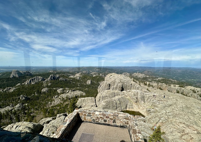


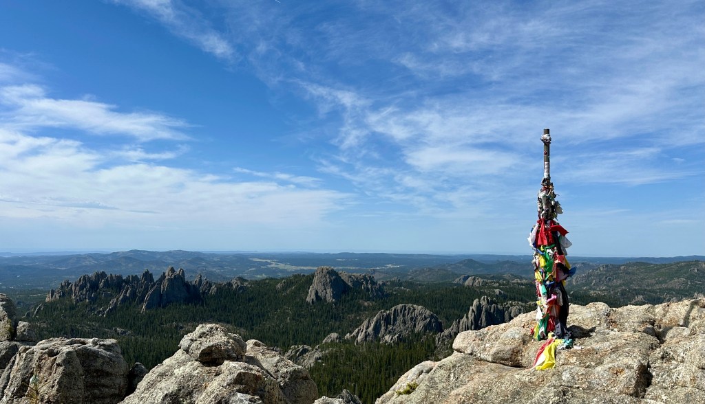

The true summit of Black Elk Peak, and therefore South Dakota, is not the fire lookout. True summit is a short jaunt and rock scramble to the west… or so Taylor and I thought. It wasn’t until I was writing this blog months later I realized we scrambled over to not true summit. OKAY, WHATEVER! We summited the top of South Dakota, both fire lookout and survey marker (which does say “Harney Peak” and does look higher, but we know that is always a deceiving notion on summits). If one cares to learn more about the 2016 survey of Black Elk Peak, this is a great website.


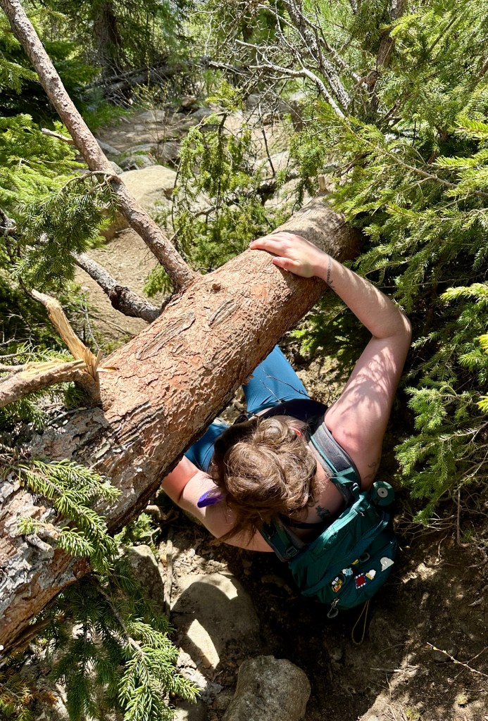
Summit gained, we backtracked down Trail #9 to the junction of Trail #4, which we headed down. This trail had a lot more solitude, which was nice as the crowds increased. It appears to not get as much traffic, and we had a few fallen trees to navigate around.
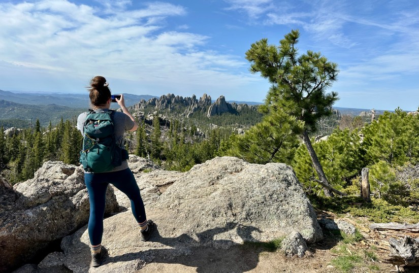
A highlight of Trail #4 is hiking past the Cathedral Spires. These granite spires can be reached from a short hike off of the Needles Highway as well. There are a few side quests on the loop. Aside from Cathedral Spires, there is a short trail to the summit of Little Devils Tower. If one has the energy or time, it wouldn’t take much to add on these side trips. I wanted to do Little Devils Tower, but the skies were clouding up too much for my liking.


The skies were darkening with storm clouds, so we tried to make quite work of the rest of the hike even though we were well into the trees (for those on the summit of Black Elk Peak… well, that’s not a place I’d want to be with storm clouds!). We soon could hear traffic on the nearby Needles Highway through the trees, and passed through the Little Devils Tower Trailhead. Janice and garter snake managed to equally scare each other, which lead to some great laughs. After quick work of a short hill, we started seeing people in flip flops and knew the car was near!

Just shy of 8 miles and 5 hours we arrived back at Taylor’s car, eager to use some bath wipes and change out of sweaty clothes. Highest point of South Dakota – CHECK! I highly recommend this hike if in the Black Hills area, even if someone is not a peakbagger or highpointer. The scenery is beautiful and the trail has some unique terrain.
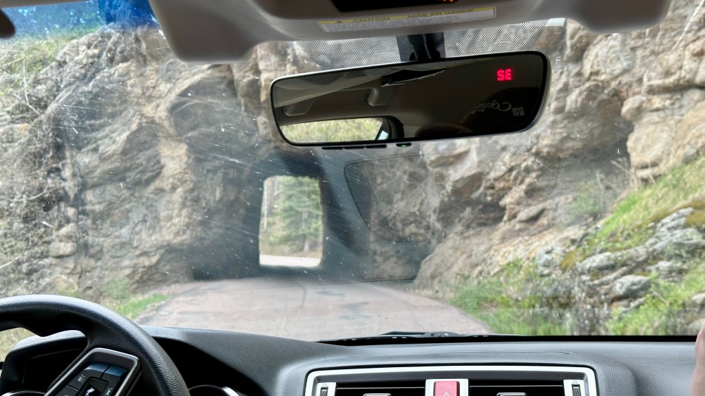
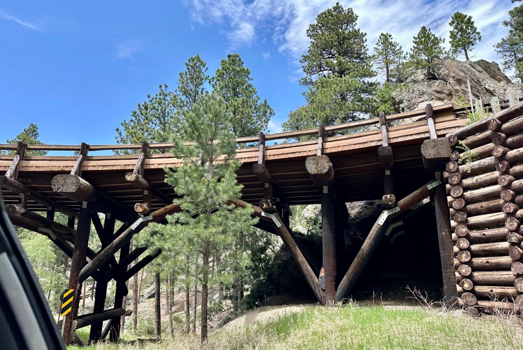
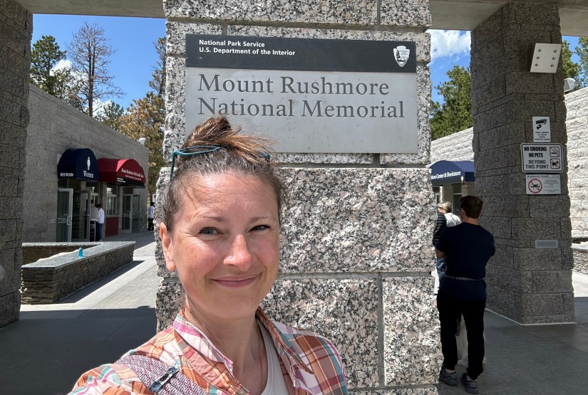
After cleaning up, we headed down the Needles Highway, through the narrow stone tunnels to Iron Mountain Road and the pigtail bridges. Mount Rushmore National Memorial was next up on our list, even though we had all visited at other points in our lives. We had ice cream, passport stamps, and Junior Ranger badges to get, naturally!


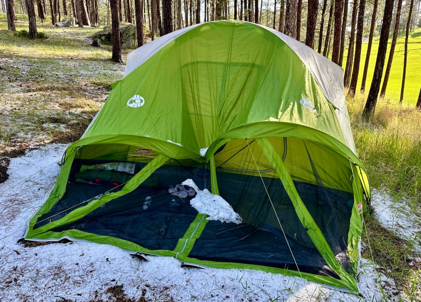
Afternoon thunderstorms rolled through, but we somehow always managed to be not where the rain and hail was actively pounding down. After some dinner at a bar in Custer (it was still the off season, and open restaurants were hard to come by), we arrived back to our hail-collapsed tent at Custer Mountain Campground. Another amazing day in the Black Hills complete!
Details:
All Trails Link
Date Hiked: May 19 2024
Trailhead: Sylvan Lake
Total Mileage: 7.86 miles (Garmin Forerunner 255s)
Total Elevation Gain: 1,759 feet
Total Time Spent: 4 hours 41 minutes
Weather: Clear, sunny skies with the morning with building clouds and threatening storms before noon.
Trail Conditions: Dry. One downed tree what was adventurous to crawl under.
Special Considerations: Sylvan Lake Trailhead is located in Custer State Park. Nonresident day use fee is $15 (2025), however there are fee-free days/weekends (like when we visited!).
The first day of our Black Hills adventure weekend can be read about here – our visit to Jewel Cave National Monument!

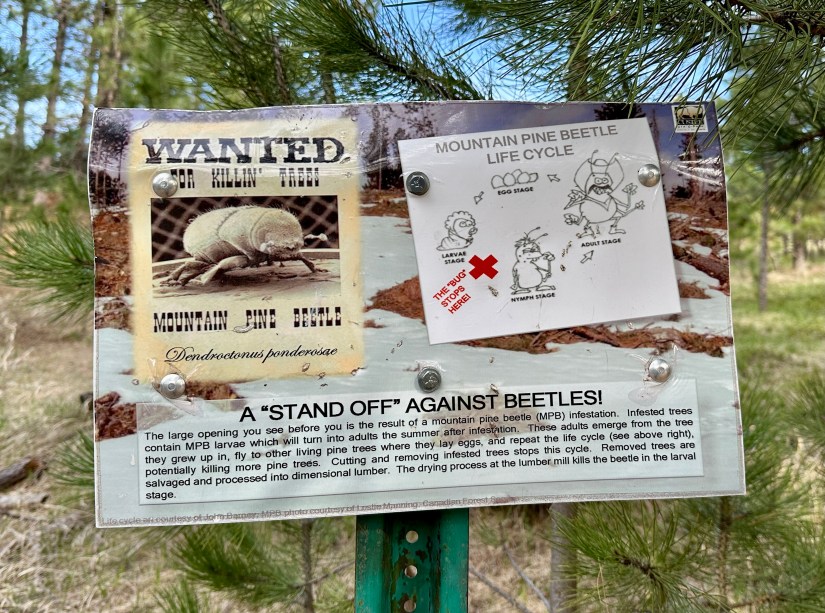
I am having problems commenting. I just wanted to say congratulations on reaching the summit and a great adventure. I guess the Mountain Pine Beetle is becoming a real pest (pun intended). I read that it is spreading over larger areas due to climate change. The landscape is gorgeous and the photos are great.
LikeLiked by 1 person
Yeah, sadly pine beetles have done a number on the forests in this region. It is quite sad. Our winters just don’t get very cold anymore, which I heard is a contributing factor to their spread.
LikeLiked by 1 person
Yes that is what I’ve read too
LikeLike
Standing on top of Black Elk Peak and getting incredible 360-degree views of the remarkable Black Hills sure makes you feel as if you’re on top of the world 🙂 I just love how along the way you get to see amazing rock formations and at the top, you can explore an old Fire Tower 🙂 Thanks for sharing, and have a good day 🙂 Aiva xx
LikeLiked by 1 person
Ohhhhh, so this is what it looks like. When I did this hike it was foggy the whole time and, unlike you guys, we were always exactly where the rain was. Also, I got a goof laugh out of “we started seeing people in flip flops and knew the car was near!” 😂
LikeLiked by 1 person
My mood has been uplifted on so many hikes when the fashion shoes and designer purses appear, ha!
LikeLiked by 1 person