

Two Girls Roving: The tale of a 16 day, 3522 mile road trip to the Pacific Northwest in celebration of my friend’s college graduation! Follow along for all the shenanigans through thousands of miles, eight National Park Service units, night after night of camping, and even some coastal backpacking!
August 31, 2024
In the early planning stages for this trip somehow it was suggested to backpack on the coast. After consulting with my adventure friend in Washington and doing some online sleuthing, Janice and I concluded that Ozette Triangle would be perfect for her first backpacking experience (and my first on the ocean). After over a week of the comforts of car camping, we would trade that all in for whatever we could carry on our backs for two nights!
Also called the Cape Alava Loop, the Ozette Triangle route is essentially an equilateral triangle leaving from Washington’s largest natural lake, Lake Ozette. Heading through forest and even a prairie, the first stop along the way is Cape Alava, the westernmost point of the contiguous U.S. (Lower 48). From Cape Alava, the route turns south, following the beach and Pacific Northwest National Scenic Trail to Sand Point. It all wraps up with another jaunt through the forest back to the trailhead. The Triangle can be completed in the other direction, and as a day hike of about 9-to-10 miles or backpack trip of varying night lengths. Janice and I chose a casual two nighter, with Cape Alava and Sand Point as our stopovers.
This trip would take place in the coastal region of Olympic National Park, therefore wilderness camping permits were necessary to obtain. Knowing that we would be staying in a quota area and we were aiming for Labor Day Weekend, I jumped on recreation.gov on April 15th and secured our permits (which I picked up at the wilderness office at the Port Angeles Visitor Center earlier in our trip). I do plan on writing an entire blog post about the logistics and nitty gritty of an Ozette Triangle backpacking trip, so I’ll spare the readers of this post all the minute details.
On to the adventure…
We awoke early at Lost Resort, and packed our tent and sleeping bags into the backpacks, and stuffed them into the car. We had about a one mile drive to the Ozette Triangle Coastal Trailhead, which was already surprisingly full when we arrived at 9am. Stuffed backpacked were hoisted, and we did a final check to make sure valuables left behind were securely stashed out of sight (I brought my wallet with me along with my DSLR) and that we were not forgetting anything (don’t worry, I forgot my backpacking light for my tent, and our hammocks). Let’s get show on the road!
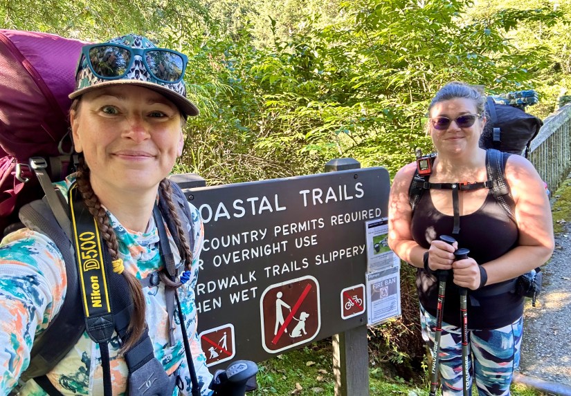


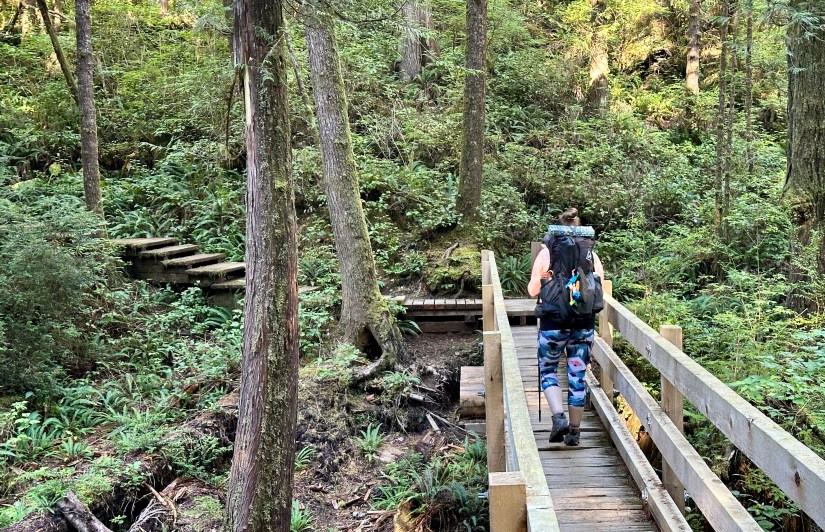
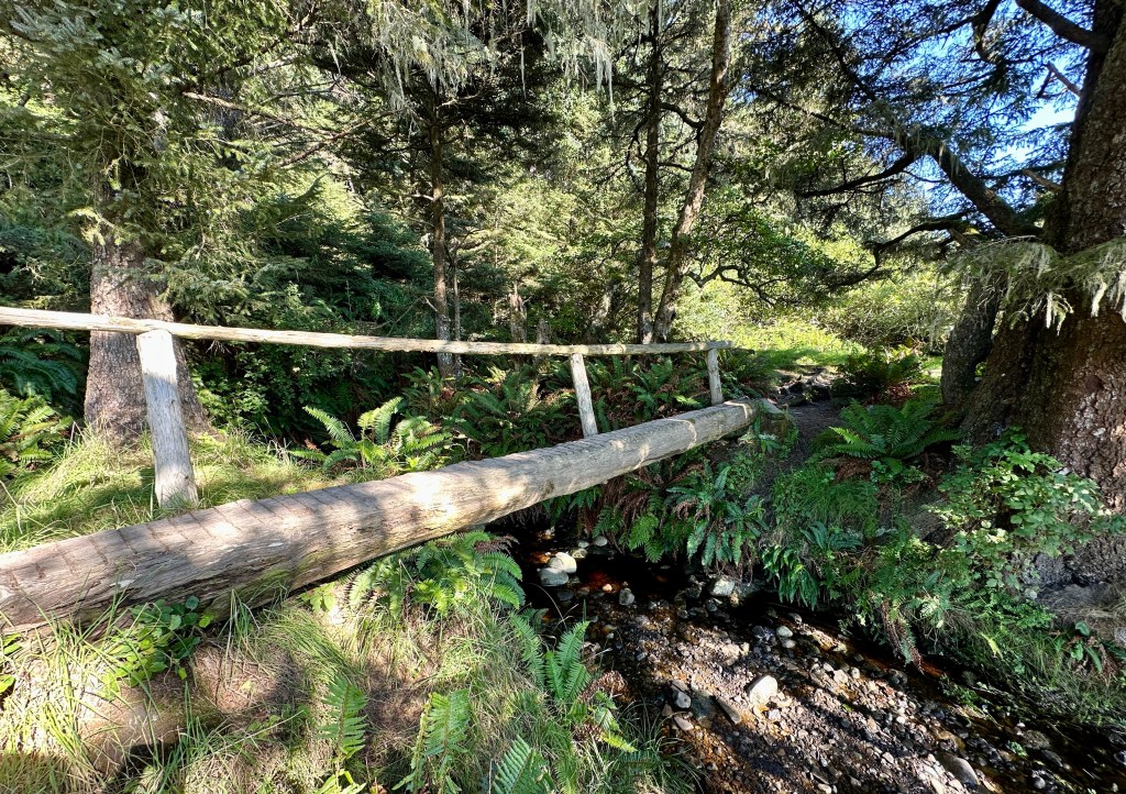
It was weird to think we were heading towards the coast as we hiked through the dense forest, with me cautioning that we needed to pace ourselves (I was being the wimpy one about backpacking, honestly!). Most of the trail was along boardwalk of varying conditon, with some rotted sections and slippery boards. It was hot and muggy as the morning sun climbed higher in the sky (which I cursed even more as we crossed Ahlstrom’s Prairie, which is not shaded at all). A highlight was Janice spotting a banana slug to the side of the boardwalk!


Strangely enough, this section of trail that felt like it was uphill both ways. “Aren’t we suppose to be reaching sea level?!” we wondered out loud a few times as we continued climbing up. We stopped for breaks, including to chat with a fellow backpacker who was returning from a trip and was able to confirm that the creek at Cape Alava was flowing well as a water source (the area was in a drought and I had fretted a tiny bit about having a solid water source, and Janice and I packed in a total of 11 liters of water between the two of us).
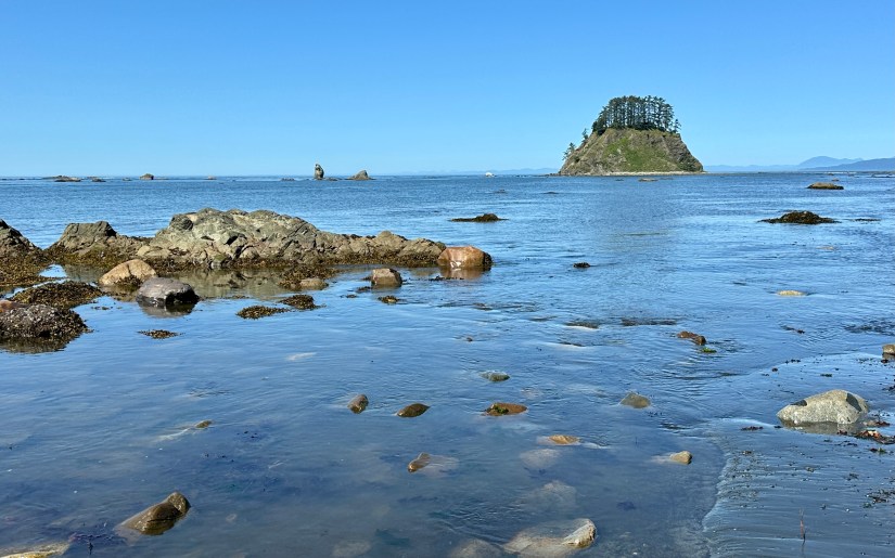
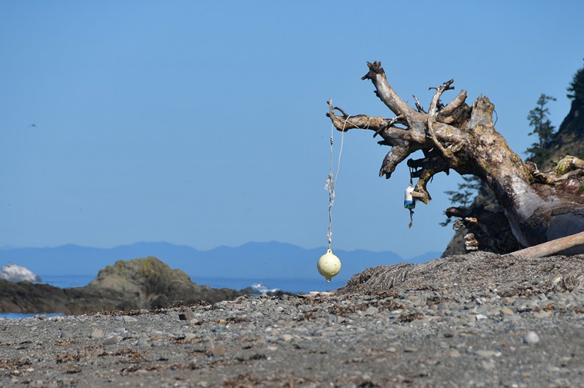
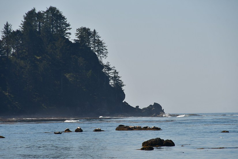
And then suddenly…. Pacific Ocean! Bam! A steep and narrow descent took us down to the coast. The campsites at Cape Alava are first-come-first-serve, with campsites stretching from the north of the trail along the cape. Luckily a great site (maybe the second or third in along the camper’s trail) was open, and Janice and I quickly decided this would be our home for the night. Instead of immediately setting up camp, we tossed down the backpacks and ran down to the ocean.


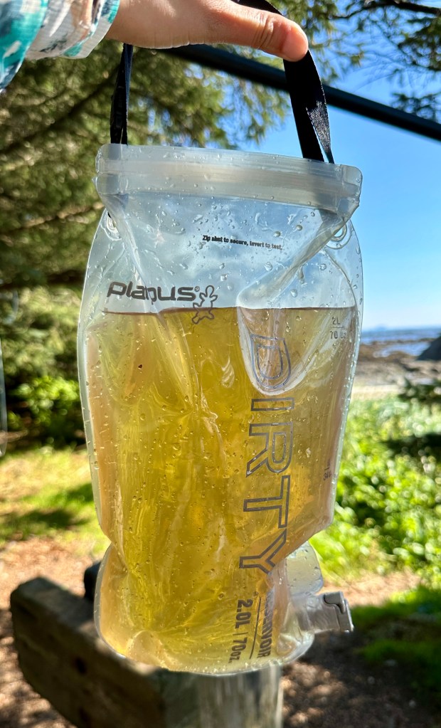
Ocean views satiated for awhile, we took to setting up camp, and I wandered back to the creek to get some water to filter. The water from the creek is yellowish-brown from tannins that leech from plant matter, which can be rather alarming. I felt like I arrived back to camp with one very full Foley catheter bag (that’s the nurse in me coming out!) to filter! Water must be filtered to be safely consumed (unless intestinal parasites are your thing, then you do you), so I ran the water through my Platypus filter, creating several liters of what can only be described as urine-colored drinking water. Janice was a bit alarmed, though she did not seem to want to express it in words. Me, being the weird one, took a large sip, deemed it as tasting quite normal. We ended up just using our tannin water for cooking and coffee, where the color doesn’t really matter.


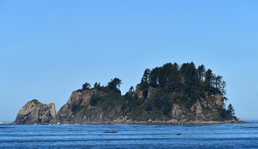
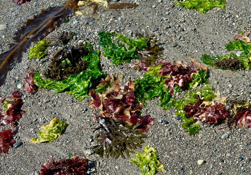
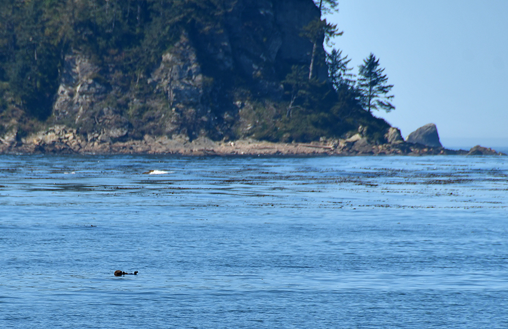
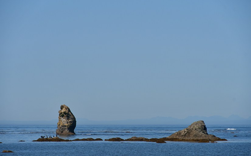
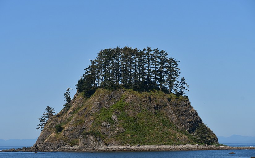
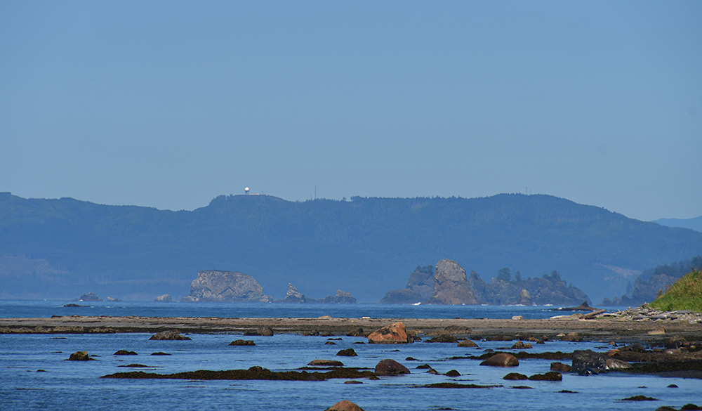
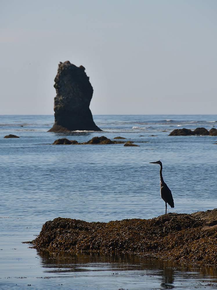
After some lunch, we decided to explore the coast to the north as the tide rolled out. We found the beach to be a stinky affair, and the closer we got to Tskawahyah Island, the thicker the stinky seaweed became. We oogled the various seabirds, and the noisy sea lions off in the distance (it is hard to truly describe how noisy and loud they are at Cape Alava!). I saw a group looking through binoculars, so I inquired at what they saw and they uttered the word “otter.” Janice, being a fair bit away, managed to hear this, and shrieked, running towards us. It is an understatement to say Janice loves otters, and this totally made the trip for her. The group shared their binoculars, and I decided to hoof it back to our campsite to grab my Nikon so I could get some photos with the 300mm zoom. Check a sea otter off the list!


Finally dragging ourselves away from our otter friend, we continued north to Tskawahyah Island, which is the official westernmost point of the Lower 48. The island is owned by the Makeh Tribe, and is off limits to visitors. Apparently there is a survey marker that can be accessed, but I tend to try to stay away from sacred places that don’t allow visitors. Like I did the day prior at Cape Flattery, I turned eastward and admired that everyone in the U.S. was to the east of me at the moment. Ha!


I never started my watch to track how far we meandered along the beach, but we ended up having quite the hike. We eventually turned back so we could relax in camp (which I struggled to do because of inch worms and other bugs), reading books, and just overall enjoying life.


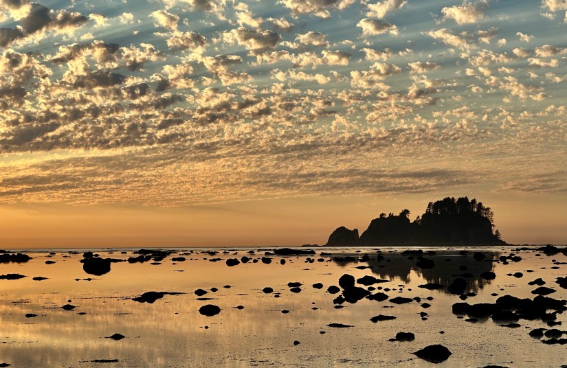
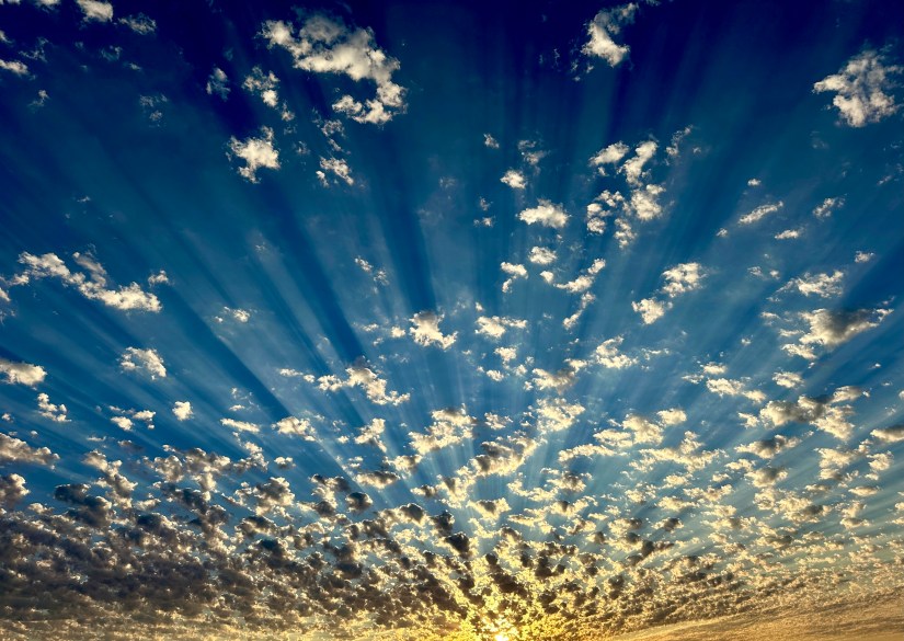
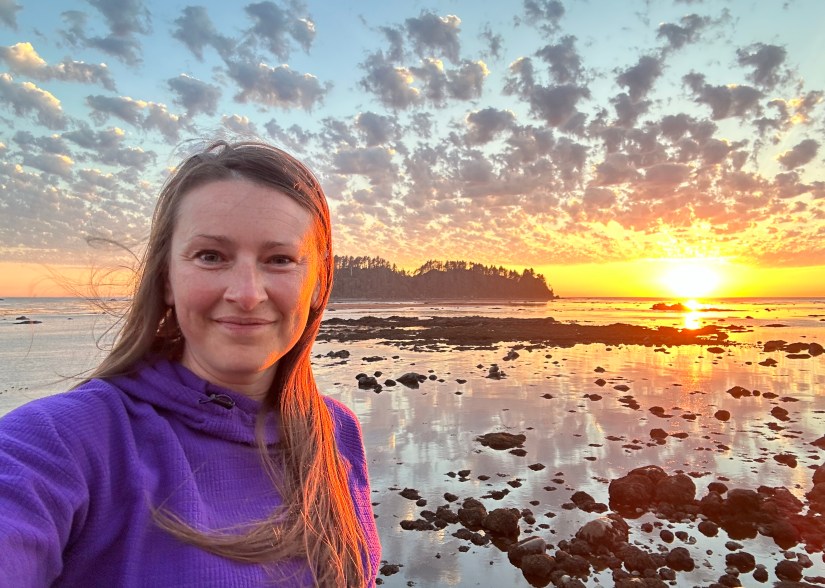
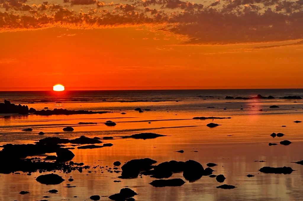
Probably one of the things i was most looking forward to on this entire trip was watching the sunset from Cape Alava and Sand Point. All sunsets are great, but there is just something about watching the sun disappear into the ocean! As sunset neared, Janice and I headed down to the water with a beer of choice from the Lost Resort General Store. I’ll let the photos now do the talking…


With the sun gone, we retired to our sleeping bags for a bit of reading, and then solid sleep. Tomorrow would bring three miles of hiking on sand!

Travel states, facts, & things with no context from Janice and I:
- 1 mile of driving
- 3.4 miles of hiking, with 413 feet of elevation again in 2 hours 3 minutes
- 1 NPS unit visited
- Olympic National Park
- $30 fee (good for 7 consecutive days) or use an annual federal lands pass such as the America the Beautiful pass
- Olympic National Park

Accommodations for the night:
- Cape Alava Backcountry Site
- $8 per person plus a $6 reservation fee (2024)
- Wilderness permit information
- No cell service (Verizon)
- The details:
- There are numerous campsites to choose from with them all being first-come-first-serve
- There is a pit toilet
- Water source is the creek that is immediately to the north of the trail that brings you to Cape Alava. All water must be filtered to be safe to drink.
- The water will be yellowish-brown in color. It is from tannins from plant matter, and is safe to drink.
- Bear canisters are required for food storage

Oh my gosh. This backpacking trip was already in on my list, but now? Otters? That campsite? The sunset? Amazing! Might have to bump this one up a few spots.
LikeLiked by 1 person
It was amazing! And such an awesome backpack that doesn’t involve too much insanity, though we found some on the next day. The rest of our days were foggy so we lucked out this day with the clear views!
LikeLiked by 1 person