

Two Girls Roving: The tale of a 16 day, 3522 mile road trip to the Pacific Northwest in celebration of my friend’s college graduation! Follow along for all the shenanigans through thousands of miles, eight National Park Service units, night after night of camping, and even some coastal backpacking!
August 29, 2024
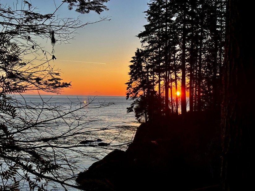
Our Olympic Peninsula leg of the adventure was officially underway, and with a spectacular start! The sunrise over the Strait of Juan de Fuca was something no photo or video could do justice of.


After relishing in the dawning light of a new day, we took advantage of most people still being asleep, and used the shower facilities (which are quite nice at Salt Creek Recreation Area – clean, plentiful hot water, and only 25 cents for 2 minutes) before tearing down camp. Both Janice and I have visited Olympic National Park (together and separately), but I found plenty for us on this trip that we hadn’t seen previously. On the agenda for today would be driving up Hurricane Ridge and hiking Hurricane Hill, and then staying the night in the Sol Duc Valley.
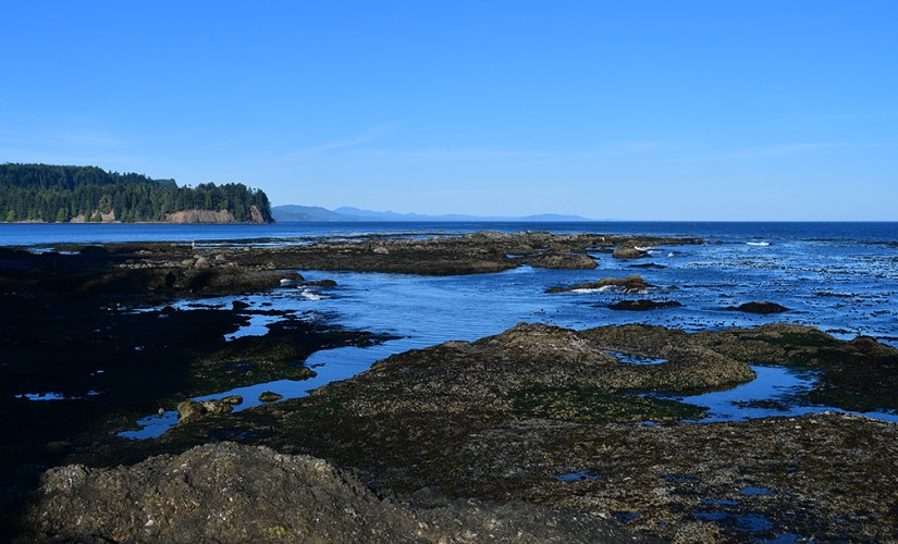
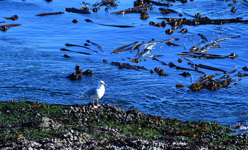
But first, we had one last special thing to do at our amazing campsite that I had so many regrets for not staying multiple nights at – the tide pools at Tongue Point! With parking located in one of the campground loops, it was an easy way to get the morning started. The tide was still out quite a bit, and we found anemones and sea urchins, along with just great, clear views over the Strait of Juan de Fuca to Canada.


Salt Creek has a lot to offer right in the area, aside from exploring the coast. There are some abandoned bunkers, and longer hiking is available, including to the summit of Striped Peak and to a site of a former fire lookout. It was pretty hard to leave the area to continue on our adventures, and such a beautiful campsite. I guess we just have to go back?!
We set course back to Port Angeles, with Janice excitedly chatting on the phone to her husband about “sea buttholes” (it was a whole thing… maybe the traveling was making us delirious at this point?). Our goal was to beat the crowds to Hurricane Ridge, a very popular area of Olympic National Park.
Olympic National Park. One of my favorites, and probably the most diverse national park I have ever visited. I am not sure I can name another national park where you can relish in the high alpine and glaciated views in the morning, eat lunch in a temperate rainforest with the banana slugs, and finish off the evening among the sea stacks of the Pacific Ocean! It is quite obvious why UNESCO designed the park a World Heritage Site in 1981! My previous visits have always been whirlwind drive-throughs, so on this trip I planned for us to spend six nights in various areas of the park so we could drive a little deeper (of course, like always, still so much was left unseen, so future trips are a must!).
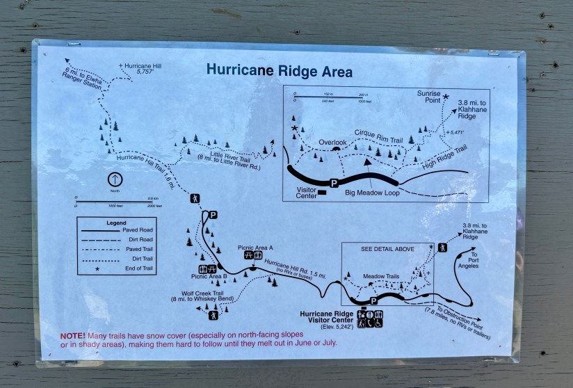
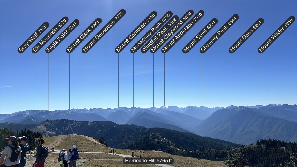
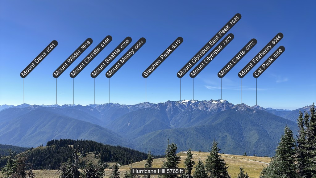
No roads cross through the interior of Olympic National Park, and Hurricane Ridge Road is the easiest way to access the mountain views, with a winding 17-mile (27km) road. There was a lodge and gift shop located at the top, but it sadly burned down in 2023. The road narrows and continues on a few more miles as Hurricane Hill Road, culminating in a small trailhead parking lot of Hurricane Hill. We arrived around 10:30am and had to circle once before getting a parking spot, even on a weekday.
Hurricane Hill is a popular hike, and seems easy on paper, coming in around 3.4 miles. Heck, it is even paved the whole way! But… its the 800 feet of elevation gain to the summit (which is at 5757 feet / 1755 meters, possibly challenging to those not acclimated to altitude). Janice and I stuffed snacks in our pockets, and set out!
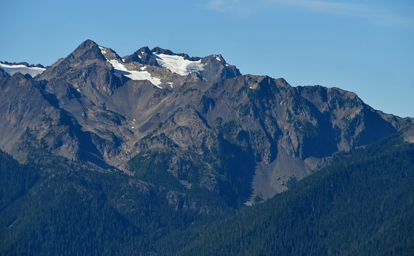
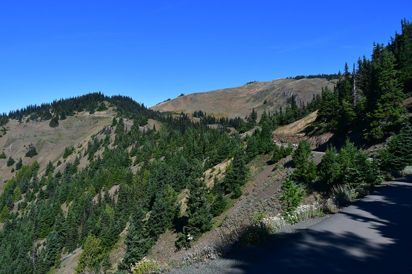
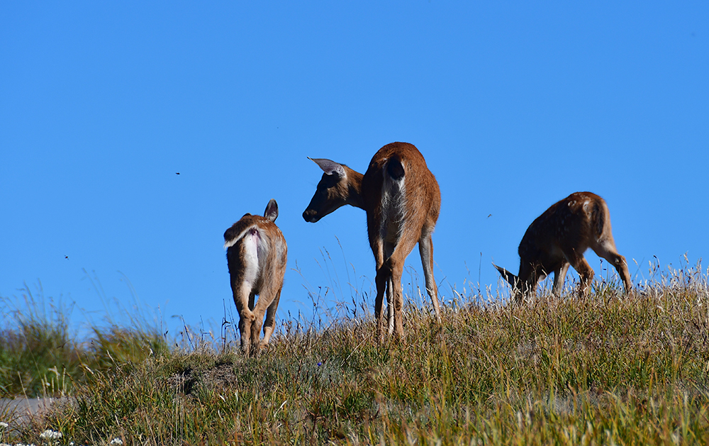
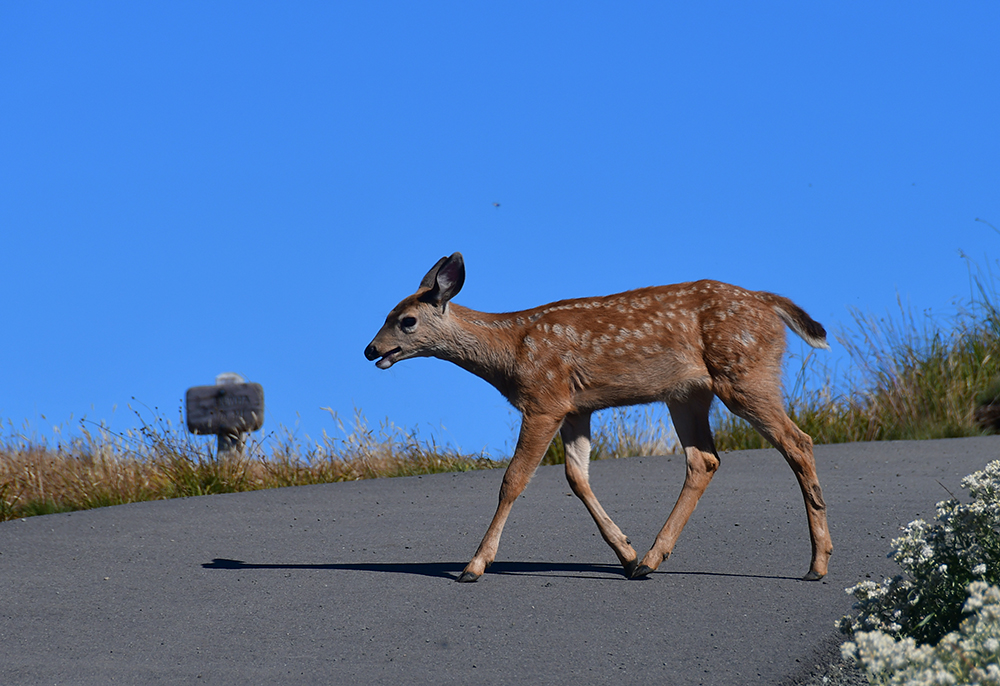
Anytime I can have 360-degree views of mountains, I am filled with glee, so I was loving the hike up Hurricane Hill. We saw deer, ravens, grouse, and even some caterpillars (which Janice took to rescuing from the trail as I screeched about wormy-things). Right before the finish push Janice found a great bench to take in the views and waved me on towards the summit (“This is a mountain, not a hill!” exclaimed Janice).
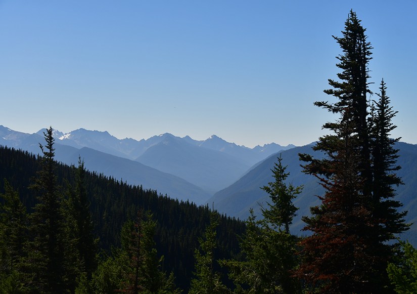
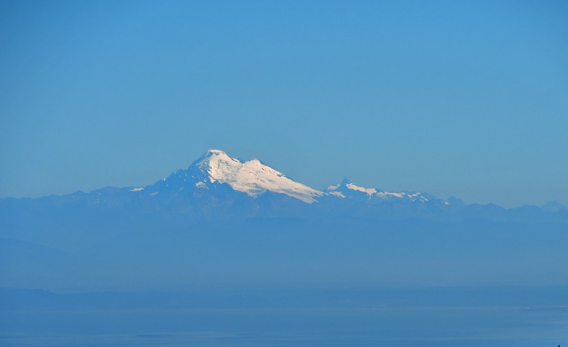
I found my way to the small rocky summit (there is a broad area with intepretive signs and benches for the crowds to hang out), and took in the views that ranged from Mount Baker, to the Strait of Juan de Fuca, to Mount Olympus. I snapped a summit selfie and used PeakFinder to identify those around me before taking to jogging down the steep trail.


Overall, our total hike time was 1 hour 25 minutes. Our pace both up and down were quite snappy (Janice is a fast uphill hiker despite her insisting that she isn’t, and set us at quite the quip). Time to scratch the hike off my 100 Greatest Hikes of the National Parks poster! After some tailgate sandwiches, we headed down Hurricane Ridge Road.
We made a quick stop at the national park visitor center outside of Port Angeles for souvenirs, passport stamps, and to pick up our backcountry camping permit for the weekend at Ozette Triangle (this wilderness office is the main location to pick up backcountry permits for the park, and also checks out bear canisters for free). Janice asked the ranger about tide restrictions, and the ranger dismissed the concern with “There’s overland trails that are easy to take, nothing to worry about. You just hike around.” If you follow this blog, remember that last sentence, as it’ll comically come back on our second day of the backpacking trip…
A Walmart trip for a few groceries and random items was up next, and then we headed west along US Highway 101, turning off on Sol Duc Road to head into the old-growth forest of the Sol Duc Valley for the night.


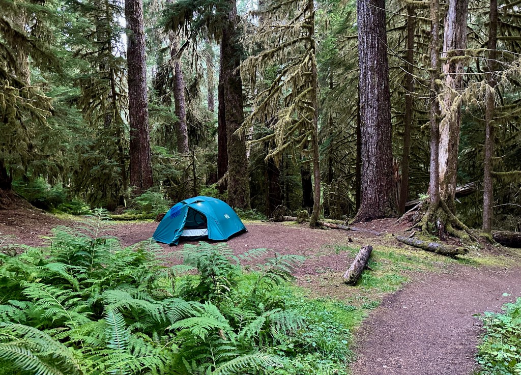
Lush, mossy forests will always be a favorite for Janice and I, and pulling into campsite #50 at Sol Duc Hot Springs Resort Campground made our hearts happy! Our campsite was spacious with a tent pad under the thick forest canopy. I finally got the Adventure Dinos out of the car for some photos, and otherwise we had a relaxing evening of fajitas, reading, and just hanging out!


Travel states, facts, & things with no context from Janice and I:
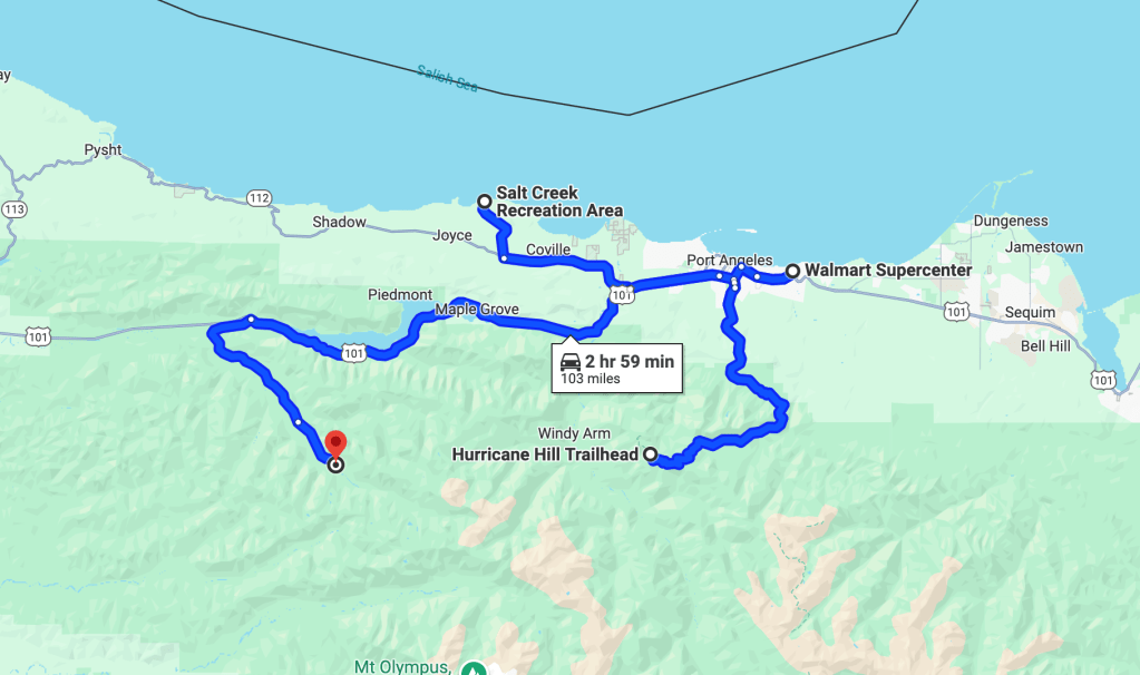
- ~103 miles and 3 hours
- 1 NPS unit visited
- Olympic National Park
- $30 fee (good for 7 consecutive days) or use an annual federal lands pass such as the America the Beautiful pass
- There are entrance stations at both Hurricane Ridge and Sol Duc Valley
- $30 fee (good for 7 consecutive days) or use an annual federal lands pass such as the America the Beautiful pass
- Olympic National Park
- Hurricane Hill is really a mountain, at least according to Janice
- Sea buttholes
- Whoever decided gummy “Lunchables” candy was a good idea should be fired
Accommodations for the night:
- Sol Duc Hot Springs Resort Campground
- Site #50
- $36.50 (including online reservation fees) for standard site. Electric hookup sites are more. (2024)
- Verizon service ok, but spotty. But there was some (surprisingly!)
- The good:
- Great, spacious campsite with easy access to bathroom facilities and trails
- Bathroom facilities with running water, flush toilets
- Showers available at the hot springs resort with entry
- Hot springs for those that love them! We didn’t visit, but I’m sure they are fantastic for a soak!
- The bad:
- There is a trail that comes right by the campsite, which reduces privacy in daylight hours
- We were only here one night and could’ve definitely stayed longer! (A problem many times on this trip…)

What a wonderful adventure and gorgeous photos. I’ve never been to Washington but it is certainly very beautiful. It is great that you are bringing adventure dinosaurs with you.
LikeLiked by 1 person
I’m laughing way too hard at sea buttholes! Honestly, I could 100% see myself coming up with that name for them too 😂
Hurricane Ridge looks so pretty! I’ve only been to Olympic once and it was still snowed in up high so we didn’t really get to see much up there.
LikeLiked by 1 person
I’ll have to tell Janice someone else is a fan of that name!!
My previous visit to Hurricanes Ridge was on a snowy, cloudy day, so it was great to see all the views and be able to actually hike!
LikeLiked by 1 person