

May 22, 2023
Black Canyon of the Gunnison National Park was quite amazing, but it was time to move on south, though I could’ve spent quite a bit more time at the canyon. 255 miles of driving awaited me, including a quick bop into southern Utah. Water was boiled, coffee pressed, and tent packed up. Finally after all these years I even realized I could leave my string lights in my tent in between campgrounds, saving time unstringing them through all the little loops on the ceiling. Today is a good day! An hour after waking I was pulling out of the campground and ready for the open road.
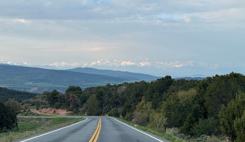
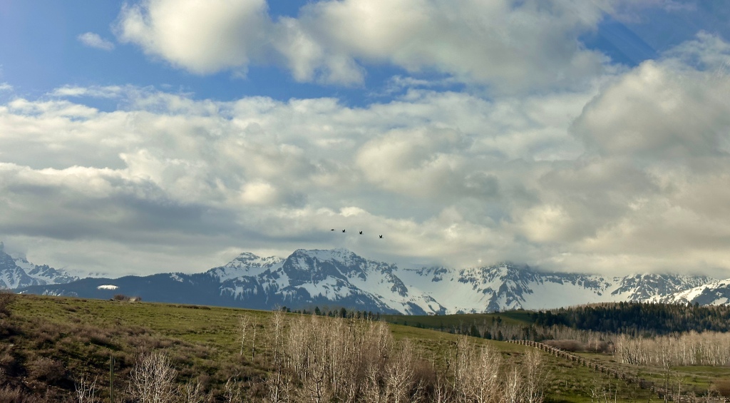
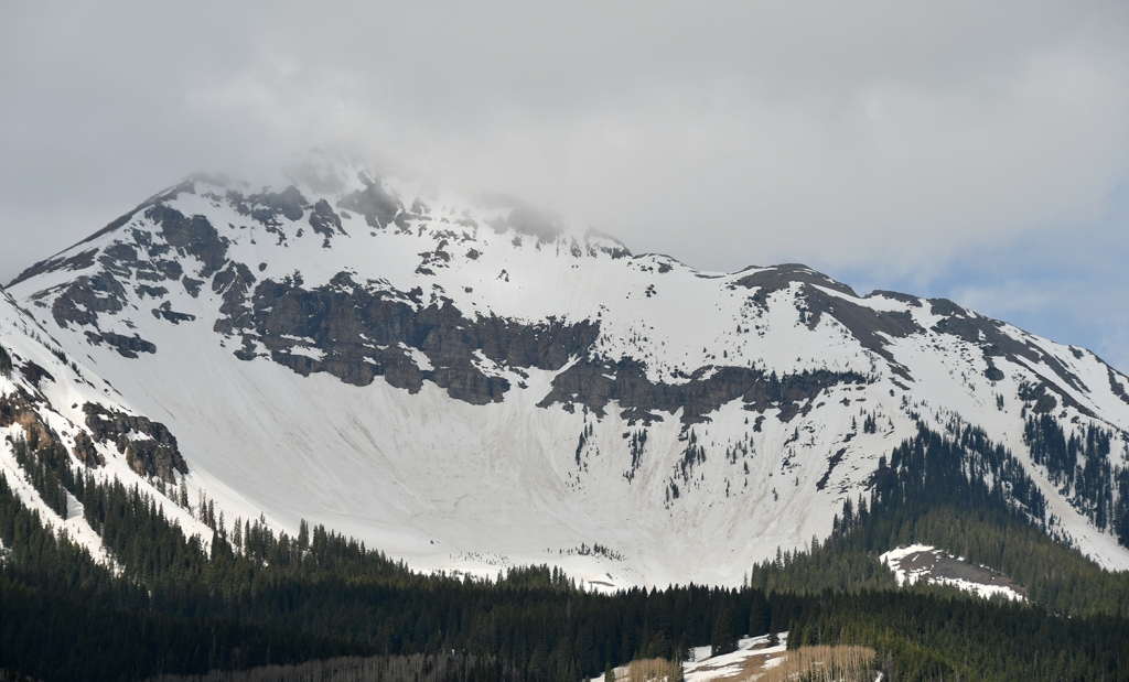
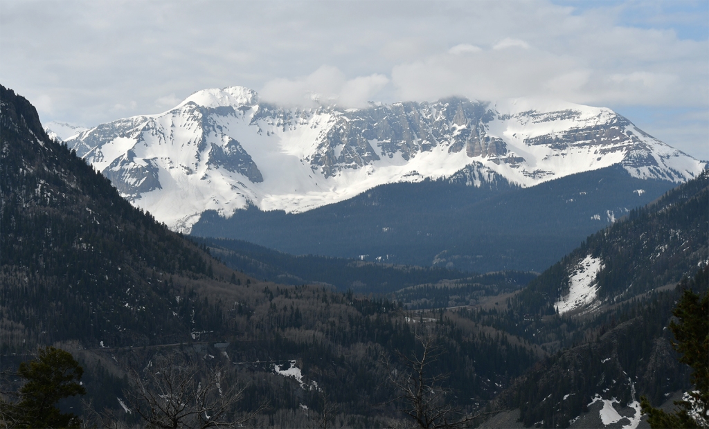
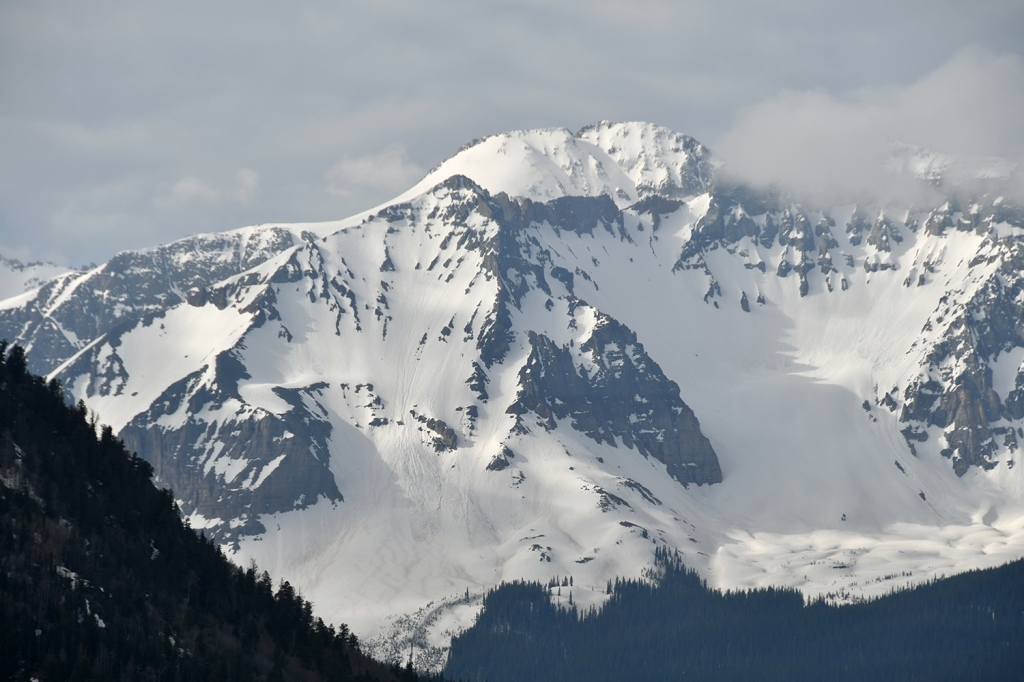
I descended down from the national park to great views of the San Juan Mountains, and I took to blabbering to myself about Mount Sneffels and other mountain muses. I made a quick gas stop in Montrose ($2.97/gallon!) before heading south towards Telluride and beyond as I headed over Lizard Head Pass on the San Juan Skyway.

The next few days of my trip would be dedicated not only to gorgeous southern Colorado views (with Utah and New Mexico sprinkled in for good measure), but immersing myself in the history of the Ancestral Puebloans, a farming culture that lived in the Four Corners area of Colorado, Arizona, New Mexico, and Utah from about 500 AD to 1300 AD. (Today’s Pueblo, Zuni and Hopi people are descendants of the Ancestral Puebloans.) I would be visiting five national parks and monuments dedicated to preserving the structures and history of the Ancestral Puebloans – Hovenweep National Monument, Canyons of the Ancients National Monument, Yucca House National Monument, Mesa Verde National Park, Aztec Ruins National Monument, and Chimney Rock National Monument.
In my childhood when I visited Mesa Verde and Aztec Ruins, the Ancestral Puebloans were called Anasazi. This is a word of Navajo origin meaning ‘ancient enemy,’ and therefore is considered disrespectful. I just want to mention this as it is something I noted when I was researching my trip that had changed even in the duration of my lifetime. To learn more about the why behind this change, this is a great resource.
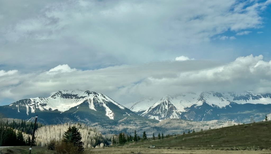
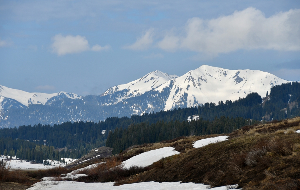
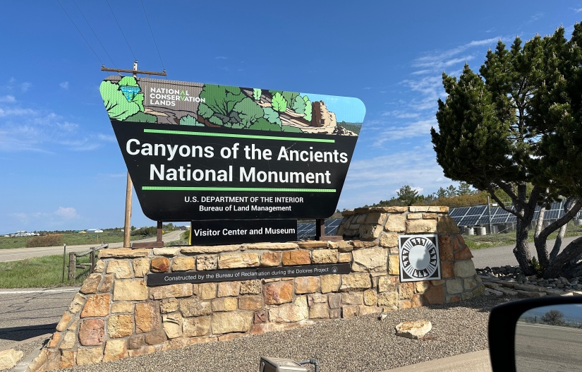
After about three hours, I left the snowy San Juan Mountains and descended into Dolores, which was a lot more desert-like. I made a super quick stop at the Canyons of the Ancients National Monument visitor center, which was closed for renovations. I still was able to grab a brochure and map before heading on my way. Unfortunately I was not really able to squeeze in activities in this national monument aside from just driving through, which is managed by the Bureau of Land Management (BLM). My campsite friend in Black Canyon, Phil, had mentioned a great hike which I would pass the trailhead for, but time and heat of the day meant I skipped it. I should’ve really detoured to Lowry Pueblo, but hindsight is 20/20.
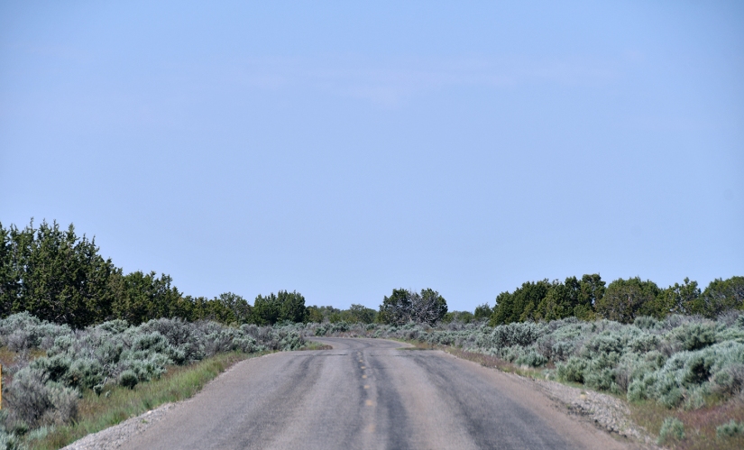
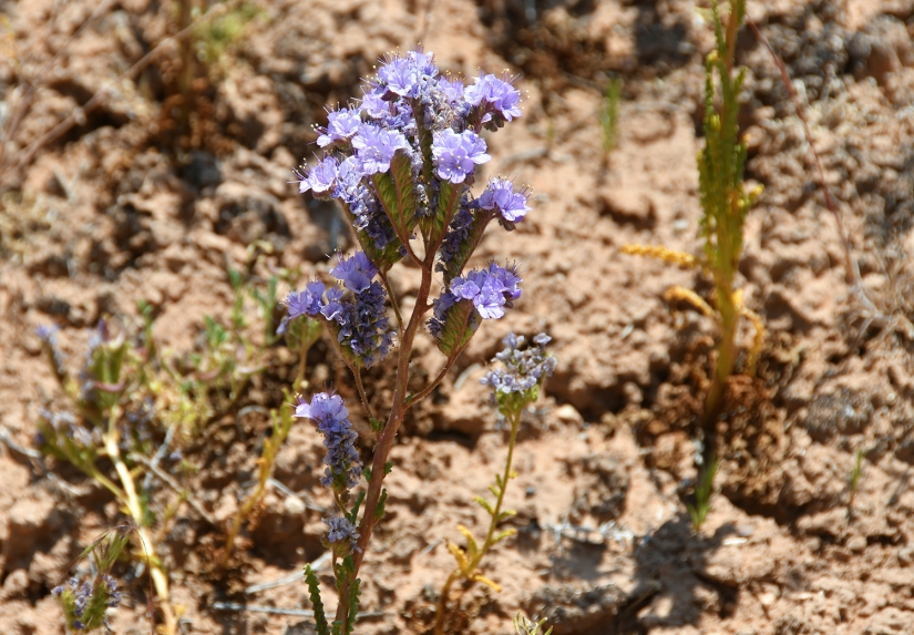
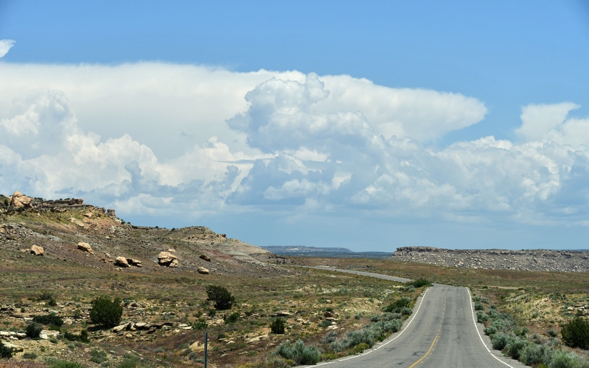
I had about a fifty minute drive to Hovenweep National Monument across farmlands and then open desert, with popping wildflowers and a lot of any other cars on the narrow road. I crossed into Utah without much fanfare (wasn’t even a sign!), and had to control myself from just continuing west towards some of my favorite places ever in southern Utah.
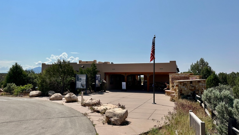
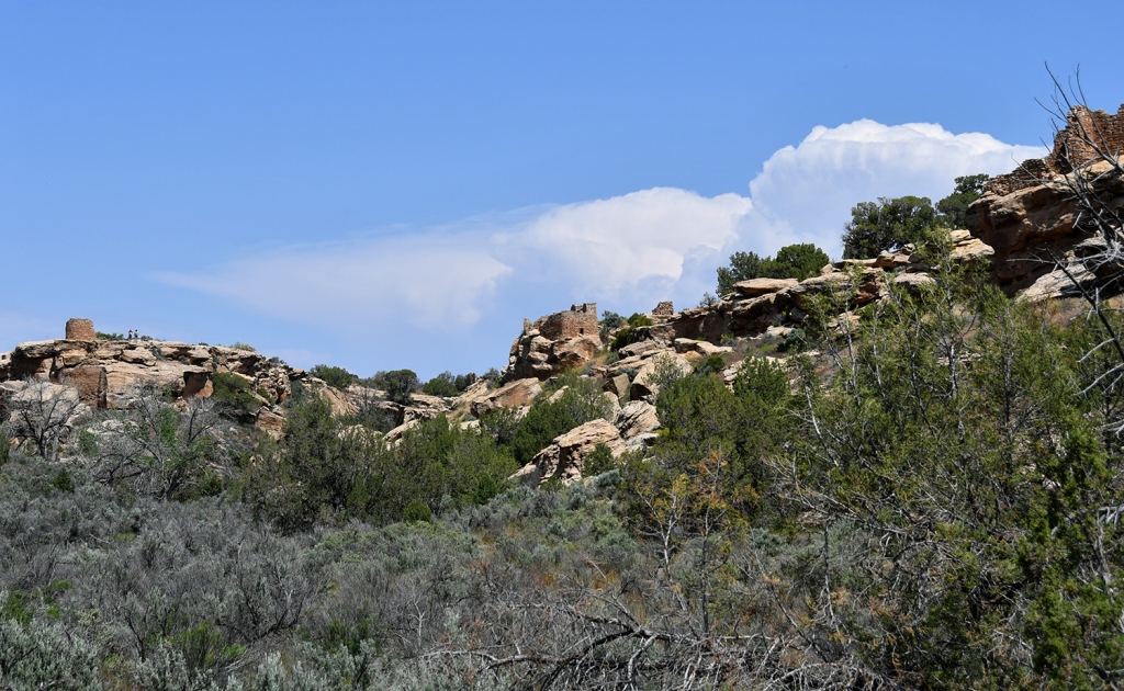
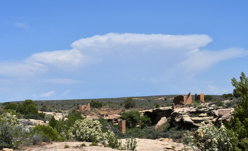
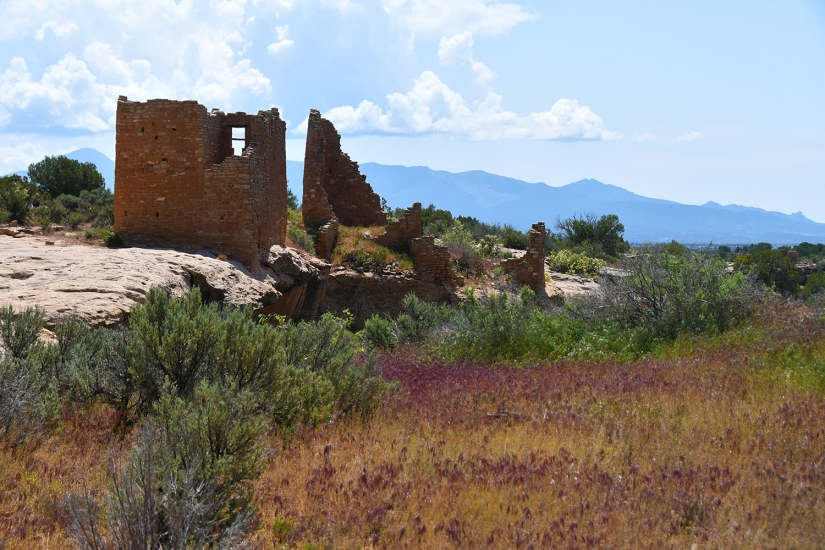
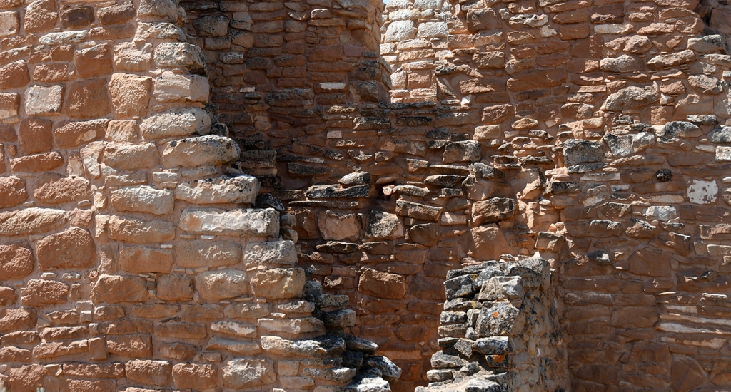
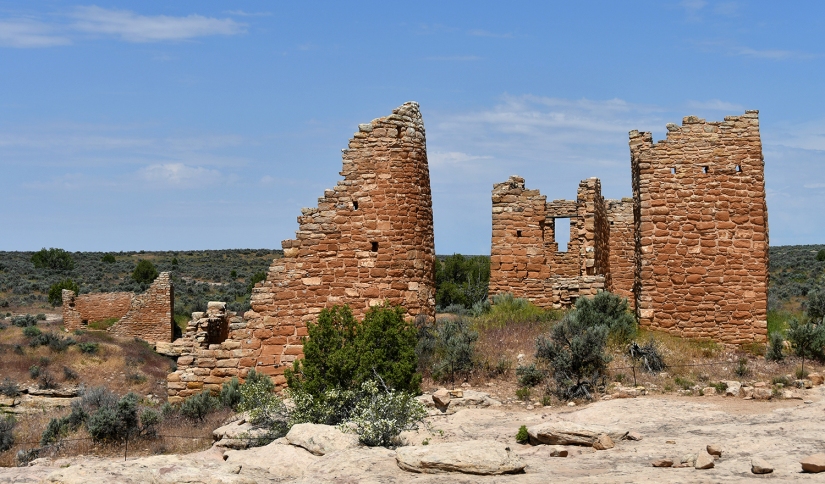
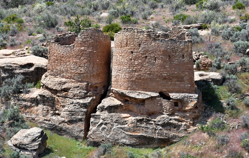
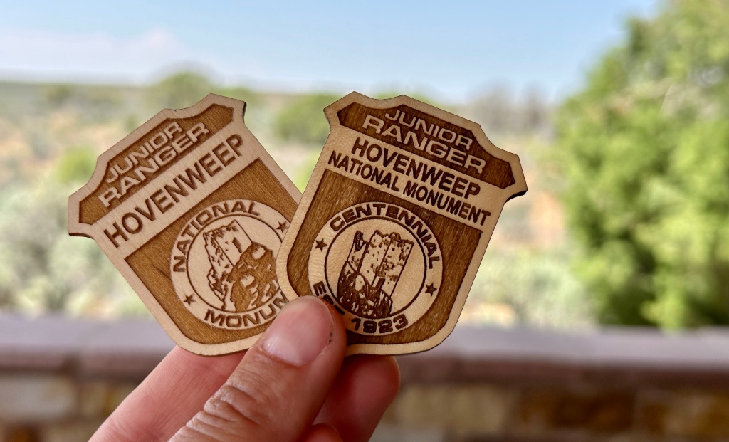
Hovenweep National Monument consists of six units on the border region of Colorado and Utah on the Cajon Mesa. Managed by the National Park Service, it became a national monument in 1923 – this year is the 100th anniversary (complete with a special passport stamp and junior ranger badge)! The fantastic visitor center is on the Utah side. Big spoiler alert – this was my favorite NPS unit of the trip when it came to the atmosphere and rangers (Black Canyon of the Gunnison National Park had my favorite nature scenes), and a great 60th NPS unit for me.

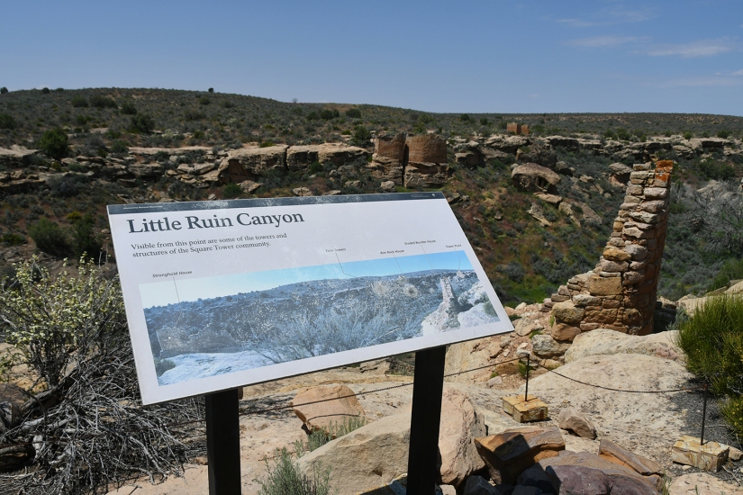
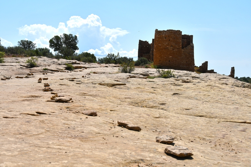
The six units of Hovenweep protect six different communities of the Ancestral Pueblo spread over twenty miles. The visitor center and campground sits within the Square Tower Group, and has a two mile long hiking trail through the ruins of Little Ruins Canyon. Most visitors to Hovenweep National Monument visit only this group since it is the most developed. The other units involve gravel roads (with recommended high-clearance and four-wheel drive for some) or extensive hiking in the desert. I opted to just visit the Square Tower Group on this trip due to being solo in remote territory on high-clearance roads did not seem like the right idea.
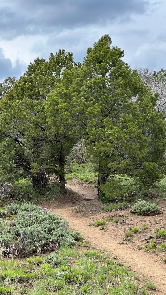
After showing my America the Beautiful pass, collecting all the passport stamps, and the special 100th anniversary junior ranger book insert at the visitor center, I donned my sun hoodie and headed for the Square Tower Loop Trail, opting to hike clockwise (apparently backwards from everyone else, but I digress). I really was apparently expecting a paved path instead of rocky singletrack, and laughed that I was wearing my Chacos – fail!


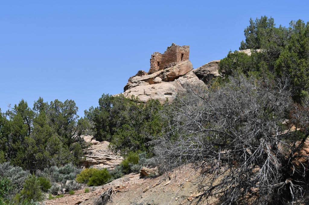
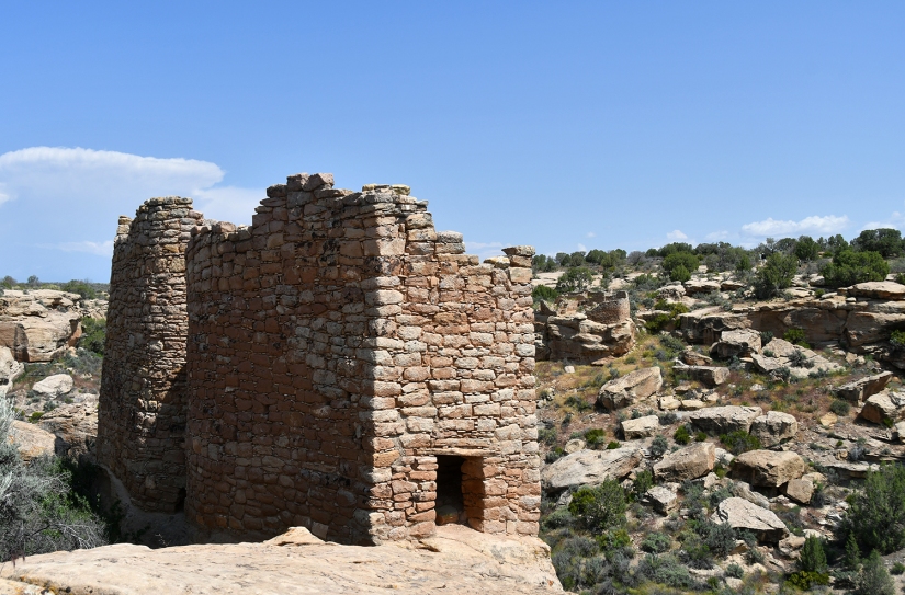
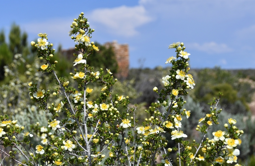
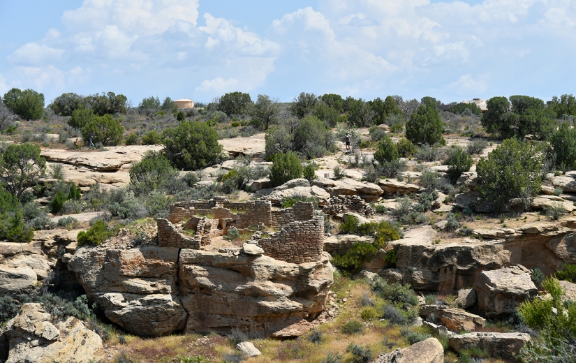


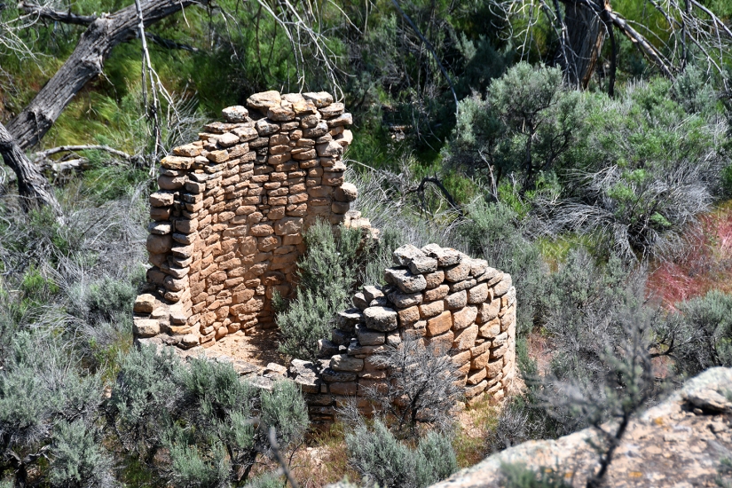
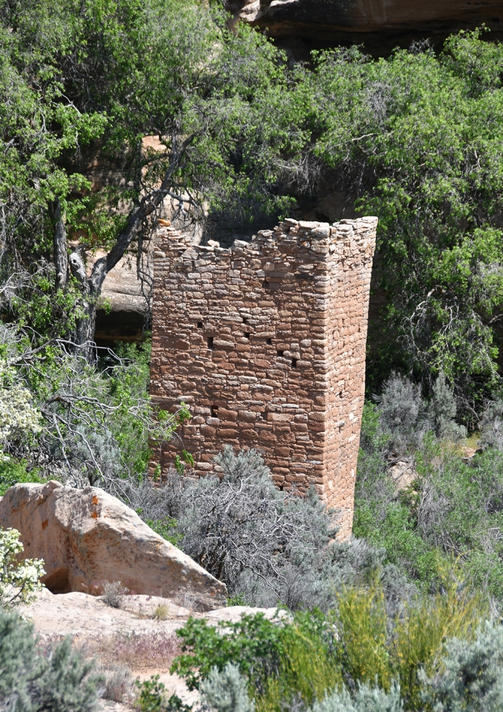
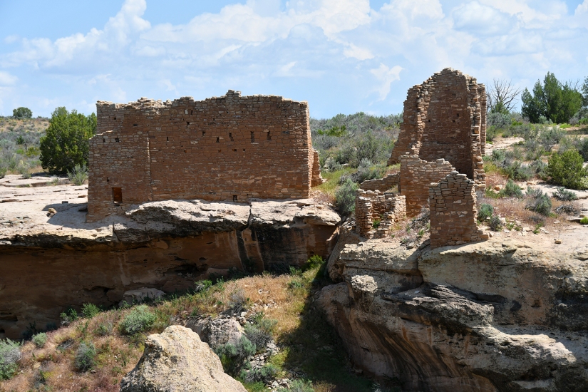
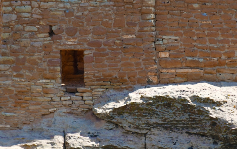
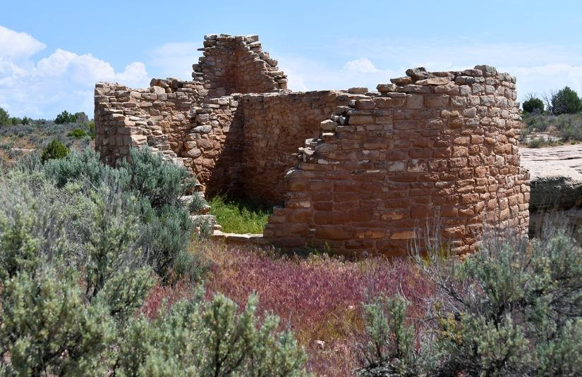
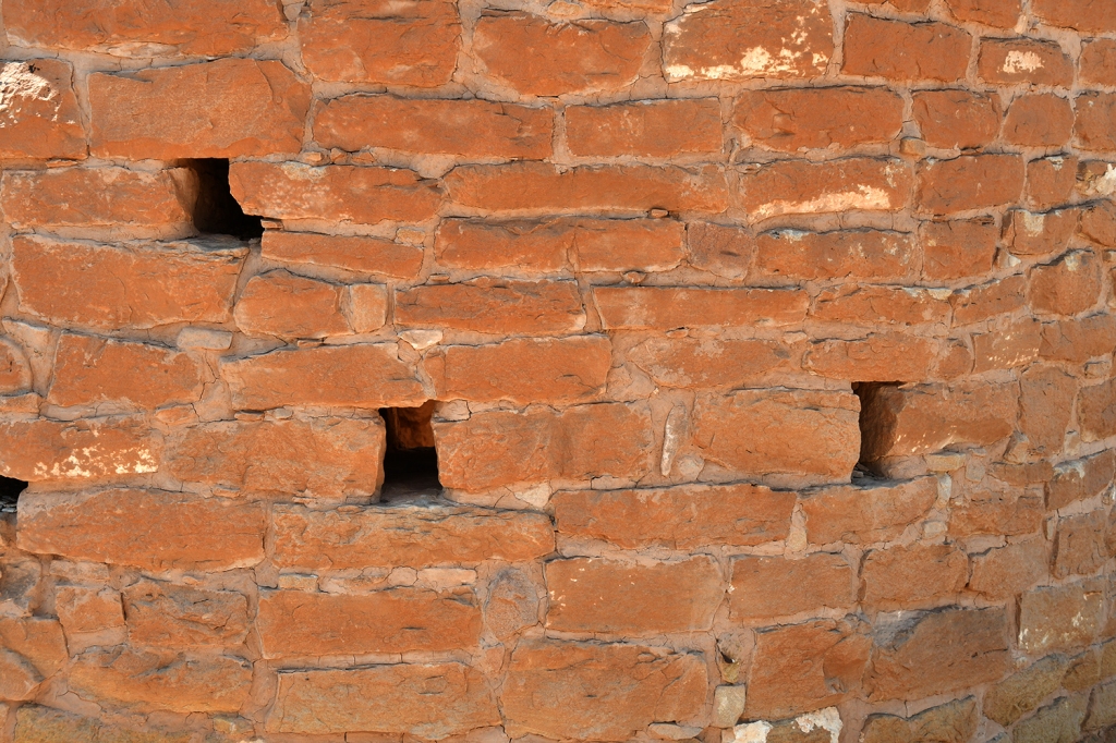

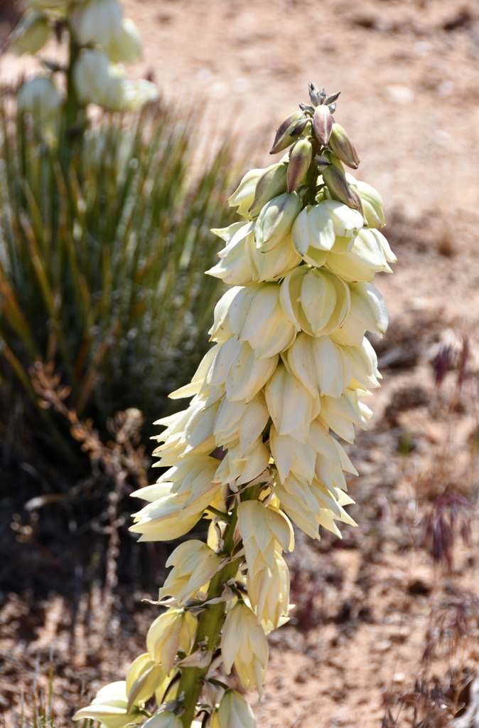

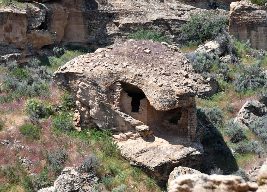
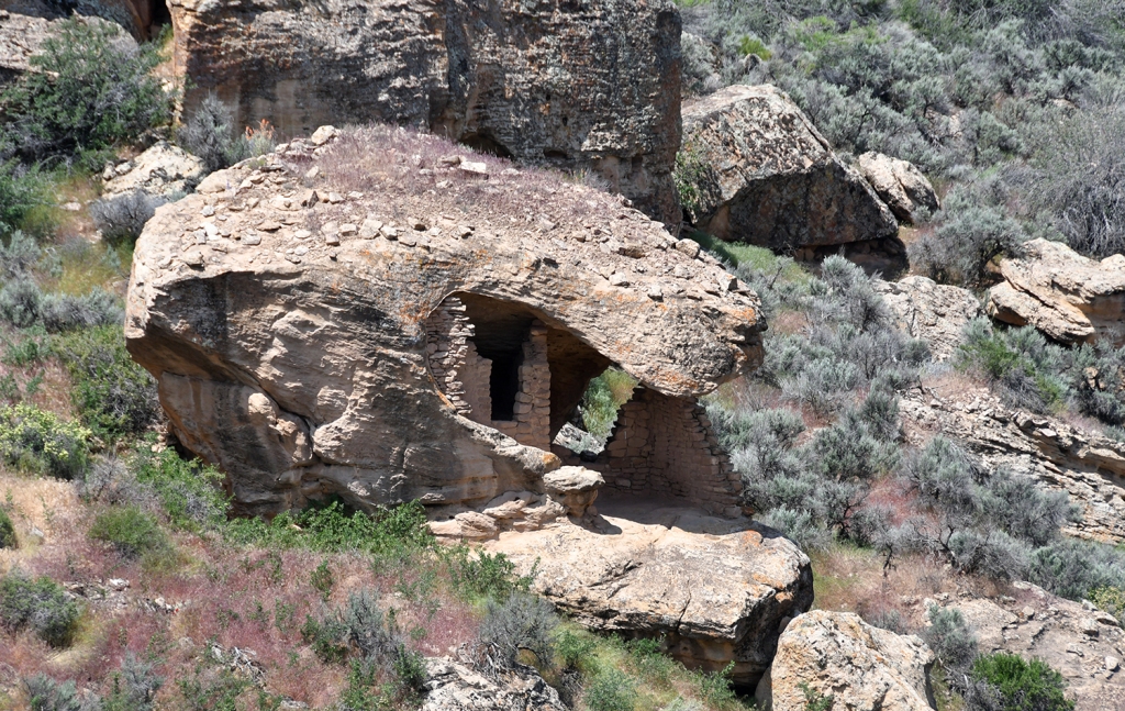
It was a hot one (okay, it was in the low 70s, but for some reason it felt boiling hot to me after a cool spring), the hike was great with all the ruins and absolutely insane bloom of wildflowers happening. I even ran into Mountain Meowzer – yay for adventure cats! Overall, it took me an hour to complete the trail.
After chatting with Ranger Sammy about all things cats (at first I was worried they were wanting to know where the cat was to kick them off the trail, so I was hesitant to share details… then I realized its because they love cats!), I headed back to have a sandwich and complete my junior ranger activities under the shade at a picnic table.
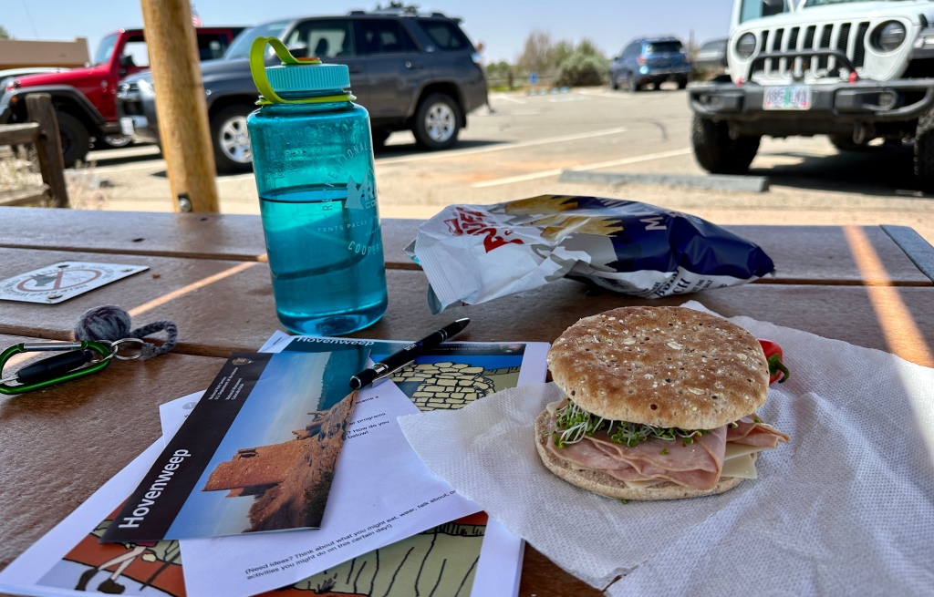
After getting sworn in as a junior ranger by Ranger Claire and buying my souvenirs, I filled up some water bottles, and enjoyed a bit of the cell service before heading out. I really enjoyed Hovenweep National Monument, and was not super eager to leave. But alas, I had camping reservations at Mesa Verse National Park for the night, and east I had to head.
Side note about trip planning… I originally was going to go to Hovenweep and Yucca House National Monument on the Wednesday of my trip after leaving Mesa Verde. A few days before I left I went through and was double checking all the places’ websites for any alert info, and learned that Hovenweep’s visitor center is closed on Tuesdays and Wednesdays. Knowing that I wanted to the passport stamps from this location, I adjusted my plans, and it ended up working out well! Checking for current information, hours, and conditions is key!
I took more small roads through McElmo Canyon back to Colorado. Traffic was light and it was smooth sailing towards Cortez. Before heading to Mesa Verde I had one more national monument to visit.
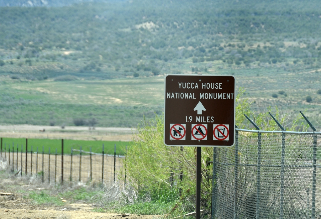
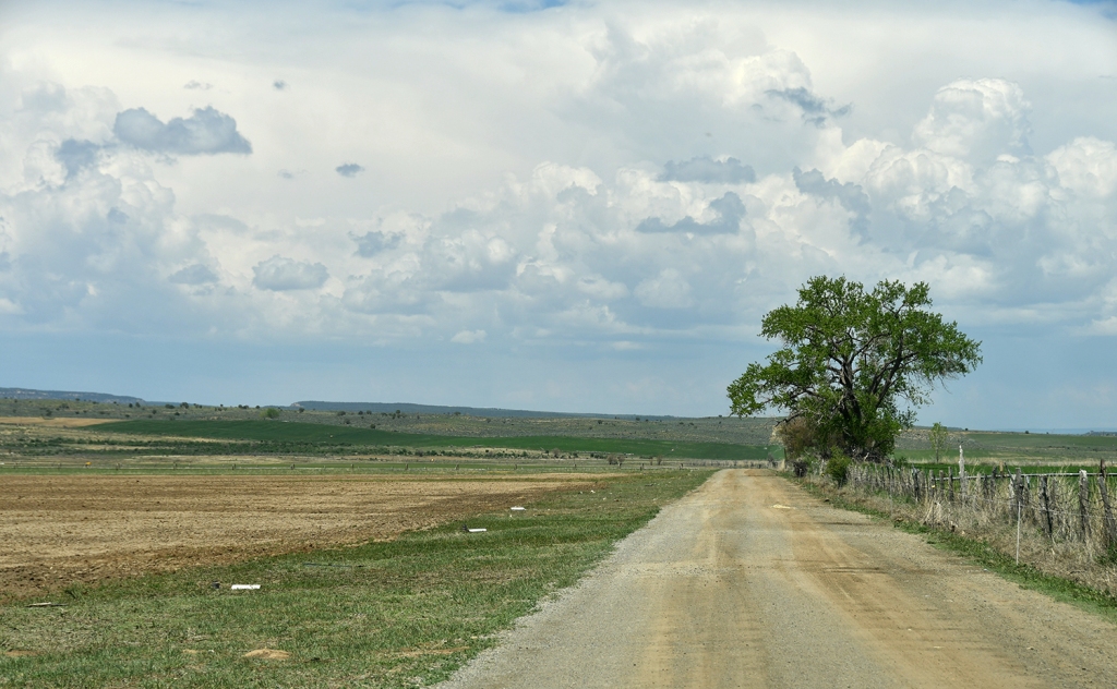
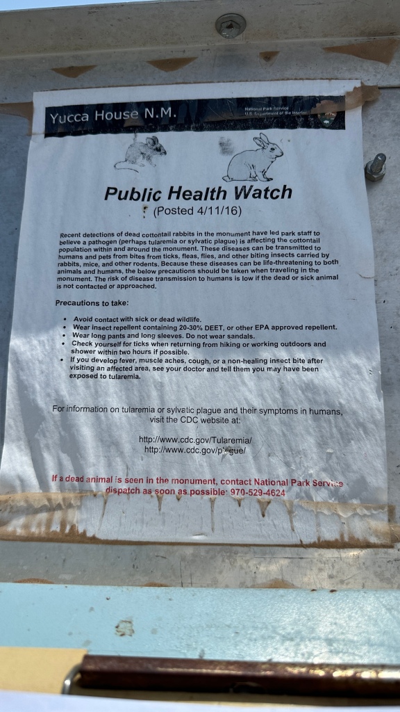
Established in 1919, Yucca House National Monument‘s thirty-five acres preserves an unexcavated pueblo in the Montezuma Valley. What you won’t find is a parking lot, visitor center, restrooms, souvenirs, or… well much of anything. You will find a farmhouse and a farmer on his tractor. Guys, I gotta say, this wins for the oddest NPS unit I have visited thus far! Surrounded by private property, it is open to the public, it just does not feel like that and it is odd just parking in a farmer’s driveway and frolicking over to the small boardwalk that leads to the sign and gate.
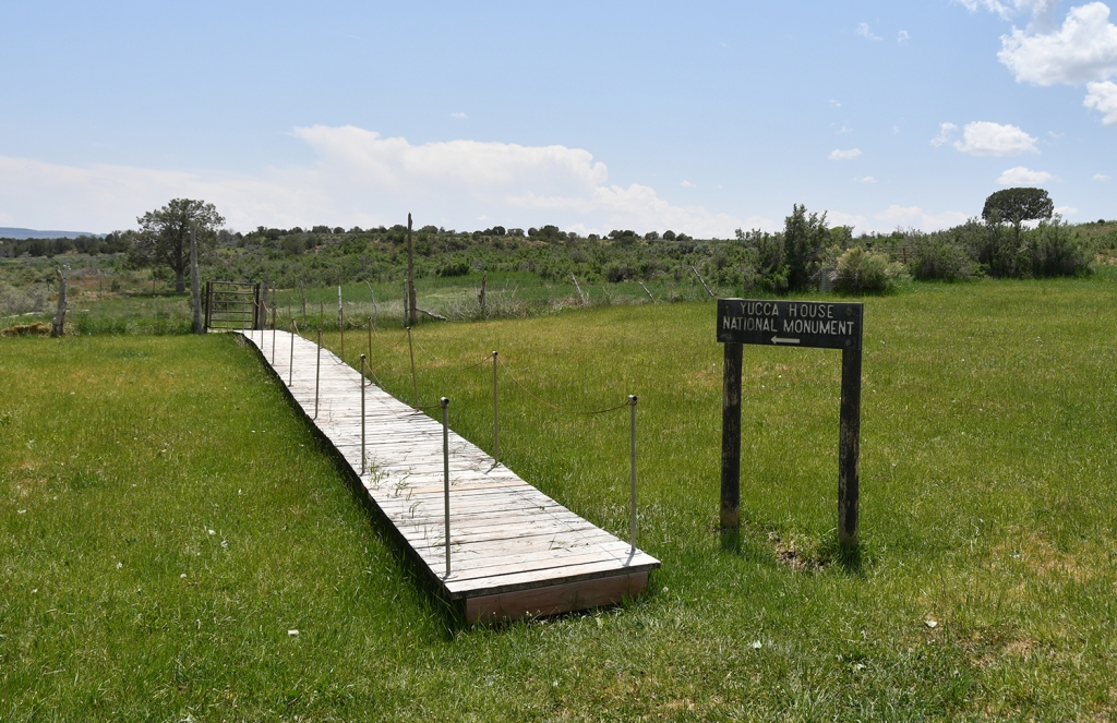
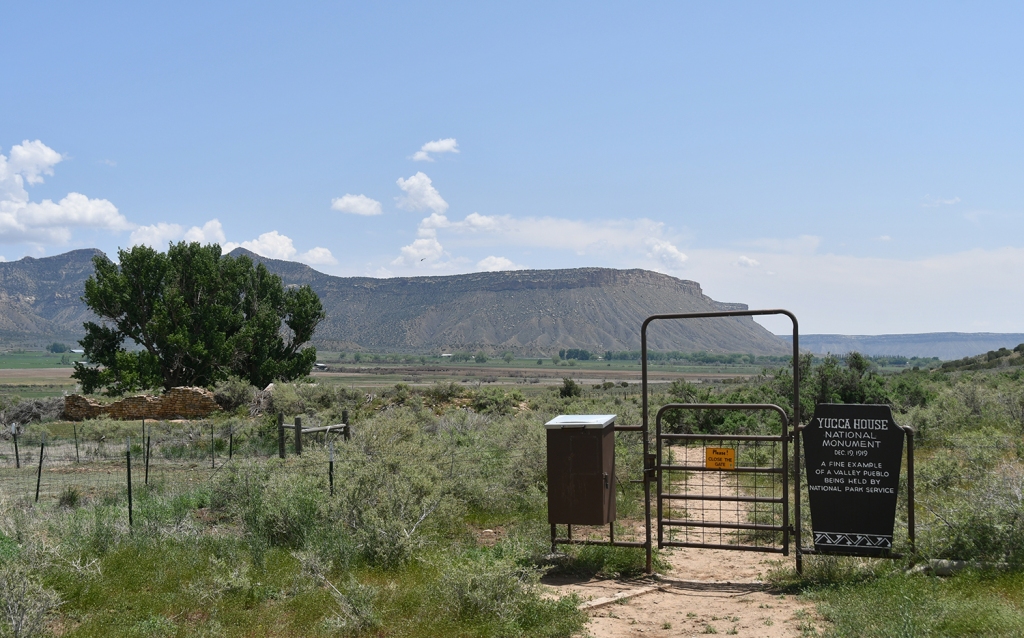
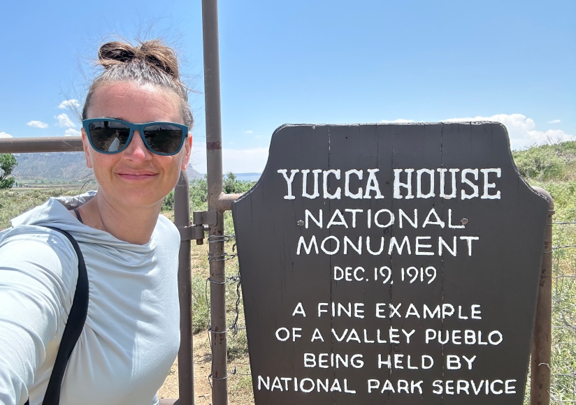
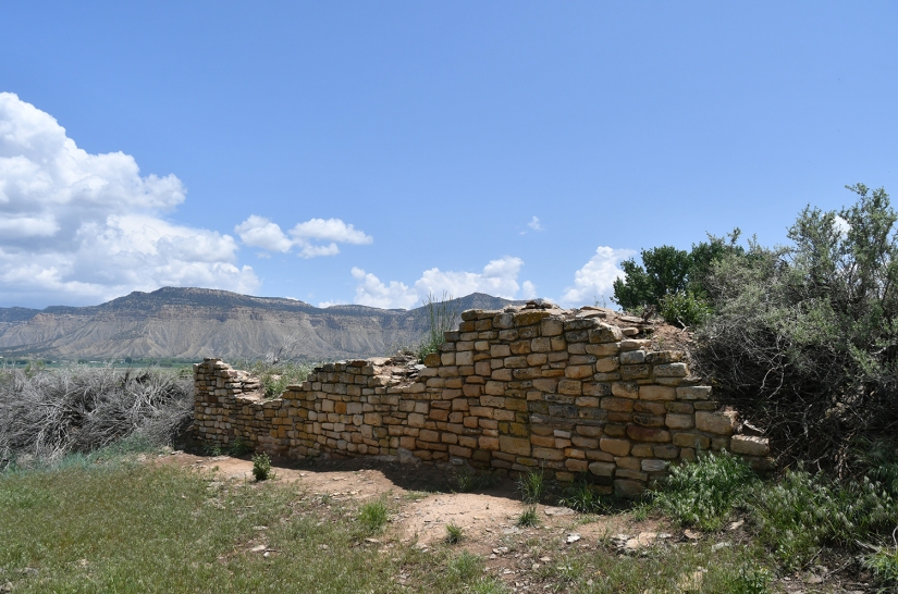
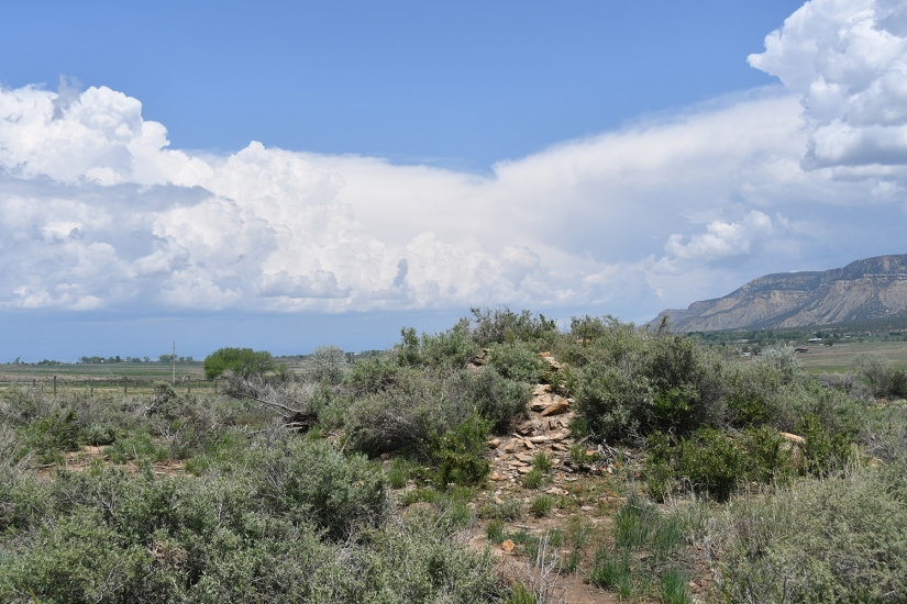
After signing the register (very important so NPS knows how many visitors are coming) and realizing I was the second person of the day visiting in a blue Subaru Forester, I cocked my head at the tularemia warning posted, opened the gate and ventured in. There is one wall that is uncovered (thank goodness, otherwise I am not sure I would’ve known what to look at), and lots of mounds of unexcavated ruins. I snapped some photos, and returned to my car, giving the farmer a friendly wave.
Total visit time? 5 minutes.
NPS unit #61, check!
I am not discrediting Yucca House at all. I am so thankful that not all history of the area has been lost to development and vandalism, and that this slice was able to be protected as a national monument. After coming from a location where the ruins were just BAM! in your face, it was interesting to see what 700+ years of dust, dirt, and plants can do when it comes to burying a whole community worth of dwellings. Since it is free and relatively simple to visit (albeit as long as the dirt road is is not wet as it looks like it could get a bit spicy when muddy), I think it is a great addition even for those not chasing NPS units to visit as a contrast to Hovenweep’s or Mesa Verde’s ruins that are more visible and excavated.
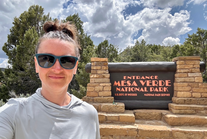
After a quick fuel up in Cortez (much more expensive than Montrose at $3.49/gallon), I headed towards my home for the next two nights, Mesa Verde National Park. I made a quick stop at the visitor center for souvenirs and passport stamps, and then headed to Morefield Campground, one of two overnight stay options in the park (the other being Far View Lodge, a hotel that is the only one in a national park that I’ve looked at and gone, “damn, I’d actually stay here!” due to its amazing views).
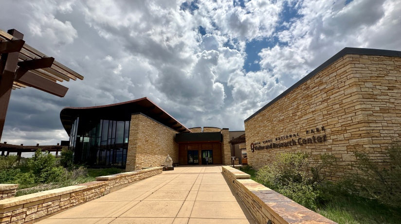
Mesa Verde National Park was established in 1906, is designated a UNESCO World Heritage Site, and is one of only national parks that wasn’t established for the nature and landscape, but for something human. From 550 to 1300 AD, the Ancestral Puebloans made their homes in the cliffs and mesa tops of Mesa Verde (which is not a mesa, but a cuesta which is like a mesa but dips or slopes in one direction). This is a decently large park, with drive times up to ninety minutes from the entrance to the further reaches some twenty-one miles away on winding, narrow roads. There are two roads that split off from the main entrance road at Far View, with one going to Wetherill Mesa (closed for 2023 due to construction) and one to Chapin Mesa. At Chapin Mesa the road splits again into Mesa Top Loop (closed during my visit for road construction but otherwise opened for summer 2023) and Cliff Palace Loop. Needless to say, I would not be able to see all the park on my visit due to the road closures, but luckily I still managed to fill my time!
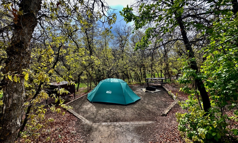
I checked into Morefield Campground, which allows you to choose your own campsite in the tent only loops. Armed with anxiety about picking the perfect campsite, I exited the general store to a thunderstorm. Running to my car, I made quick work of staying dry and heading towards the tent only loops. I settled on site #54, which is nestled in the trees and below the road, lending a bit of privacy (but yet close to the drinking water and bathrooms – after a few nights of vault toilets, flush toilets and running water in sinks was exciting to have!).
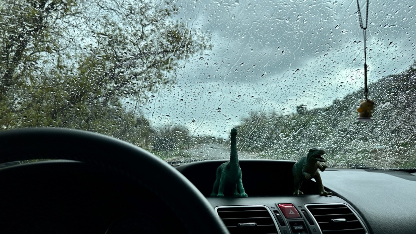
The rain poured down. Essentially stuck in my car, I realized I had some weak wifi at my campsite (but no cell service) so I browsed the internet and texted my parents. I finally gave up on the storms ending, so I headed up to the showers – yes, there are showers at Morefield! It was raining far too hard to rummage through my car for clean clothes, so I decided a clean body in dirty clothes was good enough for the moment. The rain stopped long enough after my shower to allow for me to set up my tent before the clouds unleashed again. I made a simple dinner under the rear hatch, cursing the rain.
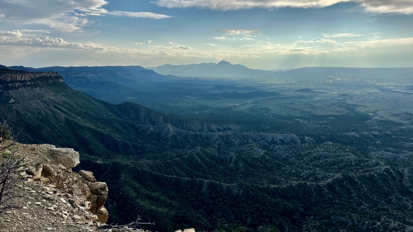
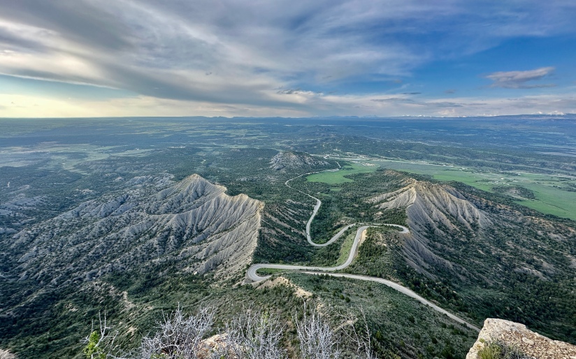
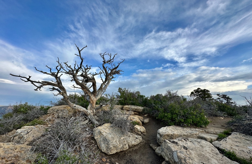
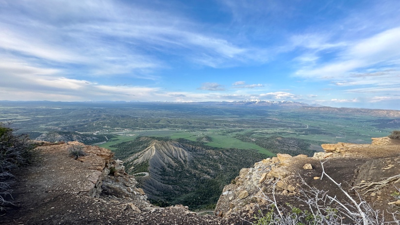
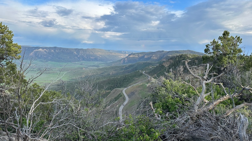
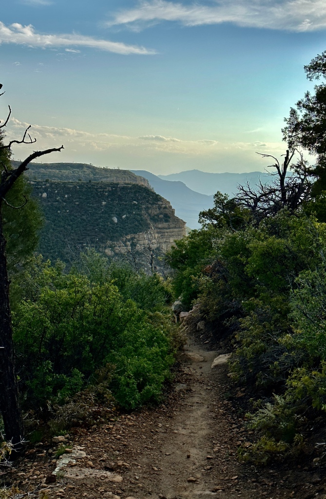
Finally a bit after 6pm and two and a half hours of waiting for the rain to stop, it did stop and the skies cleared. I finally realized that since I had wifi I could check the radar, and confirm I was safe for a short evening hike. Leaving from the back of the campground, the hike to the top of Point Lookout (8,427 feet) is about 2.2 miles round trip and became one of my favorites of my entire trip. The trail gains elevation sharply from Morefield Canyon, but the trail is built quite nicely with switchbacks to lessen the burden.
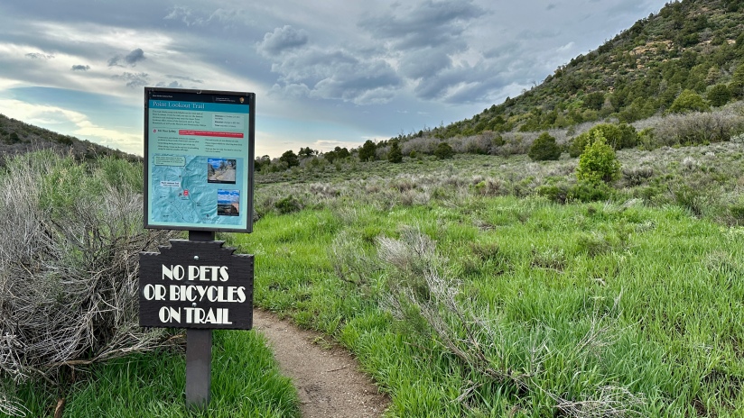
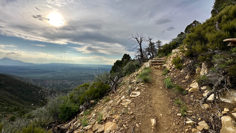
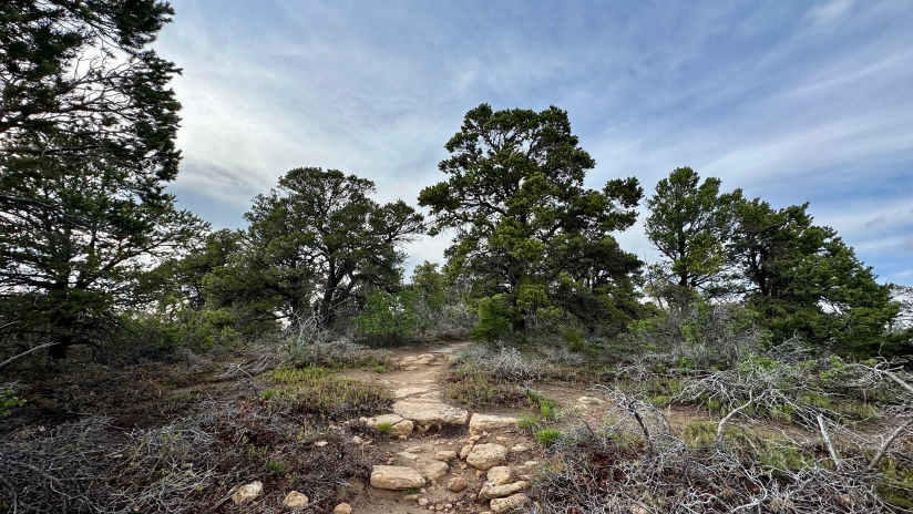
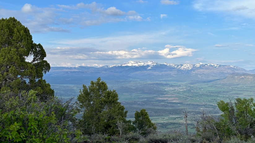
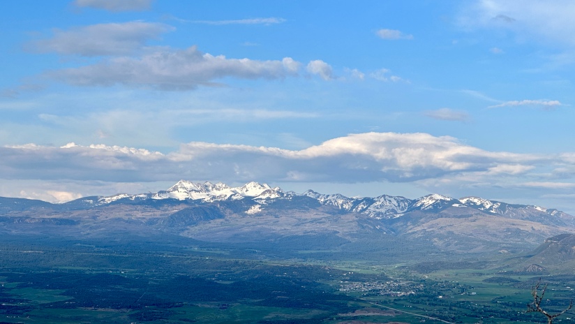
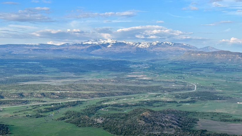
I made quick work of the climb, marveling in the smells of the fresh rain, lush plant life, and evening skies. Twenty-eight minutes later I was at the very end of Point Lookout with a lot of air below me (along with the entrance road) and crazy views of the valleys and mountains. I squealed when I realized I could see Lone Cone Mountain, one I discovered while heading to Utah in 2022. I also identified the distant Wilson group and San Juans, and the closer La Plata Mountains.

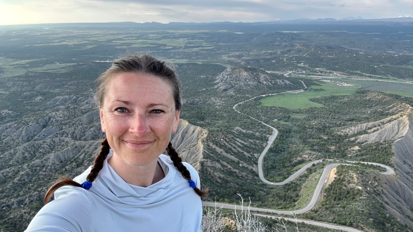
It was truly hard to drag myself off the summit of Point Lookout, but evening was approaching and I was tired after a day of driving and adventuring. I made it down, with total hike time of one hour and three minutes. Since I had cell service at this end of the campground, I called my parents really quick to catch up and so I could say hi to my cat (it has gotten a bit harder to leave her as she gets up there in age!).

Back at my campsite I readied myself for the tent, taking to doing my junior ranger book after journaling – something new I started this trip so I wouldn’t forget the odd details when it came time to do these blogs. I like the habit of doing it (or I’ve just watched too much XOverland and got influenced by Clay Croft’s journaling scenes, ha!) and I think I’ll make it more routine on adventures.
Stats:
- 255 miles driven
- 14,641 steps / 7.4 miles walked
- 3 NPS units
- Hovenweep National Monument – $20
- Yucca House National Monument – Free
- Mesa Verde National Park – $30
- **I have an annual America the Beautiful Pass, so no entry fees had to be paid
- Fuel stops
- Montrose, CO @ $2.97/gallon
- Cortez, CO @ $3.49/gallon
- Campsite
- Morefield Campground in Mesa Verde National Park
- Site #54
- $39.97 ($79.94 for two nights)
- Free showers
- Bathrooms with running water
- Morefield Campground in Mesa Verde National Park

Love love love Mesa Verde! I’m glad the weather cleared up so you could squeeze in a hike. I haven’t been to Hovenweep but it’s on my list so I appreciated the rundown. I suppose we’ll also swing by Yucca House while we’re down that way.
LikeLiked by 1 person
Yucca House is worth it just for the oddness of it all with taking the small dirt road and parking practically in someone’s front yard! To be fair, it was much more fun than most of the NPS units I visited in DC.
LikeLiked by 1 person