

September 16, 2018

Somehow I appeased the elves, and we awoke to drier weather after dealing with rain most of the previous day. Woohoo, we could finally see the scenery around us!
We ate and packed up and headed out of Svínafell with Skaftafell in Vatnajökull National Park as our destination for the morning to get in some hiking.

We arrived at Vatnajökulsþjóðgarður (sorry, I like the Icelandic for this!), and made our way to the visitor’s center to use the restrooms and pay for our parking, and then back to Carl to prepare for our hike. Initially I had wanted to do a 6-8 hour loop that included Svartifoss, Kristínartindar, and Sjónarnípa, but realized that to accomplish such a long day we’d have to have a very early start. Needless to say, I scratched Kristínartindar from the plans before we arrived in Iceland, realizing that we simply had too much on the itinerary for this day. Instead we would take a couple of hours and do the Svatifoss and Sjónarnípa loop (S6 on the park hiking maps).
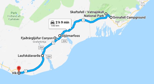
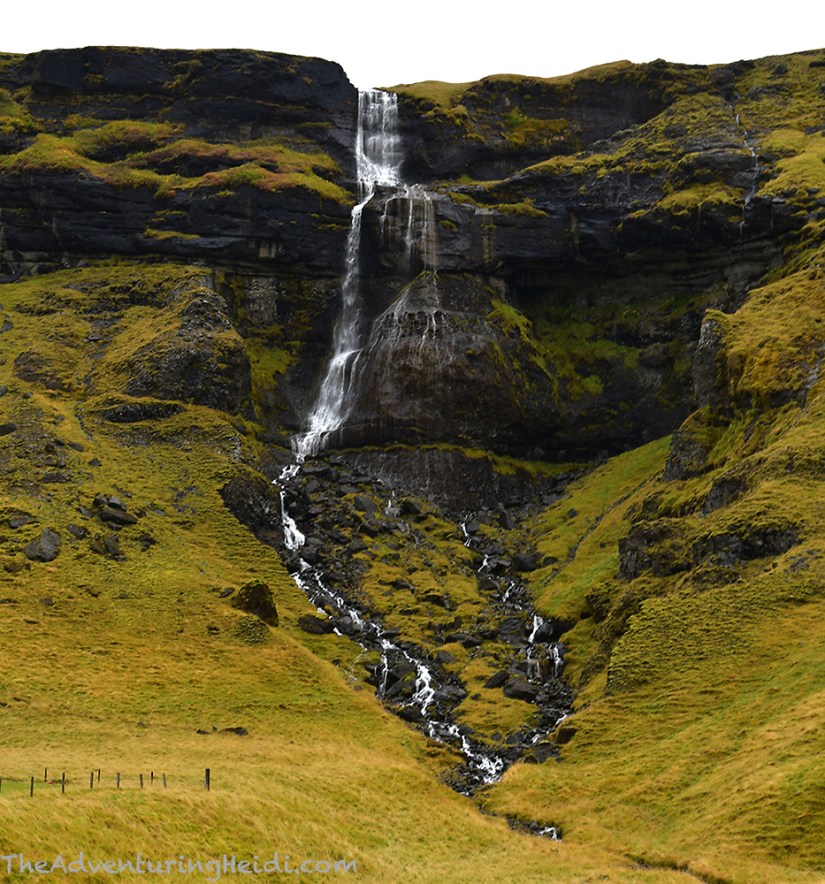
Naturally, the hike started by traveling uphill as we ascended Skaftafellsheiði. The path to Svartifoss is wide and well maintained – and heavily trafficked. We were treated to great views of Hvannadalshnúkur, Iceland’s highest point, that were hidden the previous day by the rain clouds. Also along the way was Hundafoss, which had a nice viewing platform, and I stripped off the first layer of clothing… 16 days in, and I had yet to learn not to overdress on hikes in Iceland!

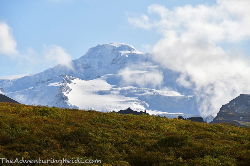

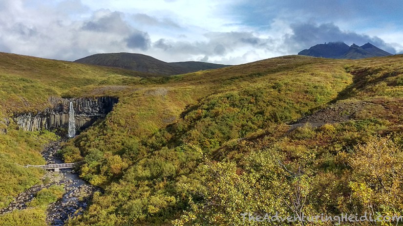
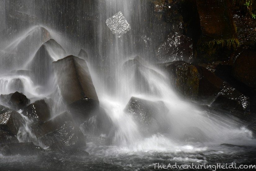
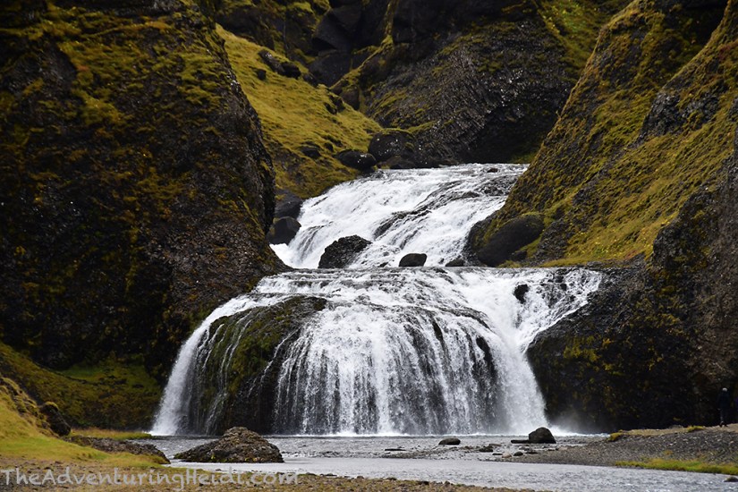
We continued on, reaching the upper viewpoints of Svartifoss before descending a tricky, narrow trail to get down to the level of the falls. Svartifoss isn’t necessarily a big waterfall, but the awesome black basalt columns that flank it give it its appeal. And honestly, when viewed from a distance, it does sit uniquely in a stunning landscape, especially with twinges of autumn colors.

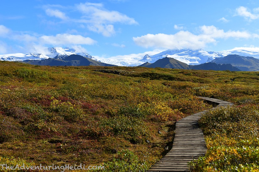
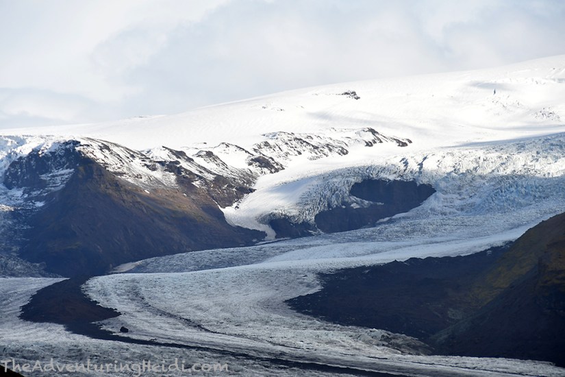
Getting our fill of Svartifoss, we hiked back to the trail that splits off to the Sjónarnípa viewpoint and goes through Skaftafellsheiði, the heath Skaftafell occupies. By now it was quite warm, and layers came off, and I tried to fashion my leggings into shorts. Blue skies were overhead, and the hot Icelandic sun was shining down. We had amazing views of Hvannadalshnúkur right in front of us, and autumn colors all around. There are a lot of small streams and tiny waterfalls to boot.


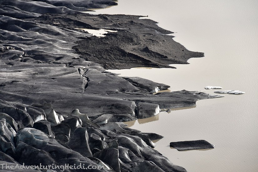
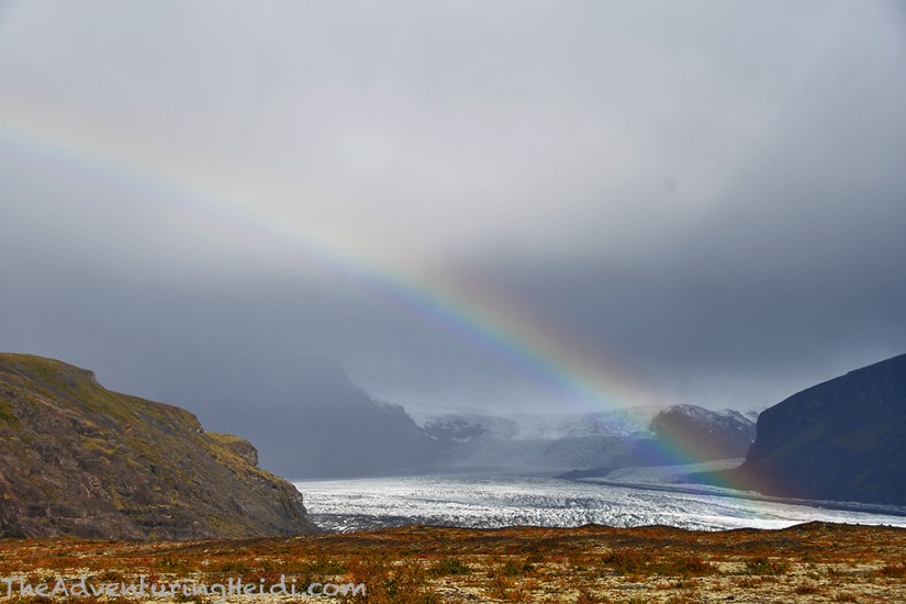
As we approached Sjónarnípa, the skies darkened and just as we got to the viewpoint over Skaftafellsjökull it started raining so Kubo and I scrambled to put our rain gear on. Then we sat down and enjoyed a protein bar or two with glacial views. Definitely the best spot I have ever enjoyed a protein bar at!

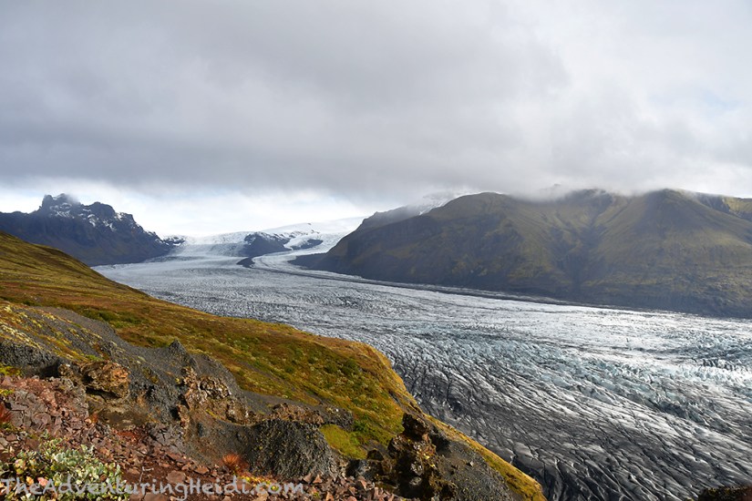

After soaking in the views and taking a good break, we began to descend the trail along Austurbrekkur towards the visitor’s center, with a view of the sandur in front of us. Soon the trail entered a forested area, where I imagined fairies and gnomes scurrying around. It was quite the change in scenery, but on par with how Iceland always seem to have a trick up its sleeve for us. The rain had since left, and once again we were fighting our layers of clothing in the humid woods.


All said and done, our hike was 5.1 miles along and took us about 3 hours and 15 minutes total with stops. Once back at the visitor’s center we went inside to explore, as there’s a very nice gift shop with a lot of books and other things for sale. I picked out a gift for my mom, and browsed some of the books, including one on edible herbs and berries of Iceland (so I confirmed, weeks later, that we had indeed eaten bilberries, ha!). I do recall Kubo and I both being rather hungry and getting grumpy with each other about it as we set out from Skaftafell. Because if you’re going to be hangry, you might as well do it as you’re setting out into a volcanic wasteland, right?
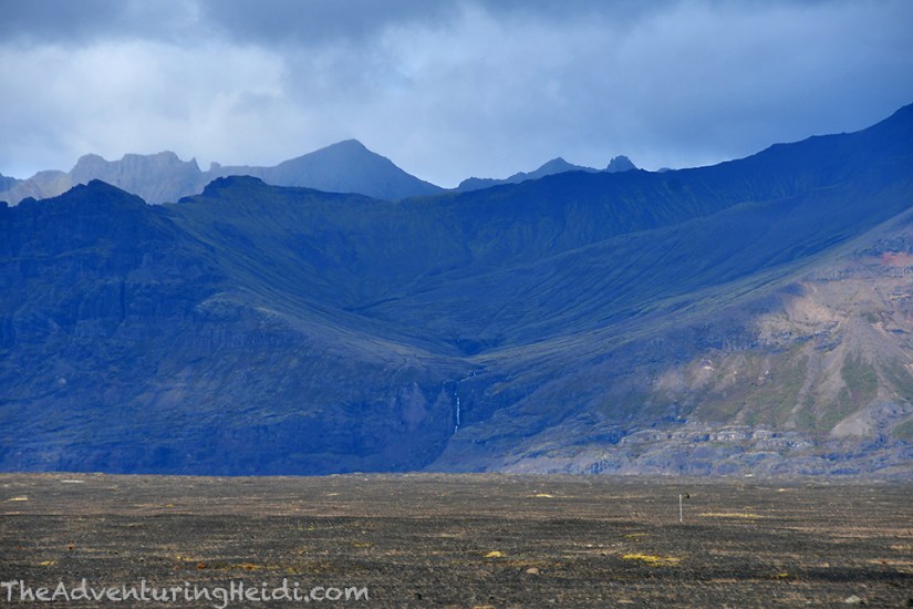
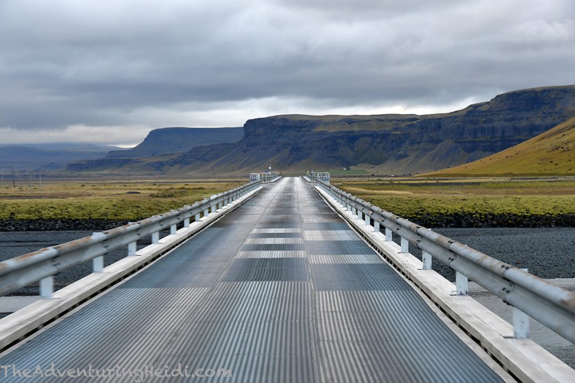
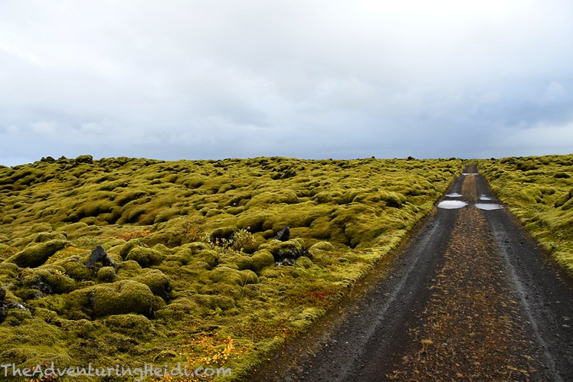
The Ring Road spends many miles traversing Skeiðarársandur as you head west from Skaftafell. Sandurs are plains formed by sediment, debris, ash, and water from glaciers, glacial floods, and in Iceland’s case, volcanic eruptions underneath the massive Vatnajökull (which is Europe’s largest glacier). Sudden glacial floods are called jökulhlaup, and can be devastating to whatever is in their path. Because there are so many rivers to cross, this part was the final bit of the Ring Road to be completed in 1974 with the bridge over Skeidará. Skeiðarárbrú was Iceland’s longest bridge at 880 meters, but in 1996 it was destroyed during a jökulhlaup. It was repaired, but the water from the glacier changed its path, and suddenly it was a bridge over dry land. It was decommissioned and a new bridge was built over the rivers’ new paths.

Sandurs. They’re cool.
Bleak. Black. Void of much life. Like suddenly driving on another planet. I quite like them. Skeiðarársandur especially.


I’d like to mention that the Ring Road is pin straight as it traverses Skeiðarársandur, and it is probably the easiest stretch to speed on, and one of the few places I feel like you can use cruise control in Iceland.
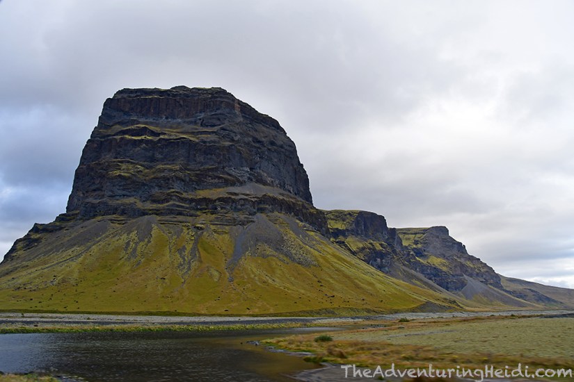
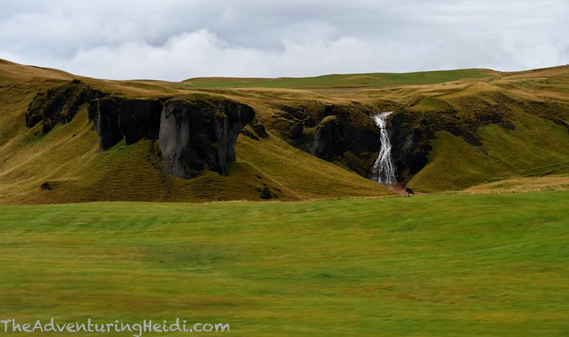
After crossing the Sulá, the landscape changed to greener tones as we entered the Brunahraun lava field and Lómagnúpur loomed next to us. Waterfalls appeared plentiful again, and so did our ever present friend the past few days of our trip, the rain.

Upon arriving in Kirkjubæjarklauster we located Kirkjugólf, a basalt formation that sits in ground so it looks like a tiled floor, but it was raining pretty steady. So found the local N1 gas station, went inside, shrugged at the $20 hamburgers (and I realized I had my fill of undercooked hamburger in Iceland), and went back out to make lunch in Carl in the parking lot. While we were cooking and enjoying our lunch, we noticed a Skoda wagon parked next to us filled with partying tourists (not American, for what it’s worth…) who were chain smoking and pounding Viking beers (driver included). Kubo commented that it must be the low-strength 2% beer, but I still scrunched up my face in displeasure, knowing the strident Iceland DUI laws. They continued their shenanigans for quite awhile, before speeding off, leaving a nearly full 24-pack of Viking in the parking lot. We made eye contact with another couple who was parked on the other side of them, who grabbed the beer. To our surprise, it was full strength beer, and the couple split it with us. Ummm… thanks for the beer, irresponsible partying tourists! That’s pretty much our entire story involving Kirkjubæjarklauster! I do wonder how far down the road that gang got before they realized they were missing their beer…
It was still raining, but lighter, after we finished eating so we journeyed back past Kirkugólf, continuing on to grab some photos of Stjórnarfoss a little further down the road. I decided I was too lazy to walk from the carpark to Kirkgólf, so we drove past it again, deciding to skip this spot. I know, I skipped something involving basalt, what the heck?!
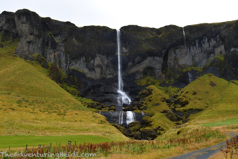
From there we hit the Ring Road again to Road 206, passing more awesome waterfalls on the way.

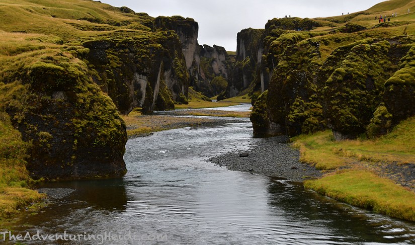
Up Road 206 we went (before it changes to an F-road that leads to Laki) to Fjaðrárgljúfur, a gorgeous canyon formed by the river Fjaðrá. Though the surrounding valley is quite young in geological terms, Fjaðrárgljúfur itself is two million years old.
We donned our rain gear, and begun the muddy hike up the rim of the canyon.
Rant time.
Humans are horrible. There are plenty of signs explaining to stay on the trail, and in fact, Fjaðrárgljúfur is closed several times a year to protect the terrain from erosion. Does this matter to the hoards? No… they jump the ropes to avoid the mud in their precious fashion style “hiking” boots and trample through the grass, and hundreds of others follow their lead. Kubo and I became very upset at seeing this happen, and began to call out tourists, first asking them if they spoke English, and then asking them if they thought the signs didn’t apply to them. We did get one couple that seemed surprised they were doing something wrong and got back on the correct side of the ropes, but everyone else pretty much told us to get lost. THIS is how places are going to get closed down permanently in Iceland. Stupid, irresponsible, selfish, arrogant behavior. Walk in the damn mud. It’s Iceland, it’s moist, it’s muddy. ARGHHH.
Anyways, aside from the dumbass members of the species I belong to, Fjaðrárgljúfur is amazing! Though they really have roped off many of the viewpoint that stick out into the canyon, there are still plenty of spots to get a good vantage over the otherworldly scene.


Fjaðrárgljúfur is such a unique, and stunning location. I hope eventually people can become more respectful and it is not lost to all of us forever through closure. We spent just about an hour, and it was about 1.7 miles of walking from the parking lot to the farthest viewpoint and back.
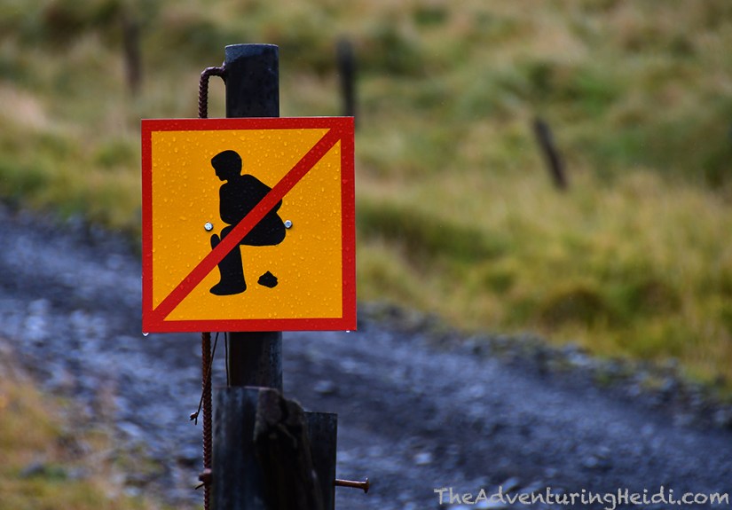
Naturally, there’s a no pooping sign at Fjaðrárgljúfur as well, ugh. Ugh because it had to be placed for a reason, clearly. However, we did take some humor in it, with Kubo and I posing for some funny photos like we were trying to poop, which caught the attention of an adorable girl who giggled and had to run over and pose next to the sign herself in the same manner. Glad we brought some smiles after so many glares from our lectures to people on the wrong side of the ropes.

Fjaðrárgljúfur was great, but nothing, I mean NOTHING, could top our next spot… the Eldhraun lava fields!! Moss, so much moss everywhere! Kubo found a dirt road to turn down and we set off into probably my favorite place in Iceland outside of Landmannalaugar.

I jumped out, rain be damned, and placed my face upon the glorious moss. I found heaven! Even Dino the Traveling Brachiosaurus approved!
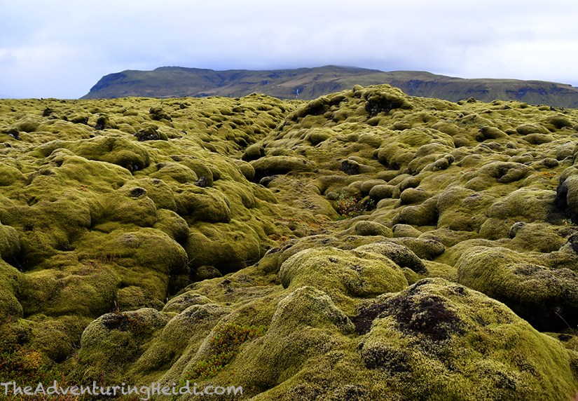

Our time spent in Eldhraun was entirely too short. I’m pretty sure I could spend an entire day lifetime there just staring at the moss. Alas, I don’t think Iceland authorities would accept that as a valid reason for overstaying my 90 day visa allowance, so sadly we continued on down the Ring Road with images of soft moss dancing in my head.
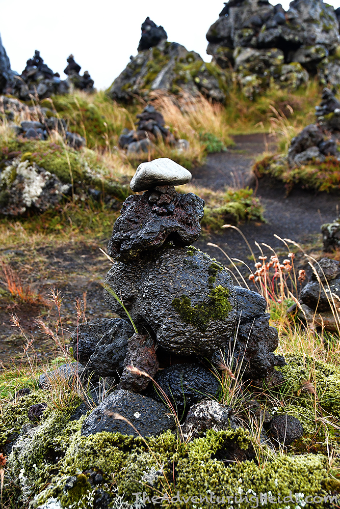
We motored on towards Vík, our stop for the night, making a quick stop at Laufskálavarða to place our cairns for good luck as we headed across the Mýrdalssandur.


Immediately upon arriving in Vík í Mýrdal (the full name of Vík, as there are many other villages named Vík in Iceland), we drove up to the famous Víkurkirkja that overlooks the town and black sand beaches. Naturally, crazy hard rain had to start coming down just as we arrived!


Vík was living up to its reputation as the wettest town in Iceland, so we headed to the new looking “mall” that consisted of a Krónan grocery store and Icewear store. We picked up a few items in Krónan, including these delicious miniature cinnamon rolls that Kubo had to take away from me so I wouldn’t eat them all (don’t worry, I snuck some when he wasn’t looking!). After groceries, we poked around Icewear, which is cheesy tourist souvenir heaven! Anything cheap and Chinese made you can find here, from shot glasses to magnets to Viking hats. There are also a variety of wool items, but I have heard that most of them are foreign made outside of Iceland. I picked out a few little souvenirs, like coasters from I Don’t Speak Icelandic breaking down how to pronounce Eyjafjallajökull, and licorice candy. Made for a good place to kill some time as the rain fell outside.
Originally I longed to stay at Þakgil Campground near Vík, which looks like it is straight out of a fairytale, but sadly discovered that their closing night was the night before we arrived in Vík, leaving us with the campground in town to stay at. We found a spot that was only decently muddy (versa insanely muddy) as a hard, steady rain fell. Dinner was cooked, and then Kubo and I prepared burritos for our hike the next day. This was a long, packed day, and tomorrow would be even crazier as we sought to get every second out of our last day in the Icelandic nature.
Follow along on our entire 19 day Iceland road trip adventure! Click here for a comprehensive itinerary, with links to each day’s adventure.

1 thought on “Heidi and Kubo Do Iceland – Day 16: Hiking in Skaftafell, Fjaðrárgljúfur, and Vík”