
This blog is really covering two topics – my first solo backpacking trip and summiting Mount Alice, so might get a bit long winded…
Honestly, a lot of Rocky Mountain National Park‘s highest summits are off the beaten path, and not easily accomplished as day hikes (Longs Peak being the perfect example of this as a 15+ mile day!). I don’t remember when or why exactly Mount Alice came on my radar, but with its 18-ish-mile roundtrip, it was an easy candidate for a wilderness camping permit when I frantically planned my trips the night before permits went on sale on March 1st. I originally tried for the Thunder Lake wilderness site, but was beaten out (probably while I was nabbing Glacier Gorge!), but was able to secure two nights at Siskin. Looking back, this I think worked out for the better as the pack in was short and sweet, though it did make for a long summit day (but still shorter than a day trip so….).
I had picked up my permit a few days prior when I was in RMNP for another hike, and Ranger Brett recommended I aimed for a 1pm arrival at Wild Basin in hopes to secure a parking place at the main trailhead (Wild Basin’s parking lot typically fills at 7am or so in the popular months, adding extra miles to any hikes as limited roadside parking also fills). I heeded his advice, and despite the grouch working the entrance station that swore there would be no parking, I arrived to plenty of open parking spaces at the trailhead at 12:30pm! I ate a quick lunch of a tuna salad sandwich before throwing on my pack (weighing in at about 42 pounds… it sucks when I have to carry ALL the gear unlike my other trips this summer where it could be split up).

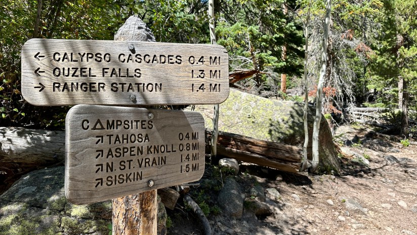
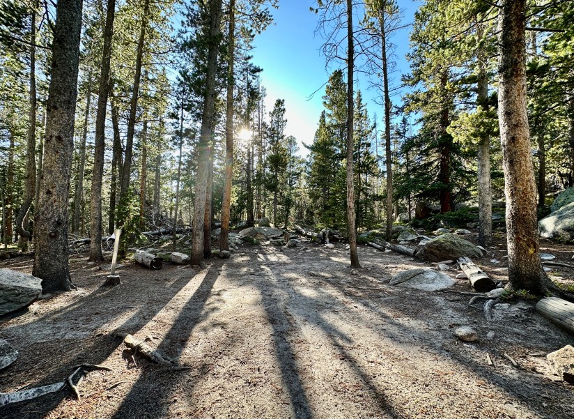
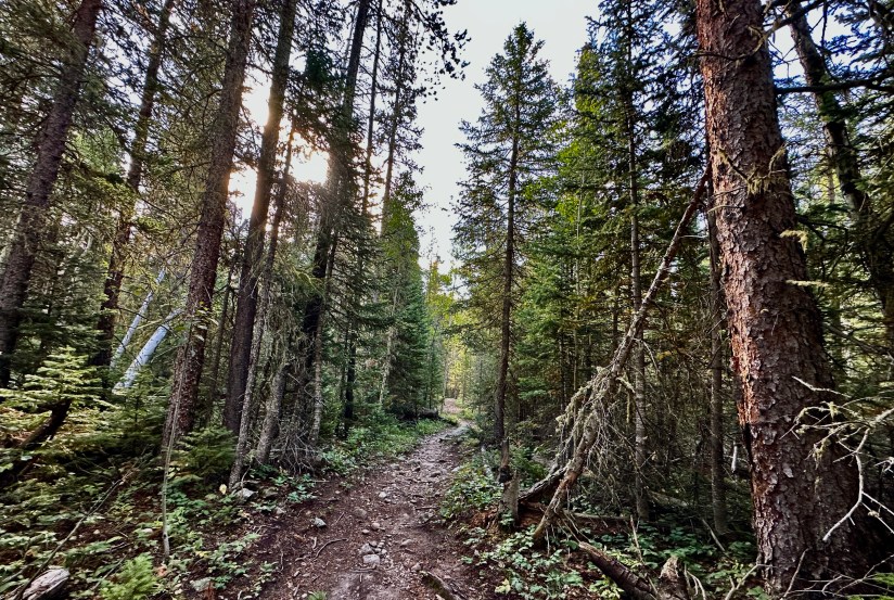
The hike up to the Siskin campsite was straight forward, starting on the main trail until cutting off on the campsites trail that cuts about a mile off the hike and goes past several wilderness campsites. The hike to camp was 2.9 miles with 1100 feet of elevation gain, and took me 1 hour 20 minutes at a casual pace.


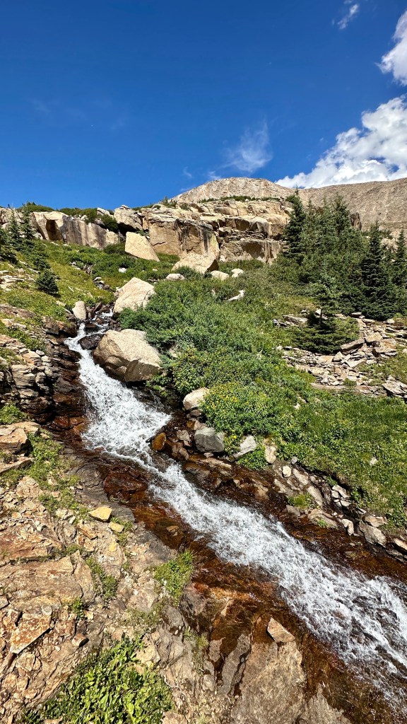
Camp was quick to set up, and afterwards I headed down to North St. Vrain Creek to filter about eight liters of water. This took some time, but was perfect as it was the only time I had to filter water on my trip, which was a big plus after the huge hike the next day to have water for meals ready to go! I read a bit in the evening, enjoyed some spaghetti, and took my bear canister on a nice hike 70 steps away from my tent (black bears are active in Wild Basin).


So for one of my funny moments of “this is my first time solo backpacking and I’m scared of the dark”… shortly after nightfall as I was trying to will myself to sleep (realizing my Ambien was in my toiletries bag which was of course in my bear canister out there in the dark), I heard twigs snapping. My heart raced, and I prepared myself for a bear to open my tent. Then a headlamp starting shining on my campsite, so my worries switched gear. A man said “F***, this isn’t the right one either!” and turned around and left. Sounds like he wasn’t having a good time…
On to the main adventure…
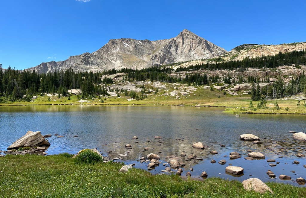
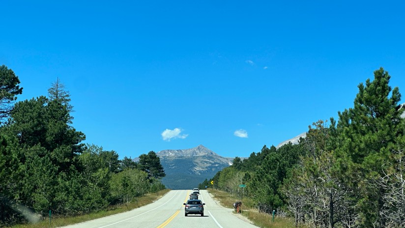
Mount Alice is one helluva beautiful mountain, probably second only to Longs Peak in RMNP in my opinion. Sitting at 13,310 feet on the Continental Divide, it has an imposing east face, but thankfully accessible slopes on the north and south sides. Most climbers complete a counterclockwise loop, ascending what is termed “Hourglass Ridge,” a class 2+/3 ridge with some spicy exposed bits, and descending Boulder-Grand Pass. But I’m me, and I can’t do things the typical way sometimes. Knowing that I would be solo, I decided I would ascend and descend Boulder-Grand Pass as an out-and-back to avoid Hourglass Ridge and keep things safer and simpler. Seemed simple enough… if I had stuck to the plan.

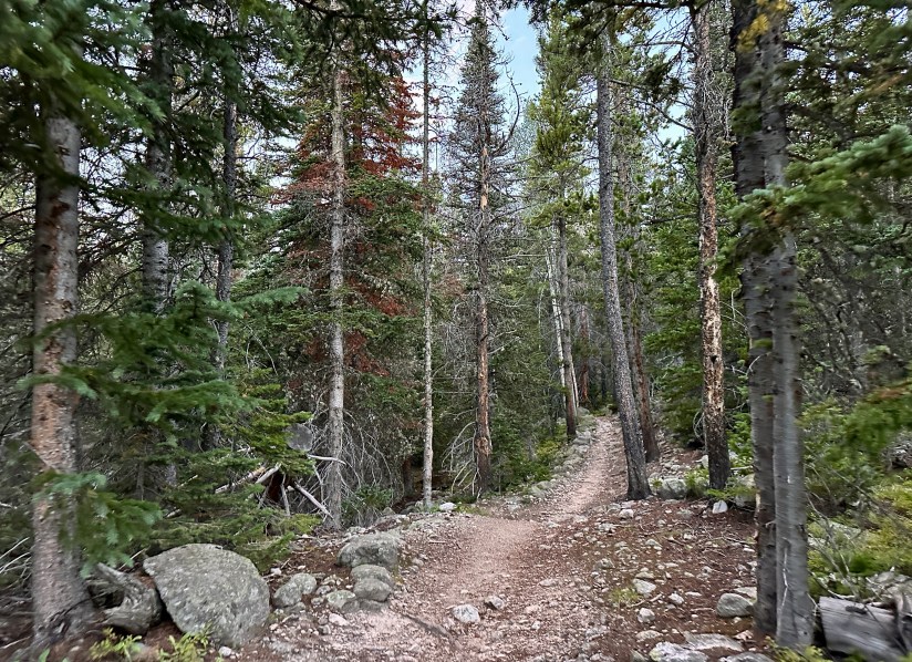
I started out at 6:08am, about forty minutes later than I originally planned since I was lazy with getting up (and venturing out into the dark to retrieve my bear canister). I followed the well maintained trail to Thunder Lake, steadily gaining elevation in a gentle manner and scaring a few deer along the way (which also scared me, I was jumpy this morning for some reason). At Thunder Lake I heard some voices and saw a stashed bear canister, but never any people, the theme of the seven and a half hours I went without seeing another human on this day.

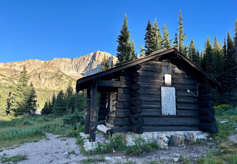
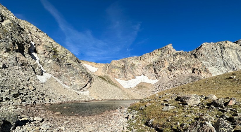
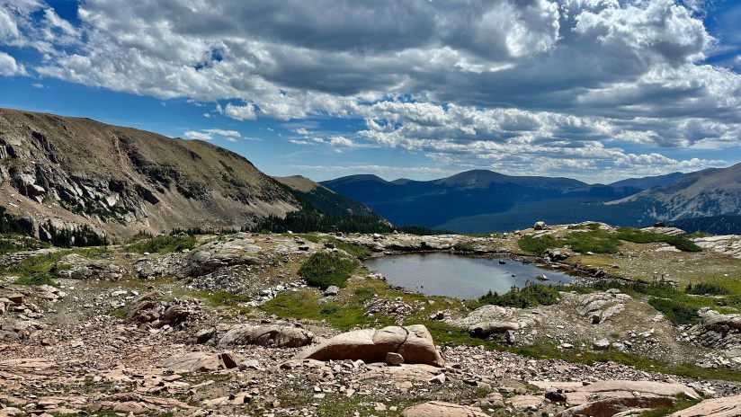
I quickly nabbed a photo of the ranger patrol cabin and worked my way around the north end of Thunder Lake on the trail, then headed west on an unmarked trail that steeply gains elevation to Lake of Many Winds. There were a handful of spots I had to use my hands to scramble up, and all around this was a calf burner to this alpine lake above treeline.
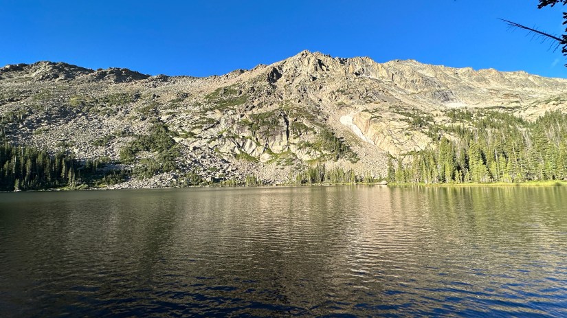

A big surprise, Lake of Many Winds was absolutely calm, but I did not take a break, and continued around the northern shore to the base of steep scree-slope of Boulder-Grand Pass. I was feeling peppy, and excited to be at this stage in the hike.

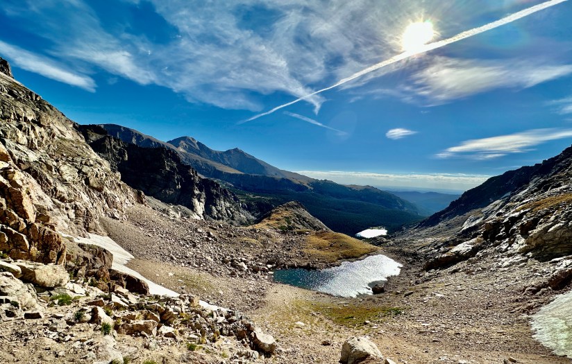
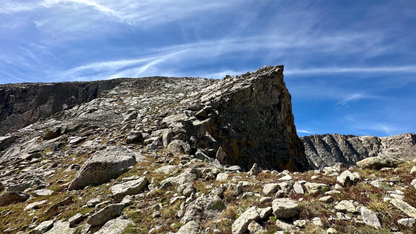
Boulder-Grand Pass, for lack of better words, kicked my ass. It was exhausting having the mountain crumble beneath my every step, and it took a shocking 45 minutes and one fall for me to climb that 500 feet to the top of the saddle I read an online post where someone said helmets probably should be worn on this part, and after doing it, I agree if one is not solo as knocking rocks and debris down is unavoidable and I caused many landslides on my slog up (something to consider if hiking in a group or below others). Once I hit the saddle and the Continental Divide, I debated calling it a day, mentally exhausted about the idea of crossing rocky tundra for another 1.25 miles to the summit of Mount Alice. I had perfect 5G cell service (I don’t even have that at my house), so I whined to those who would listen about being tired, and eventually sat down to consume my full-size Snickers and can of Red Bull, what were intended to be my summit snacks.


Despite vowing to turn around at every step, I progressed ever so slowly in the direction of the summit, finally arriving at the base that involves a bit of scrambling to gain the summit.

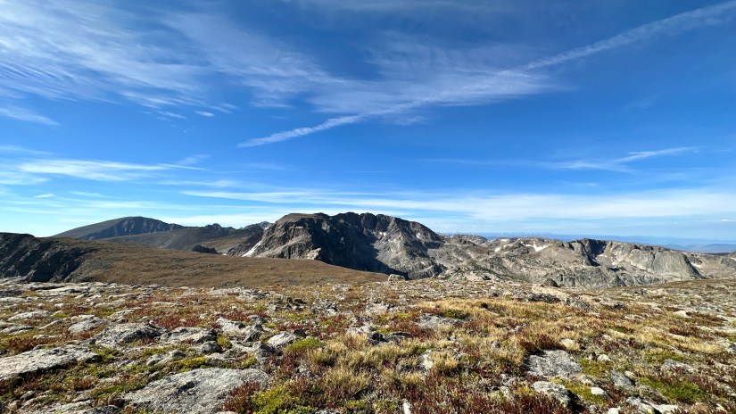
It’s funny how once you’re at the summit, the hike didn’t seem all that bad!

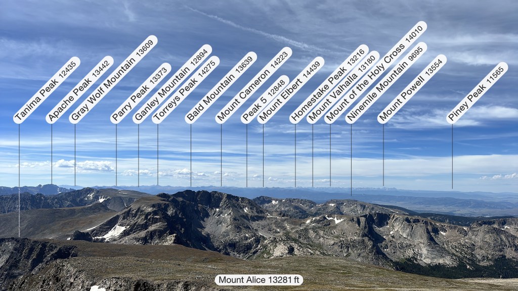
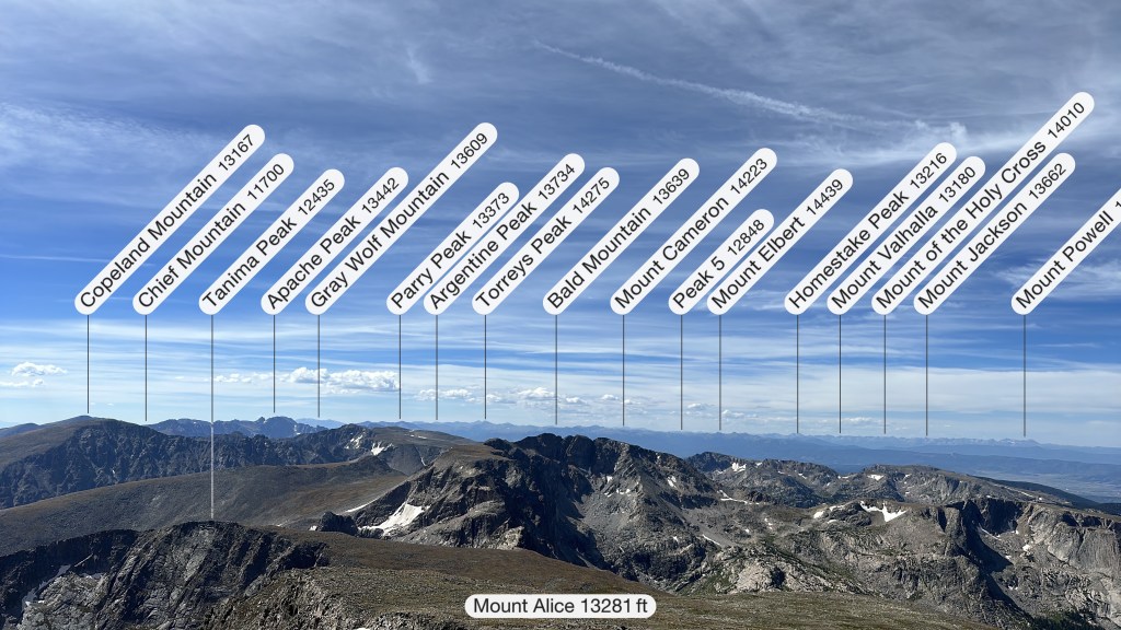
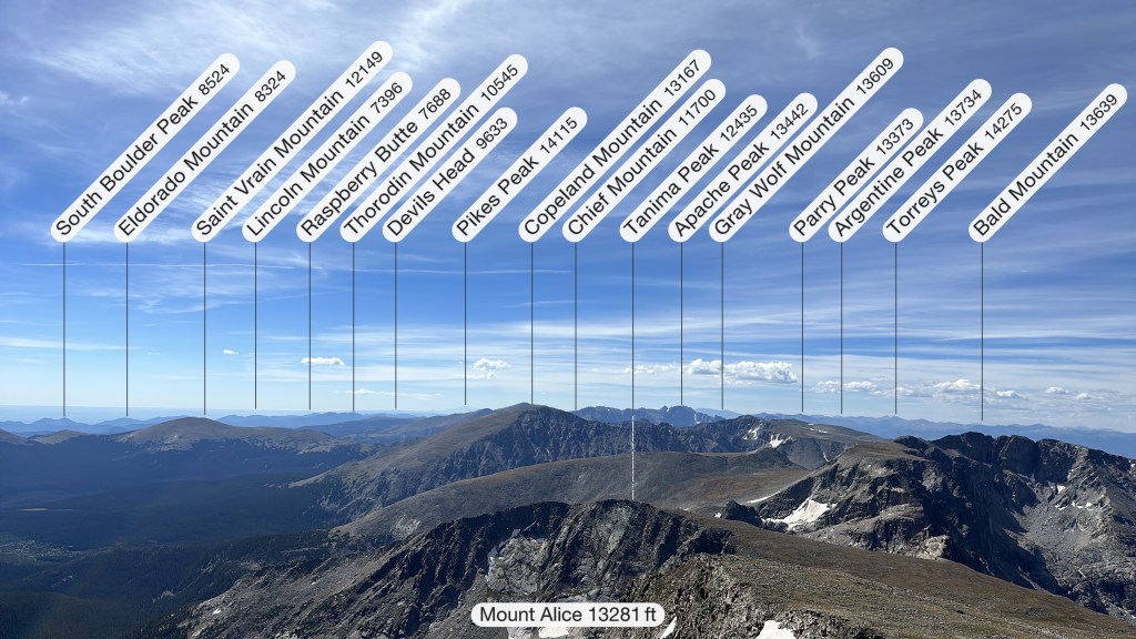
Skies were blue and the wind was calm as I took to taking videos and photos and eating a summit snack, spending about twenty minutes on the summit. The views were magnificent over to Longs Peak, Chiefs Head, and Mount Meeker to the north. To the south I could see all the way to Grays and Torreys, and also could see some smaller mountains like South Boulder Peak.


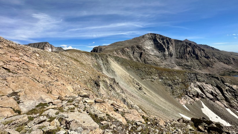
Sitting on top, I had a good view down Hourglass Ridge, and thought to myself, “well, that doesn’t seem so bad, much better than Boulder-Grand…” Alas, the seed was sown and I threw my plans of an out and back route out the window (or perhaps off the summit), and decided to descend Hourglass Ridge… because it didn’t look that bad, right? (I did let someone know I altered my hiking plans, thanks to great cell service up there.)
Down I went, happy for pretty solid footing, though the slope was steep and unforgiving on the knees. Probably the first bit of unease set in when I realized I was putting a lot of weight on my trekking poles, and I morbidly thought to the physician I worked with the past who died on a Colorado 14er when his pole snapped and he tumbled down the mountain. Scaring myself, I tried to remind myself to not lean into my poles too much as I picked my way down the slope.
I prematurely celebrated victory when I got to what I consider the bottom of Hourglass Ridge, thinking it was smooth sailing. Alas… when going downhill I feel like it is a lot easier to get off route, and I found myself having to do some pretty complicated moves around rocks, grasping for finger holds while my feet felt the loose ground give away under them. Finally I took a moment to calm my thoughts, which had started racing as every step felt the ground crumble under them as rocks bounced down and off the cliff below me. I pulled out Strava, and consulted the heatmap, and saw I was (as I describe) a couple of contour lines lower than I should’ve been. Swear words escaped my lips as I scanned above me for solid footing. Sure, Boulder-Grand Pass sucked, but at least a fall would result at worse gently rolling into an alpine lake. A fall here resulted capitulating off a cliff…
Obviously, I survived and did not tumble off a cliff since I am writing this post. But that was a scary situation, and went way above my boundaries of terrain I wanted to be in solo. Back on route where I should’ve been, looking back I could see how I descended lower that I should’ve and how this led to the spicy situation. Big lesson learned!

At this point, I was on solid ground and through there was no established trail – just a faint trail pounded in by hikers like myself – it was pretty straightforward sailing all the way back to camp. However, I found something else to fret about… I was still above treeline and it was past noon. My entire life I have lived by “below treeline by noon” so I felt like I was committing a crime. Descending had taken me way longer than I intended, but thankfully storm clouds had not begun to build.


Snowbank Lake and Lion Lake #2 filled my view as I made my way over the tundra, occasionally checking the route on Strava to make sure I wasn’t heading off another cliff. By now the hike was feeling a bit beyond Type 2 Fun, but forwarded momentum had to continue.


A trail picks up just above Lion Lake #2 and Trio Falls, which helped increase my pace as I didn’t have to spend so much time looking at the ground or figuring out where to go. At Lion Lake #1 I had a spectacular view to Mount Alice, and I smiled under realization I had stood wayyyy up there just a few hours prior!


Now the slog could truly begin. Though the trail was beautiful, all I could think of was my chicken pho meal waiting for me along with my Crocs. The skies became cloud-covered, which at least alleviated the sun and heat. At the seven and a half hour mark I saw my first humans of the day, and had a quick chat about where we each were camping and hiking plans. Finally not feeling like I was the last human alive! A few rain drops fell as I neared the junction of the Thunder Lake Trail, as thunder rolled in the distance.
Eight and a half hours later, I hobbled into my campsite to the horrible realization I still had to walk another 70 steps to retrieve my bear canister. Sigh. Fetched the canister, and collapsed into my tent just as an afternoon thunderstorm rolled in, dropping rain and temperatures for about thirty minutes until the skies cleared off as I wolfed down my Good-To-Go chicken pho.
All in all, my Mount Alice adventure clocked 13.3 miles on my Garmin with 4,413 feet of elevation gain. My longest hike ever, and definitely the most… spicy.
It was an early night, and I slept solidly with no alarm to awake me in the morning. Happy to have a short and downhill hike out to the car, it was a relaxing morning as I made breakfast and tried to figure out how to fit all my stuff back into my backpack – how come packing to go home is always a lot more disorderly?!

Three miles later and through the Labor Day Weekend crowds of Wild Basin I emerged, happy to get to my car and yank off my hiking boots. I barely had a time to toss the backpack in my car before someone was asking if they could have my parking spot… I happily obliged, and hustled to change and move on my way, saving them a few extra miles of walking since all parking was full all the way down to the entrance station!
I underestimated Mount Alice hardcore. I went in thinking the hike would take me much less time than it actually did – which, to be fair, I was originally planning on an easier out and back route utilizing Boulder-Grand Pass. I learned valuable lessons about changing routes on the fly, and risk assessment. For me, my descent off the summit took me out of my comfort zone of situations I wanted to do be in solo on a trail where I was probably the only person of the day. But I am proud of myself for calmly getting myself off the loose scree and to safety, and remaining calm. As for the backpacking portion, it was a success and an easy way to get my first solo trip under my belt (obviously I’ve solo car camped a ton, but with that my car was always right there to go hide in!)
Backpacking Trip Details:
Date Hiked: August 31-September 2, 2023
Trailhead: Wild Basin
Wilderness Campsite: Siskin (#053)
Total Mileage: 19.1 miles total for the weekend (Garmin Forerunner 255s)
Elevation Gain: 5,516 feet total for the weekend
Time to reach camp: 1 hour 20 minutes
Time back to trailhead from camp: 1 hours 8 minutes
Cell Service: None at campsite (Verizon), 4G LTE/5G on Mount Alice summit
Special Considerations for Backpacking:
- Located within Rocky Mountain National Park.
- Wilderness camping permits are required, and go on sale March 1st at 8am. As of 2023, the fee was $36 for the reservation, and reservations are non-refundable (but able to be cancelled).
- Entrance fee is still applicable.
- Wilderness camping permit serves as your timed entry reservation
- For the campsite itself:
- This is a great option for those wanting a shorter distance with a heavy pack, beginners, and families. The campsite is large and accommodate a variety of tent sizes.
- No fires are allowed and stoves must have an on/off switch
- There is no privy. Be prepare to properly bury human waste or pack out.
- Bear canisters are required at all wilderness campsites and must be kept closed and stored 70 adult steps away from your tent.
- Treat/filter/boil all water for safe consumption. Water is readily available at North St. Vrain Creek.
- The campsite is located at 9,600 feet in elevation.
Learn all about Rocky Mountain National Park wilderness camping permits and campsites here!


Leave a comment