

May 28, 2022
There is an adage in cycling – “It never gets easier, you just go faster.” This means that something will always feel hard, but you get stronger and are able to ride it faster. As I was plodding up the Round Mountain National Recreation Trail, I realized the adage also applies to hiking. After months of training my body to do a new activity often, no longer was I having to heave myself up by using my arms on my legs for stability and walking up hills had become a fact of life! Not a bad realization on this sweaty and long hike!
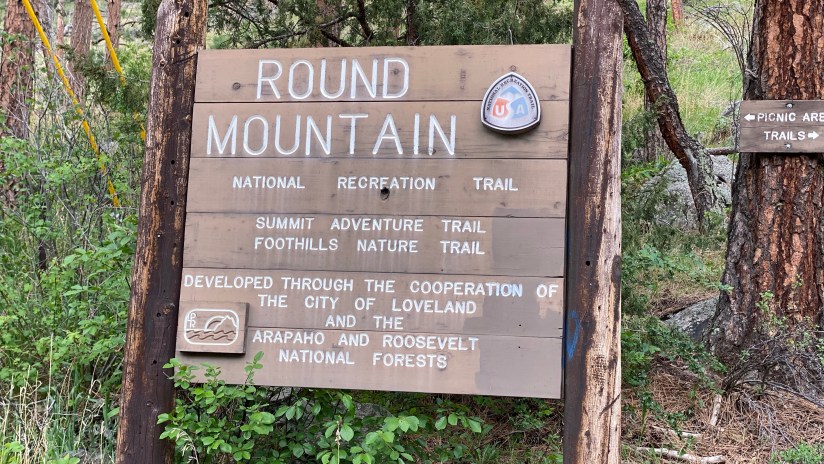
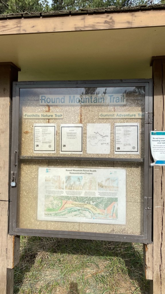
The Round Mountain National Recreation Trail was designated in 1981, and lies thirteen miles west of Loveland up US Highway 34. There’s two trails leaving from the heavily used trailhead, the Foothills Nature Trail (about a mile in length) and the Summit Adventure Trail, which is 4.4 miles (5 miles according to my watch) long one-way and goes to the summit of Sheep Mountain. I’ve never quite figured out what Round Mountain is, as the two summits easily obtained from this trail are Sheep Mountain and Stone Mountain!
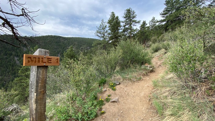
I knew Memorial Day Weekend crowds could be crazy, especially aheld of the upcoming cold front that would drop temperatures by the holiday, so I got to the trailhead early (an easy task as Loveland isn’t overly far from Cheyenne!) and started hiking at 8:26am. Straight from the parking lot the climbing starts, first starting out on a broad fire road, and narrowing to single track.


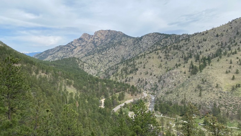

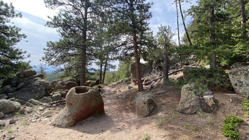
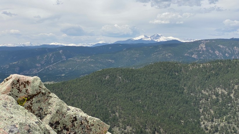
After about 2.5 miles of unreleting uphill, the trail hits a rocky portion and begins rolling a bit, with ups and downs (and you really feel that on the way back to the car!). You walk through some unique rock formations, and occasionally get some views as the trees part.

At 3.5 miles I came to where the trail to Stone Mountain spurs to the left. It is an unmarked trail junction, so can be easy to miss. I wanted to reach the rop of Sheep Mountain first, so I mentally noted the mileage on my watch and the scenery, and continued on the main trail.

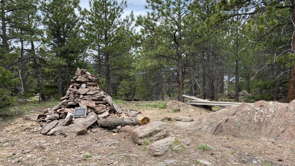
The trail steepens and switchbacks as you begin the final push to the summit of Sheep Mountain. I will say, this is a different kind of Colorado mountain summit, as you are far below treeline and the summit is wooded. There is a large cairn that marks the unremarkable summit in the thick trees at 8,450 feet. (Because it is hard to know what you have been hiking up this whole time, I like that Peakbagger.com has this photo.)


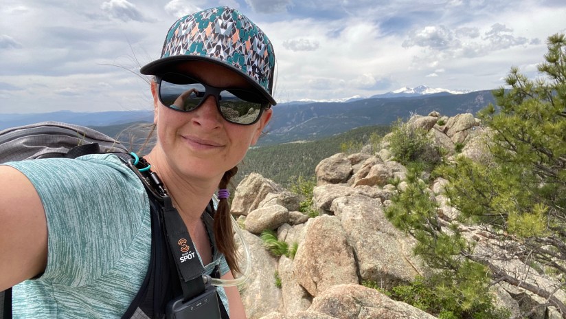
After an Uncrustable and some summit selfies, I headed back down the trail. I was still feeling peppy so decided I would add on Stone Mountain to my hiking menu for the day.
The trail to Stone Mountain is less traveled than the main trail, but is still easy to follow in most spots. There were a few downed trees I had to hurdle over. The trail rolls gently until the final push to the rocky scramble to the summit, where it gets quite steep. To reach the summit requires scrambling up large rock boulders. I spent probably longer than I should trying to find the best line to the summit, failing once when I got myself in a position where I went “ehhhh, this is sketchy.” I tried another route, and successfully made it to the top!

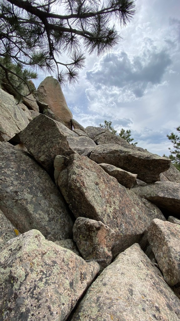
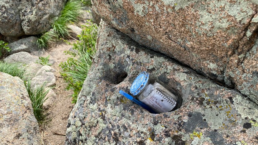
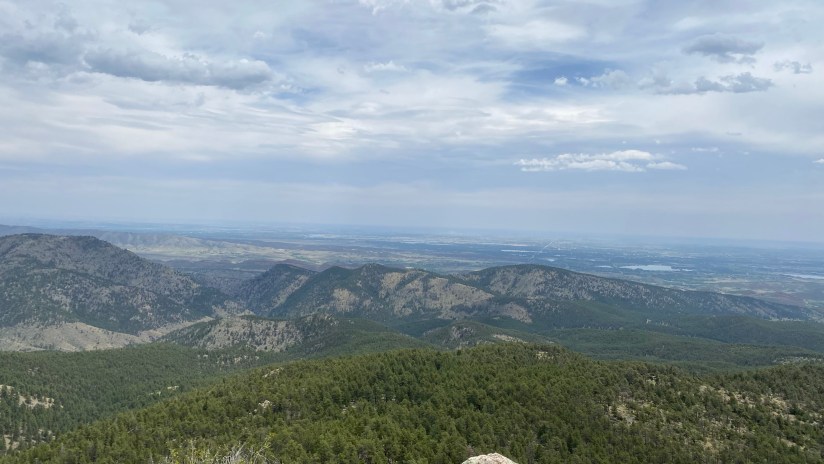
The summit of Stone Mountain is 7,655 feet, and unlike Sheep, is open and exposed so there were great views towards Rocky Mountain National Park, including Longs Peak and Mount Meeker. It was crazy windy when I arrived on the top – like blow you over windy – so it was a bit hairy to traverse the rocks to the highest point. I did find a summit register up top. After some quick photos, I carefully made my way back down (scrambling down is always so much harder) and back into the trees. Clouds were building, so I was happy to be in the trees for the rest of the hike back down to the car.

As I said previously, the rolling part in the middle was a bit annoying on the way back to the car, but otherwise it was smooth sailing. About one mile or so from the parking lot the crowds thickened with other hikers, proving how popular of an area this is. I wrapped up the 11.73 mile hike in 5 hours 15 minutes total, which I felt like wasn’t shabby at all!
Round Mountain Trail is a good winter hiking option due to the lower elevation. In fact, this is the trail I was going to hike the day I ended up going to Twin Sisters in April, as I knew it was a solid option with a questionable weather forecast. I definitely could see myself repeating it, as much as I have come to hate repeating hikes, as it is a solid option to get elevation gain in the legs when the higher mountains are off the table for whatever the reason in the winter and shoulder months.


Details:
Date Hiked: May 28, 2022
Trailhead: Round Mountain
Total Mileage: 11.73 miles (Garmin Vivoactive 4s/Strava)
Total Elevation Gain: 3,117 feet
Total Time Spent: 5 hours 15 minutes
Weather: Hot, increasing wind and clouds in the afternoon
Trail Conditions: Dry and dusty. The spur to Stone Mountain had a downed tree or two to climb over
Cell Service: Hit or miss
Special Considerations: This is a very popular trail, so trailhead parking can get limited. Dogs must be leashed for the first mile of the trail.
Video from a hike of this trail in March 2025:

1 thought on “Colorado Hiked: Round Mountain National Recreation Trail”