


Looking for a relaxed, beginner-friendly coastal backpacking route in Olympic National Park? Look no further than the Ozette Triangle!
The Ozette Triangle (also called the Ozette Loop or Cape Alava Loop) is an equilateral triangle-shaped route beginning near Lake Ozette on the northwest coast of the Olympic Peninsula. At just over 9 miles in distance, the Ozette Triangle can be accomplished as a day hike. To truly experience it, however, I highly recommend packing up a tent, sleeping bag, food, and grabbing a friend or two for a overnight coastal adventure!
Last updated: February 11, 2026
Table of Contents
- My Experience
- Ozette Triangle Route Description
- Ozette Triangle Backpacking Itineraries & Campsites
- Ozette Triangle Fees & Permits
- Ozette Triangle Good-To-Know Details
- Further Reading
My Experience
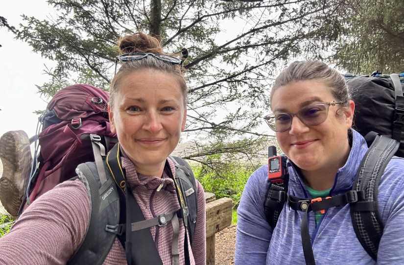
My friend, Janice, and I backpacked for two nights on Ozette Triangle over Labor Day Weekend in 2024. This was Janice’s first backpacking trip, and my first in a coastal environment. Full shenanigans can be read in following blog posts, which is light on the logistics and heavy on our personal experiences:
- Two Girls Roving: Day 9 – Ozette Triangle Backpacking to Cape Alava
- Two Girls Roving: Day 10 – Ozette Triangle Backpacking Cape Alava to Sand Point
- Two Girls Roving: Day 11 – Ozette Triangle Backpacking & Hoh Rainforest
Ozette Triangle Route Description
Trailhead
The Ozette Triangle Coastal Trailhead is located on the north end of Lake Ozette, near the Ozette Campground and ranger station. The trailhead is reached on the Ozette Lake Road, a left turn off State Route 112 about 4 miles northwest of Clallam Bay. After the left turn, continue to where the road ends in Ozette. It is a remote place, with the largest town, Port Angeles, located 75 miles away. Forks is about 54 miles. It takes about 4.5 hours to reach the trailhead from Seattle! With the time commitment to reach this remote location, it only makes sense to stay several days and backpack!
The parking lot at the trailhead is large and gravel, though we did find it to be surprisingly filled up on the Saturday morning of Labor Day Weekend (but still were able to secure a spot). There are vault toilets, but the smell was so horrendous I opted not to use them.
Amenities Near Lake Ozette
There is not a whole lot around Lake Ozette in terms of amenities. Ensure that your car is fueled up before making the drive out to Ozette, as there is not a gas station. There are two camping/accommodation options near the trailhead:
- Ozette Campground
- Practically located at the trailhead and managed by National Park Service
- 15 first-come, first-served campsites
- $20 per night (2026)
- Pit toilets, potable water
- This campground can occasionally be closed due to flooding, will be announced on the link above
- Lost Resort at Lake Ozette
- Barely a mile from the trailhead outside of the national park boundary
- $50 per night for up to 4 people, then $10 for each additional person (2026)
- Cabin rentals available
- Pay showers
- Small general store with essentials and water (great local beer selection!), some warm food items and coffee
- Closed for the off-season October 1, 2025-April 5, 2026

Ozette Triangle Route
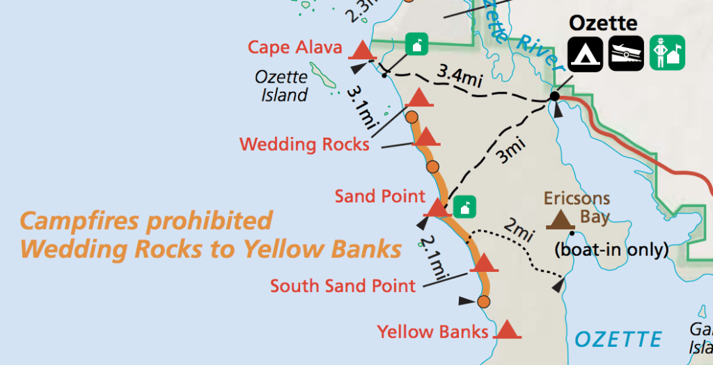
As stated earlier, the Ozette Triangle is shaped like an equilateral triangle, with each side (or leg) being roughly 3 miles, give or take a few tenths of a mile. There is no established direction of travel, it really comes down to personal choice. Since I have traveled the Ozette Triangle in a counter-clockwise direction heading to Cape Alava first, that is how I will describe the route.
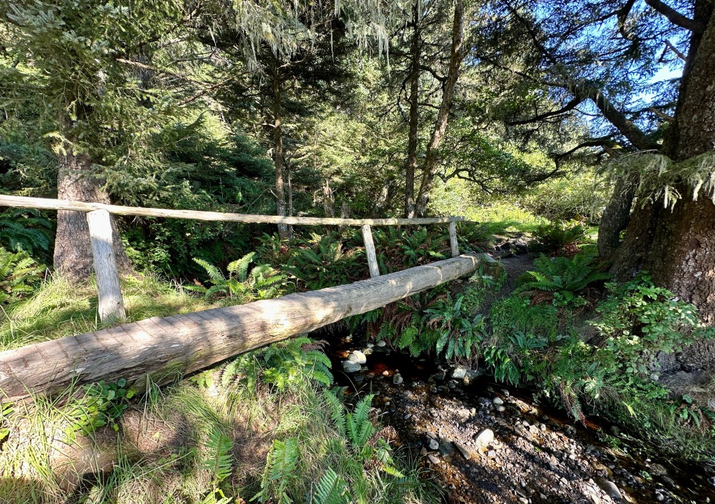
After leaving the trailhead and crossing the bridge over the Ozette River (keep an eye out for river otters here!), the trail splits – left taking you to Sand Point and right taking you to Cape Alava.

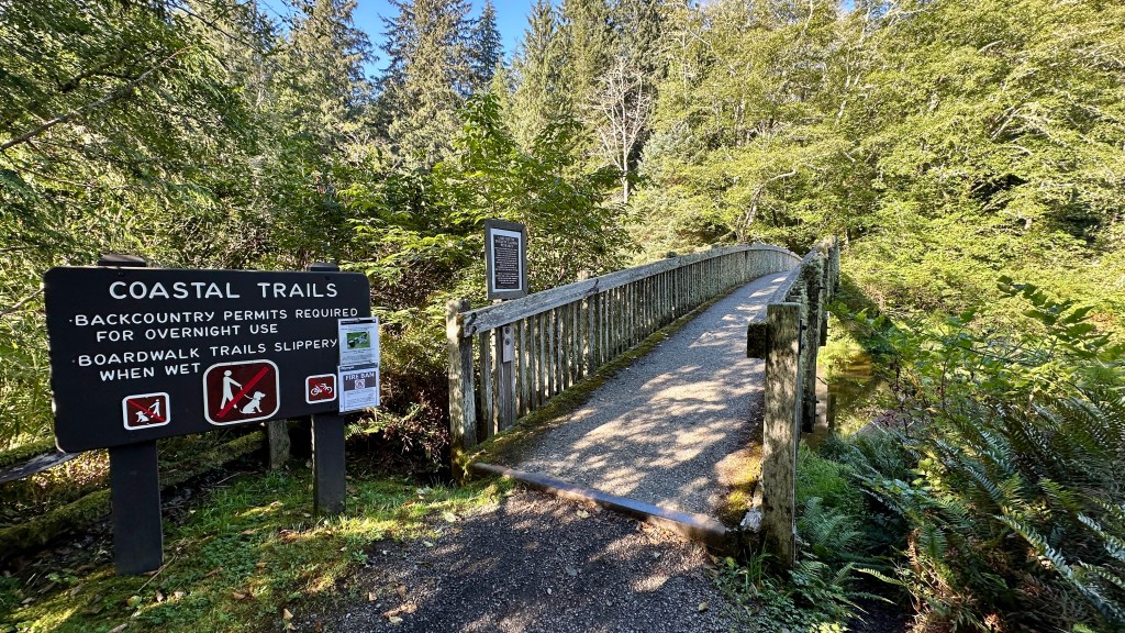
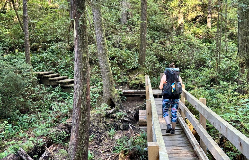
For the next 3 miles you will travel on a mix of gravel and boardwalks (of varying condition) through mostly forest, aside from a patch that crosses Ahlstrom’s Prairie at 2.25 miles. The boardwalks can be slippery and have some rotted sections, so I highly recommend good footwear and using hiking poles.


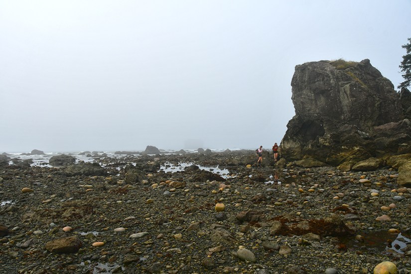
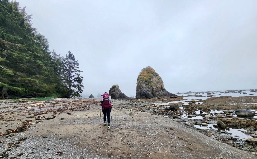
Eventually the forest lets in the roar of the Pacific Ocean, and a little after 3 miles there is a descent down the headland. A trail branches off the to right and crosses a log bridge, leading to the campsites at Cape Alava. (Trailhead to Cape Alava statistics: 3.4 miles with 413 feet of elevation gain)


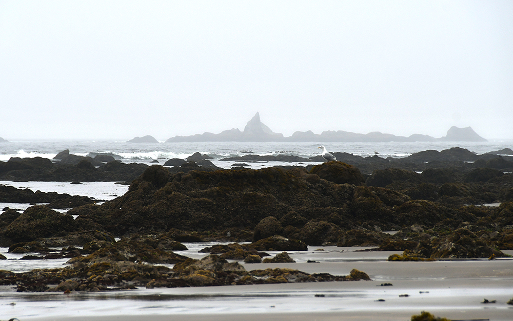
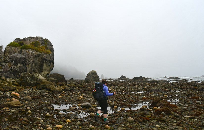
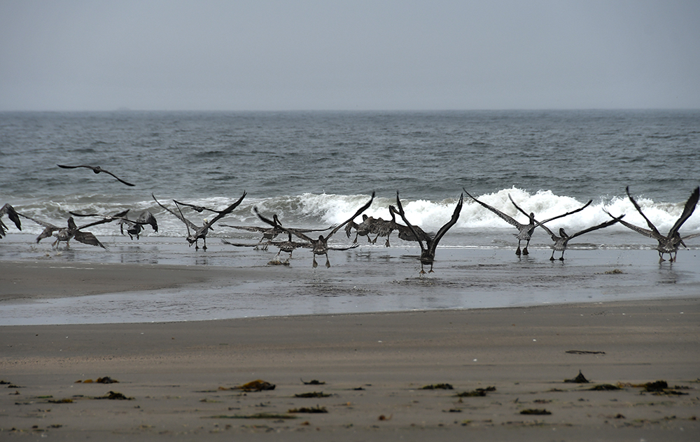
The Ozette Triangle route now begins its coastal leg, heading south from Cape Alava on the beach. This leg is part of the Pacific Northwest National Scenic Trail that travels 1,200 miles from Montana to Washington. There is no established trail on this section, just the beach guiding you south.

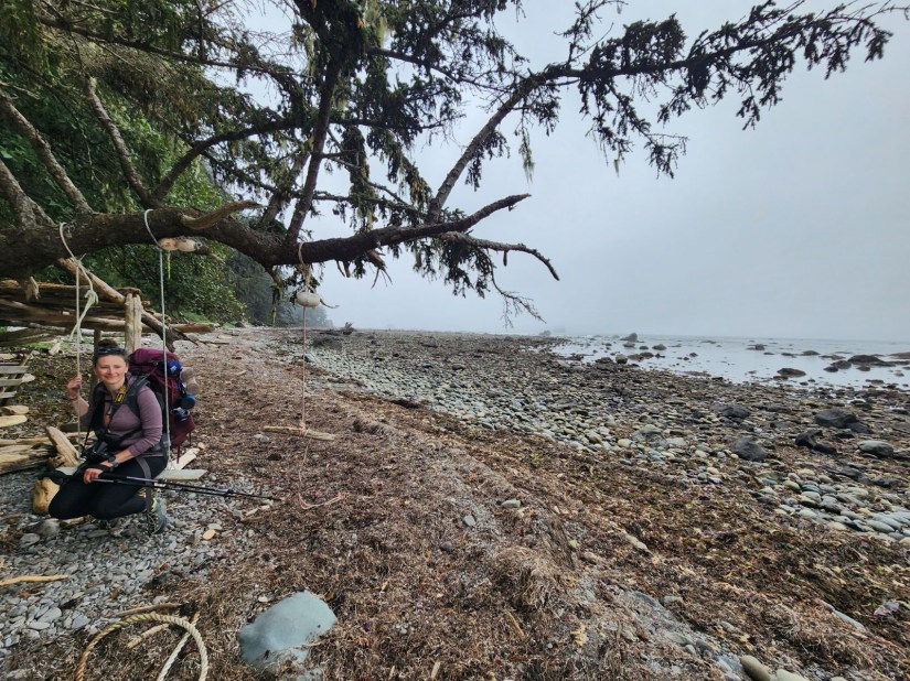
While hiking along the beach expect to experience everything from fast, firm sand to slippery seaweed and rocks to navigate over, along with fallen trees. It is anything but an easy walk, especially with heavy backpacks on. Luckily the coastal scenery more than makes up for it! The first of the Wedding Rocks campsites can be found tucked into the trees along this section.

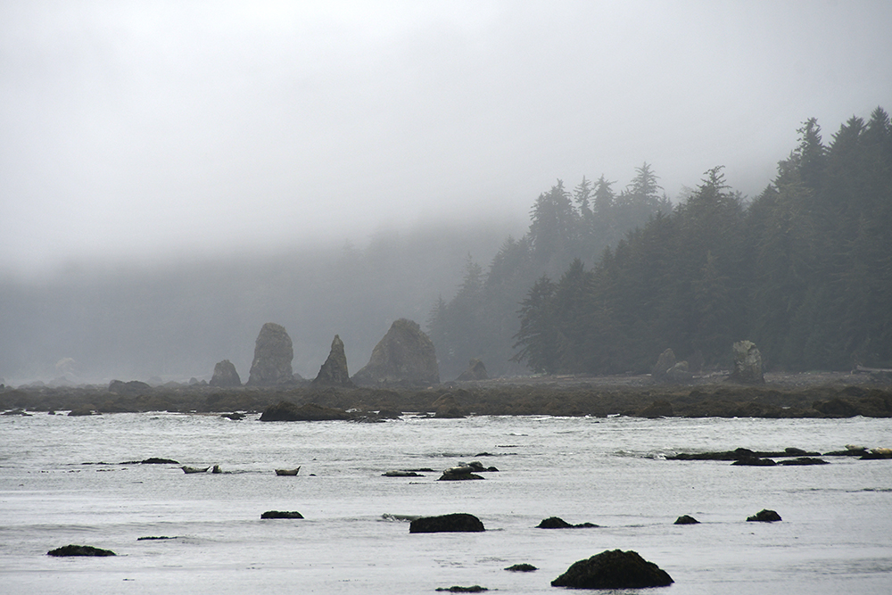
After one mile, you will arrive at Wedding Rocks and the first tidal restriction point (see section about Tides & Headland Trails below). Keep an eye out for petroglyphs among the rocks here. (Sadly during my trip we were racing the tide and did not see the petroglyphs.)
Another mile passes by with sea stacks, sea glass, and varying sand conditions before reaching the second tidal restriction just past another Wedding Rocks campsite. Here is where Janice and I had to take the headland trail.


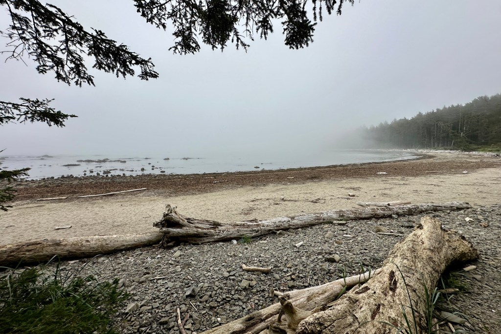
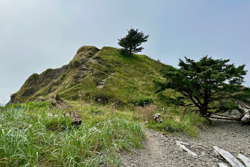
Around the headland, Sand Point appears with its namesake collapsed sea stack at its very end. The campsites at Sand Point are tucked on the spit of land in the trees, or one can camp on the beach above the high tide line. (Cape Alava to Sand Point statistics: 3.44 miles with 135 feet of elevation gain due to taking one of the headland trails)


The last leg of the Ozette Triangle returns to the forest and a mix of gravel and boardwalk trails. I found the boardwalks to be in better condition on this leg, but can still be slippery. The hiking is easy and fast, and all too soon the bridge over the Ozette River will appear along with the trailhead parking lot. (Sand Point to Trailhead statistics: 3.08 miles with 226 feet of elevation gain)

Ozette Triangle Backpacking Itineraries & Campsites
Itinerary Options
There are numerous ways a backpacking trip to Ozette Triangle can be accomplished: complete triangle, a leg of the triangle, one night, two nights… the options are there!
One Night: For one night on the Ozette Triangle, the trip can broken up into one 3-mile day and one 6-mile day, staying overnight at either Cape Alava or Sand Point. Another option would be to camp about halfway through the route at Wedding Rocks.
Two Nights: For a relaxed trip, stay one night at Cape Alava and one night at Sand Point, hiking 3 miles each day. Or reverse this and stay one night at Sand Point and the second night at Cape Alava.
When I backpacked Ozette Triangle, we opted for a two-night trip, staying at Cape Alava and Sand Point for one night each, respectively. This allowed for a relaxed pace with plenty of time for exploring the surrounding beaches. We opted for Cape Alava to be our first overnight stop, and Sand Point for the second night because I had read that the trip back to the trailhead from Sand Point was considerably easier than the trip out from Cape Alava. After the trip, I think this was fair advice (though there is nothing truly challenging in either direction, there just appears to be more ups and downs on the leg to Cape Alava).
Of course, it is possible to extend a backpacking trip even longer with additional nights. There are campsites outside of Ozette Triangle, such as South Sand Point (about one mile south of Sand Point), or South Ozette River to the north, that could be used for an extended trip and more in-depth exploring of the North Coast.
Campsite Options
There are three wilderness campsite areas available on Ozette Triangle proper: Cape Alava, Wedding Rocks, and Sand Point. If venturing off the Ozette Triangle, there are a few other options, but for the purposes of this guide I am only discussing campsites on the route.
Cape Alava
Cape Alava is the northernmost campsite on Ozette Triangle, and is located 3.4 miles from the trailhead. A special fact about Cape Alava is that it is the westernmost point in the Lower 48! A pit toilet is located on the southern end of the campsites (bring your own toilet paper!), and another at the northern end. The water source is the creek at the start of the trail to the campsites with the log bridge. Campsites are of varying quality, but most are located within the trees, which provides shade. Many will have an ocean view!

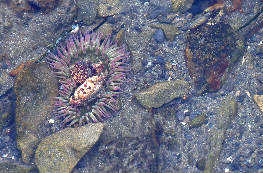
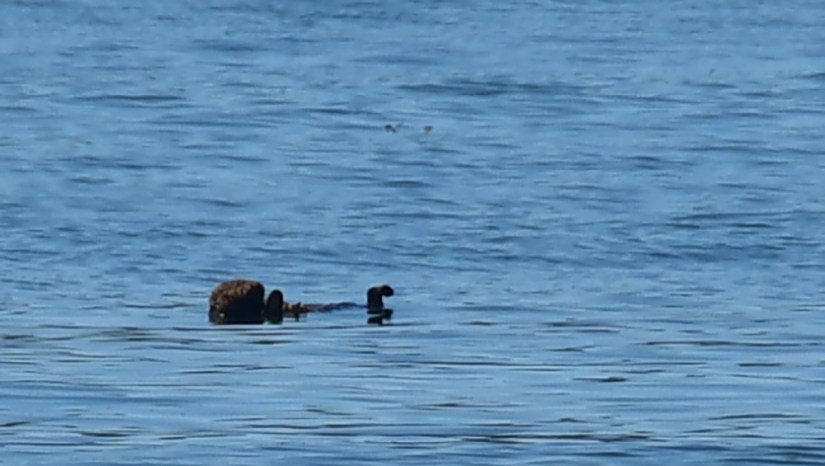
During low tide, tide pools will be visible and are a good way to kill a lot of time. Wildlife, including sea lions and sea otters, can be spotting offshore. Heading north is the Ozette Indian Reservation. Tskawahyah Island is closed to the public, please respect this closure not not walk out to the island during low tide.

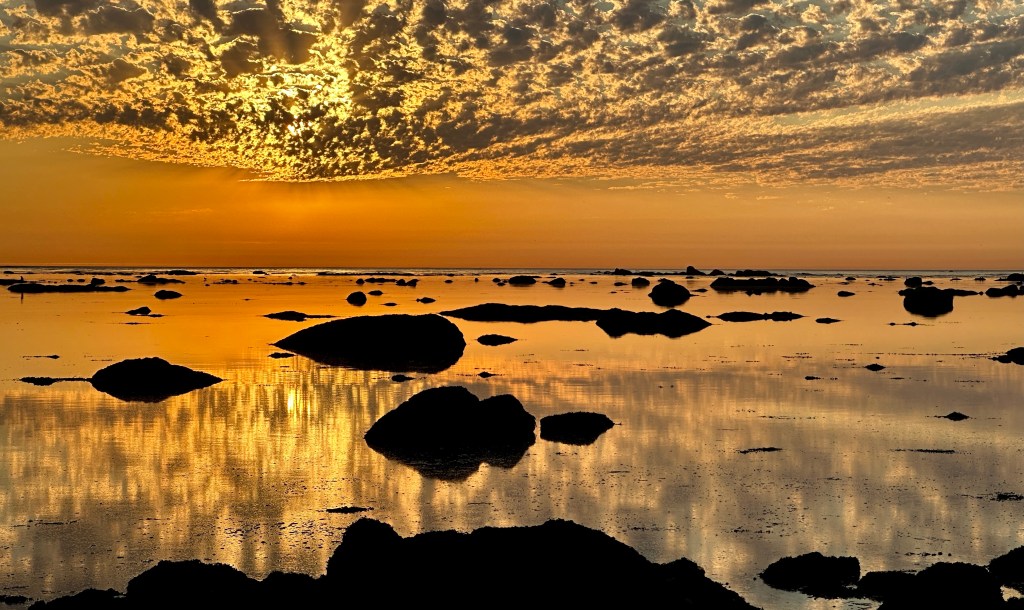
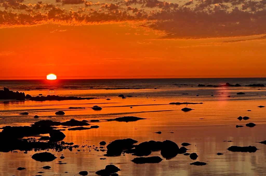
The sunsets are breathtaking at Cape Alava during optimal weather, and make staying here for one night well worth the hike in and packing in the gear!


Sand Point
Sand Point is the southernmost campsite on Ozette Triangle, located 3.1 miles south of Cape Alava, and 3 miles from the trailhead. Wish Creek (located about 400 meters south of Sand Point) serves as the water source, though in late summer it may be dry (so the National Park Service cautions to bring enough water with you if staying here). There is a pit toilet as well at Sand Point. Campsites are mostly in the trees, though camping is an option on the beach above the high tide mark. I did find the campsites at Sand Point to have less privacy and close to neighboring campers, compared to Cape Alava.

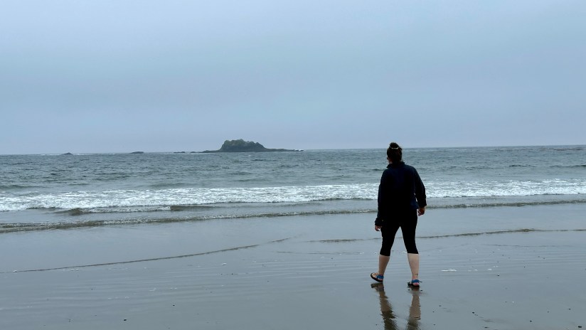
I liked Sand Point’s tide pools a lot, and during low tide a large sand bar is exposed that makes for a great walk along the shore, Hiking to the top of Sand Point, a collapsed and eroded sea stack, gives panoramic views. I hung around up there a long time, sipping a cup of tea and just taking it all in.

Wedding Rocks
Wedding Rocks campsites fall in the middle on the coast between Cape Alava and Sand Point. The campsites are not officially marked, but are easily visible from the coastal trail and people have used scavenged ropes and buoys to mark the campsites. No pit toilets or reliable water sources are near these campsites. Staying at Wedding Rocks will definitely get you away from the crowds of Cape Alava and Sand Point!
Ozette Triangle Fees & Permits
Olympic National Park Fees
Ozette Triangle, including the trailhead, is within Olympic National Park, which has an entrance fee.
As of 2025, the entrance fee is $30 and is good for 7 days. Passes can be purchased online in advance. Federal lands passes, such as the American the Beautiful pass are also accepted.
Full fee information can be found here.
Backpacking Permits & Fees
Backpacking the Ozette Triangle requires a wilderness backpacking permit.
Wilderness backpacking permits are required year-round at Olympic National Park, and are self-booked on recreation.gov. Permits for the summer season (May 15th through October 15th) become available on April 15th at 7:00am Pacific Time.
The Ozette Coast is part of a quota area, meaning 100% of permits are available for advance reservation and there are limits set on number of permits available. It is highly recommended that you make reservations for May through September as far in advance as possible to ensure you will get the campsites and dates you desire. I found getting permits for Cape Alava and Sand Point for Labor Day Weekend to not be nearly as competitive as getting permits in other national parks, but I still logged on and purchased them on April 15th to be safe. Cape Alava did sell out the quota for the night of our trip.
Important information about reservations & quota areas:
- Camping is only permitted in designated, established sites. You cannot create your own campsite wherever you please.
- In quota areas, deviation from your permit itinerary is not allowed, except in cases of emergency.
- For example: if holding a permit for Sand Point you cannot just chose to stay at Cape Alava on a whim.
- Campsites are not individually assigned, and are first-come, first-served for permit holders.
Group size is limited to 12 people. Associated groups larger than 12 people must travel at least one mile apart, and cannot come together. Associated groups must also camp in separate areas (i.e. one at Cape Alava and one at Sand Point).
Permit Fees as of February 2026:
- Adults (16 and older) – $8 per person per night
- Youth (15 and under) – free
- Annual Olympic National Park Wilderness Pass – free for pass holder only
- An annual pass is $45 and covers one person for 12 months from the date of purchase.
A $6.00 non-refundable reservation fee is required for each overnight permit reserved including Annual Olympic National Park Wilderness Pass is also charged at the time of reservation.
Reservations for permits made over a week in advance are issued by staff around 3 days before the start of the trip (though made less than a week in advance are typically issued within the same day or following morning). Once the permit has been issued, you are able to log into your recreation.gov account and print the permit. If you are unable to print it (like Janice and I were since we were traveling on an extended road trip), you can swing by a Wilderness Information Center and a ranger will print it out (and supply it with an awesome plastic holder!).

Ozette Triangle Good-To-Know Details
Bear Canister Regulations
All food, garbage, and scented items must be stored—overnight and when unattended—in park-approved bear canisters along the entire Olympic National Park Wilderness Coast.
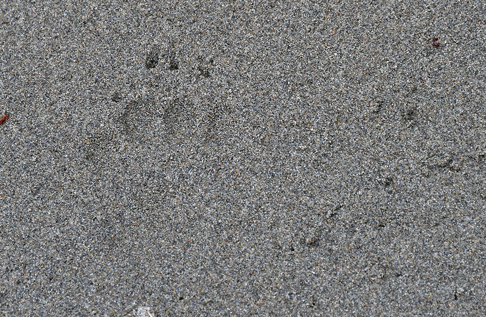
This is probably the most important regulation I can discuss! During our stay at Sand Point, a mother black bear and her two cubs were roaming through the campsites, evicting several parties until they moved on, highlighting why proper food and garbage storage is essential. A fed bear is a dead bear. Not to mention the roaming gangs of raccoons looking to treat themselves to your leftovers.

If you do not own an approved bear canister, they are available for FREE to those holding a wilderness backpacking permit at the Wilderness Information Office at the Port Angeles Visitor Center or Quinault Rain Forest Ranger Station during business hours. The supply of canisters, while big, is still limited and available on a first-come-first-served basis.
Though it is smart to plan for each person to have their own bear canister depending on length of trip, Janice and I were able to fit all our food and smelly items (and resulting trash) into one BearVault Trek BV475 canister on our two-night, three-day trip. We opted for Mountain House freeze-dried meals for dinner and breakfast, and Good-To-Go chicken pho (one of my all-time favorites!) for one lunch and pita and tuna pouches for another lunch. Choosing backpacking meals made it easy for us to fit everything in the bear canister without it weighing a ton. The meal pouches also flatten and seal, not creating a lot of bulky garbage. We also limited the number of toiletry items we each brought along, sticking to the bare essentials.
Campfires
Campfires are prohibited between the headland north of Yellow Banks and the headland at Wedding Rocks. This includes Sand Point & South Sand Point. Fire restrictions may be in place for other campsites as well. In September 2024, Cape Alava was part of the park-wide campfire ban.
Where campfires are allowed, only driftwood may be used. Driftwood can be limited, and hard to find at Cape Alava. No wood can be taken from the forested areas.

Cell Service
Goodness, you are in nature, why do you need it?!
For those who do care, I had enough Verizon cell service at Sand Point to send text messages out. I did not have Verizon cell service at Cape Alava (or at least can’t remember checking to see if I did). There is no cell service at the trailhead.
In the backcountry and remote locations, I have a Garmin inReach Mini 2 for satellite messaging if needed.

Tides & Headland Trails
There are two points on the Ozette Triangle where high tides cause restrictions:
- Wedding Rocks (about 1 mile south of Cape Alava)
- Restricted at 5 feet and higher
- 1 mile north of Sand Point
- Restricted at 5.5 feet and higher
Tides were probably the one thing that had Janice and I the most worried, as we are Wyoming girls so reading tide tables is not a skill either of us had. We asked the ranger at the Wilderness Information Center for help, and she provided us with the La Push tide table and explained to us how to read it.

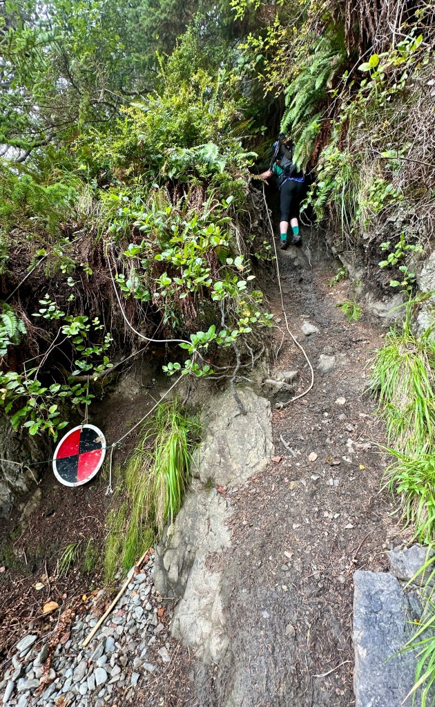
If the tide is too high and you find yourself staring at the Pacific Ocean instead of a walkable route, there is still hope! At both Wedding Rocks and the point north of Sand Point there are headland trails marked by circular red-and-black signs. These headland trails are often steep, sketchy adventures aided by a random rope or two. Not the easiest things to navigate, especially with a heavy backpack.
I cannot speak to the tidal restriction at Wedding Rocks, as during my trip we reached Wedding Rocks before the tide was too high and was able to round the point easily. I can, unfortunately, speak to the tidal restriction north of Sand Point and the headland trail. It was steep, muddy, eroded, and definitely an adventure! There were two ropes on the south side, with one of them ending about 15 feet off the ground – choose wisely!


Toilets
Pit toilets (privies) are available at Cape Alava and Sand Point. Make sure to pack some toilet paper. I highly recommend a Kula Cloth, a sanitary, reusable cloth designed for those who wipe when they pee. Using a Kula Cloth helps reduce waste and unsightly toilet paper left behind.
If ¼ of a mile away from a pit toilet, dig a cathole 6-8 inches deep and 200 ft (about 70 adult steps) from water sources, campsites, & trails. Pack out any toilet paper and wipes (a Ziploc baggie works great for this purpose).
Water
There are few drinking water sources on the Ozette Triangle: the stream at Cape Alava and Wish Creek south of Sand Point. In late summer, the streams can be dry so it is smart to ask the rangers at the Wilderness Information Center before your trip about current conditions.

The water must be treated before consuming (unless gastrointestinal illnesses and infections are your thing). Cryptosporidium and Giardia have both been found in the water coastal sources, which are gastrointestinal parasites. Iodine and other chemical treatments will not kill Cryptosporidium. Therefore, all water must be boiled properly (bring to a roaring boil and continue for 1 minute) or filtered. (Minnesota Department of Health has a great backcountry water treatment handout that explains more!)
One thing to note is the water sources have high level of tannins, which leach from plant matter into the water. This turns the water tea-colored. I drank the water, and found it to taste completely normal, but some people may notice a taste. The coloring can be a bit alarming or off-putting (honestly, as a nurse I was harkened back to days of… well, not everyone is a nurse and wants to know what I think of!). Tricks to avoid noticing the color include using dark colored water bottles, using powdered drink mixes, or using the water just for cooking. We opted to dedicate the filtered water for cooking, as Janice was a little wary of the color.
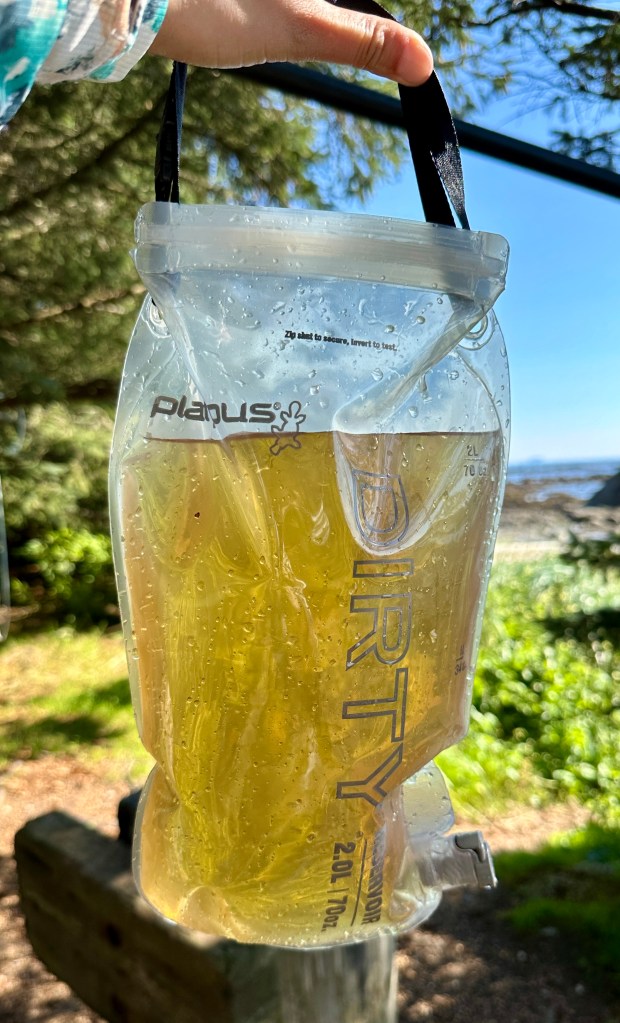

I have the Platypus Gravity Works filter kit in the 2 liter size. This filtration kit makes it easy to go fetch water with the “dirty” reservoir, and then hang at the campsite and let the gravity filter do its thing as the “clean” reservoir fills. I’ve had this filter for awhile now, and love the ease and speed of use. We were able to quickly filter any water we needed.
During our Labor Day Weekend visit the stream at Cape Alava was flowing quite well and I was able to easily access water for filtering by scampering down to the creek bed underneath the bridge. However, we were not able to receive information on Sand Point’s Wish Creek. Janice and I opted to carry in a large amount of water to help cover our three-day trip: about eleven liters between the two of us. We were able to adequately hydrate, and with the supplementation of filtered water, had plenty for cooking ten backpacking meals and four cups of coffee.
Weather & Other Hazards
Ozette Triangle can be accomplish year-round, though typically has best conditions April-October. It is best to prepare for all weather conditions no matter the time of year. For example, on our first day we had hot weather that left us running around in sports bras and shorts as we explore the beach at Cape Alava. The next morning we awoke to thick fog and temperatures about 10-to-15 degrees Fahrenheit colder than the previous day. I’d end our second day wearing a hat and fleece! I was happy I packed some cold weather essentials. We also brought along rain jackets and pants, though they were not needed during our trip.


Coastal storms can be fierce on the Ozette Triangle, especially over the winter months. Appropriate equipment becomes even more necessary, including (but not limited to) a stoutly waterproof tent, good sleeping bags, and waterproof cold weather clothing.
The marine forecast can be checked here, and is a good idea to check no matter the time of year.
Ozette Triangle is part of a tsunami hazard zone. Be aware that a tsunami may be coming if you:
- Hear a tsunami warning siren or receive a tsunami alert.
- Feel a strong earthquake near the ocean. A strong earthquake is one that knocks people down, damages buildings, or lasts for longer than 20 seconds.
- Notice a very large wave approaching.
- See coastal waters recede. As the tsunami approaches, sometimes sea level will drop rapidly as the wave gets taller.
- Notice an unusually rapid rise in sea level. Some tsunamis will have a surge in front of them as they approach land. These surges can be very damaging and dangerous.
- Notice a landslide that falls or slides into the ocean, a large lake, or a river.
Hey, I’m from Wyoming, I have an uncanny fear of tsunamis! 🙂
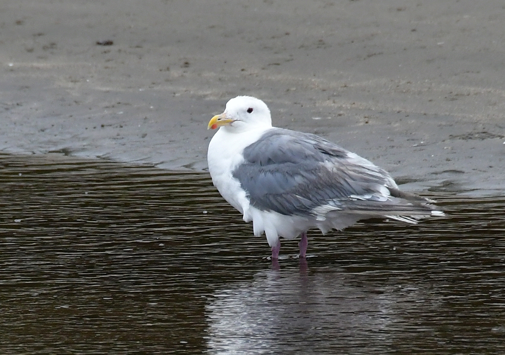
Wildlife
Sea lions, sea otters, black bears, oh my!
We saw all three, along with a variety of seabirds during our trip.


If you have room, binoculars are well worth it to bring along. The sea lions raise quite the racket at Cape Alava near Ozette Island, enough that some people can’t sleep. Nearby, sea otters bob up and down in the ocean.
Heading south from Cape Alava we quickly spotted bear scat in the sand, along with tracks. We would not see the black bears until Sand Point, where they treated the campers to quite the show (and then poked around a few campsites before moving on).


Further Reading
- Ozette Triangle page on the Olympic National Park website
- Washington Trails Association Cape Alava Loop (Ozette Triangle) website
- All Trails Ozette Triangle Trail
- Custom Correct North Olympic Coast Map

