
“In every walk with nature one receives far more than he seeks.” – John Muir

September 7th, 2021
I have never smoked anything in my life, but I woke up feeling as if I (assumingely) smoked cigarette after cigarette all night long. The air quality was stupidly awful, and I rubbed my dry, scratchy eyes as I said good morning to a new day. My lungs burned, and I was short of breath just sitting still (I eyed the inhaler, but decided I didn’t need it quite yet). If I was at home, I would not go outside and would stay sealed up in house where the air is safer to breathe as asthmatic when the air quality was this bad. But alas, that just could not happen when there was exploring to be done!
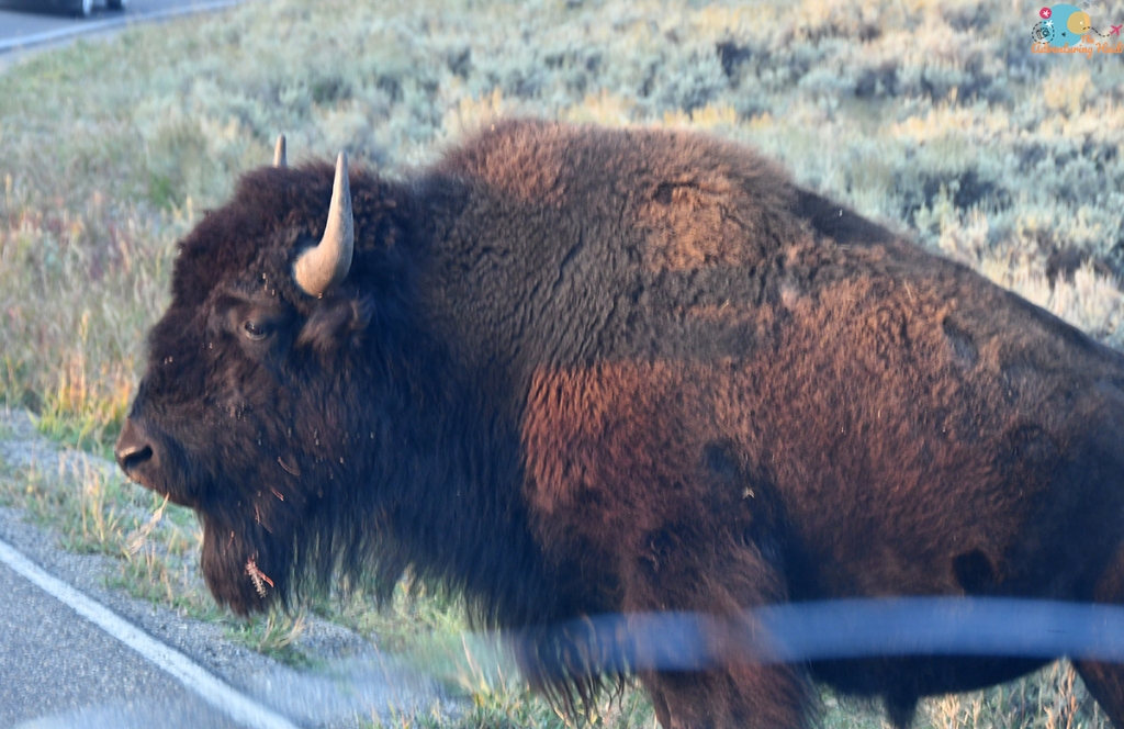
My early start was good due to my new found love of kettle lakes (aka stopping suddenly for photos) and an incredible amount of bison determined to make the morning drive slow going (or was that the tourists with New York plates?!). My first main destination would be the Bunsen Peak Trailhead, where I’d jump on my bicycle to help shorten the hike down to Osprey Falls. But there’s always the other things in between, so I also stopped for Undine Falls and took the opportunity to drive Upper Terrace Drive without the traffic madness that would descend on the Mammoth area in a few hours.


I didn’t explore the upper terraces much during my trip in 2020 due to the crowds and lack of parking, so I took the chance to take a quick peek while the place was empty, stopping at the overlook at the Main Terrace before continuing on the one-way drive. I had the road completely to myself, which was awesome as I did a lot of shooting from my driver’s window, and Fozzy could enjoy the whoops and corners a bit too 😉


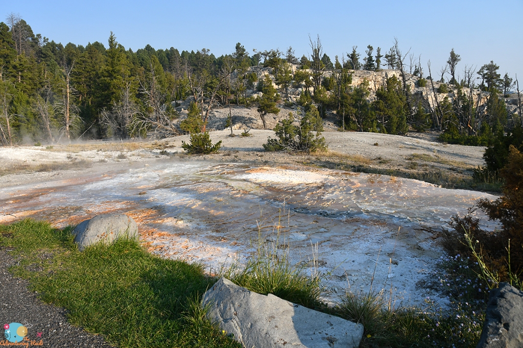

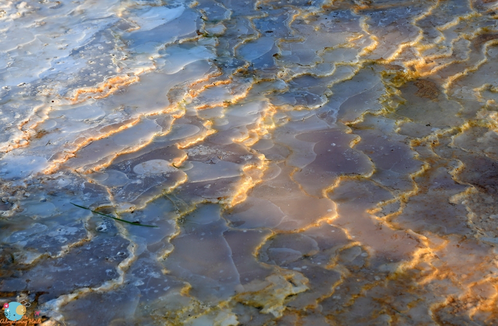
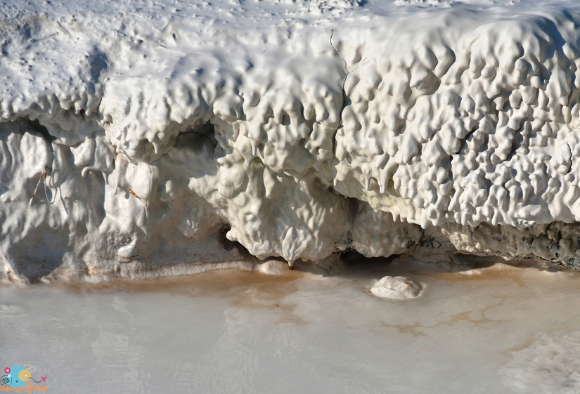
I have a degree in microbiology, and while my concentration was on the human pathogenic microbes, I appreciate ALL bacteria… especially those that can grow and thrive in conditions that humans cannot. Therefore, I really REALLY get nerdy about bacterial mats and colonizations of travertine. No apologies for the following series of photos! (Honestly, if I could do it all over again, I would’ve double majored in microbiology and geology, and focused on extremophiles living in geothermal environments!)


After the Upper Terrace Drive, it was just jaunt up to the trailhead, with a quick stop to take some photos of Rustic Falls from a new perspective. There was some road construction going on, but luckily it had not started yet (going back to Mammoth I had to wait in some traffic, but I found it not so bad as they have such a short weather window to repair roads in Yellowstone so summer it is, and you just have to be understanding!)


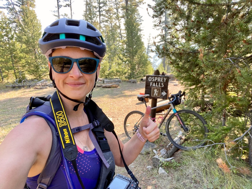
At the Bunsen Peak Trailhead I readied my bike and pack, and had a nice chat with a gentleman who was going to the falls and then to the top of Bunsen Peak before setting out. Though the double track trail ascends from the parking lot, it was an easy ride on my gravel bike (definitely not a “mountain bike only trail” but I’m not sure I would’ve done it on a road bike either), and I was thankful to see the miles fly by that otherwise would’ve taken quite a long time to walk. This bike/hike is about nine miles as an out and back (you can make it longer by heading up to the summit of Bunsen Peak, but bikes are not allowed on that trail).


I stashed my bike in the trees, locking it to one, ditching my cycling shoes and helmet with the bike (which lead to the occasional thought of “what if someone takes my shoes?!” as I was hiking). I brought my trail running shoes in my pack which I changed into. Hiking poles probably would’ve been nice for the steep, sometimes loose, descent, but I survived. I probably didn’t need to wear cycling shoes, but I’m an addict to being clipped in, so there you have it.


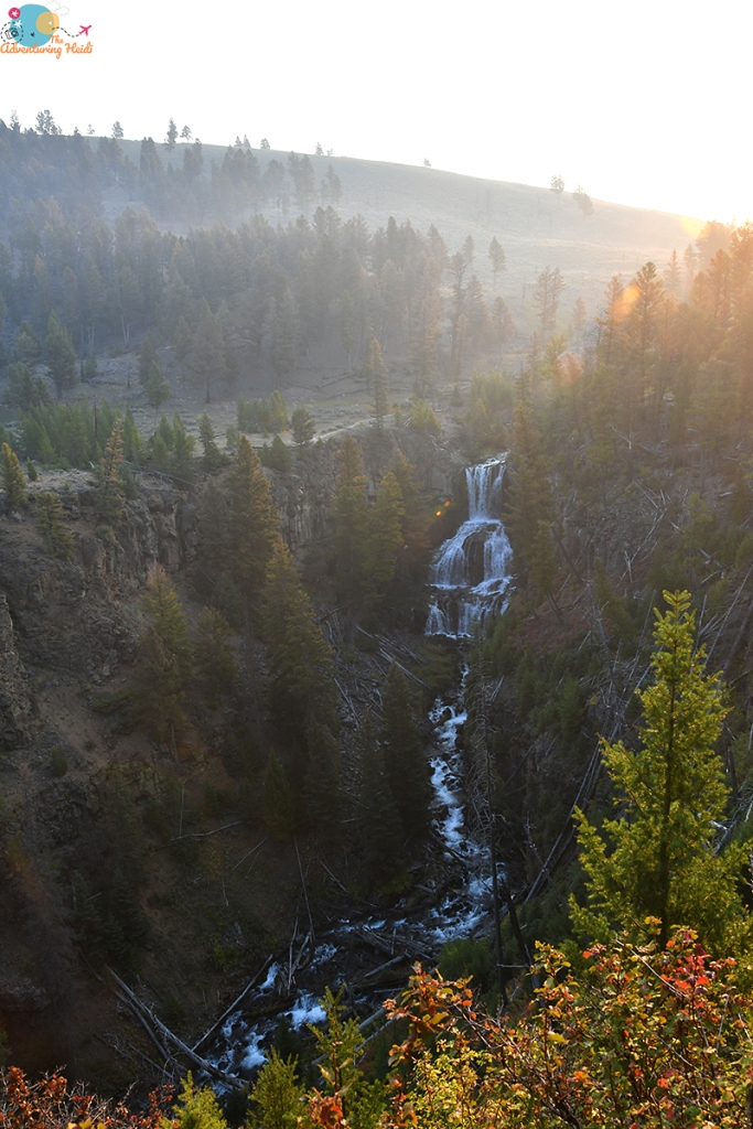
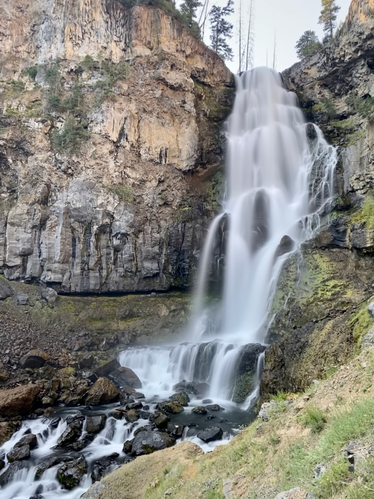
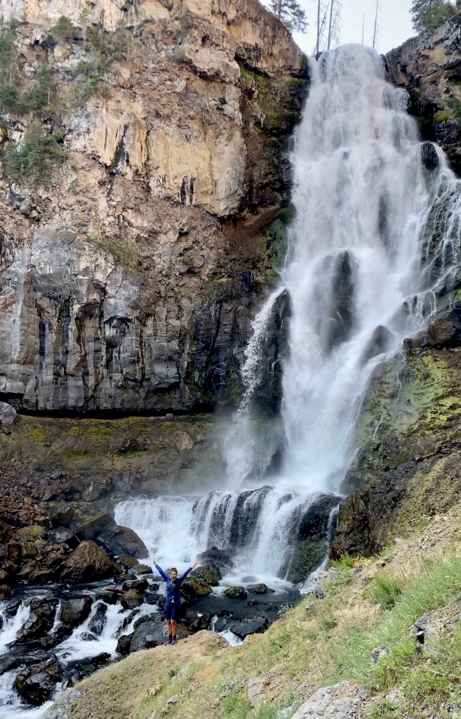
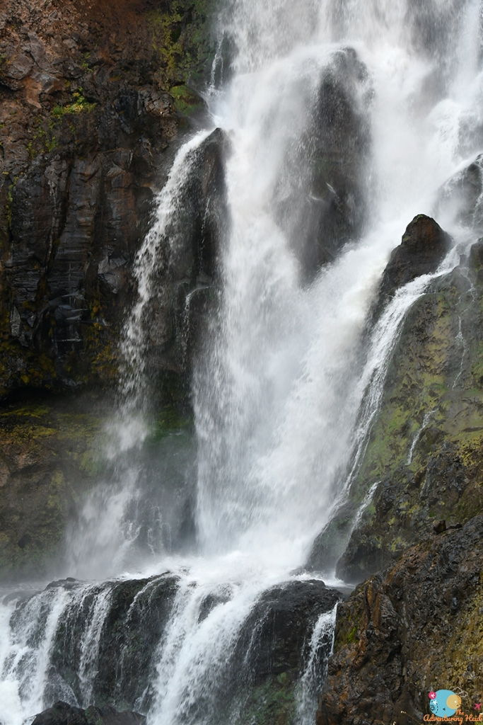
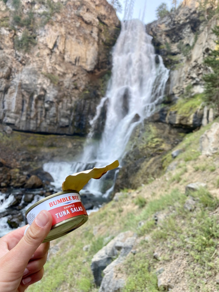
Osprey Falls is just… wow. Really no words (except swear words apparently). It is just such a magical place. I say every waterfall is my favorite, but legit Osprey Falls is in the top of my list. If I had a choice, I would’ve never left that spot. I took my time, finding the perfect rock to create a comfy spot for photos, a snack, and just spending time in solitude with the thundering falls on the Gardner River. (I did get over thirty minutes to myself in this spot, another bonus of an early start, not to mention great lighting for photos!)


I could not stay forever, so I sadly bid my new favorite waterfall goodbye, and started the steep hike out of Sheepeater Canyon. I am happy I got an early start as I could not imagine doing the climb in the heat of the day! Near the top I ran into the gentleman I had to talked to at the trailhead, and he asked about my Spot device and we enjoyed a nice chat before we continued on our separate ways. I was happy to see my bike (and shoes!) where I left it, and began the ride back. The first hill heading back is a beast, and I grunted up it on the bike, thankful for the mostly downhill miles on the rest of the way.
I quickly changed out of my chamois and took a quick “bath” with a wipe at the trailhead, flagged a waiting couple over to nab my parking spot at the full trailhead, and set out back to Mammoth to stop at the visitor center and to buy some ice to refresh the cooler (the service station had blocks of ice vs cubed!).


Since it was early in the day, I took a quick stop to see the terraces before leaving Mammoth. The boardwalk to Palette Spring was closed off, which I think was due to a bull elk that was hanging around there. I took the chance to call my parents while I had cell service, and roll my eyes at an entire family that thought walking on the boardwalk wasn’t necessary for them. Mammoth was very peopley, so I decided it was time to get out of there, and head south. Travertine is cool, but I had other new adventures to chase!


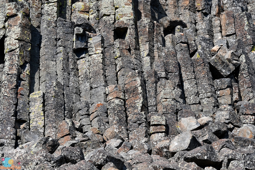
I wanted to see Tukuarika Falls near Sheepeater Cliffs (which I cannot get enough basalt in my life anyways, so even without a waterfall I’d be making a stop). I had no idea this picnic area would be so crowded, but I secured a parking spot, and took off on the short 1-mile round trip to the falls along the Gardner River. This short walk is well worth it, especially in the fall months as the willows blaze yellow and orange.


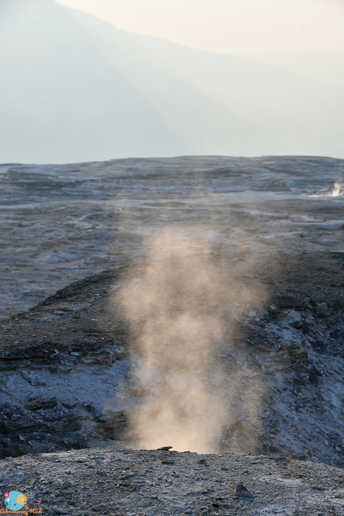
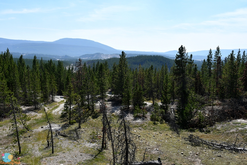
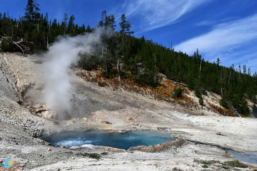
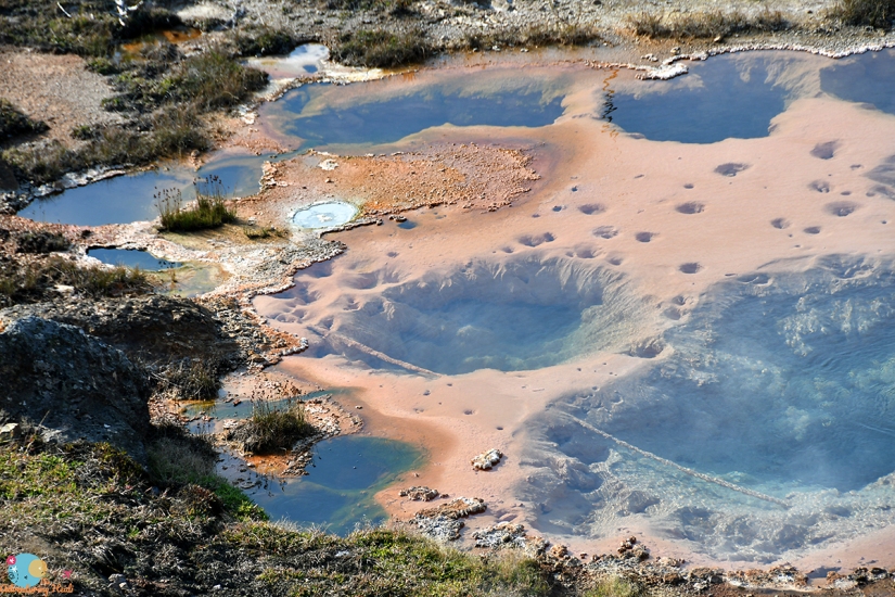
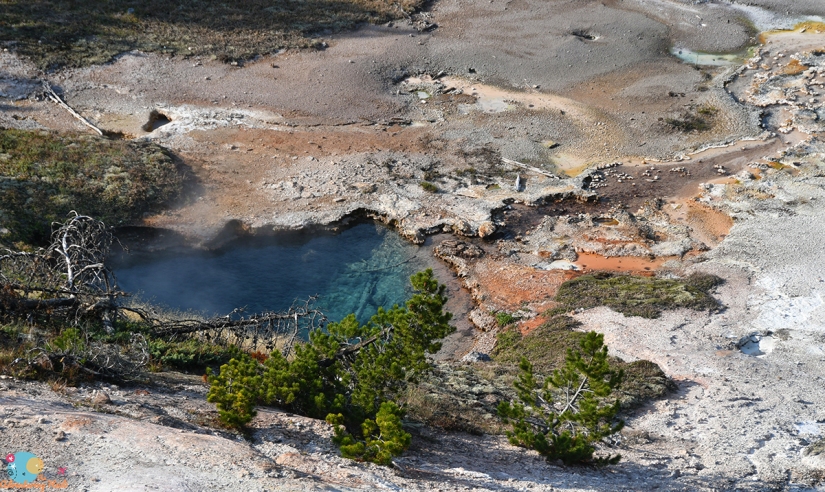
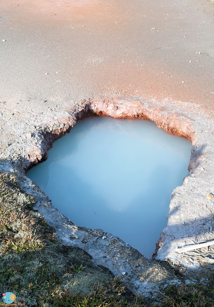
Now it was time to begin my search for roadside thermal features I missed on my first trip. Tourists typically pull over for wildlife…. me not so much. You’ll see me jaunting down the road with my camera, in search of a brilliant blue pool of boiling water. I must admit, I get a silly satisfaction when people driving slow down to see what I’m looking at and get frustrated when it is not an animal. But it’s a brilliant blue thermal pool, y’all!!!!! I was quite pleased on how trained my eyes were to catch geysers and pools off in the distance on this trip!


I opted to stop at Artists Paintpots later in the day, and headed straight to my campground for the next three nights at Madison Junction. Madison is nicely located (aside from the junction being a traffic nightmare in the evenings), especially if chasing thermal springs and geysers are your thing as it is close to the geyser basins at Old Faithful, Midway, and Lower. I settled into my campsite, G252, early. I learned this year that personal showering devices are allowed as long as you collect all the wastewater and dispose of it in the campground sink or toilet (I wish I would’ve known this last year), so I used my Rinse Kit to wash my hair and collected all the water in a huge plastic tub I used to organize items in my car. I knew I would have to to go eight days without a proper shower, but I’m the type that if I can have clean hair, I feel clean in general. Then I finished setting up my tent and just relaxing and resting after the morning’s hike out of Osprey Falls.


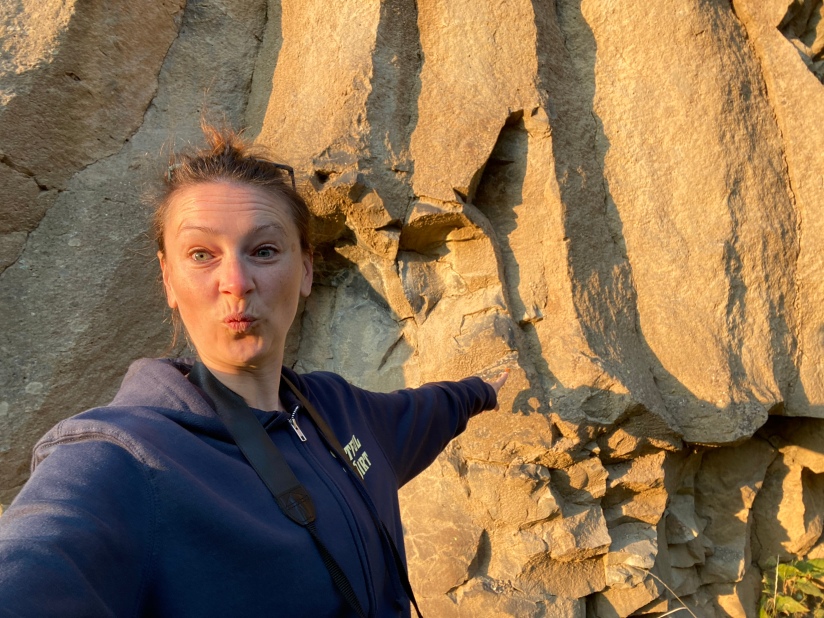
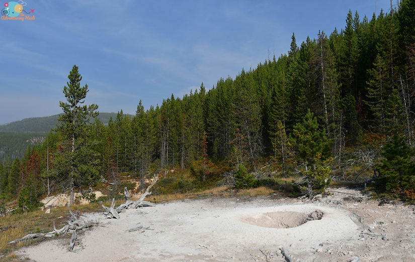
Once late afternoon hit, I headed east. First I stopped at Tuff Cliff, where I was completely alone even thought the road was packed. Being a geology nerd pays off, I get sights to myself!


Gibbon Falls was next. I had to stop here, even briefly, because it is a waterfall, and you know me with waterfalls! And this waterfall drops over the caldera rim, and I also love volcanoes!


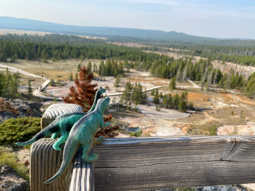
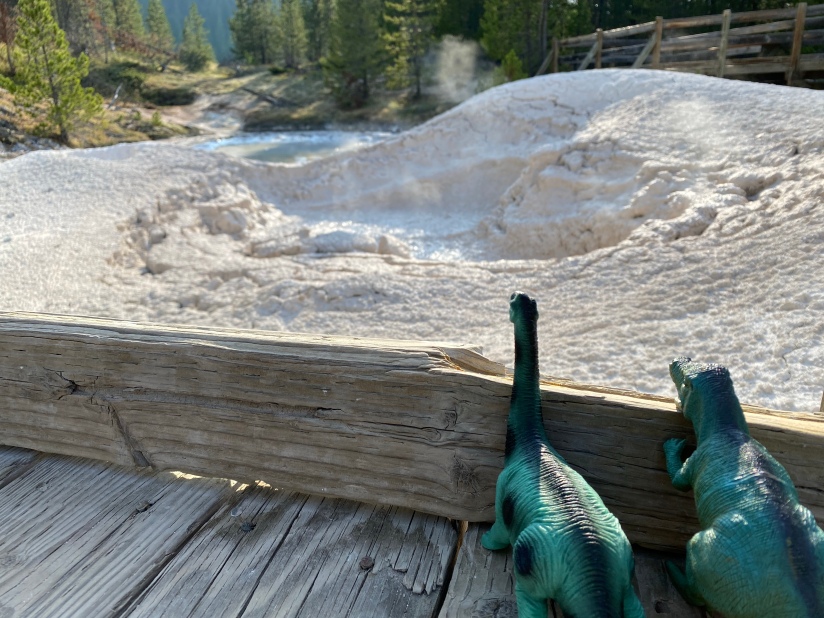
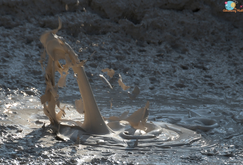
Last up was a stop at Artists Paintpots, which can be oh so crowded. Luckily I scored a parking spot easily and didn’t have to deal with the craziness of peak hours. Last year during my trip I had a scare with my car keys here where I thought I had lost them and had one of the most panicked moments of my life, so I carefully stashed them (and checked five times over that they were really zipped securely in my pocket), and then grabbed the Adventure Dinos and set out. Because every nearly-40 year old should hike with toy dinosaurs.
I switched it up this year and tackled the loop clockwise, which meant my eyes caught stuff I didn’t see last year.


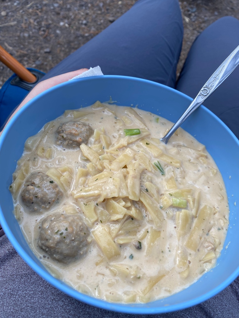
Finally it was back to my campsite for dinner and preparing for the next day, which would involve one of my longest hikes ever. Clothes were laid out, snacks assembled, Garmin watch charged!


OMG! I am blown away at all of these photos. I had a trip planned to visit that area before covid swept over the world, and I will certainly make it there when things are safer. Every picture is lovely, thanks for sharing!
LikeLike
I hope you get to go soon! It is such a fabulous place and HUGE with such variety. I haven’t seen so much of it still!
LikeLiked by 1 person